Mori Atlas logo
National parkSuakin Archipelago National Park

Discover the mapped boundaries and unique Red Sea island ecosystems of this vital national park.

Suakin Archipelago National Park: Sudan's Coastal Protected Landscape and Seabird Sanctuary

Suakin Archipelago National Park represents a critical protected marine environment situated along Sudan's eastern coast in the Red Sea. This national park encompasses a significant archipelago of islets, renowned for its extensive seabird breeding colonies and as a habitat for marine species such as sea turtles and dugongs. As a designated Important Bird Area, it offers a unique lens through which to explore the geography of Sudan's coastal protected lands and their ecological significance.

Red Sea islandsMarine protected areaImportant Bird AreaSeabird coloniesSea turtlesDugongs

Suakin Archipelago National Park

National park

Park overview

Structured park overview, official facts, and landscape profile for Suakin Archipelago National Park

Suakin Archipelago National Park park facts, protected area profile, and essential visitor context
Review the core facts for Suakin Archipelago National Park, including designation, size, terrain, visitor scale, habitats, and operating context in one park-focused overview.

About Suakin Archipelago National Park

Suakin Archipelago National Park represents a significant conservation initiative in eastern Sudan, protecting a cluster of islands in the Red Sea approximately 1,500 square kilometers in extent. The archipelago lies near the historic port town of Suakin, which has served as a gateway for trade and pilgrimage along the Red Sea coast for centuries. The park's establishment reflects Sudan's commitment to preserving its coastal and marine biodiversity, with the IUCN category II designation indicating its management as a national park with primary objectives of ecosystem conservation and protection. The islands themselves provide critical nesting habitat for seabird species, while the surrounding marine environment supports populations of sea turtles and dugongs, both of which are species of conservation concern. The Red Sea setting provides a distinctive marine ecosystem characterized by coral reefs, clear waters, and high biodiversity, making the archipelago an important area for both terrestrial and marine conservation.

Quick facts and research context for Suakin Archipelago National Park

Suakin Archipelago National Park is located in the Red Sea off the eastern coast of Sudan, near the historic port city of Suakin. The protected area covers roughly 1,500 square kilometers of island and marine ecosystems. The archipelago holds IUCN category II designation as a national park and has been identified as an Important Bird Area by BirdLife International. The site is notable for supporting breeding colonies of both lesser crested tern and greater crested tern, while the surrounding waters provide habitat for sea turtles and dugongs.

Park context

Deeper park guide and search-rich context for Suakin Archipelago National Park

Suakin Archipelago National Park history, landscape, wildlife, and travel context
Explore Suakin Archipelago National Park through its history, landscape character, ecosystems, wildlife, conservation priorities, cultural context, and seasonal travel timing in a structured park guide built for atlas discovery and search intent.

Why Suakin Archipelago National Park stands out

Suakin Archipelago National Park is best known for its significant seabird breeding colonies, particularly the substantial populations of lesser crested terns and greater crested terns that nest on the islands. The archipelago is also notable for its marine wildlife, including regular populations of sea turtles and dugongs that inhabit the surrounding Red Sea waters. The site's recognition as an Important Bird Area by BirdLife International highlights its international importance for seabird conservation in the Red Sea region.

Suakin Archipelago National Park history and protected-area timeline

The Suakin Archipelago gained formal recognition as a proposed national park through its designation under IUCN category II, reflecting international standards for protected area management. The site was subsequently identified as an Important Bird Area by BirdLife International, a global partnership of conservation organizations focused on bird conservation. This designation acknowledges the archipelago's significance as a breeding site for seabird populations, particularly tern species. While the specific timeline for national park establishment is not detailed in available sources, the protection status reflects growing recognition of the Red Sea coast's ecological value and Sudan’s interest in developing marine and coastal conservation frameworks.

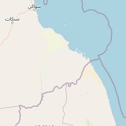
Suakin Archipelago National Park landscape and geographic character

The Suakin Archipelago consists of a large group of islets scattered across the Red Sea off Sudan’s eastern coast. The islands sit within the broader Red Sea marine environment, characterized by warm tropical waters, extensive coral reef systems, and clear visibility ideal for marine observation. The terrestrial components of the archipelago are typical of small Red Sea islands, featuring coastal vegetation, sandy beaches, and rocky outcrops that provide nesting habitat for seabirds. The surrounding sea bottom includes a mix of coral reef, seagrass beds, and sandy substrates that support diverse marine life. The proximity to the historic Suakin port adds cultural and historical dimension to the landscape, though the islands themselves are primarily significant for their ecological rather than built heritage.

Suakin Archipelago National Park ecosystems, habitats, and plant life

The Suakin Archipelago supports a distinctive Red Sea island ecosystem with both terrestrial and marine components. The islands serve as critical nesting and breeding sites for seabird populations, with particular importance for tern species. The surrounding Red Sea waters contain diverse marine habitats including coral reef systems and seagrass beds that support a range of marine organisms. The marine environment around the archipelago is recognized for its biodiversity, with the warm, clear waters of the Red Sea providing favorable conditions for coral growth and marine species distribution. The combination of island habitats for nesting birds and marine habitats for turtles and dugongs creates a multi-dimensional ecosystem that the national park designation aims to protect.

Suakin Archipelago National Park wildlife and species highlights

The Suakin Archipelago is notable for its seabird populations, particularly the breeding colonies of lesser crested tern and greater crested tern that nest on the islands. These tern species rely on the island habitats for successful reproduction, using the sandy beaches and rocky areas for nest sites. The surrounding marine waters support significant populations of sea turtles, which use the area for feeding and potentially for nesting activities. The archipelago is also home to dugongs, marine mammals that graze on seagrass beds in the shallow waters around the islands. The presence of both sea turtles and dugongs indicates healthy marine ecosystems with adequate seagrass and foraging resources, making this area a conservation priority for marine species protection.

Suakin Archipelago National Park conservation status and protection priorities

The Suakin Archipelago has been designated an Important Bird Area by BirdLife International, recognizing its international significance for seabird conservation. This designation reflects the archipelago's role as a critical breeding site for tern populations and its contribution to regional bird conservation. The IUCN category II national park designation provides a framework for ecosystem-level conservation management. The protection of the archipelago also supports broader marine conservation objectives, as the waters surrounding the islands provide habitat for species of conservation concern including sea turtles and dugongs. The park represents part of Sudan’s coastal and marine protected area network, contributing to regional efforts to conserve Red Sea biodiversity.

Suakin Archipelago National Park cultural meaning and human context

The Suakin Archipelago is located near the historic port city of Suakin, which has served as an important maritime center along the Red Sea coast for centuries. Suakin has historically functioned as a trade gateway and a embarkation point for pilgrims traveling to Mecca, giving the region significant cultural and historical importance. While the archipelago itself is primarily valued for its ecological significance, the proximity to Suakin connects the natural environment to the broader cultural history of the Red Sea coast. The relationship between the island ecosystem and the coastal communities that have utilized these waters represents the type of human-environment interaction that shapes the cultural context of the region.

Top sights and standout views in Suakin Archipelago National Park

The Suakin Archipelago stands out as one of Sudan’s most important coastal protected areas, combining significant seabird breeding colonies with rich marine biodiversity. The tern nesting colonies represent a major ornithological feature, while the presence of sea turtles and dugongs in the surrounding waters adds to the site’s conservation value. The Red Sea island setting provides a distinctive landscape characterized by clear waters, coral environments, and island scenery that differs from Sudan’s more commonly known desert landscapes. The park’s designation as an Important Bird Area at the international level underscores its significance beyond national boundaries, making it a key location for understanding Red Sea biodiversity and conservation priorities.

Best time to visit Suakin Archipelago National Park

The Suakin Archipelago's location in the Red Sea means that visits are influenced by the regional climate patterns typical of this tropical marine environment. While specific seasonal guidance is not available in current sources, visitors would generally expect warm conditions year-round characteristic of Red Sea coastal areas. Optimal visiting periods would likely correspond with favorable sea conditions and weather patterns that allow for boat access to the islands and comfortable conditions for wildlife observation. The breeding season for terns would be a particularly significant period for bird observation, though specific timing would depend on the species' reproductive biology in this region.

Park location guide

Geography guide, regional context, and park location map for Suakin Archipelago National Park

Suakin Archipelago National Park park geography, regions, and map view in Sudan
Understand where Suakin Archipelago National Park sits in Sudan through a broader geographic reading of the surrounding landscape, nearby location context, and its mapped position within the national park landscape.

How Suakin Archipelago National Park fits into Sudan

Sudan is a large African nation spanning 1.89 million km² in Northeast Africa with a population of approximately 51.8 million people. It is Africa's third-largest country by area and is governed as a federal republic with Khartoum as its capital and largest city.

Wider geography shaping Suakin Archipelago National Park in Sudan

Sudan is located in Northeast Africa with coastline along the Red Sea. It shares borders with Egypt to the north, Libya to the northwest, Chad to the west, the Central African Republic to the southwest, South Sudan to the south, and Eritrea and Ethiopia to the southeast.

Map view of Suakin Archipelago National Park

Use this park location map to pinpoint Suakin Archipelago National Park in Sudan, understand its exact geographic position, and read its mapped placement within the surrounding landscape more clearly.

Pigeon | © OpenStreetMap contributors

Location context for Suakin Archipelago National Park

Red Sea
Park atlas

Compare Red Sea Coastal Marine Environments and Adjacent Protected Landscapes

Discover Nearby National Parks and Protected Areas Surrounding Suakin Archipelago National Park
After exploring Suakin Archipelago National Park, continue your geographic discovery by browsing other protected areas in the Red Sea region. Compare marine environments, island ecosystems, and seabird breeding grounds to understand the broader conservation landscape surrounding Sudan's eastern coast.
National parkNorth Gondar Zone

Alitash National Park: Protected Lowland Woodland & Savanna Landscape

Explore the geographic context of this Ethiopian National Park.

Alitash National Park serves as a vital protected area within Ethiopia's North Gondar Zone, encompassing 2,665.7 square kilometers of distinct lowland woodland and savanna ecosystems. The park's landscape is characterized by gently undulating terrain, seasonal river valleys, and the prominent Twin Mountains of Amadog. Its mapped boundaries delineate an area rich in biodiversity, highlighting its significance as a national park for conservation efforts. Understanding Alitash National Park's geographic setting is key to appreciating its role in regional ecological preservation and atlas exploration.

Area
2,665.7 km²
Established
2006
IUCN
II
National parkTadjourah Region

Day Forest National Park: Ancient Juniper Woodland and Protected Landscape in Djibouti

Discover a rare East African forest refuge with unique endemic species.

Day Forest National Park represents a critical ecological island within Djibouti's predominantly semi-desert geography. As the nation's oldest national park, it protects the largest remaining East African juniper forest, a vital sanctuary for species found nowhere else on Earth. Located in the Goda Mountains of the Tadjourah Region, its existence relies on rare localized rainfall, creating a distinctive mountainous forest environment that offers profound insights into protected landscape dynamics and regional biodiversity.

Area
15 km²
Established
1939
IUCN
II
National parkAfar Region

Yangudi Rassa National Park: Protected Semi-Desert National Park in Afar Region

Mapped landscape and dryland ecosystems.

Yangudi Rassa National Park represents a critical protected area within Ethiopia's Afar Region, covering extensive semi-desert and grassland terrains. The park's geography is marked by Mount Yangudi and the broad Rassa Plains, with the Awash River shaping its riverine forests and marshes. This national park offers a unique insight into dryland ecosystems and their conservation, providing a distinct mapped landscape for geographic study and exploration.

Area
4,731 km²
Established
1969
IUCN
II
National parkEthiopia

Awash National Park: Mapped Protected Boundaries and Ethiopian Regional Geography

Discover the protected landscape of this Ethiopian National Park.

Awash National Park represents a significant protected area within Ethiopia, offering a rich focus for geographic discovery. This page illuminates the park's specific mapped boundaries and its positioning within the surrounding regional geography. It serves as a detailed entry point for understanding the park's landscape character and its role as a national park in East Africa.

Area
850 km²
Established
1966
IUCN
II
National parkEthiopia

Didessa National Park: Protected River Valley Landscape in Ethiopia's Western Highlands

Discover dramatic escarpments, forested terrain, and waterfalls.

Explore Didessa National Park, a protected area in western Ethiopia notable for its dramatic topographical features. This national park showcases a striking landscape of steep escarpments flanking the Didessa River valley, supporting lush forest ecosystems. Key features include numerous waterfalls that contribute to the park's distinctive terrain and ecological significance. Understanding Didessa National Park offers insight into Ethiopia's protected lands and their unique geographic attributes.

Area
1,300 km²
Established
2017
IUCN
II
Relief
Lowland
National parkArsi Zone

Arsi Mountains National Park: Protected Ethiopian Highlands Landscape & Geography

Mapped protected terrain and endemic species habitat within the Arsi Zone.

Arsi Mountains National Park is a vast protected area celebrated for its significant biodiversity and distinctive Afro-alpine ecosystems. Situated in the Arsi Zone, this national park encompasses a dramatic mountain landscape central to the Ethiopian Highlands. It serves as a crucial refuge for endangered endemic species, including the mountain nyala and Ethiopian wolf, within its varied ecological zones and protected park boundaries, offering rich context for geographic exploration.

Area
10,876 km²
Established
2011
IUCN
II
National parkEthiopia

Maze National Park: Ethiopia's Essential National Park for Swayne's Hartebeest and Geothermal Wonders

Discover mapped savanna ecosystems and unique montane geography within this protected Ethiopian landscape.

Maze National Park represents a significant protected area within Ethiopia, vital for the conservation of the endangered Swayne's hartebeest. Its diverse terrain includes savanna grasslands and unique geothermal features such as active geysers, all set against a distinctive montane backdrop. This national park offers a deep dive into Ethiopia's natural heritage, providing a clear geographic identity and valuable context for landscape exploration.

Area
210 km²
Established
2005
IUCN
II
National parkIsrael

Ein Avdat National Park: A Spectular Desert Oasis and Protected Landscape in Israel

Explore its unique springs, waterfalls, and ancient Nabatean and Byzantine history.

Ein Avdat National Park showcases a rare desert oasis environment, a starkly beautiful protected landscape where natural springs emerge from the Negev's arid terrain. This park is celebrated for its dramatic waterfalls, deep pools, and the preserved remnants of ancient human habitation, including a remarkable Byzantine cave monastery carved directly into the canyon walls. Its geography, shaped by the Nahal Zin wadi, provides a vivid study in desert ecosystems and their capacity for supporting life and history over millennia, making it a key site for understanding landscape context in Israel.

Area
4.8 km²
IUCN
V

Common questions about visiting, size, designation, and location context for Suakin Archipelago National Park

Suakin Archipelago National Park FAQs for park facts, access, geography, and protected area context
Find quick answers about Suakin Archipelago National Park, including protected-area facts, park geography, trail and visitor context, and how the park fits into its surrounding country and regional landscape.
MoriAtlas Explorer

Continue Your Protected Areas Search Across the Global Atlas

Deepen your exploration by continuing the structured search for national parks and protected areas worldwide. Utilize the comprehensive filtering capabilities to compare different conservation landscapes and refine your understanding of global park geography. Discover more about the distribution and characteristics of protected natural areas.

Global natural geography