Mori Atlas logo
National parkTamborine National Park

Discover mapped boundaries and rich biodiversity across Tamborine Mountain's unique plateau.

Tamborine National Park: Queensland's Accessible Protected Rainforest Landscape

Tamborine National Park represents a significant protected area on Queensland's Tamborine Mountain plateau, offering accessible natural experiences close to urban centers. This national park is a critical remnant of subtropical rainforest, wet eucalypt forest, and open woodland ecosystems vital to the Scenic Rim region's geography. Through its mapped landscape and rich biodiversity, Tamborine National Park provides a unique lens for understanding conservation within populated natural settings. Users can explore the park's distinct terrain, which includes waterfalls and basalt formations, contributing to a deeper geographic context.

RainforestWaterfallsSubtropical EnvironmentQueenslandMountain PlateauBushwalking

Tamborine National Park

National park

Park overview

Structured park overview, official facts, and landscape profile for Tamborine National Park

Tamborine National Park park facts, protected area profile, and essential visitor context
Review the core facts for Tamborine National Park, including designation, size, terrain, visitor scale, habitats, and operating context in one park-focused overview.

About Tamborine National Park

Tamborine National Park occupies a special place in Queensland's protected area network as an accessible wilderness on the doorsteps of two major population centres. The park's location on Tamborine Mountain creates an island of natural habitat within a landscape increasingly modified by rural residential development. The plateau's elevation of 525 metres above sea level produces cooler temperatures than the surrounding coastal lowlands, making it a refreshing escape during hot summer months. The park is divided into distinct sections, each offering different landscape experiences. Witches Falls on the eastern side preserves the historical heart of Queensland's national park system, while Palm Grove on the western side features piccabeen palms thriving in the moist rainforest environment. The Joalah section provides access to Curtis Falls, and Cedar Creek offers cascades through diverse plant communities. The Knoll in the north provides views and rainforest circuits, while MacDonald Park adjoins the Tamborine Mountain Botanic Gardens. The various sections are linked by scenic drives that wind through villages, creating a park that feels woven into the mountain community.

Quick facts and research context for Tamborine National Park

Tamborine National Park occupies Tamborine Mountain, a plateau measuring approximately 8 kilometres in length and 5 kilometres in width. The park was officially established in 1993, though the Witches Falls section holds the distinction of being Queensland's first national park, designated in 1908. The park is managed by the Queensland Parks and Wildlife Service and receives approximately 1.7 million domestic visitors annually. The landscape features numerous waterfalls, deep gorges, towering cliffs, and diverse forest types ranging from closed rainforest to open eucalypt woodland. The park contains no camping facilities, but offers extensive walking tracks, picnic areas, and scenic drives across its various sections.

Park context

Deeper park guide and search-rich context for Tamborine National Park

Tamborine National Park history, landscape, wildlife, and travel context
Explore Tamborine National Park through its history, landscape character, ecosystems, wildlife, conservation priorities, cultural context, and seasonal travel timing in a structured park guide built for atlas discovery and search intent.

Why Tamborine National Park stands out

Tamborine National Park is best known for its accessible rainforest walks and cascading waterfalls that provide nature experiences within easy reach of Brisbane and the Gold Coast. The Witches Falls Circuit is particularly famous, descending through ancient cycad groves, strangler fig forests and palm valleys to reach the falls themselves. Curtis Falls offers another popular waterfall experience with its basalt rock face and rock pool. The park is also renowned for its wildlife, particularly the noisy lyrebirds that can be found scratching through leaf litter, the elusive platypus in stream pools, and the conspicuous brush-turkeys that patrol the forest edges. The combination of subtropical rainforest, eucalypt forest and hoop pine formations creates a botanically rich environment that supports remarkable biodiversity.

Tamborine National Park history and protected-area timeline

The Witches Falls section of Tamborine Mountain became Queensland's first national park in 1908, establishing a precedent for nature conservation in the state. This early recognition of the area's significance reflected both its natural beauty and its proximity to the growing city of Brisbane. The park was officially consolidated and expanded in 1993 when the various reserves across Tamborine Mountain were brought together under the Tamborine National Park designation. The park's establishment reflected growing recognition that the mountain's forests, waterfalls and wildlife required formal protection despite the pressure from residential development. Over the decades, the Queensland Parks and Wildlife Service has developed walking tracks, picnic facilities and visitor infrastructure while maintaining the park's natural character. The park's scattered configuration across 14 reserves interspersed with villages represents a unique management approach that balances conservation with the area's established communities.

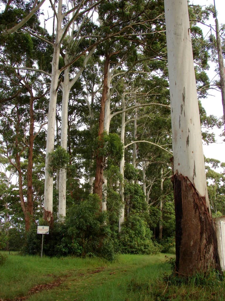
Tamborine National Park landscape and geographic character

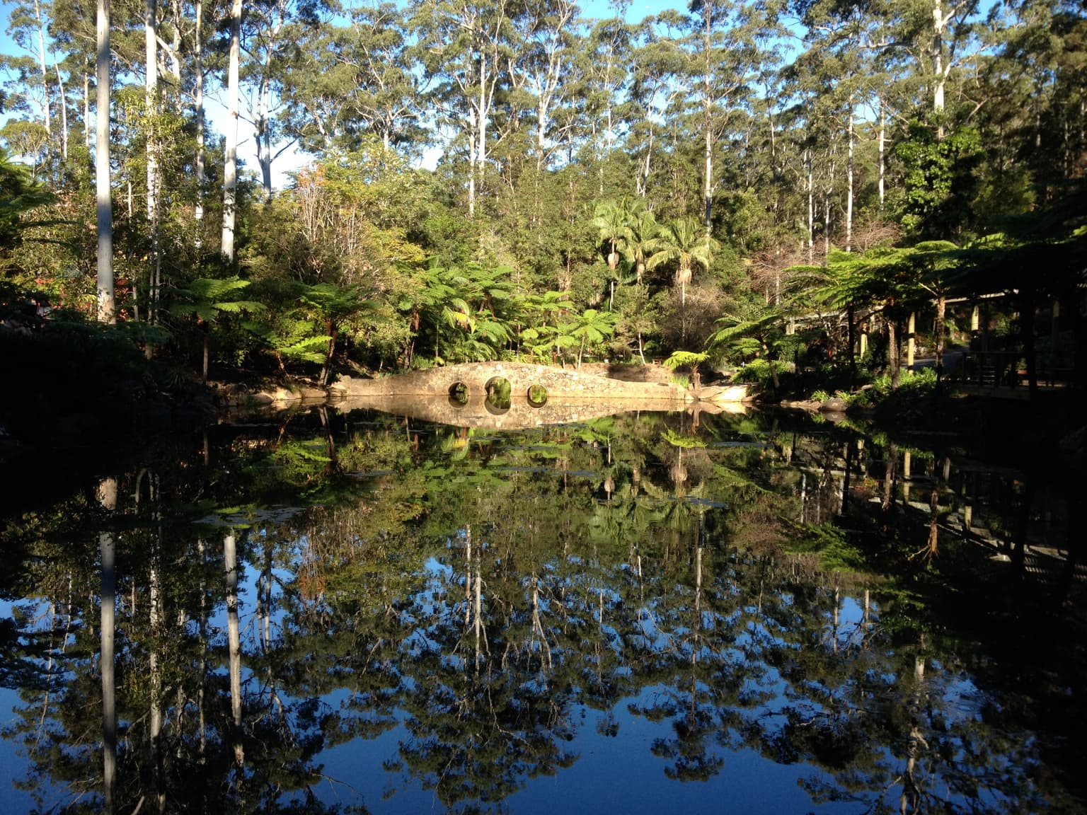
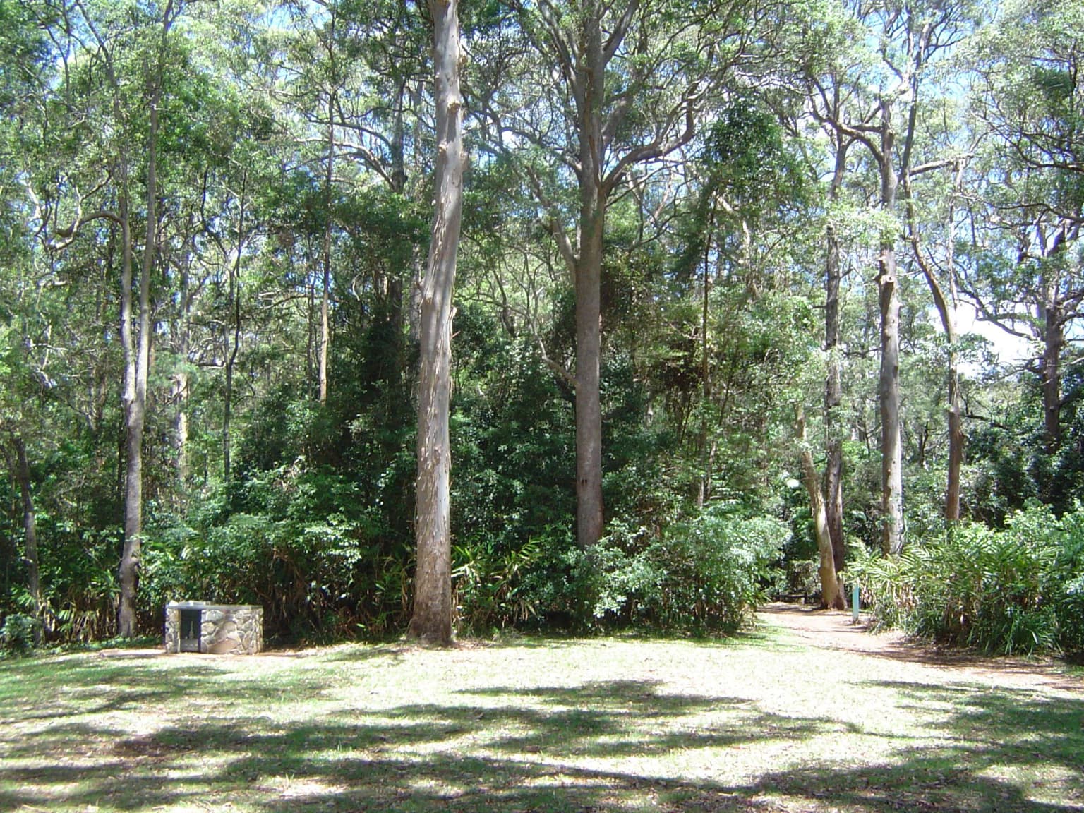
Tamborine National Park sits atop a distinctive basalt plateau that rises abruptly from the surrounding coastal plains of South East Queensland. The plateau surface is gently undulating, reaching elevations around 525 metres above sea level, and is approximately 8 kilometres long and 5 kilometres wide. The park encompasses a variety of landforms including steep scarps where the plateau edge drops away, deep gullies carved by seasonal streams, and basalt rock faces that create dramatic waterfall locations. The landscape transitions from closed canopy rainforest in the sheltered gullies to more open eucalypt forest on the ridge crests and exposed slopes. Rocky outcrops and boulder fields occur throughout, particularly along creek lines where water has carved through the basalt substrate. The park contains several notable waterfalls including Witches Falls, Cedar Creek Falls and Curtis Falls, each with its own character of cascading water, rock pools and mist-hung forest. The interplay of cliff faces, forest canopies and water creates the visual character that draws visitors to the various lookouts and walking tracks.

Tamborine National Park ecosystems, habitats, and plant life

The ecological significance of Tamborine National Park extends far beyond its modest 11.60 square kilometre area. The park preserves critical habitat within the Scenic Rim region, one of Queensland's most biodiverse areas. The park supports approximately 65 percent of all flora species and 85 percent of all fauna species recorded across the entire Scenic Rim Regional Council area. This remarkable concentration of biodiversity reflects the variety of habitats present within the park, from subtropical rainforest dominated by giant stinging trees and figs to wet eucalypt forests of flooded gums and open forests of she-oak and lacebark. The plateau's elevation creates cooler and wetter conditions than the surrounding lowlands, supporting plant species more typical of higher latitudes or altitudes. Hoop pines occur in the drier rainforest areas, while cycads represent ancient plant lineages that have persisted in the mountain's sheltered valleys. The various plant communities support the diverse animal life that makes Tamborine a significant wildlife location.

Tamborine National Park wildlife and species highlights

Tamborine National Park supports an impressive array of wildlife despite its relatively small size and proximity to urban areas. The park is particularly famous for its lyrebirds, whose elaborate tail displays and mimicry of other species make them a highlight for patient visitors who can spot them scratching through leaf litter on forest floors. The platypus, one of Australia's most unusual mammals, inhabits the streams and pools, though seeing this secretive creature requires quiet observation at dawn or dusk. Brush-turkeys are commonly encountered along walking tracks and in picnic areas, their iridescent plumage and distinctive crests making them unmistakable. Lorikeets and other parrots feed in the eucalypt canopy, while eastern whipbirds skulk in the undergrowth with their distinctive calls echoing through the forest. Satin bowerbirds construct elaborate mating structures decorated with blue objects in the forest understory. The park's creeks and streams support freshwater fish and turtles, while various marsupials including possums and gliders occupy the forest canopy and tree hollows.

Tamborine National Park conservation status and protection priorities

Tamborine National Park represents a critical conservation refuge within the heavily modified landscape of South East Queensland. The park preserves approximately 85 percent of all fauna species and 65 percent of all flora species found in the Scenic Rim Regional Council area, making it an essential stronghold for regional biodiversity. The various forest types, from subtropical rainforest to eucalypt woodland, represent remnants of the ecosystems that once covered the entire Tamborine Mountain area before European settlement and subsequent development. The park protects significant populations of native wildlife in an area where habitat loss from residential development continues to pressure native species. The conservation value is enhanced by the connectivity the park provides between larger protected areas in the Scenic Rim, though the fragmented nature of the reserves across 14 separate locations creates management challenges. The protection of water quality in the park's streams also contributes to downstream waterway health in the broader catchment.

Tamborine National Park cultural meaning and human context

Tamborine Mountain holds significance in Aboriginal tradition, with the area traditionally inhabited by the Wangerriburra people and other Aboriginal groups of the Scenic Rim. The mountain's distinctive landscape of waterfalls, gorges and elevated position created a special place in traditional belief systems and resource use patterns. European settlement of Tamborine Mountain began in the late nineteenth century, with early settlers attracted to the cool climate, fertile soils and scenic beauty. The establishment of Witches Falls as Queensland's first national park in 1908 reflected a growing appreciation for the area's natural values. The mountain developed as a rural retreat with orchards, small farms and later as a weekend destination for city dwellers from Brisbane and the Gold Coast. Today the mountain retains a village character with communities interspersed among the national park reserves, creating a landscape where conservation and human settlement exist in close proximity.

Top sights and standout views in Tamborine National Park

Tamborine National Park offers multiple highlights that draw visitors back repeatedly. The Witches Falls Circuit remains the flagship walk, descending through increasingly lush forest to reach the cascade that marked Queensland's first national park. Curtis Falls provides another popular waterfall experience with accessible viewing platforms overlooking the basalt cascade. The Palm Grove section showcases piccabeen palms in their rainforest setting, while the Knoll offers panoramic views and encounters with sunbathing skinks. The Cedar Creek Circuit explores diverse plant communities and cascading water. The various sections support different experiences, from the historic significance of Witches Falls to the botanical variety of MacDonald Park's rainforest circuit. The wildlife, particularly lyrebirds and platypus, adds an extra dimension to any visit. The accessibility from Brisbane and the Gold Coast makes these natural experiences available to visitors without extensive travel.

Best time to visit Tamborine National Park

Tamborine National Park can be visited throughout the year, though different seasons offer different experiences. The period from December to April represents the wet season on Tamborine Mountain, when higher rainfall creates fuller waterfalls and lush green forest conditions. This wet season also brings warmer temperatures and higher humidity, with afternoon thunderstorms common during the summer months. Winter from May to August brings drier conditions and cooler temperatures, making walking more comfortable for those who prefer clearer trails and lower humidity. The cooler weather during winter months makes the mountain an appealing escape from coastal heat. The plateau's elevation ensures temperatures remain moderate throughout the year, generally cooler than the Brisbane and Gold Coast coastal areas below. Visitors interested in wildlife viewing may find different opportunities across seasons, with platypus activity patterns varying with water levels and temperature changes affecting animal visibility.

Park location guide

Geography guide, regional context, and park location map for Tamborine National Park

Tamborine National Park park geography, regions, and map view in Australia
Understand where Tamborine National Park sits in Australia through a broader geographic reading of the surrounding landscape, nearby location context, and its mapped position within the national park landscape.

How Tamborine National Park fits into Australia

Australia is a constitutional monarchy and federal parliamentary democracy comprising six states and ten territories. With a population of nearly 28 million, it is one of the world's most urbanised countries, with most people concentrated on the eastern seaboard. The country has a high Human Development Index and is known for its cultural diversity, ancient Aboriginal heritage, and unique wildlife.

Wider geography shaping Tamborine National Park in Australia

Australia occupies the entire Australian continent, the island of Tasmania, and numerous smaller islands. It is the world's flattest and driest inhabited continent, featuring vast deserts in the interior (the Outback), tropical rainforests along the eastern coast, and a coastline bordering the Indian and Pacific Oceans.

Map view of Tamborine National Park

Use this park location map to pinpoint Tamborine National Park in Australia, understand its exact geographic position, and read its mapped placement within the surrounding landscape more clearly.

Pigeon | © OpenStreetMap contributors

Location context for Tamborine National Park

City of Gold CoastQueenslandScenic Rim Region
Park atlas

Trace the regional park geography and compare protected landscapes within Queensland's Scenic Rim.

Explore Nearby National Parks and Protected Areas Surrounding Tamborine National Park
After exploring Tamborine National Park's unique mountain plateau and accessible rainforests, browse other national parks and protected areas across Queensland's diverse Scenic Rim region. This expanded geographic view allows for deeper comparison of varied subtropical environments, waterfall landscapes, and distinct eucalypt forest conservation efforts.
National parkQueensland

Lamington National Park: Ancient Gondwanan Rainforests and Volcanic Terrain in Queensland

Mapped protected landscape with over 500 waterfalls and unique cloud forests.

Lamington National Park stands as a key protected area within Queensland, recognized for its world-heritage status Gondwanan rainforests and striking volcanic geography. The park's landscape is characterized by its ancient Antarctic beech forests, a legacy of millions of years of volcanic activity that sculpted dramatic cliffs, plateaus, and deep valleys, punctuated by more than 500 waterfalls. Through its mapped boundaries and detailed geographic context, users can explore the exceptional biodiversity and unique terrain that defines this significant Australian national park.

Area
206 km²
Established
1915
IUCN
II
National parkQueensland

Moogerah Peaks National Park: Protected Volcanic Peaks and Natural Terrain in Queensland

Explore mapped boundaries and regional landscape context.

Moogerah Peaks National Park represents a vital protected area in South East Queensland, safeguarding striking volcanic mountains and their unique ecosystems. This national park showcases dramatic cliff faces and distinct geological formations, offering a valuable snapshot of the region's natural heritage and landscape character. Understanding its protected status and geographic setting within Queensland enhances exploration of Australia's diverse natural environments.

Area
9.27 km²
Established
1982
IUCN
II
National parkNew South Wales

Mount Jerusalem National Park: Ancient Volcanic Terrain and Protected Landscape Discovery in New South Wales

Explore its mapped geography and Albert's lyrebird habitat.

Mount Jerusalem National Park stands as a key protected area within the dramatic landscape of New South Wales. Situated on the eroded outer rim of the ancient Tweed Caldera, the park showcases distinctive volcanic terrain shaped over millions of years. Its protected boundaries encompass vital habitats, notably supporting significant populations of Albert's lyrebird, and contribute to the watershed dynamics of the Tweed, Brunswick, and Richmond River systems, offering a rich focus for geographic and landscape exploration.

Area
52 km²
Established
1995
IUCN
II
National parkQueensland

D'Aguilar National Park: A Queensland National Park with Diverse Mountain Landscapes and Scenic Views

Explore its mapped protected area boundaries and regional geography.

D'Aguilar National Park presents a compelling geographic profile within Queensland, featuring the rugged terrain of the D'Aguilar Range. This national park is notable for its impressive biodiversity and the distinct ecological zones, ranging from arid eucalyptus forests to lush subtropical rainforests. The park's mapped landscape offers significant interest for atlas exploration, providing context on its role as a protected area and its contribution to the regional natural heritage.

Area
20.5 km²
Established
1938
IUCN
II
National parkNew South Wales

Mount Clunie National Park: Protected Mountain Landscape and Gondwana Rainforest Geography

Explore its mapped boundaries and regional significance.

Mount Clunie National Park is a protected national park in New South Wales, Australia, characterized by its mountainous terrain and its status as part of the Gondwana Rainforests of Australia World Heritage Site. Situated in the Scenic Rim region, the park's elevated position and ancient ecosystems offer unique insights into Australia's natural heritage. Understanding its geographic context and protected landscape identity provides essential context for regional atlas exploration.

Area
14.26 km²
Established
1999
IUCN
II
National parkNew South Wales

Toonumbar National Park: Australia's Gondwanan Rainforest Heritage and Volcanic Geography

Explore the mapped protected landscape and ancient ecosystems of this New South Wales national park.

Toonumbar National Park represents a significant component of the Gondwana Rainforests of Australia World Heritage Site, offering a profound look into ancient forest ecosystems. Its landscape is sculpted by ancient volcanic activity, creating dramatic peaks and fertile terrain that supports remarkable biodiversity. This protected area in New South Wales provides critical habitat for numerous threatened species within its extensive subtropical and temperate rainforests, making it a key destination for understanding Australia's natural heritage and geographic context.

Area
149.1 km²
Established
1995
IUCN
II
National parkNew South Wales

Koreelah National Park: Protected Landscape with Dramatic Gorges and Wildlife

Explore the mapped terrain and regional geography of this New South Wales national park.

Koreelah National Park is a protected national park located in northern New South Wales, Australia, celebrated for its rugged topography and significant natural features. The park's landscape is defined by spectacular gorges, sheer cliffs, and impressive waterfall systems, creating a remote wilderness experience. It serves as a vital protected area, offering refuge to diverse wildlife, including platypus and koalas, and is recognized for its importance within the Scenic Rim Important Bird Area. Discover its mapped boundaries and unique geographic context for a deeper understanding of Australian protected lands.

Area
53 km²
Established
1999
IUCN
II
National parkNew South Wales

Broadwater National Park: Protected Coastal Wilderness and Geographic Atlas Entry

Coastal rainforest, wetlands, migratory bird habitats, and unique geology.

Broadwater National Park presents a rich protected-area identity within New South Wales, Australia, characterized by its diverse mosaic of coastal rainforests, freshwater swamps, and eucalyptus woodlands. This national park is notable for its unique Coffee Rocks geological formation and its crucial role as a refuge for migratory birds, offering a compelling focus for geographic exploration and atlas-based understanding. Discover the mapped extent and ecological significance of this significant protected landscape.

Area
421 km²
Established
1974
IUCN
II

Common questions about visiting, size, designation, and location context for Tamborine National Park

Tamborine National Park FAQs for park facts, access, geography, and protected area context
Find quick answers about Tamborine National Park, including protected-area facts, park geography, trail and visitor context, and how the park fits into its surrounding country and regional landscape.
MoriAtlas Explorer

Continue Your Protected Areas Search Across the Global Atlas

Deepen your exploration by continuing the structured search for national parks and protected areas worldwide. Utilize the comprehensive filtering capabilities to compare different conservation landscapes and refine your understanding of global park geography. Discover more about the distribution and characteristics of protected natural areas.

Global natural geography