Mori Atlas logo
National parkD'Aguilar National Park

Explore the mapped boundaries and diverse ecosystems of this national park near Brisbane.

D'Aguilar National Park: Queensland's Protected Mountain Landscape and Regional Geography

D'Aguilar National Park stands as a key protected landscape within Queensland, Australia, nestled in the D'Aguilar Range. This national park encompasses a remarkable geographic transition, from dry eucalyptus woodlands in its foothills to the moist subtropical rainforests found at higher elevations. Its strategic location near Brisbane makes it a vital natural reserve, offering rich opportunities for atlas exploration and understanding the region's unique park geography and mapped terrain.

Subtropical RainforestEucalyptus ForestMountain LandscapeBirdwatchingWildlife ConservationQueensland

D'Aguilar National Park

National park

Park overview

Structured park overview, official facts, and landscape profile for D'Aguilar National Park

D'Aguilar National Park park facts, protected area profile, and essential visitor context
Review the core facts for D'Aguilar National Park, including designation, size, terrain, visitor scale, habitats, and operating context in one park-focused overview.

About D'Aguilar National Park

D'Aguilar National Park serves as a vital green corridor and recreational space for the Brisbane metropolitan area, offering residents and visitors direct access to mountainous forest environments without traveling far from the city. The park's location along the northwest edge of Brisbane places it within a convenient driving distance that makes it a regular destination for bushwalkers, birdwatchers, and those seeking scenic mountain drives. The D'Aguilar Range itself forms a prominent backdrop to the Brisbane region, with its ridgelines and forested slopes visible from many areas of the city. The park encompasses diverse terrain including steep ridgelines, sheltered valleys, and areas where creeks and waterfalls create attractive natural features. Visitors can explore the network of walking tracks that wind through different forest types, from the more open woodlands of the lower slopes to the denser, humid forests of the higher elevations. The villages of Mount Nebo and Mount Glorious sit adjacent to the park boundary along Mount Nebo Road, providing convenient access points and small-scale visitor services for those traveling through the area.

Quick facts and research context for D'Aguilar National Park

D'Aguilar National Park is located in southeast Queensland, Australia, approximately 30 kilometers northwest of central Brisbane. The park was established in 1938 and covers 20.50 square kilometers of the D'Aguilar Range. It is managed by the Queensland Parks and Wildlife Service and receives approximately 812,000 domestic visitors annually. The park features two main sections: the Mount Mee area in the north with formal vehicle-accessible camping, and the former Brisbane Forest Park area in the south with remote bush camping sites accessible only by walking. The Walkabout Creek Visitor Centre provides educational resources and park information at the park's edge.

Park context

Deeper park guide and search-rich context for D'Aguilar National Park

D'Aguilar National Park history, landscape, wildlife, and travel context
Explore D'Aguilar National Park through its history, landscape character, ecosystems, wildlife, conservation priorities, cultural context, and seasonal travel timing in a structured park guide built for atlas discovery and search intent.

Why D'Aguilar National Park stands out

D'Aguilar National Park is best known for its exceptional biodiversity and the dramatic contrast between its dry eucalyptus woodlands and cloud forests. The park protects more than 240 bird species, including the colorful paradise riflebird, regent bowerbird, and satin bowerbird, as well as 66 mammal species including koalas, platypus, and various possum and bandicoot species. The subtropical rainforests at higher elevations feature massive strangler figs that emerge prominently through the canopy, creating a distinctive visual characteristic. The park's accessible lookouts, particularly Jolly's Lookout, Westridge Outlook, and Wivenhoe Lookout, provide sweeping views over the surrounding landscape and Lake Wivenhoe, making it a popular destination for both nature enthusiasts and casual day visitors from Brisbane.

D'Aguilar National Park history and protected-area timeline

D'Aguilar National Park was officially established in 1938, making it one of Queensland's older protected areas. The park's boundaries encompass what was historically known as the D'Aguilar Range, a mountainous area that has long been recognized for its ecological and scenic value. The southern portion of the current park area was formerly designated as Brisbane Forest Park, reflecting its role as a forest reserve and recreational area serving the Brisbane community prior to its integration into the national park system. Over time, the management and classification of the area has evolved, with the unified D'Aguilar National Park now encompassing what were formerly separate management areas. The park's establishment reflected early recognition of the need to protect Queensland's forest environments and mountain landscapes from cleared development, preserving them for both conservation and public enjoyment.

D'Aguilar National Park landscape and geographic character

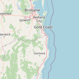
The landscape of D'Aguilar National Park is defined by the D'Aguilar Range, a series of mountainous ridges and valleys that rise from the Brisbane metropolitan area toward the northwest. The terrain features steep slopes, rocky outcrops, and numerous crevasses throughout the higher areas. The park encompasses a pronounced elevational gradient that drives significant variation in vegetation and environmental conditions across its relatively compact area. From the lower foothills with their drier, shallower soils, the landscape transitions through mid-altitude forests to the highest points where moisture-loving subtropical rainforests develop on deeper, richer basaltic soils. Several lookouts scattered throughout the park provide expansive views across the surrounding countryside, with Moreton Bay visible on clear days to the east and the distinctive volcanic peaks of the Glass House Mountains standing prominently on the horizon. The park also overlooks Lake Wivenhoe, a large reservoir created by damming the Brisbane River, which adds another dimension to the scenic landscape from elevated viewpoints.

D'Aguilar National Park ecosystems, habitats, and plant life

The ecological character of D'Aguilar National Park is defined by a striking transition from dry eucalyptus-dominated woodlands to lush subtropical rainforests as elevation increases. The lower foothills support woodlands and dry eucalypt forests dominated by spotted gum and narrow-leaved ironbark on the shallower, drier soils, with areas of heath and grass trees on ridge tops. Small pockets of lowland rainforest persist in the valley floors along watercourses. At mid-altitudes, where rainfall increases and soils deepen, the forests become more complex with grey gum, pink bloodwood, and brush box forming the canopy, while a dense understorey of ferns, vines, and shrubs develops. The highest parts of the range, particularly on the basaltic soils north of Mount Glorious, support moist subtropical rainforest where enormous strangler figs emerge dramatically through the canopy. This elevational gradient creates a mosaic of habitats that supports remarkable biodiversity across relatively limited geographic area.

D'Aguilar National Park wildlife and species highlights

D'Aguilar National Park supports an exceptional diversity of wildlife, with more than 240 bird species recorded within its boundaries. The avian community includes notable species such as the noisy pitta, southern logrunner, paradise riflebird, regent bowerbird, and satin bowerbird, along with more common species like the laughing kookaburra, pied currawong, and white-bellied sea eagle. The birdlife is particularly diverse due to the range of habitat types present. Mammal diversity is equally impressive with 66 species recorded, including the iconic koala and platypus, various marsupials such as red-necked pademelon, several possum species including short-eared and common ringtail possums, bandicoots, the long-nosed potoroo, and numerous fruit bats and insectivorous bats. Reptile diversity includes the large tree goanna or lace monitor and the distinctive land mullet, a large glossy black skink. The park also supports 26 amphibian species, with the great barred frog among the notable native species, though the introduced cane toad has become common.

D'Aguilar National Park conservation status and protection priorities

D'Aguilar National Park plays an important conservation role in the Brisbane region by protecting a significant area of mountainous forest ecosystem that would otherwise face development pressure given its proximity to a major city. The park preserves important examples of both dry eucalyptus woodland and subtropical rainforest, representing habitat types that have been extensively cleared in the surrounding region. The protected area serves as a corridor for wildlife movement through the Brisbane landscape, connecting larger forest areas and allowing species to maintain populations in an otherwise fragmented environment. The diversity of bird and mammal species recorded demonstrates the ecological health of the area and its importance as a biodiversity refuge. Protection of the D'Aguilar Range also safeguards the scenic values that make it a landmark feature of the Brisbane skyline and a valued recreational resource for the community.

D'Aguilar National Park cultural meaning and human context

The D'Aguilar Range and surrounding area have long been associated with the traditional lands of Indigenous peoples, though the specific cultural relationships of local Aboriginal groups with this landscape would require consultation with traditional knowledge holders for detailed documentation. The park's proximity to Brisbane has shaped its history as a recreational resource for the city, with the former Brisbane Forest Park designation reflecting its role as a forest reserve serving metropolitan recreation needs. The villages of Mount Nebo, Mount Glorious, and Mount Mee developed alongside the forest area, with their positions on the mountain roads reflecting the park's boundaries. These communities maintain close connections to the national park, which continues to form an important part of the local identity and economy.

Top sights and standout views in D'Aguilar National Park

The panoramic views from lookouts such as Jolly's Lookout, Westridge Outlook, and Wivenhoe Lookout rank among the park's most visited attractions, offering sweeping vistas over Moreton Bay, the Glass House Mountains, and Lake Wivenhoe. The moist subtropical rainforests north of Mount Glorious, with their towering strangler figs emerging through the canopy, represent a distinctive and visually striking environment. The birdwatching opportunities are exceptional, with over 240 species providing one of the most diverse avian communities in any Australian national park near a major city. The contrast between dry foothills woodlands and cloud forest environments can be experienced in a single day's walk, making the park an excellent destination for understanding Queensland's forest ecosystems.

Best time to visit D'Aguilar National Park

D'Aguilar National Park can be visited throughout the year, though the cooler months from autumn through spring typically offer the most comfortable conditions for walking and outdoor exploration. The subtropical climate means summer months can be hot and humid, particularly at lower elevations, while winter generally brings mild days and cooler nights. The rainforests at higher elevations tend to be wettest during the summer months, creating lush conditions but also making some tracks potentially slippery. Birdwatching can be productive year-round, though spring and early summer often bring increased bird activity. The scenic drives through the park are popular in all seasons, though fog may occasionally reduce visibility on mountain roads during winter mornings.

Park location guide

Geography guide, regional context, and park location map for D'Aguilar National Park

D'Aguilar National Park park geography, regions, and map view in Australia
Understand where D'Aguilar National Park sits in Australia through a broader geographic reading of the surrounding landscape, nearby location context, and its mapped position within the national park landscape.

How D'Aguilar National Park fits into Australia

Australia is a constitutional monarchy and federal parliamentary democracy comprising six states and ten territories. With a population of nearly 28 million, it is one of the world's most urbanised countries, with most people concentrated on the eastern seaboard. The country has a high Human Development Index and is known for its cultural diversity, ancient Aboriginal heritage, and unique wildlife.

Wider geography shaping D'Aguilar National Park in Australia

Australia occupies the entire Australian continent, the island of Tasmania, and numerous smaller islands. It is the world's flattest and driest inhabited continent, featuring vast deserts in the interior (the Outback), tropical rainforests along the eastern coast, and a coastline bordering the Indian and Pacific Oceans.

Map view of D'Aguilar National Park

Use this park location map to pinpoint D'Aguilar National Park in Australia, understand its exact geographic position, and read its mapped placement within the surrounding landscape more clearly.

Pigeon | © OpenStreetMap contributors

Location context for D'Aguilar National Park

Queensland
Park atlas

Compare Queensland's Diverse Protected Landscapes, from Mountain Ranges to Coastal Hinterlands Surrounding Brisbane

Explore Other National Parks and Protected Areas Near D'Aguilar National Park
Continue your exploration of Australia's protected areas by discovering national parks and reserves in the broader Queensland region, extending beyond D'Aguilar National Park's unique mountain terrain. Compare diverse ecosystems, mapped geography, and conservation landscapes across the Brisbane hinterland, tracing connections between distinct protected zones for deeper atlas understanding.
National parkQueensland

Kondalilla National Park: Protected Waterfall Landscape and Bunya Pine Atlas

Explore Queensland's Blackall Range geography and mapped natural terrain.

Kondalilla National Park is a protected national park on the Blackall Range in Queensland, recognized for its significant remnant subtropical rainforest and spectacular waterfalls. This atlas entry provides detailed insight into its mapped boundaries, geographic setting, and the unique landscape character, including the easternmost bunya pine stands, making it a key destination for protected-area discovery.

Area
3.27 km²
Established
1945
IUCN
II
Relief
Mixed relief
National parkQueensland

Tamborine National Park: Queensland's Accessible Rainforest and Waterfall Landscape

Explore unique plateau geography and mapped protected areas.

Tamborine National Park stands as a crucial protected area nestled atop the Tamborine Mountain plateau in South East Queensland. It preserves vital remnants of subtropical rainforest and eucalypt forests, presenting a rich tapestry of landscapes and biodiversity. The park's unique configuration, with its accessible walking tracks leading to waterfalls like Witches Falls, offers a remarkable opportunity to engage with a protected natural environment. This national park serves as an excellent resource for understanding regional geography and the importance of conservation within populated areas, featuring distinct terrain and mapped natural features.

Area
11.6 km²
Established
1993
IUCN
II
National parkQueensland

Conondale National Park: Protected Landscape, Biodiversity Hotspot in Queensland

Explore its rugged terrain and subtropical rainforests within regional geography.

Conondale National Park offers a deep dive into protected landscape geography, showcasing one of Queensland's most significant subtropical rainforests and a vital refuge for numerous threatened species. Its rugged mountain terrain, deep gorges, and scenic creeks form a pronounced catchment divide, contributing essential regional context. This national park is an Important Bird Area and a stronghold for threatened amphibians and the Richmond birdwing butterfly, highlighting its ecological significance.

Area
368 km²
Established
1977
IUCN
II
Relief
Mountain
National parkQueensland

Moogerah Peaks National Park: Protected Volcanic Peaks and Natural Terrain in Queensland

Explore mapped boundaries and regional landscape context.

Moogerah Peaks National Park represents a vital protected area in South East Queensland, safeguarding striking volcanic mountains and their unique ecosystems. This national park showcases dramatic cliff faces and distinct geological formations, offering a valuable snapshot of the region's natural heritage and landscape character. Understanding its protected status and geographic setting within Queensland enhances exploration of Australia's diverse natural environments.

Area
9.27 km²
Established
1982
IUCN
II
National parkAustralia

Mount Binga National Park National Park: Protecting South East Queensland's Araucarian Vine Forest

Explore its mapped terrain and significant protected landscape.

Mount Binga National Park stands as a crucial protected area within Australia's South East Queensland, recognized for its conservation of the rare araucarian vine forest. This national park preserves a significant remnant of this vital vegetation type, offering habitat to multiple endangered species. Delve into its specific geographic context and the importance of its mapped boundaries for maintaining regional biodiversity and ecological integrity.

Area
10.667 km²
Established
2006
IUCN
II
National parkQueensland

Mount Coolum National Park: Mapped Boundaries and Geological Significance in Queensland

Explore Queensland's unique laccolith national park and its diverse botanical landscapes.

Mount Coolum National Park offers a concentrated study in unique geological formations and botanical richness within Queensland's protected lands. As a prominent laccolith, the park's dome-shaped mountain and rhyolite cliffs provide a striking natural landmark. Explore its mapped terrain, from forested slopes to rare heath communities, and grasp its significance as a protected area contributing to the regional landscape context. Understand the distinct natural character of this Sunshine Coast national park.

Area
0.69 km²
Established
1990
IUCN
II
Relief
Mixed relief
National parkQueensland

Lamington National Park: Ancient Gondwanan Rainforests and Volcanic Terrain in Queensland

Mapped protected landscape with over 500 waterfalls and unique cloud forests.

Lamington National Park stands as a key protected area within Queensland, recognized for its world-heritage status Gondwanan rainforests and striking volcanic geography. The park's landscape is characterized by its ancient Antarctic beech forests, a legacy of millions of years of volcanic activity that sculpted dramatic cliffs, plateaus, and deep valleys, punctuated by more than 500 waterfalls. Through its mapped boundaries and detailed geographic context, users can explore the exceptional biodiversity and unique terrain that defines this significant Australian national park.

Area
206 km²
Established
1915
IUCN
II
National parkQueensland

Tewantin National Park: Queensland National Park with Volcanic Peaks and Coastal Rainforest

Explore its unique ecosystems and protected landscape boundaries.

Tewantin National Park is a key protected area in Queensland, recognized for its distinct landscape blending coastal rainforest, vibrant Wallum Heath, and the ancient volcanic dome of Mount Tinbeerwah. This national park provides essential conservation for endangered species, particularly amphibians and the swamp stringybark tree, serving as an important natural enclave within the Sunshine Coast region. Its mapped geography offers insight into the ecological significance of this protected landscape, contributing a vital piece to Australia's atlas of natural heritage.

Area
13 km²
IUCN
II
Relief
Mixed relief
Climate
Subtropical

Common questions about visiting, size, designation, and location context for D'Aguilar National Park

D'Aguilar National Park FAQs for park facts, access, geography, and protected area context
Find quick answers about D'Aguilar National Park, including protected-area facts, park geography, trail and visitor context, and how the park fits into its surrounding country and regional landscape.
MoriAtlas Explorer

Continue Your Protected Areas Search Across the Global Atlas

Deepen your exploration by continuing the structured search for national parks and protected areas worldwide. Utilize the comprehensive filtering capabilities to compare different conservation landscapes and refine your understanding of global park geography. Discover more about the distribution and characteristics of protected natural areas.

Global natural geography