Mori Atlas logo
National parkKondalilla National Park

Discover the mapped terrain and subtropical rainforest of this key national park in Queensland.

Kondalilla National Park: Queensland's Protected Landscape and Waterfall Atlas

(Kondalilla Tops National Park)

Kondalilla National Park represents a significant protected landscape on the Blackall Range in South East Queensland. This national park offers an atlas-style view into remnant subtropical rainforest ecosystems, dramatic waterfalls, and stands of bunya pines, featuring the species' most easterly occurrence in Australia. Explore its geographic context within Queensland, tracing its mapped boundaries and understanding its unique natural terrain.

Subtropical RainforestWaterfallsBirdwatchingQueenslandSunshine CoastHiking

Kondalilla National Park

National park

Park overview

Structured park overview, official facts, and landscape profile for Kondalilla National Park

Kondalilla National Park park facts, protected area profile, and essential visitor context
Review the core facts for Kondalilla National Park, including designation, size, terrain, visitor scale, habitats, and operating context in one park-focused overview.

About Kondalilla National Park

Kondalilla National Park occupies a significant position in South East Queensland's protected area network, preserving critical remnants of the Blackall Range's natural landscapes. The park's setting on the Blackall Range provides visitors with sweeping views and access to cascading waterfalls amid lush forest environments. The protection of this area reflects a long history of recognition of its scenic and ecological value, beginning with formal protection in 1906 and continuing through subsequent additions that expanded the park from its original 327 hectares to significantly larger holdings through connections to Obi Obi National Park and the incorporation of former State forest lands. The park's accessibility from nearby communities such as Flaxton makes it a popular destination for day visitors seeking to experience the natural beauty of the Sunshine Coast hinterland. The combination of subtropical rainforest, eucalypt forests, and the presence of bunya pines creates a distinctive ecological character that distinguishes this park from other Queensland protected areas.

Quick facts and research context for Kondalilla National Park

Kondalilla National Park is located in the Blackall Range of South East Queensland, part of the Greater Brisbane region. The park protects significant remnant subtropical rainforest and serves as a habitat for 107 bird species. It contains the most easterly stand of bunya pines in Australia and is home to the rare Pouched Frog and the vulnerable Bopple Nut (Macadamia ternifolia). The park features two primary walking tracks, with the Kondalilla Falls Circuit being the most popular at 4.7 kilometres. Camping is not permitted within the park.

Park context

Deeper park guide and search-rich context for Kondalilla National Park

Kondalilla National Park history, landscape, wildlife, and travel context
Explore Kondalilla National Park through its history, landscape character, ecosystems, wildlife, conservation priorities, cultural context, and seasonal travel timing in a structured park guide built for atlas discovery and search intent.

Why Kondalilla National Park stands out

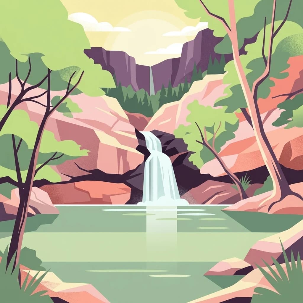
Kondalilla National Park is best known for its dramatic waterfalls, with Kondalilla Falls being the central attraction featuring a upper swimming hole accessible via walking tracks. The park protects one of the most significant remnant subtropical rainforest areas in South East Queensland, with the easternmost occurrence of bunya pines in Australia. The Picnic Creek circuit passes through historically logged areas where ring-barked trees remain visible, offering insight into the region's timber-getting past. The park forms part of the Sunshine Coast Hinterland Great Walk, a 58.8 kilometre trail connecting multiple protected areas in the region.

Kondalilla falls, Sunshine Coast, Queensland
Waterfall in Kondalilla National Park, Sunshine Coast, Queensland.

Kondalilla National Park history and protected-area timeline

The history of Kondalilla National Park reflects a transition from Aboriginal significance to European pastoral use and eventual conservation protection. For countless generations, the Blackall Range held profound spiritual significance for Aboriginal people throughout South East Queensland, particularly the Kabi Kabi and Wakka Wakka peoples. The abundant bunya pines that grew throughout the area produced large nut crops that sustained huge gatherings every three years during the Bonyee Festival, with many guests travelling great distances from coastal and inland regions to share food, songs, dances, and arrange marriages. From 1842 until 1860, the Blackall Range was declared a large reserve by Governor Gipps specifically to protect the bunya pine food source for Indigenous groups, making it illegal to settle or clear land where these trees occurred. After reserve status was rescinded, pastoralists and timber-getters arrived, with the 1880s seeing heavy logging of prized timbers including red cedar, white beech, bunya pine, blackbutt, and tallowwood. The forest around Kondalilla was significantly impacted by logging, with ring-barked trees still visible today along the Picnic Creek circuit. William Skene founded the area on his property while searching for lost cattle, originally naming it Bon Accord before transferring it to the Queensland Government, which renamed it Kondalilla in the 1950s. The area was first officially protected in 1906 as a recreational area and became a national park in 1945.

Kondalilla National Park landscape and geographic character

The landscape of Kondalilla National Park is characterised by its location on the Blackall Range, a prominent geological feature in South East Queensland that provides elevated terrain with scenic vistas and steep-sided valleys. The park encompasses subtropical rainforest ecosystems within its protected boundaries, with the terrain supporting cascading waterfalls that constitute one of the park's most significant attractions. The Picnic Creek circuit traverses areas that still bear evidence of historical logging operations, with ring-barked trees visible along the route. The topography includes both gentle sections near the picnic areas and more challenging terrain along the cliff edges of the circuit tracks. The park's landscape transitions between different forest types, incorporating both wetter rainforest elements and more open eucalypt communities. The presence of piccabeen palms, hoop pines, and casuarinas adds to the visual diversity of the park's vegetation-covered slopes.

Kondalilla National Park ecosystems, habitats, and plant life

Kondalilla National Park protects important remnants of subtropical rainforest that once covered much of the Blackall Range. The park contains diverse vegetation communities including stands of piccabeen palms, pink ash, hoop pines, and casuarinas, alongside extensive eucalypt forests and the remarkable stand of bunya pines that represents the most easterly occurrence of this species in Australia. The protected rainforest areas provide critical habitat connections in a landscape that has experienced extensive clearing for settlement and agriculture. The combination of elevation, moisture, and protection has allowed these rainforest remnants to persist, supporting biodiversity values that extend beyond the park's boundaries. The vulnerable plant species Macadamia ternifolia, also known as the Bopple Nut, grows within the park, highlighting its significance for conservation of rare flora.

Kondalilla National Park wildlife and species highlights

The park provides habitat for 107 bird species, making it an important area for avian biodiversity in the South East Queensland region. The subtropical rainforest and eucalypt forest environments support diverse bird communities throughout the year. The rare Pouched Frog occurs within the park, representing a significant herpetological presence in this protected area. The combination of forest types, from rainforest to eucalypt woodlands, creates varied habitat structures that support different wildlife communities. The presence of the vulnerable Bopple Nut (Macadamia ternifolia) within the park adds to its significance for conservation, as this species faces threats in its natural range.

Kondalilla National Park conservation status and protection priorities

Kondalilla National Park plays an important role in preserving remnants of the Blackall Range's natural communities in a region that has experienced extensive land clearing for agriculture and development. The protection of the most easterly stand of bunya pines in Australia represents a significant conservation achievement, as this species once dominated the forests of South East Queensland. The park preserves critical subtropical rainforest habitat that supports 107 bird species and the rare Pouched Frog, alongside the vulnerable Bopple Nut. The history of protection beginning in 1906 and expanding through subsequent decades reflects ongoing commitment to maintaining these forest remnants. The connection to Obi Obi National Park in 1988 and subsequent additions have created larger conservation blocks that provide better habitat connectivity and ecological resilience.

Kondalilla National Park cultural meaning and human context

Kondalilla National Park sits within a landscape of deep Aboriginal significance, particularly for the Kabi Kabi and Wakka Wakka peoples of South East Queensland. The Blackall Range traditionally supported large Aboriginal gatherings centred on the bunya pine nut crop, which peaked every three years and enabled the Bonyee Festival to bring together people from coastal and inland areas. A large grassy area near Baroon Pocket served as an important gathering place for these cultural celebrations involving food sharing, songs, dances, and social interactions including marriage arrangements. The park's name itself derives from an Aboriginal word meaning running water, reflecting the linguistic heritage of the region's traditional custodians. Following European settlement, the area experienced significant change through pastoral and timber-getting activities that altered the landscape, though some areas were eventually set aside for recreation and conservation.

Top sights and standout views in Kondalilla National Park

The Kondalilla Falls Circuit offers a 4.7 kilometre walking experience through the park's most scenic terrain, requiring approximately two hours to complete and passing close to cliff edges in places. The upper falls swimming hole provides a popular swimming destination accessible via shorter tracks from the main picnic area. The park forms part of the Sunshine Coast Hinterland Great Walk, a 58.8 kilometre trail that requires at least four days to complete and begins at Baroon Pocket Dam. The Picnic Creek Circuit at 1.7 kilometres provides a shorter walking option that passes through historically logged areas with visible ring-barked trees. The remnant subtropical rainforest and bunya pine stands represent significant ecological highlights that distinguish this park within the region.

Best time to visit Kondalilla National Park

The park can be visited year-round, though the subtropical climate of South East Queensland means that summer months bring warmer temperatures and more active waterfall flows following seasonal rains. The winter months typically offer cooler, more comfortable conditions for walking, though rainfall is generally lower. The quality of waterfall flows may vary with seasonal precipitation patterns. Visitors planning longer circuits such as the Kondalilla Falls Circuit should allow at least two hours and be prepared for sections where tracks run close to unfenced cliff edges. The park is most popular on weekends and during school holidays, so those seeking a quieter experience may prefer weekday visits.

Park location guide

Geography guide, regional context, and park location map for Kondalilla National Park

Kondalilla National Park park geography, regions, and map view in Australia
Understand where Kondalilla National Park sits in Australia through a broader geographic reading of the surrounding landscape, nearby location context, and its mapped position within the national park landscape.

How Kondalilla National Park fits into Australia

Australia is a constitutional monarchy and federal parliamentary democracy comprising six states and ten territories. With a population of nearly 28 million, it is one of the world's most urbanised countries, with most people concentrated on the eastern seaboard. The country has a high Human Development Index and is known for its cultural diversity, ancient Aboriginal heritage, and unique wildlife.

Wider geography shaping Kondalilla National Park in Australia

Australia occupies the entire Australian continent, the island of Tasmania, and numerous smaller islands. It is the world's flattest and driest inhabited continent, featuring vast deserts in the interior (the Outback), tropical rainforests along the eastern coast, and a coastline bordering the Indian and Pacific Oceans.

Map view of Kondalilla National Park

Use this park location map to pinpoint Kondalilla National Park in Australia, understand its exact geographic position, and read its mapped placement within the surrounding landscape more clearly.

Pigeon | © OpenStreetMap contributors

Location context for Kondalilla National Park

Queensland

Gain visual reference into Kondalilla National Park's unique subtropical rainforest, dramatic waterfalls, and Blackall Range eucalypt forests.

Explore Kondalilla National Park: Comprehensive Photo Gallery of Rainforests and Waterfalls
Browse a detailed visual atlas of Kondalilla National Park, showcasing its distinctive subtropical rainforests, cascading waterfalls, and Blackall Range eucalypt landscapes. These images provide essential insights into the park's diverse habitats, dramatic terrain, and protected environmental character, helping users visually trace its unique geographic identity.

Kondalilla falls, Sunshine Coast, Queensland

Park atlas

Compare regional park geography and browse Queensland's protected landscapes across the Blackall Range hinterland.

Explore Nearby National Parks and Protected Areas Beyond Kondalilla National Park
Discover more national parks and protected areas near Kondalilla National Park, tracing the geographical spread across Queensland's Blackall Range and Sunshine Coast region. Evaluate these adjacent protected landscapes to understand regional conservation patterns, compare diverse ecosystems, and explore interconnected park geography.
National parkQueensland

Conondale National Park: Protected Landscape, Biodiversity Hotspot in Queensland

Explore its rugged terrain and subtropical rainforests within regional geography.

Conondale National Park offers a deep dive into protected landscape geography, showcasing one of Queensland's most significant subtropical rainforests and a vital refuge for numerous threatened species. Its rugged mountain terrain, deep gorges, and scenic creeks form a pronounced catchment divide, contributing essential regional context. This national park is an Important Bird Area and a stronghold for threatened amphibians and the Richmond birdwing butterfly, highlighting its ecological significance.

Area
368 km²
Established
1977
IUCN
II
Relief
Mountain
National parkQueensland

Mount Coolum National Park: Mapped Boundaries and Geological Significance in Queensland

Explore Queensland's unique laccolith national park and its diverse botanical landscapes.

Mount Coolum National Park offers a concentrated study in unique geological formations and botanical richness within Queensland's protected lands. As a prominent laccolith, the park's dome-shaped mountain and rhyolite cliffs provide a striking natural landmark. Explore its mapped terrain, from forested slopes to rare heath communities, and grasp its significance as a protected area contributing to the regional landscape context. Understand the distinct natural character of this Sunshine Coast national park.

Area
0.69 km²
Established
1990
IUCN
II
Relief
Mixed relief
National parkQueensland

Tewantin National Park: Queensland National Park with Volcanic Peaks and Coastal Rainforest

Explore its unique ecosystems and protected landscape boundaries.

Tewantin National Park is a key protected area in Queensland, recognized for its distinct landscape blending coastal rainforest, vibrant Wallum Heath, and the ancient volcanic dome of Mount Tinbeerwah. This national park provides essential conservation for endangered species, particularly amphibians and the swamp stringybark tree, serving as an important natural enclave within the Sunshine Coast region. Its mapped geography offers insight into the ecological significance of this protected landscape, contributing a vital piece to Australia's atlas of natural heritage.

Area
13 km²
IUCN
II
Relief
Mixed relief
Climate
Subtropical
National parkQueensland

D'Aguilar National Park: A Queensland National Park with Diverse Mountain Landscapes and Scenic Views

Explore its mapped protected area boundaries and regional geography.

D'Aguilar National Park presents a compelling geographic profile within Queensland, featuring the rugged terrain of the D'Aguilar Range. This national park is notable for its impressive biodiversity and the distinct ecological zones, ranging from arid eucalyptus forests to lush subtropical rainforests. The park's mapped landscape offers significant interest for atlas exploration, providing context on its role as a protected area and its contribution to the regional natural heritage.

Area
20.5 km²
Established
1938
IUCN
II
National parkAustralia

Mount Binga National Park National Park: Protecting South East Queensland's Araucarian Vine Forest

Explore its mapped terrain and significant protected landscape.

Mount Binga National Park stands as a crucial protected area within Australia's South East Queensland, recognized for its conservation of the rare araucarian vine forest. This national park preserves a significant remnant of this vital vegetation type, offering habitat to multiple endangered species. Delve into its specific geographic context and the importance of its mapped boundaries for maintaining regional biodiversity and ecological integrity.

Area
10.667 km²
Established
2006
IUCN
II
National parkFraser Coast Region

Poona National Park: Coastal Wetland Refuge and Protected Landscape Exploration

Discover the mapped terrain and regional geography of this national park.

Poona National Park protects a critical coastal wetland ecosystem in Queensland's Fraser Coast Region, renowned for its role as a refuge for endangered trees and threatened animal species. The park's landscape is characterized by extensive marshy areas and coastal forests situated between river systems and the ocean. This undeveloped protected area provides essential habitat, highlighting the unique geographic context and conservation importance of these coastal environments within Australia.

Area
53.68 km²
Established
1991
IUCN
II
Relief
Lowland
National parkQueensland

Tamborine National Park: Queensland's Accessible Rainforest and Waterfall Landscape

Explore unique plateau geography and mapped protected areas.

Tamborine National Park stands as a crucial protected area nestled atop the Tamborine Mountain plateau in South East Queensland. It preserves vital remnants of subtropical rainforest and eucalypt forests, presenting a rich tapestry of landscapes and biodiversity. The park's unique configuration, with its accessible walking tracks leading to waterfalls like Witches Falls, offers a remarkable opportunity to engage with a protected natural environment. This national park serves as an excellent resource for understanding regional geography and the importance of conservation within populated areas, featuring distinct terrain and mapped natural features.

Area
11.6 km²
Established
1993
IUCN
II
National parkQueensland

Mount Walsh National Park: Mapped Granite Landscape and Protected Area in Queensland

Explore Queensland's unique volcanic terrain and regional park geography.

Mount Walsh National Park in Queensland, Australia, offers a compelling study in landscape contrasts, defined by its striking granite bluff and rugged topography. This protected area features dramatic exposed rock formations, steep forested slopes, and sheltered gullies, a direct result of ancient geological processes. The park's unique terrain, from bare granite summits to vegetated ridges, provides essential habitat and illustrates the intricate relationship between geology and ecology. For those interested in atlas-style geographic discovery, Mount Walsh National Park serves as a prime example of a distinctive Australian protected landscape.

Area
52.4 km²
Established
1947
IUCN
II
Relief
Mountain

Common questions about visiting, size, designation, and location context for Kondalilla National Park

Kondalilla National Park FAQs for park facts, access, geography, and protected area context
Find quick answers about Kondalilla National Park, including protected-area facts, park geography, trail and visitor context, and how the park fits into its surrounding country and regional landscape.
MoriAtlas Explorer

Continue Your Protected Areas Search Across the Global Atlas

Deepen your exploration by continuing the structured search for national parks and protected areas worldwide. Utilize the comprehensive filtering capabilities to compare different conservation landscapes and refine your understanding of global park geography. Discover more about the distribution and characteristics of protected natural areas.

Global natural geography