Mori Atlas logo
National parkPoona National Park

Explore the mapped boundaries and unique marshland geography of this vital Australian national park.

Poona National Park: Protected Coastal Wetland Landscape in Fraser Coast Region

Poona National Park stands as a significant protected coastal wetland in Queensland's Fraser Coast Region, offering a crucial refuge for endangered species and rare marshland habitats. This national park encompasses 5,368 hectares of low-lying coastal terrain where river systems meet the sea, creating a mosaic of wetlands and forests. Its undeveloped character prioritizes habitat preservation, making it an important area for understanding coastal ecosystems and regional geography within Australia.

coastal wetlandswildlife refugeQueensland national parkendangered species habitatFraser Coastmarshland

Poona National Park

National park

Park overview

Structured park overview, official facts, and landscape profile for Poona National Park

Poona National Park park facts, protected area profile, and essential visitor context
Review the core facts for Poona National Park, including designation, size, terrain, visitor scale, habitats, and operating context in one park-focused overview.

About Poona National Park

Poona National Park represents an important conservation designation along Queensland's Fraser Coast, protecting a coastal landscape that blends marshland, forest, and wetland environments. The park's location in the Fraser Coast Region places it within one of Queensland's more densely populated regional areas, yet the protected area maintains natural values that warrant formal preservation. Established in 1991, Poona was created to safeguard the ecological character of this coastal zone, where rivers meet the sea and create habitats supporting both common and endangered species. The park occupies central and eastern portions of the Boonooroo Plains locality along with northern sections of Boonooroo, creating a protected corridor that connects riverine and coastal ecosystems. Unlike many national parks that emphasize visitor access and recreational infrastructure, Poona operates primarily as a wildlife refuge with limited development, reflecting its conservation-focused management philosophy.

Quick facts and research context for Poona National Park

Poona National Park covers 5,368 hectares along the Queensland coast in the Fraser Coast Region. The park was established in 1991 under the management of Queensland Parks and Wildlife Service. It sits between rivers and the ocean in a predominantly marshy and forested landscape. The nearest city is Maryborough, located 6 kilometers to the northwest. The park serves as a wildlife refuge with particular conservation significance for endangered trees and animals.

Park context

Deeper park guide and search-rich context for Poona National Park

Poona National Park history, landscape, wildlife, and travel context
Explore Poona National Park through its history, landscape character, ecosystems, wildlife, conservation priorities, cultural context, and seasonal travel timing in a structured park guide built for atlas discovery and search intent.

Why Poona National Park stands out

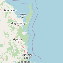
Poona National Park is best known for its role as a coastal wetland refuge protecting endangered trees and threatened animal species. The park's extensive marshes and forested areas between rivers and the sea create a distinctive coastal ecosystem that supports biodiversity in a region where such habitats are increasingly rare. Its proximity to the Fraser Coast makes it a significant conservation area within easy reach of a regional population center, though the park remains relatively undeveloped with no designated walking trails, emphasizing its focus on habitat preservation over visitor infrastructure.

Poona National Park history and protected-area timeline

Poona National Park was established in 1991 through formal protected area designation by the Queensland government. The creation of the park reflected growing recognition during the late 20th century of the conservation value inherent in Queensland's coastal wetland systems. The Fraser Coast Region, where Poona is located, had experienced various forms of agricultural and coastal development that reduced the extent of intact natural habitats. Designating Poona as a national park provided formal legal protection for the area's ecological values, particularly its wetlands and forested communities that support threatened species. Management responsibility was assigned to the Queensland Parks and Wildlife Service, which continues to oversee the park's conservation priorities.

Poona National Park landscape and geographic character

The landscape of Poona National Park is defined by its coastal position where river systems meet the Pacific Ocean. The terrain is predominantly low-lying, with extensive marshy areas and forested patches distributed between watercourses and the shoreline. The park occupies a transition zone between terrestrial and marine environments, creating a complex mosaic of wetlands, woodlands, and waterways. This coastal geography supports specialized plant communities adapted to periodic flooding and saline influences. The flat to gently undulating terrain lacks dramatic topographic relief but possesses its own subtle beauty through the patterns of vegetation, water channels, and open wetland spaces.

Poona National Park ecosystems, habitats, and plant life

Poona National Park protects a coastal ecosystem characterized by marshland and forest communities. The wetlands within the park serve as important ecological filters and provide habitat for water-associated species. The forested sections contain tree species, some of which carry endangered status, reflecting the conservation significance of this area. The park's position along the coast places it within a biogeographic zone where tropical and temperate influences overlap, creating ecological diversity within a relatively compact area. These habitats collectively support the park's function as a wildlife refuge.

Poona National Park wildlife and species highlights

As a wildlife refuge, Poona National Park provides habitat for various animal species, including those classified as endangered. The wetland environments support waterbirds and aquatic fauna, while the forest communities offer shelter for terrestrial species. The presence of endangered animals was specifically noted in the park's establishment documentation, indicating that Poona serves as a sanctuary for species of conservation concern. The mix of wetland, forest, and coastal habitats creates a diverse environment capable of supporting multiple ecological niches.

Poona National Park conservation status and protection priorities

Poona National Park holds conservation significance as a protected area for endangered trees and animals in coastal Queensland. The park's designation as a wildlife refuge emphasizes its primary function of species protection rather than recreation. The Fraser Coast Region has experienced development pressure, making protected areas like Poona increasingly important for maintaining biodiversity. The park protects coastal wetland ecosystems that provide services including water filtration, flood buffering, and habitat provision for migratory and resident species. Its location within a populated region means the park also serves as an ecological anchor within a modified landscape.

Poona National Park cultural meaning and human context

The park occupies land within the Boonooroo Plains and Boonooroo localities, which are places with local heritage within the Fraser Coast Region. The area has historical connections to the traditional lands of Aboriginal peoples, though detailed cultural information specific to the park's boundary would require additional local sources.

Top sights and standout views in Poona National Park

Poona National Park's main attributes include its status as a coastal wetland refuge with endangered species, its accessibility from Maryborough and the broader Fraser Coast, and its undeveloped character that prioritizes conservation over recreation. The park offers fishing at Kalah Creek and permits photography and nature observation, providing modest nature-based activities within a protected landscape. Its wetland and forest habitats represent increasingly rare coastal ecosystems in the region.

Best time to visit Poona National Park

The park can be visited year-round given its coastal Queensland location. The warmer months from spring through autumn typically offer more comfortable conditions for outdoor activities like photography and fishing. Wetland bird activity may be more observable during drier periods when water bodies concentrate wildlife. Visitors should note that camping is not permitted and there are no formal walking trails, so the park experience centers on day-use activities.

Park location guide

Geography guide, regional context, and park location map for Poona National Park

Poona National Park park geography, regions, and map view in Australia
Understand where Poona National Park sits in Australia through a broader geographic reading of the surrounding landscape, nearby location context, and its mapped position within the national park landscape.

How Poona National Park fits into Australia

Australia is a constitutional monarchy and federal parliamentary democracy comprising six states and ten territories. With a population of nearly 28 million, it is one of the world's most urbanised countries, with most people concentrated on the eastern seaboard. The country has a high Human Development Index and is known for its cultural diversity, ancient Aboriginal heritage, and unique wildlife.

Wider geography shaping Poona National Park in Australia

Australia occupies the entire Australian continent, the island of Tasmania, and numerous smaller islands. It is the world's flattest and driest inhabited continent, featuring vast deserts in the interior (the Outback), tropical rainforests along the eastern coast, and a coastline bordering the Indian and Pacific Oceans.

Map view of Poona National Park

Use this park location map to pinpoint Poona National Park in Australia, understand its exact geographic position, and read its mapped placement within the surrounding landscape more clearly.

Pigeon | © OpenStreetMap contributors

Location context for Poona National Park

Fraser Coast RegionQueensland
Park atlas

Trace the regional geography of protected landscapes across Queensland's Fraser Coast region.

Compare Nearby National Parks and Protected Areas Surrounding Poona National Park
Explore additional national parks and protected areas across Queensland's Fraser Coast, encompassing diverse coastal wetlands, marshlands, and vital forested habitats. This geographic view allows you to compare conservation efforts and landscape features in a region critical for endangered species protection.
National parkQueensland

Mount Walsh National Park: Mapped Granite Landscape and Protected Area in Queensland

Explore Queensland's unique volcanic terrain and regional park geography.

Mount Walsh National Park in Queensland, Australia, offers a compelling study in landscape contrasts, defined by its striking granite bluff and rugged topography. This protected area features dramatic exposed rock formations, steep forested slopes, and sheltered gullies, a direct result of ancient geological processes. The park's unique terrain, from bare granite summits to vegetated ridges, provides essential habitat and illustrates the intricate relationship between geology and ecology. For those interested in atlas-style geographic discovery, Mount Walsh National Park serves as a prime example of a distinctive Australian protected landscape.

Area
52.4 km²
Established
1947
IUCN
II
Relief
Mountain
National parkQueensland

Tewantin National Park: Queensland National Park with Volcanic Peaks and Coastal Rainforest

Explore its unique ecosystems and protected landscape boundaries.

Tewantin National Park is a key protected area in Queensland, recognized for its distinct landscape blending coastal rainforest, vibrant Wallum Heath, and the ancient volcanic dome of Mount Tinbeerwah. This national park provides essential conservation for endangered species, particularly amphibians and the swamp stringybark tree, serving as an important natural enclave within the Sunshine Coast region. Its mapped geography offers insight into the ecological significance of this protected landscape, contributing a vital piece to Australia's atlas of natural heritage.

Area
13 km²
IUCN
II
Relief
Mixed relief
Climate
Subtropical
National parkQueensland

Goodnight Scrub National Park: Protected Dry Rainforest and Hoop Pine Ecosystems

Explore the mapped terrain and conservation significance of this Queensland park.

Goodnight Scrub National Park safeguards a rare dry rainforest ecosystem, a significant ecological asset within Queensland's protected area network. Dominated by iconic hoop pine trees, this national park showcases a unique landscape characterized by its distinct vegetation and geographic setting. The park's conservation value is highlighted by its role in preserving a habitat type uncommon in Australia, offering insights into regional landscape dynamics and protected land importance.

Area
63.3 km²
IUCN
II
National parkQueensland

Mount Coolum National Park: Mapped Boundaries and Geological Significance in Queensland

Explore Queensland's unique laccolith national park and its diverse botanical landscapes.

Mount Coolum National Park offers a concentrated study in unique geological formations and botanical richness within Queensland's protected lands. As a prominent laccolith, the park's dome-shaped mountain and rhyolite cliffs provide a striking natural landmark. Explore its mapped terrain, from forested slopes to rare heath communities, and grasp its significance as a protected area contributing to the regional landscape context. Understand the distinct natural character of this Sunshine Coast national park.

Area
0.69 km²
Established
1990
IUCN
II
Relief
Mixed relief
National parkQueensland

Kondalilla National Park: Protected Waterfall Landscape and Bunya Pine Atlas

Explore Queensland's Blackall Range geography and mapped natural terrain.

Kondalilla National Park is a protected national park on the Blackall Range in Queensland, recognized for its significant remnant subtropical rainforest and spectacular waterfalls. This atlas entry provides detailed insight into its mapped boundaries, geographic setting, and the unique landscape character, including the easternmost bunya pine stands, making it a key destination for protected-area discovery.

Area
3.27 km²
Established
1945
IUCN
II
Relief
Mixed relief
National parkQueensland

Conondale National Park: Protected Landscape, Biodiversity Hotspot in Queensland

Explore its rugged terrain and subtropical rainforests within regional geography.

Conondale National Park offers a deep dive into protected landscape geography, showcasing one of Queensland's most significant subtropical rainforests and a vital refuge for numerous threatened species. Its rugged mountain terrain, deep gorges, and scenic creeks form a pronounced catchment divide, contributing essential regional context. This national park is an Important Bird Area and a stronghold for threatened amphibians and the Richmond birdwing butterfly, highlighting its ecological significance.

Area
368 km²
Established
1977
IUCN
II
Relief
Mountain
National parkQueensland

Bulburin National Park: Central Queensland's Significant Subtropical Rainforest Preserve

Mapped protected landscape and ecological refuge.

Bulburin National Park represents the most substantial remaining area of subtropical rainforest in central Queensland, established as a protected national park. Its dense forest ecosystem provides crucial habitat for numerous species, including endangered marsupials and notable birdlife. Exploring Bulburin National Park reveals a distinct natural landscape within Queensland, offering insights into regional conservation and the geographic distribution of vital protected areas.

Established
2015
IUCN
II
National parkNorth Burnett Region

Auburn River National Park: A Protected Landscape Defined by River Gorge and Hardwood Forests

Explore the mapped terrain and protected area geography of this Queensland national park.

Auburn River National Park, designated a national park in Australia, showcases a remarkable protected landscape sculpted by the Auburn River. Its geography is characterized by a steep, dramatic river gorge and extensive hardwood forests, creating a visually striking and ecologically significant area. This park provides crucial insight into riparian ecosystems and their role within the regional geographic context of the North Burnett Region, inviting detailed exploration of its mapped terrain and conservation value.

Area
3.9 km²
Established
1964
IUCN
II

Common questions about visiting, size, designation, and location context for Poona National Park

Poona National Park FAQs for park facts, access, geography, and protected area context
Find quick answers about Poona National Park, including protected-area facts, park geography, trail and visitor context, and how the park fits into its surrounding country and regional landscape.
MoriAtlas Explorer

Continue Your Protected Areas Search Across the Global Atlas

Deepen your exploration by continuing the structured search for national parks and protected areas worldwide. Utilize the comprehensive filtering capabilities to compare different conservation landscapes and refine your understanding of global park geography. Discover more about the distribution and characteristics of protected natural areas.

Global natural geography