Mori Atlas logo
National parkTaza National Park

Discover mapped boundaries, unique terrain, and critical habitats within Jijel Province.

Taza National Park: Algeria's Protected Mediterranean Coastal and Tell Atlas Landscape

Taza National Park, established in 1923, protects a vital 3,807-hectare expanse of mountainous terrain in Algeria's Jijel Province. This national park features a dramatic transition from rugged Mediterranean coastal cliffs to the towering forested heights of the Tell Atlas region, descending sharply from over 1,100 meters to the sea. As a UNESCO-recognized biosphere reserve, Taza National Park safeguards critical habitats, including Algeria's largest cork oak and gall oak forest, and is a stronghold for endangered species like the Barbary macaque and Algerian nuthatch, offering a unique glimpse into North African protected landscapes.

Mediterranean forestCork oak forestBiosphere reserveCoastal cliffsEndangered speciesTell Atlas

Taza National Park

National park

Park overview

Structured park overview, official facts, and landscape profile for Taza National Park

Taza National Park park facts, protected area profile, and essential visitor context
Review the core facts for Taza National Park, including designation, size, terrain, visitor scale, habitats, and operating context in one park-focused overview.

About Taza National Park

Taza National Park occupies a dramatic position along Algeria's Mediterranean coastline in the mountainous Tell Atlas region of Jijel Province. The park's landscape is characterized by steep forested slopes that descend from the Guerrouch massif directly into the sea, creating a unique interface between mountain and marine environments. The park was established in 1923 during the French colonial period, making it one of Algeria's oldest protected areas, originally created to protect both the coastline and the remarkable forested heights that define the region. The park encompasses approximately 3,807 hectares of land, including parts of the forested Guerrouch massif, and extends from sea level at the Mediterranean shoreline up to elevations exceeding 1,100 meters. The combination of dramatic cliffs, coastal caves, sand beaches, and dense forest makes this park distinctive among Algeria's protected areas. As a UNESCO-recognized biosphere reserve, the park aims to balance conservation of its unique ecosystems with sustainable use of natural resources, supporting both ecological integrity and the economic wellbeing of local communities.

Quick facts and research context for Taza National Park

Taza National Park covers 38.07 square kilometers along Algeria's Mediterranean coast in Jijel Province. Established in 1923, it is one of the oldest protected areas in North Africa. The park features dramatic cliffs rising from sea level to over 1,100 meters, cave systems, sand beaches, and grottoes. Annual precipitation ranges from 1,000 to 1,400 millimeters with an average temperature of 18°C, creating a humid microclimate that supports lush forest growth. The park is a UNESCO biosphere reserve and contains the largest remaining cork oak forest in Algeria.

Park context

Deeper park guide and search-rich context for Taza National Park

Taza National Park history, landscape, wildlife, and travel context
Explore Taza National Park through its history, landscape character, ecosystems, wildlife, conservation priorities, cultural context, and seasonal travel timing in a structured park guide built for atlas discovery and search intent.

Why Taza National Park stands out

Taza National Park is best known for protecting one of the last strongholds of the endangered Barbary macaque, a primate with a narrowly restricted distribution in North Africa. The park also contains the largest and most significant cork oak and gall oak forest in Algeria, representing a critical habitat type in the Mediterranean region. Its dramatic coastal cliffs, cave systems, andStatus as a UNESCO biosphere reserve further distinguish it as a conservation priority area. The park is also notable for hosting the endangered Algerian nuthatch, with an estimated population of 364 individuals recorded in surveys.

Taza National Park history and protected-area timeline

Taza National Park was established in 1923 by French colonial administrators during Algeria's period under French rule. The creation of the park reflected early colonial conservation priorities, aiming to protect the remarkable Mediterranean coastline and the impressive forested mountain heights of the region. The park was specifically designed to provide protection for the Barbary macaque, which even then was recognized as a species of particular conservation concern. Following Algeria's independence in 1962, the park remained under protection and was later recognized as a UNESCO biosphere reserve, reflecting its international significance for biodiversity conservation. The park's management has evolved to incorporate modern conservation principles while addressing the needs of the approximately 5,600 Berber residents who live within the reserve boundaries.

Taza National Park landscape and geographic character

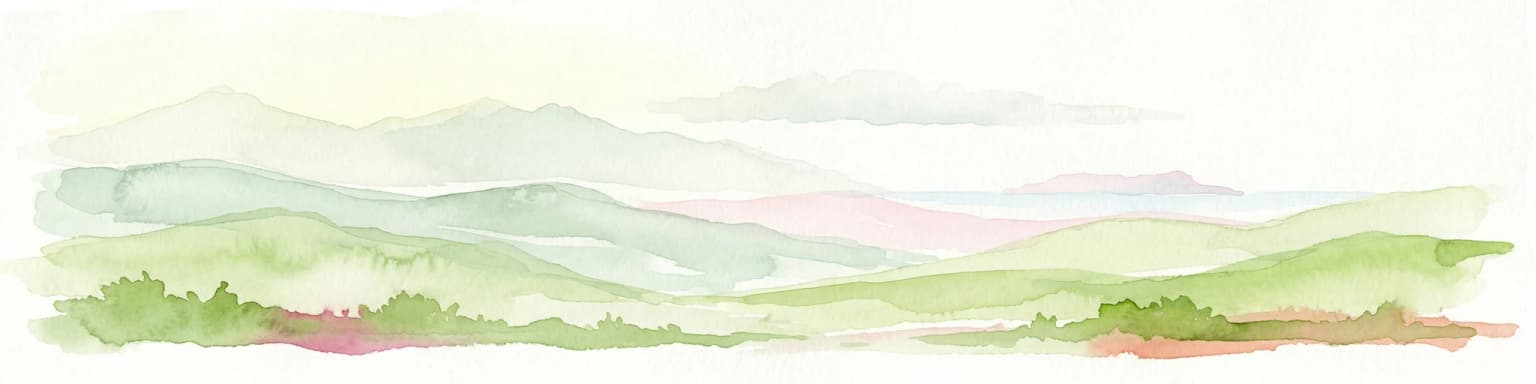
The landscape of Taza National Park is defined by a dramatic transition from Mediterranean coastal environments to mountainous forest terrain. Steep cliffs rise directly from sea level to elevations exceeding 1,100 meters, creating one of the most visually striking coastal protected areas in North Africa. The park includes the caves of Jijel, numerous sand beaches, and a network of cliffs and grottoes along the shoreline. The Guerrouch massif forms the mountainous backbone of the park, with its lower slopes covered in dense cork oak and gall oak forest. The contrast between the rugged coastline and the lush forested interior creates a varied and visually impressive landscape. Winter snow may cover the higher peaks while the lower coastal areas remain relatively warm and frost-free throughout the year.

Taza National Park ecosystems, habitats, and plant life

The ecological character of Taza National Park is defined by its Mediterranean forest ecosystems, which represent some of the most significant remaining forest cover in Algeria. The park contains the largest cork oak forest in the country, a habitat type of considerable conservation importance in the Mediterranean region. At lower altitudes, the forest is dominated by cork oaks, while higher elevations feature Algerian chestnut-leaved oak and Algerian oak. The forest understorey includes diverse species such as bird cherry, Mediterranean willow, European alder, Montpellier maple, and narrow-leaved ash. The park's position along the Mediterranean and its elevation range create varied microclimates that support this remarkable biodiversity. As a UNESCO biosphere reserve, the park aims to combine conservation with sustainable resource use that supports local communities.

Taza National Park wildlife and species highlights

Taza National Park provides critical habitat for several endangered and ecologically significant species. The Barbary macaque, an endangered primate with a narrowly restricted distribution, is present in the park and represents one of the species for which the protected area was originally established. The endangered Algerian nuthatch also inhabits the park, with an estimated population of 364 individuals recorded in a 1989 survey, making this one of the most important sites for this species. The park is known for its populations of birds of prey, which use the coastal cliffs and forested areas for hunting and nesting. Historically, the Barbary lion's range included this region, though the species is now extinct in the area. The combination of coastal, cliff, and forest habitats creates diverse ecological niches that support this range of wildlife.

Taza National Park conservation status and protection priorities

Taza National Park holds significant conservation importance as one of Algeria's oldest protected areas and a UNESCO-recognized biosphere reserve. The park protects critical habitat for the endangered Barbary macaque and Algerian nuthatch, both species of high conservation priority in North Africa. The cork oak and gall oak forests represent the largest remaining stand of these tree species in Algeria, making the park essential for maintaining genetic diversity and ecosystem function of this Mediterranean forest type. The park's designation as a biosphere reserve reflects international recognition of its conservation value and the successful integration of local community needs with protection objectives. Management includes eco-development projects such as distributing beehives and fruit tree seeds to villagers, while improving forest tracks and electricity supplies for remote communities.

Taza National Park cultural meaning and human context

The Taza Biosphere Reserve is home to approximately 5,600 people, predominantly of Berber origin, who have maintained traditional agricultural practices within the park boundaries. These communities largely sustain themselves through small agricultural holdings, cultivating vegetables, fodder crops, and tree fruits. Tourism provides an important additional source of income for the local economy. The integration of human communities within a protected area reflects the biosphere reserve model of combining conservation with sustainable development. Management approaches acknowledge the importance of supporting these communities through eco-development initiatives while preserving the natural values that make the region significant.

Top sights and standout views in Taza National Park

Taza National Park offers a distinctive combination of Mediterranean coastal and mountainous forest environments within a single protected area. The dramatic cliffs rising from sea level to over 1,100 meters provide stunning scenery and important habitat for birds of prey. The park contains Algeria's largest cork oak forest, a Mediterranean ecosystem of significant conservation importance. The presence of the endangered Barbary macaque and Algerian nuthatch makes this park especially important for primate and bird conservation in North Africa. The UNESCO biosphere reserve status reflects the park's successful integration of conservation with the needs of local Berber communities.

Best time to visit Taza National Park

The best time to visit Taza National Park depends on the experience sought. The lower parts of the park experience relatively warm and dry conditions with infrequent frost, making them accessible throughout most of the year. Summer months offer the warmest conditions for beach and coastal exploration, though the mountain forests provide cooler refuge from heat. Spring and autumn typically provide the most comfortable temperatures for hiking and exploring the forested areas. Winter may bring snow to the higher peaks, creating dramatic winter scenery, though some trails may be more challenging. The annual precipitation of 1,000 to 1,400 millimeters means rainfall can occur throughout the year, with the wettest periods typically in winter and spring.

Park location guide

Geography guide, regional context, and park location map for Taza National Park

Taza National Park park geography, regions, and map view in Algeria
Understand where Taza National Park sits in Algeria through a broader geographic reading of the surrounding landscape, nearby location context, and its mapped position within the national park landscape.

How Taza National Park fits into Algeria

Algeria is a North African country spanning over 2.38 million km², making it the largest country in Africa. It borders the Mediterranean Sea to the north and shares land borders with seven countries. The population exceeds 47 million, with most concentrated in the northern coastal region.

Wider geography shaping Taza National Park in Algeria

Algeria occupies the central portion of the Maghreb region in North Africa. It is bordered by Tunisia and Libya to the northeast, Niger to the southeast, Mali, Mauritania, and Western Sahara to the southwest, and Morocco to the west. The Mediterranean Sea forms its northern border. The terrain consists of the Tell Atlas mountain range and coastal plains in the north, transitioning to the Sahara desert in the south.

Map view of Taza National Park

Use this park location map to pinpoint Taza National Park in Algeria, understand its exact geographic position, and read its mapped placement within the surrounding landscape more clearly.

Pigeon | © OpenStreetMap contributors

Location context for Taza National Park

Jijel Province
Park atlas

Browse adjacent protected landscapes and map their geographic spread within Algeria's Tell Atlas region.

Discover Other National Parks and Protected Areas Near Taza National Park, Algeria
Explore national parks and protected areas neighboring Taza National Park, expanding your view of Algeria's Mediterranean coastal environments and forested Tell Atlas region. Compare the distinct conservation profiles of these adjacent protected landscapes, tracing their geographic spread and ecological connections across North Africa's varied terrain.
National parkEl Tarf Province

El Kala National Park: Protected Wetlands and Barbary Stag Habitat

Explore its mapped geography and vital ecosystem context.

El Kala National Park represents a crucial protected landscape within El Tarf Province, Algeria, recognized internationally for its extensive Mediterranean wetlands and rich biodiversity. This national park is a vital ecological zone, comprising six major lakes and a significant stretch of coastline, offering a unique mosaic of aquatic and terrestrial environments. Its role as a sanctuary for the Barbary stag and migratory birds highlights its importance in regional conservation efforts. Exploring El Kala National Park provides insight into the mapped terrain, protected boundaries, and distinct geographic features that define this significant North African natural area.

Area
764 km²
Established
1993
IUCN
II
National parkKasserine Governorate

Chambi National Park: Tunisia's Highest Mountain Protected Area and Biosphere Reserve

Explore its mountainous terrain and conservation significance.

Chambi National Park is a protected national park in Tunisia's Kasserine Governorate, safeguarding the country's highest mountain, Djebel Chambi. This park is renowned for its mountainous terrain, semi-arid vegetation, and its role as a critical habitat for endangered species like the Cuvier's gazelle and Barbary sheep. As a UNESCO biosphere reserve, it offers significant insights into North African mountain ecosystems and landscape conservation.

Area
67.23 km²
Established
1980
IUCN
II
Relief
Mountain
Stylized illustration of a coastal landscape featuring a stone castle on rocky terrain, with a body of water, sailboats, and green hills
Protected area

Cabrera National Park: A Mapped Protected Area in the Balearic Islands

Explore Mediterranean island geography and protected marine ecosystems.

Cabrera National Park, a protected maritime-terrestrial area in Spain's Balearic Islands, offers a unique focus for geographic discovery. This entry details the archipelago's distinct island geography, its mapped coastal and marine ecosystems, and its role within the Mediterranean. Users can explore the park's protected boundaries and understand its place in the regional atlas for a comprehensive view of Spain's island conservation landscapes.

IUCN
II
Scope
Mixed
Water
Water-dominated
National parkTunisia

Boukornine National Park: A Protected Mediterranean Mountain Landscape in Tunisia

Explore its mapped terrain and unique protected ecosystem.

Boukornine National Park in Tunisia represents a significant protected landscape, notable for its central granite peak, Jebel Boukornine, which rises sharply above the surrounding coastal plains. This national park, covering approximately 1,939 hectares, preserves a distinctive Mediterranean mountain ecosystem. Its rugged terrain, rocky slopes, and the presence of Aïn Zargua spring support a unique concentration of species, including notable flora and fauna. Understanding Boukornine National Park provides insight into the regional geography and the importance of conserving these mountainous protected areas within Tunisia.

Area
19.39 km²
Established
1987
IUCN
II
National parkGafsa Governorate

Bou-Hedma National Park: Mapped Protected Area and Conservation Sanctuary in Gafsa Governorate

Discover Saharan wildlife, Roman ruins, and unique semi-arid landscapes.

Bou-Hedma National Park serves as a crucial conservation hub in Tunisia's Gafsa Governorate, renowned for its success in reintroducing endangered Saharan large mammals like the scimitar oryx and addax. The park's geography spans arid plains and seasonal wadis, encompassing the Ramsar-listed Sebkhet Noual wetland. Its unique landscape also preserves significant Roman-era archaeological sites, offering a rich context for exploring protected-area identity, conservation achievements, and ancient human history within a North African setting.

Established
1980
IUCN
II
Stylized illustration of rocky coastal cliffs, turquoise sea, scattered trees, and a sea stack
National parkItaly

National Park of the Gulf of Orosei and Gennargentu: Italy's Coastal and Mountain Protected Terrain

Mapped geography of a unique Sardinian protected landscape.

Delve into the atlas-level details of the National Park of the Gulf of Orosei and Gennargentu, a protected area in Italy renowned for its stark contrast between dramatic coastal cliffs bordering the Gulf of Orosei and the wild, mountainous interior of the Gennargentu massif. This page provides structured geographic context, mapping the park's boundaries and showcasing its distinctive karst landscape, hidden beaches, and rugged peaks for comprehensive protected-area exploration.

IUCN
II
Watercolor illustration of a coastal landscape with green hills, shoreline, and blue sea under a pale yellow sky
National parkSardinia

Asinara National Park: National Park Protected Landscape and Geographic Setting

Explore mapped terrain and protected area context within Sardinia.

Asinara National Park stands as a key protected landscape within the Italian national park system, located off the coast of Sardinia. This entry provides detailed geographic context, focusing on its mapped boundaries and the unique natural terrain that defines this island sanctuary. MoriAtlas facilitates a structured discovery of Asinara National Park, enabling users to understand its protected area status and its significant position within the broader regional geography of Sardinia for atlas exploration.

Area
51.7 km²
Established
1997
IUCN
II
Relief
Mixed relief
Watercolor painting of a landscape with rolling hills, pink wildflowers, and scattered trees
National park

Pantelleria National Park: A Protected Landscape within Italy's Atlas

Mapped boundaries and regional geographic context.

Pantelleria National Park is a designated national park in Italy offering a distinct protected landscape for exploration. This page provides essential geographic context, highlighting the park's mapped boundaries and its significance within the regional atlas. Understand the terrain and protected land features that define this important natural area.

Area
66.4 km²
Established
2016
IUCN
II
Relief
Highland

Common questions about visiting, size, designation, and location context for Taza National Park

Taza National Park FAQs for park facts, access, geography, and protected area context
Find quick answers about Taza National Park, including protected-area facts, park geography, trail and visitor context, and how the park fits into its surrounding country and regional landscape.
MoriAtlas Explorer

Continue Your Protected Areas Search Across the Global Atlas

Deepen your exploration by continuing the structured search for national parks and protected areas worldwide. Utilize the comprehensive filtering capabilities to compare different conservation landscapes and refine your understanding of global park geography. Discover more about the distribution and characteristics of protected natural areas.

Global natural geography