Mori Atlas logo
National parkBoukornine National Park

Discover the mapped terrain, unique ecosystems, and geographic context of this prominent peak.

Boukornine National Park: Tunisia's Protected Mediterranean Mountain Landscape and National Park

(Parc national de Boukornine)

Boukornine National Park, a designated national park in Tunisia, offers a unique glimpse into a compact Mediterranean mountain ecosystem. Centered on the striking 576-metre Jebel Boukornine peak, this protected area showcases rugged granite and limestone terrain just 15 kilometres from Tunis. Explore the park's mapped boundaries, discover its distinctive flora and fauna adapted to semi-arid conditions, and understand its regional geographic significance as a vital natural landscape.

Mediterranean mountainsProtected areaTunisiaNature reserveNational parkMaquis ecosystem

Boukornine National Park

National park

Park overview

Structured park overview, official facts, and landscape profile for Boukornine National Park

Boukornine National Park park facts, protected area profile, and essential visitor context
Review the core facts for Boukornine National Park, including designation, size, terrain, visitor scale, habitats, and operating context in one park-focused overview.

About Boukornine National Park

Boukornine National Park represents a significant conservation achievement in Tunisia's protected areas system, established in 1987 to safeguard a unique Mediterranean mountain environment near the nation's capital. The reserve occupies a strategic position in the hills that rise along Tunisia's eastern coast, creating a natural boundary between the coastal agricultural zone and the interior plains. Jebel Boukornine, the park's central feature, is composed primarily of granite and limestone, with steep ridges and rocky outcrops that support specialized plant communities. The park's establishment reflects Tunisia's recognition that even small, accessible protected areas provide substantial ecological and educational value, particularly for urban populations seeking nature experiences close to major cities. The ecomuseum housed within the park boundary offers visitors interpretive context about regional ecology, geology, and human interaction with the landscape, making the reserve particularly valuable for environmental education.

Quick facts and research context for Boukornine National Park

Boukornine National Park spans 1,939 hectares in northern Tunisia, established on 12 February 1987 near the coastal town of Hammam-Lif. The park's focal point is Jebel Boukornine, a 576-metre mountain that dominates the reserve's terrain. The area is notable for its Mediterranean maquis vegetation and the presence of ecologically significant species including the Persian cyclamen and the Etruscan shrew, recognized as the world's smallest known mammal. An ecomuseum within the park provides educational context about the region's natural and cultural heritage.

Park context

Deeper park guide and search-rich context for Boukornine National Park

Boukornine National Park history, landscape, wildlife, and travel context
Explore Boukornine National Park through its history, landscape character, ecosystems, wildlife, conservation priorities, cultural context, and seasonal travel timing in a structured park guide built for atlas discovery and search intent.

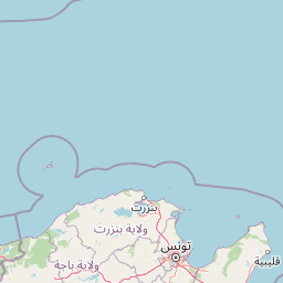
Why Boukornine National Park stands out

Boukornine National Park is distinguished by its remarkable concentration of notable species within a relatively small area. The park protects populations of the Persian cyclamen, a distinctive flowering plant prized for its ornamental value, and serves as a habitat for the Etruscan shrew, the smallest mammal species in the world. The mountain gazelle also inhabits the park's rocky terrain. The park's most recognizable feature is Jebel Boukornine itself, a prominent peak that provides panoramic views over the Gulf of Tunis and serves as a landmark for the surrounding region. The presence of Aïn Zargua spring adds hydrological significance to the reserve, supporting vegetation in an otherwise semi-arid environment.

Boukornine National Park history and protected-area timeline

Boukornine National Park was officially established on 12 February 1987, becoming part of Tunisia's growing network of national parks during a period of increased environmental conservation emphasis in the country. The park's creation responded to both ecological preservation needs and growing recognition of the area's value as a natural laboratory for studying Mediterranean mountain ecosystems. Prior to formal protection, the Jebel Boukornine area had been subject to traditional land use including grazing and charcoal production, and the establishment of the reserve represented a shift toward sustainable management. The ecomuseum development followed shortly after the park's creation, providing infrastructure for interpretation and environmental education that distinguishes this reserve from more purely ecological protected areas in Tunisia.

Boukornine National Park landscape and geographic character

The landscape of Boukornine National Park is dominated by the steep-sided mass of Jebel Boukornine, a mountain of approximately 576 metres elevation that rises abruptly from the surrounding terrain. The mountain's granite and limestone composition has produced rugged terrain with rocky cliffs, boulder-strewn slopes, and narrow valleys that channel seasonal water flow. The lower slopes transition into a more gentle undulating terrain before meeting the coastal plain. Aïn Zargua spring provides a permanent water source within the reserve, supporting riparian vegetation in an environment characterized by long dry seasons and limited precipitation. The combination of elevation, rock type, and water availability creates a mosaic of microhabitats within the relatively small park boundary.

Boukornine National Park ecosystems, habitats, and plant life

The vegetation of Boukornine National Park reflects the Mediterranean climate zone characteristic of northern Tunisia, dominated by maquis shrubland and garrigue plant communities. The characteristic evergreen shrubs including rosemary, thyme, and various sage species carpet the lower slopes, while denser vegetation clusters around water sources and in sheltered valleys. The park's most celebrated botanical resident is the Persian cyclamen, a bulbous perennial that blooms in late winter and early spring, producing distinctive curved petals in shades of pink and white. This species thrives in the rocky, shaded conditions provided by the mountain's upper slopes and forest margins.

Boukornine National Park wildlife and species highlights

Boukornine National Park supports a notable fauna population despite its modest size, with several species of particular conservation significance. The park is home to the Etruscan shrew, recognized as the world's smallest known mammal, a species that weighs only a few grams and possesses distinctive elongated features adapted for insectivorous feeding. The mountain gazelle, a graceful antelope species adapted to rocky terrain, inhabits the park's steeper slopes and open areas. Smaller mammals including various rodent species and hedgehogs contribute to the park's mammalian diversity. The Mediterranean scrubland provides habitat for numerous bird species, though the source material focuses primarily on the mammalian residents.

Boukornine National Park conservation status and protection priorities

Boukornine National Park serves as an important conservation island in Tunisia's heavily modified eastern coastal region, protecting representative Mediterranean mountain habitat that has been lost or degraded in surrounding areas. The park's small size belies its ecological significance, as it preserves viable populations of species including the Persian cyclamen and mountain gazelle that face pressure from habitat fragmentation elsewhere in Tunisia. The reserve also protects the watershed that feeds Aïn Zargua spring, maintaining hydrological function in a region where water availability shapes ecosystem health. The park's accessibility from Tunis supports conservation education objectives, allowing urban populations to experience relatively intact natural environments.

Boukornine National Park cultural meaning and human context

The Boukornine region has historical connections to human settlement and land use that predate the park's establishment. Traditional activities including grazing and small-scale charcoal production shaped the landscape over generations. The park's ecomuseum acknowledges this human dimension, presenting not only natural history but also the relationship between local communities and the mountain environment. The proximity to Hammam-Lif, a coastal town with its own historical development, creates a cultural landscape where the protected area serves as a green backdrop to ongoing human activity.

Top sights and standout views in Boukornine National Park

Jebel Boukornine dominates the park both visually and ecologically, its 576-metre peak offering commanding views and supporting distinctive plant communities. The presence of the world's smallest mammal, the Etruscan shrew, gives the park international scientific significance beyond its modest area. The Persian cyclamen provides seasonal floral interest, carpeting parts of the mountain in late winter. The ecomuseum offers interpretive resources uncommon in Tunisia's protected areas. The park's location just 15 kilometres from Tunis makes it uniquely accessible among the country's mountain reserves.

Best time to visit Boukornine National Park

The optimal period for visiting Boukornine National Park spans from late autumn through early spring, when cooler temperatures make hiking comfortable and the Persian cyclamen typically blooms. Winter and early spring bring the most verdant vegetation conditions, with wildflowers appearing on the slopes following seasonal rains. Summer months feature hotter, drier conditions that reduce the appeal of outdoor exploration but may suit visitors preferring quieter park access. The Mediterranean climate means that rain is possible during the winter months, adding variety to the landscape but potentially affecting trail conditions.

Park location guide

Geography guide, regional context, and park location map for Boukornine National Park

Boukornine National Park park geography, regions, and map view in Tunisia
Understand where Boukornine National Park sits in Tunisia through a broader geographic reading of the surrounding landscape, nearby location context, and its mapped position within the national park landscape.

How Boukornine National Park fits into Tunisia

Tunisia is a Maghreb country in North Africa with a Mediterranean coastline, bordered by Algeria and Libya. The country features the ancient ruins of Carthage, the Great Mosque of Kairouan, and portions of the Atlas Mountains and Sahara Desert. With a population of approximately 12 million, Tunisia operates as a unitary presidential republic with Arabic as the official language.

Wider geography shaping Boukornine National Park in Tunisia

Tunisia occupies 163,610 km² in North Africa, bordering Algeria to the west and southwest, Libya to the southeast, and the Mediterranean Sea to the north and east. The country features the eastern end of the Atlas Mountains in the north and extends into the northern Sahara Desert in the south. Its 1,300 km of coastline runs along the Mediterranean Basin. Africa's northernmost point, Cape Angela, is located in Tunisia.

Map view of Boukornine National Park

Use this park location map to pinpoint Boukornine National Park in Tunisia, understand its exact geographic position, and read its mapped placement within the surrounding landscape more clearly.

Pigeon | © OpenStreetMap contributors
Park atlas

Compare surrounding landscapes and conservation efforts in Tunisia's diverse park geography

Explore Nearby National Parks and Protected Areas Beyond Boukornine National Park
Browse other national parks and protected areas near Boukornine National Park, tracing the regional spread of conserved Mediterranean mountain ecosystems and coastal plains across Tunisia. Continuing park discovery offers geographic context, allowing comparison of diverse landscapes, unique species habitats, and varying conservation strategies within North Africa's protected-area network.
Watercolor painting of a landscape with rolling hills, pink wildflowers, and scattered trees
National park

Pantelleria National Park: A Protected Landscape within Italy's Atlas

Mapped boundaries and regional geographic context.

Pantelleria National Park is a designated national park in Italy offering a distinct protected landscape for exploration. This page provides essential geographic context, highlighting the park's mapped boundaries and its significance within the regional atlas. Understand the terrain and protected land features that define this important natural area.

Area
66.4 km²
Established
2016
IUCN
II
Relief
Highland
National parkEl Tarf Province

El Kala National Park: Protected Wetlands and Barbary Stag Habitat

Explore its mapped geography and vital ecosystem context.

El Kala National Park represents a crucial protected landscape within El Tarf Province, Algeria, recognized internationally for its extensive Mediterranean wetlands and rich biodiversity. This national park is a vital ecological zone, comprising six major lakes and a significant stretch of coastline, offering a unique mosaic of aquatic and terrestrial environments. Its role as a sanctuary for the Barbary stag and migratory birds highlights its importance in regional conservation efforts. Exploring El Kala National Park provides insight into the mapped terrain, protected boundaries, and distinct geographic features that define this significant North African natural area.

Area
764 km²
Established
1993
IUCN
II
National parkKasserine Governorate

Chambi National Park: Tunisia's Highest Mountain Protected Area and Biosphere Reserve

Explore its mountainous terrain and conservation significance.

Chambi National Park is a protected national park in Tunisia's Kasserine Governorate, safeguarding the country's highest mountain, Djebel Chambi. This park is renowned for its mountainous terrain, semi-arid vegetation, and its role as a critical habitat for endangered species like the Cuvier's gazelle and Barbary sheep. As a UNESCO biosphere reserve, it offers significant insights into North African mountain ecosystems and landscape conservation.

Area
67.23 km²
Established
1980
IUCN
II
Relief
Mountain
National parkGafsa Governorate

Bou-Hedma National Park: Mapped Protected Area and Conservation Sanctuary in Gafsa Governorate

Discover Saharan wildlife, Roman ruins, and unique semi-arid landscapes.

Bou-Hedma National Park serves as a crucial conservation hub in Tunisia's Gafsa Governorate, renowned for its success in reintroducing endangered Saharan large mammals like the scimitar oryx and addax. The park's geography spans arid plains and seasonal wadis, encompassing the Ramsar-listed Sebkhet Noual wetland. Its unique landscape also preserves significant Roman-era archaeological sites, offering a rich context for exploring protected-area identity, conservation achievements, and ancient human history within a North African setting.

Established
1980
IUCN
II
National park

Ta' Qali National Park: Malta's Largest Urban Protected Landscape and Recreation Hub

Mapped Gardens, Event Venues, and Recreational Zones

Ta' Qali National Park serves as a vital green lung in central Malta, showcasing a landscape transformed from a wartime airfield into a modern urban protected area. This national park is recognized for its extensive recreational zones, meticulously designed formal gardens, and a prominent open-air concert venue that hosts major cultural events. Its relatively flat terrain and planned infrastructure offer a distinct map-based perspective on urban parkland, highlighting its significance as a major public amenity and a key feature of Malta's landscape.

Area
0.35 km²
IUCN
V
Relief
Lowland
Climate
Mediterranean
Stylized illustration of rocky coastal cliffs, turquoise sea, scattered trees, and a sea stack
National parkItaly

National Park of the Gulf of Orosei and Gennargentu: Italy's Coastal and Mountain Protected Terrain

Mapped geography of a unique Sardinian protected landscape.

Delve into the atlas-level details of the National Park of the Gulf of Orosei and Gennargentu, a protected area in Italy renowned for its stark contrast between dramatic coastal cliffs bordering the Gulf of Orosei and the wild, mountainous interior of the Gennargentu massif. This page provides structured geographic context, mapping the park's boundaries and showcasing its distinctive karst landscape, hidden beaches, and rugged peaks for comprehensive protected-area exploration.

IUCN
II
National parkJijel Province

Taza National Park: Protected Mediterranean Coast and Tell Atlas Forest Landscape

Explore its unique mapped geography and conservation significance.

Taza National Park, situated in Algeria's Jijel Province, represents a crucial protected landscape where the Tell Atlas mountains meet the Mediterranean Sea. This 3,807-hectare national park is celebrated for its dramatic coastal cliffs, extensive cork oak and gall oak forests, the largest in Algeria, and its designation as a UNESCO biosphere reserve. The park's geography facilitates unique habitat zones, making it a key area for atlas-based discovery of North African biodiversity, including the Barbary macaque and Algerian nuthatch, within a landscape of exceptional natural beauty and conservation priority.

Area
38.07 km²
Established
1923
IUCN
II
National park

Arcipelago di La Maddalena National Park: An Italian National Park Defined by Archipelago Geography

Discover mapped protected boundaries and regional landscape context.

Arcipelago di La Maddalena National Park stands as a vital protected area within Italy, characterized by its distinctive archipelago geography. This national park offers a unique lens through which to explore mapped natural landscapes, understand protected land distribution, and contextualize its regional geographic significance. Dive into the detailed mapping of its protected territories to appreciate the full scope of this significant natural asset for structured atlas discovery.

Area
201.46 km²
Established
1994
IUCN
II
Relief
Lowland

Common questions about visiting, size, designation, and location context for Boukornine National Park

Boukornine National Park FAQs for park facts, access, geography, and protected area context
Find quick answers about Boukornine National Park, including protected-area facts, park geography, trail and visitor context, and how the park fits into its surrounding country and regional landscape.
MoriAtlas Explorer

Continue Your Protected Areas Search Across the Global Atlas

Deepen your exploration by continuing the structured search for national parks and protected areas worldwide. Utilize the comprehensive filtering capabilities to compare different conservation landscapes and refine your understanding of global park geography. Discover more about the distribution and characteristics of protected natural areas.

Global natural geography