Mori Atlas logo
National parkThree Bays Protected Area

Discover mapped marine ecosystems, coastal terrain, and protected natural features across Haiti's northeastern coast.

Three Bays Protected Area National Park: Haiti's Premier Coastal and Marine Protected Landscape

(Aire Protégée de Ressources Naturelles Gérées des Trois Baies)

Three Bays Protected Area in Haiti is a significant national park safeguarding Haiti's largest marine and coastal complex. This protected landscape, spanning over 75,000 hectares, includes vital fringing and barrier coral reefs, dense seagrass beds, and extensive mangrove forests, alongside adjacent dry tropical forests. Its geographic scope stretches along the northeastern coast, from the Dominican Republic border to near Cap-Haïtien, offering critical insights into Haiti's coastal geography and protected natural resources.

Marine Protected AreaCoral ReefsMangrove ForestsCaribbean IslandsCoastal EcosystemsWetlands

Three Bays Protected Area

National park

Park overview

Structured park overview, official facts, and landscape profile for Three Bays Protected Area

Three Bays Protected Area park facts, protected area profile, and essential visitor context
Review the core facts for Three Bays Protected Area, including designation, size, terrain, visitor scale, habitats, and operating context in one park-focused overview.

About Three Bays Protected Area

Three Bays Protected Area represents a critical conservation milestone for Haiti, a nation that has historically faced significant challenges in environmental protection and natural resource management. Established in 2014, it became the first protected area in the country to be co-managed by government and non-governmental organizations, reflecting an innovative approach to conservation governance. The protected area's extensive marine complex includes coral reefs, seagrass beds, and mangrove forests that together provide essential ecosystem services including coastal protection, fisheries support, and carbon sequestration. The region encompasses over 75,000 hectares of coastal and marine environments, with boundaries that extend from the Massacre River on the eastern border with the Dominican Republic westward to the Grande-Rivière-du-Nord. The northern boundary reaches to the territorial sea limit while the southern boundary follows the 10-meter topographic contour line, effectively protecting the coastal plain and shallow marine zones. This strategic positioning also creates a transboundary conservation network with adjacent protected areas in the Dominican Republic, including the Parque Nacional Manglares de Estero Balsa and several marine protected zones near San Fernando de Monte Cristi.

Quick facts and research context for Three Bays Protected Area

Three Bays Protected Area covers 75,406 hectares along Haiti's northeastern coastline, making it the second-largest protected area in the country after the Port Salut/Aquin Protected Area. The protected zone extends over 40 kilometers east-west and reaches from the territorial sea limit inland to the 10-meter topographic contour line. It was formally established in 2014 under IUCN Category IV (habitat/species management area) and is co-managed by the Agence Nationale des Aires Protégées (ANAP) and the non-governmental organization Fondation pour la Protection de la Biodiversité Marine (FoProBiM). The area borders several protected zones in the Dominican Republic, creating a transboundary conservation context.

Park context

Deeper park guide and search-rich context for Three Bays Protected Area

Three Bays Protected Area history, landscape, wildlife, and travel context
Explore Three Bays Protected Area through its history, landscape character, ecosystems, wildlife, conservation priorities, cultural context, and seasonal travel timing in a structured park guide built for atlas discovery and search intent.

Why Three Bays Protected Area stands out

Three Bays Protected Area is best known for its exceptional marine ecosystems, particularly the extensive fringing and barrier coral reefs that rank among the most healthy in Haiti. The protected area encompasses one of the country's most biologically productive marine environments, with dense seagrass beds and mangrove forests that together form a complex coastal protection system. The adjacent coastal plains feature dry tropical forests characteristic of the Hispaniolan dry forest ecoregion. The area's significance is enhanced by its proximity to the Citadelle Laferrière, a UNESCO World Heritage Site that provides panoramic views over the protected coastal zone.

Three Bays Protected Area history and protected-area timeline

The Three Bays region carries immense historical significance spanning multiple epochs of human occupation and colonial history. The area has been inhabited since pre-Columbian times by indigenous Taino peoples who established communities along the fertile coastal plains and utilized the marine resources of the bay areas. The arrival of Christopher Columbus in the late 15th century initiated a sequence of transformative events, including Spanish and French colonization that dramatically reshaped the landscape and social fabric of the region. The area witnessed key moments during the Haitian Revolution, the successful slave uprising that established Haiti as the first independent Black republic. Fort Liberté, located within the eastern portion of the protected area, stands as one of the oldest cities in Haiti and served as the location where Haiti's independence was proclaimed. The mountaintop fortress of Citadelle Laferrière, a UNESCO World Heritage Site situated approximately 16 kilometers southwest of the protected area, offers commanding views over the Three Bays landscape and represents the revolutionary era's architectural legacy.

Three Bays Protected Area landscape and geographic character

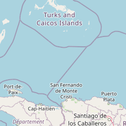
The Three Bays Protected Area encompasses a distinctive coastal landscape characterized by the interplay between marine and terrestrial environments. The marine component features extensive fringing reefs that develop directly along the shoreline and barrier reef formations that parallel the coast at a distance, creating sheltered lagoon areas between them. Seagrass beds occupy the shallow seafloor between reef systems and the shoreline, while mangrove forests fringe the coastline and develop in tidal zones, their prop roots creating complex aquatic habitats. The terrestrial portion of the protected area includes the coastal plain, which supports dry tropical forest vegetation typical of the Hispaniolan ecoregion. The boundary extends inland to the 10-meter elevation contour, capturing the transition from coastal marshes and mangrove systems to drier forest habitats. The landscape is framed by the city of Cap-Haïtien to the west and Fort Liberté to the east, both historic urban centers that anchor the regional geography.

Three Bays Protected Area ecosystems, habitats, and plant life

The ecosystems within Three Bays Protected Area represent some of the most ecologically significant coastal environments in Haiti. The coral reef systems, both fringing and barrier varieties, support high marine biodiversity despite significant fishing pressure from regional communities. These reefs provide structural habitat for numerous fish species, invertebrates, and other marine organisms while also serving as natural breakwaters that reduce wave energy and protect coastal communities from storm damage. Seagrass beds function as critical nursery areas for juvenile fish and sea turtles, while their extensive root systems stabilize sediments and improve water clarity. Mangrove forests provide multiple ecological functions including nutrient cycling, carbon storage, and habitat for bird species and crustaceans. The adjacent dry tropical forests of the coastal plain add terrestrial biodiversity to the protected area, representing the Hispaniolan dry forest ecoregion that has been significantly reduced across the island.

Three Bays Protected Area wildlife and species highlights

The marine waters within Three Bays Protected Area support diverse fish communities and other marine species despite being subject to intensive fishing pressure from local communities. Coral reef ecosystems host numerous reef fish species, while seagrass beds serve as feeding and nursery grounds for species including sea turtles. The mangrove forests provide roosting and nesting habitat for coastal bird species and support crustacean populations including various shrimp and crab species. The adjacent dry forest areas contain bird species typical of the Hispaniolan dry forest ecoregion, including various passerine species adapted to the seasonal drought conditions. While the area is recognized for its biological productivity, the source material notes that the marine environments are extremely overfished, indicating ongoing pressures on wildlife populations.

Three Bays Protected Area conservation status and protection priorities

Three Bays Protected Area holds particular conservation significance as Haiti's first co-managed protected area, representing an innovative model that combines governmental oversight with NGO expertise through the partnership between ANAP and FoProBiM. The IUCN Category IV designation reflects its primary focus on habitat and species management rather than strict preservation, acknowledging the traditional use of marine resources by local fishing communities. The protected area preserves some of the most extensive and healthiest marine ecosystems remaining in Haiti, including coral reefs, seagrass beds, and mangrove forests that provide critical ecosystem services including coastal protection, fisheries support, and climate regulation. Its establishment in 2014 marked an important step in Haiti's commitment to biodiversity conservation, though the area faces significant challenges from overfishing and broader environmental pressures affecting the region.

Three Bays Protected Area cultural meaning and human context

The Three Bays region carries deep cultural heritage spanning the pre-Columbian era through the present day. Indigenous Taino communities inhabited these coastal areas for centuries before European contact, utilizing the marine resources and establishing settlements along the coast. The colonial period brought significant changes, with Spanish and French colonial powers establishing settlements and agricultural systems that transformed the landscape. Fort Liberté, within the protected area's boundaries, represents the colonial historical layer while also serving as a symbolically important location where Haiti's independence was declared in 1804 following the successful Haitian Revolution. The contemporary landscape includes fishing communities that have maintained traditional relationships with the marine environment, though these communities also contribute to the overfishing pressures that challenge the protected area's ecological health.

Top sights and standout views in Three Bays Protected Area

Three Bays Protected Area stands out as Haiti's premier marine conservation site, protecting extensive coral reef systems, seagrass beds, and mangrove forests along the northeastern coast. The area encompasses over 75,000 hectares of coastal and marine environments, making it the second-largest protected area in the country. Its innovative co-management structure between government agencies and local organizations represents a progressive approach to conservation in Haiti. The proximity to the Citadelle Laferrière UNESCO World Heritage Site creates a unique opportunity for integrated cultural and natural heritage tourism. The transboundary connection to Dominican Republic protected areas establishes this as a node in a larger Caribbean conservation network.

Best time to visit Three Bays Protected Area

The optimal time to visit Three Bays Protected Area generally corresponds to the dry season, which typically runs from November through March, when rainfall is minimal and sea conditions are more stable for marine activities such as snorkeling and diving around the coral reefs. The shoulder months of April and May may offer good conditions though with increasing heat. Visitors should be aware that Haiti experiences a hurricane season from June through November, which could affect travel plans and sea conditions. The dry season months generally provide the clearest water for viewing coral reef ecosystems, though marine visibility can vary throughout the year based on weather patterns and sea conditions.

Park location guide

Geography guide, regional context, and park location map for Three Bays Protected Area

Three Bays Protected Area park geography, regions, and map view in Haiti
Understand where Three Bays Protected Area sits in Haiti through a broader geographic reading of the surrounding landscape, nearby location context, and its mapped position within the national park landscape.

How Three Bays Protected Area fits into Haiti

Haiti is a Caribbean country occupying the western third of Hispaniola Island in the Caribbean Sea. It gained independence from France in 1804 following the Haitian Revolution, becoming the first sovereign state established by a slave revolt and the second independent nation in the Americas. The country is known for its complex political history, economic challenges, and cultural significance in the Caribbean.

Wider geography shaping Three Bays Protected Area in Haiti

Haiti occupies the western third of Hispaniola Island in the Caribbean, sharing the island with the Dominican Republic. The country is positioned in the Caribbean Sea, east of Cuba and south of the Bahamas. Haiti's terrain is predominantly mountainous, with valleys and coastal plains. The country borders the Caribbean Sea on its western, southern, and southwestern coasts.

Map view of Three Bays Protected Area

Use this park location map to pinpoint Three Bays Protected Area in Haiti, understand its exact geographic position, and read its mapped placement within the surrounding landscape more clearly.

Pigeon | © OpenStreetMap contributors

Location context for Three Bays Protected Area

NordNord-Est
Park atlas

Explore Haiti's Coastal Protected Landscapes and Regional Marine Conservation Zones

Discover Nearby Protected Areas and National Parks Near Three Bays Protected Area
Continue your exploration of Haiti's protected areas by comparing Three Bays Protected Area with other marine and coastal conservation landscapes in the surrounding region. A detailed atlas view offers a structured way to trace connected ecosystems, understand geographic spread, and discover additional protected sites for comprehensive regional park discovery.
National parkMonte Cristi Province

Monte Cristi National Park: Dominican Republic National Park Geography and Atlas

Explore mapped boundaries and regional landscape context.

Monte Cristi National Park serves as a vital component of the Dominican Republic's protected lands, located within the Monte Cristi Province. This entry provides essential geographic context and visualizes the park's mapped boundaries, contributing to a comprehensive understanding of its landscape. Delve into the atlas perspective of this national park, examining its terrain and regional significance for structured geographic exploration.

Area
550 km²
Established
1983
IUCN
II
National parkDominican Republic

José Armando Bermúdez National Park: Dominican Republic National Park Atlas and Landscape Context

Discover the mapped protected area and geographic setting of this Dominican Republic national park.

Gain an understanding of José Armando Bermúdez National Park as a distinct protected landscape within the Dominican Republic. This entry focuses on its role as a national park, providing geographic context and highlighting its mapped boundaries for atlas exploration. Explore the park's specific terrain and its place within the nation's conservation network.

Area
766 km²
Established
1956
IUCN
II
National parkHaiti

La Visite National Park: Protected Highland Terrain and Endemic Pine Forest Landscape

Explore the geography and mapped park boundaries of Haiti's significant national park.

La Visite National Park is a vital protected area located in Haiti's mountainous Massif de la Selle region. It is distinguished by its rare montane ecosystems, including extensive Hispaniolan pine forests and high-altitude grasslands, creating a unique landscape within the Caribbean. This atlas entry focuses on the park's geographic setting, its mapped protected boundaries, and its ecological significance as a key component of Haiti's natural heritage, offering a detailed look at its distinctive terrain.

Area
30 km²
Established
1983
IUCN
II
National parkIndependencia Province

La Gran Sabana National Park: National Park Identity and Geographic Mapping

Exploring protected landscapes and regional context.

This detail entry focuses on La Gran Sabana National Park, delineating its identity as a protected national park within Independencia Province. It provides essential context for understanding the park's mapped boundaries, its specific geographic setting, and its role within the natural landscape. Users can explore its atlas-relevant features and understand its place in the broader geography of the Dominican Republic.

Area
219.58 km²
Established
2009
IUCN
II
Relief
Lowland
National parkBahamas

Little Inagua National Park: Remote Bahamian Protected Landscape & Marine Habitat

Island wilderness, sea turtle nesting, and queen conch larval zones.

Little Inagua National Park, located in the Bahamas, is a remote national park combining terrestrial and marine conservation efforts. This protected area is primarily recognized for its role as a critical nesting site for sea turtles and its importance for queen conch larval development in the surrounding Caribbean waters. Discover the distinct island terrain and shallow marine ecosystems that define this ecologically significant Bahamian protected landscape.

Area
254 km²
Established
2002
IUCN
II
National parkPedernales Province

Jaragua National Park: Dominican Republic National Park Protected Landscape Atlas

Discover the mapped geography and protected boundaries of Jaragua National Park.

Jaragua National Park stands as a crucial national park within the Dominican Republic, located in Pedernales Province. This entry provides an in-depth, atlas-style examination of the park's protected landscape, focusing on its geographic features and mapped extent. Users can explore the park's position within the regional geography and understand its significance as a conservation area.

Area
1,374 km²
Established
1983
IUCN
II
National parkDominican Republic

Los Haitises National Park: Dominican Republic Protected Landscape & Park Geography

Mapped terrain and protected area boundaries in the Dominican Republic.

Los Haitises National Park is a vital protected national park in the Dominican Republic, offering unique insights into the region's geography and natural landscapes. This page delves into its mapped boundaries, regional context, and the importance of its protected status for understanding Dominican Republic's conservation areas. Gain a structured view of this important natural landscape and its place within a broader geographic atlas.

Area
826 km²
Established
1976
IUCN
II
National parkHaiti

Pic Macaya National Park: Haiti's Protected Cloud Forest and Mountain Geography

Explore critical endemic species within Haiti's mountainous protected areas.

Pic Macaya National Park stands as a significant natural sanctuary in Haiti, preserving the island's final remnants of virgin cloud forest within the challenging terrain of the Massif de la Hotte. This protected area is defined by its high-altitude volcanic and karstic landscape, including Pic Macaya, the second-highest peak in Haiti. The park is a crucial stronghold for biodiversity, harboring numerous species endemic to Hispaniola, making it an essential site for conservation and a focal point for understanding regional natural landscapes.

Area
55 km²
Established
1984
IUCN
II

Common questions about visiting, size, designation, and location context for Three Bays Protected Area

Three Bays Protected Area FAQs for park facts, access, geography, and protected area context
Find quick answers about Three Bays Protected Area, including protected-area facts, park geography, trail and visitor context, and how the park fits into its surrounding country and regional landscape.
MoriAtlas Explorer

Continue Your Protected Areas Search Across the Global Atlas

Deepen your exploration by continuing the structured search for national parks and protected areas worldwide. Utilize the comprehensive filtering capabilities to compare different conservation landscapes and refine your understanding of global park geography. Discover more about the distribution and characteristics of protected natural areas.

Global natural geography