Why Los Haitises National Park stands out
Los Haitises is best known for its spectacular karst landscape of conical limestone hills rising from a coastal plain, the extensive mangrove forests that fringe its shoreline, and the exceptional biodiversity that includes the world's largest population of Ridgway's hawk. The park contains numerous caverns adorned with pre-Columbian pictograms and petroglyphs, and its location on the northeast coast provides dramatic views of San Lorenzo Bay and offshore islets.
Los Haitises National Park history and protected-area timeline
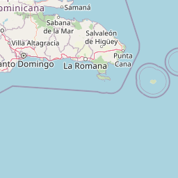
Los Haitises National Park was established by Law 409 on June 3, 1976, creating formal protection for this ecologically significant coastal region. The park was preceded by a forest reserve designation called Zona Vedada de Los Haitises (Los Haitises Prohibited Zone), established under Law 244, which represented an earlier attempt to regulate land use in the area. In 1996, the park's boundaries were significantly expanded from 208 square kilometers to 826 square kilometers through Decree 233, more than quadrupling the protected area. The park's boundary has been redrawn on several occasions, and some uncertainty remains regarding its exact limits. The bulk of the park falls within the municipality of Sabana de la Mar in Hato Mayor Province, with portions extending into Monte Plata and Samaná provinces. Despite advanced deforestation in surrounding areas, the park itself retains substantial forest cover, and the region continues to receive high annual rainfall between 1,900 and 2,000 millimeters, ranking among the wettest locations in the Dominican Republic in both total precipitation and number of rainy days.
Los Haitises National Park landscape and geographic character
The landscape of Los Haitises National Park is defined by its dramatic karst topography, a limestone plateau characterized by dense clusters of nearly uniform conical hills rising 200 to 300 meters above the surrounding terrain. These hills, formed during the Miocene epoch, are interspersed with numerous sinkholes and caverns created by water erosion over millions of years. The maximum dimensions of this karst block extend 82 kilometers east to west and 26 kilometers north to south. The hills of the interior are geologically continuous with the rocky islets visible in Samaná Bay, representing the same geological processes acting on different scales. The park spans portions of two major hydrological basins: the lower basin of the Yuna River in the western half, and a zone spanning Miches and Sabana de la Mar in the eastern half. The Yuna River drains through two mouths, while other water bodies including the Payabo River, Los Cocos River, Naranjo River, and numerous natural channels traverse the park. The coastal areas feature extensive mangrove forests growing in the intertidal zone, while the interior supports humid subtropical forest on the karst slopes.
Los Haitises National Park ecosystems, habitats, and plant life
Los Haitises contains two distinct Holdridge life zones that reflect its gradient from coastal to interior environments: humid subtropical forest and very humid subtropical forest. The broadleaf forest communities include diverse tree species such as musk wood locally known as cabirma santa, cigar-box cedar, ceiba, West Indian mahogany known locally as caoba, cupey, and grandleaf seagrape. The park supports a remarkable diversity of orchid species, reflecting the moist conditions and variety of microhabitats. The coastal mangrove ecosystem represents the greatest abundance of Caribbean mangrove, dominated by red mangrove and white mangrove species that form dense coastal forests along tidal channels and sheltered bays. These mangrove forests provide critical habitat for marine species, filter sediments, and protect the coastline from storm damage. The combination of karst geology, high rainfall, and multiple habitat types creates the ecological diversity that makes Los Haitises the most biodiverse protected area in the Dominican Republic.
Los Haitises National Park wildlife and species highlights
The fauna of Los Haitises National Park exhibits exceptional variety due to the park's diverse physical geography and multiple habitat types. Two endemic mammal species, both threatened with extinction, are found within the park: the Hispaniolan hutia and the Hispaniolan solenodon, both representing ancient Caribbean lineages that have survived only on Hispaniola. The park's position as a coastal and marine area supports a particularly rich bird community, including most of the bird species endemic to the Dominican Republic. Notable species include the brown pelican, magnificent frigatebird, Hispaniolan amazon, barn owl, and stygian owl. Most significantly, Los Haitises contains the largest population in the world of the endemic Ridgway's hawk, a raptor species found only in the Dominican Republic and one of the rarest birds in the Caribbean. The coastal islets provide important nesting sites for colonial seabirds, with Cayo de los Pájaros (Bird Key) being particularly notable for the continuous presence of frigatebirds and pelicans circling overhead.
Los Haitises National Park conservation status and protection priorities
Los Haitises National Park holds significant conservation importance as the largest protected area in the Dominican Republic and the one with the greatest biodiversity. The park protects critical habitat for endangered endemic species including the Hispaniolan hutia and Hispaniolan solenodon, both listed as threatened with extinction, and the Ridgway's hawk, whose largest global population occurs within the park boundaries. The extensive mangrove forests provide important ecosystem services including coastal protection, sediment filtration, and nursery habitat for marine fish and crustaceans. The karst ecosystem itself is vulnerable to degradation from deforestation and unsustainable land use in surrounding areas, though the park's protected status helps preserve its interior forest. Management challenges include the difficulty of patrolling the remote terrain and balancing conservation with the growing interest in ecotourism, which is regulated through limited visitor numbers and guided tours from Sabana de la Mar.
Los Haitises National Park cultural meaning and human context
The caverns of Los Haitises contain archaeological evidence of pre-Columbian human presence, including pictograms and petroglyphs carved onto cave walls by indigenous peoples. The identity of the cultures that created these artistic works remains unclear, with some possibly predating the Taíno people who dominated the island at the time of European contact. The park's name itself derives from the Taíno language, in which "haitises" means highland or mountain range, reflecting the distinctive landscape of conical karst hills that characterizes the region. This naming provides a direct connection to the indigenous understanding of the land, even though the elevation of the hills ranges only 30 to 40 meters above the surrounding plain. The region around the park, particularly Monte Plata Province, maintains economic activities centered on cattle ranching and sugarcane farming, which create the roads that visitors may notice traversing the landscape.
Top sights and standout views in Los Haitises National Park
Los Haitises National Park offers visitors an exceptional combination of geological wonder, ecological diversity, and archaeological significance. The San Lorenzo Bay provides a dramatic maritime entrance to the park, with views of offshore islets and the characteristic karst hills rising from the water. The Cayo de los Pájaros (Bird Key) delivers an unforgettable birdwatching experience where frigatebirds and pelicans circle continuously overhead, while the smaller islets serve as nesting colonies for seabirds. The mangrove channels provide a unique aquatic environment for exploration by boat, showcasing the dense root systems of red and white mangrove that define the coastal ecosystem. Several cavern systems contain pictograms and petroglyphs left by unidentified pre-Columbian cultures, adding a human history dimension to the natural landscape. The cupey tree dominates the forest canopy, while wild banyan trees and tropical almond add to the park's distinctive vegetation character.
Best time to visit Los Haitises National Park
Los Haitises National Park can be visited year-round due to its tropical climate, though the period from December through April typically offers the most comfortable conditions with lower humidity and reduced rainfall. The park's high annual precipitation of approximately 2,000 millimeters means that rainfall can occur in any month, but the drier season generally provides more predictable conditions for boat tours through the mangroves and exploration of the coastal areas. The wetter months from May through November may offer lush green conditions but can include more frequent rain events and potentially tropical storms. Visitors arriving by sea from Sabana de la Mar, Sánchez, or Samaná should be aware that sea conditions can vary, and the wet season may bring choppier waters in the bay.