Why Cueva de las Maravillas National Park stands out
The park is renowned for its extraordinary collection of ancient Taíno rock art, representing one of the most significant archaeological sites in the Caribbean. Inside the cave, visitors can view approximately 500 paintings and engravings created by the Taíno Indians, the indigenous inhabitants of Hispaniola. The artwork includes about 10 petroglyphs (rock engravings) and 472 pictographs painted on cave walls, featuring abstract designs, human faces, animal figures, and geometric patterns. Among the most notable attractions are the Great Panel, which depicts a Taíno funeral ritual, and the Water Mirror Gallery, an artificial lake that reflects the cave ceiling creating a striking visual effect. The cave's name, which translates to Cave of Wonders, was chosen in 1949 to capture the imaginative beauty of its stalactite and stalagmite formations alongside the remarkable pictographic heritage.
Cueva de las Maravillas National Park history and protected-area timeline
The cave's history reflects both geological processes spanning millions of years and human cultural heritage dating back to the Taíno period. Originally named Cueva Jaguar in 1926, the site received its current designation in 1949 when Professor Francisco Richiez Acevedo renamed it to Cueva de las Maravillas, inspired by the breathtaking beauty revealed within its chambers and the imaginative power of the stalactite and stalagmite formations. The Taíno people created the extensive pictographic artwork that now defines the site's significance, leaving behind approximately 500 paintings and engravings that document their spiritual practices, daily life, and artistic traditions. The cave remained a site of cultural importance through the centuries before being formally protected as a national park on July 22, 1997, recognizing the need to preserve both its natural formations and its irreplaceable archaeological heritage for future generations.
Cueva de las Maravillas National Park landscape and geographic character
The landscape of Cueva de las Maravillas National Park is characterized by its position within the South East Coastal Plain, a limestone-rich region that has produced the cave system's remarkable formations. The underground environment features an 800-meter-long cave passage descending 25 meters below the surface, with stalactites hanging from the ceiling and stalagmites rising from the floor, creating a diverse array of mineral formations. The cave opens through a limestone reef formation that marks the entrance to this subterranean world. The surrounding above-ground landscape consists of tropical vegetation supporting the 48 documented plant species, with the area near the Soco River and Cumayasa providing additional ecological context. The park's 4.5 square kilometer area encompasses both the underground cave system and the surrounding terrain that forms the integral protected landscape.
Cueva de las Maravillas National Park ecosystems, habitats, and plant life
The ecological character of Cueva de las Maravillas extends beyond its famous cave to encompass a diverse array of tropical plant species within the protected area. The park's flora includes 48 documented natural species, among them arraijanes, guáyiga, yellow caya, lignum vitae, pegapalo, jasmine, cat's claw, carboy, stick hen, black Cuba, yaya brown, bighorn coffee, cane juice, stick donkey, pringamosa, and bitter stick. This botanical diversity reflects the park's location within the southeastern Dominican Republic's tropical ecosystem. While the cave itself represents a unique subterranean habitat, the surrounding landscape maintains the Caribbean tropical forest character typical of the region, with species adapted to the local climate and soil conditions contributing to the overall ecological significance of the protected area.
Cueva de las Maravillas National Park wildlife and species highlights
The wildlife at Cueva de las Maravillas National Park is primarily associated with the cave's unique subterranean environment and the surrounding tropical ecosystem. The cave system provides habitat for various species adapted to underground conditions, while the surrounding area supports typical Caribbean fauna associated with tropical forest and coastal plain environments. The park's significant wildlife value is closely tied to the preservation of both the cave ecosystem and the surface habitats that support native species. While the primary focus of the park remains the protection of its exceptional archaeological and geological features, the broader protected area maintains ecological significance for native wildlife species inhabiting the southeastern Dominican Republic's diverse habitats.
Cueva de las Maravillas National Park conservation status and protection priorities
Cueva de las Maravillas National Park was established on July 22, 1997, to protect one of the Caribbean region's most significant archaeological and geological sites. The national park designation recognizes the dual importance of preserving both the extensive Taíno pictographic collection, comprising approximately 500 paintings and engravings, and the unique cave environment that houses them. The site holds IUCN category II protected area status as a national park, reflecting its formal recognition as a nature conservation protected area. Conservation efforts focus on maintaining the integrity of the cave's delicate artwork, which remains vulnerable to environmental changes, physical disturbance, and natural deterioration processes. The protected area status also serves to preserve the geological formations and the surrounding ecosystem that contribute to the site's overall significance.
Cueva de las Maravillas National Park cultural meaning and human context
The cultural significance of Cueva de las Maravillas derives primarily from its exceptional collection of Taíno rock art, created by the indigenous inhabitants of Hispaniola before European contact. The approximately 500 paintings and engravings within the cave represent a window into Taíno spiritual and cultural life, featuring pictographs painted in black and red pigments. Classification of the pictographs reveals diverse artistic themes: 144 cryptic or abstract designs at 69 points throughout the cave, 135 pictographs depicting human faces, 18 animal representations, 41 combined human and animal forms, and 38 geometric patterns. The most prominent feature, the Great Panel, depicts a Taíno funeral ritual, providing direct insight into indigenous ceremonial practices. The cave's original name, Cueva Jaguar, and its subsequent renaming in 1949 by Professor Francisco Richiez Acevedo reflect the site's ongoing cultural resonance and the lasting legacy of Taíno artistic achievement.
Top sights and standout views in Cueva de las Maravillas National Park
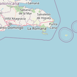
The cave system contains approximately 500 Taíno paintings and engravings, including about 10 petroglyphs and 472 pictographs representing the most extensive pre-Columbian rock art collection in the Dominican Republic. The Great Panel stands as the most significant feature, depicting a Taíno funeral ritual in vivid detail. The Water Mirror Gallery offers a unique visual experience where an artificial lake reflects the cave ceiling like a mirror. The cave's geological formations of stalactites and stalagmites create an imaginative landscape that inspired the 1949 renaming from Cueva Jaguar to Cueva de las Maravillas. Located near the Soco River and Cumayasa between San Pedro de Macorís and La Romana, the park preserves both natural and cultural heritage spanning geological time and millennia of human occupation.
Best time to visit Cueva de las Maravillas National Park
The park can be visited year-round given the Dominican Republic's consistently warm tropical climate, though the cooler months from November through April typically offer more comfortable conditions for exploring the underground cave system. The cave's underground location provides naturally regulated temperatures, making it a possible destination in any season. Visitors interested in experiencing the park's cultural and natural features should consider that the dry season from December to April generally provides more predictable weather conditions for travel in the southeastern region. The cave's interior maintains a stable environment regardless of external weather, allowing for consistent visitor experiences throughout the year.