

Mori Atlas logo
National parkPueblo Viejo National Park

Discover the archaeological landscape of early Spanish colonization and the first gold rush.

Pueblo Viejo National Park: Dominican Republic's Colonial Heritage and Gold Mining Atlas

(Archaeological and Historical National Park of Pueblo Viejo)

Pueblo Viejo National Park in the Dominican Republic preserves the extensive archaeological remains of Concepción de la Vega, an early Spanish colonial settlement founded by Christopher Columbus. This national park is significant for its representation of one of the Western Hemisphere's first major gold mining operations and its early European urban planning. Explore the mapped foundations of this historic city and its fortress, understanding its place in Caribbean heritage and early American colonial geography.

archaeological sitecolonial historygold mining heritageUNESCO tentative listhistorical parkcolonial ruins

Pueblo Viejo National Park

National park

Park overview

Structured park overview, official facts, and landscape profile for Pueblo Viejo National Park

Pueblo Viejo National Park park facts, protected area profile, and essential visitor context

Review the core facts for Pueblo Viejo National Park, including designation, size, terrain, visitor scale, habitats, and operating context in one park-focused overview.

About Pueblo Viejo National Park

Pueblo Viejo National Park serves as a protected repository of the Dominican Republic's colonial-era heritage, preserving the archaeological remains of a city that played a pivotal role in the early history of European colonization in the Americas. The park's boundaries encompass the site of Concepción de la Vega, a fortified settlement established by Christopher Columbus in 1495 that became the administrative center of Spanish gold mining operations in the region. The settlement was strategically positioned to control access to the Pueblo Viejo gold mine, which at its peak was among the largest and most productive gold mining operations in the Western Hemisphere. The ruins of the fortress and associated colonial structures provide tangible evidence of the architectural and urban planning approaches used by early Spanish colonizers. The site's inclusion on UNESCO's World Heritage Tentative List reflects its significance as an archaeological resource that can illuminate the dynamics of early colonial settlement, resource extraction, and the cultural interactions between European newcomers and the indigenous populations who originally inhabited the island.

Quick facts and research context for Pueblo Viejo National Park

Located in the central highlands of the Dominican Republic, Pueblo Viejo National Park encompasses the archaeological remains of a 16th-century colonial city and gold mining complex. The park preserves the fortress of Concepción de la Vega, which served as the administrative and economic center of one of the Spanish Empire's most productive gold extraction operations in the New World. The site represents a rare example of early colonial mining infrastructure and urban planning from the discovery era. The surrounding landscape features the Camú River valley, where the survivors of the 1562 earthquake relocated to establish modern La Vega.

Protection and recognition

Documenting the terrestrial boundary scope and official designation details for regional preservation.

Pueblo Viejo National Park Official Protected Status and Conservation Scope

Verifying the protected area designation and terrestrial conservation framework of Pueblo Viejo National Park helps researchers map global environmental networks. Verified documentation outlines the official management scope and transboundary status to support structured geographic discovery of key international reserves.

Protection details

Protection scope
Terrestrial
Transboundary protection
No
Park context

Deeper park guide and search-rich context for Pueblo Viejo National Park

Pueblo Viejo National Park history, landscape, wildlife, and travel context

Explore Pueblo Viejo National Park through its history, landscape character, ecosystems, wildlife, conservation priorities, cultural context, and seasonal travel timing in a structured park guide built for atlas discovery and search intent.

Why Pueblo Viejo National Park stands out

Pueblo Viejo is best known for preserving the ruins of one of the earliest European colonial settlements in the Caribbean, established during Christopher Columbus's early voyages. The site encompasses the remains of the fortress city of Concepción de la Vega, which was at the heart of the Spanish gold mining operation that made the Dominican Republic one of the first sources of significant gold extraction in the Americas. The park represents the physical remnants of the New World's first major gold rush and the colonial settlement pattern that emerged from precious metal extraction.

Pueblo Viejo National Park history and protected-area timeline

The history of Pueblo Viejo is inextricably linked to the early Spanish colonization of Hispaniola and the pursuit of gold that motivated much of European exploration in the 16th century. Christopher Columbus founded the fortress city of Concepción de la Vega in 1595, establishing it as a key administrative and military presence in the island's interior. The settlement quickly grew into a prosperous mining town centered on the Pueblo Viejo gold mine, which became the primary source of wealth for the colonial enterprise in the region. The city prospered for more than six decades, serving as a hub for gold extraction, processing, and trade. However, on December 2, 1562, a powerful earthquake destroyed the city, rendering it uninhabitable. The surviving population abandoned the site and relocated to a new settlement on the banks of the Camú River, which became the modern city of La Vega. The abandoned city and mining complex remained largely forgotten until archaeological investigations brought renewed attention to its historical significance, leading to its designation as a national park and tentative inclusion on the UNESCO World Heritage List.

Pueblo Viejo National Park conservation status and protection priorities

Pueblo Viejo National Park represents an important conservation initiative focused on preserving colonial archaeological heritage rather than natural ecosystems. The park's protected status safeguards the structural remains of the fortress, mining infrastructure, and urban foundations from further deterioration and unauthorized excavation. The site's inclusion on UNESCO's World Heritage Tentative List reflects international recognition of its conservation value and the need for systematic preservation of its archaeological resources. Conservation efforts at the site focus on stabilizing surviving structures, documenting architectural features, and managing visitor access to minimize impact on sensitive archaeological zones. The park exemplifies how protected area designations can serve cultural and historical preservation objectives alongside or independent of natural landscape protection.

Pueblo Viejo National Park cultural meaning and human context

The cultural context of Pueblo Viejo National Park is deeply intertwined with the broader narrative of early European colonization of the Caribbean and the transformative impact of gold extraction on indigenous societies. The site represents the physical remnants of one of the first sustained European settlement attempts in the Americas, established during the period when the Spanish Crown sought to extract maximum wealth from its new colonial territories. The indigenous Taíno people who originally inhabited the region were forcibly integrated into the colonial mining operation, and their labor and knowledge of local gold deposits enabled the rapid development of extraction infrastructure. The park preserves not only Spanish colonial architecture but also the traces of pre-Columbian indigenous presence in the region. The abandonment of the city following the 1562 earthquake and the subsequent relocation of survivors to establish modern La Vega represents a significant chapter in the demographic and cultural evolution of the Dominican Republic's central highlands.

Top sights and standout views in Pueblo Viejo National Park

The park's primary highlights include the substantial ruins of the Concepción de la Vega fortress, which preserve portions of defensive walls, towers, and architectural foundations dating to the early 16th century. Visitors can explore the archaeological remains of what was once a thriving colonial mining town, including evidence of gold processing facilities and residential structures. The site offers a rare opportunity to examine early Spanish colonial construction techniques and urban planning principles in a relatively undisturbed setting. The historical narrative of the city's founding by Columbus, its rapid prosperity through gold mining, and its dramatic destruction by earthquake provides a compelling story that distinguishes this park from typical natural protected areas.

Best time to visit Pueblo Viejo National Park

The park can be visited year-round given its cultural heritage focus rather than natural landscape dependency. The dry season from November to April typically offers more comfortable conditions for exploring outdoor archaeological sites, with lower humidity and reduced chance of rain interfering with site visits. Early morning visits are recommended to avoid the heat of midday and to enjoy the site before peak visitor activity. The park's highland location in central Dominican Republic means temperatures are generally milder than in coastal areas, though sunshine protection is advisable year-round.

Monthly climate preview

Long term temperature and precipitation patterns across the coordinate profile

Pueblo Viejo National Park Climate Normals and Monthly Weather Records

Historical monitoring data from 1991 to 2020 outlines the measured annual temperature and precipitation rhythm recorded at a representative point within Pueblo Viejo National Park. Examining the complete twelve month profile reveals detailed monthly variations in average minimum and maximum temperatures alongside daily precipitation rates.
Annual mean25 °C
23 °C27 °C
Jan23°
Feb23°
Mar24°
Apr25°
May26°
Jun27°
Jul27°
Aug27°
Sep27°
Oct26°
Nov25°
Dec23°
Warmest month
August

27 °C

Coolest month
January

22.9 °C

Wettest month
November

2.9 mm/day

Driest month
February

1.1 mm/day

Park location guide

Geography guide, regional context, and park location map for Pueblo Viejo National Park

Pueblo Viejo National Park park geography, regions, and map view in Dominican Republic

Understand where Pueblo Viejo National Park sits in Dominican Republic through a broader geographic reading of the surrounding landscape, nearby location context, and its mapped position within the national park landscape.

How Pueblo Viejo National Park fits into Dominican Republic

The Dominican Republic is a presidential republic on Hispaniola island in the Caribbean. It occupies the eastern portion of the island, sharing the western part with Haiti. The country has a population of approximately 11.5 million and is known for its colonial history, beaches, and mountainous interior. Santo Domingo is the capital and largest city.

Wider geography shaping Pueblo Viejo National Park in Dominican Republic

The Dominican Republic occupies the eastern five-eighths of Hispaniola island in the Greater Antilles, bordered by the Caribbean Sea. It shares a land border with Haiti to the west and has maritime boundaries with Puerto Rico to the east. The terrain features mountainous interior ranges, fertile valleys, and coastal plains. The country is second in size among Caribbean nations after Cuba.

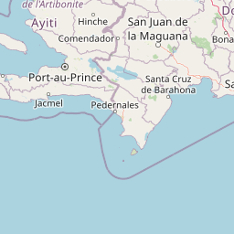
Map view of Pueblo Viejo National Park

Use this park location map to pinpoint Pueblo Viejo National Park in Dominican Republic, understand its exact geographic position, and read its mapped placement within the surrounding landscape more clearly.

Pigeon | © OpenStreetMap contributors
Park atlas

Map the surrounding protected landscapes, comparing archaeological sites and colonial history within the Dominican Republic's diverse geography.

Explore National Parks and Protected Areas Near Pueblo Viejo National Park, Dominican Republic

Explore other national parks and protected areas found in the Dominican Republic, including those geographically close to Pueblo Viejo National Park and sites with related historical significance. Compare these diverse protected landscapes to understand regional conservation patterns and trace broader geographic relationships or shared colonial history across the Dominican Republic.
National parkDominican Republic
About 33 km away#1 closest

West

José Armando Bermúdez National Park: Dominican Republic National Park Atlas and Landscape Context

Discover the mapped protected area and geographic setting of this Dominican Republic national park.

Gain an understanding of José Armando Bermúdez National Park as a distinct protected landscape within the Dominican Republic. This entry focuses on its role as a national park, providing geographic context and highlighting its mapped boundaries for atlas exploration. Explore the park's specific terrain and its place within the nation's conservation network.

Area
766 km²
Established
1956
IUCN
II
Relief
Mountain
National parkDominican Republic
About 36 km away#2 closest

South

Valle Nuevo National Park: Nearctic Highland Ecosystem and Glacial Landscapes

Mapped protected area in the Dominican Republic's Cordillera Central.

Valle Nuevo National Park in the Dominican Republic offers a rare glimpse into a Nearctic ecosystem within the Caribbean. Spanning 910 square kilometers in the Cordillera Central, it features dramatic mountain peaks like Loma Alto de la Bandera and distinctive glacial landforms. The park protects extensive Hispaniolan pine forests and cloud forest habitats, supporting remarkable endemic biodiversity and serving as a critical watershed for the region.

Area
910 km²
Established
1996
IUCN
II
Relief
Mountain
National parkDominican Republic
About 61 km away#3 closest

East

Los Haitises National Park: Dominican Republic Protected Landscape & Park Geography

Mapped terrain and protected area boundaries in the Dominican Republic.

Los Haitises National Park is a vital protected national park in the Dominican Republic, offering unique insights into the region's geography and natural landscapes. This page delves into its mapped boundaries, regional context, and the importance of its protected status for understanding Dominican Republic's conservation areas. Gain a structured view of this important natural landscape and its place within a broader geographic atlas.

Area
826 km²
Established
1976
IUCN
II
Relief
Upland
National parkMonte Cristi Province
About 93 km away#4 closest

Northwest

Monte Cristi National Park: Dominican Republic National Park Geography and Atlas

Explore mapped boundaries and regional landscape context.

Monte Cristi National Park serves as a vital component of the Dominican Republic's protected lands, located within the Monte Cristi Province. This entry provides essential geographic context and visualizes the park's mapped boundaries, contributing to a comprehensive understanding of its landscape. Delve into the atlas perspective of this national park, examining its terrain and regional significance for structured geographic exploration.

Area
550 km²
Established
1983
IUCN
II
Relief
Upland
National parkDominican Republic
About 116 km away#5 closest

Southeast

The Three Eyes National Park: Dominican Republic National Park Geography and Atlas Context

Mapped protected landscapes and natural terrain within Hispaniola.

Delve into the protected area details of The Three Eyes National Park, a designated national park situated in the Dominican Republic. This page facilitates a structured discovery of its geographic scope, mapped boundaries, and the surrounding natural landscapes, offering essential context for anyone exploring the atlas of protected areas within Hispaniola. Understand its unique character as a key element of the country's conservation geography.

IUCN
II
Relief
Lowland
Climate
Tropical
Access
Easy access
National parkDominican Republic
About 130 km away#6 closest

Southeast

La Caleta Underwater National Park: Dominican Republic National Park Geography and Atlas Exploration

Discover its protected marine landscape and mapped underwater terrain.

La Caleta Underwater National Park is a designated national park within the Dominican Republic, offering a unique focus on protected marine geography. Explore the mapped underwater terrain and understand its protected landscape identity. This entry provides essential context for atlas-based discovery of its specific geographic features and conservation significance in the Caribbean.

IUCN
II
Scope
Marine
National parkIndependencia Province
About 133 km away#7 closest

Southwest

La Gran Sabana National Park: National Park Identity and Geographic Mapping

Exploring protected landscapes and regional context.

This detail entry focuses on La Gran Sabana National Park, delineating its identity as a protected national park within Independencia Province. It provides essential context for understanding the park's mapped boundaries, its specific geographic setting, and its role within the natural landscape. Users can explore its atlas-relevant features and understand its place in the broader geography of the Dominican Republic.

Area
219.58 km²
Established
2009
IUCN
II
Relief
Lowland
National parkHaiti
About 163 km away#8 closest

West

Three Bays Protected Area National Park: Haiti's Extensive Marine and Coastal Protected Landscape

Mapped coral reefs, mangrove forests, and unique regional geography.

The Three Bays Protected Area in Haiti is a key national park established to conserve its vital marine and coastal environments. Covering over 75,000 hectares, it is the country's largest protected marine complex, encompassing extensive and healthy coral reefs, critical seagrass beds, and sprawling mangrove forests. This protected landscape provides essential ecosystem services and coastal protection, showcasing a significant portion of Haiti's natural heritage and regional geographic context along its northeastern shoreline.

Area
754.06 km²
Established
2014
IUCN
IV
Relief
Lowland

Common questions about visiting, size, designation, and location context for Pueblo Viejo National Park

Pueblo Viejo National Park FAQs for park facts, access, geography, and protected area context

Find quick answers about Pueblo Viejo National Park, including protected-area facts, park geography, trail and visitor context, and how the park fits into its surrounding country and regional landscape.
MoriAtlas Explorer

Continue Your Protected Areas Search Across the Global Atlas

Deepen your exploration by continuing the structured search for national parks and protected areas worldwide. Utilize the comprehensive filtering capabilities to compare different conservation landscapes and refine your understanding of global park geography. Discover more about the distribution and characteristics of protected natural areas.

Global natural geography