Mori Atlas logo
National parkJaragua National Park

Mapping the protected landscape of Jaragua National Park in Pedernales Province.

Jaragua National Park: Dominican Republic National Park Atlas and Geographic Context

(Parque Nacional Jaragua)

Jaragua National Park represents a significant protected area within the Dominican Republic, situated in Pedernales Province. This page offers an atlas-focused exploration of the park's geographic identity, detailing its mapped boundaries and the surrounding natural landscapes. Understand Jaragua National Park's role as a designated national park and its contribution to the regional geography and conservation landscape.

National ParkCaribbean Protected AreaDry Forest EcosystemImportant Bird AreaMarine Protected AreaBiosphere Reserve

Jaragua National Park

National park

Park overview

Structured park overview, official facts, and landscape profile for Jaragua National Park

Jaragua National Park park facts, protected area profile, and essential visitor context
Review the core facts for Jaragua National Park, including designation, size, terrain, visitor scale, habitats, and operating context in one park-focused overview.

About Jaragua National Park

Jaragua National Park represents one of the most significant conservation achievements in the Caribbean, protecting a sweeping expanse of diverse ecosystems at the southwestern tip of the Dominican Republic. The park's territory extends from the inland slopes of the Baoruco Mountain Range down to coastal mangroves and into offshore marine waters, creating a comprehensive protected landscape that is rare in the region. The park was established specifically to preserve the Hispaniolan dry forests ecoregion and its remarkable concentration of endemic species, many of which are found nowhere else on Earth. Within its boundaries, the park encompasses Beata Island and Alto Velo Island, two significant offshore islands that add marine and terrestrial protected zones to the park's holdings. The coastal area includes Bahía de las Águilas, a stretch of pristine beachfront that remains one of the least developed coastal areas in the Caribbean. Lago de Oviedo, a saltwater lake in the park's interior, supports a rich ecosystem of waterfowl and wading birds, making it a particular focus for ornithological interest. The park's inclusion in the UNESCO Man and the Biosphere Programme reflects its international recognition as a site of significant ecological value requiring coordinated conservation and sustainable use strategies.

Quick facts and research context for Jaragua National Park

Jaragua National Park covers 1,374 square kilometers in Pedernales Province, making it the largest protected area in the Caribbean. The park was established on August 11, 1983, and is part of the UNESCO Man and the Biosphere Programme. It encompasses the historic Taíno territory of Xaragua and protects the Hispaniolan dry forests ecoregion. Key geographic features include the Baoruco Mountain Range southern slopes, Beata Island, Alto Velo Island, Bahía de las Águilas, and Lago de Oviedo, a saltwater lake ecosystem renowned for birdlife. The park is designated as an Important Bird Area by BirdLife International.

Park context

Deeper park guide and search-rich context for Jaragua National Park

Jaragua National Park history, landscape, wildlife, and travel context
Explore Jaragua National Park through its history, landscape character, ecosystems, wildlife, conservation priorities, cultural context, and seasonal travel timing in a structured park guide built for atlas discovery and search intent.

Why Jaragua National Park stands out

Jaragua National Park is best known for being the Caribbean's largest protected area, encompassing a remarkable diversity of habitats within a single park boundary. The park is particularly celebrated for its significant populations of American flamingos that inhabit the coastal lagoons and the saltwater Lake of Oviedo. Its designation as an Important Bird Area reflects exceptional avifauna diversity, including numerous endemic species such as the Hispaniolan parrot, Hispaniolan emerald, and Antillean piculet. The park also protects critical dry forest ecosystems that have largely disappeared elsewhere on Hispaniola, along with pristine marine habitats around Beata Island and Alto Velo Island. The presence of Bahía de las Águilas, one of the most unspoiled beaches in the Caribbean, adds to the park's distinctive character.

Jaragua National Park history and protected-area timeline

Jaragua National Park was established on August 11, 1983, through Presidential Decree No. 1315, representing a landmark commitment by the Dominican Republic to conserve its natural heritage. The park was named after Xaragua, one of the five Taíno chiefdoms that existed on Hispaniola before European contact, linking the protected area to the island's pre-Columbian human history. The establishment of the park responded to growing recognition that the Hispaniolan dry forests, once covering much of the island's lowlands, had been dramatically reduced by agricultural expansion and charcoal production. The park's creation aimed to protect the remaining significant tracts of this endangered forest type and the unique species that depend on it. Over the decades, Jaragua has gained additional recognition, including designation as an Important Bird Area by BirdLife International and inclusion in the UNESCO Man and the Biosphere Programme, reflecting its global significance for biodiversity conservation.

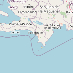
Jaragua National Park landscape and geographic character

The landscape of Jaragua National Park presents a striking contrast between the semi-arid inland terrain of the Baoruco foothills and the lush coastal wetlands along the Caribbean shore. The Baoruco Mountain Range forms a dramatic backdrop, with the park encompassing the southern slopes where dry forest and scrubland create a characteristic xerophytic landscape adapted to seasonal drought. Moving toward the coast, the terrain transitions through mangrove zones and coastal scrub before reaching the shoreline and offshore islands. Beata Island and Alto Velo Island add distinct island landscapes to the park's geography, each supporting specialized coastal and marine environments. The park contains numerous lagoons, including Lagunas Oviedo, Salada, Manuel Matos, La Rabiza, Puerto en Medio, Bucán Base, and Salado Bucán, which create a complex wetland mosaic throughout the coastal plain. Lago de Oviedo stands out as a significant saltwater lake that punctuates the park's interior, its shallow waters supporting abundant birdlife and creating a focal point for ecological diversity within the broader semi-arid landscape.

Jaragua National Park ecosystems, habitats, and plant life

The nature of Jaragua National Park is defined by the Hispaniolan dry forests ecoregion, one of the most threatened and biodiverse forest types in the Caribbean. The park protects extensive stands of dry forest characterized by trees adapted to seasonal drought conditions, along with coastal mangrove ecosystems that provide critical habitat for marine and bird species. The diverse habitats within the park support a remarkable concentration of biodiversity, with particular significance for endemic species that evolved in isolation on Hispaniola. The numerous lagoons scattered throughout the park create freshwater and brackish wetland habitats that attract both resident and migratory bird species, supporting the park's reputation as an ornithological destination. The protected marine habitats around Beata and Alto Velo Islands extend the park's ecological significance into the Caribbean Sea, protecting coral reef communities and marine ecosystems that are integral to the broader marine biodiversity of the Dominican Republic. The park's status as the only protected area of the Paleoisla del Sur geoformation adds geological significance, preserving evidence of the island's formation during the late Pleistocene period.

Jaragua National Park wildlife and species highlights

Jaragua National Park supports exceptional wildlife diversity, with particular prominence given to bird species that thrive in the various habitats within the park's boundaries. The American flamingo is among the most iconic species, with flocks commonly observed wading in the shallow waters of lagoons and coastal areas. The park provides critical habitat for numerous waterfowl, wading birds, and passerine species, both as breeding grounds and as migration stopovers along the Caribbean flyway. The diversity of psittaciformes is notable, with the Hispaniolan parrot and other parrot species inhabiting the forest canopy. Hummingbirds, including the Hispaniolan emerald and Hispaniolan mango, add to the park's avian character, while birds of prey patrol the skies throughout the protected area. Endemic species such as the Greater Antillean bullfinch, Antillean piculet, Greater Antillean grackle, Abbott's northern potoo, and vervain hummingbird represent species found nowhere else in the world, underscoring the park's global significance for avian conservation.

Jaragua National Park conservation status and protection priorities

Jaragua National Park represents a cornerstone of Dominican conservation efforts and holds international recognition for its ecological importance. The park's designation as a UNESCO Biosphere Reserve reflects its role in demonstrating sustainable conservation approaches that balance ecological protection with compatible human uses. As the largest protected area in the Caribbean, Jaragua provides a critical refuge for species that have lost habitat elsewhere on Hispaniola, particularly within the endangered dry forests ecoregion. The Important Bird Area designation by BirdLife International acknowledges the park's exceptional avifauna, including significant populations of endemic and migratory species. Conservation challenges in the park include managing the tension between protection and the needs of local communities, addressing pressures from agricultural expansion, and maintaining the integrity of marine habitats against broader environmental threats. The park's comprehensive approach to protecting both terrestrial and marine ecosystems positions it as a model for integrated coastal zone management in the Caribbean region.

Jaragua National Park cultural meaning and human context

The cultural context of Jaragua National Park is deeply connected to the pre-Columbian history of Hispaniola, as the park bears the name of Xaragua, one of the five Taíno chiefdoms that organized indigenous life on the island before European contact. The Taíno people inhabited the territory now encompassed by the park, establishing settlements and agricultural systems in the coastal areas and interior lands. The naming of the park after this historic chiefdom acknowledges the long human history associated with the landscape and reinforces the connection between contemporary conservation and the island's ancestral heritage. While the park's primary designation focuses on natural conservation, the cultural dimension adds depth to its identity and provides a framework for understanding the long relationship between human communities and the dry forest ecosystems that once dominated this region of Hispaniola.

Top sights and standout views in Jaragua National Park

Jaragua National Park offers several standout features that distinguish it within the Caribbean protected area network. The park's status as the largest protected area in the Caribbean provides exceptional scope for exploration and conservation. The opportunity to observe American flamingos in their natural habitat, particularly around Lago de Oviedo and the coastal lagoons, represents a major draw for visitors. The park's birdlife is extraordinarily diverse, with numerous endemic species present, making it a premier destination for ornithologists and bird enthusiasts. The presence of Beata Island and Alto Velo Island adds remote island ecosystems rarely accessible to visitors. Bahía de las Águilas offers a nearly pristine beach experience, one of the few remaining undeveloped coastal areas in the Caribbean. The diversity of habitats within a single park, from mountain forest to coastal mangroves to marine environments, creates remarkable ecological complexity. The park's geological significance as the only protected area of the Paleoisla del Sur adds scientific interest to the visitor experience.

Best time to visit Jaragua National Park

The optimal time to visit Jaragua National Park aligns with the cooler, drier months from November through April, when temperatures are more moderate and rainfall is reduced, making outdoor exploration more comfortable. This period also corresponds with the peak of the migratory bird season, offering enhanced opportunities to observe both resident species and northern migrants passing through the park. The dry forest habitats are most accessible during these months when trail conditions are better and vegetation is less dense. The summer months from May through October bring higher temperatures and increased rainfall, which can limit some activities but also bring the landscape to life with lush vegetation. The American flamingos are present year-round but may be more easily observed when water levels in the lagoons recede during the drier months, concentrating birds in remaining water areas. Visitors interested in the park's marine environments should note that water conditions are generally favorable year-round, though the winter months may bring rougher seas along certain coastlines.

Park location guide

Geography guide, regional context, and park location map for Jaragua National Park

Jaragua National Park park geography, regions, and map view in Dominican Republic
Understand where Jaragua National Park sits in Dominican Republic through a broader geographic reading of the surrounding landscape, nearby location context, and its mapped position within the national park landscape.

How Jaragua National Park fits into Dominican Republic

The Dominican Republic is a presidential republic on Hispaniola island in the Caribbean. It occupies the eastern portion of the island, sharing the western part with Haiti. The country has a population of approximately 11.5 million and is known for its colonial history, beaches, and mountainous interior. Santo Domingo is the capital and largest city.

Wider geography shaping Jaragua National Park in Dominican Republic

The Dominican Republic occupies the eastern five-eighths of Hispaniola island in the Greater Antilles, bordered by the Caribbean Sea. It shares a land border with Haiti to the west and has maritime boundaries with Puerto Rico to the east. The terrain features mountainous interior ranges, fertile valleys, and coastal plains. The country is second in size among Caribbean nations after Cuba.

Map view of Jaragua National Park

Use this park location map to pinpoint Jaragua National Park in Dominican Republic, understand its exact geographic position, and read its mapped placement within the surrounding landscape more clearly.

Pigeon | © OpenStreetMap contributors

Location context for Jaragua National Park

Pedernales Province
Park atlas

Compare surrounding protected landscapes, tracing coastal zones and dry forest ecoregions across the Dominican Republic.

Discover Other National Parks and Protected Areas Near Jaragua National Park
Discover other national parks and protected areas neighboring Jaragua National Park, allowing a direct comparison of diverse coastal habitats and inland dry forest ecosystems. Expand your atlas exploration by understanding the regional spread of conservation efforts and the distinct protected landscapes across the Dominican Republic.
National parkIndependencia Province

La Gran Sabana National Park: National Park Identity and Geographic Mapping

Exploring protected landscapes and regional context.

This detail entry focuses on La Gran Sabana National Park, delineating its identity as a protected national park within Independencia Province. It provides essential context for understanding the park's mapped boundaries, its specific geographic setting, and its role within the natural landscape. Users can explore its atlas-relevant features and understand its place in the broader geography of the Dominican Republic.

Area
219.58 km²
Established
2009
IUCN
II
Relief
Lowland
National parkHaiti

La Visite National Park: Protected Highland Terrain and Endemic Pine Forest Landscape

Explore the geography and mapped park boundaries of Haiti's significant national park.

La Visite National Park is a vital protected area located in Haiti's mountainous Massif de la Selle region. It is distinguished by its rare montane ecosystems, including extensive Hispaniolan pine forests and high-altitude grasslands, creating a unique landscape within the Caribbean. This atlas entry focuses on the park's geographic setting, its mapped protected boundaries, and its ecological significance as a key component of Haiti's natural heritage, offering a detailed look at its distinctive terrain.

Area
30 km²
Established
1983
IUCN
II
Relief
Mountain
National parkDominican Republic

José Armando Bermúdez National Park: Dominican Republic National Park Atlas and Landscape Context

Discover the mapped protected area and geographic setting of this Dominican Republic national park.

Gain an understanding of José Armando Bermúdez National Park as a distinct protected landscape within the Dominican Republic. This entry focuses on its role as a national park, providing geographic context and highlighting its mapped boundaries for atlas exploration. Explore the park's specific terrain and its place within the nation's conservation network.

Area
766 km²
Established
1956
IUCN
II
Relief
Mountain
National parkHaiti

National History Park National Park: Haiti's Protected Landscape and Geographic Atlas

Discover the park's mapped terrain and protected land geography.

The National History Park serves as a critical protected area within Haiti, offering detailed insights into its unique landscape and geographic setting. As a designated national park, it provides valuable data for atlas-based exploration of protected territories. Users can investigate the park's mapped boundaries, its regional context within Haiti, and the characteristics of its natural terrain, enriching their understanding of conservation landscapes.

Area
25.28 km²
Established
1968
IUCN
IV
Relief
Mountain
National parkMonte Cristi Province

Monte Cristi National Park: Dominican Republic National Park Geography and Atlas

Explore mapped boundaries and regional landscape context.

Monte Cristi National Park serves as a vital component of the Dominican Republic's protected lands, located within the Monte Cristi Province. This entry provides essential geographic context and visualizes the park's mapped boundaries, contributing to a comprehensive understanding of its landscape. Delve into the atlas perspective of this national park, examining its terrain and regional significance for structured geographic exploration.

Area
550 km²
Established
1983
IUCN
II
Relief
Upland
National parkHaiti

Three Bays Protected Area National Park: Haiti's Extensive Marine and Coastal Protected Landscape

Mapped coral reefs, mangrove forests, and unique regional geography.

The Three Bays Protected Area in Haiti is a key national park established to conserve its vital marine and coastal environments. Covering over 75,000 hectares, it is the country's largest protected marine complex, encompassing extensive and healthy coral reefs, critical seagrass beds, and sprawling mangrove forests. This protected landscape provides essential ecosystem services and coastal protection, showcasing a significant portion of Haiti's natural heritage and regional geographic context along its northeastern shoreline.

Area
754.06 km²
Established
2014
IUCN
IV
Relief
Lowland
National parkDominican Republic

Los Haitises National Park: Dominican Republic Protected Landscape & Park Geography

Mapped terrain and protected area boundaries in the Dominican Republic.

Los Haitises National Park is a vital protected national park in the Dominican Republic, offering unique insights into the region's geography and natural landscapes. This page delves into its mapped boundaries, regional context, and the importance of its protected status for understanding Dominican Republic's conservation areas. Gain a structured view of this important natural landscape and its place within a broader geographic atlas.

Area
826 km²
Established
1976
IUCN
II
Relief
Upland
National parkDominican Republic

Cueva de las Maravillas National Park: Dominican Republic National Park Protected Landscape and Geography

Explore the mapped features and natural terrain of this Dominican national park.

Cueva de las Maravillas National Park is a key protected entity within the Dominican Republic, offering rich geographic context for atlas exploration. This entry focuses on the park's identity as a national park, detailing its mapped boundaries and natural landscape features. Understand its specific role within the Dominican Republic's broader geography and its significance as a conservation area, providing essential context for landscape discovery.

Area
4.5 km²
Established
1997
IUCN
II
Relief
Lowland

Common questions about visiting, size, designation, and location context for Jaragua National Park

Jaragua National Park FAQs for park facts, access, geography, and protected area context
Find quick answers about Jaragua National Park, including protected-area facts, park geography, trail and visitor context, and how the park fits into its surrounding country and regional landscape.
MoriAtlas Explorer

Continue Your Protected Areas Search Across the Global Atlas

Deepen your exploration by continuing the structured search for national parks and protected areas worldwide. Utilize the comprehensive filtering capabilities to compare different conservation landscapes and refine your understanding of global park geography. Discover more about the distribution and characteristics of protected natural areas.

Global natural geography