Mori Atlas logo
National parkNational History Park

Trace the mapped boundaries and explore the natural terrain of this significant protected area.

National History Park National Park: Haiti's Protected Landscape and Geographic Context

The National History Park stands as a key protected national park within Haiti, offering a distinct geographic identity for atlas exploration. Situated in the Caribbean nation, this park invites a deeper understanding of its landscape context and mapped natural features. Discover the protected area's role and its place within the broader Haitian geography, providing essential detail for structured geographic discovery.

UNESCO World Heritage SiteHistorical SiteColonial ArchitectureMountain FortressCaribbean HeritageRoyal Palace Ruins

National History Park

National park

Park overview

Structured park overview, official facts, and landscape profile for National History Park

National History Park park facts, protected area profile, and essential visitor context
Review the core facts for National History Park, including designation, size, terrain, visitor scale, habitats, and operating context in one park-focused overview.

About National History Park

National History Park stands as Haiti's most important cultural heritage site and one of the most significant historical monuments in the Caribbean. The park's monumental ensemble traces its origins to the Haitian Revolution, the only successful large-scale slave rebellion that resulted in the establishment of an independent nation. Following independence in 1804, Haiti was divided between the southern republic under President Jean-Jacques Dessalines and the northern kingdom ruled by King Henry Christophe, who chose the Milot valley as his capital and seat of power. The Sans-Souci Palace, constructed beginning around 1810, served as the royal residence and the administrative heart of the Kingdom of Haiti. Its name, meaning without worry in French, reflected the king's aspiration for a peaceful, prosperous realm. The palace was designed in a neoclassical style with Haitian architectural adaptations and was surrounded by elaborate gardens and outbuildings. Adjacent to the palace, the massive Citadelle Laferrière was constructed on a rocky outcrop approximately 1,000 meters above sea level, its thick walls and strategic positioning designed to withstand any military assault. The fortress could house up to 5,000 soldiers and was armed with numerous cannons, many taken from the fleeing French colonial forces. The Ramiers area served as a secondary palace complex and included various structures used for ceremonial, administrative, and residential purposes. Together these sites form a remarkable testimony to the political ambitions and architectural sophistication of early independent Haiti, a period often overshadowed in broader Caribbean historical narratives.

Quick facts and research context for National History Park

National History Park occupies a mountainous landscape in the Milot area of northern Haiti, approximately 150 kilometers north of Port-au-Prince. The park encompasses the ruins of Sans-Souci Palace, once the residence of King Henry I of Haiti, the massive Citadelle Laferrière fortress built to defend Haitian sovereignty, and various structures at the Ramiers complex. The park was established in 1968 and received World Heritage status in 1982. It is classified as an IUCN Category IV protected area, reflecting its dual role in habitat management and species protection within its historical cultural landscape. The elevation of the citadel site provides sweeping views of the surrounding terrain and the Caribbean Sea on clear days.

Park context

Deeper park guide and search-rich context for National History Park

National History Park history, landscape, wildlife, and travel context
Explore National History Park through its history, landscape character, ecosystems, wildlife, conservation priorities, cultural context, and seasonal travel timing in a structured park guide built for atlas discovery and search intent.

Why National History Park stands out

National History Park is renowned for the Citadelle Laferrière, one of the largest fortresses in the Western Hemisphere, built between 1805 and 1820 to protect the newly independent Haitian state from colonial restoration attempts. The adjacent Sans-Souci Palace, sometimes called the Haitian Versailles, represents the finest colonial architecture in Haiti and served as the royal residence and administrative center of King Henry Christophe's northern kingdom. Together these sites form the most complete physical expression of post-independence Haitian statehood and royal authority in the Americas.

National History Park history and protected-area timeline

The National History Park's historical significance originates from the tumultuous period following the Haitian Revolution. After Haiti declared independence in 1804, the nation faced constant threats from European colonial powers seeking to restore slavery and French rule. King Henry Christophe, who ruled the northern portion of Haiti as President and later King Henry I from 1807 to 1820, prioritized the defense and symbolic assertion of Haitian sovereignty. The construction of Citadelle Laferrière began in 1805 and continued for approximately fifteen years, employing thousands of workers and absorbing a significant portion of the kingdom's resources. The fortress was designed by the king's engineers and built using massive stone blocks quarried from the surrounding mountains. The Sans-Souci Palace was constructed during the same period as a royal residence and administrative center, named in deliberate contrast to the suffering of the revolution. The park was formally established as a national park in 1968 by the Haitian government, recognizing the need to preserve these irreplaceable historical structures. In 1982, the ensemble was inscribed on the UNESCO World Heritage List, becoming the first Haitian site to receive this recognition. The designation acknowledged the sites' significance not only for Haiti but for the entire history of decolonization and human rights. Despite challenges including earthquakes, tropical storms, and economic difficulties that have affected maintenance and conservation, the Haitian government and international partners have undertaken various restoration efforts to preserve these monuments for future generations.

National History Park landscape and geographic character

The National History Park is set in a dramatic mountainous landscape in northern Haiti, within the foothills of the Massif du Nord, the highest mountain range in the country. The terrain is characterized by steep ridges, deep valleys, and rocky outcrops that provide both natural defensive advantages and spectacular visual settings for the historical structures. The Citadelle Laferrière occupies a conical peak that rises abruptly from the surrounding hills, its position allowing panoramic views of the northern Haitian coastline and, on clear days, the waters of the Atlantic Ocean. The Sans-Souci Palace sits in a valley approximately five kilometers from the citadel, positioned along a river in a more accessible location that nonetheless maintains the regal isolation appropriate for a royal residence. The landscape around the park reflects the tropical climate of northern Haiti, with vegetation including various tree species, scrubland, and agricultural areas in the valleys below. The contrast between the massive stone structures and the surrounding natural terrain creates a visually striking ensemble that embodies the ambitious scope of King Henry Christophe's building program. The pathways and stairways connecting the various sites traverse the mountainous terrain, requiring visitors to navigate the steep slopes that were originally designed to reinforce the defensive character of the complex.

National History Park ecosystems, habitats, and plant life

While National History Park is primarily valued for its historical significance, the protected area encompasses natural ecosystems characteristic of Haiti's northern mountain regions. The park's vegetation includes secondary forest in some areas, scrubland, and various tropical plant species adapted to the region's distinct wet and dry seasons. The mountainous setting creates diverse microhabitats across the park's elevation gradient, from the valley floors where the Sans-Souci Palace sits to the higher elevations around the citadel. The protected status under IUCN Category IV indicates that the area is managed not only for its cultural heritage but also for supporting biodiversity and habitat conservation. The surrounding landscape, while heavily influenced by human activity and agriculture, still supports various bird species and smaller wildlife typical of Haiti's terrestrial environments. The park's location in the Massif du Nord places it within one of Haiti's more ecologically significant mountainous regions, though much of the original forest has been altered by human activity over the past two centuries.

National History Park wildlife and species highlights

The wildlife present in National History Park reflects the broader biodiversity of Haiti's northern highlands, though the park's primary significance lies in its cultural heritage rather than as a wildlife sanctuary. Bird species common to the region can be observed in the park's wooded areas and around the palace ruins, including various passerines and tropical songbirds adapted to the heterogeneous landscape. The surrounding agricultural and scrubland areas support populations of small mammals, reptiles, and insects typical of Haiti's lowland to mid-elevation environments. The mountainous terrain provides some habitat continuity with the broader ecological corridors of the Massif du Nord, though the park's intensive historical use and ongoing visitor activity limit its function as a wildlife refuge compared to other Haitian protected areas. The park's value for wildlife is more incidental than designed, as the primary conservation focus remains the preservation of the historical structures and cultural landscape.

National History Park conservation status and protection priorities

National History Park represents a unique conservation challenge as one of the few World Heritage Sites in the Caribbean that combines significant cultural monuments within a natural protected area. The park's 1982 World Heritage inscription recognized the outstanding universal value of the Haitian royal ensemble, noting its significance as the only surviving example of a Black republic's early state-building efforts. Conservation efforts have focused on stabilizing the ruins of the Sans-Souci Palace, preserving the structural integrity of the Citadelle Laferrière, and maintaining the pathways and access routes throughout the park. Various restoration projects have been undertaken with support from international organizations, though the challenges of maintaining historic monuments in a tropical climate with limited resources have been substantial. The park's IUCN Category IV designation reflects its management approach that balances heritage conservation with habitat and species management, though the cultural resources remain the primary focus of protection efforts. The ongoing conservation work aims to ensure that these unique monuments, which embody both Haitian national identity and broader themes of liberation and self-determination, remain accessible and structurally sound for future generations.

National History Park cultural meaning and human context

National History Park is deeply intertwined with Haitian national identity and the broader history of the Haitian Revolution, the first successful large-scale slave uprising in the modern era. The monuments within the park represent the architectural expression of the independent Haitian state that emerged from the revolution, a state that modeled itself not only as free but as a kingdom with European-style political institutions. King Henry Christophe, who ruled the northern kingdom, was a former slave who rose to become one of the revolution's leading generals and later the architect of an ambitious building program designed to demonstrate Haitian civilization and capability to the world. The Citadelle Laferrière was explicitly conceived as a symbol of Haitian independence and resistance to colonial restoration, its very name honoring the French engineer Henri Louis Berthier who had helped design the fortress. The Sans-Souci Palace took its name from a famous palace in Potsdam, Germany, signaling the king's aspiration to be considered among the ranks of European monarchs. The park's cultural context extends beyond the structures themselves to encompass the entire landscape of memory and national meaning that Haitians attach to these sites, which remain powerful symbols of sovereignty and Black achievement in the Americas.

Top sights and standout views in National History Park

The Citadelle Laferrière stands as the park's most spectacular feature, a massive stone fortress perched on an almost inaccessible peak and visible for miles across the northern Haitian landscape. The fortress contains large interior courtyards, barracks, and storage areas, with its thick walls and commanding position having never been tested in actual combat. The ruins of the Sans-Souci Palace, though heavily damaged by earthquake and neglect, still convey the grandeur of the original complex, with remnants of elaborate reception halls, private apartments, and formal gardens. The Ramiers ensemble includes various structures that served the administrative and ceremonial functions of the kingdom, providing additional context for understanding the complete scope of Henry Christophe's royal complex. The physical connection between the sites, with pathways traversing the mountain landscape, allows visitors to experience the deliberately dramatic progression from the accessible palace in the valley to the dramatically sited citadel on its heights.

Best time to visit National History Park

The optimal period to visit National History Park coincides with the dry season in northern Haiti, typically running from November through March. During these months, rainfall is reduced, making outdoor exploration more comfortable and the mountain trails less treacherous. The cooler temperatures of the dry season, particularly in the higher elevations around the citadel, provide more comfortable conditions for the substantial walking required to visit all the major sites. The period from December to February generally offers the most pleasant conditions, though this corresponds with peak tourist season in Haiti. Visitors should be aware that the park's highland location can result in cool, windy conditions at the citadel, particularly in the early morning hours, even when the lowlands are warm. The wet season from April through October brings higher temperatures, increased humidity, and the possibility of heavy rain that can make trail conditions difficult, though the landscape is often greener during this period. Regardless of season, visitors should plan for substantial walking and climbing and bring appropriate footwear and sun protection.
Park location guide

Geography guide, regional context, and park location map for National History Park

National History Park park geography, regions, and map view in Haiti
Understand where National History Park sits in Haiti through a broader geographic reading of the surrounding landscape, nearby location context, and its mapped position within the national park landscape.

How National History Park fits into Haiti

Haiti is a Caribbean country occupying the western third of Hispaniola Island in the Caribbean Sea. It gained independence from France in 1804 following the Haitian Revolution, becoming the first sovereign state established by a slave revolt and the second independent nation in the Americas. The country is known for its complex political history, economic challenges, and cultural significance in the Caribbean.

Wider geography shaping National History Park in Haiti

Haiti occupies the western third of Hispaniola Island in the Caribbean, sharing the island with the Dominican Republic. The country is positioned in the Caribbean Sea, east of Cuba and south of the Bahamas. Haiti's terrain is predominantly mountainous, with valleys and coastal plains. The country borders the Caribbean Sea on its western, southern, and southwestern coasts.

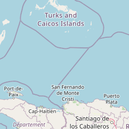
Map view of National History Park

Use this park location map to pinpoint National History Park in Haiti, understand its exact geographic position, and read its mapped placement within the surrounding landscape more clearly.

Pigeon | © OpenStreetMap contributors
Park atlas

Explore nearby protected landscapes and compare their unique geographic or historical context within the surrounding Haitian region.

Discover Other National Parks and Protected Areas Near National History Park
Explore other national parks and protected areas across northern Haiti, expanding your geographic understanding beyond National History Park's dramatic historical ensembles. Compare their unique conservation values, cultural heritage, and diverse landscapes, tracing the regional spread of protected natural areas.
National parkHaiti

Three Bays Protected Area National Park: Haiti's Extensive Marine and Coastal Protected Landscape

Mapped coral reefs, mangrove forests, and unique regional geography.

The Three Bays Protected Area in Haiti is a key national park established to conserve its vital marine and coastal environments. Covering over 75,000 hectares, it is the country's largest protected marine complex, encompassing extensive and healthy coral reefs, critical seagrass beds, and sprawling mangrove forests. This protected landscape provides essential ecosystem services and coastal protection, showcasing a significant portion of Haiti's natural heritage and regional geographic context along its northeastern shoreline.

Area
754.06 km²
Established
2014
IUCN
IV
Relief
Lowland
National parkMonte Cristi Province

Monte Cristi National Park: Dominican Republic National Park Geography and Atlas

Explore mapped boundaries and regional landscape context.

Monte Cristi National Park serves as a vital component of the Dominican Republic's protected lands, located within the Monte Cristi Province. This entry provides essential geographic context and visualizes the park's mapped boundaries, contributing to a comprehensive understanding of its landscape. Delve into the atlas perspective of this national park, examining its terrain and regional significance for structured geographic exploration.

Area
550 km²
Established
1983
IUCN
II
Relief
Upland
National parkDominican Republic

José Armando Bermúdez National Park: Dominican Republic National Park Atlas and Landscape Context

Discover the mapped protected area and geographic setting of this Dominican Republic national park.

Gain an understanding of José Armando Bermúdez National Park as a distinct protected landscape within the Dominican Republic. This entry focuses on its role as a national park, providing geographic context and highlighting its mapped boundaries for atlas exploration. Explore the park's specific terrain and its place within the nation's conservation network.

Area
766 km²
Established
1956
IUCN
II
Relief
Mountain
National parkHaiti

La Visite National Park: Protected Highland Terrain and Endemic Pine Forest Landscape

Explore the geography and mapped park boundaries of Haiti's significant national park.

La Visite National Park is a vital protected area located in Haiti's mountainous Massif de la Selle region. It is distinguished by its rare montane ecosystems, including extensive Hispaniolan pine forests and high-altitude grasslands, creating a unique landscape within the Caribbean. This atlas entry focuses on the park's geographic setting, its mapped protected boundaries, and its ecological significance as a key component of Haiti's natural heritage, offering a detailed look at its distinctive terrain.

Area
30 km²
Established
1983
IUCN
II
Relief
Mountain
National parkIndependencia Province

La Gran Sabana National Park: National Park Identity and Geographic Mapping

Exploring protected landscapes and regional context.

This detail entry focuses on La Gran Sabana National Park, delineating its identity as a protected national park within Independencia Province. It provides essential context for understanding the park's mapped boundaries, its specific geographic setting, and its role within the natural landscape. Users can explore its atlas-relevant features and understand its place in the broader geography of the Dominican Republic.

Area
219.58 km²
Established
2009
IUCN
II
Relief
Lowland
Watercolor painting of a coastline with green hills, a single tree, calm sea, and light sky
National parkBahamas

Inagua National Park: Bahamian National Park Geography and Mapped Boundaries

Discover the protected landscape and regional atlas context.

Delve into the specifics of Inagua National Park, a protected national park situated within the Bahamas. This entry focuses on its geographic identity, mapped protected area extent, and its place within the archipelago's broader natural landscape context. Understand the park's structured details and its mapped presence for atlas exploration, providing a foundation for understanding Bahamian conservation lands.

Area
890 km²
Established
1965
Relief
Lowland
Climate
Tropical
National parkPedernales Province

Jaragua National Park: Dominican Republic National Park Protected Landscape Atlas

Discover the mapped geography and protected boundaries of Jaragua National Park.

Jaragua National Park stands as a crucial national park within the Dominican Republic, located in Pedernales Province. This entry provides an in-depth, atlas-style examination of the park's protected landscape, focusing on its geographic features and mapped extent. Users can explore the park's position within the regional geography and understand its significance as a conservation area.

Area
1,374 km²
Established
1983
IUCN
II
Relief
Mountain
National parkBahamas

Little Inagua National Park: Remote Bahamian Protected Landscape & Marine Habitat

Island wilderness, sea turtle nesting, and queen conch larval zones.

Little Inagua National Park, located in the Bahamas, is a remote national park combining terrestrial and marine conservation efforts. This protected area is primarily recognized for its role as a critical nesting site for sea turtles and its importance for queen conch larval development in the surrounding Caribbean waters. Discover the distinct island terrain and shallow marine ecosystems that define this ecologically significant Bahamian protected landscape.

Area
254 km²
Established
2002
IUCN
II
Climate
Tropical

Common questions about visiting, size, designation, and location context for National History Park

National History Park FAQs for park facts, access, geography, and protected area context
Find quick answers about National History Park, including protected-area facts, park geography, trail and visitor context, and how the park fits into its surrounding country and regional landscape.
MoriAtlas Explorer

Continue Your Protected Areas Search Across the Global Atlas

Deepen your exploration by continuing the structured search for national parks and protected areas worldwide. Utilize the comprehensive filtering capabilities to compare different conservation landscapes and refine your understanding of global park geography. Discover more about the distribution and characteristics of protected natural areas.

Global natural geography
National History Park National Park: Haiti Protected Area Map & Geography