Mori Atlas logo
National parkTjoritja / West MacDonnell National Park

Discover the expansive protected terrain of the West MacDonnell Ranges near Alice Springs.

Tjoritja / West MacDonnell National Park: National Park Geography and Mapped Landscape Context

Tjoritja / West MacDonnell National Park in Australia's Northern Territory presents a vast, linear protected landscape defined by the ancient MacDonnell Ranges. Spanning approximately 2,568 square kilometres, this national park offers immediate geographic context west of Alice Springs, showcasing dramatic mountain ranges, deep gorges, and geological formations that hold profound cultural and environmental significance. Explore its mapped terrain and understand the park's unique position within the heart of Australia's interior.

Desert MountainsArrernte CountryLong-distance HikingGorges and CanyonsCentral AustraliaIndigenous Heritage

Tjoritja / West MacDonnell National Park

National park

Park overview

Structured park overview, official facts, and landscape profile for Tjoritja / West MacDonnell National Park

Tjoritja / West MacDonnell National Park park facts, protected area profile, and essential visitor context
Review the core facts for Tjoritja / West MacDonnell National Park, including designation, size, terrain, visitor scale, habitats, and operating context in one park-focused overview.

About Tjoritja / West MacDonnell National Park

Tjoritja / West MacDonnell National Park represents one of the Northern Territory's most significant protected areas, encompassing a complex landscape of mountain ranges, gorges, waterholes, and ridgelines that define the character of Central Australia's western MacDonnell Ranges. The park extends as a linear protected area stretching roughly 250 kilometres west from Alice Springs, following the geological strike of the MacDonnell Ranges through a terrain that has been shaped by hundreds of millions of years of geological processes including uplift, erosion, and the deposition of ancient sea sediments. TheArrernte people have maintained continuous connection to this landscape for many generations, and their traditional knowledge and cultural practices remain interwoven with the physical geography of the park. Modern visitors experience this ancient landscape through a network of well-maintained walking tracks, scenic drives, and accessible lookouts that reveal the park's geological diversity and ecological resilience. The park provides critical habitat for numerous species adapted to the harsh desert environment, with permanent waterholes serving as vital refuges during dry periods.

Quick facts and research context for Tjoritja / West MacDonnell National Park

Located in the Northern Territory of Australia, Tjoritja / West MacDonnell National Park stretches over 250 kilometres along the West MacDonnell Ranges due west of Alice Springs. The park was formally established on 30 September 1992 under the management of the Parks and Wildlife Commission of the Northern Territory. The landscape is characterized by rugged quartzite and sandstone ridges, intermittent rivers, and permanent waterholes that sustain remarkable biodiversity in this semi-arid environment. The Larapinta Trail, one of Australia's premier long-distance walking tracks, traverses the full length of the park from east to west.

Park context

Deeper park guide and search-rich context for Tjoritja / West MacDonnell National Park

Tjoritja / West MacDonnell National Park history, landscape, wildlife, and travel context
Explore Tjoritja / West MacDonnell National Park through its history, landscape character, ecosystems, wildlife, conservation priorities, cultural context, and seasonal travel timing in a structured park guide built for atlas discovery and search intent.

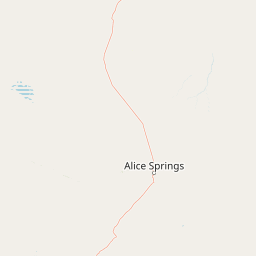
Why Tjoritja / West MacDonnell National Park stands out

Tjoritja is best known for the Larapinta Trail, a 223-kilometre bushwalking track that follows the spine of the West MacDonnell Ranges through some of the most scenically dramatic terrain in Australia's interior. The park is also renowned for its spectacular gorges and natural attractions including Standley Chasm, a narrow geological cleft that fills with light at certain times of day, Glen Helen Gorge where the Finke River cuts through ancient rock, and Ormiston Pound, a large sandstone enclosure with its own ecosystem. The Ochre Pits, a significant cultural site where traditionalArrernte people collected mineral pigments for ceremonial purposes, represents another distinctive feature. Mount Sonder, the fourth-highest peak in the Northern Territory, marks the western terminus of the park and offers challenging summit walks with panoramic views across the ranges.

West MacDonnell National Park
View along the West MacDonnell Ranges from Counts Point on the Larapinta Trail. Mount Sonder, one of the highest mountains in the Northern Territory, is in the background.

Tjoritja / West MacDonnell National Park history and protected-area timeline

The land that now comprises Tjoritja / West MacDonnell National Park has been continuously inhabited by theArrernte people for thousands of years, with archaeological evidence indicating human presence in the MacDonnell Ranges region extending back at least 30,000 years. The formal establishment of the national park occurred on 30 September 1992, consolidating what had previously been a series of separate reserves and recreational areas into a single protected unit managed by the Parks and Wildlife Commission of the Northern Territory. Prior to national park designation, the area had been managed as a collection of reserves and crown land, with varying levels of protection and access. The Larapinta Trail, originally known as the Bicentennial Trail, was developed in the early 1990s as a collaborative project between the Northern Territory Government and the Australian Bicentennial Authority to create a long-distance walking experience that would showcase the natural and cultural heritage of the MacDonnell Ranges. The trail was officially renamed the Larapinta Trail in 1997, using theArrernte word for the platypus, and has since become one of Australia's most celebrated multi-day hiking routes.

Tjoritja / West MacDonnell National Park landscape and geographic character

The physical landscape of Tjoritja is dominated by the West MacDonnell Ranges, a series of quartzite and sandstone ridges that have been sculpted by erosion into dramatic crests, valleys, and gorges. The ranges rise abruptly from the surrounding desert plains, creating a mountainous environment in the heart of Australia's semi-arid interior. Prominent geological features include the sheer quartzite walls of Standley Chasm, the落差 of Ellery Creek Bighole where a natural amphitheatre has been carved by water erosion, and the deep cleft of Serpentine Gorge. The Finke River, one of the oldest river systems in the world, flows through the park in an intermittent fashion, carving gorges such as Glen Helen before disappearing into the sand plains to the west. Redbank Gorge at the western end of the park represents another dramatic geological feature where ancient rock formations create a narrow passage. The landscape varies considerably along the park's length, with some sections dominated by steep escarpments while others feature more gently undulating terrain and open valleys.

Tjoritja / West MacDonnell National Park ecosystems, habitats, and plant life

The ecological character of Tjoritja reflects the harsh but biodiverse nature of Central Australian desert environments. The park encompasses multiple habitat types including rocky ridges, river corridors, permanent waterholes, and open spinifex grasslands, each supporting distinct communities of plants and animals. The MacDonnell Ranges serve as an important biodiversity corridor in an otherwise arid landscape, with the ranges capturing more moisture than the surrounding plains and supporting vegetation communities including ghost gums, witchetty bushes, and various acacia species. The permanent waterholes found throughout the park, such as those at Ormiston Gorge and Glen Helen, provide critical refuges for wildlife during dry periods and support ecological communities quite different from the surrounding desert. These waterholes are surrounded by river red gums and coolabah trees that depend on the reliable presence of water. The park's elevation range creates temperature variations that influence the distribution of species, with higher ridgelines supporting different plant communities than the valley floors.

Tjoritja / West MacDonnell National Park wildlife and species highlights

The wildlife of Tjoritja includes a range of species adapted to the extreme conditions of the Australian desert, with the park's gorges and waterholes providing important habitat for many animals. Birdlife is particularly diverse, with over 150 species recorded in the park including the endangered Alexandra's parrot, the spinifex pigeon, and various honeyeater species that visit flowering plants throughout the year. Red-tailed black cockatoos are a common sight along the ranges, and the permanent waterholes attract waterbirds including ducks, grebes, and herons. Mammals found in the park include the euro or wallaroo, which is well adapted to rocky terrain, as well as smaller marsupials such as the central rock-rat and various possum species. Reptiles are well represented, with numerous snake and lizard species including the desert monitor and various gecko species. The park's permanent waterholes support fish populations including the desert rainbowfish and other native species adapted to the variable water conditions of Central Australian rivers.

Tjoritja / West MacDonnell National Park conservation status and protection priorities

Tjoritja / West MacDonnell National Park plays a significant role in the conservation of Central Australia's unique natural heritage, protecting a representative sample of the MacDonnell Ranges bioregion. The park encompasses ecosystems that are relatively intact compared to many lowland areas that have been more heavily modified by pastoral activity, and the protection of the range habitats ensures the continuity of ecological processes in a region where water is the limiting factor for most species. The park's management focuses on maintaining biodiversity while allowing sustainable visitor access, with fire management strategies designed to protect the mosaic of habitats across the landscape. The protection of cultural sites in collaboration with traditional owners also contributes to broader conservation outcomes, asArrernte land management practices have shaped the landscape over millennia. The park's inclusion in national park reserves ensures that key habitat for threatened species, including several birds and mammals, receives formal protection under Australian law.

Tjoritja / West MacDonnell National Park cultural meaning and human context

The cultural landscape of Tjoritja is inseparable from the living culture of theArrernte people, the traditional owners whose connection to this country extends back through countless generations. TheArrernte name Tjoritja reflects the deep significance of this place within their cultural framework, and many sites throughout the park hold specific meaning relating toDreamtime stories, ancestral beings, and traditional resource use. The Ochre Pits represent one of the most significant cultural sites, where mineral pigments have been extracted for ceremonial purposes, including body painting for ceremonies and funerary practices. These ochre deposits are not merely historical artifacts but continue to hold cultural importance for contemporaryArrernte communities. The landscape itself is understood through a cultural lens that connects physical features to stories and responsibilities, creating a framework for understanding country that differs fundamentally from Western scientific perspectives but provides equally sophisticated knowledge of the environment.

Top sights and standout views in Tjoritja / West MacDonnell National Park

The Larapinta Trail stands as the park's signature experience, offering hikers the opportunity to traverse the full length of the West MacDonnell Ranges through terrain of exceptional scenic quality. Standley Chasm provides a dramatic natural spectacle where visitors can witness the narrow gorge filled with golden light during mid-morning. Glen Helen Gorge offers both scenic beauty and the chance to swim in permanent waterholes surrounded by ancient rock walls. The Ochre Pits connect visitors to the deep cultural heritage of theArrernte people and the traditional use of natural materials. Mount Sonder, as the western anchor of the park, offers a challenging but rewarding climb to a summit providing sweeping views across the ranges and plains beyond. Ormiston Pound encloses a distinctive landscape of its own, with the Pound walk providing a circuit of the sandstone amphitheare.

Best time to visit Tjoritja / West MacDonnell National Park

The cooler months from April to September represent the most comfortable time for outdoor activities in Tjoritja, with daytime temperatures moderate enough for hiking and sightseeing. During these winter and spring months, minimum temperatures can drop significantly at night, particularly in June and July, while maximum temperatures typically range from the high teens to mid-twentiles Celsius. Summer months from October to March bring extreme heat to the Central Australian landscape, with daytime temperatures regularly exceeding 40 degrees Celsius making sustained outdoor activity dangerous. The summer period does, however, bring the wet season, and occasional thunderstorms can transform the landscape with temporary waterfalls and increased water flow through the gorges. The most spectacular wildflower displays typically occur in late winter and early spring following the winter rains.

Park location guide

Geography guide, regional context, and park location map for Tjoritja / West MacDonnell National Park

Tjoritja / West MacDonnell National Park park geography, regions, and map view in Australia
Understand where Tjoritja / West MacDonnell National Park sits in Australia through a broader geographic reading of the surrounding landscape, nearby location context, and its mapped position within the national park landscape.

How Tjoritja / West MacDonnell National Park fits into Australia

Australia is a constitutional monarchy and federal parliamentary democracy comprising six states and ten territories. With a population of nearly 28 million, it is one of the world's most urbanised countries, with most people concentrated on the eastern seaboard. The country has a high Human Development Index and is known for its cultural diversity, ancient Aboriginal heritage, and unique wildlife.

Wider geography shaping Tjoritja / West MacDonnell National Park in Australia

Australia occupies the entire Australian continent, the island of Tasmania, and numerous smaller islands. It is the world's flattest and driest inhabited continent, featuring vast deserts in the interior (the Outback), tropical rainforests along the eastern coast, and a coastline bordering the Indian and Pacific Oceans.

Map view of Tjoritja / West MacDonnell National Park

Use this park location map to pinpoint Tjoritja / West MacDonnell National Park in Australia, understand its exact geographic position, and read its mapped placement within the surrounding landscape more clearly.

Pigeon | © OpenStreetMap contributors

Location context for Tjoritja / West MacDonnell National Park

Northern Territory

Explore the dramatic gorges, ancient ranges, and unique desert habitats defining this iconic protected area in Australia's Red Centre.

Tjoritja / West MacDonnell National Park Photos: Visualizing Central Australian Landscapes
Discover the rugged terrain and unique ecosystems of Tjoritja / West MacDonnell National Park through a curated visual gallery, showcasing its dramatic gorges, ancient quartzite ranges, and vital permanent waterholes. These images offer a crucial perspective on the park's distinct geological formations and the arid zone habitats that characterize this significant Central Australian protected area.

West MacDonnell National Park

Park atlas

Discover the regional park context and surrounding protected landscapes across the MacDonnell Ranges.

Explore Nearby National Parks and Protected Areas around Tjoritja / West MacDonnell National Park in Central Australia
Continue your exploration from Tjoritja / West MacDonnell National Park by browsing other national parks and protected areas across Central Australia's dramatic desert mountains and ancient gorges. Compare these conservation landscapes to understand the broader regional geography and diverse protected-area spread adjacent to the iconic MacDonnell Ranges.
National parkNorthern Territory

Watarrka National Park: Central Australian National Park with Iconic Canyon Landscapes

Explore its mapped terrain and protected area geography.

Watarrka National Park, located in the Northern Territory, is distinguished by the dramatic sandstone formations of Kings Canyon. This protected area showcases a unique arid zone biodiversity, including rare plant species and ancient cycad forests. Its geological significance and Aboriginal heritage make it a compelling point of study for understanding Central Australia's natural and cultural landscapes through structured atlas exploration.

Area
1,051.85 km²
Established
1989
IUCN
II
National parkQueensland

Munga-Thirri National Park: Queensland's Premier Desert Dune Protected Landscape

Explore the vast sand ridges and unique arid ecosystems of this national park.

Munga-Thirri National Park is Queensland's largest national park, preserving a spectacular desert landscape dominated by extensive parallel sand dunes. Situated in the remote central west, this protected area offers a unique lens into arid ecosystems, showcasing striking red dunes that define its geographic identity. Discover the mapped features and landscape context of this significant Australian protected land, offering a deep dive into the Simpson Desert's unique terrain and natural heritage.

Area
10,120 km²
Established
1967
IUCN
II
Relief
Lowland
National parkSouth Australia

Lake Torrens National Park: Explore South Australia's Remarkable Inland Salt Lake Geography

A unique protected landscape of arid plains and expansive salt flats.

Lake Torrens National Park offers an unparalleled exploration of Australia's remote outback, centered around a vast, ancient salt lake basin. This national park in South Australia provides a canvas of stark, minimalist terrain, featuring shimmering saltpans, arid gibber plains, and rocky outcrops. Understand the park's unique geographic identity, its ecological significance as a temporary wetland habitat, and its dramatic visual appeal for landscape photography and geological interest. It is a key protected area showcasing the extreme environment of Australia's interior.

Area
5,676.68 km²
Established
1991
IUCN
VI
National parkWestern Australia

Eucla National Park: Remote Coastal Protected Landscape in Western Australia

Explore limestone cliffs, sand dunes, and historic sites.

Eucla National Park showcases the dramatic interface of the Great Australian Bight with Western Australia's coastline. This protected area features striking limestone cliffs, vast migrating sand dune systems like the Delisser sandhills, and undulating mallee scrub. Discover the atmospheric ruins of the historic Eucla Telegraph Station, partially engulfed by dunes, and understand the unique geographic context and protected landscape identity of this remote national park.

Area
35.6 km²
IUCN
II
National parkNorthern Territory

Barranyi (North Island) National Park: Northern Territory Island Protected Area and Landscape Context

Explore mapped geography and unique island terrain.

Barranyi (North Island) National Park is a remote national park in the Northern Territory, distinguished by its island setting in the Gulf of Carpentaria. The park's landscape features low coastal terrain, beaches, and dune formations, embodying a protected island ecosystem. Discover its mapped boundaries and geographic context within the vast northern Australian region, offering a specific example of island conservation and Indigenous land stewardship.

Area
53.81 km²
Established
1992
IUCN
II
National parkQueensland

Lochern National Park: Queensland's Outback River Channel Protected Landscape

Mapped boundaries and unique riparian ecosystems in Central West Queensland.

Lochern National Park protects a crucial segment of the Thomson River system, presenting an unexpected wetland environment within the arid interior of Queensland. This national park is celebrated for its network of channels and lagoons, which offer vital refuges for wildlife, particularly waterbirds, in a region where surface water is otherwise scarce. The landscape is characterized by the interplay between these riverine features and the dominant mulga and gidgee woodlands, creating a visually distinctive and ecologically important protected area.

Area
239.93 km²
Established
1994
IUCN
II
National parkWestern Australia

Tunnel Creek National Park: Ancient Devonian Reef Caves and Aboriginal Heritage

Discover Western Australia's ancient geological and cultural protected landscape.

Tunnel Creek National Park offers a unique glimpse into geological time and Aboriginal heritage, centered on an ancient underground river flowing through the Napier Range. This National Park features one of Western Australia's oldest cave systems, carved from fossilized Devonian reef limestone dating back 350 million years. Explore the remarkable 750-meter cave tunnel, marvel at its speleothems, and appreciate the significant rock art that tells stories of its cultural past. The park's protected status safeguards this extraordinary geological formation and its historical narratives for continued exploration.

Area
0.91 km²
Established
1992
IUCN
II
National parkWestern Australia

Windjana Gorge National Park: Ancient Devonian Reef Gorge Landscape Exploration

Explore mapped geography and fossil-rich sandstone formations.

Windjana Gorge National Park offers an unparalleled opportunity to explore a protected landscape defined by its ancient Devonian reef origins. Situated in Western Australia, this national park protects a dramatic gorge carved through fossil-rich sandstone, revealing a 375-million-year-old geological past. Examine the mapped park boundaries and the unique contours of this ancient reef system, providing crucial context for understanding the natural history and landscape evolution of the Kimberley region.

Area
20.5 km²
Established
1971
IUCN
II
Relief
Lowland

Common questions about visiting, size, designation, and location context for Tjoritja / West MacDonnell National Park

Tjoritja / West MacDonnell National Park FAQs for park facts, access, geography, and protected area context
Find quick answers about Tjoritja / West MacDonnell National Park, including protected-area facts, park geography, trail and visitor context, and how the park fits into its surrounding country and regional landscape.
MoriAtlas Explorer

Continue Your Protected Areas Search Across the Global Atlas

Deepen your exploration by continuing the structured search for national parks and protected areas worldwide. Utilize the comprehensive filtering capabilities to compare different conservation landscapes and refine your understanding of global park geography. Discover more about the distribution and characteristics of protected natural areas.

Global natural geography