Mori Atlas logo
National parkAdam's Bridge Marine National Park

Discover the geography and mapped boundaries of this significant marine national park.

Adam's Bridge Marine National Park: A Protected Coastal Landscape in Sri Lanka's Northern Province

Adam's Bridge Marine National Park in Sri Lanka's Northern Province protects the famed Adam's Bridge, a chain of limestone shoals and islands with deep cultural significance. This coastal and marine protected area offers insights into shallow-water ecosystems, vital migratory bird routes, and habitats for marine life such as dugongs and sea turtles. Its unique geography, characterized by sand dunes and seagrass meadows emerging from turquoise waters, makes it a distinctive natural and mythological landmark within the regional landscape.

Marine protected areaCoastal ecosystemMigratory bird routeDugong habitatSea turtle nestingSand dunes

Adam's Bridge Marine National Park

National park

Park overview

Structured park overview, official facts, and landscape profile for Adam's Bridge Marine National Park

Adam's Bridge Marine National Park park facts, protected area profile, and essential visitor context
Review the core facts for Adam's Bridge Marine National Park, including designation, size, terrain, visitor scale, habitats, and operating context in one park-focused overview.

About Adam's Bridge Marine National Park

Adam's Bridge Marine National Park encompasses the Sri Lankan portion of the Adam's Bridge causeway, a remarkable geological formation of limestone shoals, sandbanks, and small islands that historically connected the island nation to the Indian subcontinent. The marine protected area was formally established in 2015 following recommendations from an Integrated Strategic Environmental Assessment conducted by the Sri Lankan government with support from the United Nations Development Programme and United Nations Environment Programme. The park covers approximately 18,990 hectares of coastal and marine territory in the Northern Province, making it one of the more substantial marine protected areas in the country. The bridge itself consists of a series of rocky islets and sandbars that emerge from the shallow waters of the Gulf of Mannar, creating a distinctive landscape that has shaped regional maritime routes and human settlement patterns for centuries. The marine environment features relatively shallow waters that support extensive seagrass beds, which form the foundation of the coastal food web and provide critical feeding grounds for endangered marine megafauna.

Quick facts and research context for Adam's Bridge Marine National Park

Adam's Bridge Marine National Park is located in the Northern Province of Sri Lanka, approximately 30 kilometers northwest of Mannar. The park was established on June 22, 2015, covering an area of 18,990 hectares. It is administered by Sri Lanka's Department of Wildlife Conservation. The marine park protects a chain of islands, sand dunes, and shallow coral waters that form a natural bridge between India and Sri Lanka. The area serves as a critical corridor for migratory birds traveling between the Indian subcontinent and Sri Lanka, and supports populations of dolphins, dugongs, and sea turtles.

Park context

Deeper park guide and search-rich context for Adam's Bridge Marine National Park

Adam's Bridge Marine National Park history, landscape, wildlife, and travel context
Explore Adam's Bridge Marine National Park through its history, landscape character, ecosystems, wildlife, conservation priorities, cultural context, and seasonal travel timing in a structured park guide built for atlas discovery and search intent.

Why Adam's Bridge Marine National Park stands out

Adam's Bridge Marine National Park is best known for protecting the legendary Adam's Bridge, a chain of shoals and islands with profound mythological significance in Hindu tradition as Rama's Bridge from the Ramayana epic. The marine park is also significant for its shallow-water ecosystems supporting dugongs, multiple turtle species, and dolphins, as well as serving as a crucial avian migratory corridor. The sand dunes along the bridge function as important breeding grounds for seabirds such as the brown noddy, while the surrounding waters contain diverse fish populations and seagrass beds.

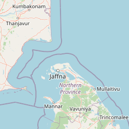
Adam's Bridge Marine National Park history and protected-area timeline

The establishment of Adam's Bridge Marine National Park represents a relatively recent development in Sri Lanka's protected area network, reflecting the country's post-civil conflict commitment to environmental conservation in the Northern Province. Prior to the park's creation, an Integrated Strategic Environmental Assessment of the Northern Province was conducted with support from the United Nations Development Programme and United Nations Environment Programme, with findings published in October 2014. This assessment recommended the creation of a national park covering the Sri Lankan section of Adam's Bridge to protect its ecological and cultural values. In May 2015, the Sri Lankan government announced that portions of Adam's Bridge would be designated as a national park, alongside several other proposed protected areas in the region including Chundikkulam National Park, Delft National Park, and Madhu Road National Park. Adam's Bridge was formally declared a national park on June 22, 2015, with an initial area of 18,990 hectares. The Indian portion of Adam's Bridge falls within the boundaries of India's Gulf of Mannar Marine National Park, creating a transboundary marine protected area that crosses the international maritime boundary.

Adam's Bridge Marine National Park landscape and geographic character

The landscape of Adam's Bridge Marine National Park is defined by its distinctive chain of islands, sandbars, and shallow reef systems that create an almost continuous causeway across the shallow waters between Mannar Island and the Indian mainland. The area features a succession of low-lying limestone islands and coral sand cays that emerge from turquoise waters typically only a few meters deep. Along the bridge itself, prominent sand dunes have formed, particularly on the eastern side, creating miniature desert-like terrain amid the marine environment. The surrounding seabed consists largely of seagrass meadows and scattered coral formations that support the park's marine biodiversity. Mannar Island, visible in the foreground of aerial views of the bridge, provides a rugged backdrop with its flat terrain and scattered vegetation. The overall visual character combines the serene beauty of shallow tropical waters with the stark, windswept appearance of exposed sandbars and dune formations.

Adam's Bridge Marine National Park ecosystems, habitats, and plant life

The marine ecosystem of Adam's Bridge Marine National Park supports a remarkable concentration of biodiversity despite its relatively recent protection status. The shallow waters of the Gulf of Mannar in this area are characterized by extensive seagrass beds that provide critical habitat and food sources for marine species. These seagrass meadows represent some of the most productive coastal habitats, supporting complex food webs that range from small fish and invertebrates to large marine mammals. The transitional nature of the Adam's Bridge corridor, connecting two major landmasses, has created unique conditions that support both Indo-Pacific marine species and those with more restricted distributions. The park lies within a broader region recognized for its ecological significance, situated adjacent to other protected areas in both Sri Lanka and India that together form a transboundary marine conservation network.

Adam's Bridge Marine National Park wildlife and species highlights

The wildlife of Adam's Bridge Marine National Park encompasses both significant marine fauna and important avian populations. The shallow waters around Adam's Bridge support populations of dolphins, which are frequently observed in the area, as well as the endangered dugong, a marine mammal that depends on seagrass beds for survival. Sea turtles, including several species, are found in the waters surrounding the bridge, utilizing the area for feeding and perhaps nesting. The fish diversity in the area is substantial, with numerous varieties thriving in the shallow, productive waters. The sand dunes of Adam's Bridge serve a particularly important ecological function as breeding grounds for seabirds, notably the brown noddy. The corridor formed by Pamban Island, Adam's Bridge, and Mannar Island constitutes a major migratory bird route, with many species following this path as they travel to and from Sri Lanka, making the area especially significant for avian conservation.

Adam's Bridge Marine National Park conservation status and protection priorities

Adam's Bridge Marine National Park contributes to Sri Lanka's marine conservation network by protecting a unique coastal ecosystem that spans an important biogeographic boundary. The establishment of the park in 2015 reflects growing recognition of the need to protect transboundary marine environments and the species that depend on them. The area's significance extends beyond national boundaries, as the Indian section of Adam's Bridge is protected within India's Gulf of Mannar Marine National Park, creating an international conservation framework. The protection of this marine corridor helps preserve critical habitat for endangered species including dugongs and sea turtles, while also maintaining the ecological integrity of the broader Gulf of Mannar region. The park's designation followed scientific assessment of the Northern Province's ecological resources, ensuring that protection was focused on areas of genuine conservation value.

Adam's Bridge Marine National Park cultural meaning and human context

Adam's Bridge carries profound cultural and religious significance in Hindu tradition, where it is known as Rama's Bridge or Setu Banda in reference to its mention in the ancient epic Ramayana. According to Hindu mythology, the bridge was constructed by the army of monkeys under the leadership of Hanuman to enable Lord Rama's forces to cross from the Indian mainland to Lanka to rescue his wife Sita from the demon king Ravana. This mythological association has made the bridge a site of religious pilgrimage for Hindus, who believe that walking across the bridge or visiting its islands can bring spiritual merit. The dual identity of Adam's Bridge, as both a scientifically interesting geological formation and a sacred site in Hindu tradition, creates a unique cultural landscape where natural and spiritual values intertwine. The park's establishment must be understood within this cultural context, as it protects not only ecological resources but also a landscape imbued with deep religious meaning for millions of people.

Top sights and standout views in Adam's Bridge Marine National Park

Adam's Bridge Marine National Park protects one of Sri Lanka's most culturally significant coastal landscapes, the legendary causeway connecting the island to India. The marine environment supports populations of endangered dugongs and sea turtles, while the sand dunes provide crucial breeding habitat for seabirds including the brown noddy. The park lies along a major migratory bird route linking Pamban Island, Adam's Bridge, and Mannar Island, making it a critical location for avian conservation. The shallow waters contain diverse fish populations and extensive seagrass meadows that sustain the park's marine food web. As a transboundary protected area connected to India's Gulf of Mannar Marine National Park, the park represents international cooperation in marine conservation.

Best time to visit Adam's Bridge Marine National Park

The best time to visit Adam's Bridge Marine National Park generally corresponds to the dry season in northern Sri Lanka, typically from May to September, when weather conditions are more stable and sea conditions allow for better marine viewing opportunities. The monsoon season from October to December brings rougher seas and reduced visibility, which can limit wildlife observation capabilities. Visitors interested in observing migratory birds may find the periods around migration seasons particularly rewarding, though specific timing varies by species. The climate in this coastal region can be hot and humid throughout the year, so visiting during cooler morning or late afternoon hours is advisable for land-based exploration. As the park is a relatively recent establishment, visitors should check current regulations and access arrangements with the Department of Wildlife Conservation before planning their trip.

Park location guide

Geography guide, regional context, and park location map for Adam's Bridge Marine National Park

Adam's Bridge Marine National Park park geography, regions, and map view in Sri Lanka
Understand where Adam's Bridge Marine National Park sits in Sri Lanka through a broader geographic reading of the surrounding landscape, nearby location context, and its mapped position within the national park landscape.

How Adam's Bridge Marine National Park fits into Sri Lanka

Sri Lanka is a tropical island nation in South Asia with a recorded history spanning over 3,000 years. Formerly known as Ceylon, it became independent in 1948 and adopted its current constitutional name in 1972. The country features diverse geography ranging from coastal plains to mountainous highlands and maintains a population exceeding 22 million.

Wider geography shaping Adam's Bridge Marine National Park in Sri Lanka

Sri Lanka is an island nation in the Indian Ocean, positioned southwest of the Bay of Bengal. It is separated from India by the Gulf of Mannar and Palk Strait to the northwest. The island has a pear-like shape with diverse terrain including coastal plains, central highlands, and river valleys.

Map view of Adam's Bridge Marine National Park

Use this park location map to pinpoint Adam's Bridge Marine National Park in Sri Lanka, understand its exact geographic position, and read its mapped placement within the surrounding landscape more clearly.

Pigeon | © OpenStreetMap contributors

Location context for Adam's Bridge Marine National Park

Northern Province
Park atlas

Compare surrounding marine and coastal protected landscapes, tracing regional park geography and conservation.

Explore Nearby National Parks and Protected Areas Beyond Adam's Bridge Marine National Park
Browse national parks and protected areas geographically close or ecologically similar to Adam's Bridge Marine National Park, spanning adjacent coastal and marine landscapes. Compare their distinct ecosystems, vital marine habitats, and conservation efforts to trace regional protected area patterns and geographic spread.
National parkTamil Nadu

Gulf of Mannar Marine National Park: Protected Island Archipelago and Marine Atlas

Explore India's vital marine national park and its coral reef ecosystems.

Gulf of Mannar Marine National Park is a designated national park located in Tamil Nadu, India, protecting a chain of 21 islands and their surrounding marine environments. This protected area is renowned for its extensive coral reefs, crucial seagrass meadows supporting dugongs, and diverse fish species, making it a key site for marine conservation and geographic exploration. The park's unique island landscape and intertidal zones offer a distinct perspective on coastal protected areas within the Indian Ocean, providing rich material for atlas-style discovery and understanding regional marine geography.

Area
560 km²
Established
1986
IUCN
II
Relief
Lowland
National parkNorthern Province

Madhu Road National Park: Sri Lanka's Northern Province Dry Zone National Park

Explore protected landscapes and mapped geography.

Madhu Road National Park, situated in Sri Lanka's Northern Province, is a significant protected area defined by its dry zone ecosystems, including forests, grasslands, and wetlands. As one of the island's larger national parks, it offers critical habitat for diverse wildlife and represents an important component of northern Sri Lanka's conservation efforts. This page provides detailed atlas-style insights into the park's geography, mapped boundaries, and its ecological context within the region.

Area
631 km²
Established
2015
IUCN
II
National parkNorth Western Province

Wilpattu National Park: Sri Lanka's Largest Protected Landscape and Wetland Atlas

Discover the unique willu system and mapped geography of this National Park.

Wilpattu National Park represents a significant protected area within Sri Lanka's North Western Province, recognized for its vast expanse and the distinctive natural sand-rimmed water basins known as willu. This atlas entry provides a deep dive into the park's geographic setting, focusing on its dry zone forest, coastal lowland terrain, and the critical wetland habitats that define its ecological importance. Understand the mapped boundaries and landscape character of Wilpattu National Park, a key site for conservation and natural discovery.

Area
1,316.67 km²
Established
1938
IUCN
II
National parkNorth Central Province

Horowpathana National Park: Protected Landscape within North Central Province's Dry Zone

Explore its mapped boundaries and vital wildlife habitat.

Horowpathana National Park is a designated national park in Sri Lanka's North Central Province, covering 2,570 hectares of dry zone forest. Established to protect critical habitats for endangered species like the Sri Lankan elephant and leopard, it plays a vital role in regional wildlife conservation and managing human-wildlife conflict. Its landscape is characterized by dry forest ecosystems situated near the Tawalamham Hammillewa reservoir system, presenting a unique environmental context within the broader mapped geography of the island.

Area
2,570 km²
Established
2011
IUCN
II
National parkNorth Central Province

Minneriya National Park: A Protected National Park in North Central Province

Explore mapped boundaries and regional landscape context.

Minneriya National Park is a designated national park offering unique protected landscape exploration within Sri Lanka's North Central Province. This entry provides structured data crucial for understanding the park's geographic features, its defined boundaries, and its significance as a protected area. Dive into the atlas context that illuminates the natural terrain and regional setting of Minneriya National Park.

Area
88.894 km²
Established
1997
IUCN
II
National parkNorth Central Province

Angammedilla National Park: Protecting the Watershed for Parakrama Samudra in North Central Province

Mapped dry evergreen forests and mountainous terrain boundaries.

Angammedilla National Park is a national park in Sri Lanka's North Central Province renowned for its pivotal role in safeguarding the drainage basin for the large Parakrama Samudra reservoir. This protected landscape features significant dry evergreen forest ecosystems and mountainous terrain, contributing to the region's ecological stability and wildlife habitats. Its establishment highlights a commitment to preserving vital natural resources and understanding the complex interplay between protected areas and regional geography.

Area
75.29 km²
Established
2006
IUCN
II
National parkNorth Central Province

Flood Plains National Park: Sri Lanka's Vital Wetland and Elephant Corridor

Mapping the geography of its unique villus system and Mahaweli River flood plain.

Flood Plains National Park stands as a paramount protected wetland ecosystem in Sri Lanka's North Central Province, critically important as an elephant corridor along the Mahaweli River. The park's landscape is defined by its unique villus system, shallow swampy depressions that support extraordinary biodiversity and serve as vital feeding grounds for Asian elephants and migratory waterfowl. Understanding the mapped park boundaries and its regional geographic context reveals its significance in landscape-level conservation efforts within the Mahaweli basin.

Area
173.5 km²
Established
1984
IUCN
II
National parkKerala

Periyar National Park: National Park Protected Area Atlas and Geographic Context

Mapped protected lands and regional landscape exploration in Kerala.

Discover Periyar National Park as a distinct protected landscape offering rich geographic context for atlas exploration. This entry details its mapped boundaries and its significance within the broader regional geography of Kerala. Understand the natural terrain and protected-area distribution that makes Periyar National Park a key element in India's conservation mapping.

Area
350.54 km²
Established
1982
IUCN
II
Visitors
754.3K annual

Common questions about visiting, size, designation, and location context for Adam's Bridge Marine National Park

Adam's Bridge Marine National Park FAQs for park facts, access, geography, and protected area context
Find quick answers about Adam's Bridge Marine National Park, including protected-area facts, park geography, trail and visitor context, and how the park fits into its surrounding country and regional landscape.
MoriAtlas Explorer

Continue Your Protected Areas Search Across the Global Atlas

Deepen your exploration by continuing the structured search for national parks and protected areas worldwide. Utilize the comprehensive filtering capabilities to compare different conservation landscapes and refine your understanding of global park geography. Discover more about the distribution and characteristics of protected natural areas.

Global natural geography