Mori Atlas logo
National parkWilpattu National Park

Discover the unique willu lake system and dry zone forest of Wilpattu National Park.

Wilpattu National Park: Sri Lanka's Largest National Park and Mapped Protected Landscape

(Wilpattu Ramsar Wetland Cluster)

Wilpattu National Park, located in Sri Lanka's North Western Province, is the nation's largest and oldest protected area. This page serves as a detailed atlas entry for Wilpattu, highlighting its unique willu wetland basins and extensive dry zone forest. Explore the geographic boundaries and landscape context of this critical natural habitat, recognized for its significant leopard population and ecological diversity.

National ParkLeopard HabitatWetlandsDry Zone ForestRamsar SiteSri Lankan Wildlife

Wilpattu National Park

National park

Park overview

Structured park overview, official facts, and landscape profile for Wilpattu National Park

Wilpattu National Park park facts, protected area profile, and essential visitor context
Review the core facts for Wilpattu National Park, including designation, size, terrain, visitor scale, habitats, and operating context in one park-focused overview.

About Wilpattu National Park

Wilpattu National Park occupies a significant position in Sri Lanka's protected area network as the country's largest national park, spanning approximately 1,317 square kilometers along the northwest coast lowland dry zone. The park's defining characteristic is its willu system, comprising nearly 106 natural lakes scattered throughout the reserve. These unique sand-rimmed water basins fill with rainwater during the monsoon seasons, creating a distinctive hydrological landscape that distinguishes Wilpattu from other protected areas in Sri Lanka. The terrain ranges from sea level to 152 meters above sea level, encompassing coastal dune areas, dry forest zones, and extensive marshlands. Located approximately 180 kilometers north of Colombo, the park is accessible from Anuradhapura and Puttalam, though visitor access remains limited to roughly 25% of the total area due to dense forest cover and ongoing conservation management considerations. The park's biodiversity encompasses multiple habitat types including littoral vegetation along the coast, monsoon forest with tall emergent species such as palu, satin, and ebony, and freshwater marsh areas surrounding the willu lakes.

Quick facts and research context for Wilpattu National Park

Wilpattu National Park covers 1,317 square kilometers in northwestern Sri Lanka, straddling the North Western and North Central provinces. Established as a wildlife sanctuary in 1905 and upgraded to national park status in 1938, it is the largest national park in Sri Lanka. The park features the unique "willu" system, natural lakes that fill with monsoon rains, and supports diverse habitats including coastal littoral vegetation, dry monsoon forests, and freshwater marshes. The park is home to 31 mammal species including the Sri Lankan leopard, elephant, sloth bear, and sambar deer, along with numerous bird and reptile species. From 1988 to 2003, the park was closed due to the Sri Lankan Civil War and has since reopened with visitor access limited to about 25% of the total area.

Park context

Deeper park guide and search-rich context for Wilpattu National Park

Wilpattu National Park history, landscape, wildlife, and travel context
Explore Wilpattu National Park through its history, landscape character, ecosystems, wildlife, conservation priorities, cultural context, and seasonal travel timing in a structured park guide built for atlas discovery and search intent.

Why Wilpattu National Park stands out

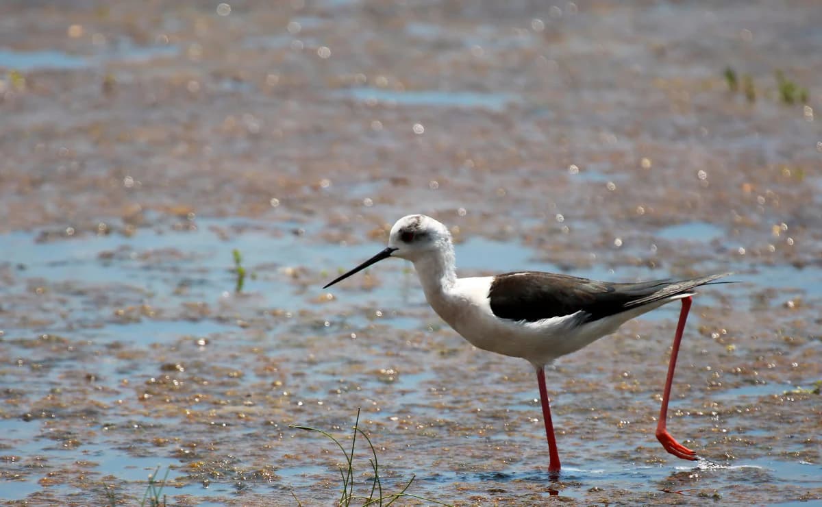
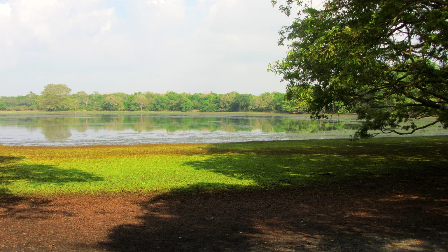
Wilpattu is world-renowned for its exceptional leopard population, representing one of the highest density leopard populations in Sri Lanka. The park's 2018 camera trap survey recorded 133 individual leopards across a 660 square kilometer surveyed area, with a population density estimated at 18 leopards per 100 square kilometers. Beyond leopards, the park is distinguished by its unique willu lake system, natural sand-rimmed depressions that create a distinctive wetland landscape not found in other Sri Lankan national parks. The combination of dry zone forest, coastal ecosystems, and wetland habitats makes Wilpattu a critical conservation area in Sri Lanka's protected area network.

Tufted gray langur in Wilpattu National Park
Semnopithecus priam (Tufted gray langur) in Wilpattu National Park, Sri Lanka, February 5, 2018.

Wilpattu National Park history and protected-area timeline

Wilpattu National Park has a protection history dating back over a century. According to the Mahavansa chronicle, the area holds historical significance dating to 543 BC when Prince Vijaya landed at Tambapanni, now known as Kudrimalai Point or Horse Point, establishing the Sinhalese kingdom. The area was formally designated as a wildlife sanctuary in 1905 and upgraded to national park status on December 25, 1938. During the Sri Lankan Civil War, the park remained closed from December 1988 until March 16, 2003, a period of fifteen years during which wildlife populations were largely undisturbed. The park reopened to visitors in 2003, though access has remained limited to certain zones. In 2012, the park boundary was expanded through government gazettes to include regions of the Northern Province, extending the park's coverage significantly. Additionally, in February 2013, Wilpattu was designated as the Wilpattu Ramsar Wetland Cluster, recognizing its international importance as a wetland ecosystem.

Wilpattu National Park landscape and geographic character

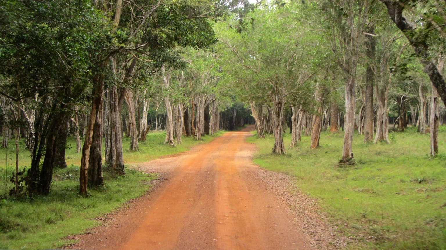
The landscape of Wilpattu National Park is characterized by a unique combination of coastal lowland terrain and interior dry zone forest, centered around its distinctive willu lake system. The park occupies the northwest coast lowland dry zone of Sri Lanka, with elevation ranging from sea level to 152 meters. Nearly 106 natural lakes, known locally as willu, are distributed throughout the park. These are sand-rimmed water basins that fill with rainwater, creating seasonal wetlands critical to the park's ecology. The vegetation includes littoral vegetation along the coastal fringe with salt grass and low scrub, transitioning into monsoon forest with tall emergent trees including palu, satin, milla, weera, ebony, and wewarna. Marshy vegetation surrounds the willu lakes, providing important wetland habitats. The park's terrain includes gentle slopes, sandy areas, and scattered rocky outcrops typical of the dry zone landscape.

Painted stork in Wilpattu National Park
Painted stork (Mycteria leucocephala) in Wilpattu National Park, Sri Lanka, photographed on February 5, 2018.

Wilpattu National Park ecosystems, habitats, and plant life

Wilpattu National Park supports diverse ecological systems reflecting its position in Sri Lanka's dry zone and its unique wetland habitat network. The park's vegetation types include coastal littoral vegetation characterized by salt grass and low scrub, and dry monsoon forest with tall emergent species such as palu, satin, milla, weera, ebony, and wewarna. The willu lake system creates extensive freshwater marsh habitats that support significant biodiversity. These wetlands serve as critical water sources for wildlife during dry seasons and provide breeding grounds for numerous bird and reptile species. The combination of forest, coastal, and wetland habitats makes Wilpattu a ecologically diverse protected area, supporting species adapted to dry zone conditions as well as those requiring aquatic environments.

Mugger crocodile in Wilpattu National Park
Mugger crocodile (Crocodylus palustris) in Wilpattu National Park, Sri Lanka. Photographed on February 5, 2018.

Wilpattu National Park wildlife and species highlights

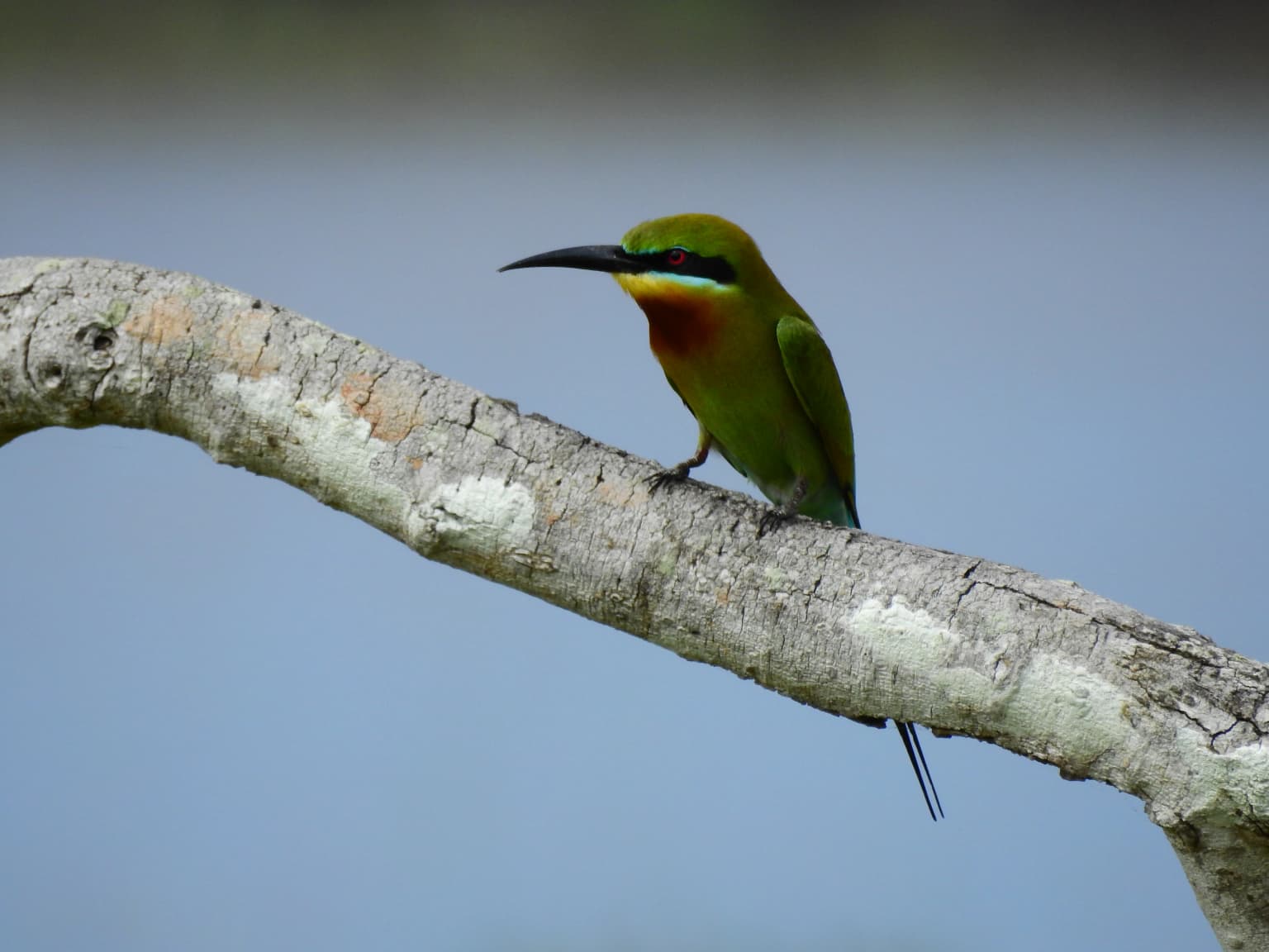
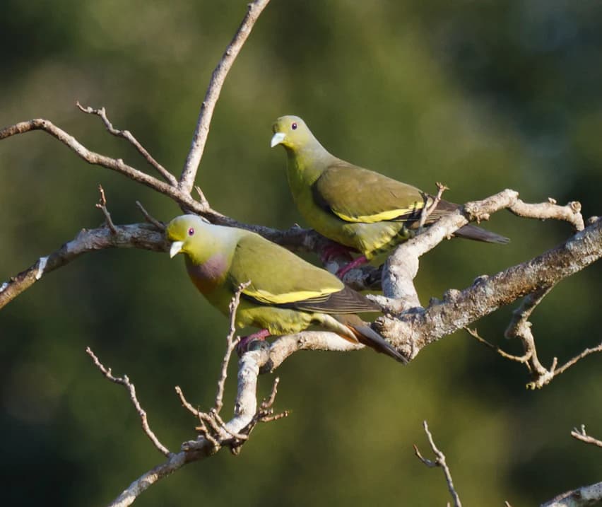
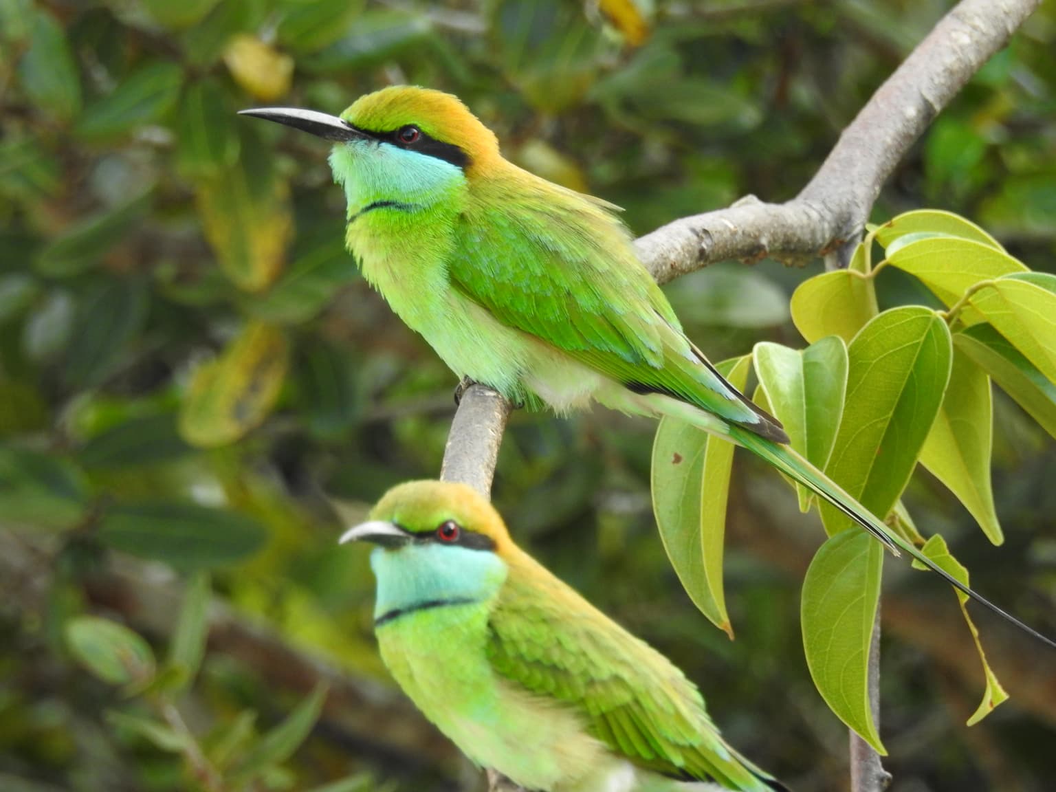
Wilpattu National Park is home to 31 documented mammal species, with the Sri Lankan leopard being the most celebrated resident. Camera trap surveys have documented remarkable leopard densities, with a 2018 study recording 133 individual leopards including 116 independent adults and 17 cubs across a 660 square kilometer surveyed area. The density was estimated at 18 leopards per 100 square kilometers, representing one of the highest densities in Sri Lanka. Other significant mammals include the Sri Lankan elephant, sloth bear, sambar deer, and spotted deer. The park supports diverse birdlife including painted storks, openbills, little cormorants, Sri Lankan junglefowl, and numerous waterfowl such as garganey, pintail, and whistling teal. Reptile species include the mugger crocodile, Sri Lankan python, cobra, land monitor, and several turtle species including the Sri Lankan black turtle and flapshell turtle.

Malabar pied hornbill in Wilpattu National Park
Malabar pied hornbill (Anthracoceros coronatus) in Wilpattu National Park, Sri Lanka, February 5, 2018.

Wilpattu National Park conservation status and protection priorities

Wilpattu National Park holds significant conservation importance as Sri Lanka's largest national park and a Ramsar-designated wetland site since 2013. The park's conservation value is emphasized by its exceptional leopard population, representing a viable and healthy population of the endemic Sri Lankan leopard subspecies. The willu lake system provides critical wetland habitat supporting numerous species and ecological processes. The park's location in the dry zone makes it important for conserving dry forest ecosystems that have faced significant pressure across Sri Lanka. However, the park faces challenges including historical deforestation concerns and boundary expansion issues that have created complex conservation and social dynamics. The current protected status and Ramsar designation provide frameworks for ongoing conservation management, though effective enforcement and balancing conservation with community needs remain ongoing considerations.

Wilpattu National Park cultural meaning and human context

Wilpattu National Park holds significant cultural and historical importance in Sri Lankan history. According to the Mahavansa, the area is associated with the legendary landing of Prince Vijaya in 543 BC at Tambapanni, now known as Kudrimalai Point or Horse Point, where he established the Sinhalese kingdom and founded the Sinhala nation. Historical records indicate that Kudrimalai was visited in 47 AD by a subject of Emperor Claudius who was blown off course by monsoon winds, with the local king subsequently sending envoys to Rome during Pliny's time. These historical connections give the park region significance beyond its ecological value, linking it to the foundational narratives of Sri Lankan civilization.

Indian peafowl in Wilpattu National Park
Indian peafowl (Pavo cristatus) in Wilpattu National Park, Sri Lanka. Photographed on 5th February 2018.

Top sights and standout views in Wilpattu National Park

Wilpattu National Park stands out as Sri Lanka's largest and oldest national park, offering a distinctive safari experience centered on its unique willu lake system and exceptional leopard population. The park provides excellent wildlife viewing opportunities, particularly for leopard sightings, with population densities among the highest in the country. The combination of dry zone forest, coastal habitats, and seasonal wetlands creates a varied landscape supporting diverse flora and fauna. The Ramsar designation underscores the international significance of the park's wetland ecosystems. Visitors can explore the park through guided safari experiences, particularly during the optimal visiting season from February to October when wildlife viewing conditions are most favorable.

Indian paradise flycatcher in Wilpattu National Park
Indian paradise flycatcher (Terpsiphone paradisi) in Wilpattu National Park, Sri Lanka on February 5, 2018.

Best time to visit Wilpattu National Park

The optimal visiting period for Wilpattu National Park extends from February through October, coinciding with the drier months when wildlife tends to congreg around the remaining water sources in the willu lakes. The inter-monsoonal rains in March and the northeast monsoon from December to February provide the main rainfall to the region, with the park receiving approximately 1,000mm of annual precipitation. During the dry season, the reduced water availability concentrates wildlife around the remaining lakes and waterholes, enhancing wildlife viewing opportunities. While the park remains open year-round with some private ecotourism operators conducting safaris throughout the year, the period between February and October generally offers the most consistent conditions for wildlife observation.

Park location guide

Geography guide, regional context, and park location map for Wilpattu National Park

Wilpattu National Park park geography, regions, and map view in Sri Lanka
Understand where Wilpattu National Park sits in Sri Lanka through a broader geographic reading of the surrounding landscape, nearby location context, and its mapped position within the national park landscape.

How Wilpattu National Park fits into Sri Lanka

Sri Lanka is a tropical island nation in South Asia with a recorded history spanning over 3,000 years. Formerly known as Ceylon, it became independent in 1948 and adopted its current constitutional name in 1972. The country features diverse geography ranging from coastal plains to mountainous highlands and maintains a population exceeding 22 million.

Wider geography shaping Wilpattu National Park in Sri Lanka

Sri Lanka is an island nation in the Indian Ocean, positioned southwest of the Bay of Bengal. It is separated from India by the Gulf of Mannar and Palk Strait to the northwest. The island has a pear-like shape with diverse terrain including coastal plains, central highlands, and river valleys.

Map view of Wilpattu National Park

Use this park location map to pinpoint Wilpattu National Park in Sri Lanka, understand its exact geographic position, and read its mapped placement within the surrounding landscape more clearly.

Pigeon | © OpenStreetMap contributors

Location context for Wilpattu National Park

North Central ProvinceNorth Western Province

Visualize Wilpattu National Park's diverse protected landscapes, from its unique willu wetlands to dry zone forests.

Wilpattu National Park Photos: Explore Unique Wetland Landscapes and Dry Zone Scenery
Explore a comprehensive gallery of Wilpattu National Park images to understand its distinctive willu lake system, expansive dry zone forests, and coastal lowland terrain. Visualizing these diverse habitats provides essential context for its acclaimed conservation status and rich biodiversity, including its renowned leopard population.

Tufted gray langur in Wilpattu National Park

Sri Lankan axis deer in Wilpattu National Park

Painted stork in Wilpattu National Park

Mugger crocodile in Wilpattu National Park

Malabar pied hornbill in Wilpattu National Park

Wilpattu National Park - February 2018 - Little Egret

Indian peafowl in Wilpattu National Park

Indian paradise flycatcher in Wilpattu National Park

Wilpattu National Park, Grey Heron

Wilpattu National Park - Green imperial pigeon

Green bee-eater, Wilpattu National Park

Crested serpent eagle in Wilpattu National Park

Crested hawk-eagle in Wilpattu National Park

Chestnut-headed bee-eater in Wilpattu National Park

Brown Shrike in Wilpattu National Park

Wilpattu National Park - Blue-tailed bee-eater (1)

Park atlas

Compare surrounding conservation landscapes, mapping regional park geography and protected zone spread.

Explore Nearby National Parks and Protected Areas Beyond Wilpattu National Park
Continue your exploration from Wilpattu National Park by browsing other national parks and protected areas located within the surrounding regional geography. This allows you to compare diverse conservation landscapes, trace the spread of protected zones, and deepen your understanding of Sri Lanka's unique park network.
National parkNorthern Province

Madhu Road National Park: Sri Lanka's Northern Province Dry Zone National Park

Explore protected landscapes and mapped geography.

Madhu Road National Park, situated in Sri Lanka's Northern Province, is a significant protected area defined by its dry zone ecosystems, including forests, grasslands, and wetlands. As one of the island's larger national parks, it offers critical habitat for diverse wildlife and represents an important component of northern Sri Lanka's conservation efforts. This page provides detailed atlas-style insights into the park's geography, mapped boundaries, and its ecological context within the region.

Area
631 km²
Established
2015
IUCN
II
National parkNorthern Province

Adam's Bridge Marine National Park: Protected Coastal Landscape and Geographic Significance

Mapped marine geography and protected island ecosystems.

Adam's Bridge Marine National Park is a protected national park in Sri Lanka's Northern Province, notable for encompassing the legendary Adam's Bridge. This marine protected area safeguards critical shallow-water habitats, including seagrass meadows and sand dunes, which are vital for migratory birds, dugongs, and sea turtles. The park's unique geographic identity as a chain of limestone shoals and islands offers a distinct landscape for atlas-based discovery and understanding of coastal conservation significance.

Area
190 km²
Established
2015
IUCN
II
National parkNorth Central Province

Horowpathana National Park: Protected Landscape within North Central Province's Dry Zone

Explore its mapped boundaries and vital wildlife habitat.

Horowpathana National Park is a designated national park in Sri Lanka's North Central Province, covering 2,570 hectares of dry zone forest. Established to protect critical habitats for endangered species like the Sri Lankan elephant and leopard, it plays a vital role in regional wildlife conservation and managing human-wildlife conflict. Its landscape is characterized by dry forest ecosystems situated near the Tawalamham Hammillewa reservoir system, presenting a unique environmental context within the broader mapped geography of the island.

Area
2,570 km²
Established
2011
IUCN
II
National parkTamil Nadu

Gulf of Mannar Marine National Park: Protected Island Archipelago and Marine Atlas

Explore India's vital marine national park and its coral reef ecosystems.

Gulf of Mannar Marine National Park is a designated national park located in Tamil Nadu, India, protecting a chain of 21 islands and their surrounding marine environments. This protected area is renowned for its extensive coral reefs, crucial seagrass meadows supporting dugongs, and diverse fish species, making it a key site for marine conservation and geographic exploration. The park's unique island landscape and intertidal zones offer a distinct perspective on coastal protected areas within the Indian Ocean, providing rich material for atlas-style discovery and understanding regional marine geography.

Area
560 km²
Established
1986
IUCN
II
Relief
Lowland
National parkNorth Central Province

Minneriya National Park: A Protected National Park in North Central Province

Explore mapped boundaries and regional landscape context.

Minneriya National Park is a designated national park offering unique protected landscape exploration within Sri Lanka's North Central Province. This entry provides structured data crucial for understanding the park's geographic features, its defined boundaries, and its significance as a protected area. Dive into the atlas context that illuminates the natural terrain and regional setting of Minneriya National Park.

Area
88.894 km²
Established
1997
IUCN
II
National parkNorth Central Province

Angammedilla National Park: Protecting the Watershed for Parakrama Samudra in North Central Province

Mapped dry evergreen forests and mountainous terrain boundaries.

Angammedilla National Park is a national park in Sri Lanka's North Central Province renowned for its pivotal role in safeguarding the drainage basin for the large Parakrama Samudra reservoir. This protected landscape features significant dry evergreen forest ecosystems and mountainous terrain, contributing to the region's ecological stability and wildlife habitats. Its establishment highlights a commitment to preserving vital natural resources and understanding the complex interplay between protected areas and regional geography.

Area
75.29 km²
Established
2006
IUCN
II
National parkNorth Central Province

Flood Plains National Park: Sri Lanka's Vital Wetland and Elephant Corridor

Mapping the geography of its unique villus system and Mahaweli River flood plain.

Flood Plains National Park stands as a paramount protected wetland ecosystem in Sri Lanka's North Central Province, critically important as an elephant corridor along the Mahaweli River. The park's landscape is defined by its unique villus system, shallow swampy depressions that support extraordinary biodiversity and serve as vital feeding grounds for Asian elephants and migratory waterfowl. Understanding the mapped park boundaries and its regional geographic context reveals its significance in landscape-level conservation efforts within the Mahaweli basin.

Area
173.5 km²
Established
1984
IUCN
II
National parkUva Province

Gal Oya National Park: Protected Landscape and Reservoir Geography in Uva Province

Explore savannah grasslands, elephant populations, and mapped terrain.

Gal Oya National Park presents a unique protected landscape within Uva Province, Sri Lanka. This national park is defined by its broad savannah grasslands, known as thalawa, interspersed with forested hills and the vast Senanayake Samudraya reservoir. Its varied topography, from lowlands to mountain peaks, offers a rich canvas for geographic exploration and understanding protected-area dynamics. The park's consistent visibility of elephant populations across these diverse terrains makes it a key site for wildlife observation within Sri Lanka's atlas of natural heritage.

Area
259 km²
Established
1954
IUCN
II

Common questions about visiting, size, designation, and location context for Wilpattu National Park

Wilpattu National Park FAQs for park facts, access, geography, and protected area context
Find quick answers about Wilpattu National Park, including protected-area facts, park geography, trail and visitor context, and how the park fits into its surrounding country and regional landscape.
MoriAtlas Explorer

Continue Your Protected Areas Search Across the Global Atlas

Deepen your exploration by continuing the structured search for national parks and protected areas worldwide. Utilize the comprehensive filtering capabilities to compare different conservation landscapes and refine your understanding of global park geography. Discover more about the distribution and characteristics of protected natural areas.

Global natural geography