Mori Atlas logo
National parkAoraki / Mount Cook National Park

Discover the geographic context of New Zealand's highest peaks and glacial terrain.

Aoraki / Mount Cook National Park: New Zealand's Premier Alpine Protected Landscape Atlas

Aoraki / Mount Cook National Park represents New Zealand's most spectacular alpine protected area, centered around the nation's highest peak within the dramatic Southern Alps. Situated in the Canterbury Region, this national park encompasses a vast territory defined by extensive glacier systems, including the Tasman Glacier, and soaring mountain peaks. MoriAtlas facilitates a deep exploration of its mapped boundaries, unique glacial landscape, and its place in the broader regional geography, offering an unparalleled view of this iconic natural environment.

Southern AlpsGlacial landscapeWorld Heritage siteMountain peaksAlpine environmentDark sky reserve

Aoraki / Mount Cook National Park

National park

Park overview

Structured park overview, official facts, and landscape profile for Aoraki / Mount Cook National Park

Aoraki / Mount Cook National Park park facts, protected area profile, and essential visitor context
Review the core facts for Aoraki / Mount Cook National Park, including designation, size, terrain, visitor scale, habitats, and operating context in one park-focused overview.

About Aoraki / Mount Cook National Park

Aoraki / Mount Cook National Park represents New Zealand's most significant alpine protected area, encompassing a landscape of extraordinary geological and ecological diversity along the Main Divide of the Southern Alps. The park stretches approximately 60 kilometers along the southern Alps, protecting the southeastern side of this major mountain range. At its heart stands Aoraki / Mount Cook, the nation's highest mountain at 3,724 meters, surrounded by a collection of peaks that form one of the most concentrated alpine environments in the world. The park's landscape is fundamentally shaped by glaciation, with glaciers covering 40 percent of the terrain and leaving behind the characteristic U-shaped valleys visible throughout the Hooker and Tasman Valleys. Beyond the dramatic mountain scenery, the park supports remarkable biodiversity, with over 400 plant species and approximately 35 bird species recorded within its boundaries. The area holds deep significance for Ngāi Tahu, whose traditional connections to the landscape are reflected in the dual naming of geographic features throughout the park. The park also serves as a gateway to one of New Zealand's most significant landscapes, with Mount Cook Village providing visitor facilities and access to the extensive network of walking tracks and mountaineering routes that explore this remarkable alpine environment.

Quick facts and research context for Aoraki / Mount Cook National Park

Aoraki / Mount Cook National Park protects the heart of New Zealand's Southern Alps, containing 19 of the country's 20 peaks exceeding 3,000 meters. The park was established in 1953, though portions were reserved as early as 1885 to preserve the area's significant landscape and vegetation. The park is managed jointly by the Department of Conservation and Ngāi Tahu. The park falls within the Te Wāhipounamu World Heritage Site, recognized for outstanding natural value under criteria vii, viii, ix, and x. The park's glacial landscape features U-shaped valleys formed during the last ice age approximately 13,000 years ago, when glaciers extended up to 40 kilometers south of the current park boundaries.

Park context

Deeper park guide and search-rich context for Aoraki / Mount Cook National Park

Aoraki / Mount Cook National Park history, landscape, wildlife, and travel context
Explore Aoraki / Mount Cook National Park through its history, landscape character, ecosystems, wildlife, conservation priorities, cultural context, and seasonal travel timing in a structured park guide built for atlas discovery and search intent.

Why Aoraki / Mount Cook National Park stands out

Aoraki / Mount Cook National Park is best known for its dramatic alpine scenery centered on New Zealand's highest peak, extensive glacier systems, and world-class mountaineering opportunities. The park contains the Tasman Glacier, New Zealand's largest, along with numerous other glaciers including Hooker, Murchison, Mueller, and Godley glaciers. The Hooker Valley Track, a relatively accessible 10-kilometer return hike, has become one of New Zealand's most popular walking routes, offering stunning views of the Mount Cook Range and glacial lakes. The park also holds recognition as part of the Aoraki Mackenzie International Dark Sky Reserve, one of the world's largest dark sky reserves, making it exceptional for stargazing and astrophotography. The area's mountaineering heritage includes the first successful ascent of Aoraki in 1894 and served as training ground for Sir Edmund Hillary.

Aoraki / Mount Cook National Park history and protected-area timeline

The history of Aoraki / Mount Cook National Park reflects both geological timescales and centuries of human interaction with this dramatic landscape. In Māori mythology, Aoraki was one of the sons of Raki the Sky Father, who along with three brothers became the mountains of the Mount Cook region when their waka overturned. While there is no evidence of permanent Māori settlement within the park boundaries, artifacts and evidence of burnt vegetation in the nearby Mackenzie Basin suggest nomadic groups visited to hunt moa and gather food. European interest in the region began in the 1850s, with early surveyors and explorers documenting the alpine environment and naming many geographic features. The mountain was named Mount Cook in 1851 by Captain Stokes of HMS Acheron to honor James Cook. Conservation efforts began in the late 19th century, with a petition in 1884 requesting government protection of the alpine region. Parts of the park were first set aside as recreation reserves in 1885, with the Hooker and Mueller Valleys gazetted in 1885 and the Tasman Valley reserved in 1887. The national park was officially established in October 1953, covering 151,780 acres. In 1990, the park became part of the Te Wāhipounamu World Heritage Site, the first place in New Zealand to achieve World Heritage status. The Ngāi Tahu Claims Settlement Act of 1998 formally recognized the original Māori names of geographic features, establishing the dual English and Māori naming that characterizes the park today.

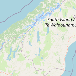
Aoraki / Mount Cook National Park landscape and geographic character

The landscape of Aoraki / Mount Cook National Park is defined by the dramatic collision of tectonic plates that has created the Southern Alps over the past 45 million years. The park lies along the Alpine Fault, a 600-kilometer active fault where the Pacific Plate is pushing westward against the Indo-Australian Plate, uplifting vast thicknesses of rock to form mountains that dominate the South Island's western coastline. The terrain features New Zealand's most impressive collection of high peaks, with 19 of the country's 20 summits exceeding 3,000 meters located within the park, including Mount Tasman, Mount Hicks, Mount Sefton, and Mount Elie de Beaumont. Glaciation has profoundly shaped the landscape, with the retreat of massive glaciers leaving behind U-shaped valleys, moraines, and proglacial lakes. The Tasman Glacier, extending approximately 29 kilometers, is the largest in New Zealand and terminates at Tasman Lake, while the Hooker Glacier creates Hooker Lake at its terminus. These glacial lakes, formed in recent decades as glaciers have retreated, have become notable features of the park's changing landscape. The geology is characterized by greywacke and argillite sandstones to the east of the Main Divide and metamorphic schists to the west, with rock along the Alpine Fault warped and folded into complex formations.

Aoraki / Mount Cook National Park ecosystems, habitats, and plant life

The nature of Aoraki / Mount Cook National Park reflects the diverse ecological zones from valley floors to alpine heights, supporting remarkable plant and bird diversity within a landscape dominated by ice and rock. The park contains over 400 plant species, including more than 100 introduced species such as Russell lupin, wild cherry, snowberries, and wilding pines. Native forest is limited to pockets along the southern Hooker Valley and lower slopes of the Sealy Range, featuring silver beech and tōtara trees, as the majority of the park sits at high altitude or within proglacial valleys where valley floors and moraine walls do not support forest growth. The characteristic vegetation consists of alpine plants, with snow tussock grassland dominating between 1,300 and 1,900 meters, alongside golden speargrass, large mountain daisies known as tikumu, and the Mount Cook lily, the largest buttercup in the world. These alpine species flower from November to February at different elevations. The park supports approximately 35 bird species, including the kea, the world's only alpine parrot, the threatened New Zealand rock wren, the rare black stilt, New Zealand falcon, and various small insectivores like the rifleman and fantail. Invertebrates are well-represented with 223 recorded moth species, seven native butterflies, and the black alpine wētā found above the snowline.

Aoraki / Mount Cook National Park wildlife and species highlights

The wildlife of Aoraki / Mount Cook National Park is characterized by specialized alpine species adapted to the harsh high-altitude environment alongside birds of the valley floors and forests. The park's most iconic resident is the kea, the only alpine parrot in the world, known for its intelligence and curious nature, often encountered near mountain huts and in the Mueller Valley. The New Zealand rock wren, known as pīwauwau, holds the distinction of being the only permanent alpine bird in New Zealand and is considered a threatened species. The black stilt, or kakī, is the rarest wading bird in the world and primarily inhabits the braided riverbed of the Tasman Valley, where conservation efforts have included hatchery-reared birds released into the park. Other notable birds include the New Zealand falcon, Australasian harrier, silvereye, and pipit. The park supports diverse invertebrate populations including large dragonflies, crickets, grasshoppers, 223 moth species, and seven native butterfly species. The jeweled gecko inhabits the park but remains rarely seen. Introduced species including finches, sparrows, stoats, red deer, possums, tahr, and chamois also occur, with tahr and chamois introduced in the early 20th century as game animals and now requiring management control due to their impacts on alpine vegetation.

Aoraki / Mount Cook National Park conservation status and protection priorities

Aoraki / Mount Cook National Park holds exceptional conservation significance as New Zealand's premier alpine protected area and part of the Te Wāhipounamu World Heritage Site, recognized for outstanding universal value under natural criteria. The park is managed by the Department of Conservation in partnership with Ngāi Tahu, who hold mana whenua status over the region. Conservation challenges include managing introduced species such as tahr and chamois, which cause damage to alpine plants and soil erosion, with the Department encouraging hunting to control populations. Lead toxicity in kea has been a significant concern, with research in the 1990s finding dangerously high blood lead levels in kea living in the park, prompting efforts to remove lead sources from buildings. The park's designation as part of the Aoraki Mackenzie International Dark Sky Reserve in 2012 protects the exceptional night sky resource, with the reserve ranking at Bortle scale level 2. Visitor management has become increasingly important as numbers have grown dramatically, reaching over one million visitors by 2019, prompting discussions about booking systems, entrance fees, and infrastructure improvements. The park's ecological value is further enhanced by its role in protecting significant populations of threatened species including the black stilt and New Zealand rock wren.

Aoraki / Mount Cook National Park cultural meaning and human context

The cultural context of Aoraki / Mount Cook National Park is deeply intertwined with Māori mythology, colonial history, and contemporary partnership in park management. In Māori tradition, Aoraki was a son of Raki the Sky Father who, along with three brothers, descended from heaven in a waka that overturned, leaving the brothers trapped on the overturned canoe where they became the mountains Aoraki / Mount Cook, Mount Dampier, Mount Teichelmann, and Mount Tasman, while the waka itself became the Southern Alps. Although no permanent Māori settlements existed within the park, the nearby Mackenzie Basin shows evidence of nomadic groups hunting moa and gathering food. The Ngāi Tahu Claims Settlement Act of 1998 formally recognized the original names of geographic features within the takiwā of Ngāi Tahu, establishing dual English and Māori names such as Kirikirikatata / Mount Cook Range and Haupapa / Tasman Glacier. Ngāi Tahu hold mana whenua status and partner with the Department of Conservation in managing the park. The plant tutu, considered taonga by Ngāi Tahu, flourishes throughout the Hooker Valley. European exploration from the 1850s onward resulted in many geographic features being named after early explorers, with Mount Cook Village developing from Frank Huddleston's Hermitage accommodation opened in 1884.

Top sights and standout views in Aoraki / Mount Cook National Park

Aoraki / Mount Cook National Park offers an exceptional combination of natural wonders, outdoor activities, and cultural significance within New Zealand's most dramatic alpine setting. The Hooker Valley Track stands as the park's signature experience, a relatively accessible 10-kilometer return hike offering panoramic views of the Mount Cook Range, Mueller Glacier, and the iconic alpine scenery that defines the park. The Tasman Glacier and Tasman Lake provide opportunities to navigate among icebergs on boat tours, while the Mueller Hut route offers access to alpine terrain for more adventurous visitors. The dark sky reserve designation makes the park exceptional for stargazing and astrophotography, with the night sky brightness ranking at the second-darkest level on the Bortle scale. Mountaineering opportunities range from the challenging first ascents of the 1890s to accessible peaks like Sebastopol, with the area having served as training ground for Sir Edmund Hillary. The park's cultural dimension is reflected in the dual naming of features and the ongoing partnership with Ngāi Tahu, while the filming location history for major productions like The Lord of the Rings demonstrates the universal appeal of this spectacular landscape.

Best time to visit Aoraki / Mount Cook National Park

Aoraki / Mount Cook National Park offers distinct seasonal experiences, with the summer months from November to February providing the most reliable conditions for walking and outdoor activities. During this period, the alpine flowers are in bloom across the valley floors and higher elevations, temperatures in Mount Cook Village range from warm to mild, and the walking tracks are fully accessible. Winter brings colder conditions with temperatures occasionally dropping below -13°C in the village, and the high country experiences significant snowfall, creating opportunities for ski touring on the Tasman Glacier. The proglacial lakes including Tasman Lake and Hooker Lake typically freeze over during winter, offering a different character to the landscape. The shoulder seasons of spring and autumn can offer fewer crowds and different atmospheric conditions, though weather in the park can change rapidly at any time of year. The dark sky reserve provides exceptional stargazing conditions year-round, though the winter months may offer clearer skies and longer nights for viewing the southern celestial hemisphere. Visitors should be aware that the park's high altitude and variable weather require appropriate preparation regardless of season.

Park location guide

Geography guide, regional context, and park location map for Aoraki / Mount Cook National Park

Aoraki / Mount Cook National Park park geography, regions, and map view in New Zealand
Understand where Aoraki / Mount Cook National Park sits in New Zealand through a broader geographic reading of the surrounding landscape, nearby location context, and its mapped position within the national park landscape.

How Aoraki / Mount Cook National Park fits into New Zealand

New Zealand is an island nation in the southwestern Pacific Ocean comprising two main islands and numerous smaller islands. Located east of Australia across the Tasman Sea, it features varied topography with the Southern Alps running along the South Island and volcanic terrain on the North Island. The country was settled by Maori people between 1280 and 1350, followed by European exploration beginning in 1642, and became a Dominion in 1907 before gaining full independence in 1947.

Wider geography shaping Aoraki / Mount Cook National Park in New Zealand

New Zealand lies in the southwestern Pacific Ocean, east of Australia across the Tasman Sea. The country consists of two main islands, the North Island and South Island, plus over 600 smaller islands. The North Island features volcanic plateaus and hills while the South Island is dominated by the Southern Alps mountain range. The country has a long coastline and is surrounded by the Pacific Ocean.

Map view of Aoraki / Mount Cook National Park

Use this park location map to pinpoint Aoraki / Mount Cook National Park in New Zealand, understand its exact geographic position, and read its mapped placement within the surrounding landscape more clearly.

Pigeon | © OpenStreetMap contributors

Location context for Aoraki / Mount Cook National Park

Canterbury Region
Park atlas

Trace the broader geographic context and interconnected protected landscapes across New Zealand's South Island.

Discover Other National Parks and Protected Areas Surrounding Aoraki / Mount Cook National Park
Explore additional national parks and protected areas located in the wider region surrounding Aoraki / Mount Cook National Park, including its adjacent World Heritage site landscapes. This allows you to compare diverse alpine environments, glacial systems, and conservation efforts across the Southern Alps of New Zealand's South Island.
National parkWest Coast

Westland Tai Poutini National Park: A Protected Landscape of Glaciers and Temperate Rainforests

Explore its mapped terrain and unique glacial features in West Coast, NZ.

Westland Tai Poutini National Park represents a remarkable intersection of glacial power and lush temperate rainforests along New Zealand's West Coast. As a protected national park, it showcases dramatic alpine scenery and the unique characteristic of glaciers descending to low elevations. Users can explore the mapped boundaries and the distinct natural landscapes that define this significant protected area, offering a clear view of its place within the region's geography.

Area
1,319.8 km²
Established
1960
IUCN
II
National parkCanterbury

Arthur's Pass National Park: Canterbury's Southern Alps Protected Area Atlas

Dramatic alpine terrain and distinct forest ecosystems within New Zealand.

Arthur's Pass National Park is a nationally significant protected area within the Canterbury region of New Zealand's South Island. This park is defined by its dramatic glacial valleys, towering peaks, and the striking ecological transition between the drier mountain beech forests of the east and the lush rainforests of the west. Its mapped boundaries encompass a critical landscape for understanding alpine environments and conservation in the Southern Alps, offering unique geographical context for this protected territory.

Area
1,184.7 km²
Established
1929
IUCN
II
National parkWest Coast Region

Paparoa National Park: Detailed Geographic Atlas of Karst Formations and Coastal Terrain

Discover protected landscape boundaries and unique New Zealand geology.

Paparoa National Park, located in the West Coast Region of New Zealand, offers a unique window into complex karst geology and dynamic coastal landscapes. This national park is characterized by extensive limestone cave systems, underground rivers, and the famous Pancake Rocks and Blowholes. The park's geography includes dramatic mountain terrain within the Paparoa Range and a striking coastline, providing a rich dataset for mapping protected area context and understanding regional natural features. It stands apart for its subterranean wonders and eroded limestone formations.

Area
429.7 km²
Established
1987
IUCN
II
National parkSouthland Region

Fiordland National Park: A Protected Landscape of Glacier-Carved Fiords and Alpine Wilderness

Explore its vast boundaries and unique temperate rainforest.

Fiordland National Park, located in the Southland Region of New Zealand, is a testament to dramatic geological forces, featuring fifteen major fiords like Milford Sound, whose Mitre Peak rises majestically from the water. This protected national park encompasses an immense wilderness of alpine terrain, ancient beech forests, and numerous waterfalls, fueled by exceptional rainfall. Its inclusion in the Te Wāhipounamu World Heritage Area underscores its global significance for biodiversity and natural landscape preservation.

Area
12,607 km²
Established
1952
IUCN
II
National parkNew Zealand

Nelson Lakes National Park: Alpine Geography and Glacial Lakes Atlas

Explore New Zealand's protected mountain terrain and natural landscapes.

Nelson Lakes National Park provides a deep dive into a dramatic alpine environment situated at the northern edge of New Zealand's Southern Alps. This national park is characterized by its striking glacial lakes, Rotoiti and Rotoroa, and the extensive mountain ranges that surround them, offering a rich context for understanding protected land distribution. Explore the park's mapped geography, its distinct beech forest ecosystems, and the rugged natural terrain that makes it a significant feature within the broader South Island landscape.

Area
1,018.8 km²
Established
1956
IUCN
II
National parkWest Coast Region

Kahurangi National Park: A National Park of Ancient Geology and Diverse Protected Landscapes in New Zealand

Explore the mapped natural terrain and regional geographic context.

Kahurangi National Park is distinguished by its extraordinary geological diversity, representing New Zealand's finest Paleozoic rock sequence and expansive karst features. Covering a vast area in the West Coast Region, it protects a remarkable array of natural landscapes, from coastal cliffs and nikau palm forests to alpine tussock basins and deep gorges. This national park is crucial for understanding New Zealand's natural heritage, offering a rich tapestry of mapped terrain and protected biodiversity for dedicated geographic exploration.

Area
5,193 km²
Established
1996
IUCN
II
National parkNew Zealand

Rakiura National Park: New Zealand's Remote Protected Wilderness & Landscape Atlas

Explore its rugged terrain and unique subantarctic ecosystem.

Rakiura National Park encompasses the majority of Stewart Island, offering a unique glimpse into one of New Zealand's most remote and undisturbed natural environments. This protected landscape features rugged forested hills, extensive coastlines with isolated beaches, and is globally recognized for its abundant kiwi populations. Discover the park's geographic setting and its significance as a protected area for both wildlife and cultural heritage within the broader atlas of New Zealand's natural wonders.

Area
1,399.6 km²
Established
2002
IUCN
II
National parkTasman District

Abel Tasman National Park: Coastal Protected Landscape and Mapped Geography in Tasman District

New Zealand's smallest national park offering iconic coastal hiking and wildlife.

Delve into the mapped boundaries and unique geography of Abel Tasman National Park, New Zealand's smallest national park located in the Tasman District. This protected landscape features renowned golden beaches, forested hills, and vital island ecosystems. Explore its coastal trails, understand its ecological restoration context, and appreciate its historical significance as a site of early European and Māori interaction, making it a key destination for atlas-driven geographic discovery.

Area
237.1 km²
Established
1942
IUCN
II

Common questions about visiting, size, designation, and location context for Aoraki / Mount Cook National Park

Aoraki / Mount Cook National Park FAQs for park facts, access, geography, and protected area context
Find quick answers about Aoraki / Mount Cook National Park, including protected-area facts, park geography, trail and visitor context, and how the park fits into its surrounding country and regional landscape.
MoriAtlas Explorer

Continue Your Protected Areas Search Across the Global Atlas

Deepen your exploration by continuing the structured search for national parks and protected areas worldwide. Utilize the comprehensive filtering capabilities to compare different conservation landscapes and refine your understanding of global park geography. Discover more about the distribution and characteristics of protected natural areas.

Global natural geography