Mori Atlas logo
National parkWestland Tai Poutini National Park

Discover the mapped boundaries and diverse terrain of this prominent national park within the Southern Alps.

Westland Tai Poutini National Park: Glacial Landscapes and Protected Wilderness on New Zealand's West Coast

Westland Tai Poutini National Park, a protected national park on New Zealand's South Island, offers an unparalleled look at glacial landscapes and temperate rainforests. This significant protected area encompasses spectacular terrain, stretching from the alpine peaks of the Southern Alps down to coastal wetlands. Its unique geography includes the renowned Fox and Franz Josef glaciers, making it a prime destination for understanding mapped wilderness and regional landscape context.

National ParksGlaciersTemperate RainforestWorld Heritage SiteAlpine EnvironmentsCoastal Wetlands

Westland Tai Poutini National Park

National park

Park overview

Structured park overview, official facts, and landscape profile for Westland Tai Poutini National Park

Westland Tai Poutini National Park park facts, protected area profile, and essential visitor context
Review the core facts for Westland Tai Poutini National Park, including designation, size, terrain, visitor scale, habitats, and operating context in one park-focused overview.

About Westland Tai Poutini National Park

Westland Tai Poutini National Park occupies a significant portion of New Zealand's West Coast, representing one of the country's most ecologically diverse protected areas. The park's location on the western side of the Southern Alps creates a unique intersection of alpine and coastal environments, supported by the heavy orographic rainfall generated by prevailing westerly winds. This moisture-rich environment sustains the dense temperate rainforests that blanket much of the lower elevations, creating a landscape of profound natural beauty and ecological complexity. The park's establishment in 1960 marked a commitment to preserving this wilderness character, though the area's protected status has grown substantially through subsequent expansions incorporating nearby forest reserves and conservation land. Today the park stands as a living laboratory of glacial geology, forest ecology, and New Zealand's distinctive biodiversity, while serving as a gateway for visitors seeking to experience the raw beauty of the South Island's western seaboard.

Quick facts and research context for Westland Tai Poutini National Park

Westland Tai Poutini National Park covers 1,320 square kilometres of mountainous terrain and forest on the West Coast of New Zealand's South Island. The park was established in 1960 to commemorate the centenary of European settlement in Westland District and is managed by New Zealand's Department of Conservation. It is part of the larger Te Wāhipounamu World Heritage Site, designated in 1990. The park contains numerous glaciers, with Fox and Franz Josef being the most famous, and features terrain ranging from sea level to 3,498 metres at Mount Tasman. The small settlements of Fox Glacier and Franz Josef / Waiau serve as the main visitor hubs within the park.

Park context

Deeper park guide and search-rich context for Westland Tai Poutini National Park

Westland Tai Poutini National Park history, landscape, wildlife, and travel context
Explore Westland Tai Poutini National Park through its history, landscape character, ecosystems, wildlife, conservation priorities, cultural context, and seasonal travel timing in a structured park guide built for atlas discovery and search intent.

Why Westland Tai Poutini National Park stands out

Westland Tai Poutini National Park is best known for its spectacular glaciers that descend from the Southern Alps to near sea level, making Fox and Franz Josef glaciers among the most accessible in the world. The park's dramatic mountain scenery, dense temperate rainforests, and the contrast between glacial peaks and coastal wetlands create a distinctive wilderness character. The park also protects the only remaining population of Okarito kiwi (rowi), a critically endangered bird species found nowhere else on Earth. The presence of natural hot pools at Welcome Flat, accessible via the popular Copland Track, adds another dimension to the park's appeal.

Westland Tai Poutini National Park history and protected-area timeline

The human history of Westland Tai Poutini National Park stretches back centuries to when Ngāi Tahu iwi (tribe) traveled the coastal areas gathering pounamu, a sacred greenstone highly valued in Māori culture. Settlements were concentrated along the coast, with larger villages at Maitahi and Makāwhio, and a fortified pā (village) at Ōkārito. Ngāi Tahu whānau (families) possessed extensive knowledge of the inland features now within the park, and many local Māori mountaineers served as guides for early European explorers. European colonial interest in the region intensified in the mid-1860s following the West Coast gold rush, driven by the discovery of alluvial gold in beaches and waterways that now fall within the park. This gold rush led to the rapid growth of settlements including Gillespies Beach, Ōkārito, Three Mile Beach, and Five Mile Beach, though mining activity subsided within a decade. The park was formally established in 1960 as Westland National Park to commemorate the centenary of European settlement in Westland District. Subsequent expansions incorporated Ōkārito and Waikukupa State Forests in 1982, the upper Karangarua Valley in 1983, North Ōkārito and Saltwater State Forests in 2002, and an additional 4,400 hectares of land in 2010.

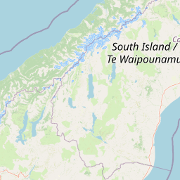
Westland Tai Poutini National Park landscape and geographic character

Westland Tai Poutini National Park presents an extraordinary range of landscapes compressed into a relatively compact area. The park extends from sea level along the coast to 3,498 metres at Mount Tasman, one of New Zealand's highest peaks. The Southern Alps form a dramatic backbone along the park's eastern boundary, where perpetual snow and glacial ice sculpt the alpine environment. The western slopes descend through a series of ridges and valleys into the coastal plain, where wetlands and lagoons break the forest cover. The park's geology is characterized by the ongoing processes of glaciation, with the Fox and Franz Josef glaciers representing some of the most dynamic glacial systems in the world. These glaciers descend to elevations below 300 metres, unusual in global terms, and their terminal faces can be viewed from accessible viewpoints. The high rainfall experienced throughout the park supports dense vegetation cover, with rata, rimu, and silver beech dominating the forest composition on the lower slopes.

Westland Tai Poutini National Park ecosystems, habitats, and plant life

The ecological character of Westland Tai Poutini National Park is defined by the interaction between moisture-laden westerly winds and the Southern Alps, creating conditions that support extensive temperate rainforests. This high-rainfall environment, known as orographic rainfall, produces some of the most densely vegetated landscapes in New Zealand. The elevation range within the park creates distinct ecological zones, from coastal wetland communities through broadleaf forest and into subalpine and alpine tundra near the Main Divide. The Ōkārito Lagoon represents an important coastal wetland habitat, while Lake Māpōourika provides additional aquatic habitat. The park's rainforests are characterized by species such as rimu, tōtara, kahikatea, and various fern species, creating a layered canopy structure. The combination of forest types, wetlands, and alpine zones within a single protected area makes this park particularly valuable for biodiversity conservation.

Westland Tai Poutini National Park wildlife and species highlights

Westland Tai Poutini National Park supports several notable wildlife species, with the Okarito kiwi (rowi) representing the park's most significant conservation priority. This endangered kiwi subspecies exists only within the lowland forests of the park, making its protection a critical responsibility. The coastal wetlands around Ōkārito Lagoon and Lake Māpōourika provide essential habitat for waterbird species, including the threatened Pūteketeke (Australian bittern) and the kōtuku (eastern great egret). Kea, the intelligent and mischievous mountain parrot, are commonly encountered throughout the park, particularly in alpine areas. The park's forests support populations of other native bird species, while the higher elevations provide habitat for specialized alpine fauna. Introduced species including red deer, chamois, and tahr are present and subject to hunting programs, though these non-native animals also pose management challenges for conservation.

Westland Tai Poutini National Park conservation status and protection priorities

Westland Tai Poutini National Park forms a core component of the Te Wāhipounamu World Heritage Site, recognized by UNESCO in 1990 for outstanding natural significance under criteria vii, viii, ix, and x. The park's inclusion in this World Heritage listing acknowledges its exceptional geological and ecological values, including active glacial processes, unique ecosystems, and irreplaceable biodiversity. The protection of the Okarito kiwi population represents a particularly significant conservation effort, as this is the only population of this subspecies anywhere in the world. Conservation management within the park balances visitor access with ecological protection, recognizing the tension between tourism infrastructure and wilderness values. The Department of Conservation manages the park with a focus on maintaining natural processes while providing sustainable visitor experiences. Ongoing efforts to control introduced species and restore native habitat complement the broader conservation objectives.

Westland Tai Poutini National Park cultural meaning and human context

The Ngāi Tahu iwi hold deep historical connections to the lands now within Westland Tai Poutini National Park, with the region historically serving as an important source of pounamu (greenstone). This sacred material was highly valued in Māori culture for tools, ornaments, and exchange. Coastal settlements at Maitahi, Makāwhio, and Ōkārito represent the locations where Ngāi Tahu whānau established permanent communities, with the pā at Ōkārito providing defensive positioning above the coastal lagoon. The park's name incorporates the Māori language, with Tai Poutini referring to the West Coast, and many features within the park retain their dual English and Māori names. While the pre-European archaeological record within the park is limited, acknowledged gaps exist in understanding Māori heritage, and existing wāhi tapu (sacred sites) remain protected through management practices that do not disclose their locations.

Top sights and standout views in Westland Tai Poutini National Park

Westland Tai Poutini National Park offers visitors remarkable diversity within a single protected area. The Fox and Franz Josef glaciers provide accessible encounters with glacial environments, with viewing areas and guided walks available. The Copland Track leads to natural hot pools at Welcome Flat, a rare alpine bathing experience in New Zealand. The park's network of walking tracks provides access to viewpoints showcasing the dramatic contrast between mountain peaks and coastal forest. The opportunity to encounter the Okarito kiwi in its natural habitat, particularly during guided night walks, represents a unique wildlife experience. The coastal wetlands around Ōkārito Lagoon support exceptional birdlife viewing, while the temperate rainforests showcase New Zealand's distinctive forest ecology.

Best time to visit Westland Tai Poutini National Park

The park can be visited throughout the year, with each season offering distinct character. Summer months (December to February) typically bring the most stable weather conditions and longer daylight hours, making this the most popular time for visitors. Winter (June to August) transforms the park with snow-capped peaks and dramatic glacier scenery, though conditions can be more challenging. The shoulder seasons of autumn and spring offer fewer crowds and the possibility of experiencing different aspects of the park's ecology, such as bird migrations or seasonal changes in vegetation. Weather in this region is notoriously changeable regardless of season, and visitors should be prepared for rain at any time. The glacier regions can be affected by seasonal variations in ice conditions, and the experience of visiting during different times of year will vary significantly.

Park location guide

Geography guide, regional context, and park location map for Westland Tai Poutini National Park

Westland Tai Poutini National Park park geography, regions, and map view in New Zealand
Understand where Westland Tai Poutini National Park sits in New Zealand through a broader geographic reading of the surrounding landscape, nearby location context, and its mapped position within the national park landscape.

How Westland Tai Poutini National Park fits into New Zealand

New Zealand is an island nation in the southwestern Pacific Ocean comprising two main islands and numerous smaller islands. Located east of Australia across the Tasman Sea, it features varied topography with the Southern Alps running along the South Island and volcanic terrain on the North Island. The country was settled by Maori people between 1280 and 1350, followed by European exploration beginning in 1642, and became a Dominion in 1907 before gaining full independence in 1947.

Wider geography shaping Westland Tai Poutini National Park in New Zealand

New Zealand lies in the southwestern Pacific Ocean, east of Australia across the Tasman Sea. The country consists of two main islands, the North Island and South Island, plus over 600 smaller islands. The North Island features volcanic plateaus and hills while the South Island is dominated by the Southern Alps mountain range. The country has a long coastline and is surrounded by the Pacific Ocean.

Map view of Westland Tai Poutini National Park

Use this park location map to pinpoint Westland Tai Poutini National Park in New Zealand, understand its exact geographic position, and read its mapped placement within the surrounding landscape more clearly.

Pigeon | © OpenStreetMap contributors

Location context for Westland Tai Poutini National Park

West Coast
Park atlas

Explore the interconnected geography of protected areas and national parks across New Zealand's South Island.

Discover Other National Parks and Protected Areas Near Westland Tai Poutini National Park
Discover other national parks and protected areas geographically linked to Westland Tai Poutini National Park, encompassing neighboring alpine, glacial, and coastal protected landscapes across the South Island. Use this regional context to compare unique conservation areas, map their geographic spread, and deepen your understanding of New Zealand's diverse park atlas.
National parkCanterbury Region

Aoraki / Mount Cook National Park: New Zealand's Iconic Alpine Protected Landscape Exploration

Mapped glacial terrain and mountain peaks in the Canterbury Region.

Delve into the heart of New Zealand's alpine grandeur with Aoraki / Mount Cook National Park. This page offers an atlas-style exploration of its protected boundaries, dramatic glacial formations like the Tasman Glacier, and the towering peaks of the Southern Alps. Understand the park's significant geographic context within the Canterbury Region and discover the mapped landscape that defines this premier national park.

Area
707 km²
Established
1953
IUCN
II
National parkCanterbury

Arthur's Pass National Park: Canterbury's Southern Alps Protected Area Atlas

Dramatic alpine terrain and distinct forest ecosystems within New Zealand.

Arthur's Pass National Park is a nationally significant protected area within the Canterbury region of New Zealand's South Island. This park is defined by its dramatic glacial valleys, towering peaks, and the striking ecological transition between the drier mountain beech forests of the east and the lush rainforests of the west. Its mapped boundaries encompass a critical landscape for understanding alpine environments and conservation in the Southern Alps, offering unique geographical context for this protected territory.

Area
1,184.7 km²
Established
1929
IUCN
II
National parkWest Coast Region

Paparoa National Park: Detailed Geographic Atlas of Karst Formations and Coastal Terrain

Discover protected landscape boundaries and unique New Zealand geology.

Paparoa National Park, located in the West Coast Region of New Zealand, offers a unique window into complex karst geology and dynamic coastal landscapes. This national park is characterized by extensive limestone cave systems, underground rivers, and the famous Pancake Rocks and Blowholes. The park's geography includes dramatic mountain terrain within the Paparoa Range and a striking coastline, providing a rich dataset for mapping protected area context and understanding regional natural features. It stands apart for its subterranean wonders and eroded limestone formations.

Area
429.7 km²
Established
1987
IUCN
II
National parkSouthland Region

Fiordland National Park: A Protected Landscape of Glacier-Carved Fiords and Alpine Wilderness

Explore its vast boundaries and unique temperate rainforest.

Fiordland National Park, located in the Southland Region of New Zealand, is a testament to dramatic geological forces, featuring fifteen major fiords like Milford Sound, whose Mitre Peak rises majestically from the water. This protected national park encompasses an immense wilderness of alpine terrain, ancient beech forests, and numerous waterfalls, fueled by exceptional rainfall. Its inclusion in the Te Wāhipounamu World Heritage Area underscores its global significance for biodiversity and natural landscape preservation.

Area
12,607 km²
Established
1952
IUCN
II
National parkNew Zealand

Nelson Lakes National Park: Alpine Geography and Glacial Lakes Atlas

Explore New Zealand's protected mountain terrain and natural landscapes.

Nelson Lakes National Park provides a deep dive into a dramatic alpine environment situated at the northern edge of New Zealand's Southern Alps. This national park is characterized by its striking glacial lakes, Rotoiti and Rotoroa, and the extensive mountain ranges that surround them, offering a rich context for understanding protected land distribution. Explore the park's mapped geography, its distinct beech forest ecosystems, and the rugged natural terrain that makes it a significant feature within the broader South Island landscape.

Area
1,018.8 km²
Established
1956
IUCN
II
National parkWest Coast Region

Kahurangi National Park: A National Park of Ancient Geology and Diverse Protected Landscapes in New Zealand

Explore the mapped natural terrain and regional geographic context.

Kahurangi National Park is distinguished by its extraordinary geological diversity, representing New Zealand's finest Paleozoic rock sequence and expansive karst features. Covering a vast area in the West Coast Region, it protects a remarkable array of natural landscapes, from coastal cliffs and nikau palm forests to alpine tussock basins and deep gorges. This national park is crucial for understanding New Zealand's natural heritage, offering a rich tapestry of mapped terrain and protected biodiversity for dedicated geographic exploration.

Area
5,193 km²
Established
1996
IUCN
II
National parkTasman District

Abel Tasman National Park: Coastal Protected Landscape and Mapped Geography in Tasman District

New Zealand's smallest national park offering iconic coastal hiking and wildlife.

Delve into the mapped boundaries and unique geography of Abel Tasman National Park, New Zealand's smallest national park located in the Tasman District. This protected landscape features renowned golden beaches, forested hills, and vital island ecosystems. Explore its coastal trails, understand its ecological restoration context, and appreciate its historical significance as a site of early European and Māori interaction, making it a key destination for atlas-driven geographic discovery.

Area
237.1 km²
Established
1942
IUCN
II
National parkNew Zealand

Rakiura National Park: New Zealand's Remote Protected Wilderness & Landscape Atlas

Explore its rugged terrain and unique subantarctic ecosystem.

Rakiura National Park encompasses the majority of Stewart Island, offering a unique glimpse into one of New Zealand's most remote and undisturbed natural environments. This protected landscape features rugged forested hills, extensive coastlines with isolated beaches, and is globally recognized for its abundant kiwi populations. Discover the park's geographic setting and its significance as a protected area for both wildlife and cultural heritage within the broader atlas of New Zealand's natural wonders.

Area
1,399.6 km²
Established
2002
IUCN
II

Common questions about visiting, size, designation, and location context for Westland Tai Poutini National Park

Westland Tai Poutini National Park FAQs for park facts, access, geography, and protected area context
Find quick answers about Westland Tai Poutini National Park, including protected-area facts, park geography, trail and visitor context, and how the park fits into its surrounding country and regional landscape.
MoriAtlas Explorer

Continue Your Protected Areas Search Across the Global Atlas

Deepen your exploration by continuing the structured search for national parks and protected areas worldwide. Utilize the comprehensive filtering capabilities to compare different conservation landscapes and refine your understanding of global park geography. Discover more about the distribution and characteristics of protected natural areas.

Global natural geography