Mori Atlas logo
National parkArthur's Pass National Park

Discover the dramatic terrain, mapped boundaries, and dual ecological zones of this national park.

Arthur's Pass National Park: New Zealand's Southern Alps Alpine Protected Landscape

Arthur's Pass National Park represents a significant protected area within New Zealand's rugged Southern Alps, situated in the Canterbury region. Established as a crucial national park, it encompasses over 1,185 square kilometers of striking alpine terrain. This protected landscape is notable for its sharp ecological divide, showcasing distinct environments from drier eastern beech forests and braided rivers to the dense, humid rainforests of the western side. Exploring Arthur's Pass National Park offers insight into its unique geography and the mapped extent of its protected natural features.

Southern AlpsMountain landscape Beech forestRainforestBird conservationEndangered species

Arthur's Pass National Park

National park

Park overview

Structured park overview, official facts, and landscape profile for Arthur's Pass National Park

Arthur's Pass National Park park facts, protected area profile, and essential visitor context
Review the core facts for Arthur's Pass National Park, including designation, size, terrain, visitor scale, habitats, and operating context in one park-focused overview.

About Arthur's Pass National Park

Arthur's Pass National Park stands as one of New Zealand's most significant protected areas, representing the gateway to the Southern Alps for visitors travelling between the East Coast and West Coast of the South Island. The park's establishment in 1929 followed growing public concern about the damage caused by tourists to the native flora, particularly the removal of rātā blooms and cutting of trees. Initially, underfunding meant national park status was largely nominal, and it took several years for proper protection of flora and fauna to be implemented. Today, the park is managed by the Department of Conservation, which maintains 31 mountain huts, tracks, and visitor facilities. The park's location bisected by State Highway 73 makes it highly accessible while also creating management challenges. Plans have been proposed to develop more visitor amenities, including high-end accommodation and improved all-weather facilities, though development decisions remain under consideration. The park has a reputation as one of New Zealand's more dangerous national parks due to its challenging terrain, rapidly changing weather conditions, and the difficulty of many tracks.

Quick facts and research context for Arthur's Pass National Park

Arthur's Pass National Park is located in Canterbury on New Zealand's South Island, within a few hours' drive from Christchurch. The park was established in 1929 and is administered by the Department of Conservation. It spans 1,185 square kilometres of mountainous terrain and contains the source of the Waimakariri River. The highest peak within the park is Mt Murchison at 2,400 metres. The park is bisected by State Highway 73 and includes the Arthur's Pass village within its boundaries, which had a resident population of 48 people in 2018.

Park context

Deeper park guide and search-rich context for Arthur's Pass National Park

Arthur's Pass National Park history, landscape, wildlife, and travel context
Explore Arthur's Pass National Park through its history, landscape character, ecosystems, wildlife, conservation priorities, cultural context, and seasonal travel timing in a structured park guide built for atlas discovery and search intent.

Why Arthur's Pass National Park stands out

Arthur's Pass National Park is best known for its dramatic alpine landscapes and as a critical sanctuary for several of New Zealand's most endangered bird species. The park protects the only remaining population of the orange-fronted parakeet, one of the world's rarest parrots, and supports significant populations of the whio (blue duck), great spotted kiwi, and kea. The park's geography features a sharp ecological divide created by the Southern Alps main divide, producing two distinct landscapes within a single protected area: the drier eastern beech forests and the wet western rainforest. The Devils Punchbowl waterfall, Avalanche Peak, and the extensive network of mountain huts and tramping tracks are among the park's most visited features.

Arthur's Pass National Park history and protected-area timeline

Arthur's Pass National Park was established in 1929 following decades of advocacy for the protection of the area's outstanding natural scenery and native wildlife. The land comprising the park had originally been set aside under the Lands Act 1885 and the Scenery Preservation Act of 1903, forming the foundation for the future national park. Following the construction of the Midland railway line, tourist excursions to the Otira Gorge began in 1926, bringing hundreds of visitors who unfortunately contributed to environmental degradation by removing native flowers and cutting trees to obtain rātā blooms. This destruction spurred the movement for formal national park status. The first park ranger, Charles Edward Warden, was appointed in 1929 and served until 1937, living in a cottage at Tin Town within the park and receiving an honorarium for his work maintaining tracks, providing visitor advice, and attempting to prevent plant destruction. Ray Cleland, ranger from 1950 to 1958, made significant improvements including establishing a museum, overseeing construction of ranger facilities, and creating walking tracks, camping areas, and the youth hostel. Ongoing expansion discussions involve the Riversdale Flats, which were gazetted for inclusion in 1901 but excluded when the park was created in 1929.

Arthur's Pass National Park landscape and geographic character

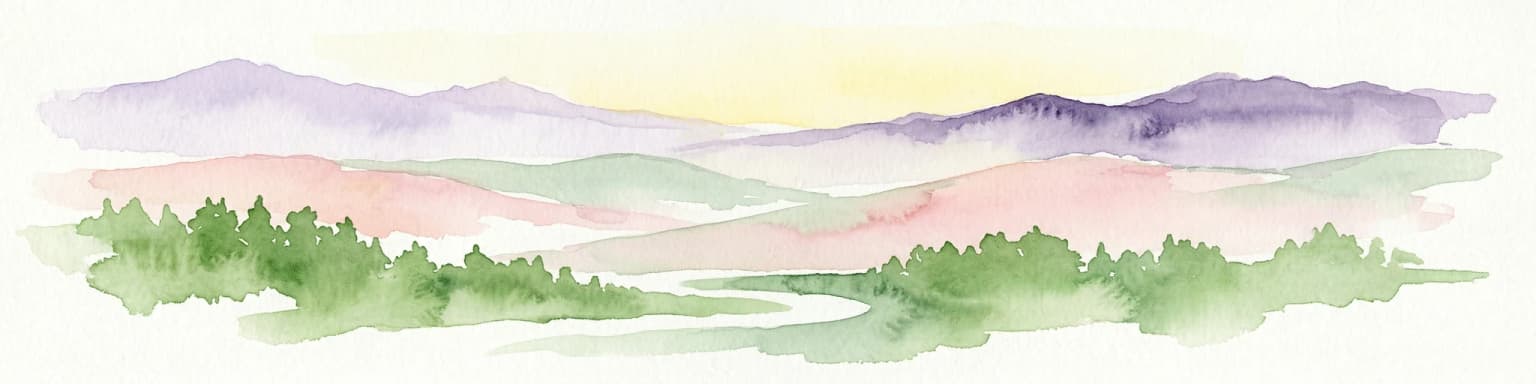
Arthur's Pass National Park showcases the dramatic terrain of the Southern Alps, with landscapes shaped by ancient glacial action that created characteristic flat-bottomed U-shaped valleys throughout the park. The eastern side of the main divide features drier conditions with mountain beech forest and wide braided riverbeds, while the western side receives higher rainfall and supports dense rainforest including mixed podocarp and rata forests. The park contains numerous peaks along the main divide of the South Island, with Mt Murchison at 2,400 metres being the highest peak within the park. The central area features a high range of large, snow-covered peaks and scree slopes. The park is the source of the Waimakariri River and contains numerous tributaries including the Bealey, Poulter, Hawdon, White, Crow, and Anti Crow Rivers on the eastern side, and the Ōtira, Deception, and Ōtehake Rivers flowing to the Taramakau on the western side. The landscape includes multiple mountain passes including Harman Pass, Waimakariri Col, Goat Pass, Tarahuna Pass, Worsley Pass, Minchin Pass, and Harper Pass.

Arthur's Pass National Park ecosystems, habitats, and plant life

The ecological diversity of Arthur's Pass National Park is defined by the sharp contrast between the eastern and western sides of the Southern Alps main divide. The eastern portion receives less rainfall and features red beech and mountain beech forests with minimal understory, while valley floors support grasses, sedges, and tussock grassland surrounded by matagouri and hebe shrubland. Above the treeline, snow tussock, alpine herb fields, and scree slopes dominate. The western side experiences high rainfall and contains deep river gorges with dense rainforest. The park lies adjacent to Craigieburn Forest Park, extending the protected habitat corridor through this mountainous region. These varied habitats support a remarkable diversity of native species, though introduced mammals including deer, pigs, possums, feral cats, stoats, and mice pose ongoing threats to native wildlife.

Arthur's Pass National Park wildlife and species highlights

Arthur's Pass National Park is home to several of New Zealand's most threatened bird species, making it critically important for conservation. The orange-fronted parakeet, the rarest of New Zealand's kākāriki species, is found only in Arthur's Pass National Park and Lake Sumner Forest Park, with a population that has grown from about 150-200 birds in 2019 to around 360 individuals following predator control efforts. The whio or blue duck, another threatened species, has been the focus of a recovery programme in the Mingha-Deception Valley area, with birds released in 2021. The great spotted kiwi or roroa lives in the mountainous beech forest near Arthur's Pass village, one of only three natural populations of this species, with a relatively stable population of around 14,000 birds. The kea, an intelligent and curious mountain parrot, is commonly seen throughout the park and village, though vehicle strikes have killed several birds in recent years. The mohua or yellowhead, once common in South Island beech forests, was reintroduced to the park in 2022 after being wiped out in 1999-2000 during a beech mast event.

Arthur's Pass National Park conservation status and protection priorities

Arthur's Pass National Park plays a vital role in protecting some of New Zealand's most endangered species and habitats. The park is the only stronghold for the orange-fronted parakeet, which has twice been declared extinct and remains critically endangered. Conservation efforts by the Department of Conservation include extensive predator control programmes using aerial drops of 1080 poison and ground-based trapping to protect native birds from rats, stoats, and possums. The Blue Duck Recovery Programme focuses on protecting whio populations through monitoring and stoat control. A 2022 initiative re-established mohua in the Poulter Valley after the population was devastated during a beech mast event in 1999-2000. The park also faces challenges from introduced mammals including deer, pigs, and feral cats that threaten native wildlife through habitat destruction, predation, and competition for food sources. Ongoing research addresses threats to kea, including vehicle collisions and toxic lead exposure from building materials.

Arthur's Pass National Park cultural meaning and human context

While Arthur's Pass National Park is primarily known for its natural values, the area has historical significance as a transportation corridor through the Southern Alps. The Arthur's Pass village serves as the gateway between Canterbury and the West Coast, with the township situated within the park boundaries on State Highway 73. The park name derives from Arthur Dudley Dobson, who discovered the pass in 1864 while working as a surveyor. The area has been a traditional travel route for Māori iwi as well. The Department of Conservation works in partnership with Ngāi Tahu, the local iwi, particularly in conservation efforts for the kākāriki karaka, which is considered a taonga species. The 1959 visitor centre, designed by Christchurch architect Paul Pascoe using local stone to reflect the park's geology, housed museum displays on the history of Arthur's Pass including Richard Seddon's stagecoach service.

Top sights and standout views in Arthur's Pass National Park

Arthur's Pass National Park offers exceptional alpine experiences including the Devils Punchbowl waterfall, a 131-metre cascade accessible via a short walk from the village, and Avalanche Peak, the only peak in the park marked by a poled route to the summit with dramatic views of the Southern Alps. The extensive network of tramping tracks includes the challenging Edwards-Hawdon track through stunning alpine landscapes, the popular Andrews-Poulter track on the eastern side, and the well-known Mingha-Deception route used in the Coast to Coast race. The Bealey Spur track provides easier access to panoramic views over the Waimakariri Basin. With 31 mountain huts maintained by the Department of Conservation, the park offers extensive opportunities for multi-day tramping and mountaineering adventures across this dramatic mountain landscape.

Best time to visit Arthur's Pass National Park

The summer months from December to February offer the most accessible conditions for visitors, with longer days and generally more stable weather, though the park's alpine environment means conditions can change rapidly at any time of year. The summer peak season sees the highest visitor numbers, and this is when most tramping routes are most accessible. Winter brings significant snow to the higher elevations and can make many tracks dangerous or impassable, though the nearby ski fields at Porters, Cheeseman, Broken River, Craigieburn, and Temple Basin attract winter visitors. Spring and autumn offer quieter conditions but can bring unpredictable weather. Visitors should be aware that Arthur's Pass has a reputation as one of New Zealand's more dangerous national parks due to the challenging terrain, steep tracks, and the need to be prepared for sudden weather changes regardless of the season.

Park location guide

Geography guide, regional context, and park location map for Arthur's Pass National Park

Arthur's Pass National Park park geography, regions, and map view in New Zealand
Understand where Arthur's Pass National Park sits in New Zealand through a broader geographic reading of the surrounding landscape, nearby location context, and its mapped position within the national park landscape.

How Arthur's Pass National Park fits into New Zealand

New Zealand is an island nation in the southwestern Pacific Ocean comprising two main islands and numerous smaller islands. Located east of Australia across the Tasman Sea, it features varied topography with the Southern Alps running along the South Island and volcanic terrain on the North Island. The country was settled by Maori people between 1280 and 1350, followed by European exploration beginning in 1642, and became a Dominion in 1907 before gaining full independence in 1947.

Wider geography shaping Arthur's Pass National Park in New Zealand

New Zealand lies in the southwestern Pacific Ocean, east of Australia across the Tasman Sea. The country consists of two main islands, the North Island and South Island, plus over 600 smaller islands. The North Island features volcanic plateaus and hills while the South Island is dominated by the Southern Alps mountain range. The country has a long coastline and is surrounded by the Pacific Ocean.

Map view of Arthur's Pass National Park

Use this park location map to pinpoint Arthur's Pass National Park in New Zealand, understand its exact geographic position, and read its mapped placement within the surrounding landscape more clearly.

Pigeon | © OpenStreetMap contributors

Location context for Arthur's Pass National Park

Canterbury
Park atlas

Trace the broader geographic context of the Southern Alps, mapping protected areas for comparative atlas exploration.

Explore Other National Parks Near Arthur's Pass, Uncovering Adjacent Protected Landscapes
Continue your exploration of New Zealand's South Island protected areas by comparing national parks and other significant conservation landscapes surrounding Arthur's Pass National Park. Browse mapped park geography to understand the regional spread of alpine environments, beech forests, and rainforests, offering valuable insights into connected ecosystems and conservation efforts.
National parkWest Coast Region

Paparoa National Park: Detailed Geographic Atlas of Karst Formations and Coastal Terrain

Discover protected landscape boundaries and unique New Zealand geology.

Paparoa National Park, located in the West Coast Region of New Zealand, offers a unique window into complex karst geology and dynamic coastal landscapes. This national park is characterized by extensive limestone cave systems, underground rivers, and the famous Pancake Rocks and Blowholes. The park's geography includes dramatic mountain terrain within the Paparoa Range and a striking coastline, providing a rich dataset for mapping protected area context and understanding regional natural features. It stands apart for its subterranean wonders and eroded limestone formations.

Area
429.7 km²
Established
1987
IUCN
II
National parkWest Coast

Westland Tai Poutini National Park: A Protected Landscape of Glaciers and Temperate Rainforests

Explore its mapped terrain and unique glacial features in West Coast, NZ.

Westland Tai Poutini National Park represents a remarkable intersection of glacial power and lush temperate rainforests along New Zealand's West Coast. As a protected national park, it showcases dramatic alpine scenery and the unique characteristic of glaciers descending to low elevations. Users can explore the mapped boundaries and the distinct natural landscapes that define this significant protected area, offering a clear view of its place within the region's geography.

Area
1,319.8 km²
Established
1960
IUCN
II
National parkCanterbury Region

Aoraki / Mount Cook National Park: New Zealand's Iconic Alpine Protected Landscape Exploration

Mapped glacial terrain and mountain peaks in the Canterbury Region.

Delve into the heart of New Zealand's alpine grandeur with Aoraki / Mount Cook National Park. This page offers an atlas-style exploration of its protected boundaries, dramatic glacial formations like the Tasman Glacier, and the towering peaks of the Southern Alps. Understand the park's significant geographic context within the Canterbury Region and discover the mapped landscape that defines this premier national park.

Area
707 km²
Established
1953
IUCN
II
National parkNew Zealand

Nelson Lakes National Park: Alpine Geography and Glacial Lakes Atlas

Explore New Zealand's protected mountain terrain and natural landscapes.

Nelson Lakes National Park provides a deep dive into a dramatic alpine environment situated at the northern edge of New Zealand's Southern Alps. This national park is characterized by its striking glacial lakes, Rotoiti and Rotoroa, and the extensive mountain ranges that surround them, offering a rich context for understanding protected land distribution. Explore the park's mapped geography, its distinct beech forest ecosystems, and the rugged natural terrain that makes it a significant feature within the broader South Island landscape.

Area
1,018.8 km²
Established
1956
IUCN
II
National parkWest Coast Region

Kahurangi National Park: A National Park of Ancient Geology and Diverse Protected Landscapes in New Zealand

Explore the mapped natural terrain and regional geographic context.

Kahurangi National Park is distinguished by its extraordinary geological diversity, representing New Zealand's finest Paleozoic rock sequence and expansive karst features. Covering a vast area in the West Coast Region, it protects a remarkable array of natural landscapes, from coastal cliffs and nikau palm forests to alpine tussock basins and deep gorges. This national park is crucial for understanding New Zealand's natural heritage, offering a rich tapestry of mapped terrain and protected biodiversity for dedicated geographic exploration.

Area
5,193 km²
Established
1996
IUCN
II
National parkTasman District

Abel Tasman National Park: Coastal Protected Landscape and Mapped Geography in Tasman District

New Zealand's smallest national park offering iconic coastal hiking and wildlife.

Delve into the mapped boundaries and unique geography of Abel Tasman National Park, New Zealand's smallest national park located in the Tasman District. This protected landscape features renowned golden beaches, forested hills, and vital island ecosystems. Explore its coastal trails, understand its ecological restoration context, and appreciate its historical significance as a site of early European and Māori interaction, making it a key destination for atlas-driven geographic discovery.

Area
237.1 km²
Established
1942
IUCN
II
National parkSouthland Region

Fiordland National Park: A Protected Landscape of Glacier-Carved Fiords and Alpine Wilderness

Explore its vast boundaries and unique temperate rainforest.

Fiordland National Park, located in the Southland Region of New Zealand, is a testament to dramatic geological forces, featuring fifteen major fiords like Milford Sound, whose Mitre Peak rises majestically from the water. This protected national park encompasses an immense wilderness of alpine terrain, ancient beech forests, and numerous waterfalls, fueled by exceptional rainfall. Its inclusion in the Te Wāhipounamu World Heritage Area underscores its global significance for biodiversity and natural landscape preservation.

Area
12,607 km²
Established
1952
IUCN
II
National parkNew Zealand

Egmont National Park: New Zealand's Distinctive Volcanic National Park

Explore the mapped volcanic terrain and protected landscape of Mount Taranaki.

Egmont National Park represents a significant protected area within New Zealand's North Island, dominated by the iconic stratovolcano, Mount Taranaki. This national park is celebrated for its distinct circular protected boundary, a unique feature against the surrounding pastoral farmlands, and its dramatic volcanic landscape. Visitors can explore a range of natural habitats from dense temperate rainforests to alpine environments, all mapped within this significant conservation landmark.

Area
341.7 km²
Established
1900
IUCN
II

Common questions about visiting, size, designation, and location context for Arthur's Pass National Park

Arthur's Pass National Park FAQs for park facts, access, geography, and protected area context
Find quick answers about Arthur's Pass National Park, including protected-area facts, park geography, trail and visitor context, and how the park fits into its surrounding country and regional landscape.
MoriAtlas Explorer

Continue Your Protected Areas Search Across the Global Atlas

Deepen your exploration by continuing the structured search for national parks and protected areas worldwide. Utilize the comprehensive filtering capabilities to compare different conservation landscapes and refine your understanding of global park geography. Discover more about the distribution and characteristics of protected natural areas.

Global natural geography