Mori Atlas logo
National parkEgmont National Park

Discover the mapped geography and distinct circular protected area of Mount Taranaki's volcanic terrain.

Egmont National Park: New Zealand's Iconic Volcanic Protected Landscape

(Te Papa-Kura-o-Taranaki)

Egmont National Park, situated in New Zealand's North Island, protects the dramatic landscape of Mount Taranaki, a near-perfect volcanic cone, and its surrounding extinct ranges. This national park showcases a unique circular boundary against agricultural lands, preserving diverse ecosystems from temperate rainforests to alpine zones. Its distinct volcanic terrain and rich natural heritage make it a key landmark for geographic exploration and atlas-based discovery.

volcanic landscapetemperate rainforestdormant volcanoNew Zealand national parkalpine environmentprotected forest

Egmont National Park

National park

Park overview

Structured park overview, official facts, and landscape profile for Egmont National Park

Egmont National Park park facts, protected area profile, and essential visitor context
Review the core facts for Egmont National Park, including designation, size, terrain, visitor scale, habitats, and operating context in one park-focused overview.

About Egmont National Park

Egmont National Park represents a remarkable convergence of geological, ecological, and cultural significance in New Zealand's protected landscape network. The park's central feature, Mount Taranaki, is a dormant stratovolcano that has been active for approximately 200,000 years, with the last major eruption occurring around 1655. The mountain's presence dominates the landscape, creating dramatic climatic gradients through orographic precipitation as moist westerly winds from the Tasman Sea are forced upward against the peaks. This meteorological influence supports extensive temperate rainforest at lower elevations, a ecosystem that is nationally unusual for its complete absence of beech trees. The park was first protected in 1881 as a forest reserve created within a six-mile radius of the summit, driven by concerns over widespread deforestation and burning. The establishment of Egmont National Park in 1900 marked a pivotal moment in New Zealand conservation history, creating the nation's second national park and establishing precedents for protected area management. In 2025, the park underwent significant transformation through the Taranaki Maunga Collective Redress Act, which renamed the park to Te Papa-Kura-o-Taranaki, granted legal personhood to both the park and the mountain, and established co-management arrangements between the Crown and regional iwi.

Quick facts and research context for Egmont National Park

Egmont National Park occupies a 9.9-kilometer radius surrounding Mount Taranaki in the Taranaki region of New Zealand's North Island. The park covers three volcanic cones, with Mount Taranaki reaching 2,518 meters as the second-highest peak on the North Island. The area experiences extreme climatic variation, with annual rainfall ranging from 1.5 meters at low elevations to over 7 meters in higher zones, and summit winds averaging 40 kilometers per hour. The park was formally renamed Te Papa-Kura-o-Taranaki in April 2025 following Treaty of Waitangi settlements, making it one of the few protected areas in New Zealand with legal personhood status. Nearly 400,000 visitors annually explore the park's extensive trail network, with the Pouakai Circuit and Mount Taranaki summit climb being the most popular routes.

Park context

Deeper park guide and search-rich context for Egmont National Park

Egmont National Park history, landscape, wildlife, and travel context
Explore Egmont National Park through its history, landscape character, ecosystems, wildlife, conservation priorities, cultural context, and seasonal travel timing in a structured park guide built for atlas discovery and search intent.

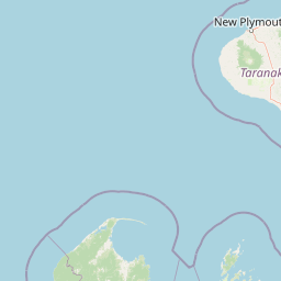
Why Egmont National Park stands out

Egmont National Park is best known for its dramatic volcanic landscape centered on the perfectly conical Mount Taranaki, which has become one of New Zealand's most photographed mountains. The park is distinguished by its unique circular shape formed by the protective boundary surrounding the volcanic cone, and by the striking contrast between the protected forest interior and the surrounding pastoral farmland. The Pouākai Range contains the rare Ahukawakawa Swamp, a high-elevation sphagnum moss wetland offering reflective views of the mountain. The park protects New Zealand's unusual temperate rainforest that notably lacks beech trees, along with critical habitat for threatened species including the blue duck, North Island brown kiwi, and several native fish species. The mountain itself holds deep cultural significance to local Māori, with the 2025 renaming reflecting the site's sacred status.

Egmont National Park history and protected-area timeline

The history of Egmont National Park reflects both geological timescales and centuries of human interaction with the landscape. Māori oral traditions hold that Mount Taranaki, originally called Pukeonaki, was once situated central to the North Island alongside the peaks of Ruapehu, Tongariro, and Pihanga. According to legend, Taranaki fled westward after losing a contest for Pihanga's affection to the stronger Tongariro, eventually settling in its current position beside the Pouākai Range. The mountain was considered sacred by local Māori, who believed ancestors descended from its slopes. European discovery came in 1770 when Captain James Cook first sighted the peak and named it Mount Egmont after John Perceval, 2nd Earl of Egmont. Following the New Zealand Wars of the 1860s, the mountain and surrounding lands were seized by the Crown as punishment for rebellious Māori. The formal protection movement began in 1881 when land within 9.6 kilometers of the summit was declared a forest reserve in response to extensive deforestation. The Taranaki Scenery Reservation Society subsequently lobbied for national park status, and the Egmont National Park Act of 1900 created New Zealand's second national park with the establishment of the nation's first national park board. This board operated until 1977. In 2025, the Taranaki Maunga Collective Redress Act renames the park Te Papa-Kura-o-Taranaki, meaning "the highly regarded and treasured lands of Taranaki," and granted the park and mountain legal personhood.

Egmont National Park landscape and geographic character

The landscape of Egmont National Park is defined by volcanic geology and the powerful erosive forces that have shaped the terrain over millennia. Three volcanic cones dominate the park's topography: the active Mount Taranaki standing at 2,518 meters as a near-perfect stratovolcano cone, the extinct Pouākai Range rising to 1,399 meters, and the coastal Kaitake Range reaching 684 meters. These peaks are part of the Taranaki Volcanic Succession, with Mount Taranaki considered geologically young in volcanic terms. Lava flows, ash showers, and lahars have distributed volcanic material across the surrounding terrain, with remnant lava flows still visible in the western park areas. The soils throughout the park reflect this volcanic heritage, ranging from Maero and Newall soils created by pyroclastic flows in the southwest and northwest, to pumice and scoria soils in the southeast originating from eruptions between 3,500 and 500 years ago, to Burrell pumice shower deposits in the east from 1685. The park exhibits a distinctive radial drainage pattern emanating from the central peak, visible clearly in satellite imagery. Elevations range from approximately 100 meters at the park boundaries to 2,500 meters at the summit, creating dramatic terrain transitions from pastoral foothills through densely forested slopes to alpine tussock and rocky summit zones.

Egmont National Park ecosystems, habitats, and plant life

The ecological character of Egmont National Park reflects the extraordinary climatic and altitudinal gradients created by Mount Taranaki's influence on moisture-bearing winds. The park protects a comprehensive sequence of vegetation zones from coastal forest through temperate rainforest to subalpine shrubland and alpine communities. The temperate rainforest at lower elevations is dominated by a rich association of northern rātā, rimu, and broadleaf species, with kāmahi becoming increasingly prevalent at higher elevations. This forest is nationally significant for its total absence of beech trees, a characteristic shared with no other major forest area in New Zealand. The understory features the distinctive crown fern as a dominant species in old-growth areas. The Pouākai Range contains the ecologically significant Ahukawakawa Swamp, a rare high-elevation sphagnum moss wetland at 920 meters that supports endemic species adapted to acidic soils and cool temperatures. The Kaitake Range supports distinctive flora not found elsewhere in the park, including nikau, titoki, kohekohe, and puriri in its lowland coastal areas. Approximately 95 percent of the park's vegetation is native forest, representing a remarkable conservation achievement given the surrounding agricultural landscape.

Egmont National Park wildlife and species highlights

Egmont National Park provides critical habitat for several threatened bird species that depend on the extensive forest ecosystems. The blue duck, known as whio, inhabits the park's fast-flowing streams, while the North Island brown kiwi persists in the forest remnants despite intense predation pressure. The fernbird also occupies wetland and forest edge habitats within the park. The aquatic ecosystems support remarkable fish biodiversity, with nearly half of New Zealand's indigenous freshwater fish species present, including the threatened giant kōkopu, shortjaw kōkopu, banded kōkopu, and kōaro. Introduced pest animals including possums, rodents, hares, stoats, weasels, and ferrets pose ongoing threats to native wildlife, though the park was declared free of feral goats in 2022 following the world's longest goat eradication program, becoming the first national park in New Zealand to achieve ungulate-free status. The eradication of feral pigs and deer had previously been accomplished. Ongoing conservation work focuses on expanding protected areas for kiwi populations and controlling predator species through extensive trapping networks and targeted 1080 poison operations.

Egmont National Park conservation status and protection priorities

Egmont National Park represents a significant conservation achievement in New Zealand's protected area network, preserving substantial indigenous ecosystems within a landscape heavily modified by agriculture. The park's conservation value is enhanced by its comprehensive altitudinal sequence of habitats and the presence of rare ecosystem types such as the Ahukawakawa high-elevation swamp. The 2025 Treaty settlement granting legal personhood to both the park and Taranaki Maunga marks a transformative approach to conservation governance, establishing co-management arrangements with regional iwi through Te Tōpuni Kōkōrangi, a body half-appointed by iwi and half by the Crown. The kiwi recovery program represents a major conservation focus, with work commencing in 2018 to eradicate possums and mustelids from a 4,500-hectare area expanded in 2023 by an additional 5,000 hectares. The successful goat eradication program, spanning multiple decades, achieved feral goat removal in 2022 and represents a global model for invasive species management in protected areas. Over 1,060 traps for possums, stoats, and ferrets are maintained within the park, complemented by periodic aerial 1080 operations to control pest populations.

Egmont National Park cultural meaning and human context

Egmont National Park holds profound cultural significance for the Māori people of the Taranaki region, with Mount Taranaki regarded as sacred land where ancestors descended. The mountain, originally called Pukeonaki in Māori legend, is central to a powerful narrative involving the peaks of Ruapehu, Tongariro, and Pihanga, telling of competition for the mountain Pihanga and Taranaki's subsequent westward flight. The name Te Papa-Kura-o-Taranaki, confirmed in April 2025, translates as "the highly regarded and treasured lands of Taranaki" and reflects the mountain's status as a taonga of immense cultural value. The park sits within the territory of eight iwi who now participate in co-management through Te Tōpuni Ngārahu, representing a landmark partnership between the Crown and Māori in protected area governance. The summit of Mount Taranaki is considered tapu by Māori, and climbing to the highest point is regarded as offensive. Archaeological sites include the burial cave Te Ana-a-Tahatiti near the Hangatahua River, named by the early ancestor Ruataranaki. The 2025 settlement represents one of the most significant developments in New Zealand conservation history, recognizing Māori worldview and Treaty of Waitangi obligations.

Top sights and standout views in Egmont National Park

Mount Taranaki dominates the park as a near-perfect volcanic cone that has become an iconic symbol of the Taranaki region. The Pouakai Circuit offers a multi-day hiking experience through diverse landscapes including forest, alpine tussock fields, and the unique Ahukawakawa Swamp, with the famous tarn reflection viewpoint being one of the most photographed locations in the park. The summit climb attracts over 20,000 people annually, though the peak's sacred status means climbing to the highest point is culturally sensitive. The Manganui Ski Area provides winter recreation on the mountain's slopes, operated by volunteers and offering skiing from early June to mid-October. The Around the Mountain Circuit is a demanding five-to-seven-day loop covering 52 kilometers through the park's varied terrain. The park's successful goat eradication program achieved ungulate-free status in 2022, a first for any New Zealand national park. The circular shape created by the six-mile protection radius around the volcano is visible from space and creates a striking contrast with surrounding farmland.

Best time to visit Egmont National Park

The best time to visit Egmont National Park depends on activities planned, though the summer months of December through February generally offer the most reliable conditions for hiking and climbing. During this period, daytime temperatures are milder at higher elevations and trail conditions are most stable, though afternoon weather changes are common. The shoulder seasons of spring and autumn provide alternative experiences with fewer crowds and distinctive seasonal characteristics, though weather can be more unpredictable. Winter conditions above 1,000 meters involve significant hazards including gale-force winds, blizzards, and severe windchill, making the Pouakai Circuit potentially impassable and the summit climb requiring specialized equipment including crampons and ice axes. The Manganui Ski Area operates from early June through mid-October, offering the best winter conditions for skiing enthusiasts. The park's high rainfall means visitors should be prepared for wet conditions year-round, with the west coast exposure bringing moisture-laden westerly winds particularly during autumn and winter. The dramatic cloud formations that frequently surround Mount Taranaki create distinctive visual moments but can also obscure summit views.

Park location guide

Geography guide, regional context, and park location map for Egmont National Park

Egmont National Park park geography, regions, and map view in New Zealand
Understand where Egmont National Park sits in New Zealand through a broader geographic reading of the surrounding landscape, nearby location context, and its mapped position within the national park landscape.

How Egmont National Park fits into New Zealand

New Zealand is an island nation in the southwestern Pacific Ocean comprising two main islands and numerous smaller islands. Located east of Australia across the Tasman Sea, it features varied topography with the Southern Alps running along the South Island and volcanic terrain on the North Island. The country was settled by Maori people between 1280 and 1350, followed by European exploration beginning in 1642, and became a Dominion in 1907 before gaining full independence in 1947.

Wider geography shaping Egmont National Park in New Zealand

New Zealand lies in the southwestern Pacific Ocean, east of Australia across the Tasman Sea. The country consists of two main islands, the North Island and South Island, plus over 600 smaller islands. The North Island features volcanic plateaus and hills while the South Island is dominated by the Southern Alps mountain range. The country has a long coastline and is surrounded by the Pacific Ocean.

Map view of Egmont National Park

Use this park location map to pinpoint Egmont National Park in New Zealand, understand its exact geographic position, and read its mapped placement within the surrounding landscape more clearly.

Pigeon | © OpenStreetMap contributors

Location context for Egmont National Park

Taranaki
Park atlas

Map the surrounding Taranaki region, trace connected protected landscapes, and compare other New Zealand national parks.

Discover Nearby Protected Areas: Expanding Your Atlas View Beyond Egmont National Park
Browse a curated selection of national parks and protected areas near Egmont National Park, extending your exploration across New Zealand's Taranaki region and North Island landscapes. This geographic overview helps compare unique volcanic terrains, temperate rainforests, and other conservation landmarks, providing rich context for regional protected area discovery.
National parkNorth Island

Whanganui National Park: A Protected Landscape of River Valleys and Lowland Forests

Explore mapped boundaries and regional geography on North Island.

Delve into Whanganui National Park, a key protected area on New Zealand's North Island. This national park is defined by its extensive lowland podocarp-hardwood forests and the iconic Whanganui River valley, presenting a unique wilderness character. Understand its geographic context and mapped landscape features, offering a distinct point of exploration within the broader atlas of New Zealand's protected lands.

Area
742 km²
Established
1986
IUCN
II
National parkNew Zealand

Tongariro National Park: New Zealand's Premier Volcanic National Park Atlas

Explore mapped terrain, active volcanoes, and unique dual World Heritage values.

Tongariro National Park, situated in New Zealand's North Island, is a globally significant protected area celebrated for its dramatic volcanic landscapes and profound cultural heritage. As the nation's oldest national park, it features three active volcanoes: Mount Ruapehu, Mount Ngauruhoe, and Mount Tongariro, set within a diverse terrain that includes forests, alpine zones, and the Rangipo Desert. Its dual World Heritage status underscores its importance for both natural attributes and its sacred cultural landscape, offering rich opportunities for geographic and atlas exploration.

Area
795.96 km²
Established
1887
IUCN
II
National parkTasman District

Abel Tasman National Park: Coastal Protected Landscape and Mapped Geography in Tasman District

New Zealand's smallest national park offering iconic coastal hiking and wildlife.

Delve into the mapped boundaries and unique geography of Abel Tasman National Park, New Zealand's smallest national park located in the Tasman District. This protected landscape features renowned golden beaches, forested hills, and vital island ecosystems. Explore its coastal trails, understand its ecological restoration context, and appreciate its historical significance as a site of early European and Māori interaction, making it a key destination for atlas-driven geographic discovery.

Area
237.1 km²
Established
1942
IUCN
II
National parkWest Coast Region

Kahurangi National Park: A National Park of Ancient Geology and Diverse Protected Landscapes in New Zealand

Explore the mapped natural terrain and regional geographic context.

Kahurangi National Park is distinguished by its extraordinary geological diversity, representing New Zealand's finest Paleozoic rock sequence and expansive karst features. Covering a vast area in the West Coast Region, it protects a remarkable array of natural landscapes, from coastal cliffs and nikau palm forests to alpine tussock basins and deep gorges. This national park is crucial for understanding New Zealand's natural heritage, offering a rich tapestry of mapped terrain and protected biodiversity for dedicated geographic exploration.

Area
5,193 km²
Established
1996
IUCN
II
National parkNew Zealand

Nelson Lakes National Park: Alpine Geography and Glacial Lakes Atlas

Explore New Zealand's protected mountain terrain and natural landscapes.

Nelson Lakes National Park provides a deep dive into a dramatic alpine environment situated at the northern edge of New Zealand's Southern Alps. This national park is characterized by its striking glacial lakes, Rotoiti and Rotoroa, and the extensive mountain ranges that surround them, offering a rich context for understanding protected land distribution. Explore the park's mapped geography, its distinct beech forest ecosystems, and the rugged natural terrain that makes it a significant feature within the broader South Island landscape.

Area
1,018.8 km²
Established
1956
IUCN
II
National parkWest Coast Region

Paparoa National Park: Detailed Geographic Atlas of Karst Formations and Coastal Terrain

Discover protected landscape boundaries and unique New Zealand geology.

Paparoa National Park, located in the West Coast Region of New Zealand, offers a unique window into complex karst geology and dynamic coastal landscapes. This national park is characterized by extensive limestone cave systems, underground rivers, and the famous Pancake Rocks and Blowholes. The park's geography includes dramatic mountain terrain within the Paparoa Range and a striking coastline, providing a rich dataset for mapping protected area context and understanding regional natural features. It stands apart for its subterranean wonders and eroded limestone formations.

Area
429.7 km²
Established
1987
IUCN
II
National parkCanterbury

Arthur's Pass National Park: Canterbury's Southern Alps Protected Area Atlas

Dramatic alpine terrain and distinct forest ecosystems within New Zealand.

Arthur's Pass National Park is a nationally significant protected area within the Canterbury region of New Zealand's South Island. This park is defined by its dramatic glacial valleys, towering peaks, and the striking ecological transition between the drier mountain beech forests of the east and the lush rainforests of the west. Its mapped boundaries encompass a critical landscape for understanding alpine environments and conservation in the Southern Alps, offering unique geographical context for this protected territory.

Area
1,184.7 km²
Established
1929
IUCN
II
National parkWest Coast

Westland Tai Poutini National Park: A Protected Landscape of Glaciers and Temperate Rainforests

Explore its mapped terrain and unique glacial features in West Coast, NZ.

Westland Tai Poutini National Park represents a remarkable intersection of glacial power and lush temperate rainforests along New Zealand's West Coast. As a protected national park, it showcases dramatic alpine scenery and the unique characteristic of glaciers descending to low elevations. Users can explore the mapped boundaries and the distinct natural landscapes that define this significant protected area, offering a clear view of its place within the region's geography.

Area
1,319.8 km²
Established
1960
IUCN
II

Common questions about visiting, size, designation, and location context for Egmont National Park

Egmont National Park FAQs for park facts, access, geography, and protected area context
Find quick answers about Egmont National Park, including protected-area facts, park geography, trail and visitor context, and how the park fits into its surrounding country and regional landscape.
MoriAtlas Explorer

Continue Your Protected Areas Search Across the Global Atlas

Deepen your exploration by continuing the structured search for national parks and protected areas worldwide. Utilize the comprehensive filtering capabilities to compare different conservation landscapes and refine your understanding of global park geography. Discover more about the distribution and characteristics of protected natural areas.

Global natural geography