Mori Atlas logo
National parkTongariro National Park

Explore the mapped terrain and dual cultural-natural heritage of this significant national park.

Tongariro National Park: New Zealand's Iconic Volcanic Protected Landscape

Tongariro National Park stands as a cornerstone of New Zealand's protected lands, encompassing a remarkable 796 square kilometers of dramatic volcanic geography on the central North Island. This historic national park, established in 1887, showcases a unique dual World Heritage designation for its outstanding natural values and profound cultural significance as a sacred landscape. Users can delve into its mapped boundaries, exploring terrain that ranges from lush temperate rainforests and beech forests to alpine tussock lands and the unusual Rangipo Desert.

volcanic landscapeWorld Heritage Sitealpine environmentskiinghikingMāori cultural significance

Tongariro National Park

National park

Park overview

Structured park overview, official facts, and landscape profile for Tongariro National Park

Tongariro National Park park facts, protected area profile, and essential visitor context
Review the core facts for Tongariro National Park, including designation, size, terrain, visitor scale, habitats, and operating context in one park-focused overview.

About Tongariro National Park

Tongariro National Park stands as one of New Zealand's most significant protected areas, representing both the nation's oldest national park and a place of profound cultural and ecological importance. The park's central North Island location on the volcanic plateau places it at the southern end of a 2,500-kilometre chain of volcanoes stretching to Samoa, where the Australian Plate meets the Pacific Plate. This tectonic setting has created a landscape of remarkable volcanic activity and diversity over more than two million years. The three dominant peaks, Ruapehu, Ngauruhoe and Tongariro, remain active and define the park's character, while to the north the older volcanic formations of Pihanga and the Kakaramea-Tihia Massif represent eruptions from over 20,000 years ago. The park's ecological diversity is equally remarkable, supporting multiple vegetation zones from podocarp-broadleaf rainforest through beech forests to alpine herb fields and the unique Rangipo Desert environment on the eastern leeward side. This combination of outstanding natural beauty, geological significance, biodiversity and cultural spirituality led to UNESCO awarding Tongariro dual World Heritage status, the first such recognition of a national park's cultural landscape values.

Quick facts and research context for Tongariro National Park

Tongariro National Park covers 795.96 square kilometres in the central North Island of New Zealand, bordering the Ruapehu District. The park protects three active volcanic mountains, with Mount Ruapehu being the highest peak at 2,797 metres. The park is managed by the Department of Conservation from the Whakapapa Visitor Centre. It is one of New Zealand's Great Walks destination and contains three ski fields on Mount Ruapehu. The park holds dual World Heritage status for both natural and cultural values, recognised in 1990 and extended in 1993 to include Māori cultural significance.

Park context

Deeper park guide and search-rich context for Tongariro National Park

Tongariro National Park history, landscape, wildlife, and travel context
Explore Tongariro National Park through its history, landscape character, ecosystems, wildlife, conservation priorities, cultural context, and seasonal travel timing in a structured park guide built for atlas discovery and search intent.

Why Tongariro National Park stands out

Tongariro National Park is best known for its three active volcanic peaks that form an iconic landscape of global significance. The park is famous for the Tongariro Alpine Crossing, widely regarded as one of the world's best one-day hikes, crossing dramatic volcanic terrain including the Red Crater and Emerald Lakes. Mount Ngauruhoe, a near-perfect conical volcano, gained additional fame as Mount Doom in the Lord of the Rings film trilogy. The park's three ski fields on Mount Ruapehu make it a major winter destination, while its sacred mountain summits hold deep spiritual significance for Māori iwi. The park's dual World Heritage status recognises both its outstanding natural values and its cultural landscape importance.

Tongariro National Park history and protected-area timeline

Tongariro National Park's modern history began with the visionary gift of mountain peaks from Ngāti Tūwharetoa chief Te Heuheu Tūkino IV (Horonuku) to the Crown in 1887, on condition that a protected area be established. This unprecedented act of conservation foresight came after local Māori, recognising the sacred significance of the mountains and seeking to prevent their sale to European settlers, surveyed the peaks through the Native Land Court and set them aside as a reserve. The park was formally established through the Tongariro National Park Act passed in October 1894, initially covering about 252 square kilometres. Subsequent expansions, particularly the addition of Pihanga Scenic Reserve in 1975, brought the park to its current size. The park's development accelerated with the opening of the North Island Main Trunk railway in 1908 and road construction in the 1920s, leading to the establishment of Whakapapa Village and the iconic Chateau Tongariro hotel in 1929. Skiing became popular from about 1914, with the creation of the Ruapehu Ski Club and subsequent development of ski fields that continue operating today. In 1990, the park gained World Heritage status, extended in 1993 to recognise its cultural values, making it the first national park in the world with dual natural and cultural recognition.

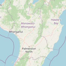
Tongariro National Park landscape and geographic character

The landscape of Tongariro National Park is dominated by the dramatic volcanic massif of three active volcanoes rising from the central North Island volcanic plateau. Mount Ruapehu, the highest peak at 2,797 metres, is a composite volcano and the most active in New Zealand, featuring permanent snow fields and glaciers at its summit. Mount Ngauruhoe presents a near-perfect conical form rising to 2,291 metres, while Mount Tongariro occupies a broader, more complex volcanic terrain at 1,978 metres. The park encompasses remarkable diversity beyond the peaks, including the Rangipo Desert to the east, a seemingly arid landscape despite receiving 1,500-2,500mm of annual rainfall, created by the volcanic substrate, poor soils and strong winds. Glacial valleys such as the Wahianoa Valley scar the southeastern slopes of Ruapehu, while the park contains numerous rivers including the sacred Waikato River which rises on Mount Ruapehu. The Pihanga Scenic Reserve, separated from the main park, contains Lake Rotopounamu and Mount Pihanga, adding further landscape diversity.

Tongariro National Park ecosystems, habitats, and plant life

Tongariro National Park supports an exceptional range of ecosystems and vegetation zones determined primarily by altitude and environmental conditions. The park contains numerous distinct vegetation zones with usually sharp boundaries: podocarp-broadleaf rainforest in the north, beech forests of red, silver and mountain beech on the mid-slopes, tussock and shrubland at higher altitudes, and alpine communities above the treeline. The podocarp-broadleaf rainforests feature species including Hall's totara, kahikatea, rimu, northern rātā, kāmahi and kaikawaka, with diverse understorey species. The beech forests dominate large areas, particularly around the Waihohonu Huts and to the south and west of Ruapehu. Above 1200 metres, tussock grassland dominated by red tussock grass prevails, while the highest altitudes support only specialized alpine plants, mosses and lichens. The Rangipo Desert, despite its name, receives significant rainfall but supports only sparse vegetation due to soil conditions and wind exposure.

Tongariro National Park wildlife and species highlights

Tongariro National Park supports more than 56 bird species including several rare endemic species of significant conservation concern. The park provides habitat for the North Island brown kiwi, kākā, blue duck, North Island fernbird, double-banded plover and New Zealand falcon. Common species include tūī, New Zealand bellbird, morepork, grey warbler, fantail, whitehead and silvereye. The park contains New Zealand's only two native mammal species, the short-tailed and long-tailed bats, though introduced mammals including red deer, goats, pigs, possums, rabbits, hares, cats, stoats and black rats also occur. The insect fauna includes moths and wētā, while the Kaimanawa horses, descendants of animals brought to New Zealand in the 1800s, now inhabit areas surrounding the park but are managed to prevent their return to the park itself.

Tongariro National Park conservation status and protection priorities

Tongariro National Park faces several significant conservation challenges alongside its protected status. The invasive heather introduced in the early 20th century for grouse hunting spread extensively across the park, threatening native ecosystems and displacing endemic plants. Biological control using the heather beetle Lochmaea suturalis began in 1996 and has proven increasingly effective, with over 35,000 hectares damaged by 2018, allowing native plants to recover. Wilding pines, another introduced species, have been aggressively controlled since the 1960s, with the National Wilding Conifer Control Programme since 2016 achieving significant success in stopping their spread. Introduced deer, goats and pigs continue to impact native vegetation and wildlife, requiring ongoing management through culling and hunting programmes. The park also addresses over-tourism concerns, particularly on the popular Tongariro Alpine Crossing, implementing a booking system in 2023 to manage visitor numbers and reduce environmental degradation.

Tongariro National Park cultural meaning and human context

Tongariro National Park holds profound significance for Māori iwi, particularly Ngāti Tūwharetoa and Ngāti Rangi, whose tribal areas encompass the park. The volcanoes are personified in Māori legend as participants in ancient battles for the love of Pihanga, with the landscape features reflecting these mythic events. Many summits within the park, including Ngauruhoe and Ruapehu, are tapu (sacred), and in 2017 the Department of Conservation issued an advisory requesting visitors not to climb these peaks out of respect for their spiritual significance. The Waitangi Tribunal's national park inquiry from 2004 to 2013 examined Treaty of Waitangi claims relating to the park, with ongoing negotiations regarding cultural redress. The park's dual World Heritage status recognises this cultural dimension, with the spiritual significance of the mountains to Māori formally acknowledged as a cultural landscape. The gift of the mountain peaks by Te Heuheu Tūkino IV in 1887 remains commemorated at the visitor centre.

Top sights and standout views in Tongariro National Park

The defining highlights of Tongariro National Park centre on its extraordinary volcanic landscape of three active peaks, particularly the iconic profile of Mount Ngauruhoe. The Tongariro Alpine Crossing delivers an unparalleled one-day hiking experience across dramatic volcanic terrain, while the three ski fields on Mount Ruapehu provide major winter recreation. The park's dual World Heritage status for both natural and cultural values is unique globally, reflecting the profound Māori relationship with the mountains. The historical significance of the 1887 gift from Te Heuheu Tūkino IV established New Zealand as a pioneer in national park conservation. The presence of sacred mountain summits, the diversity from rainforest to alpine environments, and the accessibility of year-round outdoor activities combine to make Tongariro one of New Zealand's most significant and visited protected areas.

Best time to visit Tongariro National Park

Tongariro National Park offers distinct seasonal experiences throughout the year. Summer months from December to February provide the most stable weather for hiking the Tongariro Alpine Crossing and other tracks, with long daylight hours and generally mild temperatures at lower altitudes, though alpine conditions can change rapidly. Winter from June to November brings skiing and snowboarding opportunities to Mount Ruapehu's three ski fields, with the season typically running from late June to early November. Spring and autumn offer quieter periods with fewer visitors, though weather can be less predictable. The park's high altitude means temperatures can drop below freezing any time of year, and snow can fall at any time, particularly above 1500 metres. Visitors should be aware that volcanic activity can lead to trail closures, particularly on Mount Tongariro where eruptions have occurred in recent years including 2012.

Park location guide

Geography guide, regional context, and park location map for Tongariro National Park

Tongariro National Park park geography, regions, and map view in New Zealand
Understand where Tongariro National Park sits in New Zealand through a broader geographic reading of the surrounding landscape, nearby location context, and its mapped position within the national park landscape.

How Tongariro National Park fits into New Zealand

New Zealand is an island nation in the southwestern Pacific Ocean comprising two main islands and numerous smaller islands. Located east of Australia across the Tasman Sea, it features varied topography with the Southern Alps running along the South Island and volcanic terrain on the North Island. The country was settled by Maori people between 1280 and 1350, followed by European exploration beginning in 1642, and became a Dominion in 1907 before gaining full independence in 1947.

Wider geography shaping Tongariro National Park in New Zealand

New Zealand lies in the southwestern Pacific Ocean, east of Australia across the Tasman Sea. The country consists of two main islands, the North Island and South Island, plus over 600 smaller islands. The North Island features volcanic plateaus and hills while the South Island is dominated by the Southern Alps mountain range. The country has a long coastline and is surrounded by the Pacific Ocean.

Map view of Tongariro National Park

Use this park location map to pinpoint Tongariro National Park in New Zealand, understand its exact geographic position, and read its mapped placement within the surrounding landscape more clearly.

Pigeon | © OpenStreetMap contributors

Location context for Tongariro National Park

Manawatū-WhanganuiRuapehu District
Park atlas

Trace the Regional Park Geography Across New Zealand's North Island and Compare Protected Landscapes

Explore More National Parks and Protected Areas Near Tongariro National Park
Explore national parks and protected areas beyond Tongariro National Park, spanning New Zealand's North Island with its diverse volcanic regions and alpine environments. Compare distinct park geographies, trace connected protected landscapes, and gain deeper insights into regional conservation efforts across similar or contrasting natural settings.
National parkNorth Island

Whanganui National Park: A Protected Landscape of River Valleys and Lowland Forests

Explore mapped boundaries and regional geography on North Island.

Delve into Whanganui National Park, a key protected area on New Zealand's North Island. This national park is defined by its extensive lowland podocarp-hardwood forests and the iconic Whanganui River valley, presenting a unique wilderness character. Understand its geographic context and mapped landscape features, offering a distinct point of exploration within the broader atlas of New Zealand's protected lands.

Area
742 km²
Established
1986
IUCN
II
National parkNew Zealand

Egmont National Park: New Zealand's Distinctive Volcanic National Park

Explore the mapped volcanic terrain and protected landscape of Mount Taranaki.

Egmont National Park represents a significant protected area within New Zealand's North Island, dominated by the iconic stratovolcano, Mount Taranaki. This national park is celebrated for its distinct circular protected boundary, a unique feature against the surrounding pastoral farmlands, and its dramatic volcanic landscape. Visitors can explore a range of natural habitats from dense temperate rainforests to alpine environments, all mapped within this significant conservation landmark.

Area
341.7 km²
Established
1900
IUCN
II
National parkTasman District

Abel Tasman National Park: Coastal Protected Landscape and Mapped Geography in Tasman District

New Zealand's smallest national park offering iconic coastal hiking and wildlife.

Delve into the mapped boundaries and unique geography of Abel Tasman National Park, New Zealand's smallest national park located in the Tasman District. This protected landscape features renowned golden beaches, forested hills, and vital island ecosystems. Explore its coastal trails, understand its ecological restoration context, and appreciate its historical significance as a site of early European and Māori interaction, making it a key destination for atlas-driven geographic discovery.

Area
237.1 km²
Established
1942
IUCN
II
National parkWest Coast Region

Kahurangi National Park: A National Park of Ancient Geology and Diverse Protected Landscapes in New Zealand

Explore the mapped natural terrain and regional geographic context.

Kahurangi National Park is distinguished by its extraordinary geological diversity, representing New Zealand's finest Paleozoic rock sequence and expansive karst features. Covering a vast area in the West Coast Region, it protects a remarkable array of natural landscapes, from coastal cliffs and nikau palm forests to alpine tussock basins and deep gorges. This national park is crucial for understanding New Zealand's natural heritage, offering a rich tapestry of mapped terrain and protected biodiversity for dedicated geographic exploration.

Area
5,193 km²
Established
1996
IUCN
II
National parkNew Zealand

Nelson Lakes National Park: Alpine Geography and Glacial Lakes Atlas

Explore New Zealand's protected mountain terrain and natural landscapes.

Nelson Lakes National Park provides a deep dive into a dramatic alpine environment situated at the northern edge of New Zealand's Southern Alps. This national park is characterized by its striking glacial lakes, Rotoiti and Rotoroa, and the extensive mountain ranges that surround them, offering a rich context for understanding protected land distribution. Explore the park's mapped geography, its distinct beech forest ecosystems, and the rugged natural terrain that makes it a significant feature within the broader South Island landscape.

Area
1,018.8 km²
Established
1956
IUCN
II
National parkWest Coast Region

Paparoa National Park: Detailed Geographic Atlas of Karst Formations and Coastal Terrain

Discover protected landscape boundaries and unique New Zealand geology.

Paparoa National Park, located in the West Coast Region of New Zealand, offers a unique window into complex karst geology and dynamic coastal landscapes. This national park is characterized by extensive limestone cave systems, underground rivers, and the famous Pancake Rocks and Blowholes. The park's geography includes dramatic mountain terrain within the Paparoa Range and a striking coastline, providing a rich dataset for mapping protected area context and understanding regional natural features. It stands apart for its subterranean wonders and eroded limestone formations.

Area
429.7 km²
Established
1987
IUCN
II
National parkCanterbury

Arthur's Pass National Park: Canterbury's Southern Alps Protected Area Atlas

Dramatic alpine terrain and distinct forest ecosystems within New Zealand.

Arthur's Pass National Park is a nationally significant protected area within the Canterbury region of New Zealand's South Island. This park is defined by its dramatic glacial valleys, towering peaks, and the striking ecological transition between the drier mountain beech forests of the east and the lush rainforests of the west. Its mapped boundaries encompass a critical landscape for understanding alpine environments and conservation in the Southern Alps, offering unique geographical context for this protected territory.

Area
1,184.7 km²
Established
1929
IUCN
II
National parkWest Coast

Westland Tai Poutini National Park: A Protected Landscape of Glaciers and Temperate Rainforests

Explore its mapped terrain and unique glacial features in West Coast, NZ.

Westland Tai Poutini National Park represents a remarkable intersection of glacial power and lush temperate rainforests along New Zealand's West Coast. As a protected national park, it showcases dramatic alpine scenery and the unique characteristic of glaciers descending to low elevations. Users can explore the mapped boundaries and the distinct natural landscapes that define this significant protected area, offering a clear view of its place within the region's geography.

Area
1,319.8 km²
Established
1960
IUCN
II

Common questions about visiting, size, designation, and location context for Tongariro National Park

Tongariro National Park FAQs for park facts, access, geography, and protected area context
Find quick answers about Tongariro National Park, including protected-area facts, park geography, trail and visitor context, and how the park fits into its surrounding country and regional landscape.
MoriAtlas Explorer

Continue Your Protected Areas Search Across the Global Atlas

Deepen your exploration by continuing the structured search for national parks and protected areas worldwide. Utilize the comprehensive filtering capabilities to compare different conservation landscapes and refine your understanding of global park geography. Discover more about the distribution and characteristics of protected natural areas.

Global natural geography