Mori Atlas logo
National parkCania Gorge National Park

Discover the rugged gorge terrain, unique cliff ecosystems, and significant Aboriginal heritage within this Queensland national park.

Cania Gorge National Park: A Mapped Protected Landscape of Sandstone Cliffs and Ancient Rock Art in Queensland

Cania Gorge National Park in Queensland, Australia, offers a striking visual of dramatic sandstone cliffs rising up to 70 meters, carved over millennia by Three Moon Creek. This protected area, covering 30 square kilometers, is renowned for its impressive geological formations, including The Overhang and Dragon Cave, which house ancient Aboriginal rock art. As a key national park within Queensland's mapped landscapes, it provides a unique opportunity to explore rugged terrain and understand the region's significant natural and cultural heritage.

sandstone cliffsgorge terrainAboriginal rock artQueensland national parksAustralian wildlifedry rainforest

Cania Gorge National Park

National park

Park overview

Structured park overview, official facts, and landscape profile for Cania Gorge National Park

Cania Gorge National Park park facts, protected area profile, and essential visitor context
Review the core facts for Cania Gorge National Park, including designation, size, terrain, visitor scale, habitats, and operating context in one park-focused overview.

About Cania Gorge National Park

Cania Gorge National Park protects a distinctive section of Queensland's inland landscape where sandstone escarpments have been carved by water and wind over millions of years. The park is centered on Three Moon Creek, a waterway that flows through the length of the gorge, creating permanent waterholes that sustain wildlife throughout the year. The dramatic cliff faces rise sharply from the creek line, forming sheltered caves and overhangs that have served as shelter and ceremonial sites for Aboriginal peoples over millennia. The landscape transitions from open eucalypt woodland on the plateau above to denser brigalow forest and dry rainforest in the sheltered gullies and along the creek corridors. Visitors access the park via a main entrance road that leads to a picnic area with facilities, from which most walking tracks originate. The park offers a relatively accessible wilderness experience for those willing to explore its trails, with the natural environment remaining substantially intact despite the proximity of historical mining activity in the surrounding area.

Quick facts and research context for Cania Gorge National Park

Cania Gorge National Park is located in Queensland, Australia, within the North Burnett Region near the town of Monto. The park covers 30 square kilometers of rugged sandstone terrain characterized by 70-meter-high cliffs, seasonal waterholes, and diverse vegetation communities. Established in 1977, the area is managed by the Queensland Parks and Wildlife Service and contains over 150 plant species and more than 90 bird species. The park features several walking tracks of varying difficulty, with the longest circuit trail extending 5.6 kilometers to Giants Chair Lookout and Fern Tree Pool.

Park context

Deeper park guide and search-rich context for Cania Gorge National Park

Cania Gorge National Park history, landscape, wildlife, and travel context
Explore Cania Gorge National Park through its history, landscape character, ecosystems, wildlife, conservation priorities, cultural context, and seasonal travel timing in a structured park guide built for atlas discovery and search intent.

Why Cania Gorge National Park stands out

Cania Gorge is best known for its striking sandstone cliff formations and the ancient Aboriginal rock art that adorns the cave walls throughout the gorge. The dramatic 70-meter sandstone cliffs, particularly features like The Overhang and Dragon Cave, represent the park's most visually impressive geological elements. The gorge also supports a remarkable diversity of wildlife, including populations of rock wallabies, bettongs, and platypus in the creek systems, alongside more than 90 recorded bird species. The 5.6-kilometer walking circuit to Giants Chair Lookout offers panoramic views across the gorge, while trails to Dripping Rock, Bloodwood Cave, and Fern Tree Pool provide access to the park's key natural and cultural attractions.

Cania Gorge National Park history and protected-area timeline

Cania Gorge National Park was formally established in 1977 as part of Queensland's expanding national park system during a period when the state was systematically identifying and protecting significant natural areas. Prior to protection, the gorge and surrounding lands had been subject to various land uses including grazing and mining, with remnants of a former mine site still visible along one of the walking tracks within the park today. The establishment of the park recognized both the geological significance of the sandstone formations and the cultural importance of the Aboriginal rock art sites. Management of the reserve falls to the Queensland Parks and Wildlife Service, which has implemented visitor facilities and walking tracks to enable public enjoyment while protecting the park's natural and cultural values. The park's designation as a Category II protected area under the IUCN system reflects its primary purpose of conserving natural ecosystems while allowing for sustainable tourism and environmental education.

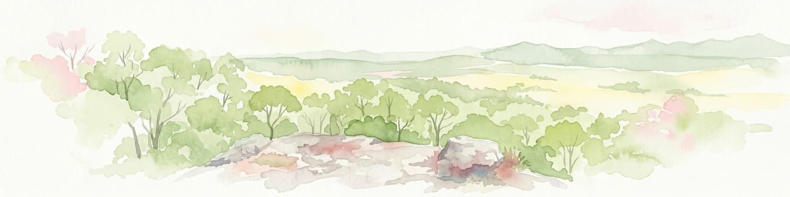
Cania Gorge National Park landscape and geographic character

The landscape of Cania Gorge is dominated by its most distinctive feature: the towering sandstone cliffs that form the walls of the gorge. These cliffs rise approximately 70 meters above the creek floor and have been sculpted by erosional processes into dramatic shapes including overhangs, caves, and natural arches. The Overhang is one of the most notable geological formations, a massive shelf of sandstone that juts out from the cliff face and creates a sheltered area beneath. Dragon Cave and Bloodwood Cave are other significant cave systems within the park, containing both geological interest and Aboriginal rock art. The floor of the gorge is relatively narrow in places but widens in certain sections where the creek has created pools and more open areas. The terrain is rugged and broken, with the creek acting as the central drainage line through the park.

Cania Gorge National Park ecosystems, habitats, and plant life

The ecological character of Cania Gorge reflects the transition between several distinct vegetation communities across the relatively small area of the park. Cypress pine woodland covers much of the higher ground and plateau areas, while eucalypt woodland dominates the slopes and more open sections. In the sheltered gullies and along Three Moon Creek, the vegetation becomes denser, with brigalow forest and dry rainforest providing habitat for more moisture-dependent species. The diversity of habitats supports a remarkable plant inventory of more than 150 species within the park boundaries. The riparian zone along Three Moon Creek is particularly important, supporting vegetation that relies on the permanent water supply and providing corridors for wildlife movement through the landscape.

Cania Gorge National Park wildlife and species highlights

Cania Gorge supports a diverse faunal community that has adapted to the varied habitats within the gorge. Rock wallabies are a notable presence among the cliff formations, using the rocky terrain for shelter and feeding on vegetation growing on the cliff faces. Bettongs, small macropods that were once widespread across eastern Australia but have declined in many areas, persist in suitable habitats within the park. The waters of Three Moon Creek support platypus, one of Australia's most distinctive monotremes, which can be observed in the permanent pools. Reptiles including various gecko species inhabit the rocky areas and woodland habitats, while the bird community is particularly diverse with more than 90 species recorded. The combination of cliff habitats, riparian zones, and woodland communities creates a mosaic of environments that supports both common and specialist species.

Cania Gorge National Park conservation status and protection priorities

Cania Gorge National Park represents an important protected area in central Queensland that conserves both significant geological features and ecological communities that have largely disappeared from the surrounding landscape. The park protects the sandstone gorge environment, which is a relatively rare landscape type in the region, and the riparian ecosystems associated with Three Moon Creek. The Aboriginal rock art sites add cultural heritage value to the conservation significance, with evidence of indigenous occupation spanning at least 19,000 years. The protected area provides refuge for species that have declined in the broader region due to land clearing and changed fire regimes, making the park an important component of the local conservation network.

Cania Gorge National Park cultural meaning and human context

The cultural significance of Cania Gorge extends back to Aboriginal occupation of the area for at least 19,000 years, as evidenced by the rock art found throughout the caves and cliff shelters within the park. These artistic works represent some of the oldest continuous cultural traditions in Australia and demonstrate the long relationship between Aboriginal peoples and this landscape. The caves and overhangs within the gorge provided shelter and were used for ceremonial purposes, with the rock art serving as both cultural expression and connection to the spiritual dimension of the landscape. European settlement of the area brought changes including mining activity, with a former mine site still present along one of the walking tracks. The park now operates as a place where indigenous cultural heritage and more recent European history coexist within a protected natural landscape.

Top sights and standout views in Cania Gorge National Park

The most impressive highlight of Cania Gorge is the towering 70-meter sandstone cliff formations, particularly The Overhang and Dragon Cave, which showcase the geological character of the gorge. The 5.6-kilometer walking circuit to Giants Chair Lookout offers the park's most comprehensive experience, passing through varied terrain with views across the gorge to Fern Tree Pool, a permanent waterhole that supports platypus and other wildlife. The Aboriginal rock art in the caves provides a direct connection to thousands of years of indigenous history and cultural practice. The diversity of vegetation communities, from open eucalypt woodland to dry rainforest, creates a visually varied landscape that supports an impressive array of wildlife including rock wallabies, bettongs, and over 90 bird species.

Best time to visit Cania Gorge National Park

The best time to visit Cania Gorge is during the cooler months from autumn through to spring, when temperatures are more comfortable for walking and the risk of summer thunderstorms is reduced. Summer in Queensland can bring extreme heat and heavy rainfall, which can make outdoor activities uncomfortable and potentially dangerous, particularly in the gorge terrain where flash flooding can occur. The permanent waterholes such as Fern Tree Pool provide year-round points of interest, though wildlife viewing is often better in the cooler months when animals are more active during daylight hours. The park can be visited throughout the year, but spring brings the added benefit of wildflower displays in the woodland areas.

Park location guide

Geography guide, regional context, and park location map for Cania Gorge National Park

Cania Gorge National Park park geography, regions, and map view in Australia
Understand where Cania Gorge National Park sits in Australia through a broader geographic reading of the surrounding landscape, nearby location context, and its mapped position within the national park landscape.

How Cania Gorge National Park fits into Australia

Australia is a constitutional monarchy and federal parliamentary democracy comprising six states and ten territories. With a population of nearly 28 million, it is one of the world's most urbanised countries, with most people concentrated on the eastern seaboard. The country has a high Human Development Index and is known for its cultural diversity, ancient Aboriginal heritage, and unique wildlife.

Wider geography shaping Cania Gorge National Park in Australia

Australia occupies the entire Australian continent, the island of Tasmania, and numerous smaller islands. It is the world's flattest and driest inhabited continent, featuring vast deserts in the interior (the Outback), tropical rainforests along the eastern coast, and a coastline bordering the Indian and Pacific Oceans.

Map view of Cania Gorge National Park

Use this park location map to pinpoint Cania Gorge National Park in Australia, understand its exact geographic position, and read its mapped placement within the surrounding landscape more clearly.

Pigeon | © OpenStreetMap contributors

Location context for Cania Gorge National Park

North Burnett RegionQueensland
Park atlas

Trace the regional protected-area geography, comparing national parks near Cania Gorge in Queensland.

Discover Other National Parks and Protected Areas Near Cania Gorge National Park in Queensland
Explore other national parks and protected areas geographically near Cania Gorge National Park, uncovering comparable sandstone gorge formations and diverse Queensland ecosystems. Compare the regional spread of conservation landscapes and understand how geology, wildlife, and Aboriginal cultural heritage connect protected areas across Central Queensland.
National parkQueensland

Bulburin National Park: Central Queensland's Significant Subtropical Rainforest Preserve

Mapped protected landscape and ecological refuge.

Bulburin National Park represents the most substantial remaining area of subtropical rainforest in central Queensland, established as a protected national park. Its dense forest ecosystem provides crucial habitat for numerous species, including endangered marsupials and notable birdlife. Exploring Bulburin National Park reveals a distinct natural landscape within Queensland, offering insights into regional conservation and the geographic distribution of vital protected areas.

Established
2015
IUCN
II
National parkQueensland

Castle Tower National Park: Queensland National Park with Granite Peaks and Woodland

Mapped terrain and protected landscape in the Gladstone Region.

Castle Tower National Park in Queensland represents a significant protected natural area characterized by striking granite peak formations and expansive eucalypt woodlands. Established in 1932, the park's rugged terrain, including Mount Stanley, offers a unique geographic perspective within Central Queensland. This national park provides an opportunity to explore its mapped boundaries and distinctive landscape context, distinguishing it as a notable protected area in the Gladstone Region.

Area
49.8 km²
Established
1932
IUCN
II
National parkQueensland

Eurimbula National Park: Central Queensland's Diverse Coastal Protected Landscape

Explore mapped terrain and protected ecosystem boundaries.

Eurimbula National Park in Queensland is an exceptional example of a protected coastal wilderness, featuring a remarkable array of habitats including mangroves, littoral rainforests, and extensive paperbark wetlands. Its diverse landscape supports significant biodiversity and offers a clear representation of central Queensland's natural heritage. Understanding Eurimbula National Park's geography through its mapped protected area helps situate its ecological importance within the broader Australian atlas.

Area
125 km²
Established
1977
IUCN
II
National parkQueensland

Goodnight Scrub National Park: Protected Dry Rainforest and Hoop Pine Ecosystems

Explore the mapped terrain and conservation significance of this Queensland park.

Goodnight Scrub National Park safeguards a rare dry rainforest ecosystem, a significant ecological asset within Queensland's protected area network. Dominated by iconic hoop pine trees, this national park showcases a unique landscape characterized by its distinct vegetation and geographic setting. The park's conservation value is highlighted by its role in preserving a habitat type uncommon in Australia, offering insights into regional landscape dynamics and protected land importance.

Area
63.3 km²
IUCN
II
National parkNorth Burnett Region

Auburn River National Park: A Protected Landscape Defined by River Gorge and Hardwood Forests

Explore the mapped terrain and protected area geography of this Queensland national park.

Auburn River National Park, designated a national park in Australia, showcases a remarkable protected landscape sculpted by the Auburn River. Its geography is characterized by a steep, dramatic river gorge and extensive hardwood forests, creating a visually striking and ecologically significant area. This park provides crucial insight into riparian ecosystems and their role within the regional geographic context of the North Burnett Region, inviting detailed exploration of its mapped terrain and conservation value.

Area
3.9 km²
Established
1964
IUCN
II
National parkQueensland

Mount Walsh National Park: Mapped Granite Landscape and Protected Area in Queensland

Explore Queensland's unique volcanic terrain and regional park geography.

Mount Walsh National Park in Queensland, Australia, offers a compelling study in landscape contrasts, defined by its striking granite bluff and rugged topography. This protected area features dramatic exposed rock formations, steep forested slopes, and sheltered gullies, a direct result of ancient geological processes. The park's unique terrain, from bare granite summits to vegetated ridges, provides essential habitat and illustrates the intricate relationship between geology and ecology. For those interested in atlas-style geographic discovery, Mount Walsh National Park serves as a prime example of a distinctive Australian protected landscape.

Area
52.4 km²
Established
1947
IUCN
II
Relief
Mountain
National parkQueensland

Palmgrove National Park: Queensland's Remote Protected Landscape for Scientific Conservation

Rugged sandstone terrain and unique eucalypt woodlands define this park.

Palmgrove National Park is a significant scientific reserve in south-central Queensland, Australia, characterized by its dissected sandstone terrain and dry eucalypt woodlands. Designated as a strict nature reserve, its primary value lies in protecting vulnerable species and threatened ecosystems, notably serving as a crucial breeding habitat for the black-breasted buttonquail. The park's isolated geography and limited public access underscore its importance as a sanctuary for avian conservation and ecological research within Australia's protected areas network.

Area
256 km²
Established
1991
IUCN
Ia
National parkQueensland

Baga National Park: Unique Volcanic Geography and Protected Landscape in Queensland

Mapped terrain and protected area identity for a distinctive national park.

Baga National Park stands as a notable protected area in central Queensland, Australia, centered around the striking Mount Baga, a trachyte volcanic plug. This geological marvel offers a unique landscape context, showcasing the remnants of ancient volcanic activity within the regional geography. As a national park, it serves to preserve this distinctive natural feature and its associated habitats, providing a compact yet significant destination for atlas-based discovery of Queensland's diverse protected lands.

Area
1.44 km²
Established
1977
IUCN
II

Common questions about visiting, size, designation, and location context for Cania Gorge National Park

Cania Gorge National Park FAQs for park facts, access, geography, and protected area context
Find quick answers about Cania Gorge National Park, including protected-area facts, park geography, trail and visitor context, and how the park fits into its surrounding country and regional landscape.
MoriAtlas Explorer

Continue Your Protected Areas Search Across the Global Atlas

Deepen your exploration by continuing the structured search for national parks and protected areas worldwide. Utilize the comprehensive filtering capabilities to compare different conservation landscapes and refine your understanding of global park geography. Discover more about the distribution and characteristics of protected natural areas.

Global natural geography