Mori Atlas logo
National parkCát Bà National Park

Explore the mapped boundaries and diverse ecosystems of this critical island national park.

Cát Bà National Park: Vietnam's Premier Limestone Karst Protected Landscape

Cát Bà National Park represents a significant protected landscape within Vietnam's Hạ Long Bay archipelago. This national park is defined by its dramatic limestone karst terrain, encompassing steep peaks, hidden valleys, and vital mangrove coastlines. Its designation as a protected area underscores its importance for endemic species, including the critically endangered Cát Bà langur, and diverse ecological habitats. MoriAtlas provides a detailed geographic context for understanding this unique island sanctuary.

Limestone KarstCritically Endangered SpeciesUNESCO Biosphere ReserveIsland Protected AreaMangrove ForestOld-Growth Forest

Cát Bà National Park

National park

Park overview

Structured park overview, official facts, and landscape profile for Cát Bà National Park

Cát Bà National Park park facts, protected area profile, and essential visitor context
Review the core facts for Cát Bà National Park, including designation, size, terrain, visitor scale, habitats, and operating context in one park-focused overview.

About Cát Bà National Park

Cát Bà National Park protects the ecological integrity of Cát Bà Island, the largest island in the Hạ Long Bay archipelago and a cornerstone of northern Vietnam's protected area network. The park's establishment in 1986 reflected growing recognition of the island's unique biodiversity and the urgent need to conserve the critically endangered Cát Bà langur, whose population had been declining due to habitat loss and hunting pressure. The park's location within Hạ Long Bay, itself a UNESCO World Heritage Site celebrated for its thousands of limestone karst islands and islets, adds global recognition to the protected area's significance.

The park's terrain is dominated by limestone karst geology, with rugged hills rising from sea level to approximately 500 meters. These formations create a complex landscape of steep slopes, rocky outcrops, narrow valleys, and hidden caves that support specialized vegetation communities. The forest cover includes both primary old-growth forest in the more inaccessible areas and secondary forest that has regenerated following past disturbance. Coastal areas feature mangrove wetlands that provide critical habitat for migratory waterfowl and marine species. The park's marine component includes inshore waters supporting coral reefs and fish communities, extending the protected area's ecological value beyond the terrestrial zone.

Quick facts and research context for Cát Bà National Park

Cát Bà National Park is located on Cát Bà Island within the Hạ Long Bay archipelago in northern Vietnam, approximately 30 kilometers east of Hai Phong city. The protected area covers roughly 16,200 hectares comprising about 10,900 hectares of forest and 5,300 hectares of inshore marine waters. Established on March 31, 1986, the park is categorized as IUCN protected area management category II. The landscape is dominated by limestone karst formations rising to elevations around 500 meters, with narrow valleys running northeast to southwest across the island. The park is part of a UNESCO World Heritage Site and a UNESCO biosphere reserve under the Man and the Biosphere Programme.

Park context

Deeper park guide and search-rich context for Cát Bà National Park

Cát Bà National Park history, landscape, wildlife, and travel context
Explore Cát Bà National Park through its history, landscape character, ecosystems, wildlife, conservation priorities, cultural context, and seasonal travel timing in a structured park guide built for atlas discovery and search intent.

Why Cát Bà National Park stands out

Cát Bà National Park is best known as the sole remaining habitat of the Cát Bà langur (Trachypithecus poliocephalus), one of the world's rarest primates classified as critically endangered by the IUCN. The park's dramatic limestone karst landscape, characterized by rugged peaks, hidden caves, and steep forested slopes, defines its visual identity and makes it a distinctive component of the Hạ Long Bay World Heritage Site. The combination of terrestrial forest ecosystems and coastal mangrove habitats creates unusual ecological diversity within a relatively compact area.

Cát Bà National Park history and protected-area timeline

Cát Bà National Park was officially established on March 31, 1986, through Decision No.79/CP issued by the Council of Ministers of Vietnam, creating the legal framework for protecting the island's natural resources and the endangered langur population. In the decades following its designation, the park became increasingly accessible to visitors, particularly after the mid-1990s when tourism to northern Vietnam expanded significantly. Initially, the park attracted primarily Vietnamese tourists and visitors from neighboring regions, though the visitor profile has diversified over time.

The conservation history of the Cát Bà langur illustrates both the challenges and some successes of protected area management in Vietnam. The species experienced severe population decline during the 1990s and early 2000s, with numbers falling from an estimated 2,600 individuals to just 40 by 2003, driven by habitat destruction, logging, and demand for traditional medicine. Intensive conservation efforts, including strengthened protection measures and habitat restoration, have contributed to population recovery, with counts reaching approximately 67 individuals by 2016. This recovery demonstrates the potential for protected areas to support species recovery when management interventions are sustained and effective.

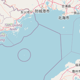
Cát Bà National Park landscape and geographic character

The physical landscape of Cát Bà National Park is defined by its limestone karst geology, which has produced a distinctive terrain of steep, jagged peaks, vertical cliffs, and凹陷 valleys. The island's bedrock consists primarily of limestone that has been eroded over millions of years, creating the characteristic tower-like formations that characterize Hạ Long Bay. Elevations range from sea level to approximately 500 meters, with most hillslopes falling in the 50 to 200 meter range. The alternating narrow valleys run roughly northeast to southwest across the island, channeling water flow and creating microhabitats within the broader karst matrix.

Soils on the island are closely tied to the underlying limestone, with several distinct soil groups supporting different vegetation types. Brown soils and weathered limestone soils dominate the forested hillslopes, while valley soils accumulate in the lower-lying areas where moisture retention supports denser vegetation. Coastal areas feature mangrove soils developed in the estuarine zones where freshwater meets tidal saltwater. The park's marine environment includes sheltered coastal waters, coral reef areas, and the submerged portions of the limestone formations extending beneath the sea surface.

Cát Bà National Park ecosystems, habitats, and plant life

The ecological diversity of Cát Bà National Park reflects its complex mosaic of limestone forest, valley wetlands, and coastal marine habitats. Over 1,500 plant species have been recorded within the park, including approximately 118 tree species and 160 species with documented medicinal properties. The forest vegetation varies with elevation and aspect, with different species assemblages occupying the moist valley bottoms compared to the drier ridge tops and cliff faces. Mangrove forests occupy the tidal zones along the island's coast, particularly in the sheltered areas where river estuaries enter the sea.

The marine component of the park supports significant biodiversity despite its relatively limited extent. Coral reefs host diverse invertebrate communities and provide habitat for numerous fish species. The park's position along the coast places it within a region of high marine productivity, supporting both resident and migratory species. The combination of terrestrial and marine protected habitats makes Cát Bà unusual among Vietnam's national parks, which typically focus primarily on land-based ecosystems.

Cát Bà National Park wildlife and species highlights

The wildlife of Cát Bà National Park is highlighted most critically by the Cát Bà langur, a primate species endemic to this specific area and classified as critically endangered by the International Union for Conservation of Nature. This langur, also known as the white-headed langur due to its distinctive pale coloration, survives only within the boundaries of Cát Bà National Park and surrounding areas of Cát Bà Island, making the park irreplaceable for the species' survival. Beyond this flagship species, the park supports 32 recorded mammal species including civets, deer, macaques, and various squirrel species that are commonly observed by visitors.

Bird diversity is well-represented with 78 species documented within the park, including significant waterfowl populations that utilize the island as a stopover along major East Asian flyway migration routes. The mangrove forests provide critical feeding and roosting habitat for these migratory species. Reptile and amphibian diversity includes 20 species, while the marine environments support 196 fish species and 177 coral species. The invertebrate communities include 98 zooplankton species, illustrating the park's ecological complexity across different habitat types and trophic levels.

Cát Bà National Park conservation status and protection priorities

Cát Bà National Park's conservation significance derives from its role as the primary habitat for the Cát Bà langur, one of the rarest primates on Earth and a species for which the park represents virtually the entire global range. The park's designation as part of the Hạ Long Bay World Heritage Site places it within one of the world's most celebrated natural landscapes, creating both obligations and resources for conservation management. Its status as a UNESCO biosphere reserve under the Man and the Biosphere Programme further emphasizes its role in balancing conservation with sustainable development objectives.

The langur population recovery from approximately 40 individuals in 2003 to around 67 by 2016 demonstrates that intensive conservation action within a protected area framework can produce measurable results for critically endangered species. However, the species remains vulnerable due to its extremely restricted range and small population size. The park's forest and marine habitats face ongoing pressures from development, tourism, and resource extraction that require sustained management attention. Conservation priorities include maintaining habitat connectivity, controlling invasive species, and reducing human-wildlife conflict in the interface zones between protected forest and human settlement areas.

Cát Bà National Park cultural meaning and human context

Cát Bà Island has historically been inhabited by fishing communities whose traditional lifestyles are intertwined with the marine environments surrounding the island. While the national park boundaries encompass the natural habitats, the island's human population continues to live in and around the protected area, creating a cultural landscape where human activity and natural systems coexist. The local communities have traditional knowledge of the island's ecology, including the locations of significant forest areas and the seasonal patterns of marine resources.

The Vietnamese name for the park, Vườn Quốc Gia Cát Bà, reflects the national significance attributed to this protected area within Vietnam's system of national parks and nature reserves. The park's proximity to Hai Phong, one of Vietnam's major port cities, has influenced its accessibility and the nature of visitation it receives. The relationship between the park's conservation objectives and the livelihood needs of local communities represents an ongoing management challenge common to many protected areas in populated regions.

Top sights and standout views in Cát Bà National Park

The limestone karst landscape of Cát Bà National Park offers dramatic scenery with its towering peaks, hidden caves, and steep forested slopes rising from the sea, providing one of Vietnam's most visually striking protected area experiences. The critically endangered Cát Bà langur represents a unique conservation draw, as this primate exists nowhere else on Earth and can be observed within the park's forest habitats with appropriate guidance. The mangrove forests along the island's coast provide tranquil water-based exploration opportunities and support exceptional birdwatching, particularly during the migratory season when waterfowl congregate in significant numbers. The park's dual terrestrial and marine environments create unusual diversity, allowing visitors to experience both forest-covered karst peaks and underwater coral reefs within a single protected area visit.

Best time to visit Cát Bà National Park

The optimal time to visit Cát Bà National Park coincides with the cooler, drier months from October through December and from February through April, when temperatures are moderate and rainfall is reduced compared to the summer monsoon season. The winter months from December through February can bring cooler temperatures and occasional fog that may limit visibility but also create atmospheric conditions suited to forest exploration. The summer months from May through September bring higher temperatures, increased humidity, and heavy rainfall that can restrict some activities and make outdoor exploration less comfortable.

Wildlife viewing opportunities for the Cát Bà langur are generally better during the dry season when animals tend to concentrate around water sources and are more active during cooler parts of the day. Bird migration through the area peaks during the spring and autumn periods when waterfowl move along the East Asian flyway. The park's marine environments can be explored year-round, though water conditions and visibility vary seasonally. Visitors should be aware that the park can become crowded during Vietnamese holiday periods, particularly around the Tet festival in January or February and during national holidays.

Park location guide

Geography guide, regional context, and park location map for Cát Bà National Park

Cát Bà National Park park geography, regions, and map view in Vietnam
Understand where Cát Bà National Park sits in Vietnam through a broader geographic reading of the surrounding landscape, nearby location context, and its mapped position within the national park landscape.

How Cát Bà National Park fits into Vietnam

Vietnam, officially the Socialist Republic of Viet Nam, is a unitary communist state in Southeast Asia. It occupies roughly 331,000 square kilometres along the eastern edge of Mainland Southeast Asia, with a population exceeding 102 million. The country is bordered by China to the north, Laos and Cambodia to the west, and has maritime boundaries in the Gulf of Thailand and South China Sea.

Wider geography shaping Cát Bà National Park in Vietnam

Vietnam occupies the eastern edge of Mainland Southeast Asia, stretching along the Gulf of Thailand to the southwest and the South China Sea to the east. The country is bordered by China to the north, and Laos and Cambodia to the west. It has a diverse landscape ranging from the Red River Delta in the north to the Mekong Delta in the south.

Map view of Cát Bà National Park

Use this park location map to pinpoint Cát Bà National Park in Vietnam, understand its exact geographic position, and read its mapped placement within the surrounding landscape more clearly.

Pigeon | © OpenStreetMap contributors
Park atlas

Explore regional protected areas, comparing diverse landscapes and marine ecosystems within Vietnam's geographic context.

Explore Nearby National Parks and Protected Areas Beyond Cát Bà National Park's Limestone Karst Geography
Discover other national parks and protected areas near Cát Bà National Park, including conservation landscapes with unique limestone karst formations, coastal mangroves, and diverse marine environments. Broaden your park-discovery journey by comparing ecological features and geographic spread across the surrounding region, enhancing your understanding of Vietnam's protected areas.
National parkQuảng Ninh Province

Bái Tử Long National Park: Protected Island Archipelago and Marine Landscape Discovery

Explore the geography and mapped protected boundaries.

Bái Tử Long National Park, located in Vietnam's Quảng Ninh Province, is a protected national park distinguished by its archipelago of approximately 40 limestone islands and significant marine environments. As one of Vietnam's few national parks designated to protect both land and sea, it provides critical atlas-level insights into coastal karst topography, marine biodiversity, and the interconnectedness of island ecosystems. Discover the park's unique geographic features and its role as a vital protected landscape within the broader regional context.

Area
157.83 km²
Established
2001
IUCN
II
National parkVĩnh Phúc Province

Tam Dao National Park: Vietnam's Mountain National Park and Biodiversity Hotspot

Explore mapped boundaries and regional landscape context.

Tam Dao National Park is a key protected area in northern Vietnam, defined by its rugged mountain terrain featuring over 20 peaks exceeding 1,000 meters. This national park is a vital habitat for diverse flora and fauna, including numerous endemic species, and showcases transitional forest ecosystems from tropical to montane zones. Understanding Tam Dao National Park involves exploring its geographic setting within Vĩnh Phúc Province and appreciating its role as a significant protected landscape.

Area
368.83 km²
Established
1996
IUCN
II
National parkHanoi

Ba Vì National Park: Ancient Volcanic Mountains and Protected Landscape Near Hanoi

Discover the mapped geography and biodiversity of this national park.

Ba Vì National Park, a protected natural area near Hanoi, showcases a dramatic landscape shaped by ancient volcanic activity. The park features three significant peaks, including Vua Mountain, creating a distinct topographical profile. Spanning over 10,800 hectares, it is recognized for its ecological diversity, harboring a wealth of plant and animal species. This national park serves as a vital protected landscape, offering a unique opportunity for geographic exploration and understanding the natural terrain surrounding the Vietnamese capital.

Area
108.15 km²
Established
1991
IUCN
II
Relief
Mountain
National parkPhú Thọ Province

Xuân Sơn National Park: Protected Mountain Landscape and Regional Geography

Mapping the southeastern edge of the Hoang Lien Mountains.

Delve into the protected landscape of Xuân Sơn National Park, a key national park situated in Phú Thọ Province, Vietnam. This area, covering about 150 square kilometers, is defined by its rugged mountainous terrain, featuring steep forested slopes and distinct ridgelines that contribute to the region's varied topography. As a protected national park, Xuân Sơn plays a crucial role in preserving the natural characteristics of the southeastern Hoang Lien Mountains. Its geographic setting is significant, acting as a transition zone between higher montane environments and the nearby lowland river systems, offering a unique perspective on Vietnam's diverse natural heritage.

Area
150.48 km²
Established
1986
IUCN
II
National parkVietnam

Phong Nha, Kẻ Bàng National Park: Vietnam's Karst Terrain and Subterranean World

Explore protected landscapes, cave systems, and geological wonders.

Phong Nha, Kẻ Bàng National Park in Vietnam is a globally significant protected landscape, recognized by UNESCO for its exceptional karst topography and extensive cave networks. This national park features dramatic limestone mountains, deep river gorges, and some of the world's most impressive subterranean formations, offering a rich atlas of natural history and geological wonders to explore.

Area
857.54 km²
Established
2001
IUCN
II
National parkLào Cai Province

Hoàng Liên National Park: Vietnam's Highest Mountain and Botanical Treasure in Lào Cai Province

Discover exceptional mountain terrain and unique endemic species habitat.

Hoàng Liên National Park stands as a critical protected landscape in Lào Cai Province, Vietnam, centered around the iconic Fansipan mountain, the highest point in the Indochinese Peninsula. This national park is renowned as a globally important center for plant diversity, showcasing varied mountain terrain from lush evergreen forests to subalpine ecosystems. Explore the mapped boundaries and geographic context of this significant highland protected area, a key destination for understanding Southeast Asian botanical richness.

Area
685.69 km²
Established
2002
IUCN
II
National parkVietnam

Bach Ma National Park: Protected Area and Mountain Landscape in Vietnam

Explore the biodiversity and unique geography of this vital national park.

Bach Ma National Park in Vietnam is a protected area defined by its steep, granite-rich mountainous terrain within the Annamite Range. The park’s location at a significant biogeographical crossroads contributes to its exceptional biodiversity, particularly its documented birdlife and varied forest ecosystems. Understanding Bach Ma National Park through its mapped landscape provides critical insight into Vietnam's natural heritage and the ecological dynamics shaped by its unique regional geography.

Area
220 km²
Established
1986
IUCN
II
National parkSakon Nakhon Province

Phu Phan National Park: Thailand's Protected Mountain Landscape and Natural Atlas Entry

Explore dry dipterocarp forest and unique terrain in Sakon Nakhon.

Phu Phan National Park offers a detailed look into Thailand's northeastern geography, characterized by its mountainous terrain and extensive dry dipterocarp forests. As a national park, it represents a vital protected landscape within Sakon Nakhon Province, showcasing unique geological formations and providing a rich context for atlas-based exploration. Discover the park's mapped boundaries, its ecological significance, and the distinct natural features that define this prominent Isan region protected area.

Area
665 km²
Established
1972
IUCN
II

Common questions about visiting, size, designation, and location context for Cát Bà National Park

Cát Bà National Park FAQs for park facts, access, geography, and protected area context
Find quick answers about Cát Bà National Park, including protected-area facts, park geography, trail and visitor context, and how the park fits into its surrounding country and regional landscape.
MoriAtlas Explorer

Continue Your Protected Areas Search Across the Global Atlas

Deepen your exploration by continuing the structured search for national parks and protected areas worldwide. Utilize the comprehensive filtering capabilities to compare different conservation landscapes and refine your understanding of global park geography. Discover more about the distribution and characteristics of protected natural areas.

Global natural geography