Mori Atlas logo
National parkXuân Sơn National Park

Mapping the mountainous terrain and forest ecosystems at the southeastern edge of the Hoang Lien Mountains.

Xuân Sơn National Park: Protected Landscape and Geographic Context in Phú Thọ Province

(Vườn quốc gia Xuân Sơn)

Xuân Sơn National Park represents a significant protected natural landscape within Phú Thọ Province, northern Vietnam. This national park encompasses approximately 150 square kilometers of dramatic mountainous terrain, characterized by steep, forested slopes and extensive ridgelines that descend into valley systems. Situated at the southeastern extent of the prominent Hoang Lien Mountains, the park offers a unique geographic vantage point, bridging highland forest ecosystems with lower-elevation terrains near the Red and Black River confluence. Understanding Xuân Sơn National Park through its mapped boundaries and regional geography provides crucial insight into Vietnam's commitment to preserving its vital mountain forest ecosystems.

mountain forestsIUCN category IIHoang Lien Mountainsnorthern Vietnamprotected areanational park

Xuân Sơn National Park

National park

Park overview

Structured park overview, official facts, and landscape profile for Xuân Sơn National Park

Xuân Sơn National Park park facts, protected area profile, and essential visitor context
Review the core facts for Xuân Sơn National Park, including designation, size, terrain, visitor scale, habitats, and operating context in one park-focused overview.

About Xuân Sơn National Park

Xuân Sơn National Park occupies a mountainous landscape in the southeastern reaches of the Hoang Lien Mountains, a range that extends along the border between Vietnam and China in the northern highland region. The terrain consists primarily of steep forested slopes, with elevation changes creating a diverse topography of ridges, valleys, and stream corridors. This location at the extreme southeastern edge of the Hoang Lien range places the park in a transitional ecological zone between higher-altitude mountain forest communities and the lower-lying terrain leading toward the Red River and Black River floodplains. The protection of this mountainous landscape reflects Vietnam's commitment to preserving its highland forest ecosystems and the ecological services these areas provide. The park serves as a protected area within the country's national park system, contributing to the conservation of biodiversity and natural landscapes in this portion of the northern highlands.

Quick facts and research context for Xuân Sơn National Park

Xuân Sơn National Park is situated in Phú Thọ Province, approximately 45 kilometers southwest of the confluence of the Red River and Black River. The protected area spans 150.48 square kilometers of mountainous terrain at the southeastern edge of the Hoang Lien Mountains. It was established on August 9, 1986, initially as a nature reserve before achieving national park status. The park falls within IUCN category II, denoting its classification as a national park with mountain forest ecosystems.

Park context

Deeper park guide and search-rich context for Xuân Sơn National Park

Xuân Sơn National Park history, landscape, wildlife, and travel context
Explore Xuân Sơn National Park through its history, landscape character, ecosystems, wildlife, conservation priorities, cultural context, and seasonal travel timing in a structured park guide built for atlas discovery and search intent.

Why Xuân Sơn National Park stands out

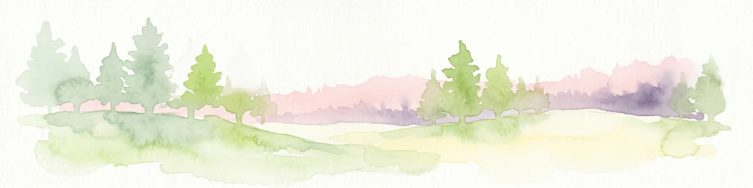
Xuân Sơn National Park is notable for its location at the southeastern edge of the Hoang Lien Mountains, one of Vietnam's most significant mountain ranges. The park protects a transitional zone between highland mountain forest and lower-elevation terrain, encompassing steep ridgelines, forested slopes, and valley systems characteristic of this mountainous border region. This positioning at the edge of a major mountain range gives the park particular geographic significance within Vietnam's northern highlands.

Xuân Sơn National Park history and protected-area timeline

Xuân Sơn National Park was established on August 9, 1986, initially designated as a nature reserve before being elevated to national park status as part of Vietnam's developing protected area network. The establishment reflected Vietnam's growing emphasis on nature conservation during the 1980s and 1990s, a period when the country began systematically designating national parks and nature reserves to protect representative ecosystems across different biogeographic regions. The park's location within the Hoang Lien Mountains placed it within a region of significant ecological importance, prompting its inclusion in Vietnam's national park system as a protected area for mountain forest ecosystems in the northern highlands.

Xuân Sơn National Park landscape and geographic character

The landscape of Xuân Sơn National Park is defined by its position at the southeastern edge of the Hoang Lien Mountains, a major mountain range extending along the Sino-Vietnamese border. The terrain is characterized by steep, forested slopes rising along ridgelines and descending into narrow valleys and stream corridors. This mountainous topography creates a landscape of considerable topographic variation, with the elevation changes supporting diverse forest types and habitat zones. The park's position at the range's southeastern extent means the terrain transitions from higher mountain terrain to lower-elevation terrain as it extends toward the Red River and Black River lowlands. The combination of steep slopes, forest cover, and the mountainous setting gives the park its distinctive character as a highland protected area in northern Vietnam.

Xuân Sơn National Park ecosystems, habitats, and plant life

The nature of Xuân Sơn National Park centers on its mountain forest ecosystems positioned at the edge of the Hoang Lien Mountains. The protected area encompasses forest communities adapted to the subtropical highland environment of northern Vietnam, with vegetation patterns shaped by elevation, slope aspect, and moisture gradients. The park's position at the southeastern edge of a major mountain range creates ecological transitional characteristics, as species from higher-elevation mountain forests mix with those from lower-elevation forest types. These mountain forest ecosystems support the park's biodiversity value and form the ecological foundation for its protected area status.

Xuân Sơn National Park conservation status and protection priorities

Xuân Sơn National Park holds IUCN category II protection status, classifying it as a national park within the international protected area framework. This designation recognizes the park's significance as a protected mountain forest area in northern Vietnam, with the IUCN category denoting areas protected primarily for ecosystem conservation and recreation. The park's inclusion in Vietnam's national park system reflects broader conservation objectives to preserve representative examples of the country's major ecosystem types, including the mountain forest environments found in the Hoang Lien Mountains region. The protected area contributes to Vietnam's network of national parks that together aim to maintain biodiversity and natural landscape values across different regions of the country.

Top sights and standout views in Xuân Sơn National Park

Xuân Sơn National Park protects a significant mountain forest landscape at the southeastern edge of Vietnam's Hoang Lien Mountains, an important highland range in the northern part of the country. The park's 150 square kilometers of protected terrain include steep forested slopes and valley systems that form part of the broader Red River and Black River highland watershed. Its location 45 kilometers southwest of the confluence of these two major rivers places it strategically within a region of significant geographic and ecological importance. The park's establishment in 1986 reflects Vietnam's commitment to preserving its mountain forest ecosystems and natural heritage.

Best time to visit Xuân Sơn National Park

The best time to visit Xuân Sơn National Park aligns with the typical visiting season for Vietnam's northern highland regions, generally from October to December and from March to May. These periods offer more moderate temperatures and varying landscape conditions that affect the forest environment and visitor experience. The park's mountainous setting means that conditions can differ notably from lowland areas, with cooler temperatures in the higher elevations particularly during the winter months from December to February.

Park location guide

Geography guide, regional context, and park location map for Xuân Sơn National Park

Xuân Sơn National Park park geography, regions, and map view in Vietnam
Understand where Xuân Sơn National Park sits in Vietnam through a broader geographic reading of the surrounding landscape, nearby location context, and its mapped position within the national park landscape.

How Xuân Sơn National Park fits into Vietnam

Vietnam, officially the Socialist Republic of Viet Nam, is a unitary communist state in Southeast Asia. It occupies roughly 331,000 square kilometres along the eastern edge of Mainland Southeast Asia, with a population exceeding 102 million. The country is bordered by China to the north, Laos and Cambodia to the west, and has maritime boundaries in the Gulf of Thailand and South China Sea.

Wider geography shaping Xuân Sơn National Park in Vietnam

Vietnam occupies the eastern edge of Mainland Southeast Asia, stretching along the Gulf of Thailand to the southwest and the South China Sea to the east. The country is bordered by China to the north, and Laos and Cambodia to the west. It has a diverse landscape ranging from the Red River Delta in the north to the Mekong Delta in the south.

Map view of Xuân Sơn National Park

Use this park location map to pinpoint Xuân Sơn National Park in Vietnam, understand its exact geographic position, and read its mapped placement within the surrounding landscape more clearly.

Pigeon | © OpenStreetMap contributors

Location context for Xuân Sơn National Park

Phú Thọ ProvinceTân Sơn District
Park atlas

Map the geographical spread of protected landscapes and park entities across Vietnam's northern highlands, offering comparative views.

Compare National Parks and Protected Areas Surrounding Xuân Sơn National Park in Northern Vietnam
Explore additional national parks and protected areas situated within the mountainous terrain and highland ecosystems surrounding Xuân Sơn National Park, extending discovery across northern Vietnam. Compare adjacent protected landscapes to understand regional conservation patterns and the geographic distribution of significant natural areas beyond the boundaries of Xuân Sơn.
National parkHanoi

Ba Vì National Park: Ancient Volcanic Mountains and Protected Landscape Near Hanoi

Discover the mapped geography and biodiversity of this national park.

Ba Vì National Park, a protected natural area near Hanoi, showcases a dramatic landscape shaped by ancient volcanic activity. The park features three significant peaks, including Vua Mountain, creating a distinct topographical profile. Spanning over 10,800 hectares, it is recognized for its ecological diversity, harboring a wealth of plant and animal species. This national park serves as a vital protected landscape, offering a unique opportunity for geographic exploration and understanding the natural terrain surrounding the Vietnamese capital.

Area
108.15 km²
Established
1991
IUCN
II
Relief
Mountain
National parkVĩnh Phúc Province

Tam Dao National Park: Vietnam's Mountain National Park and Biodiversity Hotspot

Explore mapped boundaries and regional landscape context.

Tam Dao National Park is a key protected area in northern Vietnam, defined by its rugged mountain terrain featuring over 20 peaks exceeding 1,000 meters. This national park is a vital habitat for diverse flora and fauna, including numerous endemic species, and showcases transitional forest ecosystems from tropical to montane zones. Understanding Tam Dao National Park involves exploring its geographic setting within Vĩnh Phúc Province and appreciating its role as a significant protected landscape.

Area
368.83 km²
Established
1996
IUCN
II
National parkLào Cai Province

Hoàng Liên National Park: Vietnam's Highest Mountain and Botanical Treasure in Lào Cai Province

Discover exceptional mountain terrain and unique endemic species habitat.

Hoàng Liên National Park stands as a critical protected landscape in Lào Cai Province, Vietnam, centered around the iconic Fansipan mountain, the highest point in the Indochinese Peninsula. This national park is renowned as a globally important center for plant diversity, showcasing varied mountain terrain from lush evergreen forests to subalpine ecosystems. Explore the mapped boundaries and geographic context of this significant highland protected area, a key destination for understanding Southeast Asian botanical richness.

Area
685.69 km²
Established
2002
IUCN
II
National parkVietnam

Cát Bà National Park: Vietnam's Critically Endangered Species Sanctuary & Karst Landscape

Mapped protected area with diverse terrestrial and marine ecosystems.

As a critical national park in Vietnam, Cát Bà National Park protects a remarkable limestone karst landscape central to the Hạ Long Bay region. This area is renowned for its steep peaks, narrow valleys, and coastal mangrove environments, supporting a uniquely diverse array of flora and fauna. Its status as a protected area highlights its global importance for conservation, particularly as the exclusive habitat of the Cát Bà langur. Explore the mapped geography and ecological significance of this vital Vietnamese protected land.

Area
152 km²
Established
1986
IUCN
II
National parkQuảng Ninh Province

Bái Tử Long National Park: Protected Island Archipelago and Marine Landscape Discovery

Explore the geography and mapped protected boundaries.

Bái Tử Long National Park, located in Vietnam's Quảng Ninh Province, is a protected national park distinguished by its archipelago of approximately 40 limestone islands and significant marine environments. As one of Vietnam's few national parks designated to protect both land and sea, it provides critical atlas-level insights into coastal karst topography, marine biodiversity, and the interconnectedness of island ecosystems. Discover the park's unique geographic features and its role as a vital protected landscape within the broader regional context.

Area
157.83 km²
Established
2001
IUCN
II
National parkVietnam

Phong Nha, Kẻ Bàng National Park: Vietnam's Karst Terrain and Subterranean World

Explore protected landscapes, cave systems, and geological wonders.

Phong Nha, Kẻ Bàng National Park in Vietnam is a globally significant protected landscape, recognized by UNESCO for its exceptional karst topography and extensive cave networks. This national park features dramatic limestone mountains, deep river gorges, and some of the world's most impressive subterranean formations, offering a rich atlas of natural history and geological wonders to explore.

Area
857.54 km²
Established
2001
IUCN
II
National parkSakon Nakhon Province

Phu Phan National Park: Thailand's Protected Mountain Landscape and Natural Atlas Entry

Explore dry dipterocarp forest and unique terrain in Sakon Nakhon.

Phu Phan National Park offers a detailed look into Thailand's northeastern geography, characterized by its mountainous terrain and extensive dry dipterocarp forests. As a national park, it represents a vital protected landscape within Sakon Nakhon Province, showcasing unique geological formations and providing a rich context for atlas-based exploration. Discover the park's mapped boundaries, its ecological significance, and the distinct natural features that define this prominent Isan region protected area.

Area
665 km²
Established
1972
IUCN
II
National parkKhon Kaen Province

Nam Phong National Park: Mapped Protected Landscape and Geography in Khon Kaen Province

Explore scenic viewpoints, rock formations, and reservoir landscapes.

Nam Phong National Park presents a compelling case study in protected landscape geography, particularly within Thailand's northeastern region. This national park is defined by its mountainous terrain, featuring the Phu Phan Kham and Phu Meng ranges that dramatically meet the waters of the Ubol Ratana Dam reservoir. Its mapped boundaries encompass striking viewpoints like Hin Chang Si, prehistoric rock paintings, and geological formations, offering a detailed look at its natural and archaeological significance for atlas exploration.

Area
197 km²
Established
2000
IUCN
II
Visitors
68.3K annual

Common questions about visiting, size, designation, and location context for Xuân Sơn National Park

Xuân Sơn National Park FAQs for park facts, access, geography, and protected area context
Find quick answers about Xuân Sơn National Park, including protected-area facts, park geography, trail and visitor context, and how the park fits into its surrounding country and regional landscape.
MoriAtlas Explorer

Continue Your Protected Areas Search Across the Global Atlas

Deepen your exploration by continuing the structured search for national parks and protected areas worldwide. Utilize the comprehensive filtering capabilities to compare different conservation landscapes and refine your understanding of global park geography. Discover more about the distribution and characteristics of protected natural areas.

Global natural geography