Mori Atlas logo
National parkHoàng Liên National Park

Explore the dramatic terrain and exceptional biodiversity of this highland national park in Lào Cai Province.

Hoàng Liên National Park: Vietnam's Highest Peak and ASEAN Heritage Protected Landscape

(Vườn quốc gia Hoàng Liên)

Hoàng Liên National Park, located in Lào Cai Province, Vietnam, protects the towering Hoàng Liên Son mountain range, culminating in Fansipan, the highest peak of the Indochinese Peninsula. This ASEAN Heritage Park is a globally significant center for plant diversity, featuring dramatic mountain terrain from 1,000 to over 3,000 meters. Discover the park's extensive protected landscape and its unique ecological significance through detailed mapping and geographic context.

mountain national parkbiodiversity hotspotASEAN Heritage Parkalpine ecosystemsendemic species habitattropical montane forest

Hoàng Liên National Park

National park

Park overview

Structured park overview, official facts, and landscape profile for Hoàng Liên National Park

Hoàng Liên National Park park facts, protected area profile, and essential visitor context
Review the core facts for Hoàng Liên National Park, including designation, size, terrain, visitor scale, habitats, and operating context in one park-focused overview.

About Hoàng Liên National Park

Hoàng Liên National Park occupies the northwestern mountainous region of Vietnam, where the Hoàng Liên Son range forms a natural barrier between the Vietnamese highlands and the Chinese border. The park spans elevations from approximately 1,000 meters to Fansipan's summit at 3,147 meters, creating a dramatic landscape of steep ridges, deep valleys, and cascading streams that drain into the Red River system. The protection framework divides the park into a core area of nearly 30,000 hectares containing a strict protected zone of roughly 11,900 hectares, a forest rehabilitation zone of about 17,900 hectares, and a small administrative area, surrounded by a peripheral zone extending protection to the surrounding commune lands. The park's location at the intersection of tropical and temperate climatic influences, combined with its elevation range, produces the complex ecological patterns that underpin its biodiversity significance. Beyond its ecological value, the park supports the livelihoods and cultural practices of six ethnic communities whose traditional land use patterns have shaped and been shaped by this mountain environment over generations.

Quick facts and research context for Hoàng Liên National Park

Hoàng Liên National Park occupies a strategic position in Northwest Vietnam, protecting a critical corridor of alpine and subalpine forest ecosystems. The core protected zone spans nearly 30,000 hectares, with an additional peripheral area extending the protection to nearly 39,000 hectares. The park's elevation range from 1,000 to 3,147 meters creates distinct altitudinal zonation, supporting vegetation types that transition from tropical montane forests at lower elevations through temperate broadleaf forests to subalpine shrublands near the summit. Six ethnic groups reside in the surrounding landscape, with the Dao and H'mong peoples forming the majority communities with deep cultural connections to the mountain environment.

Park context

Deeper park guide and search-rich context for Hoàng Liên National Park

Hoàng Liên National Park history, landscape, wildlife, and travel context
Explore Hoàng Liên National Park through its history, landscape character, ecosystems, wildlife, conservation priorities, cultural context, and seasonal travel timing in a structured park guide built for atlas discovery and search intent.

Why Hoàng Liên National Park stands out

Hoàng Liên National Park is best known for protecting the Indochinese Peninsula's highest mountain and a globally significant center of plant endemism. Fansipan mountain alone harbors an estimated 25 percent of Vietnam's endemic plant species, making it a botanical treasure trove of exceptional conservation importance. The park's butterfly diversity, with 199 species recorded including the Fansipaniana moth named after the mountain, represents another distinctive biological asset. The combination of high mountain terrain, remarkable floristic diversity, and the presence of multiple globally threatened vertebrate species establishes this protected area as one of Vietnam's most ecologically significant parks.

Hoàng Liên National Park history and protected-area timeline

Hoàng Liên National Park was formally established in 2006 through Decision number 90/2002/QĐ-TTg issued by the Government of Vietnam, which elevated the former Hoàng Liên Nature Reserve to national park status. The transition reflected growing recognition of the area's exceptional biodiversity values and the need for enhanced protection mechanisms. Prior to national park designation, the area had been protected as a nature reserve, acknowledging its significance as a center of plant diversity and habitat for threatened species. The establishment as a national park brought additional regulatory frameworks and management resources, while also recognizing the park's potential for sustainable development through ecotourism and environmental education. The ASEAN Heritage Parks designation, which the park received as part of the broader network of the Association of Southeast Asian Nations, further international recognition of its outstanding universal value.

Hoàng Liên National Park landscape and geographic character

The Hoàng Liên Son range presents a landscape of outstanding mountain grandeur, with Fansipan standing as the supreme peak of Vietnam and the entire Indochinese Peninsula. The terrain is characterized by steep, north-south trending ridges separated by deep V-shaped valleys that channel water flow toward the Red River basin. Elevations throughout the park range from approximately 1,000 meters in the lower valleys to 3,147 meters at the summit, creating dramatic changes in landscape character across relatively short horizontal distances. The geology consists primarily of ancient metamorphic and granitic rocks that have been uplifted and dissected by ongoing erosion processes. Below approximately 2,200 meters, the landscape supports evergreen broadleaf forest covering the slopes, while the higher elevations feature subalpine vegetation adapted to cooler temperatures and more exposed conditions. The combination of high peaks, steep terrain, and the transition between tropical and temperate ecosystems creates a visually striking and ecologically complex landscape.

Hoàng Liên National Park ecosystems, habitats, and plant life

The ecological character of Hoàng Liên National Park is defined by pronounced altitudinal zonation that produces remarkable plant diversity across a compressed geographic area. At lower elevations, tropical montane forest dominates with diverse tree species, epiphytic orchids, and climbing vines characteristic of humid Southeast Asian forests. As elevation increases, the forest composition transitions through zones of temperate broadleaf species to the subalpine conditions near the summit where stunted shrubs and bamboo grassland dominate. The park has documented over 3,000 plant species, with Fansipan mountain alone estimated to contain approximately 25 percent of all plants endemic to Vietnam. This extraordinary concentration of endemism makes the park one of the most important botanical sites in Southeast Asia. The ecological diversity extends beyond vascular plants to include rich communities of fungi, lichens, and bryophytes that thrive in the varied microhabitats created by the complex topography and moisture gradients.

Hoàng Liên National Park wildlife and species highlights

Hoàng Liên National Park supports significant vertebrate biodiversity despite ongoing conservation challenges from poaching pressure. Mammal populations include several globally endangered species, with the park documenting ten endangered animal species and four endangered bird species. The Fansipan shrew mole represents one of the park's notable endemic mammal species, named for its presence in this high elevation habitat. Avian diversity is particularly noteworthy, with 347 bird species recorded in and around the park, including 49 species restricted to the northwest Tonkin region of Vietnam. Reptile diversity is evidenced by Fansipan being the type locality for the snake species Protobothrops cornutus, indicating the park's herpetological significance. Amphibian surveys have documented 38 anuran species in the park, representing approximately one-third of all amphibian species known from Vietnam. Invertebrate communities are equally diverse, with 199 butterfly species recorded and notable moth diversity including 78 sphinx moth species and 286 Noctuidae species.

Hoàng Liên National Park conservation status and protection priorities

Hoàng Liên National Park holds significant conservation recognition as both an ASEAN Heritage Park and a Centre of Plant Diversity designated by the IUCN Plant Conservation Program. These designations reflect the park's outstanding universal value in protecting a globally significant concentration of endemic plant species, particularly on Fansipan mountain. The strict protected area within the park's core zone provides formal habitat protection for the most ecologically sensitive areas, while the surrounding peripheral zone helps maintain ecological connectivity and buffer the core areas from external pressures. Conservation challenges include poaching pressure on wildlife populations, which has reduced mammal abundance throughout the park, and the ongoing need to balance community livelihood needs with protection objectives. The presence of six ethnic communities whose traditional practices are interwoven with the landscape requires conservation approaches that respect local rights and incorporate traditional ecological knowledge.

Hoàng Liên National Park cultural meaning and human context

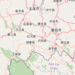
The landscape surrounding Hoàng Liên National Park is home to six ethnic groups, with the Dao and H'mong peoples forming the majority populations in the communes that border and interpenetrate the protected area. These communities have developed deep cultural connections to the mountain environment over generations, with traditional agricultural practices, spiritual beliefs, and material culture closely tied to the seasonal rhythms of the highland landscape. The terraced rice fields characteristic of the valleys below the park represent centuries of adaptation to the mountainous terrain, while higher elevation zones have been used for rotational cultivation and animal husbandry. The cultural landscape surrounding the park includes traditional village architectures, ceremonial practices tied to agricultural cycles, and craft traditions that utilize forest resources in sustainable ways. Sa Pa town, the nearest urban center, has developed as a base for visitors exploring the park and the surrounding highland communities.

Top sights and standout views in Hoàng Liên National Park

Hoàng Liên National Park offers exceptional highlights for nature enthusiasts and conservation-minded visitors. The summit trek to Fansipan, the Indochinese Peninsula's highest peak, provides a challenging but rewarding alpine experience with views spanning the northwest Vietnam mountains and into China. The botanical richness of the trail, which passes through multiple forest types as elevation increases, showcases the park's extraordinary plant diversity including numerous endemic species found nowhere else on Earth. Bird watching opportunities reveal species restricted to the northwest Vietnam highlands, while the butterfly diversity in the lower elevation forests provides color and interest. The cultural dimension of visits, including encounters with Dao and H'mong communities in surrounding villages, adds depth to the wilderness experience.

Best time to visit Hoàng Liên National Park

The optimal period for visiting Hoàng Liên National Park corresponds with the dry season from November through April, when rainfall is reduced and trail conditions are more favorable for trekking to higher elevations. December through February brings cooler temperatures appropriate for mountain exploration but may include cloud and mist accumulation in the higher terrain. March and April offer clearer skies and the bloom of spring flora in the forests. The wet season from May through October brings heavier precipitation that can make trails slippery and reduce visibility, though the landscape becomes increasingly lush and waterfalls reach full flow. Temperature variations between the base and summit are substantial, requiring visitors to prepare for conditions ranging from mild temperatures in the valleys to cool alpine conditions near Fansipan's peak.

Park location guide

Geography guide, regional context, and park location map for Hoàng Liên National Park

Hoàng Liên National Park park geography, regions, and map view in Vietnam
Understand where Hoàng Liên National Park sits in Vietnam through a broader geographic reading of the surrounding landscape, nearby location context, and its mapped position within the national park landscape.

How Hoàng Liên National Park fits into Vietnam

Vietnam, officially the Socialist Republic of Viet Nam, is a unitary communist state in Southeast Asia. It occupies roughly 331,000 square kilometres along the eastern edge of Mainland Southeast Asia, with a population exceeding 102 million. The country is bordered by China to the north, Laos and Cambodia to the west, and has maritime boundaries in the Gulf of Thailand and South China Sea.

Wider geography shaping Hoàng Liên National Park in Vietnam

Vietnam occupies the eastern edge of Mainland Southeast Asia, stretching along the Gulf of Thailand to the southwest and the South China Sea to the east. The country is bordered by China to the north, and Laos and Cambodia to the west. It has a diverse landscape ranging from the Red River Delta in the north to the Mekong Delta in the south.

Map view of Hoàng Liên National Park

Use this park location map to pinpoint Hoàng Liên National Park in Vietnam, understand its exact geographic position, and read its mapped placement within the surrounding landscape more clearly.

Pigeon | © OpenStreetMap contributors

Location context for Hoàng Liên National Park

Lai Châu ProvinceLào Cai Province
Park atlas

Browse an atlas of regional park geography and adjacent protected landscapes surrounding the Hoàng Liên Son mountain range.

Discover Other National Parks and Protected Areas Near Hoàng Liên National Park in Northern Vietnam
After exploring Hoàng Liên National Park, continue your discovery by browsing other national parks and diverse protected areas across the mountainous northern Vietnam region. Compare their unique geographies, trace the spread of conservation landscapes, and understand the broader ecological context of the Indochinese Peninsula's high peaks.
National parkPhú Thọ Province

Xuân Sơn National Park: Protected Mountain Landscape and Regional Geography

Mapping the southeastern edge of the Hoang Lien Mountains.

Delve into the protected landscape of Xuân Sơn National Park, a key national park situated in Phú Thọ Province, Vietnam. This area, covering about 150 square kilometers, is defined by its rugged mountainous terrain, featuring steep forested slopes and distinct ridgelines that contribute to the region's varied topography. As a protected national park, Xuân Sơn plays a crucial role in preserving the natural characteristics of the southeastern Hoang Lien Mountains. Its geographic setting is significant, acting as a transition zone between higher montane environments and the nearby lowland river systems, offering a unique perspective on Vietnam's diverse natural heritage.

Area
150.48 km²
Established
1986
IUCN
II
National parkVĩnh Phúc Province

Tam Dao National Park: Vietnam's Mountain National Park and Biodiversity Hotspot

Explore mapped boundaries and regional landscape context.

Tam Dao National Park is a key protected area in northern Vietnam, defined by its rugged mountain terrain featuring over 20 peaks exceeding 1,000 meters. This national park is a vital habitat for diverse flora and fauna, including numerous endemic species, and showcases transitional forest ecosystems from tropical to montane zones. Understanding Tam Dao National Park involves exploring its geographic setting within Vĩnh Phúc Province and appreciating its role as a significant protected landscape.

Area
368.83 km²
Established
1996
IUCN
II
National parkHanoi

Ba Vì National Park: Ancient Volcanic Mountains and Protected Landscape Near Hanoi

Discover the mapped geography and biodiversity of this national park.

Ba Vì National Park, a protected natural area near Hanoi, showcases a dramatic landscape shaped by ancient volcanic activity. The park features three significant peaks, including Vua Mountain, creating a distinct topographical profile. Spanning over 10,800 hectares, it is recognized for its ecological diversity, harboring a wealth of plant and animal species. This national park serves as a vital protected landscape, offering a unique opportunity for geographic exploration and understanding the natural terrain surrounding the Vietnamese capital.

Area
108.15 km²
Established
1991
IUCN
II
Relief
Mountain
National parkVietnam

Cát Bà National Park: Vietnam's Critically Endangered Species Sanctuary & Karst Landscape

Mapped protected area with diverse terrestrial and marine ecosystems.

As a critical national park in Vietnam, Cát Bà National Park protects a remarkable limestone karst landscape central to the Hạ Long Bay region. This area is renowned for its steep peaks, narrow valleys, and coastal mangrove environments, supporting a uniquely diverse array of flora and fauna. Its status as a protected area highlights its global importance for conservation, particularly as the exclusive habitat of the Cát Bà langur. Explore the mapped geography and ecological significance of this vital Vietnamese protected land.

Area
152 km²
Established
1986
IUCN
II
National parkQuảng Ninh Province

Bái Tử Long National Park: Protected Island Archipelago and Marine Landscape Discovery

Explore the geography and mapped protected boundaries.

Bái Tử Long National Park, located in Vietnam's Quảng Ninh Province, is a protected national park distinguished by its archipelago of approximately 40 limestone islands and significant marine environments. As one of Vietnam's few national parks designated to protect both land and sea, it provides critical atlas-level insights into coastal karst topography, marine biodiversity, and the interconnectedness of island ecosystems. Discover the park's unique geographic features and its role as a vital protected landscape within the broader regional context.

Area
157.83 km²
Established
2001
IUCN
II
National parkPhrae Province

Mae Yom National Park: Protected Mountain Forest and Yom River Geography

Discover its mapped boundaries and natural teak ecosystems.

Mae Yom National Park represents a significant protected landscape in Phrae Province, Thailand, characterized by its mountainous terrain and the prominent Yom River. This national park is particularly noteworthy for its naturally growing teak forests, offering a unique glimpse into indigenous timber ecosystems within a conservation area. The park's geography features steep ridges, tributary streams feeding the main river, and distinct landscapes like the Kaeng Sua Ten rapids, providing a rich atlas context for northern Thailand's protected areas and natural terrain.

Area
455 km²
Established
1986
IUCN
II
National parkThailand

Doi Luang National Park: Northern Thailand's Extensive Mountain Protected Area

Mapped terrain, forest ecosystems, and watershed significance.

Doi Luang National Park is a substantial protected landscape situated in the Phi Pan Nam Range of Northern Thailand, covering extensive mountainous territory. The park's geographic importance is highlighted by its role in protecting critical headwater ecosystems for both the Wang and Lao Rivers, featuring rugged ridgelines and significant natural terrain. Discover the mapped boundaries and conservation value of this expansive national park, integral to Thailand's regional geography and ecological health.

Area
1,169 km²
Established
1990
IUCN
II
National parkChiang Mai Province

Doi Wiang Pha National Park: Protected Mountainous Terrain and Watershed Dynamics in Northern Thailand

Explore the geography of this vital national park's peaks and valleys.

Doi Wiang Pha National Park stands as a significant national park in Chiang Mai Province, renowned for its dramatic mountainous terrain and its crucial function as a watershed. The park's complex system of ridges and valleys, along with its central peak, Doi Wiang Pha, defines its rugged landscape. Its waters feed into the Fang and Mae Lao river systems, highlighting its ecological importance for regional agriculture and communities. Understanding Doi Wiang Pha National Park through its mapped geography reveals a key protected area within northern Thailand's atlas of natural landscapes.

Area
343.37 km²
IUCN
II
Visitors
939 annual
Relief
Mountain

Common questions about visiting, size, designation, and location context for Hoàng Liên National Park

Hoàng Liên National Park FAQs for park facts, access, geography, and protected area context
Find quick answers about Hoàng Liên National Park, including protected-area facts, park geography, trail and visitor context, and how the park fits into its surrounding country and regional landscape.
MoriAtlas Explorer

Continue Your Protected Areas Search Across the Global Atlas

Deepen your exploration by continuing the structured search for national parks and protected areas worldwide. Utilize the comprehensive filtering capabilities to compare different conservation landscapes and refine your understanding of global park geography. Discover more about the distribution and characteristics of protected natural areas.

Global natural geography