Why Doi Wiang Pha National Park stands out
Doi Wiang Pha National Park is best known for its dramatic mountain landscape and role as a vital watershed in northern Thailand. The park's signature feature is Doi Wiang Pha Peak at 1,834 meters, which provides stunning panoramic views and serves as a destination for hikers and nature enthusiasts. The area is notable for its waterfall system, including the three-tier Huai Sai Khao Waterfall and the 18-meter-high Doi Wiang Pha Waterfall. The park's ecological significance derives from its diverse forest ecosystems that transition across elevation zones, supporting both lowland deciduous species and highland evergreen vegetation. The watershed function is particularly important, as the park supplies water to multiple river systems that sustain regional agriculture and communities.
Doi Wiang Pha National Park history and protected-area timeline
Doi Wiang Pha National Park was established as part of Thailand's national park system and is managed by the Department of National Parks, Wildlife and Plant Conservation (DNP). The protected area was designated to preserve the region's significant watershed function and the unique mountain ecosystems found along the provincial boundary between Chiang Mai and Chiang Rai. The establishment reflects Thailand's broader conservation strategy of protecting critical watersheds and mountain forest systems that provide essential ecological services beyond their boundaries. The park's management focuses on maintaining forest cover, protecting water sources, and providing sustainable recreational opportunities for visitors. As part of Thailand's network of protected areas, Doi Wiang Pha contributes to national biodiversity conservation while supporting the ecological integrity of the wider Mae Lao River basin.
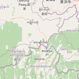
Doi Wiang Pha National Park landscape and geographic character
The landscape of Doi Wiang Pha National Park is characterized by rugged mountainous terrain with a complex system of ridges and valleys oriented in a north-south direction. The park's highest point, Doi Wiang Pha Peak, rises to 1,834 meters above sea level and forms a prominent landmark visible from surrounding areas. The terrain creates dramatic changes in elevation across relatively short distances, with steep slopes and deep valleys defining much of the park's character. The mountain ridges form a natural boundary between Chiang Mai and Chiang Rai provinces, giving the park strategic geographic importance. The park's hydrological system includes numerous streams and tributaries that descend through the valleys, feeding into the Fang River and Mae Lao River systems. These watercourses have carved valleys over time, creating the diverse topography that characterizes the park today.
Doi Wiang Pha National Park ecosystems, habitats, and plant life
Doi Wiang Pha National Park supports an impressive diversity of forest ecosystems that vary with elevation and local climate conditions. At lower elevations, mixed deciduous forest dominates, featuring species such as teak (Tectona grandis), Burma padauk (Pterocarpus macrocarpus), and Lagerstroemia calyculata. As elevation increases, hill evergreen forest becomes established, containing Talauma hodgsonii and the distinctive White Rose rhododendron (Rhododendron veitchianum). Dry evergreen forest occurs in certain areas with champak (Michelia champaca) and dipterocarp species (Dipterocarpus alatus). Pine forest occupies higher elevations, with Benguet pine (Pinus kesiya) and various oak species (Quercus spp.) being common. At the lowest elevations, deciduous dipterocarp forest features Burma sal (Shorea obtusa) and Shorea siamensis. This vertical zonation of forest types creates a mosaic of habitats that supports the park's ecological diversity.
Doi Wiang Pha National Park wildlife and species highlights
The wildlife community of Doi Wiang Pha National Park reflects the diverse habitats created by the park's elevation range and forest types. Mammals inhabiting the park include common muntjac (Muntiacus muntjak), wild boar (Sus scrofa), serow (Capricornis sumatraensis), siamese hare (Lepus peguensis), palm civet (Paradoxurus hermaphroditus), various macaque species (Macaca spp.), porcupines (Hystrix spp.), and squirrels and treeshrews. The bird population includes white-rumped shama (Copsychus malabaricus), red junglefowl (Gallus gallus), scarlet minivet (Pericrocotus flammeus), Asian barbets (Megalaimidae), sunbirds (Nectariniidae), hawks (Accipitridae), doves (Columbidae), and woodpeckers (Picidae). The presence of salamanders and water lizards serves as an indicator of healthy ecosystem function. The combination of deciduous, evergreen, and dipterocarp forests provides diverse food sources and shelter opportunities that support this variety of species.
Doi Wiang Pha National Park conservation status and protection priorities
Doi Wiang Pha National Park plays a significant conservation role in northern Thailand by protecting critical watershed forests that supply water to major river systems serving local communities and agriculture. The park's forest cover helps regulate water flow, reduce erosion, and maintain water quality in the Fang and Mae Lao River basins. The diverse forest ecosystems, ranging from lowland deciduous to highland pine forests, represent important habitat types that support biodiversity conservation. The protected area status helps maintain connectivity between different ecological zones, allowing species to move and adapt to changing conditions. As an IUCN Category II protected area, the park balances conservation objectives with sustainable recreational use, providing opportunities for visitors to experience the natural landscape while maintaining protection for key ecological functions.
Doi Wiang Pha National Park cultural meaning and human context
Doi Wiang Pha National Park is situated in a region with rich cultural heritage, though the park itself focuses primarily on natural values. The area spans the traditional boundary between what are now Chiang Mai and Chiang Rai provinces, both of which have historically been important centers of northern Thai culture and governance. Local communities in the surrounding areas have maintained traditional relationships with the landscape, though the park boundary separates these communities from the protected core area. The park's name derives from local geographic features, with "Doi" meaning mountain in the northern Thai dialect, and "Wiang Pha" likely referring to specific local landmarks or historical features of the area.
Top sights and standout views in Doi Wiang Pha National Park
The highlights of Doi Wiang Pha National Park center on its mountain landscapes, waterfalls, and recreational opportunities. Doi Wiang Pha Peak at 1,834 meters provides the park's most significant viewpoint, attracting hikers seeking panoramic vistas of the surrounding mountains and valleys. The waterfall system includes the accessible three-tier Huai Sai Khao Waterfall just 300 meters from the park office, the 18-meter-high Doi Wiang Pha Waterfall located 8 kilometers from headquarters, and the tranquil Mae Fang Luang Waterfall surrounded by lush forest. The Doi Wiang Pha Viewpoint is popular for sunrise and sunset photography. The cool season from November to February offers the most comfortable conditions for hiking and wildlife observation, while the rainy season brings lush greenery and cascading waterfalls. The park provides camping facilities near headquarters for those wishing to experience the landscape overnight.
Best time to visit Doi Wiang Pha National Park
The best time to visit Doi Wiang Pha National Park is during the cool season from November to February, when temperatures are pleasant and conditions are ideal for hiking, wildlife observation, and sightseeing. This period offers comfortable trekking weather with crisp air and clear views from the mountain viewpoints. The hot season from March to April brings higher temperatures, though the park's high-altitude areas remain cooler and provide a refreshing escape from lowland heat. The rainy season from May to October transforms the landscape with lush greenery and full-flowing waterfalls, though visitors should be prepared for regular rainfall and potentially more challenging trail conditions. The timing of a visit ultimately depends on interests: those prioritizing comfortable hiking and scenic views should choose the cool season, while those who appreciate verdant landscapes and fewer crowds may find the rainy season appealing.