Mori Atlas logo
National parkLan Sang National Park

Discover the tiered waterfalls and mountainous terrain of this national park in northern Thailand.

Lan Sang National Park: Protected Area Atlas and Mapped Landscape in Tak Province

Lan Sang National Park serves as a key protected landscape within Thailand's Tak Province, offering a detailed geographic context for the Dawna Range. This national park, established in 1979, encompasses approximately 104 square kilometers of mountainous terrain, characterized by its prominent series of tiered waterfalls and diverse forest ecosystems. Its accessible location makes it a significant point of reference for understanding the region's protected areas and natural terrain.

WaterfallsMountain ForestsDawna RangeNorthern ThailandTropical RainforestProtected Area

Lan Sang National Park

National park

Park overview

Structured park overview, official facts, and landscape profile for Lan Sang National Park

Lan Sang National Park park facts, protected area profile, and essential visitor context
Review the core facts for Lan Sang National Park, including designation, size, terrain, visitor scale, habitats, and operating context in one park-focused overview.

About Lan Sang National Park

Lan Sang National Park protects a significant portion of the Dawna Range in northwestern Thailand, an area characterized by rugged mountainous terrain and deep valleys. The park's establishment in 1979 marked it as the 15th national park in Thailand, reflecting the country's early efforts to preserve representative natural landscapes. The protected area encompasses multiple distinct forest ecosystems that change with elevation and aspect, ranging from dense rain forests in the lower valleys to coniferous and hill evergreen forests on higher slopes. This ecological diversity supports varied wildlife populations and creates the conditions for the dramatic waterfalls that define the park's character. The park's location along the major Tak-Mae Sot Highway makes it a practical destination for travelers moving between central Thailand and the border regions, while its natural features provide a destination worth dedicated visitation.

Quick facts and research context for Lan Sang National Park

Lan Sang National Park occupies 104 square kilometres (65,000 rai) in the Dawna Range of Tak Province, northwestern Thailand. The park was established in 1979 and is managed by Thailand's Department of National Parks, Wildlife and Plant Conservation. It contains multiple forest types including rain forest, coniferous forest, hill evergreen forest, deciduous dipterocarp forest, and mixed deciduous forest. The park recorded approximately 38,882 visitors in 2019 and features several notable waterfalls accessible via trails through the protected area.

Park context

Deeper park guide and search-rich context for Lan Sang National Park

Lan Sang National Park history, landscape, wildlife, and travel context
Explore Lan Sang National Park through its history, landscape character, ecosystems, wildlife, conservation priorities, cultural context, and seasonal travel timing in a structured park guide built for atlas discovery and search intent.

Why Lan Sang National Park stands out

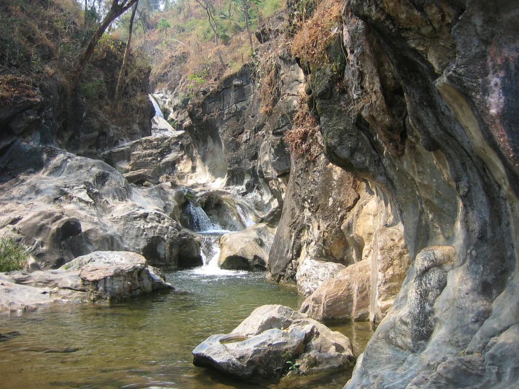
Lan Sang National Park is best known for its series of tiered waterfalls that descend through the mountainous terrain of the Dawna Range. The park contains at least eight named waterfalls including Namtok Pha Lat, Namtok Lan Sang, Namtok Pha Ngoep, and Namtok Tha Le, each with distinctive drop heights and geological formations. The viewpoint at Khao Noi provides sweeping vistas over Tak town, adding a scenic lookout dimension to the park's appeal. The diverse forest types supporting the waterfalls create a lush, tropical environment contrasting with the relatively dry lowland areas surrounding the protected zone.

Lan Sang National Park history and protected-area timeline

Lan Sang National Park was established in 1979, becoming Thailand's 15th national park and part of the country's initial wave of protected area designations during that period. The creation of the park reflected growing awareness in Thailand of the need to preserve mountainous forest ecosystems, particularly in regions like the Dawna Range that serve as watersheds for surrounding lowland agricultural areas. The park was placed under the management of the Royal Thai Government's Department of National Parks, Wildlife and Plant Conservation, which continues to oversee its administration and visitor services. The name Lan Sang derives from Thai language roots with multiple possible interpretations, as the precise original meaning of the name has not been definitively established.

Lan Sang National Park landscape and geographic character

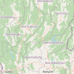
The landscape of Lan Sang National Park consists of mountainous terrain characteristic of the Dawna Range, with steep slopes, rocky ridges, and valleys carved by seasonal watercourses. The terrain features prominent cliff faces and rock formations that create the dramatic drop structures visible in the park's waterfalls. The waterfalls range from broad, split-level cascades like Namtok Pha Lat to narrow, high drops like Namtok Tha Le, which reaches 50 metres in height. The park's highest viewpoint at Khao Noi provides elevation gain for visitors seeking panoramic views across the surrounding Tak Province countryside toward the town of Tak itself. The combination of forested slopes, exposed rock faces, and flowing water creates a landscape of considerable visual variety within the protected area.

Lan Sang National Park ecosystems, habitats, and plant life

The ecological character of Lan Sang National Park reflects the intersection of multiple forest types within a relatively compact mountainous area. The park contains rain forest in the lower elevations where moisture collects in the valleys, transitioning through mixed deciduous forest and deciduous dipterocarp forest on drier slopes, to coniferous forest and hill evergreen forest at higher elevations. This vertical zonation creates diverse habitat conditions within a relatively small area, supporting the range of wildlife species documented in the park. The permanent water flow from the numerous waterfalls and streams provides aquatic habitat even during dry seasons, while the dense vegetation cover offers shelter and foraging grounds for forest-dwelling species.

Lan Sang National Park wildlife and species highlights

Lan Sang National Park is home to several wildlife species typical of northern Thailand's forested mountains. Mammals recorded in the park include common wild pig, barking deer, serow, and civet, representing the park's larger mammal community. The avifauna includes the Black-crested Bulbul among notable bird species. The park also contains the Siamese big-headed turtle, a species of conservation concern that inhabits the aquatic environments created by the park's streams and waterfalls. Flying lizards have also been documented in the park, representing the reptile and amphibian community adapted to the forest canopy. While not a intensively studied wildlife destination, the park provides protected habitat for these species within its forest and aquatic ecosystems.

Lan Sang National Park conservation status and protection priorities

As an IUCN Category II protected area, Lan Sang National Park serves a clear conservation function in protecting a representative sample of the Dawna Range's forest ecosystems. The park's multiple forest types, waterfall systems, and wildlife habitats receive formal protection under Thailand's national park legislation. The protected status helps preserve watershed function in the mountainous terrain, benefiting downstream agricultural areas in Tak Province. The park's location along a major highway also creates opportunities for environmental education, as visitors can observe forest conservation in action while enjoying recreational access to the natural areas.

Lan Sang National Park cultural meaning and human context

The name Lan Sang carries cultural significance even as its precise meaning remains uncertain. The toponymic information documented in official sources presents multiple interpretations of the two component words. The element "lan" can refer to the fan palm tree (Corypha umbraculifera) whose leaves have historically been used for religious texts, or alternatively to open spaces like yards and courtyards. The element "sang" presents more varied interpretations, ranging from references to decay or odor to more ethereal concepts of spirits or mythological creatures. This linguistic complexity reflects the layered cultural history of the region, though definitive translation remains elusive.

Top sights and standout views in Lan Sang National Park

Lan Sang National Park offers visitors a combination of accessible natural features including multiple waterfalls, forest trails, and scenic viewpoints. The tiered waterfall Namtok Pha Lat features a split-level cascade over broad rock formations, while Namtok Tha Le reaches 50 metres in height. The viewpoint at Khao Noi provides panoramic views of Tak town and the surrounding landscape. The diverse forest environments along the trail systems allow visitors to experience the ecological transitions from valley rain forest to higher elevation vegetation types.

Best time to visit Lan Sang National Park

The waterfalls in Lan Sang National Park flow most reliably during the rainy season and cool season, when water volumes are highest and the falls display their most dramatic character. Namtok Pha Ngoep, for example, has water only during rainy and cool seasons. The cool season from November to February typically offers comfortable temperatures for hiking and trail exploration, while the hot season from March to May may limit waterfall flow and increase visitor discomfort on steep trails. The park can be visited year-round, though those seeking optimal waterfall viewing should target the wetter months.

Park location guide

Geography guide, regional context, and park location map for Lan Sang National Park

Lan Sang National Park park geography, regions, and map view in Thailand
Understand where Lan Sang National Park sits in Thailand through a broader geographic reading of the surrounding landscape, nearby location context, and its mapped position within the national park landscape.

How Lan Sang National Park fits into Thailand

Thailand is a Southeast Asian nation formerly called Siam, located in mainland Southeast Asia. It operates as a unitary parliamentary constitutional monarchy under King Vajiralongkorn. The country borders Myanmar, Laos, Cambodia, and Malaysia, with maritime boundaries involving Vietnam, Indonesia, and India. Thailand has a population of nearly 66 million and covers approximately 513,120 km². Historically, the Sukhothai Kingdom marks the beginning of Thai history, followed by the powerful Ayutthaya Kingdom.

Wider geography shaping Lan Sang National Park in Thailand

Thailand occupies mainland Southeast Asia with borders to Myanmar (west/northwest), Laos (east/northeast), Cambodia (southeast), and Malaysia (south). The country has coastline along the Gulf of Thailand to the southeast and the Andaman Sea to the southwest. The territory covers approximately 513,120 km².

Map view of Lan Sang National Park

Use this park location map to pinpoint Lan Sang National Park in Thailand, understand its exact geographic position, and read its mapped placement within the surrounding landscape more clearly.

Pigeon | © OpenStreetMap contributors

Location context for Lan Sang National Park

Tak Province
Park atlas

Compare the diverse protected landscapes, mountain forests, and waterfall regions surrounding Lan Sang National Park in Northern Thailand.

Discover National Parks and Protected Areas Near Lan Sang National Park, Thailand
Continue your exploration of Thailand's protected areas by browsing additional national parks and conservation landscapes situated near Lan Sang National Park, encompassing similar mountainous terrain and unique forest ecosystems. This contextual view allows for geographic comparison, revealing the regional spread of waterfall systems and distinct protected zones within the Dawna Range and adjacent areas.
National parkKamphaeng Phet Province

Khlong Wang Chao National Park: Thailand's Distinct Mountainous Protected Landscape in Kamphaeng Phet

Explore mapped boundaries and terrain of this significant national park.

Khlong Wang Chao National Park is a key protected area in western Thailand, recognized for its impressive mountainous geography within the Thanon Thong Chai Range. Spanning 747 square kilometers, the park features complex ridges, valleys, and Yen Mountain, its highest peak. Its designation as a national park highlights the importance of its dense teak forests and unique central valley formations, offering a rich subject for geographic and landscape exploration.

Area
747 km²
Established
1990
IUCN
II
National parkChiang Mai Province

Op Luang National Park: Dramatic River Canyon and Prehistoric Heritage in Chiang Mai Province

Explore protected landscape boundaries and natural terrain.

Op Luang National Park offers a unique glimpse into Thailand's protected areas, highlighted by its defining feature: the striking Op Luang Canyon. This national park in Chiang Mai Province preserves a dramatic mountain landscape carved by the Mae Chaem River, complemented by impressive waterfalls like Mae Tia and Mae Chon, and intriguing cave systems. The presence of ancient rock paintings adds a layer of prehistoric heritage, making it a significant site for geographic and cultural discovery within northern Thailand's conservation network.

Area
553 km²
Established
1991
IUCN
II
National parkLamphun Province

Doi Khun Tan National Park: Protected Mountain Landscape and Forest Terrain in Lamphun Province

Explore its mapped geography and the Khun Tan Tunnel.

Doi Khun Tan National Park is a protected mountain region in northern Thailand, recognized for its varied terrain and ecological significance. The park's geography includes steep slopes supporting distinct forest types, from lowland deciduous woodlands to upland evergreen forests, all contained within its clearly mapped boundaries. A prominent feature is the historic Khun Tan Tunnel, Thailand's longest railroad tunnel, highlighting the park's unique combination of natural landscapes and historical infrastructure. This national park offers a rich opportunity for atlas exploration of its protected area identity and regional geographic context within Lamphun Province.

Area
255 km²
Established
1975
IUCN
II
Visitors
12.7K annual
National parkMae Hong Son Province

Salawin National Park: Mapped Boundaries and Protected Landscape Geography

Discover its national park status and regional context.

Delve into the geographic specifics of Salawin National Park, a designated national park situated in Mae Hong Son Province, Thailand. This park's mapped boundaries and protected landscape identity are key to understanding its role within the broader regional geography. Explore its natural terrain and discover its atlas significance as a conservation area, offering valuable context for geographic study.

Area
721 km²
Established
1994
IUCN
II
National parkPhitsanulok Province

Namtok Chat Trakan National Park: Protected Mountain Forests and River Headwaters in Phitsanulok Province

Discover mapped geography and unique protected landscape features.

Namtok Chat Trakan National Park protects over 543 square kilometers of mountainous dipterocarp forest within Phitsanulok Province, Thailand. Established in 1987, it is recognized for its role as a vital watershed area, safeguarding the headwaters of the Khwae Noi River system. The park's rugged terrain, dense forests, and prominent waterfalls, including the multi-tiered Chat Trakan cascade, provide a distinct geographic identity. Explore the mapped boundaries and natural landscape of this significant protected area.

Area
543 km²
Established
1987
IUCN
II
National parkChom Thong District

Doi Inthanon National Park: Thailand's Highest National Park and Montane Landscape Explorer

Mapped geography and protected land context in Chom Thong District.

Doi Inthanon National Park, the crown jewel of Thailand's northern highlands, represents an unparalleled opportunity for geographic discovery. As the nation's highest mountain national park, it showcases exceptional vertical zonation of ecosystems, from tropical deciduous forests to rare cloud forests and sphagnum peat bogs. This protected landscape in Chom Thong District is vital for watershed protection and offers critical insights into Thailand's montane biodiversity, making its mapped boundaries and terrain essential for atlas-based exploration.

Area
482 km²
Established
1972
IUCN
II
National parkThailand

Phu Hin Rong Kla National Park: A Protected Mountain Landscape in Northern Thailand

Explore rock formations, waterfalls, and unique historical terrain.

Phu Hin Rong Kla National Park, situated in northern Thailand, is a significant national park known for its dramatic mountainous terrain, including impressive fractured rock formations and numerous multi-tiered waterfalls. This protected area also holds historical importance, having served as a former communist insurgent stronghold. Its rugged landscape is defined by steep ridges, deep valleys, and diverse forest ecosystems, making it a compelling destination for understanding Thailand's natural and historical geography within a mapped context.

Area
307 km²
Established
1984
IUCN
II
National parkPhrae Province

Mae Yom National Park: Protected Mountain Forest and Yom River Geography

Discover its mapped boundaries and natural teak ecosystems.

Mae Yom National Park represents a significant protected landscape in Phrae Province, Thailand, characterized by its mountainous terrain and the prominent Yom River. This national park is particularly noteworthy for its naturally growing teak forests, offering a unique glimpse into indigenous timber ecosystems within a conservation area. The park's geography features steep ridges, tributary streams feeding the main river, and distinct landscapes like the Kaeng Sua Ten rapids, providing a rich atlas context for northern Thailand's protected areas and natural terrain.

Area
455 km²
Established
1986
IUCN
II

Common questions about visiting, size, designation, and location context for Lan Sang National Park

Lan Sang National Park FAQs for park facts, access, geography, and protected area context
Find quick answers about Lan Sang National Park, including protected-area facts, park geography, trail and visitor context, and how the park fits into its surrounding country and regional landscape.
MoriAtlas Explorer

Continue Your Protected Areas Search Across the Global Atlas

Deepen your exploration by continuing the structured search for national parks and protected areas worldwide. Utilize the comprehensive filtering capabilities to compare different conservation landscapes and refine your understanding of global park geography. Discover more about the distribution and characteristics of protected natural areas.

Global natural geography