Why Doi Luang National Park stands out
Doi Luang National Park is best known for its extensive mountainous wilderness in Northern Thailand, characterized by dramatic ridgelines, rugged rock formations, and pristine forest ecosystems within the Phi Pan Nam Range. The park's notable waterfalls, particularly Pu Kaeng waterfall, represent significant scenic attractions within this rugged terrain. The protected area provides habitat for several threatened large mammal species including Asian black bears, sun bears, and Indochinese leopards, making it important for regional biodiversity conservation. The park also protects critical watershed areas that feed major river systems serving downstream agricultural and community needs.
Doi Luang National Park history and protected-area timeline
Doi Luang National Park was officially established on April 16, 1990, representing a consolidation of four previously designated protected areas within the Phi Pan Nam mountain range. This administrative merging reflected a growing understanding in Thai conservation management that large, interconnected protected landscapes provide superior ecological outcomes compared to smaller, fragmented reserves. The formation of the park aligned with Thailand's broader strategy during this period of strengthening national park coverage in ecologically significant mountain regions.
Prior to national park designation, the area had been subject to various forms of protected area status, though precise documentation of these earlier designations is limited in available sources. The Phi Pan Nam Range had long been recognized as an important forest area, with its watershed functions and biodiversity values providing rationale for incremental expansion of protection over time. The park's creation occurred during a period of active national park development in Thailand, as the country sought to establish representative protected area networks covering major ecosystem types.
The governance of the park falls under the Department of National Parks, Wildlife and Plant Conservation, the national agency responsible for Thailand's protected area system. This institutional framework provides management capacity for conservation activities, visitor services, and boundary enforcement within the park. The park's multi-province character has required coordination across Chiang Rai, Lampang, and Phayao Provincial authorities, reflecting the complex administrative landscape of managing extensive protected areas in Thailand.
Doi Luang National Park landscape and geographic character
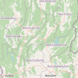
Doi Luang National Park occupies a dramatic landscape within the Phi Pan Nam Range, one of the prominent mountain systems of Northern Thailand. The range runs northwest to southeast through the upper northern region, and the park encompasses portions of its northwestern extent where the terrain attains some of its most rugged character. The park's mountainous terrain features steep ridgelines, deep valleys, and exposed rock formations that create a distinctive scenic character typical of northern Thai highland landscapes.
The park contains several distinct peaks, with Doi Luang in Mae Chai District reaching approximately 1,426 meters above sea level. Notably, a higher peak sharing the same name, Doi Luang of the Phi Pan Nam Range at 1,694 meters, lies approximately 30 kilometers further south within the same mountain chain but falls outside the park's boundaries. This distinction is important for understanding the park's specific topographic character, which while mountainous, does not include the range's highest summit.
The hydrological significance of the park is substantial, as it contains the source regions for both the Wang River and the Lao River. These river systems originate in the highland areas and flow outward to serve extensive downstream regions, making the park's watershed function of considerable importance for regional water resources. The combination of steep terrain, forest cover, and headwater location creates a landscape with significant influence on water quality and flow patterns in surrounding lowland areas.
Doi Luang National Park ecosystems, habitats, and plant life
The forests of Doi Luang National Park represent important examples of Northern Thailand's montane and evergreen forest ecosystems. The park's vegetation includes several notable tree species: Mesua ferrea, a species valued for its durable wood; Hopea odorata, known locally for its aromatic properties; Toona ciliata, a large deciduous tree common in Asian forests; Lagerstroemia tomentosa, an ornamental species with distinctive bark; and Irvingia malayana, a tropical forest tree of the region. These species compose forest communities that vary with elevation and aspect, creating a mosaic of habitat types across the park's mountainous terrain.
The ecological significance of the park extends beyond its forest composition to include its role as a protected area within Thailand's northern highland region. The Phi Pan Nam Range serves as a biogeographic corridor connecting forest ecosystems across regional scales, and protection of this landscape contributes to maintaining connectivity for wildlife populations moving through the mountainous terrain. The park's elevation range supports diverse ecological zones, from valley-bottom communities to montane forest types on higher slopes.
Doi Luang National Park wildlife and species highlights
Doi Luang National Park supports populations of several significant mammal species, reflecting the ecological importance of the Phi Pan Nam Range as a habitat corridor. The Asian black bear and sun bear both occur within the park, representing two of Thailand's larger terrestrial mammals that require extensive forest habitats. The Indochinese leopard, a subspecies of leopard adapted to forested Asian landscapes, also inhabits the park, though like other large carnivores, populations are likely sparse and concentrated in areas with minimal disturbance.
Smaller mammals recorded from the park include muntjac, a common deer species throughout Southeast Asian forests, and bamboo rat, a rodent species associated with dense vegetation. Tree shrews, small mammals with primitive characteristics, also occur in the park's forest environments. Among birds, the blue-winged siva and red-billed blue magpie are noted as notable species within the park's avifauna. These bird species contribute to the park's biodiversity value, though comprehensive inventories of the park's full bird community are not detailed in available sources.
Doi Luang National Park conservation status and protection priorities
Doi Luang National Park contributes to Thailand's protected area network as an IUCN Category II designation, the national park category indicating areas protected for ecosystem conservation and recreation. The park's large area and location within a significant mountain range make it relevant to regional conservation planning, particularly for maintaining connectivity across the forested landscapes of Northern Thailand. The protection of headwater areas for the Wang River and Lao River adds watershed conservation to the park's value, as these water resources support downstream agricultural communities and ecosystems.
The presence of large mammals including bears and leopards indicates the park retains relatively intact habitat conditions, as these species require extensive territories and prefer areas with limited human disturbance. However, pressures from surrounding land uses and development in the broader region present ongoing challenges for maintaining park integrity. Management by the Department of National Parks, Wildlife and Plant Conservation provides institutional capacity for conservation activities, though the multi-province extent of the park creates coordination complexity.
Doi Luang National Park cultural meaning and human context
Doi Luang National Park lies within a region of Northern Thailand with rich cultural heritage, though the available source material focuses primarily on the park's natural features rather than detailed cultural history. The park's three-province extent encompasses areas inhabited by ethnic communities whose traditional relationships with the mountainous landscape predate formal protected area designation. Mountain agriculture, including rotational cultivation and hillside rice farming, has characterized human use of these highlands for generations.
The park's establishment required negotiation between conservation objectives and pre-existing land use patterns, a common challenge in Thailand's highland protected areas. The Phi Pan Nam Range has been subject to various development pressures over recent decades, including infrastructure expansion and agricultural conversion in lower elevations. Understanding the park's cultural context would benefit from additional sources beyond the primary Wikipedia entry, as the available material provides limited detail on human dimensions of this landscape.
Top sights and standout views in Doi Luang National Park
Doi Luang National Park offers visitors access to Northern Thailand's mountainous wilderness with opportunities for forest exploration, wildlife observation, and scenic waterfall viewing. The park's 1,169 square kilometer extent makes it one of the larger protected areas in the region, providing substantial backcountry recreation opportunities. Notable features include the Pu Kaeng waterfall area, which serves as a primary visitor destination, and the network of mountain trails crossing varied terrain. The park's ecological significance is tied to its forest ecosystems, watershed function, and habitat for large mammals including bears and leopards, though wildlife viewing opportunities require patience and appropriate timing. The park's position spanning three provinces makes it accessible from multiple gateway communities, though visitor infrastructure remains modest compared to more developed Thai national parks.
Best time to visit Doi Luang National Park
The optimal period for visiting Doi Luang National Park corresponds to Thailand's cool dry season, typically from November through February, when temperatures are moderate and rainfall is minimal. This season offers the most comfortable conditions for hiking and outdoor activities within the park's mountainous terrain. The hot season from March through May brings higher temperatures that may make extended outdoor activities less pleasant, particularly at midday. The rainy season from June through October brings increased precipitation that can affect trail conditions and access, though the landscape is often at its most lush during this period.