Mori Atlas logo
National parkDeva Vatala National Park

Discover the mapped boundaries and ecological significance of this national park situated in Pakistan's tropical thorn forest region.

Deva Vatala National Park: Pakistan's Unique Protected Landscape in the Lower Himalayas

(Deva-Vatala National Park)

Deva Vatala National Park represents a distinct protected landscape within Pakistan, nestled in the foothills of the Lower Himalayan Range. This national park, spanning approximately 7,000 hectares, is distinguished by its unique tropical thorn forest ecosystem and semiarid climate, a rarity compared to higher-elevation Himalayan protected areas. Its geography features undulating terrain reaching up to 1,101 meters, punctuated by lake systems that enhance its ecological diversity and provide critical habitat. The park's significance lies not only in its unusual habitat interface between Himalayan and plains ecosystems but also as a key conservation area in South Asia.

thorn forestHimalayan foothillsprotected areawetlandswildlife conservationAzad Kashmir

Deva Vatala National Park

National park

Park overview

Structured park overview, official facts, and landscape profile for Deva Vatala National Park

Deva Vatala National Park park facts, protected area profile, and essential visitor context
Review the core facts for Deva Vatala National Park, including designation, size, terrain, visitor scale, habitats, and operating context in one park-focused overview.

About Deva Vatala National Park

Deva Vatala National Park represents a significant conservation area in northern Pakistan, established in 1998 to protect the unique biodiversity of the Bhimber District in Azad Kashmir. The park occupies a strategic position along the Indo-Pak border within the Lower Himalayan foothills, spanning approximately 7,000 hectares of mountainous terrain. Unlike most protected areas in Azad Kashmir, Deva Vatala is characterized by tropical thorn forest rather than the coniferous or alpine vegetation more common at these latitudes. The semiarid climate supports a distinctive vegetation community dominated by acacia species interspersed with evergreen trees and diverse shrub undergrowth. The park's network of lakes provides critical wetland habitat within this generally dry landscape, supporting populations of waterfowl and serving as ecological focal points for the surrounding terrain. This combination of Himalayan mountain setting, thorn forest ecosystem, and wetland areas creates a complex habitat mosaic that supports remarkable species diversity.

Quick facts and research context for Deva Vatala National Park

Deva Vatala National Park is situated in the foothills of the Lower Himalayan Range in Azad Kashmir, covering around 7,000 hectares of tropical thorn forest. The park reaches elevations up to 1,101 meters and features multiple lakes that attract waterfowl. It was formally notified as a national park in 1998, following the region's change of jurisdiction in 1971. The park is distinguished by hosting the only population of Red Junglefowl in Pakistan, alongside species such as Indian leopard, nilgai, and king cobra.

Park context

Deeper park guide and search-rich context for Deva Vatala National Park

Deva Vatala National Park history, landscape, wildlife, and travel context
Explore Deva Vatala National Park through its history, landscape character, ecosystems, wildlife, conservation priorities, cultural context, and seasonal travel timing in a structured park guide built for atlas discovery and search intent.

Why Deva Vatala National Park stands out

Deva Vatala National Park is best known for protecting the only population of Red Junglefowl in Pakistan, a species of significant conservation importance on the subcontinent. The park is also notable for its location within the Lower Himalayan Range combined with tropical thorn forest habitat, creating an unusual ecological interface between Himalayan and plains ecosystems. Its diverse wildlife includes predators such as Indian leopard and king cobra, alongside large herbivores like nilgai and hog deer. The presence of several lakes within the park makes it an important habitat for migratory waterfowl.

Deva Vatala National Park history and protected-area timeline

Deva Vatala National Park was officially notified in 1998, becoming one of the later-established protected areas in Pakistan's national park system. The park covers an area of approximately 7,000 hectares, corresponding to roughly 29 square kilometers of protected terrain in the Bhimber District. Prior to 1971, the territory comprising the park was part of India; the region became part of Pakistan following the Indo-Pakistani War of 1971 and the subsequent territorial adjustments. The establishment of Deva Vatala as a national park reflected growing recognition of the region's ecological significance and the need to protect its distinctive thorn forest ecosystem and wildlife populations. As one of the few protected areas in Azad Kashmir located within a thorn forest habitat, the park represents a conservation priority for this ecological community type.

Deva Vatala National Park landscape and geographic character

Deva Vatala National Park occupies hilly terrain within the foothills of the Lower Himalayan Range, with elevations reaching 1,101 meters above sea level. The landscape is characterized by undulating topography typical of Himalayan foothills transition zones, interspersed with valley bottoms and the lake systems that punctuate the terrain. The underlying geology supports the tropical thorn forest vegetation that defines the park's character, distinguishing it from higher-elevation Himalayan protected areas dominated by coniferous forests. The semiarid climate of the region influences the park's appearance, with vegetation adapted to seasonal moisture variations and extended dry periods. The lakes scattered throughout the park provide scenic focal points and ecological diversity within the broader dry forest matrix, creating a heterogeneous landscape of forest, shrubland, and wetland habitats.

Deva Vatala National Park ecosystems, habitats, and plant life

The nature of Deva Vatala National Park is defined by its tropical thorn forest ecosystem, a vegetation type more commonly associated with plains and lowland areas than with Himalayan foothill zones. The forest is dominated by acacia species, with numerous evergreen trees providing canopy structure and diverse shrub growth forming the understory layer. This vegetation community exists within a semiarid climate regime that shapes both plant community composition and the overall character of the landscape. The park's lakes represent critical ecological features within this forest matrix, providing water resources that support greater biological productivity and attract diverse wildlife. The combination of dry forest, wetland, and hillside habitats creates a complex ecological system that supports species from multiple habitat requirements.

Deva Vatala National Park wildlife and species highlights

Deva Vatala National Park supports a remarkable diversity of wildlife across multiple taxa. The park is particularly significant as the only location in Pakistan where Red Junglefowl occurs, representing a population of major conservation importance. Mammalian fauna includes Indian leopard as the apex predator, alongside golden jackal, Indian grey mongoose, small Indian civet, wild boar, nilgai, hog deer, Cape hare, and Indian porcupine. The avifauna is diverse, with Indian peafowl, black francolin, grey francolin, mallard, northern shoveler, and Eurasian coot among the notable species. Reptiles include Indian python, king cobra, and Bengal monitor, representing significantreptile diversity. The lakes attract waterfowl and provide important habitat for both resident and migratory bird species.

Deva Vatala National Park conservation status and protection priorities

Deva Vatala National Park serves as an important conservation area for multiple reasons. The park protects the only population of Red Junglefowl in Pakistan, a species whose conservation status makes its protection nationally significant. The thorn forest ecosystem, while not as globally threatened as some other forest types, is underrepresented in Pakistan's protected area network, making Deva Vatala's representation of this habitat type valuable. The presence of Indian leopard and king cobra indicates a functioning predator-prey system and ecological integrity. The lakes provide critical wetland habitat in a region where such habitats are limited, supporting waterfowl populations and contributing to broader biodiversity conservation in the Himalayan foothills region.

Deva Vatala National Park cultural meaning and human context

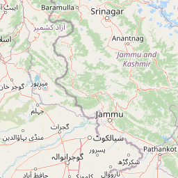
Deva Vatala National Park is located in Bhimber District of Azad Kashmir, a region with its own distinct cultural identity within the broader Kashmir territory. The park lies close to the border with India and adjacent to Gujrat District, positioning it within a landscape of historical and contemporary significance. Prior to 1971, this territory was under Indian administration, and the region's political history continues to shape its contemporary context. The local communities in the surrounding area maintain connections to the land that now falls within the park boundary, though detailed information about specific cultural or indigenous interactions with the landscape is limited in available sources.

Top sights and standout views in Deva Vatala National Park

Deva Vatala National Park's standout features include its unique status as Pakistan's only Red Junglefowl habitat, its location within the Lower Himalayan Range featuring tropical thorn forest, and the presence of significant predators including Indian leopard and king cobra. The park's lake system provides wetland habitat within a predominantly dry forest landscape, supporting waterfowl and adding ecological diversity. The combination of Himalayan mountain setting with thorn forest vegetation creates an unusual habitat interface. The semiarid climate and acacia-dominated forest differ markedly from typical Himalayan protected areas, offering a distinctive conservation profile.

Best time to visit Deva Vatala National Park

The best time to visit Deva Vatala National Park would likely be during the cooler winter months from October through March, when temperatures are more comfortable for outdoor exploration. The semiarid climate means that the summer months can be quite warm, potentially making wildlife viewing and hiking less pleasant. Winter provides clearer skies and more comfortable conditions for exploring the park's trails and observing wildlife around the lakes. The post-monsoon period in autumn may also offer favorable conditions with landscapes remaining green from seasonal rains.

Park location guide

Geography guide, regional context, and park location map for Deva Vatala National Park

Deva Vatala National Park park geography, regions, and map view in Pakistan
Understand where Deva Vatala National Park sits in Pakistan through a broader geographic reading of the surrounding landscape, nearby location context, and its mapped position within the national park landscape.

How Deva Vatala National Park fits into Pakistan

Pakistan, officially the Islamic Republic of Pakistan, is a federal parliamentary Islamic republic in South Asia. It is the fifth-most populous country and the 33rd-largest by area. The country gained independence from British India in 1947 and has a diverse history spanning ancient civilizations including Mehrgarh and the Indus Valley Civilisation. Pakistan shares maritime borders with Oman and is bounded by the Arabian Sea, Gulf of Oman, and several neighboring countries.

Wider geography shaping Deva Vatala National Park in Pakistan

Pakistan is located in South Asia, bordered by the Arabian Sea to the south, the Gulf of Oman to the southwest, and shares land borders with India to the east, Afghanistan to the west, Iran to the southwest, and China to the northeast. The country also shares a maritime border with Oman in the Gulf of Oman. The Wakhan Corridor in Afghanistan separates Pakistan from Tajikistan in the northwest.

Map view of Deva Vatala National Park

Use this park location map to pinpoint Deva Vatala National Park in Pakistan, understand its exact geographic position, and read its mapped placement within the surrounding landscape more clearly.

Pigeon | © OpenStreetMap contributors

Location context for Deva Vatala National Park

Azad Kashmir
Park atlas

Compare park geography across the Lower Himalayan Range and adjacent tropical thorn forest ecosystems.

Explore Other National Parks and Protected Areas Surrounding Deva Vatala National Park
Browse national parks and protected areas geographically close to Deva Vatala National Park, exploring the diverse Lower Himalayan Range terrain and tropical thorn forest ecosystems. Compare these conservation landscapes to understand regional variations in protected habitats, offering valuable insights into South Asian park geography.
National parkPunjab

Pabbi and Rasul Reserve Forest National Park: Punjab's Protected Landscape and Regional Geography

Subtropical thorn scrub, undulating hills, and wetland habitats.

Pabbi and Rasul Reserve Forest National Park, situated in Punjab, Pakistan, is a significant protected area renowned for its subtropical thorn scrub vegetation and its role in conserving the Pothohar Plateau's biodiversity. The park's landscape features a diverse mosaic of undulating hills, scrub-covered ridges, grasslands, and wetlands, situated within the dry tropical environments characteristic of northern Punjab. Its recent designation as a national park highlights its importance for regional conservation efforts, offering a unique glimpse into the mapped geography and protected natural landscapes of the region.

Area
147.2 km²
Established
2023
IUCN
II
National parkAzad Jammu and Kashmir

Pir Lasura National Park: Pakistan National Park with Subtropical Pine Forest Landscape

Explore the mapped boundaries and geography of this unique Azad Jammu and Kashmir protected area.

Pir Lasura National Park in Azad Jammu and Kashmir, Pakistan, is a critical national park encompassing approximately 15.8 square kilometers of subtropical chir pine forest and scrub vegetation. Located in the Pir Lasura mountain range, it features a varied terrain with elevations ranging from 1,000 to 2,000 meters, contributing to its unique ecosystem at the transitional zone between major geographic regions. This page offers a detailed atlas-style exploration of the park's mapped features, its importance as a protected landscape, and its role in supporting diverse wildlife including significant vulture roosting sites and common leopard habitats.

Area
15.8 km²
Established
2005
IUCN
II
National parkAzad Jammu and Kashmir

Poonch River Mahaseer National Park: Pakistan's First Riverine Conservation Area

Mapped aquatic landscape and freshwater biodiversity in Azad Jammu and Kashmir.

Poonch River Mahaseer National Park is a significant aquatic protected area established in 2010, renowned for being Pakistan's first dedicated riverine conservation zone. Situated along the Poonch River in Azad Jammu and Kashmir, it spans approximately 22.5 square kilometers, encompassing the main river channel and key tributary nullahs crucial for breeding. The park's primary objective is to protect the endangered golden mahseer and the broader freshwater ecosystem, serving as a vital model for river-based conservation and mapped biodiversity stewardship in the region.

Area
22.5 km²
Established
2010
IUCN
II
National parkJhelum District

Tilla Reserve National Park: Mapped Protected Landscape and Dry Forest Ecosystem

Explore the geography and ancient heritage of this Salt Range national park.

Tilla Reserve National Park is a protected area recognized for its significant dry subtropical forest ecosystems and rich cultural history within Pakistan's Salt Range. Situated in Jhelum District, the park's landscape is characterized by steep, rocky ridges and ancient geological formations. Discover its unique mapped terrain, the distribution of its remnant forest habitats, and its importance as a protected natural and spiritual site.

Area
40.6 km²
Established
2021
IUCN
II
National parkAzad Kashmir

Panjal Mastan National Park: High-Altitude Plateau Landscape in Azad Kashmir

Discover mapped terrain and protected area geography.

Panjal Mastan National Park represents a significant protected landscape within the Pir Panjal mountain range of Azad Kashmir, Pakistan. This national park is characterized by its expansive high-altitude plateau, sitting at an average elevation of 2,800 meters, offering a unique regional geography. Known for its dramatic mountainous surroundings and seasonal wildflower meadows that bloom in spring, the park provides valuable context for understanding the natural terrain and protected area distribution in this part of the western Himalayas.

Area
300 km²
IUCN
II
National parkKhyber Pakhtunkhwa

Ayubia National Park: Protected Area Identity and Mountainous Terrain

Discover its mapped geography within Khyber Pakhtunkhwa

Ayubia National Park stands as a key protected landscape within the Himalayan foothills of Khyber Pakhtunkhwa, Pakistan. Its designation as a national park signifies its role in conserving unique temperate coniferous and mixed forests across steep mountainous terrain. This page details the park's geographic setting, its mapped boundaries, and the natural features that define its protected status, offering a structured view for atlas-driven exploration of Pakistan's natural heritage.

Area
33.12 km²
Established
1984
IUCN
V
National parkPunjab

Kheri Murat National Park: Protected Scrub Forest and Wildlife Conservation in Punjab

Explore the mapped terrain and protected landscape context.

Discover Kheri Murat National Park, a recent national park designation located in Punjab, Pakistan, situated on the rolling hills of the Kala Chitta Range. This protected area features a distinct subtropical thorn scrub forest ecosystem, providing essential habitat for wildlife, including the Punjab urial, and serving as a critical site for bird conservation. Its unique landscape offers valuable insights into regional geography and the preservation of natural wilderness within a predominantly agricultural province, making it a noteworthy entity for atlas exploration.

Area
35.37 km²
Established
2020
IUCN
II
National parkIslamabad Capital Territory

Margalla Hills National Park: Pakistan's Gateway to Himalayan Foothills Geography

Mapped protected landscape with rich Sino-Himalayan biodiversity.

Margalla Hills National Park, situated in the Islamabad Capital Territory, serves as Pakistan's most accessible national park and a vital entry point to the Himalayan foothills. This protected landscape is defined by its rugged mountain terrain, ranging from lower scrublands to higher pine and oak woodlands, with elevations up to 1,604 meters. The park's geological significance, with ancient marine fossil formations, adds a unique dimension to its natural identity. Discover the mapped boundaries and ecological richness that characterize this important protected area, offering insights into regional geography and diverse habitats.

Area
173.86 km²
Established
1980
IUCN
V

Common questions about visiting, size, designation, and location context for Deva Vatala National Park

Deva Vatala National Park FAQs for park facts, access, geography, and protected area context
Find quick answers about Deva Vatala National Park, including protected-area facts, park geography, trail and visitor context, and how the park fits into its surrounding country and regional landscape.
MoriAtlas Explorer

Continue Your Protected Areas Search Across the Global Atlas

Deepen your exploration by continuing the structured search for national parks and protected areas worldwide. Utilize the comprehensive filtering capabilities to compare different conservation landscapes and refine your understanding of global park geography. Discover more about the distribution and characteristics of protected natural areas.

Global natural geography