Mori Atlas logo
National parkTilla Reserve National Park

Discover the mapped boundaries and arid forest geography of this unique national park.

Tilla Reserve National Park: A Protected Landscape in Pakistan's Salt Range

Tilla Reserve National Park, established in 2021 within Pakistan's Jhelum District, represents a vital protected area in the Salt Range. This national park preserves a unique dry subtropical forest ecosystem across steep ridges and rocky terrain, significant for its ancient cultural heritage and ecological remnant status. Explore the park's geography, landscape context, and its role within Pakistan's conservation network through detailed mapping and regional information.

dry subtropical forestSalt Rangemountain ridgesancient monasterypilgrimage sitePakistan protected area

Tilla Reserve National Park

National park

Park overview

Structured park overview, official facts, and landscape profile for Tilla Reserve National Park

Tilla Reserve National Park park facts, protected area profile, and essential visitor context
Review the core facts for Tilla Reserve National Park, including designation, size, terrain, visitor scale, habitats, and operating context in one park-focused overview.

About Tilla Reserve National Park

Tilla Reserve National Park represents a significant addition to Pakistan's protected area network, established in 2021 under the Protected Areas Initiative launched by the Government of Pakistan. The park occupies a distinctive position in the eastern Salt Range near Pind Dadan Khan, encompassing the historic Tilla Jogian ridge and adjoining forest reserves that preserve one of the oldest forest ecosystems in the Salt Range region. The landscape is characterized by steep, rocky ridges rising from approximately 570 meters to over 975 meters at Tilla Jogian, the highest point of the entire Salt Range. These Precambrian rock formations create a dramatic backdrop of exposed cliffs and forested slopes that contrast sharply with the surrounding agricultural plains of Punjab. The park is bounded to the east by the Jhelum River and to the west by Khewra Gorge, placing it at a strategic ecological crossroads between the river valley and the mountainous terrain. Beyond its natural values, the park encompasses an ancient hilltop monastery complex that has drawn pilgrims for centuries, representing a living cultural landscape where natural and heritage values interweave intimately.

Quick facts and research context for Tilla Reserve National Park

Tilla Reserve National Park spans roughly 40.6 square kilometers in the eastern Salt Range near Pind Dadan Khan, Jhelum District, Punjab Province, Pakistan. Established in June 2021 through notification under the Punjab Wildlife (Protection, Preservation, Conservation and Management) Act, 1974, the park protects a critical corridor of dry subtropical forest amidst an otherwise heavily utilized agricultural landscape. The park's elevation ranges from approximately 570 meters in the foothills to over 975 meters at Tilla Jogian, making it the highest point in the Salt Range. The park lies bounded by the Jhelum River to the east and Khewra Gorge to the west, creating a distinct ecological and geological setting characterized by Precambrian rock formations and steep ridgelines.

Park context

Deeper park guide and search-rich context for Tilla Reserve National Park

Tilla Reserve National Park history, landscape, wildlife, and travel context
Explore Tilla Reserve National Park through its history, landscape character, ecosystems, wildlife, conservation priorities, cultural context, and seasonal travel timing in a structured park guide built for atlas discovery and search intent.

Why Tilla Reserve National Park stands out

Tilla Reserve National Park is best known for two intertwined legacies. The first is its ecological character as a remnant dry subtropical forest in the Salt Range, supporting vegetation communities dominated by Acacia modesa (phulai), Olea ferruginea (wild olive), and Dodonaea viscosa amid rocky, arid soils. The second is its extraordinary cultural heritage: the Tilla Jogian ridge preserves the ruins of a centuries-old monastic complex that served as a major pilgrimage center for the Nath tradition of Hindu ascetics. Historical accounts note that Guru Nanak visited this site during his travels, adding to its significance in Sikh tradition as well. The coexistence of ancient forest ecosystem and archaeological heritage makes this park uniquely significant within Pakistan's protected area network.

Tilla Reserve National Park history and protected-area timeline

The formal establishment of Tilla Reserve National Park occurred in June 2021 through Notification No. 77 of 2021, issued under the Punjab Wildlife (Protection, Preservation, Conservation and Management) Act, 1974. This designation emerged from Pakistan's broader Protected Areas Initiative, a government program aimed at expanding the nation's network of protected areas. However, the cultural history of Tilla Jogian stretches far deeper than its recent national park status. The hilltop monastery complex represents a centuries-old pilgrimage site associated with the Nath tradition of Hindu ascetics, who established meditation caves and spiritual retreats across the ridge. Historical records indicate that Guru Nanak, the founder of Sikhism, visited Tilla Jogian during his extensive travels across the Indian subcontinent, lending the site particular significance in multiple religious traditions. The ruins of monasteries, ponds, and associated structures visible across the ridge today testify to centuries of continuous spiritual use. The forest reserves adjoining the ridge were managed by the Punjab Forest Department prior to national park designation, and their inclusion within the protected area framework ensures the preservation of both cultural and ecological heritage under unified management.

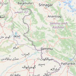
Tilla Reserve National Park landscape and geographic character

The landscape of Tilla Reserve National Park is defined by the dramatic topography of the Salt Range, a series of low mountains and steep ridges that rise abruptly from the Punjab plains. The park encompasses the Tilla Jogian ridge, which reaches elevations exceeding 975 meters and constitutes the highest point in the Salt Range. The terrain is characterized by steep, rocky ridges separated by narrow valleys, with exposed Precambrian rock formations creating a rugged and visually striking environment. The underlying geology dates to ancient Precambrian times, among the oldest rock formations in the region. Dry subtropical forest covers the slopes, with vegetation concentrated in the valleys and on north-facing aspects where moisture conditions are slightly more favorable. The park's boundaries are naturally defined by the Jhelum River to the east, which flows through a broad valley immediately adjacent to the park's foothills, and by Khewra Gorge to the west, where the Salt Range's characteristic salt formations create a distinctive geological landscape. The combination of elevation, rocky terrain, and forest cover creates a habitat that contrasts sharply with the intensively cultivated surrounding plains.

Tilla Reserve National Park ecosystems, habitats, and plant life

The park is situated within the Pabbi Hills-Salt Range dry subtropical forest belt, an ecological region characterized by limited rainfall and vegetation adapted to arid and semi-arid conditions. The dominant tree species include Acacia modesta, locally known as phulai, which forms the primary forest canopy, accompanied by Olea ferruginea (wild olive), Dodonaea viscosa (sanatha), and Ziziphus nummularia. These species are well-adapted to the rocky, nutrient-poor soils and seasonal water limitations that characterize the Salt Range environment. The forest structure is best described as open woodland or scrub forest, with scattered trees and an understory of grasses and shrubs adapted to dry conditions. The park represents one of the few remaining intact examples of this forest type in the Salt Range, as much of the original forest cover has been degraded by overgrazing, fuelwood extraction, and agricultural expansion. The ecological significance of preserving this remnant forest ecosystem was a key driver behind the national park designation.

Tilla Reserve National Park wildlife and species highlights

Tilla Reserve National Park provides habitat for wildlife characteristic of Pakistan's northern arid zone. The mammal community includes the Indian pangolin, a critically important species due to its endangered status from poaching for scales, as well as the Asiatic jackal, Indian crested porcupine, Indian hare, and wild boar. Several small carnivore species and reptiles are also present in the area. The bird community features resident species such as the grey francolin and black partridge, which are commonly found in the rocky, scrub-covered terrain, while the blue rock pigeon inhabits the cliff faces and rocky outcrops. During winter months, migratory raptors pass through the area, taking advantage of the open terrain and prey availability. The Salt Range cliffs within and adjacent to the park also support colonies of bats and nesting raptors, adding to the area's biodiversity significance. The park thus serves as an important refuge for species that have lost habitat elsewhere in the increasingly agricultural Punjab plains.

Tilla Reserve National Park conservation status and protection priorities

The designation of Tilla Reserve National Park serves multiple conservation objectives within Pakistan's environmental framework. The park protects a unique remnant of the Salt Range's dry forest ecosystem, a habitat type that has become increasingly threatened by overgrazing, fuelwood extraction, and agricultural encroachment. By preserving this forest corridor, the park contributes to maintaining ecological connectivity in a landscape where natural habitats have been heavily fragmented. The national park status also supports Pakistan's commitments under the Billion Tree Tsunami programme, a major reforestation and restoration initiative. Additionally, the park's inclusion in the Protected Areas Initiative represents the federal and provincial government's strategy to expand the national protected area network. Management responsibilities fall to the Punjab Wildlife and Parks Department, which conducts anti-poaching patrols, conservation activities, and community outreach programs, often in collaboration with the IUCN and local forest divisions. The dual natural and cultural heritage values of the site have also prompted attention from heritage conservation perspectives.

Tilla Reserve National Park cultural meaning and human context

The cultural significance of Tilla Reserve National Park extends far beyond its ecological values, centered on the ancient hilltop monastery complex of Tilla Jogian. This site has served as a major pilgrimage center for centuries, associated with the Nath tradition of Hindu ascetics who established spiritual retreats and meditation caves throughout the ridge. The ruins of monasteries and sacred ponds remain visible across the hilltop, creating a cultural landscape of considerable archaeological and religious importance. Historical accounts record that Guru Nanak, the founder of Sikhism, visited Tilla Jogian during his travels through the region, adding a dimension of Sikh heritage to the site's significance. The hill's inclusion within the national park framework ensures that both natural ecosystems and cultural heritage are afforded protection, recognizing that these values are inseparable in this landscape. Local communities maintain connections to the site through continued pilgrimage and traditional use, though the intensity of religious activity has diminished from historical peaks.

Top sights and standout views in Tilla Reserve National Park

Tilla Reserve National Park stands out as one of the most culturally and ecologically significant protected areas in the Salt Range, combining ancient spiritual heritage with threatened forest ecosystems. The Tilla Jogian ridge offers both natural and historical exploration opportunities, with its panoramic views, ancient monastery ruins, and century-old pilgrimage pathways. The park preserves one of the last intact examples of dry subtropical forest in the Salt Range, providing crucial habitat for species including the Indian pangolin and supporting birdlife such as francolins, partridges, and seasonal raptors. The establishment of this national park in 2021 represents a recent but important expansion of Pakistan's protected area network, contributing to both national conservation targets and local ecological restoration efforts. The site's dual significance as both a natural refuge and cultural heritage landscape makes it unique among Pakistan's national parks.

Best time to visit Tilla Reserve National Park

The best time to visit Tilla Reserve National Park is during the cooler months from October through March, when temperatures are more comfortable for hiking and outdoor exploration. Winter months offer pleasant daytime temperatures and clear skies, making them ideal for exploring the ridge trails and appreciating the panoramic views from Tilla Jogian. The summer months from May through September can bring intense heat that makes outdoor activity difficult and reduces the appeal of the forest trails. The post-monsoon period in late summer and early autumn can also offer good conditions, though rainfall patterns in the Salt Range are unpredictable. Visitors interested in wildlife viewing may find the dry season more productive, as animals are more likely to congregate around water sources. Those interested in the cultural heritage of the site may prefer to visit during pilgrimage seasons, though the monastery complex is now largely in ruins and accessible year-round.

Park location guide

Geography guide, regional context, and park location map for Tilla Reserve National Park

Tilla Reserve National Park park geography, regions, and map view in Pakistan
Understand where Tilla Reserve National Park sits in Pakistan through a broader geographic reading of the surrounding landscape, nearby location context, and its mapped position within the national park landscape.

How Tilla Reserve National Park fits into Pakistan

Pakistan, officially the Islamic Republic of Pakistan, is a federal parliamentary Islamic republic in South Asia. It is the fifth-most populous country and the 33rd-largest by area. The country gained independence from British India in 1947 and has a diverse history spanning ancient civilizations including Mehrgarh and the Indus Valley Civilisation. Pakistan shares maritime borders with Oman and is bounded by the Arabian Sea, Gulf of Oman, and several neighboring countries.

Wider geography shaping Tilla Reserve National Park in Pakistan

Pakistan is located in South Asia, bordered by the Arabian Sea to the south, the Gulf of Oman to the southwest, and shares land borders with India to the east, Afghanistan to the west, Iran to the southwest, and China to the northeast. The country also shares a maritime border with Oman in the Gulf of Oman. The Wakhan Corridor in Afghanistan separates Pakistan from Tajikistan in the northwest.

Map view of Tilla Reserve National Park

Use this park location map to pinpoint Tilla Reserve National Park in Pakistan, understand its exact geographic position, and read its mapped placement within the surrounding landscape more clearly.

Pigeon | © OpenStreetMap contributors

Location context for Tilla Reserve National Park

Jhelum DistrictPunjab
Park atlas

Trace the geographic spread of protected landscapes across Pakistan's Salt Range, comparing nearby park ecosystems and cultural heritage sites.

Discover Other National Parks and Protected Areas in Pakistan's Salt Range, Continuing Your Exploration Beyond Tilla Reserve National Park
Browse a selection of national parks and protected areas within Pakistan's Salt Range, offering geographic and ecological comparisons to Tilla Reserve National Park. Expanding your exploration beyond Tilla Reserve National Park offers valuable regional context for protected land management and enables comparative study of distinct dry forest ecosystems and cultural heritage.
National parkPunjab

Pabbi and Rasul Reserve Forest National Park: Punjab's Protected Landscape and Regional Geography

Subtropical thorn scrub, undulating hills, and wetland habitats.

Pabbi and Rasul Reserve Forest National Park, situated in Punjab, Pakistan, is a significant protected area renowned for its subtropical thorn scrub vegetation and its role in conserving the Pothohar Plateau's biodiversity. The park's landscape features a diverse mosaic of undulating hills, scrub-covered ridges, grasslands, and wetlands, situated within the dry tropical environments characteristic of northern Punjab. Its recent designation as a national park highlights its importance for regional conservation efforts, offering a unique glimpse into the mapped geography and protected natural landscapes of the region.

Area
147.2 km²
Established
2023
IUCN
II
National parkPunjab

Chinji National Park: National Park Atlas, Salt Range Geography, and Protected Landscape

Discover the unique eroded terrain and semi-arid ecosystems of Punjab, Pakistan.

Chinji National Park is a protected national park located in the Punjab province of Pakistan, specifically within the historic Salt Range. This park is characterized by its deeply eroded terrain, composed of sandstone and igneous rock formations, shaped by seasonal streams that lead towards the Soan River. As a key example of a semi-arid mountain ecosystem within the Baluchistan xeric woodlands ecoregion, Chinji National Park offers significant insights into the geological heritage and unique biodiversity of central Pakistan.

Area
60.95 km²
Established
1987
IUCN
II
National parkPunjab

Kheri Murat National Park: Protected Scrub Forest and Wildlife Conservation in Punjab

Explore the mapped terrain and protected landscape context.

Discover Kheri Murat National Park, a recent national park designation located in Punjab, Pakistan, situated on the rolling hills of the Kala Chitta Range. This protected area features a distinct subtropical thorn scrub forest ecosystem, providing essential habitat for wildlife, including the Punjab urial, and serving as a critical site for bird conservation. Its unique landscape offers valuable insights into regional geography and the preservation of natural wilderness within a predominantly agricultural province, making it a noteworthy entity for atlas exploration.

Area
35.37 km²
Established
2020
IUCN
II
National parkAzad Jammu and Kashmir

Pir Lasura National Park: Pakistan National Park with Subtropical Pine Forest Landscape

Explore the mapped boundaries and geography of this unique Azad Jammu and Kashmir protected area.

Pir Lasura National Park in Azad Jammu and Kashmir, Pakistan, is a critical national park encompassing approximately 15.8 square kilometers of subtropical chir pine forest and scrub vegetation. Located in the Pir Lasura mountain range, it features a varied terrain with elevations ranging from 1,000 to 2,000 meters, contributing to its unique ecosystem at the transitional zone between major geographic regions. This page offers a detailed atlas-style exploration of the park's mapped features, its importance as a protected landscape, and its role in supporting diverse wildlife including significant vulture roosting sites and common leopard habitats.

Area
15.8 km²
Established
2005
IUCN
II
National parkIslamabad Capital Territory

Margalla Hills National Park: Pakistan's Gateway to Himalayan Foothills Geography

Mapped protected landscape with rich Sino-Himalayan biodiversity.

Margalla Hills National Park, situated in the Islamabad Capital Territory, serves as Pakistan's most accessible national park and a vital entry point to the Himalayan foothills. This protected landscape is defined by its rugged mountain terrain, ranging from lower scrublands to higher pine and oak woodlands, with elevations up to 1,604 meters. The park's geological significance, with ancient marine fossil formations, adds a unique dimension to its natural identity. Discover the mapped boundaries and ecological richness that characterize this important protected area, offering insights into regional geography and diverse habitats.

Area
173.86 km²
Established
1980
IUCN
V
National parkPakistan

Deva Vatala National Park: Pakistan's Protected Tropical Thorn Forest Landscape

Explore mapped boundaries and regional geography within the Lower Himalayan foothills.

Deva Vatala National Park is a significant protected area located in Pakistan's Lower Himalayan Range, notable for its unique tropical thorn forest ecosystem. Occupying hilly terrain with elevations up to 1,101 meters, the park's landscape is defined by semiarid conditions and acacia-dominated vegetation, creating an unusual ecological interface. Its mapped boundaries encompass lake systems and diverse habitats, making it a critical conservation site within South Asia, distinct from typical Himalayan protected areas.

Area
70 km²
Established
1998
IUCN
II
National parkAzad Jammu and Kashmir

Poonch River Mahaseer National Park: Pakistan's First Riverine Conservation Area

Mapped aquatic landscape and freshwater biodiversity in Azad Jammu and Kashmir.

Poonch River Mahaseer National Park is a significant aquatic protected area established in 2010, renowned for being Pakistan's first dedicated riverine conservation zone. Situated along the Poonch River in Azad Jammu and Kashmir, it spans approximately 22.5 square kilometers, encompassing the main river channel and key tributary nullahs crucial for breeding. The park's primary objective is to protect the endangered golden mahseer and the broader freshwater ecosystem, serving as a vital model for river-based conservation and mapped biodiversity stewardship in the region.

Area
22.5 km²
Established
2010
IUCN
II
National parkKhyber Pakhtunkhwa

Ayubia National Park: Protected Area Identity and Mountainous Terrain

Discover its mapped geography within Khyber Pakhtunkhwa

Ayubia National Park stands as a key protected landscape within the Himalayan foothills of Khyber Pakhtunkhwa, Pakistan. Its designation as a national park signifies its role in conserving unique temperate coniferous and mixed forests across steep mountainous terrain. This page details the park's geographic setting, its mapped boundaries, and the natural features that define its protected status, offering a structured view for atlas-driven exploration of Pakistan's natural heritage.

Area
33.12 km²
Established
1984
IUCN
V

Common questions about visiting, size, designation, and location context for Tilla Reserve National Park

Tilla Reserve National Park FAQs for park facts, access, geography, and protected area context
Find quick answers about Tilla Reserve National Park, including protected-area facts, park geography, trail and visitor context, and how the park fits into its surrounding country and regional landscape.
MoriAtlas Explorer

Continue Your Protected Areas Search Across the Global Atlas

Deepen your exploration by continuing the structured search for national parks and protected areas worldwide. Utilize the comprehensive filtering capabilities to compare different conservation landscapes and refine your understanding of global park geography. Discover more about the distribution and characteristics of protected natural areas.

Global natural geography