Mori Atlas logo
National parkGrand Bois National Park

Discover the mapped boundaries and unique biodiversity of this critical conservation area in Sud.

Grand Bois National Park: Haiti's Pristine Mountain Rainforest Protected Landscape

(Parc National Naturel de Grand Bois)

Grand Bois National Park, located in Haiti's Sud region, represents a vital protected natural area focused on preserving a rare primary rainforest ecosystem. This national park encompasses the dramatic mountainous terrain of Morne Grand Bois, a peak rising over 1,200 meters, creating a unique cloud forest environment above 900 meters elevation. Its establishment safeguards crucial habitat for species found nowhere else, including endemic frogs and rare Magnolia trees, underscoring its significance for regional biodiversity and conservation in one of the Caribbean's most deforested nations. The park's mapped boundaries protect approximately 3.7 square kilometers of ecologically critical mountain landscape.

Primary RainforestMountain ConservationCaribbean Protected AreaBiodiversity HotspotEndemic SpeciesCloud Forest

Grand Bois National Park

National park

Park overview

Structured park overview, official facts, and landscape profile for Grand Bois National Park

Grand Bois National Park park facts, protected area profile, and essential visitor context
Review the core facts for Grand Bois National Park, including designation, size, terrain, visitor scale, habitats, and operating context in one park-focused overview.

About Grand Bois National Park

Grand Bois National Park represents one of Haiti's most significant conservation achievements in recent decades. Established in 2015 through the initiative of the Haiti National Trust and other conservation partners, the park was created to protect the unique ecosystem of Morne Grand Bois, an isolated mountain that stands apart from Haiti's generally low-lying terrain. The mountain rises dramatically from the surrounding landscape, creating distinct ecological zones and providing habitat for species adapted to cloud forest conditions. The park's establishment was driven by scientific recognition that Morne Grand Bois harbored biodiversity of national and international importance, including species that had been lost from other parts of Haiti. The primary rainforest found on Morne Grand Bois is particularly significant because it represents a nearly complete forest ecosystem with intact canopy structure, native understory vegetation, and the full complement of native species that once characterized Haitian forests. This makes the park invaluable not only for biodiversity conservation but also as a reference ecosystem for understanding historical Caribbean forest composition and function. The park's location spanning two departments adds administrative complexity but also emphasizes its regional importance as a trans-departmental conservation area.

Quick facts and research context for Grand Bois National Park

Grand Bois National Park is located in southwestern Haiti, northwest of Les Anglais, spanning the border between the Sud and Grand'Anse departments. The park centers on Morne Grand Bois, an isolated mountain peak reaching 1,262 meters in elevation, with all protected areas situated above 900 meters. Established on September 23, 2015 by President Michel Martelly, the park protects Haiti's remaining primary rainforest ecosystem, making it a critical biodiversity stronghold in the Caribbean. The park was identified by the Haiti National Trust as one of the nation's most important biodiversity landmarks due to its unique plant and animal species assemblages.

Park context

Deeper park guide and search-rich context for Grand Bois National Park

Grand Bois National Park history, landscape, wildlife, and travel context
Explore Grand Bois National Park through its history, landscape character, ecosystems, wildlife, conservation priorities, cultural context, and seasonal travel timing in a structured park guide built for atlas discovery and search intent.

Why Grand Bois National Park stands out

Grand Bois National Park is best known for protecting one of Haiti's last remaining primary rainforests, a rare and precious ecosystem in a country that has lost approximately 99% of its original forest cover. The park gained particular scientific prominence when researchers rediscovered the Tiburon stream frog (Eleutherodactylus semipalmatus), a amphibian species previously believed to be extinct. Additionally, botanists discovered a rare Magnolia tree species (Magnolia ekmanii) that had not been seen since the early 20th-century explorations of Swedish botanist Erik Leonard Ekman. These discoveries underscore the park's exceptional biodiversity significance despite its relatively small size, serving as a living laboratory for understanding Caribbean forest ecosystems and a critical refuge for species found nowhere else.

Grand Bois National Park history and protected-area timeline

Grand Bois National Park was established on September 23, 2015, when Haitian President Michel Martelly signed the decree creating the protected area. The initiative was led by the Haiti National Trust, a national conservation organization that had identified Morne Grand Bois as one of Haiti's critical biodiversity landmarks. Prior to formal protection, the mountain had remained relatively forested compared to surrounding areas, largely due to its steep terrain and elevation, which made it less attractive for agriculture and development. The founding scientists and conservationists recognized the urgency of establishing protection because deforestation pressures were increasing in the region, and without legal protection, the primary rainforest faced imminent threat. The rediscovery of the Tiburon stream frog and the finding of Magnolia ekmanii during the scientific surveys that preceded park establishment provided compelling evidence of the area's irreplaceable biodiversity value. These discoveries transformed scientific understanding of Haiti's remaining biodiversity and strengthened the case for rapid protection action.

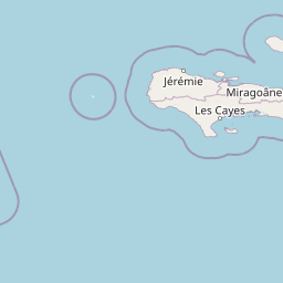
Grand Bois National Park landscape and geographic character

The landscape of Grand Bois National Park is defined by Morne Grand Bois, a dramatic isolated mountain peak that rises to 1,262 meters above sea level in southwestern Haiti. Unlike much of Haiti's terrain, which consists of rolling hills and lowland plains, Morne Grand Bois stands as a prominent peak creating a distinctive landscape feature visible across the region. The park encompasses all areas above 900 meters elevation, including the mountain's steep slopes, ridges, and valleys. The terrain is characterized by steep elevation changes, rocky outcrops, and forested slopes that transition from lower elevation tropical vegetation to cloud forest conditions at higher elevations. The mountain's isolation creates an ecological island effect, where species have evolved in relative independence from mainland populations. The park's small footprint of 3.7 square kilometers belies its environmental importance, as the vertical range and microclimates generated by the mountain's topography support diverse habitats within a compact area.

Grand Bois National Park ecosystems, habitats, and plant life

The ecological significance of Grand Bois National Park cannot be overstated for a country that has lost the vast majority of its original forests. The park protects Haiti's remaining primary rainforest, an ecosystem type that has almost entirely disappeared from the island of Hispaniola. The forest on Morne Grand Bois represents a complete, functioning ecosystem with native tree species, intact soil communities, and the full complement of native biodiversity. The mountain's elevation generates cloud forest conditions, where moisture from Trade Winds condenses on the vegetation, supporting epiphytes, ferns, and moisture-dependent species. The forest contains rare and endemic species adapted to these specific conditions, making it a unique repository of Caribbean biodiversity. The ecosystem also provides critical hydrological functions, with the forest's vegetation regulating water flow through streams and springs that serve as water sources for local communities. This watershed function adds ecological importance beyond biodiversity conservation, linking the forest's health directly to human welfare in the surrounding area.

Grand Bois National Park wildlife and species highlights

Grand Bois National Park is home to remarkable wildlife diversity relative to its small size, with several species of exceptional conservation significance. The most celebrated discovery was the Tiburon stream frog (Eleutherodactylus semipalmatus), also known as the foothill robber frog, which was rediscovered after being thought extinct. This amphibian represents a conservation success story and demonstrates the park's role as a refuge for species that have disappeared from other parts of Haiti. The discovery of Magnolia ekmanii, a rare tree species not recorded since the early 1900s, highlights the botanical significance of the park. Beyond these flagship discoveries, the primary rainforest supports diverse invertebrate communities, bird species, and smaller vertebrates that depend on intact forest habitat. The park's wildlife value is enhanced by its role as one of the last refuges for native Caribbean species in a region where habitat loss has driven many species to extinction or near-extinction.

Grand Bois National Park conservation status and protection priorities

Grand Bois National Park represents a critical conservation priority in one of the most forest-depleted countries in the world. The park was established to address the urgent threat of deforestation, which continues to impact Haiti's remaining natural areas. The primary threat to the park's ecosystems comes from clearing for agriculture, logging for fuelwood and charcoal, and general pressure from a growing population that depends on forest resources. Beyond direct forest loss, deforestation in the watershed affects streams and springs that flow through the park, impacting aquatic species habitat and reducing water availability for downstream communities. The conservation of Grand Bois is therefore linked to both biodiversity protection and sustainable resource management for local populations. The park's designation as an IUCN Category II protected area provides international recognition of its significance and access to conservation support and attention. Continued conservation success will require addressing the underlying drivers of deforestation while supporting sustainable livelihoods for communities near the park.

Top sights and standout views in Grand Bois National Park

Grand Bois National Park stands as one of Haiti's most important conservation areas, protecting the island's remaining primary rainforest on an isolated mountain peak. The park's establishment in 2015 marked a significant achievement for Caribbean conservation, preserving critical habitat for species found nowhere else including the rediscovered Tiburon stream frog and the rare Magnolia ekmanii. The mountain's 1,262-meter peak and forest-covered slopes create a dramatic landscape that is increasingly rare in Haiti. The park's watershed function provides essential water resources for surrounding communities, making its conservation directly relevant to local welfare. As one of the last intact forest ecosystems in Haiti, Grand Bois serves as a living reference for understanding the island's historical biodiversity and ecosystem function.

Park location guide

Geography guide, regional context, and park location map for Grand Bois National Park

Grand Bois National Park park geography, regions, and map view in Haiti
Understand where Grand Bois National Park sits in Haiti through a broader geographic reading of the surrounding landscape, nearby location context, and its mapped position within the national park landscape.

How Grand Bois National Park fits into Haiti

Haiti is a Caribbean country occupying the western third of Hispaniola Island in the Caribbean Sea. It gained independence from France in 1804 following the Haitian Revolution, becoming the first sovereign state established by a slave revolt and the second independent nation in the Americas. The country is known for its complex political history, economic challenges, and cultural significance in the Caribbean.

Wider geography shaping Grand Bois National Park in Haiti

Haiti occupies the western third of Hispaniola Island in the Caribbean, sharing the island with the Dominican Republic. The country is positioned in the Caribbean Sea, east of Cuba and south of the Bahamas. Haiti's terrain is predominantly mountainous, with valleys and coastal plains. The country borders the Caribbean Sea on its western, southern, and southwestern coasts.

Map view of Grand Bois National Park

Use this park location map to pinpoint Grand Bois National Park in Haiti, understand its exact geographic position, and read its mapped placement within the surrounding landscape more clearly.

Pigeon | © OpenStreetMap contributors

Location context for Grand Bois National Park

Grand'AnseSud
Park atlas

Browse surrounding protected landscapes and compare mountain conservation areas across the region.

Explore Similar National Parks and Protected Areas Near Grand Bois National Park
Continue your protected area exploration by browsing other national parks and conservation landscapes across Haiti and the wider Caribbean. Compare these mapped geographic features to understand regional park distribution, diverse mountain ecosystems, and the spread of critical forest reserves.
National parkHaiti

Pic Macaya National Park: Haiti's Protected Cloud Forest and Mountain Geography

Explore critical endemic species within Haiti's mountainous protected areas.

Pic Macaya National Park stands as a significant natural sanctuary in Haiti, preserving the island's final remnants of virgin cloud forest within the challenging terrain of the Massif de la Hotte. This protected area is defined by its high-altitude volcanic and karstic landscape, including Pic Macaya, the second-highest peak in Haiti. The park is a crucial stronghold for biodiversity, harboring numerous species endemic to Hispaniola, making it an essential site for conservation and a focal point for understanding regional natural landscapes.

Area
55 km²
Established
1984
IUCN
II
National parkHaiti

La Visite National Park: Protected Highland Terrain and Endemic Pine Forest Landscape

Explore the geography and mapped park boundaries of Haiti's significant national park.

La Visite National Park is a vital protected area located in Haiti's mountainous Massif de la Selle region. It is distinguished by its rare montane ecosystems, including extensive Hispaniolan pine forests and high-altitude grasslands, creating a unique landscape within the Caribbean. This atlas entry focuses on the park's geographic setting, its mapped protected boundaries, and its ecological significance as a key component of Haiti's natural heritage, offering a detailed look at its distinctive terrain.

Area
30 km²
Established
1983
IUCN
II
National parkHaiti

Three Bays Protected Area National Park: Haiti's Extensive Marine and Coastal Protected Landscape

Mapped coral reefs, mangrove forests, and unique regional geography.

The Three Bays Protected Area in Haiti is a key national park established to conserve its vital marine and coastal environments. Covering over 75,000 hectares, it is the country's largest protected marine complex, encompassing extensive and healthy coral reefs, critical seagrass beds, and sprawling mangrove forests. This protected landscape provides essential ecosystem services and coastal protection, showcasing a significant portion of Haiti's natural heritage and regional geographic context along its northeastern shoreline.

Area
754.06 km²
Established
2014
IUCN
IV
National parkPedernales Province

Jaragua National Park: Dominican Republic National Park Protected Landscape Atlas

Discover the mapped geography and protected boundaries of Jaragua National Park.

Jaragua National Park stands as a crucial national park within the Dominican Republic, located in Pedernales Province. This entry provides an in-depth, atlas-style examination of the park's protected landscape, focusing on its geographic features and mapped extent. Users can explore the park's position within the regional geography and understand its significance as a conservation area.

Area
1,374 km²
Established
1983
IUCN
II
National parkIndependencia Province

La Gran Sabana National Park: National Park Identity and Geographic Mapping

Exploring protected landscapes and regional context.

This detail entry focuses on La Gran Sabana National Park, delineating its identity as a protected national park within Independencia Province. It provides essential context for understanding the park's mapped boundaries, its specific geographic setting, and its role within the natural landscape. Users can explore its atlas-relevant features and understand its place in the broader geography of the Dominican Republic.

Area
219.58 km²
Established
2009
IUCN
II
Relief
Lowland
National parkMonte Cristi Province

Monte Cristi National Park: Dominican Republic National Park Geography and Atlas

Explore mapped boundaries and regional landscape context.

Monte Cristi National Park serves as a vital component of the Dominican Republic's protected lands, located within the Monte Cristi Province. This entry provides essential geographic context and visualizes the park's mapped boundaries, contributing to a comprehensive understanding of its landscape. Delve into the atlas perspective of this national park, examining its terrain and regional significance for structured geographic exploration.

Area
550 km²
Established
1983
IUCN
II
National parkDominican Republic

José Armando Bermúdez National Park: Dominican Republic National Park Atlas and Landscape Context

Discover the mapped protected area and geographic setting of this Dominican Republic national park.

Gain an understanding of José Armando Bermúdez National Park as a distinct protected landscape within the Dominican Republic. This entry focuses on its role as a national park, providing geographic context and highlighting its mapped boundaries for atlas exploration. Explore the park's specific terrain and its place within the nation's conservation network.

Area
766 km²
Established
1956
IUCN
II
National parkBahamas

Little Inagua National Park: Remote Bahamian Protected Landscape & Marine Habitat

Island wilderness, sea turtle nesting, and queen conch larval zones.

Little Inagua National Park, located in the Bahamas, is a remote national park combining terrestrial and marine conservation efforts. This protected area is primarily recognized for its role as a critical nesting site for sea turtles and its importance for queen conch larval development in the surrounding Caribbean waters. Discover the distinct island terrain and shallow marine ecosystems that define this ecologically significant Bahamian protected landscape.

Area
254 km²
Established
2002
IUCN
II

Common questions about visiting, size, designation, and location context for Grand Bois National Park

Grand Bois National Park FAQs for park facts, access, geography, and protected area context
Find quick answers about Grand Bois National Park, including protected-area facts, park geography, trail and visitor context, and how the park fits into its surrounding country and regional landscape.
MoriAtlas Explorer

Continue Your Protected Areas Search Across the Global Atlas

Deepen your exploration by continuing the structured search for national parks and protected areas worldwide. Utilize the comprehensive filtering capabilities to compare different conservation landscapes and refine your understanding of global park geography. Discover more about the distribution and characteristics of protected natural areas.

Global natural geography