Mori Atlas logo
National parkKyabobo National Park

Discover the mountainous terrain and park boundaries of Kyabobo National Park in Oti Region.

Kyabobo National Park: Ghana's Premier Highland Protected Landscape and Geography

Kyabobo National Park, situated in Ghana's Oti Region, offers a striking protected landscape defined by its mountainous terrain and prominent peaks. This 360-square-kilometer national park is home to Mount Dzebobo, Ghana's second-highest mountain, providing sweeping vistas and a distinct geographic identity. As a key conservation area, Kyabobo represents a vital transition zone between forest and savanna ecosystems, showcasing a rich diversity of natural habitats and a significant protected area for regional atlas exploration.

Mountain parksImportant Bird AreasForest savanna transitionGhana national parksHiking destinationsWildlife conservation

Kyabobo National Park

National park

Park overview

Structured park overview, official facts, and landscape profile for Kyabobo National Park

Kyabobo National Park park facts, protected area profile, and essential visitor context
Review the core facts for Kyabobo National Park, including designation, size, terrain, visitor scale, habitats, and operating context in one park-focused overview.

About Kyabobo National Park

Kyabobo National Park occupies a striking position in northern Ghana's Oti Region, where the land rises sharply from the surrounding lowlands to form a mountainous haven for wildlife and outdoor enthusiasts alike. The park's central feature is Mount Dzebobo, standing as Ghana's second-highest peak and providing a dramatic backdrop to the entire protected area. The mountain's name derives from the Ewe language, reflecting the prominent visibility of this massif across the Volta Region landscape. Adjacent to Dzebobo, the Breast Mountains create a unique twin-peak formation that has become synonymous with the park's identity, offering visitors challenging hiking trails and rewarding vistas of the sprawling Lake Volta below. The park's proximity to the Togolese border places it at the western edge of the Volta Region highlands, an area characterized by rugged terrain, deep valleys, and forests that contrast sharply with the surrounding farmlands and settlements. Beyond its scenic value, Kyabobo serves as a critical habitat corridor connecting fragmented forest patches in this part of West Africa, supporting species that require larger territories or migratory pathways to survive.

Quick facts and research context for Kyabobo National Park

Kyabobo National Park covers 360 square kilometers in Ghana's Oti Region, near the town of Nkwanta and directly bordering Togo. The park features Ghana's second-highest mountain, Mount Dzebobo, whose name means seen from afar or prominent in the Ewe language. The landscape includes the distinctive Breast Mountains, which form a prominent ridge along the park's southeastern edge. The park was formally established in 1993 with boundary adjustments continuing until September 1999 when the current perimeter was fixed. It is recognized as an Important Bird Area by BirdLife International due to its significant bird populations.

Park context

Deeper park guide and search-rich context for Kyabobo National Park

Kyabobo National Park history, landscape, wildlife, and travel context
Explore Kyabobo National Park through its history, landscape character, ecosystems, wildlife, conservation priorities, cultural context, and seasonal travel timing in a structured park guide built for atlas discovery and search intent.

Why Kyabobo National Park stands out

Kyabobo National Park is best known for its dramatic highland scenery and the iconic Mount Dzebobo, which dominates the park's skyline and provides one of Ghana's most impressive mountain views. The Breast Mountains form a distinctive pair of peaks that are the park's most recognizable landmark and a major attraction for hikers. The park sits at a critical ecological crossroads, protecting the transition zone between Ghana's forested south and the savanna regions to the north. Its diverse habitats support significant populations of large mammals including African bush elephants and African leopards, while the rock hyrax has become an unofficial symbol of the park. The area is also notable for its butterfly diversity, with surveys recording more than 500 species within the park boundaries.

Kyabobo National Park history and protected-area timeline

Kyabobo National Park was established as a protected area in 1993, marking Ghana's commitment to preserving the unique highland ecosystems of the Oti Region. During the early years following its designation, the park boundaries underwent several adjustments as officials worked to balance conservation objectives with local land use patterns and community needs. These boundary negotiations concluded in September 1999 when the current perimeter was formally fixed, providing clarity for both management authorities and surrounding communities. The establishment of Kyabobo reflected a growing recognition in Ghana during the 1990s of the need to protect representative samples of the country's diverse ecosystems, particularly in regions like the Volta Highlands where forest cover was declining. Prior to national park status, the area had likely existed as a forest reserve or game production zone, common designations for Ghana's wildlife areas before the establishment of the national park system.

Kyabobo National Park landscape and geographic character

The landscape of Kyabobo National Park is defined by its mountainous terrain and the dramatic contrast between high ridgelines and sheltered valleys. Mount Dzebobo rises to significant elevation, making it the second-highest point in Ghana and creating a prominent landmark visible from considerable distances across the Volta Region. The mountain's slopes are covered in dense vegetation that transitions from forest on the lower reaches to more open woodland at higher elevations. The Breast Mountains form a distinctive geological feature in the southeastern portion of the park, consisting of two rounded peaks that create an unmistakable silhouette against the sky. These formations provide excellent hiking opportunities, with trails ascending to strategic viewpoints where visitors can survey the surrounding countryside and glimpse the distant waters of Lake Volta. Rocky outcrops and boulder fields punctuate the landscape, particularly in higher elevations, creating microhabitats for specialized species like the rock hyrax. The park's position in a transition zone means that the vegetation varies considerably across short distances, with moist forest patches in sheltered valleys giving way to drier tree savanna on exposed ridges and lower slopes.

Kyabobo National Park ecosystems, habitats, and plant life

Kyabobo National Park occupies a critical position in Ghana's ecological landscape, protecting a transition zone where tropical rainforest gives way to tree savanna. This blending of ecosystems creates a mosaic of habitats that supports extraordinary biodiversity, with the park serving as a bridge between West Africa's forested zone and the more open landscapes to the north. The moist forest areas along valleys and lower slopes support tall trees, dense understory vegetation, and the species typically associated with Ghana's rainforest ecosystems. Moving upslope, the canopy becomes more open as tree savanna takes over, with grasses and scattered woody plants dominating the higher terrain. This ecological diversity explains the park's remarkable butterfly population, with more than 500 species recorded within its boundaries. The varied topography creates numerous microclimates and habitats, while the proximity to the Togolese border suggests this area may serve as part of a larger transboundary ecosystem that allows species movement across national boundaries.

Kyabobo National Park wildlife and species highlights

The wildlife community of Kyabobo National Park reflects the park's position at an ecological crossroads, combining species from both forest and savanna environments. Large mammals inhabiting the park include African bush elephants, which roam the forested areas and clearings, African leopards that maintain territories in the more remote sections, and African buffalo that graze in savanna portions of the park. Waterbuck are commonly observed near water sources, while bushbuck and various duiker species occupy the forest understory and forest edges. Several primate species are present, likely including various monkeys that use the forest canopy as their primary habitat. The rock hyrax has become particularly associated with the park, often observed basking on rocky outcrops and serving as an unofficial symbol of Kyabobo. Bird surveys have recorded 235 species within the park, contributing to its designation as an Important Bird Area by BirdLife International. This avifauna includes both forest-dependent species and savanna specialists, reflecting the diverse habitats the park protects.

Kyabobo National Park conservation status and protection priorities

Kyabobo National Park's designation as an Important Bird Area by BirdLife International highlights its significance beyond national boundaries, recognizing that the park supports significant populations of bird species that depend on these habitats for their survival. The park's location in a transition zone means it contains examples of ecosystems that are under pressure across West Africa, making its protection particularly valuable for conserving biodiversity in the region. The diverse habitats within Kyabobo serve as refuge for species that require large, interconnected areas to maintain viable populations, including wide-ranging mammals like elephants that need extensive territory to meet their ecological needs. Beyond species protection, the park contributes to watershed protection for the Volta Region, with its forested slopes helping to regulate water flow and reduce soil erosion in a landscape where agriculture and development pressure are increasing.

Kyabobo National Park cultural meaning and human context

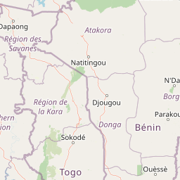
Kyabobo National Park is situated in the heart of Ewe traditional territory, with the mountain's name Dzebobo deriving from the Ewe language. In Ewe, dzebo means seen from afar or prominent, a reference to the mountain's striking visibility across the landscape that has made it a landmark for generations of local communities. The park lies near Nkwanta, a town that has historically served as a regional center for the surrounding farming communities. The local population practices agriculture and maintains traditional connections to the land that now falls within the park boundaries. This cultural context adds depth to the park's identity, connecting the protected area to the region's heritage and the communities who have lived in the shadow of these mountains for centuries.

Top sights and standout views in Kyabobo National Park

Kyabobo National Park offers visitors the chance to summit Ghana's second-highest mountain, with the hike to Mount Dzebobo's peak providing panoramic views of Lake Volta and the surrounding highlands. The Breast Mountains present another popular hiking destination, with trails ascending to viewpoints that overlook the park's forested valleys and the distant landscape beyond. Seven hiking trails and two mountain biking trails provide visitors with options for exploring the park's diverse terrain, from valley walks to challenging ridge climbs. The rock hyrax, a distinctive small mammal often observed basking on sun-warmed rocks, has become an unofficial mascot for the park and provides wildlife watchers with reliable viewing opportunities. The park's butterfly diversity, exceeding 500 species, offers exceptional opportunities for entomology enthusiasts and contributes to the park's status as one of Ghana's most ecologically valuable protected areas.

Best time to visit Kyabobo National Park

The optimal time to visit Kyabobo National Park falls within the dry season, typically from November through March, when rainfall is reduced and trail conditions are most favorable for hiking and outdoor activities. During this period, the landscape is more accessible and wildlife viewing can be more productive as animals concentrate around remaining water sources. The months following the rainy season, around April and May, can offer lush green scenery as vegetation responds to the moisture, though some trails may remain slippery or inaccessible. Visitors planning trips during the wet season months of June through October should be prepared for muddy conditions and potential trail closures, though the park's waterfalls and streams will be flowing at their fullest.

Park location guide

Geography guide, regional context, and park location map for Kyabobo National Park

Kyabobo National Park park geography, regions, and map view in Ghana
Understand where Kyabobo National Park sits in Ghana through a broader geographic reading of the surrounding landscape, nearby location context, and its mapped position within the national park landscape.

How Kyabobo National Park fits into Ghana

Ghana, officially the Republic of Ghana, is a West African nation spanning approximately 240,000 km² along the Gulf of Guinea. It achieved independence from Britain in 1957, becoming the first Sub-Saharan colony to do so, and transitioned to a republic in 1960. The country has a population of over 35 million, with Accra as its capital and largest city. Ghana features diverse ecosystems from coastal savannas to tropical rainforests and is linguistically and ethnically rich, with English as the official language.

Wider geography shaping Kyabobo National Park in Ghana

Ghana is located in West Africa along the Gulf of Guinea and Atlantic Ocean to its south. It borders Côte d'Ivoire to the west, Burkina Faso to the north, and Togo to the east. The country spans diverse ecologies including coastal savannas and tropical rainforests.

Map view of Kyabobo National Park

Use this park location map to pinpoint Kyabobo National Park in Ghana, understand its exact geographic position, and read its mapped placement within the surrounding landscape more clearly.

Pigeon | © OpenStreetMap contributors

Location context for Kyabobo National Park

Oti Region
Park atlas

Discover regional context and diverse protected landscapes near Kyabobo National Park in West Africa.

Explore Other National Parks and Protected Areas Near Kyabobo National Park, Ghana
Continue exploring national parks and protected areas geographically near Kyabobo National Park, including mountain landscapes, forest reserves, and savanna transition zones. Compare protected-area geography and conservation landscapes to understand the regional spread of significant natural habitats and ecological diversity in West Africa.
National parkBono East Region

Digya National Park: Ghana's Oldest National Park, Bordering Lake Volta

Explore its unique geography and mapped protected boundaries.

Digya National Park is a significant protected area in Ghana, renowned as the nation's oldest, established in 1900 and gazetted as a national park in 1971. Occupying 3,743 square kilometers in the Bono East Region, it is distinctively bordered on three sides by the vast Lake Volta, creating an unparalleled terrestrial-aquatic habitat interface. This national park represents a key point in Ghana's geographic atlas, situated in a transitional zone between forest and savanna ecosystems, and is a vital hub for wildlife conservation and the study of its unique landscape character.

Area
3,743 km²
Established
1971
IUCN
II
National parkKara Region

Oti-Kéran National Park: Togo's Vast Protected Savanna Ecosystem and Regional Geography

Explore the mapped terrain and protected landscape of this key national park.

Delve into the geography of Oti-Kéran National Park, Togo's largest national park situated in the Kara Region. This protected savanna landscape, recognized as a Ramsar site, offers insights into its unique sudanian zone terrain, important bird habitats, and its function as a wildlife migration corridor. Understanding its mapped boundaries and ecological significance provides a core piece of the West African protected areas atlas.

Area
690 km²
Established
1950
IUCN
II
Relief
Lowland
National parkSavannah Region

Mole National Park: A Premier Protected Landscape in Ghana's Savannah Region

Explore mapped boundaries and Guinea savannah ecosystems.

Mole National Park represents a significant protected landscape within Ghana's Savannah Region, serving as the country's largest national park and a crucial conservation area for West African wildlife. The park's geography is defined by extensive Guinea savannah, characterized by grasslands with scattered woodlands and a prominent escarpment along its southern edge. Its vast expanse offers a unique opportunity to study mapped park boundaries and understand the ecosystem's role in regional conservation efforts. Discover the unique landscape context and protected area identity of this major West African wildlife refuge.

Area
4,840 km²
Established
1958
IUCN
II
National parkBenin

Pendjari National Park: Exploring Benin's Largest Protected Area and Savanna Landscape

Mapped boundaries and regional geography of a key West African wilderness.

Pendjari National Park is the largest protected area in Benin, safeguarding nearly 2,800 square kilometers of essential West African savanna ecosystem. This national park is a crucial element of the WAP Complex, offering a profound look at one of the region's last viable wilderness expanses. Through its mapped terrain, diverse landscapes from river valleys to mountainous cliffs, and its status as a protected landscape, users gain a deep understanding of its geographic significance and conservation value.

Area
2,755 km²
IUCN
II
National parkGhana

Bui National Park: Protected Savanna Landscape and Black Volta River Geography in Ghana

Explore the mapped boundaries and unique ecosystems of this national park.

Bui National Park, a protected national park in Ghana, offers a rich geographic discovery of savanna ecosystems bisected by the Black Volta River. Its vast mapped area provides a unique setting for understanding riparian corridors, woodland savanna, and mountainous terrain. The park is critically important for its significant hippopotamus population and its designation as an Important Bird Area, showcasing its ecological value. Exploration of Bui National Park provides insight into Ghana's protected landscapes and their strategic position within West African geography, serving as a key entity for any natural atlas.

Area
1,820 km²
Established
1971
IUCN
II
National parkOyo State

Old Oyo National Park: Mapped Savanna Terrain and Historical Significance in Nigeria

Explore its geographic setting and protected landscape features.

Old Oyo National Park is a prominent national park situated in Nigeria's Oyo State, covering a substantial area of lowland savanna. The park's terrain features include scattered granite outcrops, ridges, and important archaeological sites, remnants of the ancient Oyo Empire. Its mapped geography reveals a dynamic landscape shaped by river systems and elevated formations, offering a unique blend of natural and cultural heritage for dedicated atlas exploration.

Area
2,512 km²
IUCN
II
National parkBurkina Faso

Kaboré Tambi National Park: Burkina Faso's Largest National Park and Protected Landscape

Explore the mapped savanna and birdwatching geography of this vital West African area.

Kaboré Tambi National Park represents a critical protected area in Burkina Faso, spanning a considerable expanse of Sudan-Guinea savanna. The park's geography is defined by the Nazinon River and a mosaic of woodland and grassland ecosystems, making it a significant site for understanding regional protected lands and landscape ecology. It offers a valuable point of reference for atlas-based exploration of West African natural areas.

Area
1,555 km²
Established
1976
IUCN
II
Relief
Lowland
National parkWestern North Region

Bia National Park: Ghana's Vital Protected Forest Landscape with West Africa's Tallest Trees

Explore the unique mapped geography and biodiversity of this key conservation area.

Bia National Park serves as a crucial protected landscape in Ghana's Western North Region, celebrated for harboring some of West Africa's tallest trees and a rich diversity of wildlife. This detailed entry provides context on its mapped boundaries and ecological significance as one of the last relatively untouched forest remnants in the region. Understand the park's place within Ghana's geography and its value for conservation research, showcasing its unique transitional forest ecosystem and the documented species it protects.

Area
563 km²
Established
1974
IUCN
II
Climate
Tropical

Common questions about visiting, size, designation, and location context for Kyabobo National Park

Kyabobo National Park FAQs for park facts, access, geography, and protected area context
Find quick answers about Kyabobo National Park, including protected-area facts, park geography, trail and visitor context, and how the park fits into its surrounding country and regional landscape.
MoriAtlas Explorer

Continue Your Protected Areas Search Across the Global Atlas

Deepen your exploration by continuing the structured search for national parks and protected areas worldwide. Utilize the comprehensive filtering capabilities to compare different conservation landscapes and refine your understanding of global park geography. Discover more about the distribution and characteristics of protected natural areas.

Global natural geography