Mori Atlas logo
National parkOld Oyo National Park

Explore the mapped terrain and cultural heritage of this key Nigerian national park.

Old Oyo National Park: Protected Landscape & Geographic Atlas in Oyo State

Old Oyo National Park represents a significant protected area within Nigeria, situated across northern Oyo State. This national park encompasses approximately 2,512 square kilometers of lowland savanna plains, characterized by scattered granite outcrops and historic ruins. Its geographic context within Oyo State provides a rich backdrop for understanding both its natural landscape and its deep cultural significance, offering a unique atlas perspective for exploration.

National ParkSavanna EcosystemArchaeological SiteWest AfricaOyo EmpireGranite Outcrops

Old Oyo National Park

National park

Park overview

Structured park overview, official facts, and landscape profile for Old Oyo National Park

Old Oyo National Park park facts, protected area profile, and essential visitor context
Review the core facts for Old Oyo National Park, including designation, size, terrain, visitor scale, habitats, and operating context in one park-focused overview.

About Old Oyo National Park

Old Oyo National Park represents one of Nigeria's most extensive protected areas, encompassing approximately 2,512 square kilometers of savanna ecosystem in the country's southwestern region. The park's strategic location spanning northern Oyo State and southern Kwara State places it at the intersection of significant ecological, historical, and cultural dimensions. The landscape is characterized by broad lowland plains punctuated by scattered hills, ridges, and granite rock outcrops, particularly in the central and northeastern zones where caves and rock shelters provide both geological interest and archaeological significance. The drainage systems include the Owu, Owe, and Ogun Rivers flowing through the southern sector, while the Tessi River serves the northern portion of the park. The Ikere Gorge Dam on the Ogun River has been developed as a tourist attraction, offering water-based recreational activities within the protected area. Eleven local government areas, ten in Oyo State and one in Kwara State, surround the park, creating a complex interface between the protected area and surrounding communities. The park is accessible from major towns including Saki, Iseyin, Igboho, Sepeteri, Tede, Kishi, and Igbeti, each offering additional commercial and cultural attractions that complement a visit to the national park.

Quick facts and research context for Old Oyo National Park

Old Oyo National Park covers 2,512 km² in southwestern Nigeria, straddling northern Oyo State and southern Kwara State. The park was established through the consolidation of two earlier forest reserves, Upper Ogun (established 1936) and Oyo-lle (established 1941), which were upgraded from game reserves to national park status. The administrative headquarters is located in Oyo town, Isokun area along the Oyo-Iseyin road. The park features a landscape of savanna plains with granite rock outcrops, caves, and several river systems. It is named after the historic Oyo Empire capital and contains ruins of significant cultural importance. The Ikere Gorge Dam on the Ogun River provides water-based recreational opportunities for visitors.

Park context

Deeper park guide and search-rich context for Old Oyo National Park

Old Oyo National Park history, landscape, wildlife, and travel context
Explore Old Oyo National Park through its history, landscape character, ecosystems, wildlife, conservation priorities, cultural context, and seasonal travel timing in a structured park guide built for atlas discovery and search intent.

Why Old Oyo National Park stands out

Old Oyo National Park is best known for its unique blend of natural and cultural heritage. The park preserves the archaeological remains of Oyo-lle, the ancient capital of the Oyo Empire, making it one of Nigeria's most historically significant protected areas. The savanna landscape features dramatic granite outcrops, caves, and rock shelters that are suitable for mountaineering and exploration. The park supports populations of large mammals including African buffalo, roan antelope, western hartebeest, and waterbuck, with the Ikere Gorge Dam on the Ogun River offering water recreation facilities. The combination of archaeological significance, diverse wildlife, and varied topography distinguishes this park within Nigeria's national park system.

Old Oyo National Park history and protected-area timeline

The establishment of Old Oyo National Park traces to the colonial era of British administration in Nigeria. The protected area originated from two earlier native administrative forest reserves: Upper Ogun, established in 1936, and Oyo-lle, established in 1941. These forest reserves were converted to game reserves in 1952 before being combined and upgraded to national park status, creating the present-day protected area. The park's name derives directly from Oyo-lle, the historic capital of the Oyo Empire, which was one of the most powerful pre-colonial states in West Africa and served as the political center of the Yoruba people. The park contains the ruins of this ancient city, preserving physical evidence of the empire's architectural and urban planning achievements. By the early 2020s, the park faced significant conservation challenges including poaching, illegal logging, and encroachment by herders. While poaching had decreased from levels seen in the early 2000s, herder encroachment remained a pressing concern, with organizations like Miyetti Allah acknowledging the issue while noting that many local herders were unaware of the park's exact boundaries and ecological significance. Climate change has been identified as an additional factor pushing herders further south and into park boundaries. Security operations in subsequent years resulted in mass arrests of illegal miners, herders, and poachers within the park.

Old Oyo National Park landscape and geographic character

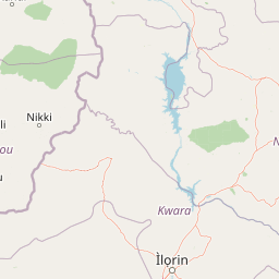
The physical landscape of Old Oyo National Park is dominated by lowland savanna plains situated at elevations between 330 and 508 meters above sea level. The terrain is characterized by its relatively flat to gently undulating nature, with the southern portion traversed by several important river systems including the Owu, Owe, and Ogun Rivers, the latter of which is dammed at Ikere Gorge to create a reservoir that provides recreational opportunities. The northern sector is drained by the Tessi River, which flows through more rolling terrain. The central part of the park features scattered hills, ridges, and rock outcrops that rise above the surrounding plains, creating topographical variation and offering potential mountaineering opportunities. Granite outcrops are particularly characteristic of the northeastern zone, where they appear at various locations including the historic site of Oyo-lle. These granite formations contain caves and rock shelters that hold both geological and archaeological significance. The combination of river valleys, savanna plains, and rocky uplands creates a diverse landscape that supports varied ecological communities and provides scenic variety for visitors.

Old Oyo National Park ecosystems, habitats, and plant life

The savanna ecosystem of Old Oyo National Park supports a range of habitat types characterized by grassland with scattered trees and woodland patches. The park's location in southwestern Nigeria places it within the Guinea savanna zone, which transitions between the forest belt to the south and the drier Sudan savanna to the north. The river systems, particularly the Ogun River and its tributaries, create riparian corridors that support more lush vegetation than the surrounding savanna plains. The granite outcrops and rock shelters provide specialized microhabitats for various plant and animal species adapted to these rocky environments. The landscape's variety, from flat plains to hills and river valleys, creates ecological diversity that supports the park's wildlife populations. The protected status of the area has helped preserve these savanna habitats, though surrounding agricultural expansion and human settlement create pressure on the park's boundaries.

Old Oyo National Park wildlife and species highlights

Old Oyo National Park supports populations of several notable large mammal species characteristic of West African savanna ecosystems. The African buffalo represents one of the park's prominent megafauna, while bushbuck and waterbuck are commonly observed in the woodland and riparian areas. The kob, a medium-sized antelope, inhabits the savanna plains, alongside the larger roan antelope and western hartebeest, both of which are impressive additions to the park's ungulate fauna. The patas monkey, known for its distinctive red-brown coat and terrestrial habits, is present in the park's woodland and grassland habitats. Historically, the park provided habitat for the endangered West African wild dog (Lycaon pictus manguensis), but this species has been locally extirpated due to hunting pressure and habitat loss from expanding human populations in the region. The park also contains diverse birdlife, though detailed species inventories are not comprehensively documented in available sources.

Old Oyo National Park conservation status and protection priorities

Old Oyo National Park serves as an important protected area for Nigeria's savanna ecosystems and cultural heritage, though it faces significant conservation challenges. The park's designation as an IUCN Category II protected area reflects its national park status and the intention to preserve both natural and cultural values. Conservation pressures include poaching, which although decreased from early 2000s levels, remains a concern, as well as illegal logging activities within park boundaries. Perhaps most significantly, the park faces ongoing encroachment from pastoralists and their livestock, a challenge attributed partly to climate change pushing herders southward into previously uninhabited areas. The interaction between conservation goals and local livelihoods creates complex management challenges. The presence of the West African wild dog as a historically resident but now extirpated species highlights the vulnerability of large carnivores in Nigerian protected areas and the broader challenges of maintaining viable populations of endangered species in fragmented landscapes.

Old Oyo National Park cultural meaning and human context

Old Oyo National Park possesses extraordinary cultural significance as the site of Oyo-lle, the ancient capital of the Oyo Empire, one of the most powerful pre-colonial states in West Africa. The Oyo Empire was a major political and economic force among the Yoruba people, controlling trade routes and maintaining military power that extended across much of what is now southwestern Nigeria. The ruins within the park represent the physical remains of this sophisticated urban center, including architectural foundations, settlement patterns, and cultural artifacts that evidence the empire's prominence. The park's name directly references this historical significance, connecting the protected area to a rich heritage of Yoruba civilization. The local government areas surrounding the park remain inhabited by Yoruba communities whose cultural practices, traditional land use patterns, and historical connections to the landscape predate and extend beyond the formal protected area designation.

Top sights and standout views in Old Oyo National Park

Old Oyo National Park stands out for its unique combination of archaeological significance and natural diversity. The ancient ruins of Oyo-lle provide a window into the history of the Oyo Empire, while the savanna landscape supports populations of African buffalo, roan antelope, western hartebeest, and other notable wildlife. The Ikere Gorge Dam on the Ogun River offers water-based recreation opportunities, distinguishing this park from many other Nigerian protected areas. The central zone's scattered hills, ridges, and rock outcrops provide excellent mountaineering and exploration opportunities, with granite caves and shelters adding geological and historical interest. The park's location at the ecological transition between forest and Sudan savanna creates habitat diversity that supports the park's wildlife populations.

Best time to visit Old Oyo National Park

The best time to visit Old Oyo National Park is during the dry season from November to April, when weather conditions are most favorable for outdoor exploration and wildlife viewing. During this period, vegetation is less dense and wildlife tends to congregate around remaining water sources, making animals easier to observe. The dry season coincides with cooler temperatures, particularly in the mornings and evenings, enhancing visitor comfort during game drives and hiking activities. The wet season from May to October brings heavier vegetation that can obscure wildlife viewing, though the landscape becomes greener and some visitors prefer this period for its scenic qualities. Visitors should note that the park's accessibility from surrounding towns remains relatively consistent year-round, though road conditions may deteriorate during peak rainy months. The administrative head office in Oyo town can provide current information on park conditions and visitor arrangements.

Park location guide

Geography guide, regional context, and park location map for Old Oyo National Park

Old Oyo National Park park geography, regions, and map view in Nigeria
Understand where Old Oyo National Park sits in Nigeria through a broader geographic reading of the surrounding landscape, nearby location context, and its mapped position within the national park landscape.

How Old Oyo National Park fits into Nigeria

Nigeria is a West African federal republic spanning 923,769 km² between the Sahel and the Gulf of Guinea. It is Africa's most populous nation with over 236 million residents, composed of diverse ethnic groups including Hausa, Yoruba, Igbo, and numerous others. The country operates as a federal presidential republic with 36 states and the Federal Capital Territory, using English as its official language and possessing significant linguistic diversity with over 525 indigenous languages.

Wider geography shaping Old Oyo National Park in Nigeria

Nigeria occupies West Africa between the Sahel region to the north and the Gulf of Guinea in the Atlantic Ocean to the south. It shares borders with Niger to the north, Chad to the northeast, Cameroon to the east, and Benin to the west. The country covers an area of 923,769 square kilometres.

Map view of Old Oyo National Park

Use this park location map to pinpoint Old Oyo National Park in Nigeria, understand its exact geographic position, and read its mapped placement within the surrounding landscape more clearly.

Pigeon | © OpenStreetMap contributors

Location context for Old Oyo National Park

Kwara StateOyo State
Park atlas

Map surrounding protected areas and compare diverse savanna ecosystems across Nigeria's historic regions

Explore National Parks Near Old Oyo, Discover Nigeria's Protected Savanna Landscapes
After exploring Old Oyo National Park's savanna plains and archaeological sites, broaden your discovery of West Africa's protected areas. Compare the regional geography and conservation landscapes surrounding Nigeria's historic Oyo Empire with other national parks and reserves.
National parkOti Region

Kyabobo National Park: Ghana's Highland National Park with Mount Dzebobo and Forest-Savanna Transition

Explore mountainous terrain, park boundaries, and regional geography in Oti Region.

Kyabobo National Park is a significant protected landscape in Ghana's Oti Region, celebrated for its mountainous topography and the commanding presence of Mount Dzebobo. This national park, established in 1993, safeguards a critical ecological transition zone featuring diverse habitats from dense forests to open tree savanna. Its unique geography and protected status make it a vital site for understanding regional conservation and atlas-based landscape exploration in West Africa, offering insights into varied terrain and ecosystems.

Area
360 km²
Established
1993
IUCN
II
National parkBenin

Pendjari National Park: Exploring Benin's Largest Protected Area and Savanna Landscape

Mapped boundaries and regional geography of a key West African wilderness.

Pendjari National Park is the largest protected area in Benin, safeguarding nearly 2,800 square kilometers of essential West African savanna ecosystem. This national park is a crucial element of the WAP Complex, offering a profound look at one of the region's last viable wilderness expanses. Through its mapped terrain, diverse landscapes from river valleys to mountainous cliffs, and its status as a protected landscape, users gain a deep understanding of its geographic significance and conservation value.

Area
2,755 km²
IUCN
II
National parkNigeria

Kamuku National Park: Nigeria's Protected Savanna Ecosystem and Inselberg Landscape

Explore mapped boundaries and regional geography.

Delve into Kamuku National Park, a significant protected savanna ecosystem in Nigeria, recognized for its unique geological features such as the Goron Dutse inselberg and the Dogon Ruwa Waterfalls. This page offers an atlas-level view of the park's landscape, detailing its protected area status, its role as elephant habitat, and its exceptional biodiversity, providing a comprehensive geographic context for exploration.

Area
1,120 km²
Established
1999
IUCN
II
National parkKara Region

Oti-Kéran National Park: Togo's Vast Protected Savanna Ecosystem and Regional Geography

Explore the mapped terrain and protected landscape of this key national park.

Delve into the geography of Oti-Kéran National Park, Togo's largest national park situated in the Kara Region. This protected savanna landscape, recognized as a Ramsar site, offers insights into its unique sudanian zone terrain, important bird habitats, and its function as a wildlife migration corridor. Understanding its mapped boundaries and ecological significance provides a core piece of the West African protected areas atlas.

Area
690 km²
Established
1950
IUCN
II
Relief
Lowland
National parkBono East Region

Digya National Park: Ghana's Oldest National Park, Bordering Lake Volta

Explore its unique geography and mapped protected boundaries.

Digya National Park is a significant protected area in Ghana, renowned as the nation's oldest, established in 1900 and gazetted as a national park in 1971. Occupying 3,743 square kilometers in the Bono East Region, it is distinctively bordered on three sides by the vast Lake Volta, creating an unparalleled terrestrial-aquatic habitat interface. This national park represents a key point in Ghana's geographic atlas, situated in a transitional zone between forest and savanna ecosystems, and is a vital hub for wildlife conservation and the study of its unique landscape character.

Area
3,743 km²
Established
1971
IUCN
II
National parkNiger

W National Park: Niger National Park, UNESCO World Heritage Site & Ramsar Wetland

Transborder savanna ecosystem and dramatic Niger River landscape.

W National Park in Niger offers a unique atlas view of a vast protected landscape defined by the Niger River's iconic W-shaped bend. As a UNESCO World Heritage Site and Ramsar Wetland, it protects crucial savanna plains, extensive floodplains, and rocky outcrops. This transborder conservation area is a vital habitat for West African wildlife, providing a rich context for geographic discovery and landscape exploration.

Area
10,000 km²
Established
1954
IUCN
II
National parkSavannah Region

Mole National Park: A Premier Protected Landscape in Ghana's Savannah Region

Explore mapped boundaries and Guinea savannah ecosystems.

Mole National Park represents a significant protected landscape within Ghana's Savannah Region, serving as the country's largest national park and a crucial conservation area for West African wildlife. The park's geography is defined by extensive Guinea savannah, characterized by grasslands with scattered woodlands and a prominent escarpment along its southern edge. Its vast expanse offers a unique opportunity to study mapped park boundaries and understand the ecosystem's role in regional conservation efforts. Discover the unique landscape context and protected area identity of this major West African wildlife refuge.

Area
4,840 km²
Established
1958
IUCN
II
National parkSouthwest Province

Korup National Park: Discover Southwest Province's Ancient Tropical Rainforest

Explore the mapped boundaries and unique protected landscape of this vital national park.

Korup National Park represents a significant protected area within Cameroon's Southwest Province, recognized for its status as one of Africa's oldest and most biodiverse tropical rainforests. With an area of 1,260 square kilometers, the park offers rich opportunities for geographic discovery, focusing on its unique lowland forest terrain, extensive plant and primate populations, and intricate stream networks. This protected landscape serves as a crucial component of the regional atlas, providing structured data on park boundaries and ecological significance for in-depth exploration.

Area
1,260 km²
Established
1986
IUCN
II
Relief
Mixed relief

Common questions about visiting, size, designation, and location context for Old Oyo National Park

Old Oyo National Park FAQs for park facts, access, geography, and protected area context
Find quick answers about Old Oyo National Park, including protected-area facts, park geography, trail and visitor context, and how the park fits into its surrounding country and regional landscape.
MoriAtlas Explorer

Continue Your Protected Areas Search Across the Global Atlas

Deepen your exploration by continuing the structured search for national parks and protected areas worldwide. Utilize the comprehensive filtering capabilities to compare different conservation landscapes and refine your understanding of global park geography. Discover more about the distribution and characteristics of protected natural areas.

Global natural geography