Mori Atlas logo
National parkW National Park

Mapping the Niger River's distinctive W-bend across savanna, wetlands, and rocky terrain.

W National Park: Niger National Park Atlas and Transborder Protected Landscape

(W Regional Park)

W National Park represents a critical protected landscape within Niger, renowned for its iconic W-shaped meander of the Niger River. This vast national park offers a rich atlas of savanna plains, vital wetlands, and contrasting rocky hill terrain, serving as a key protected area in the Sudano-Sahelian region. Its designation as a UNESCO World Heritage Site highlights its global significance for wildlife, including significant elephant and cheetah populations, and its unique transborder conservation model.

Transborder Protected AreaUNESCO World Heritage SiteRamsar WetlandSavanna EcosystemElephant HabitatWest Africa

W National Park

National park

Park overview

Structured park overview, official facts, and landscape profile for W National Park

W National Park park facts, protected area profile, and essential visitor context
Review the core facts for W National Park, including designation, size, terrain, visitor scale, habitats, and operating context in one park-focused overview.

About W National Park

W National Park represents one of West Africa's most important transboundary conservation achievements, encompassing a remarkable river landscape where the Niger River curves into a pronounced W-shaped meander that gives the protected area its distinctive name. The park spans the borders of three Sahelian nations, creating a unified conservation landscape of approximately 10,000 square kilometers that transcends political boundaries to protect shared ecological heritage. The terrain combines wetland ecosystems formed by the Mékrou River delta with drier savanna areas broken by rocky hills, creating a mosaic of habitats that supports remarkable biodiversity. Historically, the area was a major zone of human habitation, evidenced by significant archaeological sites including ancient tombs discovered throughout the region. The park's creation in 1954 established one of the first transborder protected area frameworks in Africa, and its subsequent designation as a UNESCO World Heritage Site in 1996 recognized its outstanding universal value as both a natural and cultural landscape.

Quick facts and research context for W National Park

W National Park occupies a strategic position in the W-Arly-Pendjari Complex, a network of protected areas forming one of West Africa's most important wildlife refuges. The park's location around a river meander gives it both hydrological and scenic significance, with the Mékrou River delta creating wetland habitats alongside the main Niger channel. It is recognized as an Important Bird Area by BirdLife International and supports populations of endangered species including the Northwest African cheetah and West African lion. The park contains 454 documented plant species, including two orchid species endemic to Niger.

Park context

Deeper park guide and search-rich context for W National Park

W National Park history, landscape, wildlife, and travel context
Explore W National Park through its history, landscape character, ecosystems, wildlife, conservation priorities, cultural context, and seasonal travel timing in a structured park guide built for atlas discovery and search intent.

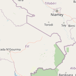
Why W National Park stands out

W National Park is best known as a last stronghold for West Africa's large mammal populations, particularly its significant elephant herds and the endangered Northwest African cheetah. The park's distinctive W-shaped river bend provides a dramatic scenic backdrop, while its transborder status makes it unique among African protected areas. It is also recognized for its birdlife, with over 350 species recorded including numerous migratory species, and for the archaeological significance of historical human settlement sites.

W National Park history and protected-area timeline

W National Park was established by decree on August 4, 1954, creating one of West Africa's earliest national parks within Niger. The park's transborder nature emerged from the recognition that the Niger River's meander and its associated ecosystems spanned natural boundaries, necessitating collaborative management across what would become three independent nations. Following its establishment, the park gained international recognition when it was inscribed as a UNESCO World Heritage Site in 1996, becoming part of the select group of protected areas recognized for their outstanding natural value. The management framework evolved significantly with the EU-funded ECOPAS project, which supported regional coordination from 1996 until 2008. In 2020, the Beninese portion of the park came under direct management by African Parks, bringing professional conservation administration to over 8,000 square kilometers of the protected area. The park has faced serious security challenges in recent years, including a tragic land mine incident in 2022 that killed eight people, fatal attacks on rangers and soldiers in 2024, and a significant loss of life in 2025.

W National Park landscape and geographic character

The physical landscape of W National Park is defined by the dramatic curvature of the Niger River, whose W-shaped meander creates a visually striking geographical feature that inspired the park's name. The terrain combines several distinct environments: the river channel and its floodplains form wetlands of international importance, while the broader landscape encompasses savanna plains broken by rocky hills that punctuate the otherwise flat terrain. The Mékrou River delta where it joins the Niger creates an extensive wetland complex that historically rendered the area malarial and largely uninhabited until the mid-20th century. The interplay between permanent water bodies and seasonal flood zones produces a dynamic landscape that shifts between wet and dry season character. Rocky outcrops and elevated terrain provide contrasting habitat for species adapted to drier conditions, creating ecological diversity within the protected area.

W National Park ecosystems, habitats, and plant life

The ecological character of W National Park reflects its position at the transition between Sahelian and Sudanian biomes, creating a diverse mosaic of habitats. The park supports 454 documented plant species, including two orchid species found nowhere else in Niger, highlighting its botanical significance. The southern limit of tiger bush plateaus distribution in Niger falls within the park, representing an important biogeographical boundary. Wetland areas formed by the Niger and Mékrou rivers provide critical habitat for migratory waterbirds and support ecological processes that sustain the broader savanna ecosystem. The combination of permanent water, seasonal flooding, and upland savanna creates ecological diversity that supports the park's remarkable wildlife populations.

W National Park wildlife and species highlights

W National Park harbors impressive populations of large mammals, representing some of West Africa's last remaining wildlife populations outside fenced conservancies. The park provides crucial habitat for African bush elephants, with the Beninese portion particularly significant for elephant conservation. Large predators present include African leopards, the endangered West African lion, and a small population of Northwest African cheetahs estimated at approximately 25 individuals across the broader protected area complex. Other notable species include African buffaloes, hippopotamuses in the river channels, caracals, servals, and warthogs. The park has historical records of West African wild dog packs, though this species may now be locally extinct. Bird diversity is exceptional, with over 350 species recorded, including numerous migratory species that use the park as a seasonal habitat. The area is recognized as an Important Bird Area, supporting both resident and transitory bird populations.

W National Park conservation status and protection priorities

W National Park holds multiple international conservation designations that recognize its outstanding universal value. Its UNESCO World Heritage status since 1996 acknowledges the park as a natural site of significance meeting criteria for natural phenomena, ecosystems, and biodiversity conservation. The park's Ramsar designations across three dates (1987, 1990, and 2007 for the W Complex) recognize its importance as a wetland of international importance, providing critical habitat for waterbirds and supporting ecological processes. The W-Arly-Pendjari Complex, of which W National Park is the central component, forms one of West Africa's most important conservation landscapes. Management by African Parks in the Beninese section brings professional conservation capacity to a portion of the park, while collaborative management across three nations demonstrates transboundary conservation cooperation.

W National Park cultural meaning and human context

The landscape of W National Park carries evidence of significant human historical presence, with archaeological sites including numerous tombs discovered throughout the area suggesting it was once a major zone of human habitation. This historical dimension adds cultural depth to the park's natural values, connecting the present ecological landscape to human history in the region. The park's name itself derives from the French description of the river's shape as a double V, reflecting the colonial linguistic heritage that influenced naming conventions in Francophone West Africa. Traditional land use patterns in the surrounding regions have shaped both human history and the park's conservation trajectory, with the historical avoidance of the malarial wetlands contributing to the area's preservation.

Top sights and standout views in W National Park

W National Park stands as one of Africa's few true transborder national parks, offering visitors and researchers access to a magnificent river landscape where the Niger River creates its distinctive W-shaped bend across three national boundaries. The park provides rare opportunities to observe West African wildlife including elephants, lions, and cheetahs in a relatively intact savanna ecosystem. Its recognition as a UNESCO World Heritage Site and multiple Ramsar designations underscore its international conservation significance. The combination of dramatic river scenery, significant wildlife populations, and transboundary cooperation makes this park a model for regional conservation in West Africa.

Best time to visit W National Park

The optimal time to visit W National Park corresponds with the dry season from November through April, when wildlife viewing opportunities improve as animals concentrate around remaining water sources and vegetation thins. The wet season from May to October transforms the landscape with seasonal flooding and denser vegetation, which while aesthetically striking, can make wildlife observation more challenging. Bird migration patterns mean that the park is particularly rewarding for ornithologists during both the arrival and departure periods of trans-Saharan migrants. Visitors should be aware of the park's transborder nature and check current entry requirements for each country section, as well as any security advisories given recent incidents in the region.

Park location guide

Geography guide, regional context, and park location map for W National Park

W National Park park geography, regions, and map view in Benin
Understand where W National Park sits in Benin through a broader geographic reading of the surrounding landscape, nearby location context, and its mapped position within the national park landscape.

Map view of W National Park

Use this park location map to pinpoint W National Park in Benin, understand its exact geographic position, and read its mapped placement within the surrounding landscape more clearly.

Pigeon | © OpenStreetMap contributors
Park atlas

Browse the geographic context and protected landscape connections around W National Park in West Africa.

Compare National Parks: Discover Protected Areas Surrounding W National Park
Explore national parks and protected areas situated near W National Park, encompassing West Africa's expansive savanna and wetland ecosystems. This enables geographic comparison, tracing shared landscape features and understanding the regional context of transboundary conservation efforts.
National parkBenin

Pendjari National Park: Exploring Benin's Largest Protected Area and Savanna Landscape

Mapped boundaries and regional geography of a key West African wilderness.

Pendjari National Park is the largest protected area in Benin, safeguarding nearly 2,800 square kilometers of essential West African savanna ecosystem. This national park is a crucial element of the WAP Complex, offering a profound look at one of the region's last viable wilderness expanses. Through its mapped terrain, diverse landscapes from river valleys to mountainous cliffs, and its status as a protected landscape, users gain a deep understanding of its geographic significance and conservation value.

Area
2,755 km²
IUCN
II
National parkKara Region

Oti-Kéran National Park: Togo's Vast Protected Savanna Ecosystem and Regional Geography

Explore the mapped terrain and protected landscape of this key national park.

Delve into the geography of Oti-Kéran National Park, Togo's largest national park situated in the Kara Region. This protected savanna landscape, recognized as a Ramsar site, offers insights into its unique sudanian zone terrain, important bird habitats, and its function as a wildlife migration corridor. Understanding its mapped boundaries and ecological significance provides a core piece of the West African protected areas atlas.

Area
690 km²
Established
1950
IUCN
II
Relief
Lowland
National parkBurkina Faso

Kaboré Tambi National Park: Burkina Faso's Largest National Park and Protected Landscape

Explore the mapped savanna and birdwatching geography of this vital West African area.

Kaboré Tambi National Park represents a critical protected area in Burkina Faso, spanning a considerable expanse of Sudan-Guinea savanna. The park's geography is defined by the Nazinon River and a mosaic of woodland and grassland ecosystems, making it a significant site for understanding regional protected lands and landscape ecology. It offers a valuable point of reference for atlas-based exploration of West African natural areas.

Area
1,555 km²
Established
1976
IUCN
II
Relief
Lowland
National parkNigeria

Kamuku National Park: Nigeria's Protected Savanna Ecosystem and Inselberg Landscape

Explore mapped boundaries and regional geography.

Delve into Kamuku National Park, a significant protected savanna ecosystem in Nigeria, recognized for its unique geological features such as the Goron Dutse inselberg and the Dogon Ruwa Waterfalls. This page offers an atlas-level view of the park's landscape, detailing its protected area status, its role as elephant habitat, and its exceptional biodiversity, providing a comprehensive geographic context for exploration.

Area
1,120 km²
Established
1999
IUCN
II
National parkOyo State

Old Oyo National Park: Mapped Savanna Terrain and Historical Significance in Nigeria

Explore its geographic setting and protected landscape features.

Old Oyo National Park is a prominent national park situated in Nigeria's Oyo State, covering a substantial area of lowland savanna. The park's terrain features include scattered granite outcrops, ridges, and important archaeological sites, remnants of the ancient Oyo Empire. Its mapped geography reveals a dynamic landscape shaped by river systems and elevated formations, offering a unique blend of natural and cultural heritage for dedicated atlas exploration.

Area
2,512 km²
IUCN
II
National parkOti Region

Kyabobo National Park: Ghana's Highland National Park with Mount Dzebobo and Forest-Savanna Transition

Explore mountainous terrain, park boundaries, and regional geography in Oti Region.

Kyabobo National Park is a significant protected landscape in Ghana's Oti Region, celebrated for its mountainous topography and the commanding presence of Mount Dzebobo. This national park, established in 1993, safeguards a critical ecological transition zone featuring diverse habitats from dense forests to open tree savanna. Its unique geography and protected status make it a vital site for understanding regional conservation and atlas-based landscape exploration in West Africa, offering insights into varied terrain and ecosystems.

Area
360 km²
Established
1993
IUCN
II
National parkSavannah Region

Mole National Park: A Premier Protected Landscape in Ghana's Savannah Region

Explore mapped boundaries and Guinea savannah ecosystems.

Mole National Park represents a significant protected landscape within Ghana's Savannah Region, serving as the country's largest national park and a crucial conservation area for West African wildlife. The park's geography is defined by extensive Guinea savannah, characterized by grasslands with scattered woodlands and a prominent escarpment along its southern edge. Its vast expanse offers a unique opportunity to study mapped park boundaries and understand the ecosystem's role in regional conservation efforts. Discover the unique landscape context and protected area identity of this major West African wildlife refuge.

Area
4,840 km²
Established
1958
IUCN
II
National parkBurkina Faso

Deux Balés National Park: Burkina Faso's Elephant Sanctuary and Savanna Protected Landscape

Explore mapped terrain and key geographic features of this protected area.

Deux Balés National Park serves as a vital protected area within Burkina Faso, acclaimed for harboring the largest elephant population in West Africa. This national park's protected landscape is defined by undulating granitic plains, lateritic plateaux, and distinct gallery forests lining the Black Volta River. The presence of ancient African baobab trees adds a unique visual character to the savanna ecosystem. Investigating this park reveals its significance for regional conservation, its mapped geographic boundaries, and its role within the broader context of protected lands in West Africa.

Area
810 km²
Established
1937
IUCN
II

Common questions about visiting, size, designation, and location context for W National Park

W National Park FAQs for park facts, access, geography, and protected area context
Find quick answers about W National Park, including protected-area facts, park geography, trail and visitor context, and how the park fits into its surrounding country and regional landscape.
MoriAtlas Explorer

Continue Your Protected Areas Search Across the Global Atlas

Deepen your exploration by continuing the structured search for national parks and protected areas worldwide. Utilize the comprehensive filtering capabilities to compare different conservation landscapes and refine your understanding of global park geography. Discover more about the distribution and characteristics of protected natural areas.

Global natural geography