Mori Atlas logo
National parkKorup National Park

Discover the mapped boundaries and rich biodiversity of this ancient protected landscape in Southwest Province.

Korup National Park: Cameroon's Premier Tropical Rainforest National Park

Korup National Park, a vital 1,260 square kilometer protected area situated in Cameroon's Southwest Province, stands as one of Africa's most ancient and biodiverse tropical rainforests. Established as a national park in 1986, it offers an unparalleled opportunity for atlas-driven exploration of lowland forest ecosystems, showcasing a remarkable density of plant and animal species, including significant primate populations. This entry provides detailed geographic context, including its proximity to the Bight of Biafra and Nigeria's Cross River National Park, highlighting its significance as a cornerstone of regional protected lands.

tropical rainforestlowland forestnational parkprimary forestprimate habitatbirdwatching

Korup National Park

National park

Park overview

Structured park overview, official facts, and landscape profile for Korup National Park

Korup National Park park facts, protected area profile, and essential visitor context
Review the core facts for Korup National Park, including designation, size, terrain, visitor scale, habitats, and operating context in one park-focused overview.

About Korup National Park

Korup National Park represents one of the most significant protected rainforest ecosystems in Central Africa, spanning 1,260 square kilometers of largely undisturbed primary forest in Cameroon's Southwest Province. The park lies within the Cross River-Mayombe Refugium, an ancient forest area that survived Pleistocene dry periods and now harbors exceptional concentrations of endemic species. The forest is characterized by massive emergent trees reaching heights of up to 50 meters, puncturing a discontinuous canopy layer dominated by trees from the Annonaceae, Euphorbiaceae, Fabaceae, Olacaceae, Lecythidaceae, and Verbenaceae families at heights of 15 to 25 meters. A dense understory of lianas and small trees, predominantly from the Rubiaceae family, supports a sparse herbaceous layer. The park's southern section maintains particularly pristine primary forest conditions, with no evidence of major historical human disturbance. Administratively, the park falls under the jurisdiction of the Ndian Division, with headquarters in the town of Mundemba located eight kilometers east of the official entrance at Mana bridge. The park is managed by the Cameroon Ministry of Forestry and Wildlife according to a five-year management plan focused on biodiversity conservation, law enforcement, sustainable land use promotion, and low-impact tourism development.

Quick facts and research context for Korup National Park

Korup National Park occupies 1,260 square kilometers of primarily primary forest in Cameroon's Southwest Province. The park features low southern terrain at approximately 50 meters elevation, rising northward to 1,079 meters at Mount Yuhan, with 82 percent of the area lying between 120 and 850 meters elevation. The region experiences a pseudo-equatorial climate with a pronounced dry season from December to February and an intense rainy season from May to October, with annual rainfall ranging from about 2,500-3,000 millimeters in the north to over 5,000 millimeters in the southeast. The park contains five villages with approximately 900 residents, while an additional 23 villages occupy a peripheral zone within three kilometers of the boundary. The park was inaugurated in 1986 and is managed by the Cameroon Ministry of Forestry and Wildlife, currently with a conservator and approximately 27 game guards.

Park context

Deeper park guide and search-rich context for Korup National Park

Korup National Park history, landscape, wildlife, and travel context
Explore Korup National Park through its history, landscape character, ecosystems, wildlife, conservation priorities, cultural context, and seasonal travel timing in a structured park guide built for atlas discovery and search intent.

Why Korup National Park stands out

Korup National Park is best known for its exceptional primate populations, including the drill, Preuss's red colobus, red-eared guenon, and Nigeria chimpanzee. The park is also celebrated as one of Africa's premier birdwatching destinations and supports remarkable reptile, amphibian, and butterfly diversity. Its status as one of the continent's oldest and richest tropical forests in terms of both floral and faunal diversity, combined with its accessibility for visitors, distinguishes it among Cameroon's protected areas. The park's scientific legacy is notable, with researchers conducting biological studies there for over three decades, generating extensive knowledge about rainforest ecosystems.

Korup National Park history and protected-area timeline

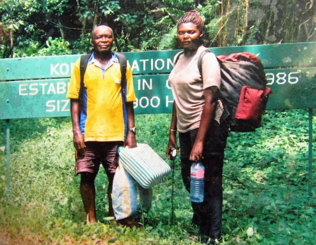
The conservation history of Korup National Park traces back to October 1937, when the Korup forest was established as a native administration forest reserve by Order No. 25. The concept of creating a national park emerged in the early 1970s when researchers Steve Gartlan and Thomas Struhsaker, who were studying forest primates in southwest Cameroon, proposed to the Cameroonian government that Korup be declared a national park alongside the Douala-Edéa reserve. Although the government did not immediately act on this proposal, the idea gained momentum through subsequent events. In 1977, Gartlan met documentary filmmaker Phil Agland, who spent five years producing a film about the Korup forest. The award-winning film Korup: An African Rainforest, broadcast on British television in November 1982, brought international attention to the forest's ecology and catalyzed conservation support. This visibility led to the first British Government contribution of 440,000 pounds through the Overseas Development Administration to rainforest conservation in Cameroon. In October 1986, Presidential Decree No. 86/1283 formally established Korup as a national park, simultaneously extending the forest reserve boundaries eastward to include the villages of Ekundu Kundu, Ikenge, and Bareka Batanga, creating the current 1,260 square kilometer protected area. Prince Charles of Wales inaugurated the park later that year. The Korup Project, an internationally funded integrated conservation and development initiative, began in 1987 and supported the new park along with surrounding forest reserves. After the project ended in 2003, leaving management with limited resources, the park became one of three focus areas of the Program of Sustainable Management of Natural Resources in Southwest Province in 2006, a bilateral cooperation between Cameroon and Germany that restored anti-poaching efforts.

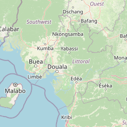
Korup National Park landscape and geographic character

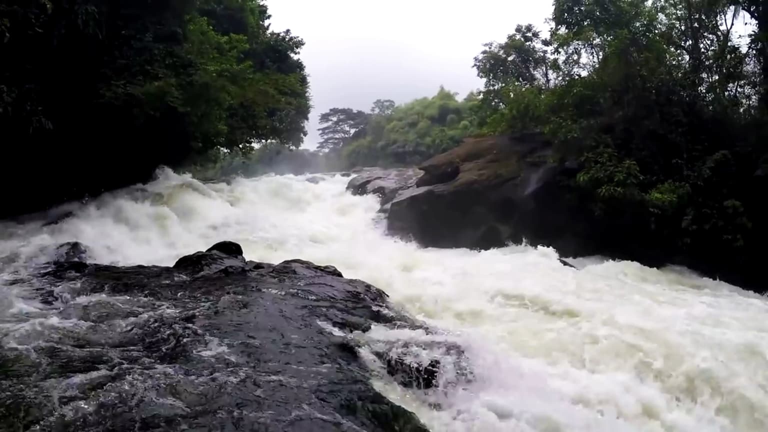
The landscape of Korup National Park features a gradual transition from low-lying southern terrain to increasingly rugged and hilly terrain as elevation rises northward. The southern section begins at approximately 50 meters above sea level and rises steadily through increasingly rugged terrain to reach the park's highest point at Mount Yuhan at 1,079 meters, near the former site of the relocated village of Ikondokondo. The northern portion of the park is characterized by low rolling hills with gentle slopes, with approximately 82 percent of the total park area falling between 120 and 850 meters elevation. The underlying geology consists of coarse-grained, sandy, well-drained soils that are acidic and low in nutrients, with low organic matter content that makes them unfavorable for agriculture. This soil characteristic has actually contributed to the park's preservation by limiting commercial farming and plantation development, leaving much of the forest in primary condition. A dense network of streams drains the Korup region into three major river systems: the Korup and Akpassang Rivers, the Ndian River, and the Bake-Munaya River. Many smaller streams become seasonally dry during the peak dry season from December to February.

Korup National Park ecosystems, habitats, and plant life

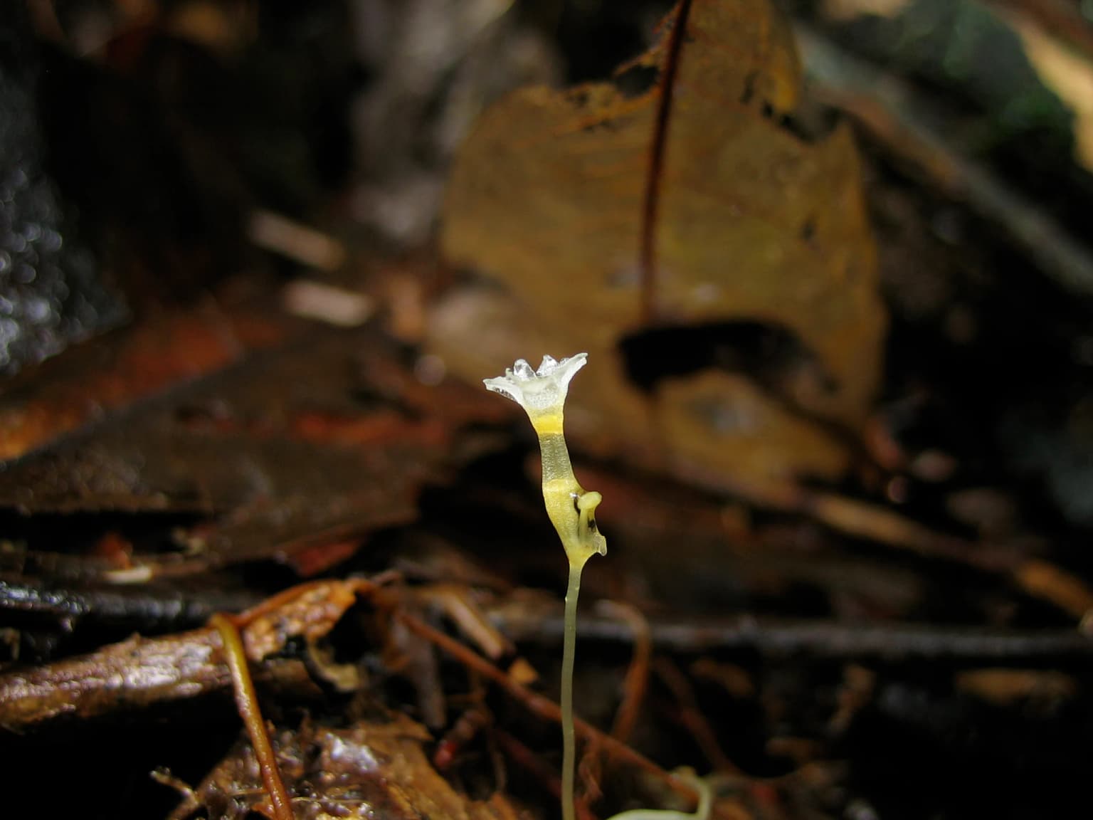
The ecological character of Korup National Park is defined by its ancient Biafran coastal forest ecosystem, classified by botanist Henri Letouzey as dominated by trees from the Caesalpinioideae subfamily of Leguminosae. The forest represents a remnant of the Cross River-Mayombe Refugium, one of Africa's key biodiversity refugia that persisted through Pleistocene climatic fluctuations. With over 1,100 tree, shrub, herb, and liana species documented to date and approximately 30 percent endemism, Korup ranks among the most floristically rich lowland forests in Africa. Plant ecological processes exhibit strong seasonality, with flowering typically occurring between January and July, peaking from March through May, followed by a fruiting season that varies considerably between years and often occurs in mast events at intervals of more than a year. The vegetation structure features large emergent trees reaching up to 50 meters in height, a predominantly continuous but uneven canopy at 15 to 25 meters, a dense understory of lianas and small trees dominated by Rubiaceae species, and a sparse herbaceous layer including representatives from the Acanthaceae, Araceae, Commelinaceae, Poaceae, Marantaceae, and Zingiberaceae families.

Korup National Park wildlife and species highlights

Korup National Park is reputedly one of the richest lowland African forests for faunal diversity, particularly for birds, reptiles, amphibians, and butterflies. The mammalian fauna includes 161 species across 33 families, with the primate community particularly notable for its diversity and conservation significance. The park supports 14 primate species, including both diurnal and nocturnal forms, making it exceptional for primate viewing. Key species include the drill, Preuss's red colobus, red-eared guenon, and the Nigeria chimpanzee. Preuss's red colobus, specifically, has become a flagship species for conservation in the region. The birdlife is exceptionally diverse, supporting the park's reputation as a premier birdwatching destination. The reptile and amphibian communities are equally rich, contributing to the park's overall biodiversity significance. Butterflies add to the invertebrate diversity, completing a faunal profile that makes Korup one of the most important protected areas for tropical forest biodiversity in Africa.

Korup National Park conservation status and protection priorities

Korup National Park holds significant conservation importance as one of Africa's oldest and richest tropical forests, protecting a substantial portion of the Cross River-Mayombe Refugium ecosystem. The park's high endemism rate of approximately 30 percent among plant species underscores its global significance for biodiversity conservation. The protected area serves as a critical corridor for wildlife movement between Cameroon and Nigeria, sharing its western boundary with the Cross River National Park's Oban Division. The park's status as a Category II protected area under the IUCN classification reflects its primary objective of ecosystem conservation and protection. Management focuses on law enforcement against illegal hunting, promotion of sustainable land use practices within local communities, and development of low-impact tourism that provides economic benefits to surrounding populations. The 2002 five-year management plan established conservation of biodiversity and ecological integrity as the overarching goal. Conservation challenges include managing human-wildlife conflict with communities living within and around the park, addressing poaching pressures, and maintaining financial sustainability for protection activities. The Korup Rainforest Conservation Society, a local NGO, actively supports conservation efforts through environmental education, research support, and community engagement.

Korup National Park cultural meaning and human context

Korup National Park exists within a landscape of human settlement that includes both communities within the protected area and villages in the surrounding peripheral zone. Five villages are located inside the park: Erat with approximately 447 residents, Esukutan with 202, Ikenge with 179, Bareka-Batanga with 52, and Bera with 26, totaling approximately 900 people as of 1999. An additional 23 villages lie within three kilometers of the park boundary, creating a peripheral zone with a combined population of approximately 2,700 people. The main livelihood activities in these communities include subsistence and cash-crop farming, particularly oil palms and cocoa, along with fishing, hunting, and local trading. The park's establishment required balancing conservation objectives with the presence of these communities, and management strategies incorporate sustainable development and benefit-sharing with local populations. The area is part of the traditional territory of the Ejagham peoples, and the park management works to involve local communities in conservation planning and implementation.

Top sights and standout views in Korup National Park

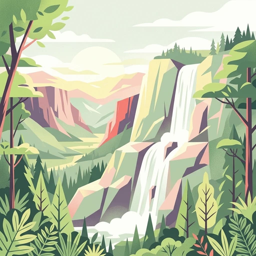
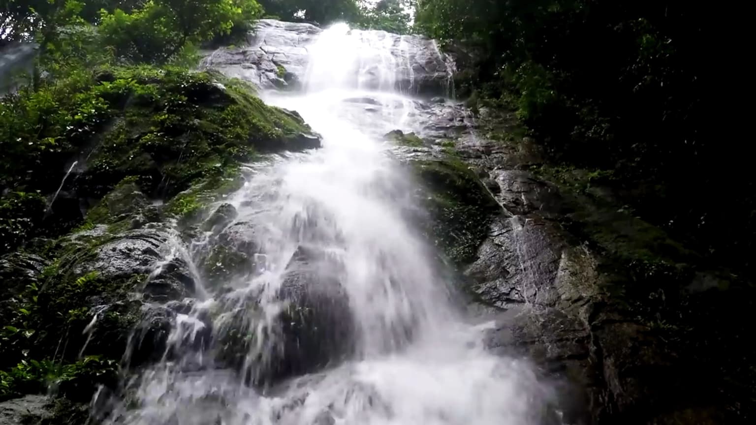
Korup National Park stands out as Cameroon's most accessible rainforest protected area, offering visitors the opportunity to explore one of Africa's oldest and richest tropical forests with basic but functional infrastructure. The park's primate populations, including the drill, Preuss's red colobus, red-eared guenon, and Nigeria chimpanzee, represent exceptional viewing opportunities for wildlife enthusiasts. The Mana bridge entrance, built by international volunteers on an Operation Raleigh expedition in 1989, serves as the gateway to the park and marks the point reached by Prince Charles during his 1986 inauguration visit. Three camp sites with basic facilities allow for multi-day exploration of the trail network. The park's scientific legacy, with over three decades of continuous research, has generated extensive knowledge about tropical rainforest ecosystems. The presence of Mount Yuhan at 1,079 meters provides an achievable summit goal for hikers, while the network of streams and waterfalls throughout the park adds scenic value to the trekking experience.

Best time to visit Korup National Park

The optimal time to visit Korup National Park depends on visitor priorities, with distinct advantages to both dry and rainy seasons. The dry season from December to February offers easier trail conditions and clearer visibility for wildlife viewing, though some streams may be seasonally dry. This period typically sees lower rainfall, with monthly totals below 100 millimeters, making it generally more comfortable for hiking and camping. The extended rainy season from May to October delivers the forest's full atmospheric character, with heavy rainfall creating lush, verdant conditions and full flow in streams and waterfalls. August typically experiences the heaviest rainfall, sometimes exceeding 10,000 millimeters in a single month. The transition periods of March through May and November offer moderate conditions but correspond with peak flowering and fruiting seasons respectively, which can enhance wildlife activity and botanical interest. Visitors should note that the northern sections of the park receive considerably less rainfall at 2,500-3,000 millimeters annually compared to over 5,000 millimeters in the southeast, which may influence route planning.

Park location guide

Geography guide, regional context, and park location map for Korup National Park

Korup National Park park geography, regions, and map view in Cameroon
Understand where Korup National Park sits in Cameroon through a broader geographic reading of the surrounding landscape, nearby location context, and its mapped position within the national park landscape.

How Korup National Park fits into Cameroon

Cameroon is a Central African country spanning coastal, highland, and forest regions. It has a population of nearly 31 million people who speak 250 native languages alongside English and French as official languages. The country gained independence from France in 1960 and unified with British Southern Cameroons in 1961.

Wider geography shaping Korup National Park in Cameroon

Cameroon is located in Central Africa, bordering Nigeria and Chad to the west and north, the Central African Republic to the east, and Equatorial Guinea, Gabon, and the Republic of the Congo to the south. The country has a coastline on the Bight of Biafra, part of the Gulf of Guinea. Terrain includes coastal plains, mountainous highlands (including Mount Cameroon), plateaus, and dense rainforest regions.

Map view of Korup National Park

Use this park location map to pinpoint Korup National Park in Cameroon, understand its exact geographic position, and read its mapped placement within the surrounding landscape more clearly.

Pigeon | © OpenStreetMap contributors

Location context for Korup National Park

Southwest Province
Park atlas

Trace the geographic spread of adjacent protected areas and compare their unique conservation landscapes.

Discover Nearby National Parks and Protected Landscapes Beyond Korup National Park
Browse other national parks and protected areas situated in the same regional geography as Korup National Park, encompassing vital tropical rainforests and interconnected conservation zones. Uncover a wider atlas view of protected landscapes, compare diverse forest ecosystems, and trace the geographic distribution of critical biodiversity hotspots.
National parkBioko Norte

Pico Basilé National Park: Volcanic Peak National Park and Protected Landscape

Explore Bioko Norte's unique montane terrain and rich avifauna.

Pico Basilé National Park is a critical conservation zone encompassing Equatorial Guinea's highest point, Pico Basilé volcano. This national park protects unique montane forest ecosystems and their diverse inhabitants, including several threatened primate species and a significant bird population, making it a key protected area on Bioko Island. Understand its geographic setting within Bioko Norte and its role as a vital natural landscape.

Area
300 km²
Established
2000
IUCN
II
National parkCameroon

Campo Ma'an National Park: Essential Protected Landscape in Cameroon's Atlantic Biafran Forest

Mapped evergreen canopy and vital great ape habitat in a key conservation area.

Campo Ma'an National Park is a crucial protected area in Cameroon, spanning 2,680 square kilometers of dense Atlantic Biafran forest. Established for environmental compensation, it safeguards critical habitat for western lowland gorillas and central chimpanzees, alongside forest elephants and diverse birdlife. The park's landscape is defined by a persistent evergreen canopy ecosystem, offering a unique context for understanding Central African rainforest geography and protected land status.

Area
2,680 km²
Established
2000
IUCN
II
National parkBénoué Department

Bénoué National Park: Protected Landscape Atlas in Bénoué Department, Cameroon

Explore savanna woodland, riparian ecosystems, and geographic context.

Bénoué National Park is a vast protected landscape in Cameroon, defined by its Sudanian savanna woodland and significant frontage along the Bénoué River. Recognized as a UNESCO Biosphere Reserve, it offers critical insights into regional geography, habitat diversity, and the broader atlas of conservation lands in West Africa. Users can explore its varied terrain, from riverine zones to higher massifs, gaining a detailed understanding of this important protected area.

Area
1,800 km²
Established
1968
IUCN
II
National parkOyo State

Old Oyo National Park: Mapped Savanna Terrain and Historical Significance in Nigeria

Explore its geographic setting and protected landscape features.

Old Oyo National Park is a prominent national park situated in Nigeria's Oyo State, covering a substantial area of lowland savanna. The park's terrain features include scattered granite outcrops, ridges, and important archaeological sites, remnants of the ancient Oyo Empire. Its mapped geography reveals a dynamic landscape shaped by river systems and elevated formations, offering a unique blend of natural and cultural heritage for dedicated atlas exploration.

Area
2,512 km²
IUCN
II
National parkNigeria

Kamuku National Park: Nigeria's Protected Savanna Ecosystem and Inselberg Landscape

Explore mapped boundaries and regional geography.

Delve into Kamuku National Park, a significant protected savanna ecosystem in Nigeria, recognized for its unique geological features such as the Goron Dutse inselberg and the Dogon Ruwa Waterfalls. This page offers an atlas-level view of the park's landscape, detailing its protected area status, its role as elephant habitat, and its exceptional biodiversity, providing a comprehensive geographic context for exploration.

Area
1,120 km²
Established
1999
IUCN
II
National parkGabon

Ivindo National Park: A Protected Rainforest Landscape in Gabon

Explore its waterfalls, diverse ecosystems, and mapped geographic context.

Ivindo National Park represents a significant protected landscape within Gabon, spanning a vast area of intact tropical rainforest. Recognized as a UNESCO World Heritage Site, the park is defined by the Ivindo River and its dramatic waterfalls, including the famous Kongou and Mingouli Falls. Its geography includes mountainous terrain and vital riverine ecosystems, supporting critical populations of forest elephants and great apes. This page offers a gateway to understanding the park's protected status, its unique natural features, and its role in the broader geography of Central Africa.

Area
3,000 km²
Established
2002
IUCN
II
National parkGabon

Loango National Park: Gabon's Coastal Wilderness and Unique Protected Landscape

Explore savanna, forest, beach, and lagoon ecosystems in this vital national park.

Loango National Park in Gabon is a significant protected area recognized for its remarkable geographic diversity. This national park encompasses over 100 kilometers of pristine, uninhabited Atlantic coastline, rare mangrove systems, and expansive savanna plains transitioning into dense tropical forests. Its unique landscape, particularly the Iguéla Lagoon, offers rich opportunities for atlas-style exploration of coastal ecosystems and protected areas. Understanding the park's mapped boundaries and regional setting is key to appreciating its ecological importance.

Area
1,550 km²
Established
2002
IUCN
II
National parkEast Region

Lobéké National Park: A Pristine National Park within Cameroon's East Region Geography

Explore mapped boundaries of semi-evergreen forest and unique bais habitats.

Lobéké National Park represents a critical component of Central Africa's protected landscape atlas, situated in Cameroon's East Region. This national park encompasses vast tracts of pristine semi-evergreen forest, notable for its lack of commercial logging. Its landscape is distinguished by natural saline swamp savannas, riverine habitats, and the iconic mineral-rich bais clearings that attract significant megafauna. Understanding Lobéké National Park offers insight into the ecological richness and geographic context of the Congo Basin's conservation areas.

Area
2,178 km²
Established
1999
IUCN
II
Relief
Lowland

Common questions about visiting, size, designation, and location context for Korup National Park

Korup National Park FAQs for park facts, access, geography, and protected area context
Find quick answers about Korup National Park, including protected-area facts, park geography, trail and visitor context, and how the park fits into its surrounding country and regional landscape.
MoriAtlas Explorer

Continue Your Protected Areas Search Across the Global Atlas

Deepen your exploration by continuing the structured search for national parks and protected areas worldwide. Utilize the comprehensive filtering capabilities to compare different conservation landscapes and refine your understanding of global park geography. Discover more about the distribution and characteristics of protected natural areas.

Global natural geography