Mori Atlas logo
National parkLoango National Park

Trace the unique mapped boundaries of this vital national park and its diverse ecosystems.

Loango National Park: Gabon's Coastal Wilderness and Protected Landscape Atlas

(Parc national de Loango)

Loango National Park represents a crucial protected landscape in western Gabon, spanning 1,550 square kilometers of extraordinary ecological diversity. This national park offers a profound window into Africa's coastal geography, featuring a remarkable mosaic of savanna, dense tropical forest, pristine beach, and extensive mangrove systems. Centered around the unique Iguéla Lagoon, it is a prime destination for understanding the interplay of marine, lagoon, and terrestrial environments through detailed park maps and geographic context.

coastal wildernesslagoon systemwhale watchinghippopotamus habitatmangrove forestsavanna landscape

Loango National Park

National park

Park overview

Structured park overview, official facts, and landscape profile for Loango National Park

Loango National Park park facts, protected area profile, and essential visitor context
Review the core facts for Loango National Park, including designation, size, terrain, visitor scale, habitats, and operating context in one park-focused overview.

About Loango National Park

Loango National Park represents one of Gabon's most ambitious conservation achievements, established in 2002 as part of a groundbreaking initiative to protect the country's natural heritage. The park occupies a unique position along Gabon's Atlantic coast, where the convergence of oceanic, lagoon, forest, and savanna environments creates an exceptional ecological tapestry. The Iguéla Lagoon, spanning 220 square kilometers, serves as the ecological heart of the park and represents the only significant western African lagoon system protected within national park boundaries. This coastal plain landscape supports an extraordinary diversity of habitats within a relatively compact area, from sandy beaches and mangrove swamps to inland savanna and tropical forest. The park's relative remoteness and limited human population have allowed wildlife populations to maintain natural behaviors, including the remarkable sight of hippos moving between lagoon, river, and ocean environments. Conservation partnerships with organizations including the Wildlife Conservation Society have enabled research and management programs that continue to reveal the park's ecological significance.

Quick facts and research context for Loango National Park

Located in western Gabon between the Nkomi and Ndogo Lagoons, Loango National Park covers 1,550 square kilometers of coastal wilderness established in 2002. The park protects the Iguéla Lagoon system, the only protected example of a typical western African lagoon in a national park. It is managed by Gabon's National Agency for National Parks and forms part of a network of 14 parks created in 2002 that protect approximately 10% of Gabon's total landmass. The park is renowned for its remarkable wildlife diversity, with elephants, buffalos, hippopotamuses, gorillas, and leopards all found within its boundaries.

Park context

Deeper park guide and search-rich context for Loango National Park

Loango National Park history, landscape, wildlife, and travel context
Explore Loango National Park through its history, landscape character, ecosystems, wildlife, conservation priorities, cultural context, and seasonal travel timing in a structured park guide built for atlas discovery and search intent.

Why Loango National Park stands out

Loango National Park is best known for its extraordinary combination of coastal and terrestrial ecosystems, particularly the phenomenon of hippopotamuses entering the ocean and swimming, which earned the area the nickname "land of surfing hippos." The park's over 100 kilometers of uninhabited Atlantic coastline host the world's second-largest concentration of whales and dolphins after South Africa, including humpback and killer whales. It is also notable as one of the few African parks where large mammals like elephants and gorillas regularly traverse beach environments. The protected lagoon system and mangrove forests provide critical habitat for marine and bird species.

Loango National Park history and protected-area timeline

The foundation for Loango National Park was laid in 1956 when the first faunal reserves were established in the Loango area, recognizing the region's ecological importance even in those early years of post-colonial African conservation. The park as it exists today was officially established in 2002 as part of a landmark conservation initiative by the Gabonese government under President Omar Bongo Ondimba. This creation coincided with the establishment of 13 other national parks, collectively protecting approximately 10% of Gabon's entire landmass and representing one of the most ambitious national park systems established anywhere in the world in a single initiative. The timing reflected Gabon's emerging role as a central African conservation leader, with the country possessing vast tracts of intact tropical forest and diverse ecosystems. Management of the park falls to the National Agency for National Parks, the governmental body responsible for overseeing Gabon's protected area network.

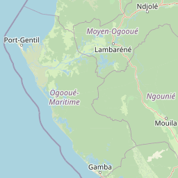
Loango National Park landscape and geographic character

The physical landscape of Loango National Park is defined by its coastal position and the interaction between marine, lagoon, and terrestrial environments. The park's Atlantic coastline stretches for over 100 kilometers of essentially uninhabited beaches, where the rhythmic crash of waves creates a dramatic backdrop against which wildlife movements are observed. Behind the beaches, extensive mangrove forests create a tangled green transition between ocean and land, with the park protecting significant portions of the lagoon systems including Iguéla Lagoon between Nkomi and Ndogo Lagoons. The interior landscape transitions from these coastal zones into savanna plains and dense tropical forest, creating a heterogeneous terrain that supports varied ecological communities. This diversity of landforms, from flat coastal plains to more elevated forest areas, contributes to the park's visual and ecological variety.

Loango National Park ecosystems, habitats, and plant life

The ecological character of Loango National Park is distinguished by the remarkable diversity of habitats contained within its boundaries and the species assemblages they support. The coastal lagoon system represents a critical ecological zone, providing sheltered breeding and feeding areas for marine species while also serving as important habitat for waterfowl and wading birds. The mangrove forests function as nurseries for fish and crustaceans while also stabilizing coastlines and filtering sediments from freshwater flows. The savanna and forest interiors support populations of large mammals whose movements between habitat types create dynamic ecological interactions. The marine environment adjacent to the park supports extraordinary biodiversity, with the coastal waters hosting what is now recognized as the world's second-most significant concentration of whales and dolphins.

Loango National Park wildlife and species highlights

Loango National Park supports an impressive array of wildlife species across its diverse habitats, with the park's large mammals being particularly notable. African elephants traverse the savanna and forest edges, often moving down to the beaches where they can be observed against the Atlantic backdrop. Buffalo herds inhabit the savanna areas, while hippopotamuses occupy the lagoon and river systems, with the park's hippos being especially famous for their unusual behavior of entering the ocean. Western lowland gorillas are present in the forest interior, while leopards maintain territories across multiple habitat types. The marine environment offshore hosts substantial populations of humpback whales and killer whales, with the waters representing a critical marine mammal habitat. Birdlife is diverse, with numerous species exploiting the various habitat zones from coastal beaches to inland forests.

Loango National Park conservation status and protection priorities

Loango National Park represents a significant conservation achievement for Gabon and for Central African biodiversity protection more broadly. The park's establishment in 2002 reflected Gabon's commitment to maintaining its ecological heritage, with the country recognizing that intact ecosystems provide essential services and economic opportunities. The protection of the Iguéla Lagoon system is particularly significant given that this represents the only significant western African lagoon protected within a national park context. Conservation partners including the Wildlife Conservation Society work with park management on research, educational programs, and adaptive management. The "Tourism pays for Conservation" principle has guided development of high-end environmental tourism infrastructure that provides economic incentives for protection while minimizing ecological impacts.

Loango National Park cultural meaning and human context

The human context of Loango National Park is characterized by the relative absence of permanent settlements within the park boundaries, with most villages located on the opposite bank of the Ngove Lagoon. Traditional communities in the surrounding area maintain connections to the land through livelihoods including fishing and agriculture, using slash-and-burn techniques for cultivation of crops such as manioc, peanuts, and mustard greens. Fishing communities employ diverse techniques including nets, lines, and traps to harvest fish and shrimp from coastal and lagoon waters. While some residents have migrated to urban centers for employment in oil and timber industries, many traditional villages continue dependent on natural resources for daily needs. This human presence around the park provides context for understanding the conservation challenges and opportunities in the region.

Top sights and standout views in Loango National Park

Loango National Park offers a rare combination of wildlife experiences unavailable elsewhere in Africa, most famously the opportunity to observe hippopotamuses swimming in the ocean along a wild beach coastline. The park's whale and dolphin watching opportunities rank among the best in Africa, with humpback and killer whales regularly visible from the shore. Elephant and buffalo viewing against the backdrop of the Atlantic Ocean creates a distinctive safari experience. The lagoon system provides paddling and boating opportunities through mangrove channels. The park's relative remoteness and limited infrastructure contribute to a wilderness character that distinguishes it from more accessible African parks.

Best time to visit Loango National Park

The optimal period to visit Loango National Park corresponds with Gabon's dry season, typically from June through September, when wildlife viewing conditions are most favorable and the landscape is more accessible. During this period, animals concentrate around remaining water sources, making savanna sightings more predictable. Whale and dolphin activity along the coast is particularly notable during these months as humpback whales migrate through the region. The wet season from October to May brings higher rainfall and greener landscapes but can make some areas more difficult to access. The park's beach and lagoon environments can be enjoyed year-round, though sea conditions and weather patterns vary seasonally.

Park location guide

Geography guide, regional context, and park location map for Loango National Park

Loango National Park park geography, regions, and map view in Gabon
Understand where Loango National Park sits in Gabon through a broader geographic reading of the surrounding landscape, nearby location context, and its mapped position within the national park landscape.

How Loango National Park fits into Gabon

Gabon is a Central African country on the Atlantic coast, positioned on the equator. It gained independence from France in 1960 and is governed as a unitary presidential republic. The country has significant oil wealth and one of the highest Human Development Index rankings in Africa, though wealth distribution remains uneven.

Wider geography shaping Loango National Park in Gabon

Gabon is situated on the Atlantic coast of Central Africa, positioned along the equator. It borders Equatorial Guinea to the northwest, Cameroon to the north, and the Republic of the Congo to the east and south. The terrain includes coastal plains along the Atlantic, mountain ranges in the center (the Cristal Mountains and Chaillu Massif), and savanna zones in the east.

Map view of Loango National Park

Use this park location map to pinpoint Loango National Park in Gabon, understand its exact geographic position, and read its mapped placement within the surrounding landscape more clearly.

Pigeon | © OpenStreetMap contributors
Park atlas

Compare coastal wilderness and diverse protected landscapes across Loango National Park's regional geography.

Explore Related National Parks and Protected Areas Near Loango National Park
Delve into a curated selection of national parks and protected areas geographically connected to Loango National Park, allowing for detailed comparison of their unique coastal, lagoon, and forest landscapes. This expanded view provides crucial regional context, helping to map the distribution of significant conservation efforts and diverse ecosystems across West-Central Africa.
National parkGabon

Moukalaba-Doudou National Park: Gabon's Forest-Savanna Mosaic Protected Landscape

Atlas exploration of unique habitats and geographic boundaries.

Moukalaba-Doudou National Park in Gabon offers a distinctive atlas exploration experience, characterized by its remarkable combination of humid tropical rainforest and savanna grasslands. Covering a vast area, this protected landscape provides critical habitat and showcases a rare ecological transition zone within Central Africa. Understanding its mapped geography and protected-area status is key to appreciating Gabon's conservation efforts and the diverse natural terrains it preserves.

Area
4,500 km²
IUCN
II
Scope
Terrestrial
Water
Minor water
National parkGabon

Waka National Park: A Mapped Protected Landscape in Gabon's Geography

Explore the natural terrain and park boundaries of this national park.

Waka National Park in Gabon represents a vital protected landscape for geographic exploration. This dedicated detail page offers insight into the park's specific mapped area and its place within the country's broader natural terrain. Understand its context as a national park, contributing to the atlas of protected areas in Central Africa. Discover the geographic identity of this significant natural reserve.

Area
1,060 km²
Established
2002
IUCN
II
Relief
Mountain
National parkGabon

Mayumba National Park: Gabon's Equatorial Protected Area and Geographic Atlas

Explore mapped park boundaries and regional landscape context.

Delve into the geographic identity of Mayumba National Park, a significant protected area situated in Gabon. This detail page provides atlas-style insights into the park's mapped boundaries, its position within the equatorial geography of Central Africa, and its role as a national park. Understand the protected landscape's environmental context and its atlas significance.

Area
870 km²
Established
2002
IUCN
II
Relief
Lowland
National parkGabon

Pongara National Park: Protected Landscape and Geographic Exploration in Gabon

Mapped boundaries and regional natural context.

Pongara National Park is a designated national park within Gabon, offering a unique opportunity for structured exploration of protected lands. Users can investigate its specific geographic setting, understand its mapped boundaries, and appreciate its place within the regional landscape context. This entry provides a factual foundation for understanding the park's identity as a protected natural area and its contribution to Gabon's geography.

Area
929 km²
Established
2002
IUCN
II
Relief
Lowland
Watercolor painting of a landscape with grassy areas, a lake, and distant hills under a light sky
National parkGabon

Lopé National Park: Gabon's Protected Landscape and National Park Geography

Explore mapped boundaries and natural terrain in Central Africa.

Delve into Lopé National Park, a designated national park situated in Gabon. This protected area serves as a crucial point for understanding the nation's geography and the distribution of its conservation landscapes. As an entry in the MoriAtlas, it offers a detailed view of its mapped territory and its contribution to the broader regional context of Central Africa, emphasizing its role in protected area atlas exploration.

Area
4,910 km²
Established
2002
IUCN
II
Relief
Mixed relief
Watercolor painting showing a river with green hills and pink flowers in the foreground
National parkKouilou Department

Conkouati-Douli National Park: Mapping Protected Landscape Boundaries and Regional Geography

Explore its national park status and geographic context.

Conkouati-Douli National Park is a protected area situated in the Kouilou Department, offering a focused point for geographic and landscape discovery. This detail provides an atlas-style perspective on its mapped boundaries and its contribution to the regional geography. Understand the park as a distinct natural landscape and a key component of conservation within its geographic setting.

Area
7,955 km²
Established
1999
IUCN
II
Relief
Lowland
National parkGabon

Birougou National Park: Mapped Protected Landscape and Regional Geography in Gabon

Explore the geographic extent and conservation context of this national park.

Birougou National Park is an important protected area situated in Gabon, offering a distinct focus for geographic and atlas-based discovery. This national park serves as a significant element within the country's network of conservation landscapes, providing a focal point for understanding mapped terrain and regional geographic patterns. Users can explore its protected boundaries and gain insight into its specific environmental context within Central Africa, making it a vital entry for atlas exploration of Gabon's natural heritage.

Area
690 km²
Established
2002
IUCN
II
Relief
Mountain
National parkWoleu-Ntem Province

Crystal Mountains National Park: National Park Protected Area and Geographic Context in Woleu-Ntem Province

Explore its mapped boundaries and regional landscape.

Crystal Mountains National Park is a designated national park offering critical insights into its protected landscape and geographic setting. Users can explore the mapped boundaries of this protected area, understand its regional terrain, and gain context within Woleu-Ntem Province through structured geographic data. This page provides the foundational atlas information for comprehending the park's conservation significance and natural features.

Area
1,200 km²
Established
2002
IUCN
II
Relief
Mountain

Common questions about visiting, size, designation, and location context for Loango National Park

Loango National Park FAQs for park facts, access, geography, and protected area context
Find quick answers about Loango National Park, including protected-area facts, park geography, trail and visitor context, and how the park fits into its surrounding country and regional landscape.
MoriAtlas Explorer

Continue Your Protected Areas Search Across the Global Atlas

Deepen your exploration by continuing the structured search for national parks and protected areas worldwide. Utilize the comprehensive filtering capabilities to compare different conservation landscapes and refine your understanding of global park geography. Discover more about the distribution and characteristics of protected natural areas.

Global natural geography