Mori Atlas logo
National parkLobéké National Park

Discover mapped boundaries and dense semi-evergreen forest ecosystems within the Congo Basin.

Lobéké National Park: Protected Landscape and Natural Terrain in Cameroon's East Region

Lobéké National Park, a significant national park located in Cameroon's East Region, offers a deep dive into the geography of the Congo Basin's protected landscapes. This park is celebrated for its largely untouched semi-evergreen forest, unique mineral-rich clearings known as bais, and saline swamp savannas. Its position as a core part of the transboundary Sangha Trinational network highlights its importance in regional conservation and provides unparalleled opportunities for structured exploration of its diverse terrain and natural features.

Congo Basin foresttransboundary protected areaforest elephant habitatgorilla conservationImportant Bird AreaWorld Heritage Site

Lobéké National Park

National park

Park overview

Structured park overview, official facts, and landscape profile for Lobéké National Park

Lobéké National Park park facts, protected area profile, and essential visitor context
Review the core facts for Lobéké National Park, including designation, size, terrain, visitor scale, habitats, and operating context in one park-focused overview.

About Lobéké National Park

Lobéké National Park represents one of Cameroon\u2019s most significant protected wilderness areas, located in the remote southeastern corner of the country within the East Province. The park occupies a strategic position in the northern Congo Basin, where it forms part of a contiguous transboundary conservation landscape that spans three Central African nations. This location along the Sangha River, which serves as an international boundary, has enabled the development of one of the most successful tri-national protected area networks in Africa. The park\u2019s establishment followed a biological assessment conducted by the World Wildlife Fund in 1991, which recommended protection of the area and noted the exceptional ecological value of the region. Today, Lobéké is managed under the framework of the Central African Forest Commission, with support from international conservation organizations including the World Wildlife Fund, the Wildlife Conservation Society, and the German Development Agency. The park\u2019s boundary adjoins Boumba Bek National Park to the northwest, creating an expanded conservation corridor within Cameroon\u2019s East Province. The surrounding Moloundu area has historical significance as one of Africa\u2019s richest rubber-producing regions, where German colonial enterprises established processing facilities, though the park itself has remained largely undeveloped and ecologically intact.

Quick facts and research context for Lobéké National Park

Lobéké National Park is situated in southeastern Cameroon, deep within the Congo Basin forest ecosystem. The park was established in October 1999 and is governed by the Central African Forest Commission (COMIFAC). It spans roughly 2,178 square kilometers with elevations ranging from 300 to 750 meters above sea level. The park shares its eastern boundary with the Sangha River, which marks the border with the Central African Republic and Republic of the Congo. Annual rainfall averages approximately 1,400 millimeters with a distinct dry season from December through February. The area is home to diverse ethnic communities including the Baka, Bantu, and Bangando peoples. In 2012, the entire Sangha Trinational protected area, which includes Lobéké, was inscribed as a World Heritage Site.

Park context

Deeper park guide and search-rich context for Lobéké National Park

Lobéké National Park history, landscape, wildlife, and travel context
Explore Lobéké National Park through its history, landscape character, ecosystems, wildlife, conservation priorities, cultural context, and seasonal travel timing in a structured park guide built for atlas discovery and search intent.

Why Lobéké National Park stands out

Lobéké National Park is best known for its extraordinary populations of flagship forest species. The park contains some of the highest densities of African forest elephants and western lowland gorillas recorded anywhere on the African continent. These critically important populations exist within a largely untouched semi-evergreen forest ecosystem that has never been commercially logged. The park\u2019s forest clearings, called bais, create unique mineral-rich environments that attract megafauna and offer exceptional wildlife viewing opportunities. The park is also recognized as an Important Bird Area supporting over 300 bird species, including the African green pigeon, various hornbill species, and the chocolate-backed kingfisher. Its role as a core component of the tri-national Sangha Trinational World Heritage Site further establishes its global conservation significance.

Sangha Tri National Landscape
Sangha Tri National Landscape, Central Africa

Lobéké National Park history and protected-area timeline

The conservation history of Lobéké National Park began in 1991 when the World Wildlife Fund conducted a comprehensive biological assessment of the southeastern Cameroon forest region. This assessment identified the Lobéké area as possessing exceptional ecological value and recommended that protection be established, initially suggesting that the unexploited 40,000 hectares be expanded to encompass over 400,000 hectares. Following nearly a decade of advocacy and institutional development, the park was officially declared a National Park in October 1999. That same year, the Yaoundé Declaration was signed, establishing a tri-national park agreement that linked Lobéké with the Dzanga-Sangha Forest Reserve in the Central African Republic and Nouabalé-Ndoki National Park in the Republic of Congo. This landmark agreement created the Sangha Trinational protected area, operated by the Central African Forest Commission and supported by international wildlife organizations including WWF, GTZ, and the Wildlife Conservation Society. The tri-national approach enabled coordinated conservation across international boundaries and pool resources for anti-poaching efforts and ecological monitoring. A significant milestone came in 2012 when the entire Sangha Trinational protected area, encompassing all three parks, was inscribed as a UNESCO World Heritage Site, recognizing its outstanding universal value as a transboundary conservation landscape.

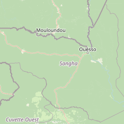
Lobéké National Park landscape and geographic character

The physical landscape of Lobéké National Park encompasses a diverse range of terrain and ecosystems characteristic of the central African forest zone. The park occupies elevations between 300 and 750 meters above sea level, with terrain that generally slopes gently toward the eastern boundary where the Sangha River flows. The park features more than twelve natural savannas distributed throughout its interior, characterized as saline swamps that create distinctive open habitats within the predominantly forested landscape. These savanna patches are bordered by palm thickets and sedge marshes, creating ecological transitions between forest and grassland environments. Along the Sangha River, sandbars and riverine ecosystems provide additional habitat diversity. Perhaps most distinctive are the large forest clearings, known locally as bais, which are natural clearings in the forest canopy where mineral-rich soils attract large mammals. The forest itself is classified as semi-evergreen, with much of the area having never been subjected to commercial logging operations. The understory consists of dense thicket formed by Marantaceae and Zingiberaceae plants, while Gilbertiodendron dewevrei trees cluster near streams and watercourses.

First Mirador, Lobéké National Park
Overnight lodging is available at the first observation tower in Lobéké National Park, East Province, Cameroon.

Lobéké National Park ecosystems, habitats, and plant life

The ecological character of Lobéké National Park is defined by its position within the Congo Basin, one of the world\u2019s most significant tropical forest ecosystems. The park\u2019s semi-evergreen forest represents a largely intact ecosystem that has avoided the logging pressures that have affected much of the region\u2019s forests. The vegetation displays remarkable diversity with more than 300 tree species recorded within the park boundaries. The dominant tree families include Malvaceae species such as Triplochiton scleroxylon, Pterygota, and Ceiba pentandra, along with Terminalia superba. The forest structure features a distinct understory layer composed of Marantaceae-Zingiberaceae thicket, with Ebenaceae and Annonaceae trees emerging above. Near permanent watercourses, distinctive Gilbertiodendron dewevrei stands create monodominant forest patches. The savanna ecosystems within the park, described as saline swamps, represent unique habitat types that occur in more than twelve locations throughout the protected area. These open habitats are bordered by palm thickets and sedge marshes, providing ecological diversity that supports distinct faunal communities. The annual rainfall of approximately 1,400 millimeters, concentrated in a wet season punctuated by a dry period from December through February, shapes the overall ecological dynamics of the park.

Lobéké National Park wildlife and species highlights

Lobéké National Park supports exceptional wildlife populations that rank among the most significant in all of Africa. The park is renowned for harboring some of the highest recorded densities of African forest elephants and western lowland gorillas, two species of profound conservation importance. These flagship species exist within a diverse mammal community that includes chimpanzees, additional gorilla populations, leopards, and at least ten species of forest ungulates. The bird fauna is equally remarkable, with more than 300 species recorded and official designation as Important Bird Area CM033. Notable avian residents include the African green pigeon, various hornbill species, the yellow-throated cuckoo, sandy scops owl, and chocolate-backed kingfisher. Within Cameroon and Gabon, the park holds particular significance for the Dja River scrub warbler. Beyond mammals and birds, the park supports 215 species of butterflies, 134 species of fish, 18 species of reptiles, and 16 species of amphibians. The mineral-rich bais, or forest clearings, serve as critical gathering points for megafauna and offer exceptional opportunities for wildlife observation.

Lobéké National Park conservation status and protection priorities

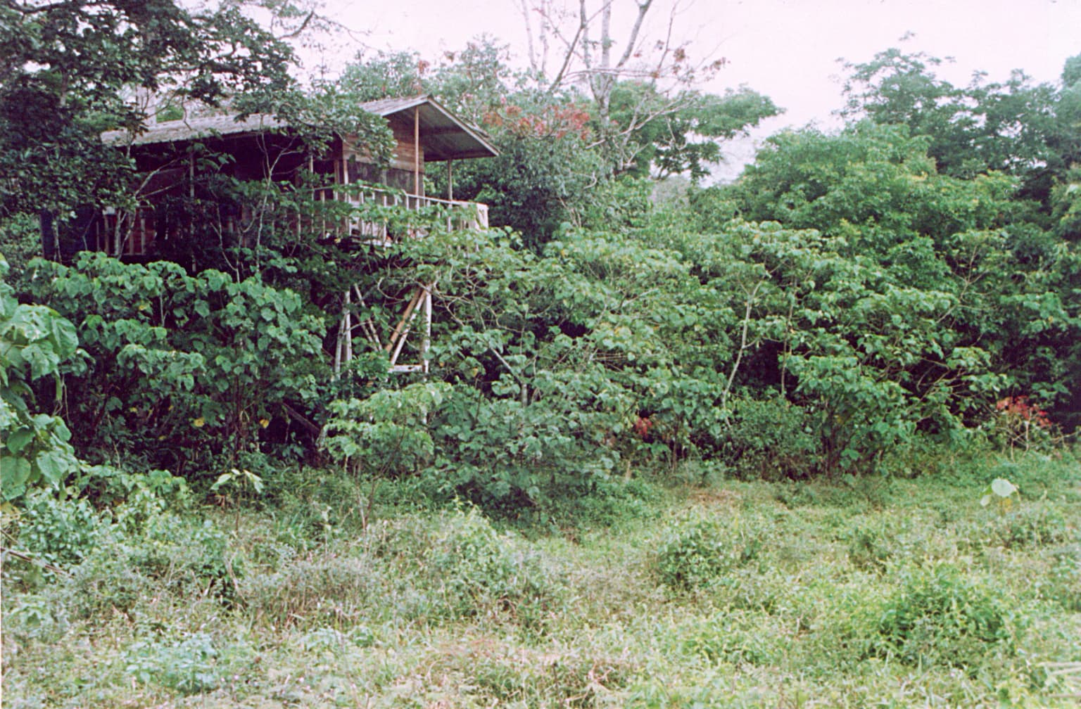
Lobéké National Park occupies a pivotal position in Central African conservation as a core component of the Sangha Trinational, a transboundary protected area network recognized for its outstanding universal value. The park\u2019s inscription as part of the Sangha Trinational World Heritage Site in 2012 reflects its global significance in preserving one of Africa\u2019s last great forest wildernesses. The tri-national framework, managed by the Central African Forest Commission and supported by international organizations including WWF, the Wildlife Conservation Society, and the German Development Agency, enables coordinated conservation across three national boundaries. However, the park faces significant conservation challenges. Timber exploitation and safari hunting pose ongoing threats, while poaching for bushmeat, exotic animals, and ivory remains a persistent concern. Illegal fishing and bird poaching, particularly the capture of African gray parrots for illegal trade, represent additional pressures. Despite a 1997 government ban on bird exports, illegal trade continues. The proximity to the Central African Republic and Republic of the Congo creates transboundary challenges but also opportunities for coordinated conservation efforts. Observation towers constructed five meters above ground level support both ecological monitoring and controlled tourism activities.

Lobéké National Park cultural meaning and human context

Lobéké National Park is situated within a region of rich cultural diversity, home to several distinct ethnic communities whose traditional territories overlap with the protected area. The park region is inhabited by the Baka people, a forest-dwelling community traditionally associated with hunter-gatherer livelihoods, as well as Bantu-speaking populations and the Bangando people. These communities maintain connections to the landscape that extend across generations, with traditional land use practices shaped by the forest environment. The surrounding Moloundu area has historical significance beyond its ecological value, having been described as one of the richest rubber-producing regions in Africa during the colonial period. German enterprises established a rubber processing plant in the area, marking the landscape with colonial economic history. The contemporary context involves balancing traditional resource use with conservation objectives, a challenge common to protected areas throughout central Africa. International conservation initiatives have engaged with local communities to develop sustainable approaches that respect both cultural heritage and ecological preservation.

Top sights and standout views in Lobéké National Park

Lobéké National Park stands as one of Africa\u2019s premier wilderness conservation areas, protecting some of the continent\u2019s most significant populations of forest elephants and western lowland gorillas within a largely pristine Congo Basin ecosystem. The park\u2019s participation in the Sangha Trinational creates one of the largest transboundary protected area networks in Central Africa, recognized as a World Heritage Site since 2012. The combination of untouched semi-evergreen forest, mineral-rich bais clearings, saline swamp savannas, and riverine habitats supports extraordinary biodiversity including over 300 tree species, more than 300 bird species, and diverse mammal populations. The park\u2019s location along the Sangha River, marking the border with both the Central African Republic and Republic of the Congo, positions it at the heart of regional conservation efforts. For visitors and researchers alike, Lobéké offers access to one of Africa\u2019s last great forest wildernesses where wildlife viewing opportunities in the forest clearings reveal the park\u2019s exceptional concentrations of megafauna.

Best time to visit Lobéké National Park

The optimal time to visit Lobéké National Park aligns with the dry season from December through February, when reduced precipitation facilitates easier movement through the forest and wildlife tends to concentrate more visibly around water sources and the mineral-rich bais clearings. The annual rainfall of approximately 1,400 millimeters falls predominantly during the wet season, which creates challenging conditions for travel and wildlife observation. The dry season offers more accessible trail conditions and improved visibility for viewing forest elephants, gorillas, and other species that gather at the clearings. However, visitor access to remote central African protected areas remains limited by infrastructure constraints and requires advance planning through authorized tour operators with established relationships with park management. The park\u2019s position in the equatorial zone means that temperature variations are minimal throughout the year, with the primary seasonal distinction lying in precipitation patterns rather than temperature swings.

Park location guide

Geography guide, regional context, and park location map for Lobéké National Park

Lobéké National Park park geography, regions, and map view in Cameroon
Understand where Lobéké National Park sits in Cameroon through a broader geographic reading of the surrounding landscape, nearby location context, and its mapped position within the national park landscape.

How Lobéké National Park fits into Cameroon

Cameroon is a Central African country spanning coastal, highland, and forest regions. It has a population of nearly 31 million people who speak 250 native languages alongside English and French as official languages. The country gained independence from France in 1960 and unified with British Southern Cameroons in 1961.

Wider geography shaping Lobéké National Park in Cameroon

Cameroon is located in Central Africa, bordering Nigeria and Chad to the west and north, the Central African Republic to the east, and Equatorial Guinea, Gabon, and the Republic of the Congo to the south. The country has a coastline on the Bight of Biafra, part of the Gulf of Guinea. Terrain includes coastal plains, mountainous highlands (including Mount Cameroon), plateaus, and dense rainforest regions.

Map view of Lobéké National Park

Use this park location map to pinpoint Lobéké National Park in Cameroon, understand its exact geographic position, and read its mapped placement within the surrounding landscape more clearly.

Pigeon | © OpenStreetMap contributors

Location context for Lobéké National Park

East RegionMoloundou Arrondissement

Explore the Untouched Semi-Evergreen Forests, Mineral-Rich Bais, and Unique Habitats Defining Lobéké National Park

Lobéké National Park Photos, Landscapes, and Visual Scenery of a Pristine Congo Basin Protected Area
Browse an atlas of imagery showcasing Lobéké National Park's diverse terrain, from dense semi-evergreen forests to distinctive mineral-rich bais and saline swamp savannas. These visual references offer crucial insights into the park's unique ecosystems and its protected-area character within the heart of the Congo Basin, revealing key habitats for forest elephants and gorillas.

Sangha Tri National Landscape

Lobéké buffalo.jpg

First Mirador, Lobéké National Park

Park atlas

Compare similar conservation landscapes and mapped protected areas throughout the broader Congo Basin region.

Explore Nearby National Parks and Protected Areas around Lobéké National Park
After exploring Lobéké National Park, browse other prominent national parks and protected areas across the expansive Congo Basin, tracing vital transboundary conservation landscapes. Compare diverse forest ecosystems, observe shared habitat ranges for iconic species, and understand the regional spread of Central African protected zones.
National parkCentral African Republic

Dzanga-Ndoki National Park National Park: Mapped Boundaries and Geographic Context in Central Africa

Explore protected landscape geography and park atlas details.

Gain a structured understanding of Dzanga-Ndoki National Park as a protected area in the Central African Republic. This page focuses on its precise geographic scope, mapped park boundaries, and its identity as a National Park. It serves as an entry point for exploring the park's landscape context and its place within the atlas of protected natural areas, offering factual details for geographic discovery.

Area
1,143.26 km²
Established
1990
IUCN
II
Relief
Lowland
National parkGabon

Ivindo National Park: A Protected Rainforest Landscape in Gabon

Explore its waterfalls, diverse ecosystems, and mapped geographic context.

Ivindo National Park represents a significant protected landscape within Gabon, spanning a vast area of intact tropical rainforest. Recognized as a UNESCO World Heritage Site, the park is defined by the Ivindo River and its dramatic waterfalls, including the famous Kongou and Mingouli Falls. Its geography includes mountainous terrain and vital riverine ecosystems, supporting critical populations of forest elephants and great apes. This page offers a gateway to understanding the park's protected status, its unique natural features, and its role in the broader geography of Central Africa.

Area
3,000 km²
Established
2002
IUCN
II
National parkHaut-Ogooué Province

Batéké Plateau National Park: Mapped Geography of a Central African Forest-Savanna Mosaic

Discover the terrain and protected landscape of Haut-Ogooué Province.

Batéké Plateau National Park is defined by its expansive forest-savanna mosaic, a rare ecological formation across Central Africa. Located within Haut-Ogooué Province, this national park showcases unique terrain characterized by savanna grasslands interspersed with woodlands and forested corridors. Understanding its geographic context and protected boundaries provides valuable insight into the region's natural heritage and conservation significance.

Area
2,034 km²
Established
2002
IUCN
II
National parkCameroon

Campo Ma'an National Park: Essential Protected Landscape in Cameroon's Atlantic Biafran Forest

Mapped evergreen canopy and vital great ape habitat in a key conservation area.

Campo Ma'an National Park is a crucial protected area in Cameroon, spanning 2,680 square kilometers of dense Atlantic Biafran forest. Established for environmental compensation, it safeguards critical habitat for western lowland gorillas and central chimpanzees, alongside forest elephants and diverse birdlife. The park's landscape is defined by a persistent evergreen canopy ecosystem, offering a unique context for understanding Central African rainforest geography and protected land status.

Area
2,680 km²
Established
2000
IUCN
II
National parkBénoué Department

Bénoué National Park: Protected Landscape Atlas in Bénoué Department, Cameroon

Explore savanna woodland, riparian ecosystems, and geographic context.

Bénoué National Park is a vast protected landscape in Cameroon, defined by its Sudanian savanna woodland and significant frontage along the Bénoué River. Recognized as a UNESCO Biosphere Reserve, it offers critical insights into regional geography, habitat diversity, and the broader atlas of conservation lands in West Africa. Users can explore its varied terrain, from riverine zones to higher massifs, gaining a detailed understanding of this important protected area.

Area
1,800 km²
Established
1968
IUCN
II
National parkDemocratic Republic of the Congo

Salonga National Park: Africa's Largest Tropical Rainforest Protected Landscape

Discover its vast mapped boundaries and riverine geography.

Salonga National Park is recognized as Africa's largest tropical rainforest, a UNESCO World Heritage Site vital for the conservation of bonobos and other endemic species. Its protected landscape is defined by extensive lowland forests and intricate river networks, with access primarily through waterways. This park offers profound insights into the geography of the Congo Basin and the conservation of endangered primates within a vast, remote wilderness.

Area
36,000 km²
Established
1970
IUCN
II
National parkGabon

Moukalaba-Doudou National Park: Gabon's Forest-Savanna Mosaic Protected Landscape

Atlas exploration of unique habitats and geographic boundaries.

Moukalaba-Doudou National Park in Gabon offers a distinctive atlas exploration experience, characterized by its remarkable combination of humid tropical rainforest and savanna grasslands. Covering a vast area, this protected landscape provides critical habitat and showcases a rare ecological transition zone within Central Africa. Understanding its mapped geography and protected-area status is key to appreciating Gabon's conservation efforts and the diverse natural terrains it preserves.

Area
4,500 km²
IUCN
II
National parkBioko Norte

Pico Basilé National Park: Volcanic Peak National Park and Protected Landscape

Explore Bioko Norte's unique montane terrain and rich avifauna.

Pico Basilé National Park is a critical conservation zone encompassing Equatorial Guinea's highest point, Pico Basilé volcano. This national park protects unique montane forest ecosystems and their diverse inhabitants, including several threatened primate species and a significant bird population, making it a key protected area on Bioko Island. Understand its geographic setting within Bioko Norte and its role as a vital natural landscape.

Area
300 km²
Established
2000
IUCN
II

Common questions about visiting, size, designation, and location context for Lobéké National Park

Lobéké National Park FAQs for park facts, access, geography, and protected area context
Find quick answers about Lobéké National Park, including protected-area facts, park geography, trail and visitor context, and how the park fits into its surrounding country and regional landscape.
MoriAtlas Explorer

Continue Your Protected Areas Search Across the Global Atlas

Deepen your exploration by continuing the structured search for national parks and protected areas worldwide. Utilize the comprehensive filtering capabilities to compare different conservation landscapes and refine your understanding of global park geography. Discover more about the distribution and characteristics of protected natural areas.

Global natural geography