Mori Atlas logo
National parkMoukalaba-Doudou National Park

Discover the mapped boundaries and diverse ecosystems of this Central African national park.

Moukalaba-Doudou National Park: A Unique Protected Landscape in Gabon's Geography

(Parc national de Moukalaba-Doudou)

Moukalaba-Doudou National Park represents a substantial protected area within Gabon, covering approximately 4,500 square kilometers. This national park is distinguished by its unusual ecological mosaic, featuring both dense humid tropical rainforest and expansive savanna grasslands. Situated in southeastern Gabon, its unique landscape context offers a valuable point of discovery for understanding regional geography and protected land distribution in Central Africa.

tropical rainforestsavanna ecosystemsmixed heritage siteCentral Africacoastal protected areaUNESCO tentative list

Moukalaba-Doudou National Park

National park

Park overview

Structured park overview, official facts, and landscape profile for Moukalaba-Doudou National Park

Moukalaba-Doudou National Park park facts, protected area profile, and essential visitor context
Review the core facts for Moukalaba-Doudou National Park, including designation, size, terrain, visitor scale, habitats, and operating context in one park-focused overview.

About Moukalaba-Doudou National Park

Moukalaba-Doudou National Park represents one of Gabon's significant protected areas, established to preserve a distinctive landscape that bridges multiple ecological zones. The park's location in southeastern Gabon places it in a region where the dense rainforests characteristic of the Congo Basin give way to more open savanna environments. This transitional character creates a heterogeneous landscape of considerable conservation interest. The protected area is part of Gabon's broader commitment to environmental stewardship, a reputation that has made the country a leader in African conservation. The park is administered by the National Agency for National Parks, which coordinates management across Gabon's system of protected areas. While the park's infrastructure and visitor facilities may be less developed than some other Gabonese parks, its ecological value is substantial, particularly given the combination of forest and savanna habitats that support distinct communities of plant and animal life.

Quick facts and research context for Moukalaba-Doudou National Park

Moukalaba-Doudou National Park covers roughly 4,500 square kilometers in southeastern Gabon, making it one of the larger protected areas in the country. The park straddles two administrative provinces, Nyanga and Ogooué-Maritime, and is situated at coordinates approximately 2.43 degrees south and 10.42 degrees east. It holds IUCN Category II designation as a national park and is managed by the National Agency for National Parks, the primary body overseeing Gabon's protected area system. The park's ecological character is defined by the unusual pairing of humid rainforest with savanna grasslands, creating a mosaic landscape that supports diverse flora and fauna. The site was inscribed on UNESCO's World Heritage Tentative List in 2005 under the Mixed category, reflecting both natural and cultural significance.

Park context

Deeper park guide and search-rich context for Moukalaba-Doudou National Park

Moukalaba-Doudou National Park history, landscape, wildlife, and travel context
Explore Moukalaba-Doudou National Park through its history, landscape character, ecosystems, wildlife, conservation priorities, cultural context, and seasonal travel timing in a structured park guide built for atlas discovery and search intent.

Why Moukalaba-Doudou National Park stands out

Moukalaba-Doudou National Park is best known for its unusual combination of two major ecosystem types that coexist within its boundaries. The humid rainforest portions represent Gabon's extensive Central African forest estate, while the savanna grasslands provide habitat for species adapted to more open landscapes. This ecological mixture is relatively rare in Gabon, where most protected areas focus on continuous forest environments. The park's position in southeastern Gabon also places it in a region that has received targeted conservation investment, including a development program initiated by the World Wildlife Fund in the mid-1990s. Its inclusion on the UNESCO World Heritage Tentative List as a mixed cultural and natural site further distinguishes it, suggesting recognition of both ecological significance and cultural heritage values.

Moukalaba-Doudou National Park history and protected-area timeline

Moukalaba-Doudou National Park was formally established as part of Gabon's expanding protected area network during the late twentieth century. The park's designation reflects Gabon's proactive approach to conservation, which accelerated significantly during the 1990s and 2000s as the country sought to protect its extensive forest resources and biodiversity. The World Wildlife Fund initiated a development program within the park beginning in 1996, indicating early international recognition of the site's conservation potential. This external engagement helped build capacity for park management and conservation activities. In 2005, the site was added to UNESCO's World Heritage Tentative List in the Mixed category, acknowledging both natural and cultural values. This tentative listing process typically precedes formal World Heritage inscription and indicates that the site meets criteria considered significant at the global level. The park's relatively recent formal recognition compared to some older African protected areas reflects both the country's methodical approach to establishing parks and the specific ecological characteristics that required conservation attention.

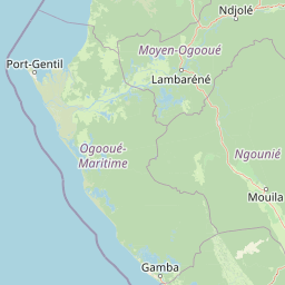
Moukalaba-Doudou National Park landscape and geographic character

The landscape of Moukalaba-Doudou National Park is defined by the interaction between two contrasting habitat types that create a mosaic environment across the protected area. The humid rainforest portions feature tall canopy trees, dense understory vegetation, and the characteristic humidity and shade of Central Africa's tropical forests. These forest areas are part of the broader Congo Basin forest ecosystem, which represents one of the world's largest remaining tropical rainforests. In contrast, the savanna grasslands within the park consist of more open terrain with grasses and scattered trees, providing a different visual and ecological character. This forest-savanna mosaic is a distinctive feature of the park, as most of Gabon's protected areas are dominated by continuous forest cover. The park's location in southeastern Gabon places it in a region where rainfall patterns and soil conditions support this transitional ecological zone. The terrain likely includes rolling hills and flat areas typical of the coastal plain regions of Gabon.

Moukalaba-Doudou National Park ecosystems, habitats, and plant life

The ecological character of Moukalaba-Doudou National Park is shaped by its position in a transitional zone between Gabon's extensive rainforests and the more open landscapes of the interior. The park's combination of humid forest and savanna ecosystems creates conditions that support two fundamentally different community types within a single protected boundary. The forest areas provide habitat for species dependent on dense tropical vegetation, including numerous bird species, mammals, and invertebrates that characterize the Central African forest fauna. The savanna portions support different species assemblages adapted to more open conditions, including grasses, shrubs, and animal species that prefer or require grassland environments. This ecological diversity within a single protected area enhances the park's conservation value, as it preserves ecological processes and species interactions that depend on landscape heterogeneity. Gabon's overall biodiversity is exceptionally high, and protected areas like Moukalaba-Doudou play a critical role in maintaining populations of both common and endangered species.

Moukalaba-Doudou National Park wildlife and species highlights

Wildlife in Moukalaba-Doudou National Park benefits from the dual-habitat environment that characterizes the protected area. The forest sections support populations of forest-dwelling species including various primates, small mammals, and an array of bird species that rely on the canopy and understory for food and shelter. The savanna areas provide habitat for species adapted to more open environments, potentially including large mammals that graze or browse in grassland conditions. While specific species are not detailed in available sources, Gabon's wildlife in general includes significant populations of forest elephants, gorillas, chimpanzees, and numerous antelope species, along with diverse birdlife. The park's location in southeastern Gabon places it within a region that maintains relatively intact wildlife populations due to the country's strong conservation policies. The presence of both forest and savanna habitats means the park can support a wider range of wildlife than single-habitat protected areas, though the specific species present would reflect the particular ecological conditions of this transition zone.

Moukalaba-Doudou National Park conservation status and protection priorities

Moukalaba-Doudou National Park contributes to Gabon's position as one of Africa's leading conservation nations. The park's inclusion on UNESCO's World Heritage Tentative List since 2005 reflects its recognized significance at the international level, particularly as a mixed natural and cultural site. This tentative listing indicates that the site meets one or more of the criteria that the World Heritage Committee uses to assess outstanding universal value. The park's management under the National Agency for National Parks connects it to Gabon's systematic approach to protected area administration. The World Wildlife Fund's development program initiated in the mid-1990s demonstrates sustained international engagement with the site's conservation. Gabon's protected area network is widely regarded as a model for effective forest conservation in Central Africa, with the country having designated roughly ten percent of its territory to protected status. Parks like Moukalaba-Doudou play a role in maintaining ecological corridors, preserving biodiversity, and supporting sustainable land use across the national territory.

Moukalaba-Doudou National Park cultural meaning and human context

Moukalaba-Doudou National Park's classification as a Mixed World Heritage site indicates recognition of cultural values alongside its ecological significance. This dual designation suggests that the park contains elements of human heritage, possibly including traditional land use practices, historical communities, or cultural landscapes that have shaped and been shaped by the local environment. The park's location in southeastern Gabon places it within regions inhabited by local communities whose relationship with the land predates formal protected area designation. The presence of savanna ecosystems within the park may reflect historical patterns of human interaction with the landscape, including fire management, grazing, or agricultural activities that have influenced vegetation patterns over time. While specific cultural details are not provided in available sources, the Mixed category designation implies that these human dimensions are considered important for the site's overall significance and warrant preservation alongside the natural environment.

Top sights and standout views in Moukalaba-Doudou National Park

Moukalaba-Doudou National Park stands out as one of Gabon's larger protected areas at approximately 4,500 square kilometers, offering extensive habitat for wildlife and ecological processes. The park's defining characteristic is its unusual combination of humid rainforest and savanna grasslands within a single protected boundary, creating an ecological transition zone that is relatively rare in Gabon. Its 2005 inclusion on UNESCO's World Heritage Tentative List as a Mixed natural and cultural site distinguishes it from many other Gabonese parks that are recognized primarily for natural values. The park's location in southeastern Gabon places it within a region that has received targeted conservation investment and benefits from the country's strong protected area management framework. The presence of both forest and savanna habitats supports a diverse array of species and ecological communities, making the park valuable for biodiversity conservation in the Congo Basin region.

Best time to visit Moukalaba-Doudou National Park

The best time to visit Moukalaba-Doudou National Park would generally align with Gabon's dry season, which typically occurs from June through September. During these months, rainfall is reduced and wildlife becomes more concentrated around water sources, potentially improving viewing opportunities. The wet season from October through May brings higher rainfall, which can affect road accessibility within the park and make some areas more difficult to reach. Temperature in southeastern Gabon remains consistently warm throughout the year due to the equatorial location. Visitors interested in birdwatching may find the transition periods between wet and dry seasons particularly rewarding, as migrant species move through the region. The park's less developed infrastructure compared to some other Gabonese protected areas means that access and logistics require more planning. Overall, the period from mid-year through early autumn typically offers the most favorable conditions for exploration of this coastal forest-savanna park.

Park location guide

Geography guide, regional context, and park location map for Moukalaba-Doudou National Park

Moukalaba-Doudou National Park park geography, regions, and map view in Gabon
Understand where Moukalaba-Doudou National Park sits in Gabon through a broader geographic reading of the surrounding landscape, nearby location context, and its mapped position within the national park landscape.

How Moukalaba-Doudou National Park fits into Gabon

Gabon is a Central African country on the Atlantic coast, positioned on the equator. It gained independence from France in 1960 and is governed as a unitary presidential republic. The country has significant oil wealth and one of the highest Human Development Index rankings in Africa, though wealth distribution remains uneven.

Wider geography shaping Moukalaba-Doudou National Park in Gabon

Gabon is situated on the Atlantic coast of Central Africa, positioned along the equator. It borders Equatorial Guinea to the northwest, Cameroon to the north, and the Republic of the Congo to the east and south. The terrain includes coastal plains along the Atlantic, mountain ranges in the center (the Cristal Mountains and Chaillu Massif), and savanna zones in the east.

Map view of Moukalaba-Doudou National Park

Use this park location map to pinpoint Moukalaba-Doudou National Park in Gabon, understand its exact geographic position, and read its mapped placement within the surrounding landscape more clearly.

Pigeon | © OpenStreetMap contributors

Location context for Moukalaba-Doudou National Park

Nyanga ProvinceOgooué-Maritime
Park atlas

Compare nearby protected landscapes and mapped geography in Gabon and surrounding Central Africa

Explore Other National Parks and Protected Areas Beyond Moukalaba-Doudou National Park
Continue your exploration of Moukalaba-Doudou National Park by browsing other protected areas throughout Gabon, including national parks and significant conservation landscapes. Deepen your understanding of regional park geography and discover similar forest-savanna mosaic ecosystems or dense tropical rainforests across Central Africa.
National parkGabon

Loango National Park: Gabon's Coastal Wilderness and Unique Protected Landscape

Explore savanna, forest, beach, and lagoon ecosystems in this vital national park.

Loango National Park in Gabon is a significant protected area recognized for its remarkable geographic diversity. This national park encompasses over 100 kilometers of pristine, uninhabited Atlantic coastline, rare mangrove systems, and expansive savanna plains transitioning into dense tropical forests. Its unique landscape, particularly the Iguéla Lagoon, offers rich opportunities for atlas-style exploration of coastal ecosystems and protected areas. Understanding the park's mapped boundaries and regional setting is key to appreciating its ecological importance.

Area
1,550 km²
Established
2002
IUCN
II
Relief
Lowland
National parkGabon

Waka National Park: A Mapped Protected Landscape in Gabon's Geography

Explore the natural terrain and park boundaries of this national park.

Waka National Park in Gabon represents a vital protected landscape for geographic exploration. This dedicated detail page offers insight into the park's specific mapped area and its place within the country's broader natural terrain. Understand its context as a national park, contributing to the atlas of protected areas in Central Africa. Discover the geographic identity of this significant natural reserve.

Area
1,060 km²
Established
2002
IUCN
II
Relief
Mountain
National parkGabon

Mayumba National Park: Gabon's Equatorial Protected Area and Geographic Atlas

Explore mapped park boundaries and regional landscape context.

Delve into the geographic identity of Mayumba National Park, a significant protected area situated in Gabon. This detail page provides atlas-style insights into the park's mapped boundaries, its position within the equatorial geography of Central Africa, and its role as a national park. Understand the protected landscape's environmental context and its atlas significance.

Area
870 km²
Established
2002
IUCN
II
Relief
Lowland
Watercolor painting showing a river with green hills and pink flowers in the foreground
National parkKouilou Department

Conkouati-Douli National Park: Mapping Protected Landscape Boundaries and Regional Geography

Explore its national park status and geographic context.

Conkouati-Douli National Park is a protected area situated in the Kouilou Department, offering a focused point for geographic and landscape discovery. This detail provides an atlas-style perspective on its mapped boundaries and its contribution to the regional geography. Understand the park as a distinct natural landscape and a key component of conservation within its geographic setting.

Area
7,955 km²
Established
1999
IUCN
II
Relief
Lowland
National parkGabon

Birougou National Park: Mapped Protected Landscape and Regional Geography in Gabon

Explore the geographic extent and conservation context of this national park.

Birougou National Park is an important protected area situated in Gabon, offering a distinct focus for geographic and atlas-based discovery. This national park serves as a significant element within the country's network of conservation landscapes, providing a focal point for understanding mapped terrain and regional geographic patterns. Users can explore its protected boundaries and gain insight into its specific environmental context within Central Africa, making it a vital entry for atlas exploration of Gabon's natural heritage.

Area
690 km²
Established
2002
IUCN
II
Relief
Mountain
Watercolor painting of a landscape with grassy areas, a lake, and distant hills under a light sky
National parkGabon

Lopé National Park: Gabon's Protected Landscape and National Park Geography

Explore mapped boundaries and natural terrain in Central Africa.

Delve into Lopé National Park, a designated national park situated in Gabon. This protected area serves as a crucial point for understanding the nation's geography and the distribution of its conservation landscapes. As an entry in the MoriAtlas, it offers a detailed view of its mapped territory and its contribution to the broader regional context of Central Africa, emphasizing its role in protected area atlas exploration.

Area
4,910 km²
Established
2002
IUCN
II
Relief
Mixed relief
National parkGabon

Pongara National Park: Protected Landscape and Geographic Exploration in Gabon

Mapped boundaries and regional natural context.

Pongara National Park is a designated national park within Gabon, offering a unique opportunity for structured exploration of protected lands. Users can investigate its specific geographic setting, understand its mapped boundaries, and appreciate its place within the regional landscape context. This entry provides a factual foundation for understanding the park's identity as a protected natural area and its contribution to Gabon's geography.

Area
929 km²
Established
2002
IUCN
II
Relief
Lowland
National parkWoleu-Ntem Province

Crystal Mountains National Park: National Park Protected Area and Geographic Context in Woleu-Ntem Province

Explore its mapped boundaries and regional landscape.

Crystal Mountains National Park is a designated national park offering critical insights into its protected landscape and geographic setting. Users can explore the mapped boundaries of this protected area, understand its regional terrain, and gain context within Woleu-Ntem Province through structured geographic data. This page provides the foundational atlas information for comprehending the park's conservation significance and natural features.

Area
1,200 km²
Established
2002
IUCN
II
Relief
Mountain

Common questions about visiting, size, designation, and location context for Moukalaba-Doudou National Park

Moukalaba-Doudou National Park FAQs for park facts, access, geography, and protected area context
Find quick answers about Moukalaba-Doudou National Park, including protected-area facts, park geography, trail and visitor context, and how the park fits into its surrounding country and regional landscape.
MoriAtlas Explorer

Continue Your Protected Areas Search Across the Global Atlas

Deepen your exploration by continuing the structured search for national parks and protected areas worldwide. Utilize the comprehensive filtering capabilities to compare different conservation landscapes and refine your understanding of global park geography. Discover more about the distribution and characteristics of protected natural areas.

Global natural geography