Mori Atlas logo
National parkBénoué National Park

Mapping the unique savanna woodland, riparian ecosystems, and wildlife habitats.

Bénoué National Park: Protected Landscape & Geographic Atlas in Bénoué Department

(Parc National de la Bénoué)

Bénoué National Park represents a significant protected area within Cameroon's Bénoué Department, spanning over 1,800 square kilometers of Sudanian savanna woodland. This park is integral to understanding the geographic transition between central African woodlands and Sahelian zones, featuring over 100 kilometers of the Bénoué River along its eastern edge. As a UNESCO Biosphere Reserve, it showcases a diverse landscape from undulating plains and forest patches to rocky massifs, offering rich context for atlas-based exploration of West African protected lands.

National ParkSavanna EcosystemUNESCO Biosphere ReserveLion Conservation UnitImportant Bird AreaRiparian Habitat
Stylized illustration of a river flowing through a canyon with waterfalls, cliffs, and forests

Bénoué National Park

National park

Park overview

Structured park overview, official facts, and landscape profile for Bénoué National Park

Bénoué National Park park facts, protected area profile, and essential visitor context
Review the core facts for Bénoué National Park, including designation, size, terrain, visitor scale, habitats, and operating context in one park-focused overview.

About Bénoué National Park

Bénoué National Park represents Cameroon’s commitment to preserving its natural heritage and forms a core component of the country’s protected area network. Located in the Bénoué Department of northeastern Cameroon, the park occupies a strategic position within the broader Bénoué savanna belt, a region of humid savannah woodland that stretches between the northern city of Garoua and the southern city of Ngaoundéré. The park’s 1,800 square kilometer expanse encompasses remarkable topographic diversity, from large rocky massifs at higher elevations reaching 760 meters to undulating plains and forested corridors at lower altitudes. The Bénoué River, stretching for over 100 kilometers along the park’s eastern boundary, serves as the lifeblood of the ecosystem, supporting riparian forests and providing critical water access for wildlife. The park is surrounded by eight hunting reserves that collectively cover 5,203.78 square kilometers, creating an extensive buffer zone around the core protected area. Access to the park is possible via the public road to Tcholliré, which cuts across the northern portion, or by traveling north from Ngaoundéré along the main road connecting that city to Garoua.

Quick facts and research context for Bénoué National Park

Bénoué National Park covers 1,800 km² in northeastern Cameroon, established as a national park in 1968 after being a wildlife reserve since 1932. The park became a UNESCO Biosphere Reserve in 1981. Elevation ranges from 250 to 760 meters above sea level, with higher areas characterized by large rocky massifs and lower sections featuring undulating plains and forest. The Bénoué River forms a 100+ kilometer eastern boundary. The park is surrounded by eight hunting reserves totaling over 5,200 km². It is recognized as a Lion Conservation Unit with an estimated 200 lions and is an Important Bird Area with 306 recorded species.

Park context

Deeper park guide and search-rich context for Bénoué National Park

Bénoué National Park history, landscape, wildlife, and travel context
Explore Bénoué National Park through its history, landscape character, ecosystems, wildlife, conservation priorities, cultural context, and seasonal travel timing in a structured park guide built for atlas discovery and search intent.

Why Bénoué National Park stands out

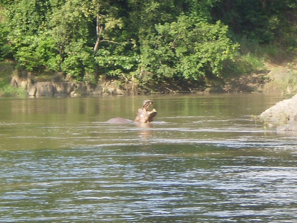
Bénoué National Park is renowned as one of the few places in Africa where visitors have a realistic chance of observing the giant eland, Africa’s largest antelope species. The park is equally famous for its substantial hippopotamus colonies that populate the Bénoué River, as well as crocodile populations. It serves as a critical habitat for approximately 200 lions, making it one of West Africa’s most important lion conservation areas. The park’s bird diversity is exceptional, with 306 species documented including the Adamawa turtle-dove, Egyptian plover, and violet turaco. The combination of riparian ecosystems along the Bénoué River, Sudanian woodland, and open savanna creates one of the most ecologically diverse protected landscapes in Cameroon.

Grassy clearing with trees, a thatched-roof building with blue windows, and people walking in the background.
Open grassy area with scattered trees and a thatched-roof structure in Bénoué National Park.

Bénoué National Park history and protected-area timeline

The conservation history of Bénoué National Park reflects evolving approaches to wildlife protection in Central Africa. The area was first protected in 1932 when it was established as a wildlife reserve, making it one of the older protected areas in Cameroon. This initial designation came during the colonial period when European administrators began recognizing the need to conserve West Africa’s wildlife populations. The reserve was upgraded to full national park status in 1968, elevating its protection level and formalizing its role in Cameroon’s national parks system. A significant milestone came in 1981 when the park was designated as a UNESCO Biosphere Reserve under the Man and the Biosphere Programme, recognizing its dual value as a conservation area and a living landscape where local communities continue their traditional practices. This biosphere reserve status acknowledges the park’s successful integration of biodiversity protection with sustainable human use of natural resources.

Bénoué National Park landscape and geographic character

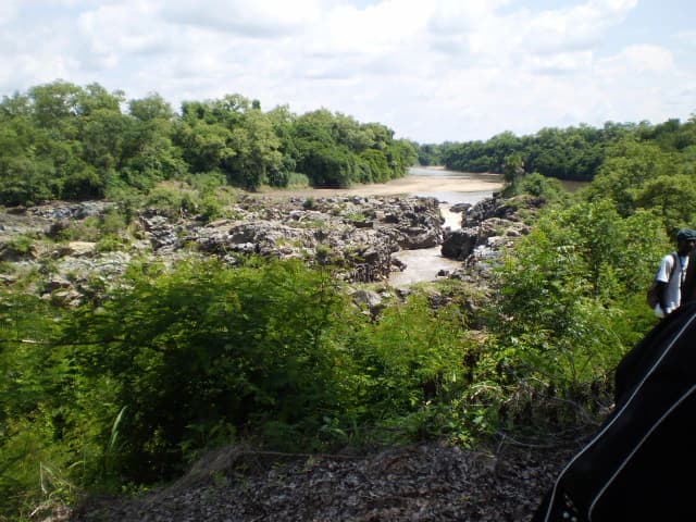
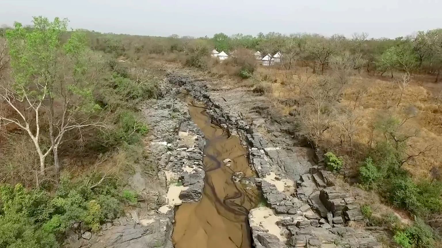
The physical landscape of Bénoué National Park displays characteristic features of the West African savanna biome. The park’s terrain rises from approximately 250 meters above sea level in the lower lying areas to around 760 meters at the highest points, creating a varied topography. The higher elevations are marked by large rocky massifs that break the visual monotony of the savanna and provide important shelter for wildlife. The lower sections consist of undulating plains interspersed with forest patches, creating a mosaic landscape that supports diverse ecological communities. The Bénoué River, with its sandy bed and seasonally fluctuating water levels, forms a prominent linear feature along the eastern boundary, its exposed sandbars during the dry season providing crucial habitat for waterbirds and shorebirds. The surrounding hunting reserves extend the savanna landscape beyond the park’s borders, creating an interconnected conservation landscape.

River flowing through rocky terrain with dense vegetation under a partly cloudy sky
Bénoué River flowing through rocky terrain surrounded by dense vegetation in Bénoué National Park

Bénoué National Park ecosystems, habitats, and plant life

The ecological character of Bénoué National Park is defined by its position within the Sudanian woodland zone, supporting a complex mosaic of habitats. The park’s vegetation consists primarily of wooded grassland, with distinct community types transitioning across the landscape. The south-central portions feature Isoberlinia-dominated woodland, a characteristic species of the Sudanian belt that forms dense canopies. Moving northward, the woodland becomes shorter and more open, transitioning to mixed wooded grassland. Along the Bénoué River and its major tributaries, semi-evergreen riparian forest and thickets develop, creating verdant corridors that contrast with the surrounding savanna. Dry Anogeissus forest occurs in patches throughout the park, adding to the habitat diversity. This variety of vegetation types supports the park’s remarkable animal diversity and explains its importance as a conservation area.

Aerial view of a savanna landscape with scattered round huts, sparse trees, and dry terrain
Drone view of Bénoué National Park showing savanna landscape with traditional round huts

Bénoué National Park wildlife and species highlights

Bénoué National Park supports an impressive array of wildlife, with several species of conservation significance. The park is particularly notable for harboring populations of giant eland, Africa’s largest antelope species, and is considered one of the few places on the continent where realistic opportunities exist to observe this magnificent animal. The predominant large ungulates include kob, western hartebeest, giant eland, waterbuck, and African buffalo, forming the basis of the predator-prey relationships that structure the ecosystem. Hippopotamus colonies are a flagship attraction, with the Bénoué River supporting substantial populations that can be observed from riverbanks. Crocodiles are common in the riverine environments. The park contains a significant lion population, estimated at approximately 200 adult individuals in 2011, and has been recognized as a Lion Conservation Unit since 2005. African wild dog is present though less common than in neighboring Faro National Park. Other notable mammals include African elephant, spotted hyena, warthog, and various monkey species. The bird fauna is exceptional, with 306 species recorded, including the Adamawa turtle-dove, Egyptian plover (known as the crocodile bird), red-throated bee-eater, red-winged grey warbler, stone partridge, and violet turaco.

River flowing through rocky terrain with scattered trees in the background
River flowing through rocky terrain in Bénoué National Park

Bénoué National Park conservation status and protection priorities

Bénoué National Park represents a cornerstone of Cameroon’s conservation strategy and holds international recognition for its ecological value. The UNESCO Biosphere Reserve designation in 1981 acknowledges both the park’s biodiversity significance and its role as a living landscape where traditional human activities continue. The park’s classification as a Lion Conservation Unit since 2005 highlights its importance for big cat conservation in West Africa, with the 2011 survey estimating 200 adult lions within its boundaries. Its designation as an Important Bird Area (CM007) reflects the exceptional avian diversity, with 306 species documented including numerous waterbirds that depend on the Bénoué River’s seasonal habitats. The surrounding hunting reserves covering over 5,200 square kilometers create an extensive buffer system that extends conservation protection beyond the core park area, though managing the relationship between these reserves and the protected park remains an ongoing challenge.

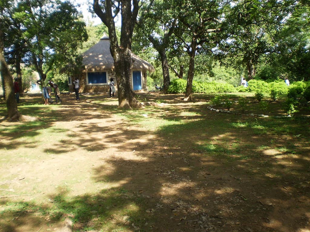
Bénoué National Park cultural meaning and human context

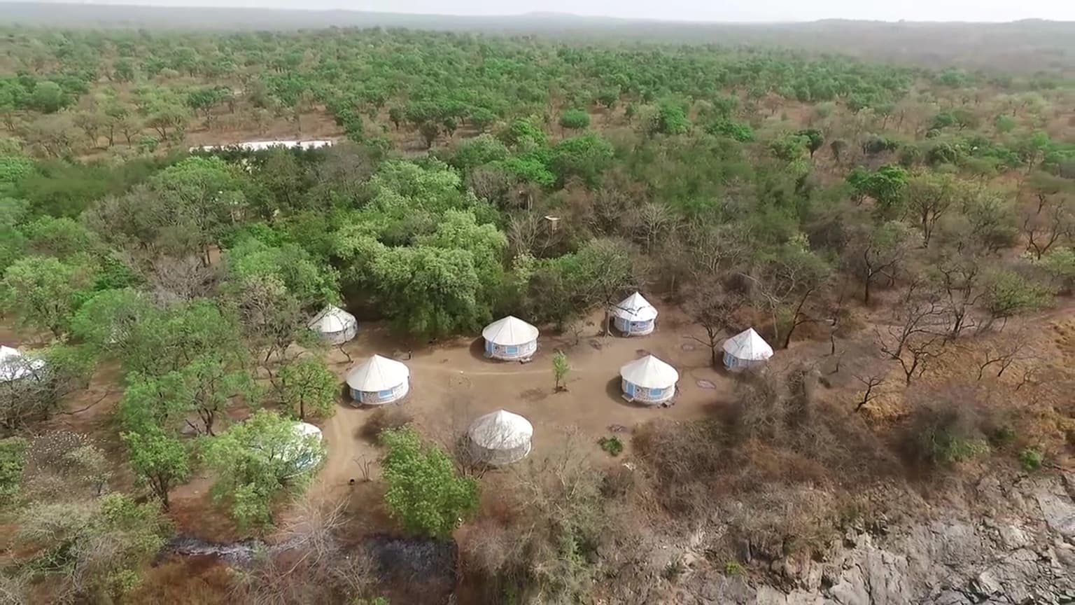
The human dimension of Bénoué National Park is characterized by the presence of nomadic communities who have historically inhabited and utilized the landscape. The majority of the human population within the park practices traditional nomadic lifestyles, creating a dynamic relationship between human activity and the natural environment. Park guards and conservation personnel operate not only as law enforcement but also as community educators and arbitrators, managing the complex interactions between local communities and wildlife. An interesting documented phenomenon is kleptoparasitism, where villagers occasionally steal meat from predator kills such as lion kills, representing a form of human-wildlife interaction that conservation programs must address. This human presence underscores that Bénoué functions not as a wilderness preserve in the strict sense but as a cultural landscape where conservation and traditional livelihoods must be balanced.

Hippo partially submerged in a river with green trees on the riverbank
Hippo swimming in the Bénoué River at Bénoué National Park

Top sights and standout views in Bénoué National Park

Bénoué National Park offers exceptional wildlife viewing opportunities in one of West Africa’s most accessible savanna ecosystems. The chance to observe giant eland, Africa’s largest antelope, represents a unique highlight found nowhere else on the continent with such reliability. The hippopotamus colonies along the Bénoué River provide reliable sightings, while crocodile populations are commonly observed. The birdlife, particularly along the river during the dry season when exposed sandbars attract waterbirds and shorebirds, offers excellent birdwatching. The park’s status as a UNESCO Biosphere Reserve and Lion Conservation Unit demonstrates its international conservation significance. The combination of varied terrain from rocky massifs to riparian forests creates scenic diversity, while the seasonal patterns of the Bénoué River add dynamic interest to visits.

Best time to visit Bénoué National Park

The optimal time to visit Bénoué National Park aligns with the dry season, typically from November through April, when wildlife congregates around the remaining water sources and vegetation is less dense, improving visibility. The dry season also coincides with the period when the Bénoué River’s water levels drop, exposing sandbars that attract waterbirds and create excellent birdwatching conditions. During this period, the landscape transitions from the lush green of the wet season to a more golden savanna, offering different visual experiences. The wet season, from May to October, brings lush vegetation but makes wildlife more difficult to spot and can affect road accessibility within the park. Visitors interested in lion and other large mammal viewing will find the dry season most productive, as animals concentrate around the river and remaining waterholes.

Park location guide

Geography guide, regional context, and park location map for Bénoué National Park

Bénoué National Park park geography, regions, and map view in Cameroon
Understand where Bénoué National Park sits in Cameroon through a broader geographic reading of the surrounding landscape, nearby location context, and its mapped position within the national park landscape.

How Bénoué National Park fits into Cameroon

Cameroon is a Central African country spanning coastal, highland, and forest regions. It has a population of nearly 31 million people who speak 250 native languages alongside English and French as official languages. The country gained independence from France in 1960 and unified with British Southern Cameroons in 1961.

Wider geography shaping Bénoué National Park in Cameroon

Cameroon is located in Central Africa, bordering Nigeria and Chad to the west and north, the Central African Republic to the east, and Equatorial Guinea, Gabon, and the Republic of the Congo to the south. The country has a coastline on the Bight of Biafra, part of the Gulf of Guinea. Terrain includes coastal plains, mountainous highlands (including Mount Cameroon), plateaus, and dense rainforest regions.

Map view of Bénoué National Park

Use this park location map to pinpoint Bénoué National Park in Cameroon, understand its exact geographic position, and read its mapped placement within the surrounding landscape more clearly.

Pigeon | © OpenStreetMap contributors

Location context for Bénoué National Park

Bénoué Department

A visual journey through Cameroon's crucial conservation landscape, showcasing savanna woodlands and vital riverine corridors.

Bénoué National Park Photo Gallery: Visualizing West African Savanna Landscapes and Key Wildlife Habitats
Explore a visual overview of Bénoué National Park's diverse terrain, encompassing undulating savanna plains, wooded grasslands, critical riparian ecosystems along the Bénoué River, and rocky massifs. Visualizing these features helps clarify the park's characteristic West African savanna biome, its unique habitat mosaic, and the protected-area character that sustains iconic wildlife.

Grassy clearing with trees, a thatched-roof building with blue windows, and people walking in the background.

Rapids flowing through dark rocks on the Bénoué River with lush green trees in the background and a small group of people observing from the riverbank

River flowing through rocky terrain with dense vegetation under a partly cloudy sky

Aerial view of a savanna landscape with scattered round huts, sparse trees, and dry terrain

River flowing through rocky terrain with scattered trees in the background

Aerial view of a river bend with sandy banks surrounded by forested areas and vegetation

Hippo partially submerged in a river with green trees on the riverbank

Park atlas

Map the regional spread of protected areas, comparing savanna and riparian conservation landscapes adjacent to Bénoué National Park

Discover Other National Parks and Protected Areas Near Bénoué National Park and Its Savanna Belt
Explore other national parks and protected areas within the West African savanna biome, extending geographic discovery from Bénoué National Park into its river basin and adjacent conservation landscapes. Compare these diverse protected areas to understand regional ecosystem variations, geographic spread, and significant conservation efforts safeguarding critical wildlife habitats.
National parkCameroon

Bouba Njida National Park: A Protected Landscape within Cameroon's National Park Atlas

Discover its mapped geography and regional context.

Bouba Njida National Park represents a key component of Cameroon's protected lands, contributing essential context to any atlas of Central African geography. As a designated national park, it offers a distinct focus for understanding mapped landscape features and the distribution of protected areas within the country. This park serves as a vital point of reference for exploring the nation's natural terrain and its significance within the broader context of regional conservation efforts.

Area
2,200 km²
Established
1980
IUCN
II
Relief
Upland
National park

Faro National Park: Central Africa's Largest Hippo Population within Sudano-Sahelian Protected Landscape

Explore mapped boundaries and regional geography of this vital national park.

Faro National Park stands as a critical protected area within Cameroon, celebrated for its immense hippopotamus population and its role in conserving large mammals across the Sudano-Sahelian zone. The park's landscape comprises undulating savanna plains, river valleys, and elevated hilltops, offering a diverse geographic context for conservation. Its inclusion in a transboundary protected network highlights its importance for regional landscape mapping and ecological continuity. Understanding Faro National Park involves appreciating its unique habitat mosaic and its contribution to the protected areas atlas.

Area
3,418 km²
Established
1989
IUCN
II
Relief
Upland
National park

Deng Deng National Park: Protected Landscape & Gorilla Habitat in East Cameroon

Discover the mapped geography and conservation significance of this national park.

Deng Deng National Park in Cameroon's East Region offers a unique glimpse into the Northern Congolian forest-savanna mosaic ecoregion. Spanning about 683 square kilometers and shaped by the Sanaga River, it is critically important as the northernmost known habitat for western lowland gorillas. Its diverse terrain supports not only gorillas but also elephants, chimpanzees, and pangolins, highlighting its role in Central African biodiversity and regional landscape context.

Area
682.64 km²
Established
2010
IUCN
II
Climate
Tropical
National parkFar North Region

Waza National Park: A Designated Protected Landscape in the Far North Region

Mapped Boundaries and Regional Geographic Context

Waza National Park stands as a vital protected natural landscape in Cameroon's Far North Region. This entry provides a deep dive into its mapped protected-area boundaries and its significance within the broader regional geography. Explore the specific landscape identity of this national park through an atlas-focused lens, understanding its terrain and context without travel logistics or visitor advice.

Area
1,700 km²
Established
1934
IUCN
II
Relief
Lowland
National parkNigeria

Chad Basin National Park: Exploring Nigeria's Protected Natural Landscape

Mapped protected area and regional geography context.

Chad Basin National Park is a key protected landscape within Nigeria, designated as a national park. This page serves as a gateway to understanding its specific geographic identity, mapped boundaries, and its role within the country's natural terrain. Users can explore detailed information, focusing on the park's atlas-relevant features and its contribution to Nigeria's protected areas, offering a distinct view of the nation's geography.

Area
2,258 km²
Established
1991
IUCN
II
Relief
Lowland
National parkCentre Region

Mpem and Djim National Park: Protected Landscape and Regional Geographic Atlas

Explore the mapped terrain and protected boundaries of this national park.

Mpem and Djim National Park is a protected natural area situated within Cameroon's Centre Region. This detail entry provides an atlas-focused view, emphasizing the park's protected landscape characteristics and its position within the regional geography. Understand the mapped context and discover the identity of Mpem and Djim National Park as a key protected area.

Area
974.8 km²
Established
2004
IUCN
II
Relief
Upland
National parkMoyen-Chari Region

Manda National Park: National Park Protected Landscape and Geographic Identity in Moyen-Chari

Discover mapped terrain and regional context for this Chad national park.

Manda National Park, a protected natural area within Chad's Moyen-Chari Region, offers valuable insights into regional geography and mapped protected landscapes. This detail page provides focused information on the park's identity as a national park, emphasizing its geographic setting and the importance of its mapped boundaries for structured atlas exploration. Understand how this protected area contributes to the diverse natural terrain of the Moyen-Chari Region.

Area
1,140 km²
Established
1969
IUCN
II
Climate
Tropical
National parkCameroon

Bakossi National Park: Detailed Protected Area Map and Geographic Identity in Cameroon

Explore the mapped landscape and regional context of this Cameroonian national park.

Bakossi National Park is an important protected area situated within Cameroon, functioning as a national park dedicated to conservation and geographic study. This page provides essential details on its mapped boundaries, regional setting, and the natural landscape it represents. It serves as a foundational element for understanding protected areas in Central Africa and their broader geographical significance.

Area
293.2 km²
Established
2008
Relief
Mountain
Climate
Tropical

Common questions about visiting, size, designation, and location context for Bénoué National Park

Bénoué National Park FAQs for park facts, access, geography, and protected area context
Find quick answers about Bénoué National Park, including protected-area facts, park geography, trail and visitor context, and how the park fits into its surrounding country and regional landscape.
MoriAtlas Explorer

Continue Your Protected Areas Search Across the Global Atlas

Deepen your exploration by continuing the structured search for national parks and protected areas worldwide. Utilize the comprehensive filtering capabilities to compare different conservation landscapes and refine your understanding of global park geography. Discover more about the distribution and characteristics of protected natural areas.

Global natural geography