Mori Atlas logo
National parkLlanos de Challe National Park

Discover the unique lomas ecosystem and dramatic terrain of this Atacama Region national park.

Llanos de Challe National Park: Protected Coastal Desert Landscape and Geography

Llanos de Challe National Park protects a critical coastal desert environment in Chile's Atacama Region, renowned for its rare fog-fed lomas ecosystem supporting remarkable biodiversity. Explore the park's varied terrain, from pristine white-sand beaches to steep mountain slopes reaching 950 meters, and understand its vital role as a mapped protected area within South America's arid landscapes. This is your entry point to understanding the geographic context and unique ecological significance of this important national park.

Coastal DesertLomas EcosystemChile National ParksAtacama DesertFog-Fed VegetationGuanaco Habitat

Llanos de Challe National Park

National park

Park overview

Structured park overview, official facts, and landscape profile for Llanos de Challe National Park

Llanos de Challe National Park park facts, protected area profile, and essential visitor context
Review the core facts for Llanos de Challe National Park, including designation, size, terrain, visitor scale, habitats, and operating context in one park-focused overview.

About Llanos de Challe National Park

Llanos de Challe National Park represents one of Chile's most ecologically distinctive protected areas, protecting a narrow band of coastal desert where the Pacific Ocean meets the Atacama Desert, the driest non-polar desert on Earth. The park's significance derives from the lomas ecosystem, a unique fog-dependent habitat that forms along the Pacific coast where cold ocean currents interact with coastal topography to create persistent morning and evening fog. This moisture, known locally as Camanchaca, sustains a surprising diversity of plant life that has adapted to capture water directly from the mist, creating green enclaves amid barren terrain. The park spans elevations from sea level to 950 meters at Cerro Negro, encompassing steep coastal cliffs, rolling hills, and sandy beaches that transition into protected wetland areas. The ecosystem is extraordinarily fragile, with plant species having evolved specific mechanisms to survive both extreme aridity and the occasional deluge that comes with El Niño events. Beyond its ecological importance, the park offers visitors a profound sense of isolation and wilderness, with vast stretches of empty coastline and the ability to experience one of the world's most unusual desert environments in its most pristine form.

Quick facts and research context for Llanos de Challe National Park

Llanos de Challe National Park is located in Chile's Atacama Region, near the coastal town of Huasco, approximately 28 degrees south latitude. The park protects a unique coastal desert environment where the lomas fog ecosystem creates pockets of remarkable biodiversity amid extreme aridity. At 950 meters, Cerro Negro represents the park's highest point, while the coastal plain features pristine white-sand beaches and important wetland habitat. The area is classified as IUCN Category II (National Park) and managed by Chile's Corporación Nacional Forestal (CONAF). The park is particularly notable for occasional desert bloom events known asierto florido, triggered by El Niño-related rainfall, and maintains the largest guanaco population in the Atacama Region.

Park context

Deeper park guide and search-rich context for Llanos de Challe National Park

Llanos de Challe National Park history, landscape, wildlife, and travel context
Explore Llanos de Challe National Park through its history, landscape character, ecosystems, wildlife, conservation priorities, cultural context, and seasonal travel timing in a structured park guide built for atlas discovery and search intent.

Why Llanos de Challe National Park stands out

Llanos de Challe is best known for its extraordinary lomas ecosystem, one of the southernmost occurrences of this fog-fed desert habitat in South America. The park is celebrated for the raroierto florido phenomenon, a spectacular desert bloom that transforms the normally arid landscape into a carpet of wildflowers following El Niño-driven rains. The park shelters the threatened Leontochir ovallei (Garra de León), a rare and visually striking plant species found only in this region. Additionally, the park supports the largest guanaco population in the Atacama Region, making it significant for camelid conservation. The coastal wetlands provide critical habitat for waterfowl including flamingos, black-necked swans, common moorhens, and red-gartered coots.

Llanos de Challe National Park history and protected-area timeline

Llanos de Challe National Park was established as a protected area under Chile's national park system and is managed by the Corporación Nacional Forestal (CONAF), the agency responsible for protected area management throughout the country. The park was created to preserve the unique lomas ecosystem and its associated biodiversity, which faced pressures from human activities including mining and grazing. More recently, the park has faced challenges from illegal mining operations, with a significant encampment detected and dismantled in 2021 in the Quebrada Minillas area, where twelve persons were living on the fringes of the park in what was described as a site of historic mining activity. This incident highlights ongoing enforcement challenges in protecting Chile's remote protected areas. The park's establishment reflects Chile's commitment to conserving its distinctive desert coastal ecosystems, which are found nowhere else in the world with such prominence.

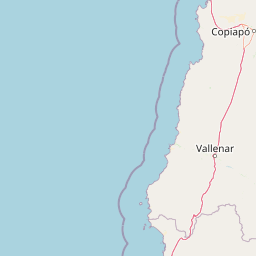
Llanos de Challe National Park landscape and geographic character

The landscape of Llanos de Challe National Park is characterized by dramatic contrast between the stark Atacama Desert interior and the fog-fed lomas vegetation along the coast. The terrain rises steeply from the Pacific shoreline through a series of coastal hills and mountains, with Cerro Negro reaching 950 meters as the park's highest point. The coastal zone features pristine white-sand beaches, some of the most unspoiled along Chile's northern coast, while inland the terrain becomes increasingly arid and rugged. The lomas formations appear as green patches on hillsides and ridges, where fog accumulation provides enough moisture to support continuous vegetation cover unlike the surrounding desert. The park includes coastal wetland areas that provide critical habitat for migratory and resident waterfowl, creating biodiversity hotspots amid the generally sparse desert environment. The interplay between the ocean, the fog, and the desert creates a visually striking landscape of stark beauty.

Llanos de Challe National Park ecosystems, habitats, and plant life

The nature of Llanos de Challe is defined by the lomas ecosystem, a fog-dependent desert habitat found exclusively along the Pacific coast of Chile and Peru. This ecosystem develops where coastal fog, originating from the cold Humboldt Current, contacts land and condenses on vegetation and soil, providing the primary water source for a distinctive plant community. The park represents the southernmost extent of these lomas formations, making it an important reference point for understanding the distribution and ecology of this rare habitat type. Vegetation in the lomas zones includes drought-adapted shrubs, succulents, and endemic species that have evolved specialized mechanisms for capturing and conserving moisture from fog. The park also supports populations of cacti, which are abundant in appropriate microhabitats, and the rare Leontochir ovallei, known locally as Garra de León, which is threatened by habitat loss and is a conservation priority for the park.

Llanos de Challe National Park wildlife and species highlights

The wildlife of Llanos de Challe National Park is notable for its populations of camelids, particularly guanacos, which reach their highest density in the Atacama Region within this protected area. These wild relatives of the llama thrive in the desert environment, having adapted to extract moisture from the plants they consume and survive in conditions that would be lethal to most mammals. The coastal wetland areas within and adjacent to the park provide critical habitat for diverse waterfowl, including common moorhens, red-gartered coots, black-necked swans, and flamingos. These wetland areas create biodiversity hotspots in the otherwise arid landscape, supporting species that depend on freshwater and brackish habitats for feeding and nesting. The desert environment itself supports a variety of reptiles, insects, and small mammals adapted to extreme aridity, though detailed species inventories for the park remain limited in available sources.

Llanos de Challe National Park conservation status and protection priorities

Llanos de Challe National Park plays a crucial conservation role as one of the southernmost protected examples of the lomas ecosystem, representing a habitat type found nowhere else in the world with such distinct ecological characteristics. The park protects critical habitat for the threatened Leontochir ovallei plant species, whose survival depends on the preservation of the lomas environment. The guanaco population within the park is significant for regional conservation, as these animals face pressure from habitat fragmentation and competition with livestock throughout their range. The coastal wetlands provide essential protection for migratory waterfowl species that depend on these habitats along the Pacific Flyway. The park's protected status also helps preserve the integrity of the coastal zone against development pressures and illegal activities, though enforcement remains challenging in this remote location. The occurrence of theierto florido phenomenon, linked to El Niño climate cycles, makes the park important for understanding how desert ecosystems respond to periodic precipitation events and climate variability.

Llanos de Challe National Park cultural meaning and human context

The cultural context of Llanos de Challe relates primarily to the historical relationship between local communities and the coastal desert environment, including traditional mining activities in the Quebrada Minillas area. The region around Huasco has a long history of human settlement and resource extraction, with the park containing evidence of historic mining operations that predate its protected status. The local communities have historically depended on the limited resources of the coastal desert, including fishing along the Pacific coast and small-scale agriculture where water was available. The park's name, Llanos de Challe, reflects the Spanish naming of the landscape, with llanos referring to the plains or flat areas characteristic of portions of the protected area.

Top sights and standout views in Llanos de Challe National Park

The highlights of Llanos de Challe National Park center on its extraordinary ecological distinction as a protected coastal desert where the rare lomas ecosystem creates unexpected biodiversity. The park offers visitors the chance to witness the spectacularierto florido desert bloom phenomenon when El Niño conditions bring rainfall to the normally arid landscape. The coastal wetlands provide accessible wildlife viewing opportunities for flamingos, black-necked swans, and other waterfowl in a setting of remarkable natural beauty. The guanaco population, the largest in the Atacama Region, offers wildlife viewing opportunities in the desert environment. The unspoiled white-sand beaches represent some of the most pristine coastline in northern Chile, offering a wilderness beach experience unlike more developed coastal areas.

Best time to visit Llanos de Challe National Park

The best time to visit Llanos de Challe National Park depends on what visitors hope to experience, with theierto florido desert bloom occurring unpredictably following El Niño-driven rainfall events, typically in years when the phenomenon is triggered. The fog season, when the Camanchaca is most persistent, generally occurs during the winter months from May through September, when the lomas vegetation is at its most lush and the desert landscape appears at its greenest. The summer months from December to March tend to be clearer and warmer, though fog is less common and the landscape appears more typically desert-like. Visitors interested in wildlife viewing should consider that guanacos are most active during early morning and late afternoon hours, while waterfowl are most visible in the wetland areas throughout the day. The park can be visited year-round, though visitors should be prepared for the extreme aridity of the desert environment regardless of season.

Park location guide

Geography guide, regional context, and park location map for Llanos de Challe National Park

Llanos de Challe National Park park geography, regions, and map view in Chile
Understand where Llanos de Challe National Park sits in Chile through a broader geographic reading of the surrounding landscape, nearby location context, and its mapped position within the national park landscape.

How Llanos de Challe National Park fits into Chile

Chile is a presidential republic in western South America, extending as a narrow strip along the western edge of the continent between the Andes Mountains and the Pacific Ocean. It is the southernmost country in the world and the closest to Antarctica. The country is bordered by Peru, Bolivia, and Argentina, and administers several Pacific islands including Easter Island. Chile is a major copper producer and has a population of approximately 19.6 million.

Wider geography shaping Llanos de Challe National Park in Chile

Chile occupies a narrow strip of land along the western edge of South America, extending approximately 4,300 km north to south but only about 350 km east to west at its widest point. The country is sandwiched between the Andes Mountains to the east and the Pacific Ocean to the west. It shares borders with Peru to the north, Bolivia to the northeast, and Argentina to the east. Southern Chile borders the Drake Passage. Chile also administers several Pacific islands including Juan Fernández Islands, Isla Salas y Gómez, Desventuradas Islands, and Easter Island, plus the Chilean Antarctic Territory.

Map view of Llanos de Challe National Park

Use this park location map to pinpoint Llanos de Challe National Park in Chile, understand its exact geographic position, and read its mapped placement within the surrounding landscape more clearly.

Pigeon | © OpenStreetMap contributors

Location context for Llanos de Challe National Park

Atacama Region
Park atlas

Compare coastal desert protected areas, unique lomas ecosystems, and regional park geography in Chile.

Discover Nearby National Parks and Protected Areas Surrounding Llanos de Challe National Park
Browse other national parks and protected areas located near Llanos de Challe National Park, discovering Chile's wider coastal desert terrain and unique fog-fed lomas ecosystems. This allows you to compare diverse conservation landscapes, understand regional ecological patterns, and trace the protected area geography of Chile's Atacama Region.
National parkLa Rioja Province

Talampaya National Park: Argentinian National Park with Dramatic Desert Canyons

Explore protected landscape and mapped geography in La Rioja Province.

Talampaya National Park, a significant national park in Argentina's La Rioja Province, offers a profound exploration of a dramatic desert canyon environment. This protected area is renowned for its rich paleontological sites, yielding crucial dinosaur fossils, and for its well-preserved indigenous petroglyphs carved into ancient rock formations. Understanding Talampaya National Park provides vital context for the region's geography and its place within Argentinian protected lands and mapped natural landscapes.

Area
2,150 km²
Established
1997
IUCN
II
National parkAntofagasta Region

Llullaillaco National Park: Mapped Volcanic Terrain and Protected Andean Landscape

Explore the high-altitude desert ecosystem and national park boundaries.

Llullaillaco National Park is a significant protected area in the Antofagasta Region, characterized by its striking volcanic landscape and high-altitude desert environment. The park's geography includes the towering Llullaillaco volcano, ancient ravines, and expansive semi-desert plains, forming a unique segment of the Central Andean dry puna ecoregion. Discover the mapped terrain and protected area context of this remarkable Chilean national park, offering insights into its arid-adapted biodiversity and geological significance.

Area
2,687 km²
IUCN
II
National parkTucumán Province

Aconquija National Park: Southern Andean Yungas Protected Landscape in Tucumán Province

Explore its montane forest and mapped geographic context.

Aconquija National Park is a significant federal protected area located in Tucumán Province, Argentina. This national park is dedicated to conserving the diverse Southern Andean Yungas montane forest ecosystem, characterized by a dramatic elevational gradient. Its landscapes transition from cloud forest to high alpine terrain, offering a unique opportunity to study and appreciate a well-preserved montane environment within a critical geographic region. Discover the mapped extent and ecological importance of this protected area.

Area
499.94 km²
Established
1995
IUCN
II
National parkValparaíso Region

La Campana National Park: Protected Landscape of Chilean Wine Palms

Explore its mapped terrain and regional geographic context.

La Campana National Park represents a significant protected landscape within Chile, celebrated for its exceptional concentration of Chilean Wine Palms (Jubaea chilensis). As a national park situated in the Valparaíso Region, it showcases a diverse range of Mediterranean ecosystems and dramatic coastal mountain terrain. This page provides detailed atlas-style context, highlighting the park's unique botanical heritage, its distinct geographic setting, and its importance as a mapped natural area for regional landscape studies.

Area
80 km²
Established
1967
IUCN
II
National parkCórdoba Province

Quebrada del Condorito National Park: Mapped Protected Landscape and Biological Island Ecosystem

Argentina National Park in Córdoba Province

Quebrada del Condorito National Park is a federally protected area in Argentina's Córdoba Province, established to safeguard a significant portion of the Sierras Pampeanas mountain ecosystem. The park's rugged terrain, including deep gorges and high-altitude plateaus, creates a distinct biological island environment supporting a wealth of endemic species. Its geographic isolation and dramatic landscape make it a unique focus for protected-area discovery and understanding Argentina's natural geography.

Area
373.44 km²
Established
1996
IUCN
II
National parkSantiago del Estero Province

Copo National Park: A Vital Dry Chaco Protected Landscape in Argentina

Explore its mapped boundaries and endemic forest ecosystems.

Copo National Park represents a significant conservation effort within Santiago del Estero Province, protecting a representative segment of the Dry Chaco biome. This national park preserves the iconic quebracho scrubland, a habitat that has been drastically reduced province-wide, serving as a critical refuge for endangered species like the jaguar and maned wolf. The park's landscape features warm climate conditions and characteristic forest formations dominated by the Santiago red quebracho, offering a unique opportunity to study and appreciate a vital, yet vulnerable, regional ecosystem. Its protected status underscores its importance for understanding Argentine protected areas and landscape ecology.

Area
1,181.18 km²
Established
2000
IUCN
II
Protected areaGran Chaco Province

Aguaragüe National Park and Integrated Management Natural Area: Bolivia's Easternmost Sub-Andean Protected Landscape

Explore its mapped mountain geography and ecological diversity.

Aguaragüe National Park and Integrated Management Natural Area is a crucial protected area in Bolivia's Gran Chaco Province, defined by the Serranía del Aguaragüe mountain range. This landscape offers a unique opportunity to explore a geographic transition zone where Southern Andean Yungas montane forests converge with Dry Chaco ecosystems. The park's protected boundaries encompass a rugged mountain backbone rising from the lowlands, representing a vital segment of Bolivia's Sub-Andean geography and protected natural areas.

Area
1,083.07 km²
Established
2000
IUCN
II
National parkLa Araucanía Region

Nahuelbuta National Park: Ancient Araucaria Forests and Protected Highland Geography

Discover its mapped boundaries atop the Cordillera de Nahuelbuta.

Nahuelbuta National Park is a significant national park in Chile's La Araucanía Region, celebrated for its ancient monkey puzzle tree forests atop the Cordillera de Nahuelbuta. This protected area showcases a unique highland landscape with rugged terrain and exposed rocky outcrops, preserving species more typical of Andean and Patagonian environments. Understanding its mapped geography and protected landscape identity is key to appreciating its ecological importance and distinct position within South America's natural atlas.

Area
68 km²
Established
1939
IUCN
II

Common questions about visiting, size, designation, and location context for Llanos de Challe National Park

Llanos de Challe National Park FAQs for park facts, access, geography, and protected area context
Find quick answers about Llanos de Challe National Park, including protected-area facts, park geography, trail and visitor context, and how the park fits into its surrounding country and regional landscape.
MoriAtlas Explorer

Continue Your Protected Areas Search Across the Global Atlas

Deepen your exploration by continuing the structured search for national parks and protected areas worldwide. Utilize the comprehensive filtering capabilities to compare different conservation landscapes and refine your understanding of global park geography. Discover more about the distribution and characteristics of protected natural areas.

Global natural geography