Mori Atlas logo
National parkLore Lindu National Park

Discover the unique endemic biodiversity and ancient megalithic heritage of this vital national park.

Lore Lindu National Park: A Mapped Protected Landscape in Central Sulawesi

(Taman Nasional Lore Lindu)

Lore Lindu National Park in Central Sulawesi, Indonesia, represents a vital protected landscape defined by its dramatic topography and rich endemic biodiversity. This national park spans diverse tropical forest ecosystems, from lowland valleys to montane zones, offering a crucial refuge for unique flora and fauna, including numerous species found nowhere else on Earth. Its mapped boundaries encompass not only ecological treasures but also one of Indonesia's most significant archaeological regions, characterized by ancient megalithic sites. As a protected area, Lore Lindu National Park is central to understanding the regional geography and the intersection of conservation and cultural heritage.

UNESCO Biosphere ReserveEndemic Bird SpeciesMegalithic SitesMontane ForestsTropical RainforestPrimates

Lore Lindu National Park

National park

Park overview

Structured park overview, official facts, and landscape profile for Lore Lindu National Park

Lore Lindu National Park park facts, protected area profile, and essential visitor context
Review the core facts for Lore Lindu National Park, including designation, size, terrain, visitor scale, habitats, and operating context in one park-focused overview.

About Lore Lindu National Park

Lore Lindu National Park occupies a mountainous interior position on the Indonesian island of Sulawesi, protecting one of the most biodiverse forest ecosystems in Southeast Asia. The park's boundaries are defined by a series of characteristic valleys: the Palolo Valley to the north, the Napu Valley to the east, the Bada Valley to the south, and collectively the Kulawi Valley system to the west. These valleys, along with the Lindu and Besoa basins, were once connected lakes that have gradually filled with sediment over geological time, leaving only Lake Lindu as the primary surviving large water body today. The park's elevation gradient from 200 to over 2,600 meters creates remarkable ecological zonation, supporting lowland tropical forest at the base, transitioning through sub-montane and montane forest, reaching sub-alpine conditions at the highest elevations. This vertical stratification, combined with Sulawesi's position at the convergence of Asian and Australian fauna provinces, produces the exceptional concentrations of endemic species that define the park's global significance. The surrounding landscape contains 117 villages, with the local population belonging to Kaili, Kulavi, and Lore ethnic groups, creating a cultural context where traditional land use practices intersect with modern conservation objectives.

Quick facts and research context for Lore Lindu National Park

Lore Lindu National Park covers 2,180 km² of forest terrain in Central Sulawesi, Indonesia, ranging from 200 to 2,610 meters elevation. The park protects exceptional biodiversity with 77 bird species endemic to Sulawesi, including the maleo, as well as rare mammals like the Tonkean macaque, lowland anoa, and pygmy tarsier. The protected area was formally established in 1982 though initially declared in 1999 at its current size. The park contains Lake Lindu, the only remaining large lake from a system of ancient valleys that once held larger water bodies. Access is from Palu to Kamarora, with the southern region receiving up to 4,000 mm of annual rainfall.

Park context

Deeper park guide and search-rich context for Lore Lindu National Park

Lore Lindu National Park history, landscape, wildlife, and travel context
Explore Lore Lindu National Park through its history, landscape character, ecosystems, wildlife, conservation priorities, cultural context, and seasonal travel timing in a structured park guide built for atlas discovery and search intent.

Why Lore Lindu National Park stands out

Lore Lindu is renowned for its extraordinary concentration of endemic species, particularly the 77 bird species found only on Sulawesi, including the distinctive maleo with its striking black plumage and prominent crown. The park's montane forests shelter unique primates like the Tonkean macaque and the diminutive pygmy tarsier, one of the world's smallest primates. Equally significant is the park's archaeological heritage, with over 400 granite megaliths distributed across the Napu, Bada, and Behoa valleys, some representing human forms up to 4.5 meters tall. The landscape of steep valley walls, remnant lakes like Lake Lindu, and the transition from lowland tropical forest to sub-alpine vegetation creates a distinctive setting that supports this exceptional combination of biological and cultural significance.

Lore Lindu National Park history and protected-area timeline

Lore Lindu National Park emerged from the consolidation of three earlier protected designations: the Lore Kalamanta Nature Reserve, the Lake Lindu Recreation and Protection Forest, and the Lore Lindu Wildlife Reserve. While an area of approximately 2,310 km² was declared for national park status in 1982, the official designation in 1999 resulted in a reduced boundary of 2,180 km², reflecting the complex process of establishing a coherent protected area within a region of human settlement and land use. The park's recognition as a UNESCO Biosphere Reserve in 1978 preceded its national park designation, acknowledging the region's exceptional ecological value and the need to balance conservation with the needs of surrounding communities. Archaeological investigations have documented megalithic activity across the Napu, Bada, and Behoa valleys, with stone carvings ranging in date from approximately 3000 BC to 1300 AD, representing a tradition of human landscape modification that predates the protected area framework by millennia. Since 2000, the Indonesian-German Collaborative Research Center known as STORMA has conducted intensive studies on forest margin stability, contributing scientific understanding of how protected area status influences deforestation patterns.

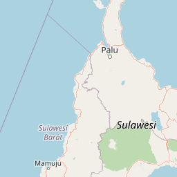
Lore Lindu National Park landscape and geographic character

The physical geography of Lore Lindu National Park is defined by a series of deep valleys carved into Sulawesi's central mountain spine, creating a complex terrain of steep ridges, narrow gorges, and remnant lake basins. The Palolo, Napu, Lindu, Besoa, and Bada valleys represent a distinctive valley system that was historically interconnected by larger lake systems before sediment accumulation reduced these water bodies to their current extent. Lake Lindu remains the park's largest surface water feature, its presence creating important habitat heterogeneity within the broader forest matrix. The western boundary follows the Kulawi Valley, a collection of narrower valleys that drain toward the coast. Elevation ranges from 200 meters in the valley floors to 2,500 meters along ridgelines, with the highest peaks supporting sub-alpine forest conditions. The terrain creates dramatic local topography with slopes often exceeding 30 degrees, while the combination of high rainfall in the southern portions and the underlying volcanic geology produces frequent cloud formation in the montane zones, contributing to the moisture-dependent character of the forest ecosystems.

Lore Lindu National Park ecosystems, habitats, and plant life

Lore Lindu National Park encompasses multiple distinct ecosystem types arranged along its steep elevation gradient, creating a vertically stratified series of forest communities from lowland tropical forest through sub-montane, montane, and sub-alpine zones. The lowland forests feature species such as Eucalyptus deglupta, Cananga odorata, and Gnetum gnemon, while higher elevations support Castanopsis argentea, Agathis philippinensis, and Phyllocladus hypophyllus in increasingly stunted forms as conditions become more extreme. The park's global significance derives primarily from its role as a center of endemism for Sulawesi's unique fauna, a reflection of the island's long-term isolation and its position at the boundary between Asian and Australian biogeographic realms. The montane forests experience persistent cloud immersion, supporting moisture-dependent species assemblages that differ markedly from the dry forest types common in other parts of Sulawesi. The combination of high rainfall in the southern valleys, with annual totals reaching 4,000 mm, and the elevational gradient creates habitat conditions for species with vastly different moisture and temperature requirements within a relatively compact geographic area.

Lore Lindu National Park wildlife and species highlights

The mammalian fauna of Lore Lindu includes an extraordinary proportion of Sulawesi endemics, species found nowhere else on Earth. The Tonkean macaque represents one of the park's most visible primate species, traveling in social groups through the forest canopy. The lowland anoa, a diminutive wild buffalo, and the extraordinary North Sulawesi babirusa with its bizarre tusk-like teeth are signature species of the Sulawesi fauna. The park shelters both the pygmy tarsier and Dian's tarsier, tiny primates adapted to nocturnal hunting in the montane forest understory. The avifauna is particularly remarkable, with 77 bird species endemic to Sulawesi recorded within the park boundaries. The maleo stands as perhaps the most iconic species, a ground-dwelling megapode that incubates its eggs in geothermal soils. Other endemic birds include the purple-bearded bee-eater, the geomalia, and numerous other species. Lake Lindu supports endemic fish including Oryzias bonneorum and Oryzias sarasinorum, as well as the endemic crab Parathelphusa linduensis, demonstrating the lake's ecological distinctiveness as an isolated aquatic ecosystem.

Lore Lindu National Park conservation status and protection priorities

Lore Lindu National Park's designation as a UNESCO Biosphere Reserve in 1978 recognized its global significance for biodiversity conservation, while its national park status under IUCN Category II provides formal protection for its forest ecosystems. The park faces significant conservation challenges, with deforestation from illegal logging and agricultural encroachment representing the primary threats to forest integrity. Management complexities arise from the presence of 62 villages along the park's boundaries and one village within the protected area, creating ongoing pressure on forest resources. Scientific studies by the STORMA program have documented that protected area status has reduced deforestation rates by approximately 9% compared to unprotected forest margins, demonstrating measurable conservation effectiveness. The park's elevation range and diversity of habitats create resilience against some threats, while the presence of endemic species with restricted distributions makes the protected area irreplaceable for long-term species survival. Conservation priorities include strengthening law enforcement, building local awareness of forest preservation importance, and developing sustainable land use practices in the buffer zone.

Lore Lindu National Park cultural meaning and human context

Lore Lindu National Park exists within a landscape of continuous human habitation, with 117 villages surrounding the protected area and traditional ethnic groups maintaining cultural connections to the land. The local population includes members of the Kaili, Kulavi, and Lore ethnic groups, whose ancestors inhabited these valleys long before the establishment of formal protection frameworks. The presence of over 400 megaliths throughout the park, including approximately 30 representing human forms, demonstrates that the landscape held significant cultural meaning for past societies, with stone carvings distributed across the Napu, Behoa, and Bada valleys. These archaeological features, along with stone pots and accompanying lids, represent a tradition spanning from approximately 3000 BC to 1300 AD, connecting contemporary conservation with millennia of human landscape modification. The relationship between local communities and the park's resources requires ongoing attention to ensure that conservation objectives can be balanced with traditional land use practices and livelihood needs.

Top sights and standout views in Lore Lindu National Park

Lore Lindu offers a rare combination of biological and cultural significance within a single protected area. The montane forests shelter endemic species found nowhere else, from the Tonkean macaque to the 77 endemic bird species including the distinctive maleo. The ancient megalithic sites in the Napu and Bada valleys represent one of Indonesia's most important archaeological landscapes, with stone figures and arrangements dating back thousands of years. Lake Lindu provides a scenic focus within the park, supporting endemic aquatic species and creating habitat diversity. The elevation gradient from 200 to over 2,600 meters creates a complete forest succession from lowland tropical conditions to sub-alpine environments, all accessible within a single protected landscape. The park's status as a UNESCO Biosphere Reserve reflects its global significance as both a biodiversity sanctuary and a model for integrating conservation with human settlement.

Best time to visit Lore Lindu National Park

The optimal period for visiting Lore Lindu National Park runs from July to September, when the southern region experiences reduced rainfall and conditions are most favorable for exploration. The park receives exceptionally high rainfall in its southern portions, with annual totals reaching 4,000 mm concentrated during the monsoon season from November to April. Visiting during the dry season provides better opportunities for trekking between valleys and accessing higher elevations, though montane areas may still experience regular cloud immersion and precipitation even during nominally drier months. Temperatures in the lowland areas remain consistently warm throughout the year, ranging from 26 to 32 degrees Celsius, with temperatures dropping approximately 6 degrees Celsius for every 1,100 meters of elevation gain. Visitors should be prepared for humid conditions throughout the year and for the possibility of rain even during the preferred July to September window, particularly at higher elevations.

Park location guide

Geography guide, regional context, and park location map for Lore Lindu National Park

Lore Lindu National Park park geography, regions, and map view in Indonesia
Understand where Lore Lindu National Park sits in Indonesia through a broader geographic reading of the surrounding landscape, nearby location context, and its mapped position within the national park landscape.

How Lore Lindu National Park fits into Indonesia

Indonesia is a vast archipelagic nation in Southeast Asia and Oceania, spanning over 17,000 islands between the Indian and Pacific Oceans. As the world's fourth-most populous country with 288 million people, it features extraordinary cultural and biological diversity, withJavanese and Sundanese being the largest ethnic groups. The country gained independence from the Netherlands in 1945 and operates as a unitary presidential republic.

Wider geography shaping Lore Lindu National Park in Indonesia

Indonesia is situated in Southeast Asia and Oceania, spanning the equatorial region between the Indian Ocean to the west and the Pacific Ocean to the east. The archipelago includes major islands such as Sumatra, Java, Sulawesi, and parts of Borneo and New Guinea. It borders Papua New Guinea, Timor-Leste, and Malaysia by land, with extensive maritime boundaries throughout the region.

Map view of Lore Lindu National Park

Use this park location map to pinpoint Lore Lindu National Park in Indonesia, understand its exact geographic position, and read its mapped placement within the surrounding landscape more clearly.

Pigeon | © OpenStreetMap contributors

Location context for Lore Lindu National Park

Central Sulawesi
Park atlas

Map the Regional Spread of Protected Areas Surrounding Lore Lindu National Park in Central Sulawesi

Discover Other National Parks and Protected Areas Near Lore Lindu National Park
Extend your atlas-style exploration beyond Lore Lindu National Park to discover other national parks and protected areas within Central Sulawesi and its surrounding landscapes. Trace how conservation efforts connect diverse lowland and montane forest ecosystems across the region.
National parkTojo Una-Una Regency

Kepulauan Togean National Park: Protected Marine Atlas and Island Landscape Geography

Explore Tojo Una-Una Regency's vital coral reef ecosystems and mapped island geography.

Kepulauan Togean National Park is a critically important marine protected area located within the Tojo Una-Una Regency of Indonesia. This national park is celebrated globally for its position at the center of the Coral Triangle, housing the most diverse array of coral species found anywhere on Earth. The park's landscape is defined by an archipelago of islands featuring a complex interplay of coral reefs, seagrass beds, and mangrove forests, creating a rich tapestry of marine habitats. Its geographic location also makes it a significant biogeographical crossroads, influencing the distribution of marine fauna between Asian and Australian regions.

Area
3,626 km²
Established
2004
IUCN
II
National parkSabah

Tun Sakaran Marine Park National Park: Sabah Marine Archipelago Atlas

Explore the islands, sand cays, and coral reef geography.

Tun Sakaran Marine Park is a protected national park in Sabah, Malaysia, known for its stunning marine biodiversity and archipelago landscape. This atlas entry details the park's distinct islands, dynamic sand cays, and extensive coral reef systems within the Celebes Sea, offering insights into its unique geographic setting and ecological significance.

Area
101 km²
Established
2004
IUCN
II
National parkNorth Kalimantan

Kayan Mentarang National Park: A Protected Landscape in North Kalimantan

Explore Borneo's critical protected area and its vast forest geography.

Kayan Mentarang National Park is an immense protected area in North Kalimantan, Indonesia, renowned for being a crucial part of the Heart of Borneo conservation initiative. This national park encompasses over 13,600 square kilometers of primary tropical rainforest, sheltering diverse montane and lowland habitats along the Indonesia-Malaysia border. Its importance lies in its vast, contiguous landscape, critical role in regional biodiversity, and its representation of one of Southeast Asia's last great wilderness expanses, offering significant insight into mapped protected areas.

Area
13,605 km²
Established
1996
IUCN
II
Scope
Mixed
National parkEast Nusa Tenggara

Kelimutu National Park: Volcanic Terrain and Colored Crater Lakes in East Nusa Tenggara

Explore the mapped geography of this unique Indonesian national park.

Kelimutu National Park represents a remarkable protected landscape in East Nusa Tenggara, Indonesia, distinguished by its volcanic origins and the famed three colored lakes of Mount Kelimutu. This national park protects diverse montane forests and offers a unique insight into the region's geological wonders. Its geography features volcanic slopes and the iconic caldera, making it a significant point of interest for atlas-driven exploration of protected natural areas.

Area
50 km²
Established
1992
IUCN
II
National parkCentral Kalimantan

Bukit Baka Bukit Raya National Park: Central Kalimantan's Protected Montane Rainforest Landscape

Explore the geographic core of Borneo's Schwaner mountain range.

Bukit Baka Bukit Raya National Park is a critical national park situated in Central Kalimantan, Indonesia, recognized for its extensive montane tropical rainforests and rugged topography. The park's landscape is dominated by the Schwaner mountain range, featuring prominent peaks like Bukit Raya, and functions as a vital watershed and biodiversity corridor. This protected area offers a rich subject for understanding regional geography, mapped landscapes, and the significance of Borneo's natural heritage within an atlas context.

Area
1,810 km²
Established
1992
IUCN
II
Relief
Mountain
National parkBrunei

Ulu Temburong National Park: Brunei's Protected Rainforest Landscape and Geographic Context

Mapped natural terrain and conservation significance.

Ulu Temburong National Park represents Brunei's commitment to preserving its most ecologically significant tropical rainforests, covering approximately 550 square kilometers. This protected area is characterized by its remote location in the Temburong District and its diverse topography, ranging from lowland areas to mountainous ridges, all within a largely undisturbed natural setting. The park's mapped boundaries encompass a vital transboundary conservation landscape, making it a key site for understanding Borneo's unique ecosystems and forest protection policies through an atlas-driven exploration approach.

Area
488.59 km²
Established
1991
IUCN
II
Relief
Mixed relief
Nature reserveBrunei

Luagan Lalak Forest Recreation Park Nature Reserve: Brunei's Pristine Freshwater Swamp Landscape

Explore mapped protected-area geography and unique wetland terrain.

Luagan Lalak Forest Recreation Park, a protected nature reserve in Brunei, preserves a rare and visually distinctive freshwater swamp ecosystem. Characterized by dark, tranquil waters and vast fields of purun grass, this natural wetland offers a unique landscape context and is a prime location for observing its rich biodiversity, especially its notable birdlife. The park's preservation as an intact swamp environment within a recreational area highlights its ecological importance for regional geography and protected-area mapping.

Area
2.7 km²
Established
1980
IUCN
II
National parkEast Nusa Tenggara

Manupeu Tanah Daru National Park: National Park Protected Landscape and East Nusa Tenggara Geography

Discover its mapped boundaries and regional atlas context.

Delve into the protected landscape of Manupeu Tanah Daru National Park, a significant national park situated within East Nusa Tenggara. This dedicated page provides detailed geographic context, focusing on the park's mapped boundaries and its contribution to the regional natural landscape. Understand its identity as a protected area and explore its place within the broader atlas of global conservation lands, fostering a deeper appreciation for its distinct geographic characteristics.

Area
879.84 km²
Established
1998
IUCN
II

Common questions about visiting, size, designation, and location context for Lore Lindu National Park

Lore Lindu National Park FAQs for park facts, access, geography, and protected area context
Find quick answers about Lore Lindu National Park, including protected-area facts, park geography, trail and visitor context, and how the park fits into its surrounding country and regional landscape.
MoriAtlas Explorer

Continue Your Protected Areas Search Across the Global Atlas

Deepen your exploration by continuing the structured search for national parks and protected areas worldwide. Utilize the comprehensive filtering capabilities to compare different conservation landscapes and refine your understanding of global park geography. Discover more about the distribution and characteristics of protected natural areas.

Global natural geography