Mori Atlas logo
National parkKepulauan Togean National Park

Discover the mapped geography and unparalleled marine biodiversity within the Togian Islands archipelago.

Kepulauan Togean National Park: Indonesia's Premier Marine Protected Landscape and Coral Reef Atlas

Kepulauan Togean National Park represents a cornerstone of marine conservation within the Gulf of Tomini, Indonesia. Established as a National Park, this protected archipelago encompasses a vast expanse of marine territory and numerous islands. Situated at the convergence of significant biogeographical realms, the park is a critical zone for marine species distribution, boasting the world's highest diversity of coral species. Its varied coastal ecosystems, including vibrant coral reefs, expansive seagrass meadows, and essential mangrove forests, collectively form an extraordinary mosaic of marine life at the heart of the Coral Triangle.

Marine National ParkCoral ReefsBiosphere ReserveTogian IslandsSulawesiIndonesia

Kepulauan Togean National Park

National park

Park overview

Structured park overview, official facts, and landscape profile for Kepulauan Togean National Park

Kepulauan Togean National Park park facts, protected area profile, and essential visitor context
Review the core facts for Kepulauan Togean National Park, including designation, size, terrain, visitor scale, habitats, and operating context in one park-focused overview.

About Kepulauan Togean National Park

Kepulauan Togean National Park represents Indonesia's commitment to marine conservation, protecting a unique archipelago that straddles two major biogeographical boundaries. The Togian Islands rise from the Gulf of Tomini, creating a mosaic of marine and terrestrial environments that support remarkable biodiversity. The park's marine core includes extensive coral reef systems, seagrass meadows, and mangrove forests that work together as an integrated ecosystem. On land, the islands feature lowland forests covering portions of their terrestrial areas, though the marine environment remains the primary focus of conservation efforts. The park's designation as part of the Tojo Una-Una Togean Biosphere Reserve in 2019 recognized its global significance not just for biodiversity but also for the sustainable livelihoods of the approximately 149,214 people who depend on these marine resources. Local fishing communities have traditionally inhabited the transition area around Ampana, maintaining connections to the sea that define regional cultural identity.

Quick facts and research context for Kepulauan Togean National Park

Kepulauan Togean National Park is located in Tojo Una-Una regency, Central Sulawesi province, Indonesia, with the nearest city being Ampana. The park was officially established in 2004 and is governed by Indonesia's Ministry of Forestry. In 2019, the area was designated as the Tojo Una-Una Togean Biosphere Reserve by UNESCO, becoming the 15th biosphere reserve in Indonesia. The park spans roughly 102.7 kilometers from west to east and sits at coordinates approximately 0.35°S 121.98°E. The biosphere reserve is home to approximately 149,214 people, predominantly local fishing communities.

Park context

Deeper park guide and search-rich context for Kepulauan Togean National Park

Kepulauan Togean National Park history, landscape, wildlife, and travel context
Explore Kepulauan Togean National Park through its history, landscape character, ecosystems, wildlife, conservation priorities, cultural context, and seasonal travel timing in a structured park guide built for atlas discovery and search intent.

Why Kepulauan Togean National Park stands out

Kepulauan Togean National Park is best known for its extraordinary coral reef biodiversity, situated in the heart of the world's coral reef triangle. The park protects some of the most diverse marine ecosystems in Indonesia, with coral reefs supporting hundreds of species. The Togian Islands archipelago provides critical habitat for marine species at the boundary of Asian and Australian faunal regions, creating a unique mixing zone where species from both biogeographical realms meet. The combination of mangrove forests, seagrass beds, and coral reefs creates a complex marine environment that supports exceptional biological productivity and diversity.

Kepulauan Togean National Park history and protected-area timeline

The park was formally established in 2004 as a national park under Indonesia's Ministry of Forestry, recognizing the exceptional marine biodiversity of the Togian Islands region. Prior to national park designation, the area had been recognized for its ecological importance but lacked formal protected area status. The establishment came amid growing Indonesian commitment to expanding marine protected areas across the archipelago. A significant milestone occurred on June 19, 2019, when UNESCO's Man and Biosphere Program designated the Tojo Una-Una Togean Biosphere Reserve during the 31st International Coordinating Council session in Paris, France. This biosphere reserve status added an international layer of recognition and framework for sustainable development alongside conservation, making it Indonesia's 15th biosphere reserve. The designation reflects decades of scientific research documenting the area's exceptional biodiversity and the government's efforts to balance conservation with community livelihoods.

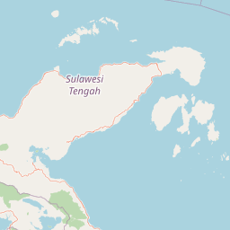
Kepulauan Togean National Park landscape and geographic character

The park encompasses an archipelago of islands scattered across the Gulf of Tomini, creating a diverse coastal landscape of beaches, rocky shores, and forested island interiors. The underwater landscape is dominated by extensive coral reef formations that create complex three-dimensional habitats supporting thousands of marine species. Between the islands, shallow seagrass meadows provide important feeding and nursery grounds for marine turtles and other species. Mangrove forests line many island coastlines, their intricate root systems providing sheltered nursery areas for juvenile fish and crustaceans. The terrestrial portions of the islands feature lowland forest vegetation, though these areas are relatively small compared to the extensive marine environments. The overall landscape creates a seamless transition from forest-covered peaks on smaller islands to vibrant coral reefs in the surrounding waters, with the marine environment extending from the shoreline to deeper waters between the archipelago islands.

Kepulauan Togean National Park ecosystems, habitats, and plant life

The ecological character of Kepulauan Togean National Park centers on its position at the heart of the world's coral reef triangle, the region with the highest marine biodiversity on Earth. The park protects critical coral reef ecosystems that support hundreds of coral species and associated fish populations. The vegetation includes approximately 363 recorded flora species on the Togean Islands, with terrestrial species including trees from the Dipterocarpaceae family such as Shorea, Dipterocarpus, and Hopea, as well as species like ironwood, palapi, and uru. The aquatic flora is equally diverse, with 33 species of aquatic plants including seven species of seagrass, with turtle grass and Enhalus acoroides being the dominant seagrass species. Mangrove species including Rhizophora, Avicennia, Ceriops, and Sonneratia form critical coastal habitats. The park sits in a biogeographically significant position between the Wallace Line and Weber Line, where Asian and Australian marine species mix, creating unique ecological communities found nowhere else.

Kepulauan Togean National Park wildlife and species highlights

The marine wildlife of Kepulauan Togean National Park is exceptionally diverse due to the park's location in the coral reef triangle. Coral reefs here support hundreds of fish species, invertebrate communities, and marine megafauna. The seagrass meadows serve as important habitat for green turtles and other marine reptiles, while the mangrove forests provide critical nursery habitat for numerous fish and crustacean species. The mixing of species from Asian and Australian biogeographical regions creates unique marine communities, with species from both realms occurring together in these waters. The protected status helps ensure these marine species have refuge in healthy ecosystems, though specific population data would require more detailed surveys. The combination of reef, seagrass, and mangrove habitats creates a complete marine ecosystem supporting the diverse wildlife that makes this area globally significant.

Kepulauan Togean National Park conservation status and protection priorities

The designation of Kepulauan Togean National Park as part of the Tojo Una-Una Togean Biosphere Reserve in 2019 by UNESCO represents the highest level of international recognition for this area's conservation significance. The biosphere reserve framework recognizes not only the exceptional biodiversity but also the sustainable use of natural resources by local communities. Being situated in the heart of the coral reef triangle means this park contributes to global efforts to protect the regions with the highest marine biodiversity. The park's marine-focused protection addresses the critical need to conserve coral reef ecosystems that face threats from climate change, ocean acidification, and local stressors. The UNESCO designation provides additional tools for conservation management while supporting sustainable development for the approximately 149,214 people living in the biosphere reserve area, primarily local fishing communities around Ampana.

Kepulauan Togean National Park cultural meaning and human context

The Tojo Una-Una Togean Biosphere Reserve is home to approximately 149,214 people, the vast majority of whom are local fishermen living in communities centered around Ampana. These fishing communities have traditional connections to the marine environment that define regional cultural identity and livelihood patterns. The sustainable relationship between local communities and marine resources has been a central consideration in the park's management and UNESCO biosphere reserve designation. The area's human presence predates modern conservation efforts, and the biosphere reserve framework explicitly incorporates sustainable development alongside biodiversity protection, recognizing that long-term conservation success depends on supporting community livelihoods. The cultural context reflects the reality that marine protected areas in this region exist within human-use landscapes rather than as wilderness areas separate from local communities.

Top sights and standout views in Kepulauan Togean National Park

The park's primary highlight is its location in the world's coral reef triangle, hosting the greatest diversity of coral species on Earth. The marine protected area encompasses coral reefs, seagrass beds, and mangrove forests that together create one of Indonesia's most biodiverse marine environments. The Togian Islands archipelago provides stunning island landscapes rising from the Gulf of Tomini. The park's position between the Wallace and Weber Lines creates a unique biogeographical mixing zone where species from Asian and Australian marine faunas overlap. UNESCO biosphere reserve status since 2019 adds international recognition for both conservation significance and sustainable community development.

Best time to visit Kepulauan Togean National Park

The park can be visited year-round given its tropical marine location, though conditions vary with seasons typical of Sulawesi. The dry season generally offers better visibility for diving and snorkeling on coral reefs, while the wet season may bring reduced visibility but also calmer sea conditions at certain times. Water temperatures remain warm throughout the year, suitable for marine activities. Visitors interested in marine wildlife viewing should consider that turtle nesting may follow seasonal patterns related to weather. The UNESCO biosphere reserve designation and ongoing community-based conservation efforts mean that visitor activities should be coordinated with local authorities to ensure sustainable tourism practices that protect the marine environment.

Park location guide

Geography guide, regional context, and park location map for Kepulauan Togean National Park

Kepulauan Togean National Park park geography, regions, and map view in Indonesia
Understand where Kepulauan Togean National Park sits in Indonesia through a broader geographic reading of the surrounding landscape, nearby location context, and its mapped position within the national park landscape.

How Kepulauan Togean National Park fits into Indonesia

Indonesia is a vast archipelagic nation in Southeast Asia and Oceania, spanning over 17,000 islands between the Indian and Pacific Oceans. As the world's fourth-most populous country with 288 million people, it features extraordinary cultural and biological diversity, withJavanese and Sundanese being the largest ethnic groups. The country gained independence from the Netherlands in 1945 and operates as a unitary presidential republic.

Wider geography shaping Kepulauan Togean National Park in Indonesia

Indonesia is situated in Southeast Asia and Oceania, spanning the equatorial region between the Indian Ocean to the west and the Pacific Ocean to the east. The archipelago includes major islands such as Sumatra, Java, Sulawesi, and parts of Borneo and New Guinea. It borders Papua New Guinea, Timor-Leste, and Malaysia by land, with extensive maritime boundaries throughout the region.

Map view of Kepulauan Togean National Park

Use this park location map to pinpoint Kepulauan Togean National Park in Indonesia, understand its exact geographic position, and read its mapped placement within the surrounding landscape more clearly.

Pigeon | © OpenStreetMap contributors

Location context for Kepulauan Togean National Park

Central SulawesiTojo Una-Una Regency
Park atlas

Extend your exploration by comparing regional protected landscapes and marine conservation zones in Indonesia, contextualizing Kepulauan Togean National Park.

Explore Nearby National Parks and Protected Areas Surrounding Kepulauan Togean National Park
Continue your exploration by browsing other national parks and protected areas across Indonesia, including marine conservation zones and island landscapes surrounding Kepulauan Togean National Park. This allows for comparison of their geographic spread and conservation significance, enriching your understanding of Indonesia's regional park atlas.
National parkSulawesi

Bogani Nani Wartabone National Park: A National Park Within Sulawesi's Geographic Atlas

Explore mapped protected landscape and regional terrain.

Bogani Nani Wartabone National Park represents a vital protected area within Sulawesi, Indonesia. This dedicated page provides an atlas-oriented view, focusing on its distinct landscape character, geographic placement, and mapped boundaries. Understand the park's role as a conservation landscape and how its terrain contributes to the regional geography, forming a crucial component of mapped natural areas.

Area
2,871.15 km²
Established
1991
IUCN
II
Climate
Tropical
National parkCentral Sulawesi

Lore Lindu National Park: Central Sulawesi's Protected Landscape and Atlas Anchor

Explore its endemic species, megalithic sites, and rich geography.

Lore Lindu National Park stands as a critical protected area within Central Sulawesi, Indonesia, recognized for its exceptional endemic biodiversity and profound archaeological importance. This national park features a dramatic geographic setting, rising from lowland forests to montane ecosystems and encompassing ancient megalithic structures within its protected landscape. Understanding Lore Lindu National Park through its mapped boundaries and unique regional geography offers deep insights into conservation and cultural heritage, providing a focal point for atlas-based discovery.

Area
2,180 km²
Established
1982
IUCN
II
Visitors
2K annual
National parkNorth Sulawesi

Bunaken National Park: Indonesian National Park Geography and Mapped Boundaries

Explore North Sulawesi's protected marine landscape.

Bunaken National Park stands as a key protected area within Indonesia's North Sulawesi region, offering essential insights for geographic discovery and atlas exploration. This page focuses on the park's mapped boundaries and its identity as a national park, providing a structured view of its landscape context. Understand the distribution and significance of conservation areas in North Sulawesi through detailed, fact-based information.

Area
890.65 km²
Established
1991
IUCN
II
Visitors
35K annual
National parkWest Sulawesi

Gandang Dewata National Park: Protected Area Identity and Geographic Context in West Sulawesi

Explore mapped boundaries and regional landscape.

Delve into the protected landscape of Gandang Dewata National Park, a key national park situated in West Sulawesi. This resource offers a detailed geographic perspective, emphasizing its mapped boundaries and its position within the regional atlas. Understand the park's protected-area status and its contribution to the natural geography of Indonesia, serving as a vital point for atlas exploration.

Area
793.42 km²
Established
2016
IUCN
II
Relief
Mountain
National parkSouth East Sulawesi

Rawa Aopa Watumohai National Park: Geographic Atlas and Protected Landscape Overview

Explore Rawa Aopa Watumohai National Park's mapped boundaries.

Gain a clear understanding of Rawa Aopa Watumohai National Park, a designated national park in South East Sulawesi. This entry offers insight into its protected landscape identity, mapped geographic features, and its specific location within the regional atlas. It serves as a focused point for comprehending the park's protected area context and its contribution to Indonesian natural geography.

Area
1,050 km²
Established
1989
IUCN
II
Relief
Mixed relief
National parkEast Kalimantan

Kutai National Park: Protected Area Details and East Kalimantan Geography

Explore the mapped boundaries and regional landscape context.

Kutai National Park, a designated national park in Indonesia's East Kalimantan region, offers rich opportunities for geographic discovery. This resource focuses on the park's protected area status, its distinct landscape characteristics, and its mapped distribution within the broader regional geography. Gain a structured understanding of Kutai National Park's environmental significance and its contribution to conservation landscapes through detailed map context and geographic analysis.

Area
1,986 km²
Established
1982
IUCN
II
Relief
Lowland
National parkSouth Sulawesi

Bantimurung-Bulusaraung National Park: National Park Protected Landscape Identity and Geographic Setting

Mapped boundaries and regional atlas context for this South Sulawesi park.

Bantimurung-Bulusaraung National Park is an important protected area in South Sulawesi, Indonesia, designated as a national park. This entry provides a focused look at its geographic scope, mapped outlines, and the characteristics that define it as a protected landscape. Understanding this park's specific terrain and regional setting is key to appreciating its role within the broader atlas of natural areas and conservation efforts.

Area
437 km²
Established
2004
IUCN
II
Visitors
600K annual
National parkSabah

Tun Sakaran Marine Park National Park: Sabah Marine Archipelago Atlas

Explore the islands, sand cays, and coral reef geography.

Tun Sakaran Marine Park is a protected national park in Sabah, Malaysia, known for its stunning marine biodiversity and archipelago landscape. This atlas entry details the park's distinct islands, dynamic sand cays, and extensive coral reef systems within the Celebes Sea, offering insights into its unique geographic setting and ecological significance.

Area
101 km²
Established
2004
IUCN
II
Relief
Lowland

Common questions about visiting, size, designation, and location context for Kepulauan Togean National Park

Kepulauan Togean National Park FAQs for park facts, access, geography, and protected area context
Find quick answers about Kepulauan Togean National Park, including protected-area facts, park geography, trail and visitor context, and how the park fits into its surrounding country and regional landscape.
MoriAtlas Explorer

Continue Your Protected Areas Search Across the Global Atlas

Deepen your exploration by continuing the structured search for national parks and protected areas worldwide. Utilize the comprehensive filtering capabilities to compare different conservation landscapes and refine your understanding of global park geography. Discover more about the distribution and characteristics of protected natural areas.

Global natural geography