Mori Atlas logo
Protected areaBukit Shahbandar Forest Recreation Park

Discover a unique protected recreational forest with challenging hiking trails and panoramic views.

Bukit Shahbandar Forest Recreation Park: Brunei's Ridge Landscape & Protected Area Geography

Bukit Shahbandar Forest Recreation Park stands as a distinct protected area within the Brunei-Muara District, recognized for its unique topographical features and recreational focus. This 234-hectare park showcases a prominent grassy ridge with multiple peaks, offering challenging hiking experiences across its terrain. Unlike traditional conservation forests, its landscape blends coniferous plantations with native kerangas woodland, providing a specific context for outdoor leisure and educational exploration within Brunei's geography.

Forest Recreation ParkCoastal ForestHiking TrailsBruneiNature ParkRidge Landscape

Bukit Shahbandar Forest Recreation Park

Protected area

Park overview

Structured park overview, official facts, and landscape profile for Bukit Shahbandar Forest Recreation Park

Bukit Shahbandar Forest Recreation Park park facts, protected area profile, and essential visitor context
Review the core facts for Bukit Shahbandar Forest Recreation Park, including designation, size, terrain, visitor scale, habitats, and operating context in one park-focused overview.

About Bukit Shahbandar Forest Recreation Park

Bukit Shahbandar Forest Recreation Park represents a unique category of protected area in Brunei, serving primarily as a recreational and educational forest rather than a biodiversity conservation reserve. The park's landscape is characterized by a prominent grassy ridge system extending southward with multiple high peaks ranging from 391 to 470 feet in elevation, creating the park's most distinctive topographic feature. To the east, a coastal range of densely forested hills rises between 200 and 358 feet, sloping gently toward the coast. The extensive trail network traverses these nine hills, offering hikers distinct pathways with varying difficulty levels, marked with checkpoints and shelters for rest and appreciation of the natural environment. The park is situated approximately 15 kilometres from Bandar Seri Begawan along the Muara-Tutong Highway, making it accessible for day trips from the capital. Facilities within the park include children's play areas, light workout equipment, a sizeable pond, refreshment stalls, and mountain biking trails, catering to families and fitness enthusiasts alike.

Quick facts and research context for Bukit Shahbandar Forest Recreation Park

The park covers 234 hectares (580 acres) of coastal forest terrain in Brunei-Muara District, established in 1998 under the management of Brunei's Forestry Department. It features a prominent ridge system with nine distinct hills offering hiking trails of varying difficulty, ranging from 391 to 470 feet in elevation on the main ridge and 200 to 358 feet on the eastern coastal hills. The vegetation includes native kerangas woodland alongside planted stands of Acacia mangium and Caribbean pine. The park is located about a 15 to 20-minute drive from Bandar Seri Begawan along the Muara-Tutong Highway, near the Empire Brunei hotel and between Kampong Jerudong and Tungku Beach. The park hosted the downhill mountain bike event during the 1999 SEA Games and has been used for various royal walking events and the annual Bukit Shahbandar Challenge.

Park context

Deeper park guide and search-rich context for Bukit Shahbandar Forest Recreation Park

Bukit Shahbandar Forest Recreation Park history, landscape, wildlife, and travel context
Explore Bukit Shahbandar Forest Recreation Park through its history, landscape character, ecosystems, wildlife, conservation priorities, cultural context, and seasonal travel timing in a structured park guide built for atlas discovery and search intent.

Why Bukit Shahbandar Forest Recreation Park stands out

Bukit Shahbandar is best known for its network of nine hills with challenging hiking trails that cater to visitors of varying skill levels, offering steep elevations, rocky terrain, and natural checkpoints along the pathways. The park's defining topographic feature is its prominent grassy ridge with multiple peaks reaching nearly 470 feet, providing panoramic views of Bandar Seri Begawan and the surrounding Jerudong area from observation towers. Unlike typical conservation-focused protected areas, this forest recreation park is specifically designed for outdoor leisure and educational activities, making it a distinctive category of protected space in Brunei. The park also gained regional recognition by hosting the downhill mountain bike competition during the 1999 SEA Games.

Bukit Shahbandar Forest Recreation Park history and protected-area timeline

The site that would become Bukit Shahbandar Forest Recreation Park was originally a cattle farm before its transformation into a recreational forest. Jogging and hiking trails were first established at the location in 1980, marking the beginning of its use as an outdoor recreation area. Under the framework of Brunei's 6th National Development Plan, the Forestry Department undertook the full development of the site, completing the transformation in 1998 and officially designating it as one of the forest recreation areas designated to meet increasing demand for outdoor leisure activities in the small nation. The park has since served as a venue for significant regional and national events, most notably hosting the downhill mountain bike competition during the 1999 SEA Games. The park also featured in Tour Brunei 2005, and has been the location of royal walking events attended by Sultan Hassanal Bolkiah, including a 2005 Ministry of Defence Shahbandar Run and a 2006 walking event with Prince Abdul Malik. The annual Bukit Shahbandar Challenge began in 2006 as part of World Forestry Day celebrations, attracting over 445 competitors in its inaugural year.

Bukit Shahbandar Forest Recreation Park landscape and geographic character

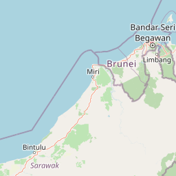
The physical landscape of Bukit Shahbandar is defined by two distinct topographic zones. The primary feature is a prominent grassy ridge with multiple peaks ranging from 391 to 470 feet (119 to 143 metres) in elevation, extending southward as the most visually striking element of the park's terrain. This ridge provides the backbone for the hiking trail system, with trails traversing the various peaks and connecting the different hilltops. To the east of the main ridge lies a coastal range of densely forested hills, with elevations between 200 and 358 feet, sloping in an east-northeasterly direction toward the coastline. The landscape combines open grassy areas on the ridge with denser forest cover on the eastern hills, creating visual and ecological diversity within the relatively compact 234-hectare property. The park's proximity to the coast influences its setting, with observation towers providing panoramic views extending across to Bandar Seri Begawan and the Jerudong area.

Bukit Shahbandar Forest Recreation Park ecosystems, habitats, and plant life

The ecological character of Bukit Shahbandar reflects its history as a former cattle farm with recreational development, differing from Brunei's primary conservation forests. The park features native kerangas woodland, which refers to the Sundaland heath forests characteristic of nutrient-poor soils in this region. This native vegetation is complemented by planted stands of Acacia mangium, a fast-growing tropical tree species commonly used in reforestation, and Caribbean pine, a coniferous species that contributes to the park's distinctive character. The vegetation structure therefore represents a mix of remnant native heath forest and plantation species, creating a semi-natural environment that supports some wildlife while serving recreational purposes. The grassy ridge areas maintain an open character, while the eastern hills support denser forest cover, creating habitat variation within the park's boundaries.

Bukit Shahbandar Forest Recreation Park wildlife and species highlights

Bukit Shahbandar is home to various wildlife species, with long-tailed macaques being notably present within the park boundaries. These primates represent the most commonly cited mammalian species in available documentation of the park's fauna. The mix of native kerangas woodland, planted coniferous areas, and open grassy ridge creates heterogeneous habitat that can support a variety of bird species and smaller fauna, though detailed species inventories are not extensively documented in available sources. The park's location along the coast and its varied topography from ridge to forested hills likely provides suitable habitat for both forest-dwelling and open-country species, though comprehensive wildlife documentation specific to this park remains limited in the source material.

Bukit Shahbandar Forest Recreation Park conservation status and protection priorities

Bukit Shahbandar occupies a distinctive position within Brunei's protected area system, serving primarily as a recreational forest rather than a biodiversity conservation reserve. While the park is protected under the forestry department's management and contains native kerangas woodland, its primary purpose is outdoor leisure and education rather than biodiversity preservation. This differs from other conservation forests in Brunei that focus on preserving intact primary forest ecosystems and their biodiversity. The park's vegetation has been altered from its original state through historical cattle farming and subsequent planting of exotic species like Acacia mangium and Caribbean pine. Nevertheless, the area provides green space near the capital, supports native heath forest remnants, and offers environmental education opportunities through its trail system and interpretive features.

Bukit Shahbandar Forest Recreation Park cultural meaning and human context

Bukit Shahbandar Forest Recreation Park is located in the Kampong Jerudong 'B' area of Brunei-Muara District, within the broader Jerudong region that includes the Empire Brunei hotel complex and proximity to Tungku Beach. The park's name incorporates 'Bukit,' the Malay word for hill or mountain, reflecting the prominent ridge topography that defines the landscape. The park has become integrated into national identity through its use for significant events including royal walking activities attended by Sultan Hassanal Bolkiah, establishing it as a venue for both recreational and ceremonial purposes. The annual Bukit Shahbandar Challenge connects the park to World Forestry Day celebrations, linking the recreational space to broader environmental awareness activities.

Top sights and standout views in Bukit Shahbandar Forest Recreation Park

The park's nine hills with their numbered trail network offer distinct hiking experiences with varying difficulty levels, steep elevations, and rocky terrain. The observation towers provide panoramic views of Bandar Seri Begawan and the Jerudong area, making the park a popular destination for scenic outlooks. The 1999 SEA Games downhill mountain bike event established the park's credentials as a sports venue, and its continued use for hiking challenges and royal events demonstrates its ongoing significance in Brunei's recreational landscape. The combination of grassy ridge terrain, forested eastern hills, native kerangas woodland, and planted conifers creates a distinctive environment that differentiates this park from typical conservation areas.

Best time to visit Bukit Shahbandar Forest Recreation Park

Bukit Shahbandar can be visited year-round given Brunei's tropical climate, though the dry season from December through April typically offers more comfortable conditions for hiking with reduced rainfall and lower humidity. Early morning visits are particularly pleasant, allowing hikers to complete the trail network before midday heat becomes intense. The park's open ridge areas receive full sun exposure, while the eastern forested hills provide cooler shaded sections during the hike. Weekend mornings tend to be busier with families and fitness enthusiasts, while weekday visits offer a quieter experience on the trails.

Park location guide

Geography guide, regional context, and park location map for Bukit Shahbandar Forest Recreation Park

Bukit Shahbandar Forest Recreation Park park geography, regions, and map view in Brunei
Understand where Bukit Shahbandar Forest Recreation Park sits in Brunei through a broader geographic reading of the surrounding landscape, nearby location context, and its mapped position within the national park landscape.

How Bukit Shahbandar Forest Recreation Park fits into Brunei

Brunei is a sovereign nation on the northern coast of Borneo island in Southeast Asia. It is the only country entirely on Borneo and is completely surrounded by Malaysia's Sarawak state. The country operates as an Islamic absolute monarchy ruled by the Sultan, with Malay as the official language.

Wider geography shaping Bukit Shahbandar Forest Recreation Park in Brunei

Brunei is located on the northern coast of Borneo island in Southeast Asia, with coastline along the South China Sea. The country is completely surrounded by the Malaysian state of Sarawak, and its territory is bifurcated by the Sarawak district of Limbang. Total area is 5,765 km².

Map view of Bukit Shahbandar Forest Recreation Park

Use this park location map to pinpoint Bukit Shahbandar Forest Recreation Park in Brunei, understand its exact geographic position, and read its mapped placement within the surrounding landscape more clearly.

Pigeon | © OpenStreetMap contributors

Location context for Bukit Shahbandar Forest Recreation Park

Brunei-Muara District
Park atlas

Explore other significant forest recreation parks and conservation landscapes within Brunei and its surrounding regional geography

Discover Nearby Protected Areas, Parks, and Similar Landscapes Near Bukit Shahbandar Forest Recreation Park
Browse a curated list of national parks, forest reserves, and other protected areas geographically situated near Bukit Shahbandar Forest Recreation Park. Comparing these diverse landscapes provides valuable insight into regional conservation efforts and highlights variations in terrain, from coastal forests to challenging ridge trails within Brunei and neighboring territories.
Nature reserveTemburong District

Peradayan Forest Reserve Nature Reserve: Understanding its Protected Landscape and Geographic Setting

Explore mapped boundaries and the natural terrain of this Brunei reserve.

Peradayan Forest Reserve stands as a significant protected natural area within Brunei's Temburong District, an exclave characterized by vast tropical rainforests. This entry focuses on its identity as a nature reserve, providing key geographic context and details about its mapped boundaries. Understand its role within the regional landscape and how its protected status contributes to the conservation of Brunei's natural heritage, facilitating a deeper dive into atlas-style geographic exploration.

Area
26.5 km²
Relief
Upland
Climate
Tropical
Access
Moderate access
Protected areaBrunei

Tasek Merimbun Heritage Park: Protected Landscape Identity and Geographic Atlas

Mapped boundaries and regional natural context for this Brunei protected area.

Tasek Merimbun Heritage Park represents a distinct protected area within the geography of Brunei. This page provides detailed insight into its protected landscape, offering a map-centric view of its boundaries and its placement within the broader natural context of Borneo. Understand the park's geographic significance and explore its unique attributes for structured atlas exploration.

Area
78 km²
Established
1984
Climate
Tropical
Access
Easy access
Nature reserveBrunei

Luagan Lalak Forest Recreation Park Nature Reserve: Brunei's Pristine Freshwater Swamp Landscape

Explore mapped protected-area geography and unique wetland terrain.

Luagan Lalak Forest Recreation Park, a protected nature reserve in Brunei, preserves a rare and visually distinctive freshwater swamp ecosystem. Characterized by dark, tranquil waters and vast fields of purun grass, this natural wetland offers a unique landscape context and is a prime location for observing its rich biodiversity, especially its notable birdlife. The park's preservation as an intact swamp environment within a recreational area highlights its ecological importance for regional geography and protected-area mapping.

Area
2.7 km²
Established
1980
IUCN
II
Visitors
4.2K annual
National parkBrunei

Ulu Temburong National Park: Brunei's Protected Rainforest Landscape and Geographic Context

Mapped natural terrain and conservation significance.

Ulu Temburong National Park represents Brunei's commitment to preserving its most ecologically significant tropical rainforests, covering approximately 550 square kilometers. This protected area is characterized by its remote location in the Temburong District and its diverse topography, ranging from lowland areas to mountainous ridges, all within a largely undisturbed natural setting. The park's mapped boundaries encompass a vital transboundary conservation landscape, making it a key site for understanding Borneo's unique ecosystems and forest protection policies through an atlas-driven exploration approach.

Area
488.59 km²
Established
1991
IUCN
II
Relief
Mixed relief
National parkSarawak

Gunung Buda National Park: Sarawak National Park Protected Landscape and Geography

Explore the mapped boundaries and regional context of this Malaysian national park.

Gunung Buda National Park is a significant protected area within Sarawak, Malaysia, contributing to the region's diverse geography. As a national park, it offers specific insights into mapped protected lands, providing a focal point for understanding Borneo's natural landscapes. This entry details its geographic identity and its role as a protected natural space, crucial for any atlas-driven exploration of East Malaysia's conservation areas.

Area
66.2 km²
Established
2001
IUCN
II
Relief
Mountain
National parkMarudi District

Gunung Mulu National Park: A Protected National Park with Distinct Geographic Identity in Marudi District

Explore its mapped protected area and regional landscape.

Gunung Mulu National Park stands as a key protected area within Marudi District, Malaysia, offering critical insights into the region's natural geography. This national park entity provides a focal point for understanding mapped protected landscapes and their specific geographic characteristics. Users can explore the park's boundaries and its role within the wider atlas of Malaysian natural areas, gaining a solid foundation in its conservation geography.

Area
528.64 km²
Established
1974
IUCN
II
Relief
Mountain
National parkSarawak

Lambir Hills National Park: Sarawak's National Park Landscape and Geographic Discovery

Explore the mapped terrain and protected boundaries within Sarawak.

Investigate Lambir Hills National Park, a protected national park in Sarawak, Malaysia. This page provides essential geographic context and details its protected landscape identity. Understand its role within the Borneo region's atlas, offering users a deep dive into its mapped terrain and specific regional geography. Discover a key piece of Malaysia's natural protected areas with focused atlas-style information.

Area
69.52 km²
Established
1975
IUCN
II
Relief
Lowland
National parkSarawak

Loagan Bunut National Park: Protected Landscape in Sarawak, Malaysia

Explore the mapped geography and natural terrain of this national park.

This page offers a detailed atlas-style exploration of Loagan Bunut National Park, situated in Sarawak, Malaysia. Understand the park's designation as a national park and its place within the mapped geography of Borneo. It provides essential context for appreciating the protected landscape and its regional significance.

Area
100 km²
Established
1990
IUCN
II
Scope
Terrestrial

Common questions about visiting, size, designation, and location context for Bukit Shahbandar Forest Recreation Park

Bukit Shahbandar Forest Recreation Park FAQs for park facts, access, geography, and protected area context
Find quick answers about Bukit Shahbandar Forest Recreation Park, including protected-area facts, park geography, trail and visitor context, and how the park fits into its surrounding country and regional landscape.
MoriAtlas Explorer

Continue Your Protected Areas Search Across the Global Atlas

Deepen your exploration by continuing the structured search for national parks and protected areas worldwide. Utilize the comprehensive filtering capabilities to compare different conservation landscapes and refine your understanding of global park geography. Discover more about the distribution and characteristics of protected natural areas.

Global natural geography