Mori Atlas logo
National parkRajang Mangroves National Park

Explore the mapped boundaries and ecological significance of this critical Borneo national park.

Rajang Mangroves National Park: A Protected Wetland Landscape in Sarawak's Delta

(Taman Negara Rajang Mangroves)

Rajang Mangroves National Park represents a crucial protected area within the expansive delta of Sarawak, Malaysia. This national park protects over 107 square kilometers of vital mangrove swamps, tidal channels, and riverine forests, forming a unique coastal wetland ecosystem at the confluence of the Rajang River and the South China Sea. As an IUCN category II protected area, it offers a valuable site for understanding Borneo's natural geography, mapped landscapes, and the intricate balance of estuarine environments essential for regional biodiversity.

Mangrove ecosystemsWetland conservationBorneo wildlifeProboscis monkeysRiver delta habitatCoastal protected area

Rajang Mangroves National Park

National park

Park overview

Structured park overview, official facts, and landscape profile for Rajang Mangroves National Park

Rajang Mangroves National Park park facts, protected area profile, and essential visitor context
Review the core facts for Rajang Mangroves National Park, including designation, size, terrain, visitor scale, habitats, and operating context in one park-focused overview.

About Rajang Mangroves National Park

Rajang Mangroves National Park represents one of Sarawak's most important coastal protected areas, established specifically to conserve the mangrove ecosystems that characterize the lower Rajang River basin. The park encompasses a network of tidal waterways, mangrove islands, and mudflats that form where the Rajang River, Borneo longest river, deposits its sediment load into the South China Sea. This dynamic interface between river and ocean creates highly productive habitats that support complex food webs and remarkable biodiversity.

The significance of this protected area extends beyond its ecological value to encompass important ecosystem services for local communities. Mangrove forests act as natural buffers against coastal erosion and storm surge, while also filtering sediments and nutrients from river water before it reaches the sea. The forests store significant quantities of carbon in their soils and biomass, contributing to climate mitigation efforts. Fishing communities in the region depend on the mangroves as nursery grounds for commercially important fish and crustacean species, making the park vital for both biodiversity conservation and sustainable livelihoods.

The park's management emphasizes community involvement through various conservation initiatives that engage local residents in habitat restoration and biodiversity monitoring. Programs such as the Mangrove Forest Rewilding Project have involved residents in planting over 2,000 mangrove plants to restore degraded areas, creating green jobs while advancing conservation goals. The Sarawak Forestry Corporation oversees park management, with support from ecological fiscal transfer programs that provide funding for conservation activities aligned with state development strategies.

Quick facts and research context for Rajang Mangroves National Park

Rajang Mangroves National Park is located in Sarawak, Malaysia, along the lower reaches of the Rajang River near the town of Sarikei. The park covers 107 square kilometers of mangrove swamp habitat and was officially gazetted on 29 May 2000 as a protected area under the IUCN category II classification. The ecosystem is characterized by extensive mangrove forests that thrive in the tidal zones where the Rajang River meets the sea, creating a dynamic and productive wetland environment. The park serves as critical habitat for estuarine crocodiles, proboscis monkeys, and numerous migratory bird species, making it a significant location for biodiversity conservation in Borneo.

Park context

Deeper park guide and search-rich context for Rajang Mangroves National Park

Rajang Mangroves National Park history, landscape, wildlife, and travel context
Explore Rajang Mangroves National Park through its history, landscape character, ecosystems, wildlife, conservation priorities, cultural context, and seasonal travel timing in a structured park guide built for atlas discovery and search intent.

Why Rajang Mangroves National Park stands out

Rajang Mangroves National Park is best known for its extensive mangrove swamp ecosystems that dominate the lower Rajang River delta. The park provides critical habitat for proboscis monkeys, the distinctive long-nosed primates that are endemic to Borneo and are rarely found in such dense concentrations elsewhere. Estuarine crocodiles also inhabit the mangroves, while the wetland systems serve as important staging and feeding grounds for migratory bird species that travel along the East Asian-Australasian flyway. The combination of mangrove forest, tidal channels, and riverine environments creates a multifaceted protected area that is recognized for its ecological significance in the broader context of Borneo conservation.

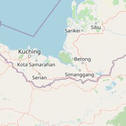
Rajang Mangroves National Park history and protected-area timeline

Rajang Mangroves National Park was officially gazetted on 29 May 2000, establishing formal protection for the mangrove ecosystems of the lower Rajang River delta. The designation came in response to growing concerns about mangrove forest degradation in Sarawak, where historical surveys revealed notably poor natural regeneration rates in exploited areas. A 1974 survey of the Rajang delta showed that natural regeneration success was less than 10 percent, highlighting the vulnerability of these ecosystems to unsustainable harvesting practices.

Following establishment, the park became a focal point for community-based conservation approaches that combine ecological restoration with livelihood support. The Ecological Fiscal Transfer for Biodiversity Conservation program and the Mangrove Forest Rewilding Project represent innovative financing mechanisms that have supported habitat restoration activities within the park boundaries. These programs emphasize active participation from local residents in conservation activities, recognizing that sustainable protection requires community buy-in and engagement.

The park has also been integrated into broader state conservation frameworks, including alignment with Sarawak's Post COVID-19 Development Strategy 2030. Monitoring capabilities have been enhanced through the Sarawak e-Biodiversity system, which enables systematic tracking of species and habitat conditions. Training initiatives such as the Honorary Wildlife Ranger Workshop have built local capacity for wildlife enforcement and conservation management, positioning the park as a model for integrated conservation and community outreach in the region.

Rajang Mangroves National Park landscape and geographic character

The landscape of Rajang Mangroves National Park is defined by the dynamic interaction between the Rajang River and the tidal influences of the South China Sea. The park encompasses extensive mangrove forests that grow in the intertidal zone, their root systems visible above the muddy substrate as the characteristic prop roots that allow the trees to survive in constantly changing water levels. Tidal channels dissect the mangrove forest, creating a complex network of waterways that shift with the twice-daily tidal cycle.

The terrain is flat and low-lying, rarely rising more than a few meters above sea level, which is typical of deltaic environments. The substrate consists of soft mud and silt deposits that accumulate from the river's flow, creating nutrient-rich but challenging conditions for vegetation. Within the mangrove forest, zones of different species occur based on their tolerance for salt water and frequency of tidal inundation, creating a vertical stratification from the water's edge inward. The surrounding landscape includes the broad floodplain of the Rajang River system and the coastal mudflats that extend beyond the mangrove boundaries.

Rajang Mangroves National Park ecosystems, habitats, and plant life

The nature of Rajang Mangroves National Park centers on its mangrove forest ecosystems, which represent some of the most productive habitats on Earth. These tidal forests support complex food webs that begin with the decomposition of leaf litter and detritus, fueling populations of crustaceans, mollusks, and fish that in turn support larger predators. The mangroves also function as nitrogen and phosphorus filters, improving water quality as river water passes through the forest before entering the coastal sea.

The vegetation of the park includes multiple mangrove species adapted to varying levels of salinity and tidal inundation. Historical surveys have identified challenges with natural regeneration, as inadequate seed tree retention, poor soil conditions in degraded areas, and competition from secondary growth species have limited forest recovery in some zones. Species such as Acanthus ilicifolius and Acrostichum aureum represent common secondary growth that can compete with desired mangrove species in disturbed areas. The park's conservation programs specifically address these regeneration challenges through active restoration efforts.

Rajang Mangroves National Park wildlife and species highlights

The wildlife of Rajang Mangroves National Park includes several species of significant conservation interest that depend on mangrove habitat for their survival. Proboscis monkeys, known for their distinctive elongated noses, are among the most notable mammal species found in the park. These arboreal primates are endemic to Borneo and are commonly found in mangrove forests where they feed on leaves, fruits, and seeds. Their social groups typically move through the canopy along tidal waterways, making the park's network of channels ideal habitat.

Estuarine crocodiles also inhabit the mangrove waterways, using the tidal channels and mudflats as hunting grounds. These apex predators are well adapted to the brackish water environment and can be found basking on mud banks or swimming through the tidal channels. The park supports diverse birdlife, including numerous migratory species that use the East Asian-Australasian flyway. These waterbirds use the mudflats and mangrove areas as staging grounds during their long-distance migrations, feeding on crabs, fish, and other invertebrates that thrive in the productive wetland environment.

Rajang Mangroves National Park conservation status and protection priorities

Rajang Mangroves National Park serves an important conservation function as a protected area for mangrove ecosystems that face multiple pressures across their range. The establishment of the park in 2000 represented a commitment to preserving the ecological integrity of the Rajang delta, recognizing the critical services these forests provide to both wildlife and human communities. The park's category II protected area status reflects its designation as a national park with primary objectives of ecosystem conservation and environmental protection.

The conservation approach at Rajang Mangroves integrates habitat restoration with community engagement, recognizing that effective protection requires addressing the underlying drivers of habitat degradation. The Mangrove Forest Rewilding Project has directly addressed historical regeneration failures by establishing nursery populations and actively replanting degraded areas with native species. The ecological fiscal transfer program provides ongoing funding that supports conservation activities while creating economic opportunities for local communities. Monitoring through the e-Biodiversity system enables adaptive management based on systematic data collection, supporting evidence-based conservation decision-making.

Rajang Mangroves National Park cultural meaning and human context

The cultural context of Rajang Mangroves National Park is closely tied to the riverine and coastal communities that have historically depended on the resources of the Rajang delta. Local fishing communities utilize the mangrove areas as sources of fish, crabs, and other seafood that form dietary staples and provide income. The park's community-based conservation model explicitly recognizes these traditional relationships and seeks to maintain sustainable resource use while protecting ecosystem integrity.

The location near Sarikei connects the park to a regional center that has developed in conjunction with the river's resources. The indigenous communities of Sarawak have long-standing relationships with the mangrove environments, though specific cultural heritage details would require additional local sources. The park's management approach emphasizes training and capacity building for local residents, including wildlife ranger programs that provide employment and involvement in conservation activities.

Top sights and standout views in Rajang Mangroves National Park

The highlights of Rajang Mangroves National Park center on its role as a premier mangrove conservation area in Borneo, protecting one of the largest remaining expanses of this critical habitat type in the region. The park provides essential habitat for proboscis monkeys, offering opportunities to observe these charismatic primates in their natural mangrove forest environment. The presence of estuarine crocodiles adds to the wildlife viewing interest, while the birdlife, particularly during migration seasons, attracts those interested in observing migratory waterbirds along the East Asian-Australasian flyway.

The park's innovative conservation model, combining habitat restoration with community participation and sustainable livelihood support, represents a notable approach to protected area management. The restoration of over 2,000 mangrove plants through community involvement demonstrates tangible conservation outcomes. The integration with broader state development strategies and systematic biodiversity monitoring through the e-Biodiversity system position this park as a model for integrated conservation in Sarawak.

Best time to visit Rajang Mangroves National Park

The best time to visit Rajang Mangroves National Park considers the tropical climate of Sarawak, where rainfall is distributed throughout the year but monsoon seasons bring more intense precipitation between November and February. The drier months from March through October generally offer more comfortable conditions for wildlife viewing and exploration, though brief showers can occur in any season. The tidal cycle significantly affects the park experience, as the mangrove waterways and exposed mudflats change dramatically between high and low tide, influencing which areas are accessible and what wildlife might be visible.

Wildlife viewing for proboscis monkeys tends to be most productive during the cooler morning hours when these primates are most active in the canopy. Bird watching is particularly rewarding during the migration seasons when migratory species pass through the delta, though resident waterbirds can be observed throughout the year. The park's mangrove environment is accessible year-round, though the experience will differ with seasonal variations in water levels and vegetation appearance.

Park location guide

Geography guide, regional context, and park location map for Rajang Mangroves National Park

Rajang Mangroves National Park park geography, regions, and map view in Malaysia
Understand where Rajang Mangroves National Park sits in Malaysia through a broader geographic reading of the surrounding landscape, nearby location context, and its mapped position within the national park landscape.

How Rajang Mangroves National Park fits into Malaysia

Malaysia is a federal constitutional monarchy located in Southeast Asia. The country consists of 13 states and three federal territories, divided by the South China Sea into Peninsular Malaysia on the Indochinese Peninsula and East Malaysia on the island of Borneo. With a population of over 34 million, it achieved independence from Britain in 1957 and became a modern federation in 1963. The country is recognized for its multicultural population, tropical climate, and significant economic role in the region.

Wider geography shaping Rajang Mangroves National Park in Malaysia

Malaysia occupies a strategic position in Southeast Asia, split by the South China Sea into two distinct regions. Peninsular Malaysia lies on the Indochinese Peninsula, sharing a land border with Thailand to the north and maritime borders with Singapore, Vietnam, and Indonesia. East Malaysia occupies the northern portion of Borneo, sharing land borders with Brunei and Indonesia, and maritime borders with the Philippines and Vietnam. The country's terrain includes coastal plains, mountain ranges such as the Titiwangsa in the peninsula, and extensive tropical rainforests.

Map view of Rajang Mangroves National Park

Use this park location map to pinpoint Rajang Mangroves National Park in Malaysia, understand its exact geographic position, and read its mapped placement within the surrounding landscape more clearly.

Pigeon | © OpenStreetMap contributors

Location context for Rajang Mangroves National Park

Sarawak
Park atlas

Trace the regional geography of Borneo's wetland parks, river delta habitats, and protected coastal landscapes.

Discover More National Parks and Protected Areas Near Rajang Mangroves National Park
Explore other national parks and protected areas geographically connected to Rajang Mangroves National Park, encompassing vital wetland ecosystems, river deltas, and coastal conservation landscapes across Borneo. This comparative atlas view allows users to trace the regional spread of protected habitats, compare diverse wildlife, and understand broader conservation efforts within similar natural environments.
National parkMalaysia

Maludam National Park: Southeast Asian Protected Landscape and National Park Geography

Mapped boundaries and natural terrain in Malaysia.

Maludam National Park offers a focused exploration of protected landscape identity and geographic context within Malaysia. As a designated national park, it serves as a vital component for understanding the distribution of protected areas and their mapped terrain. This detailed entry allows for an appreciation of the park's specific environmental character and its contribution to the broader atlas of natural landscapes in Southeast Asia, facilitating structured discovery for researchers and explorers.

Area
432 km²
Established
2000
IUCN
II
Relief
Lowland
Watercolor illustration of a coastal landscape with a distinctive rock formation, green vegetation, and calm water under a soft sky with distant mountains
National parkKuching Division

Bako National Park: Sarawak's Oldest National Park and Coastal Protected Landscape

Explore diverse ecosystems and dramatic mapped geology near Kuching Division.

Bako National Park, the oldest national park in Sarawak, Malaysia, offers a profound study in ecological concentration and geological drama. Covering a mere 27 square kilometers on the Muara Tebas peninsula, it encapsulates seven distinct ecosystem types, from coastal heath forest to mangrove areas, supporting significant biodiversity. The park's protected landscape is defined by its stunning sandstone coastline, carved by the sea into cliffs, arches, and seastacks, providing a unique geographic context. This makes Bako an essential destination for understanding Borneo's environmental diversity and the mapped boundaries of its conservation areas.

Area
27.27 km²
Established
1957
IUCN
II
Relief
Mixed relief
National parkSarawak

Santubong National Park: Sarawak's Protected Landscape for Geographic Atlas Exploration

Mapped park boundaries and regional terrain context in Borneo

Delve into Santubong National Park, a significant protected area situated within the diverse geography of Sarawak, Malaysia. This resource provides detailed information on the park's mapped boundaries, allowing for focused exploration of its specific terrain and its role within the regional protected landscape atlas. Understand the geographic identity of Santubong National Park and its contribution to Borneo's conservation mapping.

Area
14.1 km²
Established
2007
IUCN
II
Relief
Mountain
National parkSarawak

Kuching Wetlands National Park: Sarawak's Protected National Park Landscape and Geography

Explore the mapped wetland boundaries and regional context.

Gain a structured understanding of Kuching Wetlands National Park, a key protected area in Sarawak, Malaysia. This detailed entry provides insights into its specific geographic identity, mapped park boundaries, and its significance as a national park within the Borneo region's extensive natural landscapes. Discover the atlas value of this protected wetland environment for comprehensive geographic exploration.

Area
84.95 km²
Established
1992
IUCN
II
Relief
Lowland
National parkSri Aman Division

Batang Ai National Park: National Park Landscape and Geographic Discovery

Explore the protected terrain and mapped boundaries of Sri Aman Division.

Batang Ai National Park serves as a distinct national park entity, vital for understanding the protected landscape and regional geography of Malaysia's Sri Aman Division. This resource offers detailed insights into the park's geographic scope, its mapped boundaries, and the natural terrain it encompasses, enabling structured exploration for atlas enthusiasts and geography researchers.

Area
24 km²
Established
1991
IUCN
II
Relief
Lowland
National parkSarawak

Talang Satang National Park: Protected Landscape and Sarawak Geography

Explore its mapped boundaries and regional context.

Delve into the protected landscape of Talang Satang National Park, a key national park situated in the dynamic geography of Sarawak, Malaysia. This entry provides essential context for understanding its specific protected boundaries and its contribution to the broader regional natural landscape. Discover its atlas-relevant details to enrich your understanding of Borneo's protected areas and their geographic distribution.

Area
194.14 km²
Established
1999
IUCN
II
Relief
Lowland
National parkSarawak

Kubah National Park: National Park Status and Mapped Landscape in Sarawak

Explore its protected boundaries and geographic context within Borneo.

Kubah National Park is a protected national park located in Sarawak, Malaysia, representing a crucial element of the region's conservation landscape. This detailed entry focuses on its identity as a national park, its specific geographic placement within Sarawak, and its significance for map-based exploration. Users can investigate the mapped boundaries and understand how Kubah National Park fits into the larger atlas of protected areas in East Malaysia, providing a factual foundation for geographic discovery without travel advice.

Area
22.3 km²
Established
1989
IUCN
II
Visitors
45K annual
National parkSarawak

Gunung Gading National Park: Sarawak's Protected Landscape and Geographic Context

Discover mapped terrain and protected area boundaries.

Gunung Gading National Park is an important national park located in Sarawak, Malaysia, offering critical insights into the region's geography and protected lands. This park serves as a key entity for exploring its specific mapped terrain and understanding its place within the diverse landscapes of Borneo. Examining Gunung Gading National Park aids in comprehending the distribution and character of protected areas in East Malaysia through a structured, atlas-oriented approach.

Area
43.6 km²
Established
1983
IUCN
II
Relief
Mountain

Common questions about visiting, size, designation, and location context for Rajang Mangroves National Park

Rajang Mangroves National Park FAQs for park facts, access, geography, and protected area context
Find quick answers about Rajang Mangroves National Park, including protected-area facts, park geography, trail and visitor context, and how the park fits into its surrounding country and regional landscape.
MoriAtlas Explorer

Continue Your Protected Areas Search Across the Global Atlas

Deepen your exploration by continuing the structured search for national parks and protected areas worldwide. Utilize the comprehensive filtering capabilities to compare different conservation landscapes and refine your understanding of global park geography. Discover more about the distribution and characteristics of protected natural areas.

Global natural geography