Mori Atlas logo
National parkBukit Baka Bukit Raya National Park

Trace the mapped boundaries and geographic heart of Borneo's Schwaner mountain range.

Bukit Baka Bukit Raya National Park: Montane Rainforest Protected Landscape in Central Kalimantan

(Taman Nasional Bukit Baka Bukit Raya)

Bukit Baka Bukit Raya National Park represents a significant protected area within Indonesia's Central Kalimantan region, established as a national park in 1992. This expansive natural landscape, covering approximately 1,810 square kilometers, is defined by the rugged montane terrain of the Schwaner mountain range, rising dramatically with peaks like Bukit Raya at 2,278 meters. As a crucial component of the Heart of Borneo initiative, the park's intact tropical rainforest ecosystems are vital for regional biodiversity and landscape connectivity, offering a rich subject for geographic exploration and atlas-based discovery.

Montane RainforestBorneoHeart of BorneoBiodiversity HotspotEndemic SpeciesMountain Trekking

Bukit Baka Bukit Raya National Park

National park

Park overview

Structured park overview, official facts, and landscape profile for Bukit Baka Bukit Raya National Park

Bukit Baka Bukit Raya National Park park facts, protected area profile, and essential visitor context
Review the core facts for Bukit Baka Bukit Raya National Park, including designation, size, terrain, visitor scale, habitats, and operating context in one park-focused overview.

About Bukit Baka Bukit Raya National Park

Bukit Baka Bukit Raya National Park represents one of Indonesia's most significant protected areas in terms of both ecological value and geographic extent on the island of Borneo. Located at the geographic heart of the island, the park spans the Schwaner mountain range, a complex of forested peaks and ridges that form the backbone of central Borneo. The protected area was created in 1992 when two earlier reserves the Bukit Raya Nature Reserve (established in 1978 and expanded to 1,100 square kilometers in 1979) and the Bukit Baka Nature Reserve (established in 1982 covering 1,000 square kilometers) were merged into a single administrative unit covering 1,810 square kilometers. This consolidation reflected the ecological continuity between the two mountain massifs and the importance of maintaining connected habitats for wildlife movement across the island's central highlands. The park's elevation gradient from lowland forests to montane zones creates diverse habitat conditions that support remarkable plant and animal diversity. Its position straddling two provinces also gives the park significance for regional conservation coordination, as it sits within the broader Heart of Borneo initiative designed to protect the island's last great forest landscapes.

Quick facts and research context for Bukit Baka Bukit Raya National Park

The park occupies a strategic position along the Schwaner mountain range in central Borneo, straddling the provincial boundary between Central Kalimantan and West Kalimantan. It was formally established as a national park in 1992 through the consolidation of the former Bukit Raya and Bukit Baka nature reserves. The area serves important hydrological functions, acting as a catchment zone for the Melawi River basin in West Kalimantan and the Katingan River basin in Central Kalimantan. The park contains at least 817 documented plant species and provides habitat for several endangered mammal species including orangutans, clouded leopards, and sun bears. Seven Dayak ethnic groups maintain connections to the land, including the Limbai, Ransa, Kenyilu, Ot Danum, Malahui, Kahoi, and Kahayan communities.

Park context

Deeper park guide and search-rich context for Bukit Baka Bukit Raya National Park

Bukit Baka Bukit Raya National Park history, landscape, wildlife, and travel context
Explore Bukit Baka Bukit Raya National Park through its history, landscape character, ecosystems, wildlife, conservation priorities, cultural context, and seasonal travel timing in a structured park guide built for atlas discovery and search intent.

Why Bukit Baka Bukit Raya National Park stands out

Bukit Baka Bukit Raya is best known for its montane rainforest ecosystems within the Schwaner mountain range, which represent some of the most biodiverse habitats on the island of Borneo. The park protects significant populations of threatened species including the Bornean orangutan, Sunda clouded leopard, and sun bear, all of which depend on the intact forest cover that the park maintains. The twin peaks of Bukit Baka and Bukit Raya provide challenging but rewarding trekking destinations, with Bukit Raya standing as one of the highest non-volcanic peaks in Borneo. The park's participation in the Heart of Borneo conservation framework underscores its importance as a transboundary conservation landscape.

Bukit Baka Bukit Raya National Park history and protected-area timeline

The conservation history of what is now Bukit Baka Bukit Raya National Park began in the late 1970s when Indonesian authorities recognized the ecological importance of the Schwaner mountain range's upper reaches. In 1978, a nature reserve of approximately 500 square kilometers was established around Mount Bukit Raya, focusing on protecting the montane forest ecosystems of this significant peak. The following year, in 1979, the reserve was expanded to encompass 1,100 square kilometers, acknowledging the broader ecological context needed for effective protection. A separate conservation initiative resulted in the establishment of the Bukit Baka nature reserve in 1982, covering approximately 1,000 square kilometers in the adjacent mountain area. Over the following decade, boundary adjustments were made to both reserves as authorities refined their understanding of the ecological landscape and administrative requirements. In 1992, these two protected areas were formally merged into a single national park through the Ministry of Forestry's Decree Number 281/Kpts-II/1992, dated February 26, 1992, creating the comprehensive protected landscape that exists today. The park has since become an important component of Indonesia's national park system and contributes to the international Heart of Borneo conservation partnership.

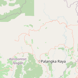
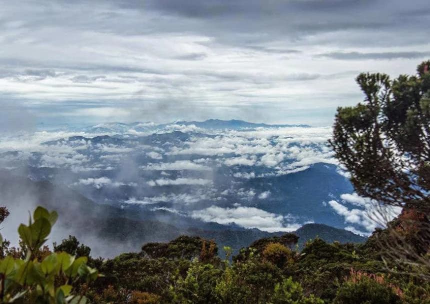
Bukit Baka Bukit Raya National Park landscape and geographic character

The physical landscape of Bukit Baka Bukit Raya National Park is dominated by the rugged terrain of the Schwaner mountain range, a massive geological formation that forms the central highlands of Borneo. The park's two namesake peaks, Bukit Baka at 1,620 meters and the higher Bukit Raya at 2,278 meters, stand as the most prominent topographic features, their forested slopes rising abruptly from the surrounding lowland terrain. The mountain range's composition creates a complex terrain of steep ridges, deep valleys, and elevated plateaus that characterizes much of the park's interior. Several other notable peaks are scattered throughout the park, including Bukit Bukit Asing at 1,750 meters, Bukit Melabanbun at 1,850 meters, and Bukit Panjing at 1,620 meters. The park's hydrological significance stems from its position as a watershed divide, with its drainage feeding both the Melawi River system flowing through West Kalimantan and the Katingan River system in Central Kalimantan. This water catchment function gives the park importance beyond its borders for downstream communities and agricultural lands. The forest-covered slopes descend through successive elevation zones, transitioning from lowland dipterocarp forests at the base to montane vegetation types at higher elevations.

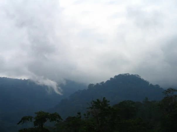
Bukit Baka Bukit Raya National Park ecosystems, habitats, and plant life

The ecological character of Bukit Baka Bukit Raya National Park is defined by its representation of Bornean montane rainforest, a habitat type that supports extraordinary plant diversity and provides critical ecosystem functions. The park contains documented records of 817 plant species spanning 139 families, with prominent representation from the Dipterocarpaceae, Myrtaceae, Sapotaceae, Euphorbiaceae, Lauraceae, and Ericaceae families. These plant communities create the layered forest structure that characterizes intact Bornean rainforest, with emergent trees, a dense canopy, and varied understory layers. The park's vegetation includes numerous endemic species found nowhere else on Earth, such as Symplocos rayae, Gluta sabahana, Dillenia beccariana, Lithocarpus coopertus, Selaginella magnifica, and Tetracera glaberrima. The Schwaner mountain range forests represent some of the most significant remaining intact forest in central Borneo, forming a critical ecological corridor within the Heart of Borneo network. The diversity of elevations within the park, from lowland slopes to montane peaks, creates multiple habitat zones that support different plant assemblages and contribute to the overall biodiversity richness.

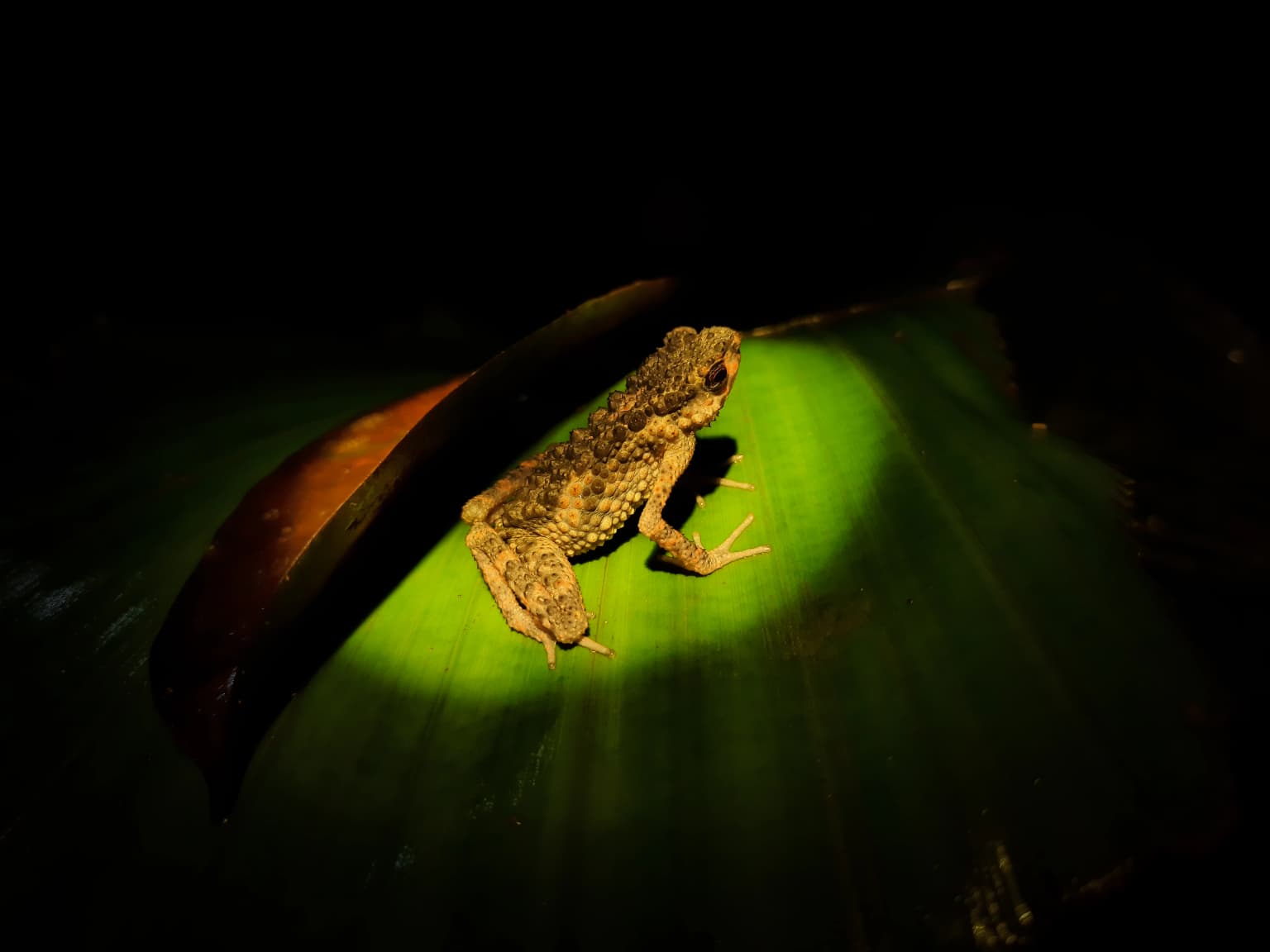
Bukit Baka Bukit Raya National Park wildlife and species highlights

The wildlife community within Bukit Baka Bukit Raya National Park reflects the exceptional biodiversity of Borneo's forests and includes several species of significant conservation concern. The park provides crucial habitat for the Bornean orangutan, one of the great apes most threatened by forest loss and fragmentation across its range. The Sunda clouded leopard, a secretive and largely nocturnal predator, inhabits the forest canopy and represents one of the smaller but still ecologically important large carnivores in the region. The sun bear, the smallest bear species in the world and unique for its arboreal habits, is also present within the park boundaries. Primate diversity includes multiple species of leaf monkeys, with the maroon leaf monkey and other Presbytis species recorded, as well as slow lorises and both the Bornean white-bearded gibbon and Mueller's gibbon. The bird fauna includes notable species such as the black hornbill and the critically endangered helmeted hornbill, whose large size and distinctive call make it a flagship species for the region. The Bornean peacock-pheasant adds to the park's significance for avifauna conservation. Sambar deer and various flying squirrel species represent the more commonly encountered mammals in the park.

Bukit Baka Bukit Raya National Park conservation status and protection priorities

Bukit Baka Bukit Raya National Park plays a strategic role in Borneo's conservation landscape as part of the Heart of Borneo initiative, a multilateral effort to protect the island's remaining large forest blocks. The park's location spanning the central Schwaner mountain range positions it as a critical connectivity corridor allowing wildlife movement between different parts of the island's interior. However, the park faces significant conservation challenges, with illegal logging emerging as a severe threat since the late 20th century. This pressure reflects broader patterns of forest conversion and exploitation across Indonesian Borneo and underscores the difficulties of enforcement in remote protected areas. The park's hydrological function as a catchment area for major river systems adds an environmental services dimension to its conservation value, as the forests help regulate water flow and maintain water quality for downstream communities in both Central and West Kalimantan. The presence of multiple endemic plant species and endangered wildlife adds to the park's significance as a conservation priority area within Indonesia's protected area network.

Bukit Baka Bukit Raya National Park cultural meaning and human context

Bukit Baka Bukit Raya National Park is ancestral territory for several Dayak ethnic groups whose traditional connections to the landscape predate its formal protected status. The Dayak Limbai, Dayak Ransa, Dayak Kenyilu, Dayak Ot Danum, Dayak Malahui, Dayak Kahoi, and Dayak Kahayan peoples maintain cultural relationships with the forest and mountain environments within the park boundaries. These communities have historically practiced forms of shifting agriculture and forest resource use that were integrated with the broader landscape ecology. Traditional longhouses known as rumah betang remain part of the cultural landscape in surrounding areas, and wooden ancestral statues carved from ironwood (ulin or belian) represent traditional craftsmanship. The park's establishment as a protected area required negotiation between conservation objectives and the historical land use patterns of these indigenous communities, a dynamic common to many Indonesian national parks. The cultural dimension adds depth to the park's identity beyond its purely ecological significance.

Top sights and standout views in Bukit Baka Bukit Raya National Park

The dual peaks of Bukit Baka and Bukit Raya offer compelling trekking objectives, with the higher summit of Bukit Raya at 2,278 meters providing one of the most significant non-volcanic summits in Borneo. The park's population of orangutans, clouded leopards, and sun bears represents a remarkable assemblage of large mammals within a single protected area. The presence of the helmeted hornbill among the bird species highlights the park's importance for some of Borneo's most threatened avifauna. The montane rainforest ecosystem, with its 817 documented plant species including numerous endemics, demonstrates the park's botanical significance. The park's participation in the Heart of Borneo initiative connects it to broader transboundary conservation efforts across the island. The watershed function serving both the Melawi and Katingan river systems gives the park regional importance for water resource management. The cultural heritage of multiple Dayak communities adds a human dimension to the park's identity.

Best time to visit Bukit Baka Bukit Raya National Park

The optimal time to visit Bukit Baka Bukit Raya National Park generally coincides with the drier months typically occurring between May and September, when rainfall is reduced and trail conditions are more favorable for trekking activities. The wet season from October through April brings more frequent precipitation, which can make forest trails slippery and more difficult to navigate, particularly on the steeper mountain approaches. Temperature conditions vary with elevation, with the lower slopes experiencing warm and humid tropical conditions while higher elevations near the peaks can be noticeably cooler, especially at night. Wildlife viewing opportunities may differ seasonally, as fruit availability in the forest influences the movement patterns of orangutans and other frugivorous species. Visitors planning summit attempts should account for the higher rainfall amounts that typically occur at elevation and prepare accordingly. The dry season offers more predictable conditions for planning trekking itineraries, though the park's remote location and infrastructure limitations mean that access and logistics require careful advance preparation.

Park location guide

Geography guide, regional context, and park location map for Bukit Baka Bukit Raya National Park

Bukit Baka Bukit Raya National Park park geography, regions, and map view in Indonesia
Understand where Bukit Baka Bukit Raya National Park sits in Indonesia through a broader geographic reading of the surrounding landscape, nearby location context, and its mapped position within the national park landscape.

How Bukit Baka Bukit Raya National Park fits into Indonesia

Indonesia is a vast archipelagic nation in Southeast Asia and Oceania, spanning over 17,000 islands between the Indian and Pacific Oceans. As the world's fourth-most populous country with 288 million people, it features extraordinary cultural and biological diversity, withJavanese and Sundanese being the largest ethnic groups. The country gained independence from the Netherlands in 1945 and operates as a unitary presidential republic.

Wider geography shaping Bukit Baka Bukit Raya National Park in Indonesia

Indonesia is situated in Southeast Asia and Oceania, spanning the equatorial region between the Indian Ocean to the west and the Pacific Ocean to the east. The archipelago includes major islands such as Sumatra, Java, Sulawesi, and parts of Borneo and New Guinea. It borders Papua New Guinea, Timor-Leste, and Malaysia by land, with extensive maritime boundaries throughout the region.

Map view of Bukit Baka Bukit Raya National Park

Use this park location map to pinpoint Bukit Baka Bukit Raya National Park in Indonesia, understand its exact geographic position, and read its mapped placement within the surrounding landscape more clearly.

Pigeon | © OpenStreetMap contributors

Location context for Bukit Baka Bukit Raya National Park

Central KalimantanWest Kalimantan
Park atlas

Trace the regional geography and connected protected landscapes within Borneo's central highlands.

Discover Other National Parks and Protected Areas Near Bukit Baka Bukit Raya National Park
After exploring Bukit Baka Bukit Raya National Park, discover other national parks and protected areas across the rugged montane rainforests of Borneo. Compare similar conservation landscapes and trace the broader geographic spread of protected areas within the Heart of Borneo region's central highlands.
National parkSarawak

Rajang Mangroves National Park: Borneo's Premier Mangrove Protected Landscape

Explore the mapped geography and wetland conservation of this Sarawak national park.

Rajang Mangroves National Park is a significant protected area dedicated to preserving the intricate mangrove swamp ecosystems of Sarawak's Rajang River delta. Encompassing a vast expanse of tidal channels and riverine forests, this national park serves as a critical habitat for unique wildlife and plays a vital role in coastal ecological health. Its landscape is defined by the dynamic interface between riverine and marine environments, offering a prime example of wetland conservation within Borneo's broader natural geography and atlas context.

Area
107 km²
Established
2000
IUCN
II
National parkKuching Division

Bako National Park: Sarawak's Oldest National Park and Coastal Protected Landscape

Explore diverse ecosystems and dramatic mapped geology near Kuching Division.

Bako National Park, the oldest national park in Sarawak, Malaysia, offers a profound study in ecological concentration and geological drama. Covering a mere 27 square kilometers on the Muara Tebas peninsula, it encapsulates seven distinct ecosystem types, from coastal heath forest to mangrove areas, supporting significant biodiversity. The park's protected landscape is defined by its stunning sandstone coastline, carved by the sea into cliffs, arches, and seastacks, providing a unique geographic context. This makes Bako an essential destination for understanding Borneo's environmental diversity and the mapped boundaries of its conservation areas.

Area
27 km²
Established
1957
IUCN
II
National parkNorth Kalimantan

Kayan Mentarang National Park: A Protected Landscape in North Kalimantan

Explore Borneo's critical protected area and its vast forest geography.

Kayan Mentarang National Park is an immense protected area in North Kalimantan, Indonesia, renowned for being a crucial part of the Heart of Borneo conservation initiative. This national park encompasses over 13,600 square kilometers of primary tropical rainforest, sheltering diverse montane and lowland habitats along the Indonesia-Malaysia border. Its importance lies in its vast, contiguous landscape, critical role in regional biodiversity, and its representation of one of Southeast Asia's last great wilderness expanses, offering significant insight into mapped protected areas.

Area
13,605 km²
Established
1996
IUCN
II
Scope
Mixed
Nature reserveBrunei

Luagan Lalak Forest Recreation Park Nature Reserve: Brunei's Pristine Freshwater Swamp Landscape

Explore mapped protected-area geography and unique wetland terrain.

Luagan Lalak Forest Recreation Park, a protected nature reserve in Brunei, preserves a rare and visually distinctive freshwater swamp ecosystem. Characterized by dark, tranquil waters and vast fields of purun grass, this natural wetland offers a unique landscape context and is a prime location for observing its rich biodiversity, especially its notable birdlife. The park's preservation as an intact swamp environment within a recreational area highlights its ecological importance for regional geography and protected-area mapping.

Area
2.7 km²
Established
1980
IUCN
II
National parkBrunei

Ulu Temburong National Park: Brunei's Protected Rainforest Landscape and Geographic Context

Mapped natural terrain and conservation significance.

Ulu Temburong National Park represents Brunei's commitment to preserving its most ecologically significant tropical rainforests, covering approximately 550 square kilometers. This protected area is characterized by its remote location in the Temburong District and its diverse topography, ranging from lowland areas to mountainous ridges, all within a largely undisturbed natural setting. The park's mapped boundaries encompass a vital transboundary conservation landscape, making it a key site for understanding Borneo's unique ecosystems and forest protection policies through an atlas-driven exploration approach.

Area
488.59 km²
Established
1991
IUCN
II
Relief
Mixed relief
Protected areaBrunei-Muara District

Bukit Shahbandar Forest Recreation Park: Protected Area with Ridge Landscape & Hiking Trails

Explore Brunei's unique recreational forest terrain and mapped natural features.

Bukit Shahbandar Forest Recreation Park is a notable protected area within the Brunei-Muara District, distinguished by its prominent grassy ridge and a network of challenging hiking trails that traverse its varied terrain. The park's landscape is characterized by rolling hills, including peaks that reach nearly 470 feet, offering strategic vantage points. As a recreational forest, it provides a distinct example of protected land use, blending modified natural vegetation with opportunities for outdoor activity and geographic discovery. Its unique topography and trail system offer a clear focus for atlas-based exploration.

Area
2.34 km²
Established
1998
IUCN
II
National parkCentral Sulawesi

Lore Lindu National Park: Central Sulawesi's Protected Landscape and Atlas Anchor

Explore its endemic species, megalithic sites, and rich geography.

Lore Lindu National Park stands as a critical protected area within Central Sulawesi, Indonesia, recognized for its exceptional endemic biodiversity and profound archaeological importance. This national park features a dramatic geographic setting, rising from lowland forests to montane ecosystems and encompassing ancient megalithic structures within its protected landscape. Understanding Lore Lindu National Park through its mapped boundaries and unique regional geography offers deep insights into conservation and cultural heritage, providing a focal point for atlas-based discovery.

Area
2,180 km²
Established
1982
IUCN
II
National parkEast Java

Meru Betiri National Park: Mapped Protected Landscape in East Java

Discover the terrain and geography of this national park.

Meru Betiri National Park in East Java, Indonesia, offers a rich tapestry of mapped landscapes, from its distinctive sandy beaches and mangrove ecosystems along the southern coast to its interior volcanic highlands and tropical rainforests. This protected area is crucial for understanding the regional geography and the distribution of conservation lands across Java. Explore its topographic diversity and unique ecological settings that define this significant national park.

Area
580 km²
Established
1982
IUCN
II

Common questions about visiting, size, designation, and location context for Bukit Baka Bukit Raya National Park

Bukit Baka Bukit Raya National Park FAQs for park facts, access, geography, and protected area context
Find quick answers about Bukit Baka Bukit Raya National Park, including protected-area facts, park geography, trail and visitor context, and how the park fits into its surrounding country and regional landscape.
MoriAtlas Explorer

Continue Your Protected Areas Search Across the Global Atlas

Deepen your exploration by continuing the structured search for national parks and protected areas worldwide. Utilize the comprehensive filtering capabilities to compare different conservation landscapes and refine your understanding of global park geography. Discover more about the distribution and characteristics of protected natural areas.

Global natural geography