Mori Atlas logo
National parkKayan Mentarang National Park

Explore the geography and mapped protected boundaries of this crucial Indonesian national park.

Kayan Mentarang National Park: Heart of Borneo's Vast Protected Landscape Atlas

(Taman Nasional Kayan Mentarang)

Kayan Mentarang National Park stands as a monumental protected landscape within Indonesia's North Kalimantan province, representing one of the largest continuous tracts of primary tropical rainforest in Southeast Asia. This national park is a cornerstone of the Heart of Borneo initiative, safeguarding vital ecosystems and transboundary conservation corridors across the Indonesian-Malaysian border. Its immense scale and ecological significance make it an essential destination for understanding regional geography and the mapped distribution of critical natural habitats.

Tropical RainforestBorneoTransboundary Protected AreaDayak CultureMontane ForestHeart of Borneo

Kayan Mentarang National Park

National park

Park overview

Structured park overview, official facts, and landscape profile for Kayan Mentarang National Park

Kayan Mentarang National Park park facts, protected area profile, and essential visitor context
Review the core facts for Kayan Mentarang National Park, including designation, size, terrain, visitor scale, habitats, and operating context in one park-focused overview.

About Kayan Mentarang National Park

Kayan Mentarang National Park represents one of Indonesia's most significant protected areas and stands as a cornerstone of regional conservation efforts on Borneo. The park's vast territory encompasses diverse terrain ranging from lowland river valleys to montane plateaus, creating a mosaic of habitats that support extraordinary biological diversity. The Apau Kayan plateau, after which the park is named, has historically served as a traditional highland corridor for the Dayak peoples, connecting settlements across the mountainous interior of northern Borneo. In recent decades, the park has become central to the Heart of Borneo initiative, a collaborative framework between Indonesia, Malaysia, and Brunei aimed at preserving the island's remaining primary forests through coordinated transboundary management. The Kayan River, which flows through the park, serves as a vital waterway for both wildlife and local communities, with floating gasoline stations along its banks representing the unique intersection of traditional life and modern infrastructure in this remote region. Despite its ecological significance, the park remains one of Indonesia's more inaccessible protected areas, with entry often requiring crossing the rural Indonesian-Malaysian border checkpoint.

Quick facts and research context for Kayan Mentarang National Park

Kayan Mentarang National Park covers approximately 13,605 square kilometers in North Kalimantan, Indonesia, making it one of the largest national parks in Southeast Asia. The park was established in 1996 and is managed by Indonesia's Ministry of Forestry under IUCN Category II protection. It forms the core of the Heart of Borneo initiative, a trinational effort to preserve the island's mountainous interior. The park takes its name from the Apau Kayan plateau, a traditional highland region traversed by ancient Mentarang mountain trails. Access has historically been challenging due to the remote border location, though recent cross-border tourism agreements have improved visitor access from Malaysia via Ba'kelalan in Sarawak.

Park context

Deeper park guide and search-rich context for Kayan Mentarang National Park

Kayan Mentarang National Park history, landscape, wildlife, and travel context
Explore Kayan Mentarang National Park through its history, landscape character, ecosystems, wildlife, conservation priorities, cultural context, and seasonal travel timing in a structured park guide built for atlas discovery and search intent.

Why Kayan Mentarang National Park stands out

Kayan Mentarang is best known as the heart of Borneo, protecting one of the last great contiguous tropical forest landscapes in Southeast Asia. The park is famous for its exceptional biodiversity, particularly its populations of proboscis monkeys, Bornean gibbons, and several species of critically endangered hornbills including the helmeted rhinoceros hornbill. Its position at the Indonesia-Malaysia border places it at the crossroads of multiple ecosystems, supporting both lowland dipterocarp forests and montane vegetation zones. The park is also renowned for the traditional cultures of the Dayak peoples who have inhabited the region for over 350 years, preserving indigenous knowledge and sustainable land-use practices across the landscape.

Kayan Mentarang National Park history and protected-area timeline

Kayan Mentarang National Park was officially established in 1996 as part of Indonesia's expanding network of protected areas. The creation of the park responded to growing recognition of the ecological importance of Borneo's interior forests and the need to protect remaining wilderness areas from expanding logging and agricultural development. Prior to national park designation, the area existed as a forest reserve with varying levels of protection. The establishment coincided with increased international attention to Borneo's deforestation crisis and the emergence of transboundary conservation frameworks. The Heart of Borneo initiative, launched in 2007, further elevated the park's significance by positioning it as a core conservation zone within a trinational network. Recent years have seen improved cross-border cooperation, with agreements facilitating tourist movement from Malaysian Borneo through the Ba'kelalan gateway, marking a shift from the park's historically restricted access.

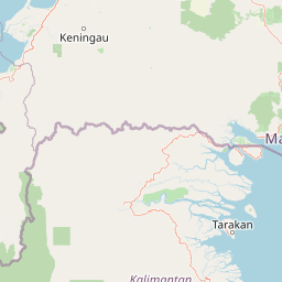
Kayan Mentarang National Park landscape and geographic character

The landscape of Kayan Mentarang National Park is characterized by its dramatic mountainous terrain and extensive forest cover. The Apau Kayan plateau forms the park's central spine, a dispersed highland region of ridges, valleys, and traditional walking trails that has long served as a corridor for indigenous movement across northern Borneo. The terrain descends from montane elevations in the central region toward lowland river valleys in the southern and eastern sections. The Kayan River and its tributaries traverse the park, carving valleys that provide both aquatic habitat and transportation routes for local communities. The park's position at the Indonesia-Malaysia border means it forms part of a continuous highland ecosystem that extends across the international boundary, creating one of the largest transboundary protected areas in Southeast Asia.

Kayan Mentarang National Park ecosystems, habitats, and plant life

Kayan Mentarang protects one of Southeast Asia's most ecologically significant forest ecosystems. The park's location at the heart of Borneo places it within the island's biodiversity hotspot, where species from Asian and Australasian lineages meet and diversify. The varied elevation gradient from lowland to montane zones supports multiple distinct vegetation types, including primary dipterocarp forests in the lower elevations, montane forests in the higher terrain, and riparian zones along the major river systems. The dense canopy and intact forest structure have allowed ecological processes to continue relatively unimpeded, supporting populations of species that have been displaced from more degraded parts of Borneo. The park's inclusion in the Heart of Borneo initiative reflects its role as a reservoir of biodiversity in a region where forest loss has been extensive.

Kayan Mentarang National Park wildlife and species highlights

The wildlife of Kayan Mentarang National Park includes remarkable assemblages of Southeast Asian forest species. Among the park's mammal populations, the proboscis monkey and Bornean gibbon represent flagship arboreal species whose populations depend on intact forest canopies. The park also shelters several felid species including the clouded leopard, marbled cat, and flat-headed cat, three of Borneo's most elusive forest predators. Other notable mammals include the sun bear, Malayan pangolin, and various primate and civet species. The birdlife is equally impressive, with four species of hornbill documented within the park, including the spectacular helmeted hornbill and the rhinoceros hornbill. These large fruit-eating birds play critical roles in seed dispersal and forest dynamics. The combination of intact forest, diverse habitats, and relative isolation has allowed these species to persist in densities that have declined across much of Borneo's logged and fragmented landscapes.

Kayan Mentarang National Park conservation status and protection priorities

Kayan Mentarang National Park plays a vital role in regional conservation strategy as the core zone of the Heart of Borneo initiative. This trinational program aims to preserve approximately 200,000 square kilometers of contiguous forest across Indonesia, Malaysia, and Brunei, representing one of the largest transboundary conservation efforts in the tropics. The park's significance stems from its vast size, relatively intact ecosystems, and its position connecting protected areas across the Indonesia-Malaysia border. Conservation challenges include pressure from logging, plantation expansion, and the need to balance traditional indigenous land use with protection objectives. The park's designation as IUCN Category II reflects its dual mandate of biodiversity protection and sustainable management, though enforcement across such an extensive remote area presents substantial logistical difficulties.

Kayan Mentarang National Park cultural meaning and human context

The region surrounding Kayan Mentarang has been inhabited for over 350 years, as evidenced by archaeological remains including stone tools and graves found within the park boundaries. Approximately 20,000 to 25,000 Dayak people live in communities around the park, representing a cultural landscape where traditional indigenous practices remain integral to the region's identity. Multiple Dayak tribes inhabit the area, including the Kenyah, Murut, Punan, Lundayeh, and Lun Bawang peoples, each maintaining distinct cultural traditions, languages, and relationships with the forest. These communities have historically practiced rotational agriculture, hunting, and the use of forest resources in ways that have shaped and been shaped by the landscape over centuries. The Apau Kayan plateau remains culturally significant as a traditional highland corridor connecting Dayak settlements across Borneo.

Top sights and standout views in Kayan Mentarang National Park

Kayan Mentarang offers exceptional opportunities to experience one of Southeast Asia's last great wilderness areas. The park's status as the centerpiece of the Heart of Borneo initiative reflects its outstanding ecological values and the critical role it plays in preserving regional biodiversity. Visitors can explore pristine river systems like the Kayan, encounter diverse primate and hornbill species, and engage with Dayak communities maintaining traditional forest-based lifestyles. The transboundary location provides a rare opportunity to experience conservation across international borders, while the Apau Kayan plateau offers access to one of Borneo's most historically and culturally significant highland regions.

Best time to visit Kayan Mentarang National Park

The optimal period for visiting Kayan Mentarang National Park generally corresponds with the drier months typical of the Borneo climate, though the park's extensive forest cover means that rain can occur throughout the year. The dry season from March through October often provides more accessible trail conditions and clearer river travel, while the wetter months from November through February may still allow visits but with more challenging logistics. Visitors should note that the park's remote location and border area require careful planning, including coordination with local authorities and awareness of cross-border permit requirements when entering from Malaysia.

Park location guide

Geography guide, regional context, and park location map for Kayan Mentarang National Park

Kayan Mentarang National Park park geography, regions, and map view in Indonesia
Understand where Kayan Mentarang National Park sits in Indonesia through a broader geographic reading of the surrounding landscape, nearby location context, and its mapped position within the national park landscape.

How Kayan Mentarang National Park fits into Indonesia

Indonesia is a vast archipelagic nation in Southeast Asia and Oceania, spanning over 17,000 islands between the Indian and Pacific Oceans. As the world's fourth-most populous country with 288 million people, it features extraordinary cultural and biological diversity, withJavanese and Sundanese being the largest ethnic groups. The country gained independence from the Netherlands in 1945 and operates as a unitary presidential republic.

Wider geography shaping Kayan Mentarang National Park in Indonesia

Indonesia is situated in Southeast Asia and Oceania, spanning the equatorial region between the Indian Ocean to the west and the Pacific Ocean to the east. The archipelago includes major islands such as Sumatra, Java, Sulawesi, and parts of Borneo and New Guinea. It borders Papua New Guinea, Timor-Leste, and Malaysia by land, with extensive maritime boundaries throughout the region.

Map view of Kayan Mentarang National Park

Use this park location map to pinpoint Kayan Mentarang National Park in Indonesia, understand its exact geographic position, and read its mapped placement within the surrounding landscape more clearly.

Pigeon | © OpenStreetMap contributors

Location context for Kayan Mentarang National Park

North Kalimantan
Park atlas

Compare other significant protected landscapes and natural reserves across Indonesia's North Kalimantan and the broader Heart of Borneo region.

Explore Nearby National Parks and Protected Areas Around Kayan Mentarang National Park in Borneo
Continue your protected-area exploration from Kayan Mentarang National Park by browsing other national parks and significant reserves within Indonesia's North Kalimantan province. Compare adjacent conservation landscapes, trace the transboundary Heart of Borneo ecosystems, and discover more of central Borneo's diverse forest and montane terrain.
National parkBrunei

Ulu Temburong National Park: Brunei's Protected Rainforest Landscape and Geographic Context

Mapped natural terrain and conservation significance.

Ulu Temburong National Park represents Brunei's commitment to preserving its most ecologically significant tropical rainforests, covering approximately 550 square kilometers. This protected area is characterized by its remote location in the Temburong District and its diverse topography, ranging from lowland areas to mountainous ridges, all within a largely undisturbed natural setting. The park's mapped boundaries encompass a vital transboundary conservation landscape, making it a key site for understanding Borneo's unique ecosystems and forest protection policies through an atlas-driven exploration approach.

Area
488.59 km²
Established
1991
IUCN
II
Relief
Mixed relief
Nature reserveBrunei

Luagan Lalak Forest Recreation Park Nature Reserve: Brunei's Pristine Freshwater Swamp Landscape

Explore mapped protected-area geography and unique wetland terrain.

Luagan Lalak Forest Recreation Park, a protected nature reserve in Brunei, preserves a rare and visually distinctive freshwater swamp ecosystem. Characterized by dark, tranquil waters and vast fields of purun grass, this natural wetland offers a unique landscape context and is a prime location for observing its rich biodiversity, especially its notable birdlife. The park's preservation as an intact swamp environment within a recreational area highlights its ecological importance for regional geography and protected-area mapping.

Area
2.7 km²
Established
1980
IUCN
II
Protected areaBrunei-Muara District

Bukit Shahbandar Forest Recreation Park: Protected Area with Ridge Landscape & Hiking Trails

Explore Brunei's unique recreational forest terrain and mapped natural features.

Bukit Shahbandar Forest Recreation Park is a notable protected area within the Brunei-Muara District, distinguished by its prominent grassy ridge and a network of challenging hiking trails that traverse its varied terrain. The park's landscape is characterized by rolling hills, including peaks that reach nearly 470 feet, offering strategic vantage points. As a recreational forest, it provides a distinct example of protected land use, blending modified natural vegetation with opportunities for outdoor activity and geographic discovery. Its unique topography and trail system offer a clear focus for atlas-based exploration.

Area
2.34 km²
Established
1998
IUCN
II
National parkSabah

Tun Sakaran Marine Park National Park: Sabah Marine Archipelago Atlas

Explore the islands, sand cays, and coral reef geography.

Tun Sakaran Marine Park is a protected national park in Sabah, Malaysia, known for its stunning marine biodiversity and archipelago landscape. This atlas entry details the park's distinct islands, dynamic sand cays, and extensive coral reef systems within the Celebes Sea, offering insights into its unique geographic setting and ecological significance.

Area
101 km²
Established
2004
IUCN
II
National parkSarawak

Rajang Mangroves National Park: Borneo's Premier Mangrove Protected Landscape

Explore the mapped geography and wetland conservation of this Sarawak national park.

Rajang Mangroves National Park is a significant protected area dedicated to preserving the intricate mangrove swamp ecosystems of Sarawak's Rajang River delta. Encompassing a vast expanse of tidal channels and riverine forests, this national park serves as a critical habitat for unique wildlife and plays a vital role in coastal ecological health. Its landscape is defined by the dynamic interface between riverine and marine environments, offering a prime example of wetland conservation within Borneo's broader natural geography and atlas context.

Area
107 km²
Established
2000
IUCN
II
National parkCentral Kalimantan

Bukit Baka Bukit Raya National Park: Central Kalimantan's Protected Montane Rainforest Landscape

Explore the geographic core of Borneo's Schwaner mountain range.

Bukit Baka Bukit Raya National Park is a critical national park situated in Central Kalimantan, Indonesia, recognized for its extensive montane tropical rainforests and rugged topography. The park's landscape is dominated by the Schwaner mountain range, featuring prominent peaks like Bukit Raya, and functions as a vital watershed and biodiversity corridor. This protected area offers a rich subject for understanding regional geography, mapped landscapes, and the significance of Borneo's natural heritage within an atlas context.

Area
1,810 km²
Established
1992
IUCN
II
Relief
Mountain
National parkKuching Division

Bako National Park: Sarawak's Oldest National Park and Coastal Protected Landscape

Explore diverse ecosystems and dramatic mapped geology near Kuching Division.

Bako National Park, the oldest national park in Sarawak, Malaysia, offers a profound study in ecological concentration and geological drama. Covering a mere 27 square kilometers on the Muara Tebas peninsula, it encapsulates seven distinct ecosystem types, from coastal heath forest to mangrove areas, supporting significant biodiversity. The park's protected landscape is defined by its stunning sandstone coastline, carved by the sea into cliffs, arches, and seastacks, providing a unique geographic context. This makes Bako an essential destination for understanding Borneo's environmental diversity and the mapped boundaries of its conservation areas.

Area
27 km²
Established
1957
IUCN
II
National parkCentral Sulawesi

Lore Lindu National Park: Central Sulawesi's Protected Landscape and Atlas Anchor

Explore its endemic species, megalithic sites, and rich geography.

Lore Lindu National Park stands as a critical protected area within Central Sulawesi, Indonesia, recognized for its exceptional endemic biodiversity and profound archaeological importance. This national park features a dramatic geographic setting, rising from lowland forests to montane ecosystems and encompassing ancient megalithic structures within its protected landscape. Understanding Lore Lindu National Park through its mapped boundaries and unique regional geography offers deep insights into conservation and cultural heritage, providing a focal point for atlas-based discovery.

Area
2,180 km²
Established
1982
IUCN
II

Common questions about visiting, size, designation, and location context for Kayan Mentarang National Park

Kayan Mentarang National Park FAQs for park facts, access, geography, and protected area context
Find quick answers about Kayan Mentarang National Park, including protected-area facts, park geography, trail and visitor context, and how the park fits into its surrounding country and regional landscape.
MoriAtlas Explorer

Continue Your Protected Areas Search Across the Global Atlas

Deepen your exploration by continuing the structured search for national parks and protected areas worldwide. Utilize the comprehensive filtering capabilities to compare different conservation landscapes and refine your understanding of global park geography. Discover more about the distribution and characteristics of protected natural areas.

Global natural geography