Mori Atlas logo
National parkMurchison Falls National Park

Discover the unique landscape context and protected area identity of this expansive Ugandan conservation landmark.

Murchison Falls National Park: Uganda's Premier National Park with Dramatic Nile Gorge & Mapped Geography

(Murchison Falls-Albert Delta Wetland System)

Murchison Falls National Park, Uganda's largest national park, offers a profound encounter with East African geography and protected landscapes. Spanning approximately 3,893 square kilometers, this park is bisected by the Victoria Nile, culminating in the powerful Murchison Falls, where the river dramatically constricts through a narrow gorge. The diverse habitats, including savanna woodlands and riparian forests, support rich biodiversity and provide a unique context for understanding the park's mapped boundaries and regional significance within Uganda.

National ParkUgandaNile RiverWaterfallSavannaWetland

Murchison Falls National Park

National park

Park overview

Structured park overview, official facts, and landscape profile for Murchison Falls National Park

Murchison Falls National Park park facts, protected area profile, and essential visitor context
Review the core facts for Murchison Falls National Park, including designation, size, terrain, visitor scale, habitats, and operating context in one park-focused overview.

About Murchison Falls National Park

Murchison Falls National Park represents Uganda's premier protected wilderness area, encompassing a vast tract of diverse habitats in the country's north-western region. The park's defining geographical feature is the Victoria Nile, which bisects the reserve from east to west before concentrating its entire flow through the dramatic Murchison Falls gorge. This natural spectacle, where Africa's longest river forces itself through a gap only 7 meters wide before falling 43 meters, creates a powerful visual and auditory experience that has captivated visitors for generations. The park stretches from the shores of Lake Albert inland, covering portions of Buliisa, Nwoya, Kiryandongo, and Masindi districts. Beyond the famous falls, the park encompasses a variety of landscapes including savanna grasslands, woodland, forest fragments, and extensive wetlands along the Nile's floodplain. The Murchison Falls Conservation Area extends beyond the park's boundaries to include the Bugungu and Karuma wildlife reserves, creating a larger conservation complex that facilitates wildlife movement across a broader landscape.

Quick facts and research context for Murchison Falls National Park

Murchison Falls National Park occupies roughly 3,893 square kilometers in north-western Uganda, making it the country's largest protected area. The Victoria Nile traverses the park from east to west, concentrating the river's flow through a dramatic 7-meter-wide gorge at Murchison Falls before descending 43 meters. The park forms the core of the larger Murchison Falls Conservation Area, which also includes the adjacent Bugungu Wildlife Reserve and Karuma Wildlife Reserve. The site holds Ramsar Wetland designation for the Murchison Falls-Albert Delta Wetland System, recognized since 2006. First explored by European explorers in the 1860s, the area was established as a national park in 1952 under Uganda's National Parks Act.

Park context

Deeper park guide and search-rich context for Murchison Falls National Park

Murchison Falls National Park history, landscape, wildlife, and travel context
Explore Murchison Falls National Park through its history, landscape character, ecosystems, wildlife, conservation priorities, cultural context, and seasonal travel timing in a structured park guide built for atlas discovery and search intent.

Why Murchison Falls National Park stands out

Murchison Falls is best known for the spectacular cascade where the Nile squeezes through a narrow rock gorge and plunges into a misty gorge below, creating one of the most powerful waterfall experiences in East Africa. The park is also renowned for its substantial populations of Rothschild's giraffe, which have been actively managed and translocated within the park, and for hosting Uganda's largest Nile crocodile population. The adjacent Budongo Forest Reserve supports chimpanzee communities, while the wetland ecosystems attract over 450 bird species including the iconic shoebill stork. The combination of dramatic river scenery, large mammal populations, and exceptional birdlife makes this park a flagship conservation area for Uganda.

Murchison Falls National Park history and protected-area timeline

The area that now comprises Murchison Falls National Park was first visited by European explorers John Speke and James Grant in 1862 during their expedition to locate the source of the Nile. More extensive exploration followed in 1863-64 when Samuel and Florence Baker traversed the region, with Florence Baker naming the falls after Roderick Murchison, then president of the Royal Geographical Society. The region's history took a dramatic turn between 1907 and 1912 when the British administration evacuated approximately 13,000 square kilometers of territory due to sleeping sickness outbreaks spread by tsetse flies. This depopulation created a natural laboratory for wildlife recovery, and in 1910 the Bunyoro Game Reserve was established south of the Nile. The reserve expanded north of the river in 1928, incorporating what is now the Nwoya District area. When Uganda gained independence and established its National Parks Act in 1952, this protected area was formally designated as Murchison Falls National Park. The park experienced a brief name change during Idi Amin's Africanization campaign in 1972, becoming Kabalega National Park to honor the Bunyoro king Kabalega, before reverting to its original name.

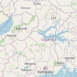
Murchison Falls National Park landscape and geographic character

The landscape of Murchison Falls National Park is dominated by the Victoria Nile, which carved a dramatic course through the Ugandan plateau to create the park's namesake falls. The river enters the park from the east and flows westward for approximately 115 kilometers before reaching the falls, where it compresses into a narrow gorge and descends dramatically into the rift valley below. Beyond the falls, the river continues to Lake Albert, creating an extensive delta wetland system. The terrain away from the river corridors consists primarily of savanna grasslands and woodland, with scattered forest patches particularly in the northern sections. The landscape provides sweeping views of the Nile valley with its riparian vegetation contrasting against the more open savanna. Karuma Falls, located near the Masindi-Gulu Highway, represents another significant waterfall feature within the broader conservation area, though it sits at the interface between the park and the Karuma Wildlife Reserve.

Murchison Falls National Park ecosystems, habitats, and plant life

The ecological character of Murchison Falls National Park centers on its riparian and savanna ecosystems, which together support remarkable biodiversity. The park's wetlands, particularly the Murchison Falls-Albert Delta system, represent critically important habitat for waterfowl and migratory birds. The riparian forests along the Nile corridor provide crucial cover and corridor function for forest-dwelling species, while the surrounding savanna supports abundant large herbivore populations. The park's position in the Albertine Rift region contributes to its species richness, with the combination of aquatic, forest, and grassland habitats creating diverse ecological niches. The Budongo Forest Reserve, though technically separate from the park, functions ecologically as part of the broader landscape and contains significant chimpanzee populations that occasionally range into the park's northern sections. The park's designation as a Ramsar Wetland since 2006 acknowledges the international significance of its delta and floodplain ecosystems.

Murchison Falls National Park wildlife and species highlights

Murchison Falls National Park supports impressive wildlife populations across its diverse habitats. The park contains 76 documented mammal species, including significant populations of Rothschild's giraffe, which have been the focus of active conservation management including translocations to establish viable populations on both sides of the Nile. The park hosts Uganda's largest concentration of Nile crocodiles, with these large predators regularly observed along the riverbanks and in the pools below the falls. Chimpanzees are present in the broader conservation area, particularly in the Budongo Forest Reserve, and occasionally range into the park's forested sections. The park serves as an important Lion Conservation Unit, though populations have faced pressures with estimates suggesting relatively low numbers. The avian community is exceptionally diverse, with 450 documented bird species including the striking shoebill stork, dwarf kingfisher, goliath heron, white-thighed hornbill, and great blue turaco. Hippos and elephants are commonly observed along the Nile, while buffaloes and various antelope species populate the savanna areas.

Murchison Falls National Park conservation status and protection priorities

Murchison Falls National Park holds significant conservation importance both within Uganda and regionally. Its designation as a Ramsar Wetland since 2006 recognizes the international significance of the Murchison Falls-Albert Delta system, which provides critical habitat for waterbirds and supports ecological processes essential to the broader Nile system. The park's status as a Lion Conservation Unit since 2005 reflects its role in protecting one of Uganda's most important predator populations, though the small estimated population of around 250 individuals highlights the ongoing conservation challenges. The Rothschild's giraffe population has benefited from active management, including translocation programs to establish new populations and reduce pressure on existing groups. The park faces emerging challenges from regional development, including the East African Crude Oil Pipeline project which involves infrastructure development within and adjacent to the park boundaries, and the Karuma Power Station which represents Uganda's largest hydroelectric facility.

Murchison Falls National Park cultural meaning and human context

The landscape surrounding Murchison Falls holds deep historical significance for the Bunyoro people, whose traditional territory encompassed much of the park area before colonial interventions. The evacuation of roughly 13,000 square kilometers between 1907 and 1912 due to sleeping sickness fundamentally altered the human presence in the region, creating the depopulated landscape that facilitated wildlife recovery and subsequent protection. The park's 1972 renaming to Kabalega National Park reflected post-colonial efforts to recognize indigenous African leadership, honoring King Kabalega of Bunyoro who resisted colonial conquest in the late 19th century. The name subsequently reverted to Murchison Falls, reflecting the complex interplay between pre-colonial heritage and colonial-era naming that characterizes many African protected areas.

Best time to visit Murchison Falls National Park

The best time to visit Murchison Falls National Park is during the dry seasons, typically from December to February and June to August, when wildlife viewing is more accessible as animals congregate around water sources and vegetation is less dense. The wet seasons bring lusher scenery and excellent birdwatching as migratory species arrive, though some roads may become more difficult to navigate. The period immediately after rains can offer beautiful green landscapes and improved wildlife activity, though conditions can change from year to year. Boat trips to the base of Murchison Falls are available year-round, though water levels and visibility may vary seasonally.

Park location guide

Geography guide, regional context, and park location map for Murchison Falls National Park

Murchison Falls National Park park geography, regions, and map view in Uganda
Understand where Murchison Falls National Park sits in Uganda through a broader geographic reading of the surrounding landscape, nearby location context, and its mapped position within the national park landscape.

How Murchison Falls National Park fits into Uganda

Uganda is a landlocked East African nation spanning approximately 241,000 km². It borders five countries and contains part of Lake Victoria, the world's second-largest freshwater lake. The country operates as a presidential republic with Kampala as its capital and largest city.

Wider geography shaping Murchison Falls National Park in Uganda

Uganda is situated in East Africa, bordered by Kenya to the east, South Sudan to the north, the Democratic Republic of the Congo to the west, Rwanda to the southwest, and Tanzania to the south. The southern portion includes a substantial part of Lake Victoria. The terrain features volcanic hills, mountains, and lakes.

Map view of Murchison Falls National Park

Use this park location map to pinpoint Murchison Falls National Park in Uganda, understand its exact geographic position, and read its mapped placement within the surrounding landscape more clearly.

Pigeon | © OpenStreetMap contributors

Location context for Murchison Falls National Park

Western Region
Park atlas

Map the regional geography, Nile River ecosystems, and connected protected landscapes surrounding Murchison Falls National Park.

Compare National Parks and Protected Areas Near Murchison Falls National Park, Uganda
Explore additional national parks and protected areas sharing geographic context with Murchison Falls National Park, tracing Uganda's diverse savanna, wetland, and Nile River ecosystems. This detailed park atlas allows for clear comparison of protected landscapes, offering insight into regional conservation efforts and distinct natural features beyond one specific park.
National parkUganda

Rwenzori Mountains National Park: Uganda's Distinctive Glacial National Park Landscape

Mapped terrain and Afro-alpine ecosystems of this East African protected area.

Rwenzori Mountains National Park represents a unique protected landscape in Uganda, known for its iconic glacial peaks and endemic Afro-alpine vegetation. As a UNESCO World Heritage Site, it showcases dramatic terrain ranging from montane forests to permanent glaciers, with Margherita Peak standing as the crown jewel. This park offers a rich geographic context for understanding East African mountain ecosystems and the mapped boundaries of significant conservation areas, providing valuable data for atlas-style exploration.

Area
996 km²
Established
1991
IUCN
VI
National parkUganda

Mount Elgon National Park: Uganda's Transboundary Volcano and Mapped Protected Area

Explore volcanic terrain, unique cave systems, and diverse montane landscapes.

Mount Elgon National Park offers a rich tapestry of protected landscapes, centered on a dormant shield volcano straddling the Uganda-Kenya border. This park is recognized for its extraordinary botanical diversity and spectacular cave systems, such as Kitum Cave, where wildlife congregates to lick salt. The elevation gradient supports distinct vegetation zones, from dense montane forests to high-altitude heath and moorland, providing crucial habitat and watershed protection. Understanding Mount Elgon National Park through its mapped boundaries and geographic context reveals a unique protected area in East Africa.

Area
1,279 km²
Established
1968
IUCN
II
National parkDemocratic Republic of the Congo

Garamba National Park: Protected Landscape Atlas and Geographic Context in DRC

Explore Mapped Boundaries of Africa's Historic Savanna Sanctuary

Garamba National Park is a foundational protected area within the Democratic Republic of the Congo, spanning nearly 5,200 square kilometers of distinctive tropical savanna. Established in 1938, this national park is recognized globally as a UNESCO World Heritage Site due to its exceptional biodiversity and role as a critical habitat. The park's landscape is characterized by rolling grasslands, scattered woodlands, and a unique ecological position that supports a rich variety of wildlife, including significant populations of elephants and the DRC's last giraffes. Exploring Garamba National Park through MoriAtlas provides insight into its mapped boundaries, regional geography, and its status as a vital sanctuary for endangered species.

Area
5,200 km²
Established
1938
IUCN
II
National parkKagera Region

Ibanda-Kyerwa National Park: Tanzania's Tri-Border Protected Landscape and Geographic Atlas

Savanna, riparian habitats, and vital regional geography exploration.

Delve into Ibanda-Kyerwa National Park, a recently established national park in Tanzania's Kagera Region. This protected area is distinguished by its critical location at the tri-border with Uganda and Rwanda, with the Kagera River system defining its unique savanna and riparian landscapes. Understanding its mapped boundaries and ecological context provides essential insight into protected land discovery in northwestern Tanzania and its role within the wider regional atlas.

Area
200 km²
Established
2019
IUCN
II
National parkDemocratic Republic of the Congo

Virunga National Park: Democratic Republic of the Congo's Premier Protected Landscape

Mapped boundaries and diverse Albertine Rift endemic geography.

Virunga National Park represents a pivotal protected area within the Democratic Republic of the Congo, characterized by an exceptional range of geographic features and vital ecosystems. Its protected landscape includes active volcanoes like Nyiragongo with its lava lake, the towering Rwenzori Mountains, and diverse lowland savannas. This atlas-focused entry highlights the park's unique position in the Albertine Rift, crucial for numerous endemic species and offering significant insight into regional geography and protected land context.

Area
7,800 km²
Established
1925
IUCN
II
National parkDemocratic Republic of the Congo

Maiko National Park National Park: Map and Protected Landscape Exploration

Discover primary forest terrain and endemic species sanctuary.

Maiko National Park, situated in the Democratic Republic of the Congo, is a cornerstone of central African conservation, protecting over 10,000 square kilometers of pristine tropical rainforest. This national park is recognized globally for its critical role in harboring endemic species such as Grauer's gorilla and the okapi, alongside significant populations of forest elephants and chimpanzees. Its extensive river systems and varied terrain within the Ituri Rainforest ecosystem provide essential habitat, establishing Maiko as a key area for understanding and preserving central African biodiversity and landscape context.

Area
10,885 km²
Established
1970
IUCN
II
National parkMara Region

Serengeti National Park: National Park Atlas and Protected Landscape Discovery

Explore savanna grasslands, regional geography, and mapped park boundaries.

Serengeti National Park, a significant national park within Tanzania's Mara Region, offers an unparalleled view into a vast protected landscape. This page provides access to the park's geographic identity, its defining savanna ecosystem, and its role as a critical component of the regional atlas. Understand the mapped extent of its protected boundaries and the unique natural context that supports its renowned wildlife.

Area
14,763 km²
Established
1940
IUCN
II
National parkEthiopia

Omo National Park: Ethiopia's Remote Protected Landscape with Rich Wildlife Spectacles

Mapped boundaries, savannah plains, and Maji Mountains terrain.

Omo National Park is a remote protected area in Ethiopia renowned for its expansive savannah, riverine woodlands, and remarkable wildlife concentrations. Covering over 4,000 square kilometers, this national park presents a landscape of sweeping plains, the vital Omo River corridor, and the dramatic Maji Mountains. The park's protected status safeguards exceptional populations of large mammals, offering a glimpse into an untamed African wilderness. Explore the mapped geography and the unique ecological zones that contribute to its significant conservation value.

Area
4,068 km²
Established
1980
IUCN
II

Common questions about visiting, size, designation, and location context for Murchison Falls National Park

Murchison Falls National Park FAQs for park facts, access, geography, and protected area context
Find quick answers about Murchison Falls National Park, including protected-area facts, park geography, trail and visitor context, and how the park fits into its surrounding country and regional landscape.
MoriAtlas Explorer

Continue Your Protected Areas Search Across the Global Atlas

Deepen your exploration by continuing the structured search for national parks and protected areas worldwide. Utilize the comprehensive filtering capabilities to compare different conservation landscapes and refine your understanding of global park geography. Discover more about the distribution and characteristics of protected natural areas.

Global natural geography