Mori Atlas logo
National parkRwenzori Mountains National Park

Discover the mapped boundaries and unique Afro-alpine terrain of this East African national park.

Rwenzori Mountains National Park: Uganda's Glacial Mountain Landscape and Protected Area

Rwenzori Mountains National Park, situated in western Uganda, is a UNESCO World Heritage Site defined by its magnificent glacial mountain range, often called the 'Mountains of the Moon'. This protected area encompasses spectacular snow-capped summits, including Margherita Peak at 5,109 meters, Africa's third-highest summit, alongside dramatic glacial valleys and unique Afro-alpine ecosystems. Its steep elevation gradient creates a vertical tapestry of habitats, from montane forests to permanent glaciers, offering unparalleled insights into regional geography and conservation landscapes.

Glacial MountainsAfro-Alpine EcosystemUNESCO World Heritage SiteMountain TrekkingAlpine VegetationEast African Parks

Rwenzori Mountains National Park

National park

Park overview

Structured park overview, official facts, and landscape profile for Rwenzori Mountains National Park

Rwenzori Mountains National Park park facts, protected area profile, and essential visitor context
Review the core facts for Rwenzori Mountains National Park, including designation, size, terrain, visitor scale, habitats, and operating context in one park-focused overview.

About Rwenzori Mountains National Park

Rwenzori Mountains National Park protects one of Africa's most spectacular mountain environments. The Rwenzori range, stretching for 120 kilometers along the Uganda-DRC border, forms a massive barrier separating the Congo basin from the East African plateau. The mountains rise steeply from elevations around 1,000 meters to peaks exceeding 5,000 meters, creating a dramatic vertical landscape. The park's interior features deep glacial valleys carved by ancient ice, with the most famous being the Stanley Valley containing the massive Stanley Glacier. These icy-blue glacial lakes and tarns dot the landscape between the summits. The terrain is extremely rugged, with steep cliffs, boulder fields, and dense montane forest covering the lower slopes. The combination of extreme altitude, permanent snow and ice, and isolated location has created an environment of global scientific importance and exceptional natural beauty.

Quick facts and research context for Rwenzori Mountains National Park

Rwenzori Mountains National Park covers approximately 998 square kilometers of mountainous terrain in western Uganda. The park was established in 1991 and received UNESCO World Heritage status in 1994. The range contains five major mountains with glaciers, the only glacial ice in Uganda. The park lies within the Albertine Rift, a region of exceptional biodiversity. It is home to unique Afro-alpine vegetation including giant lobelia, groundsels, and heather. The mountain range is traditionally inhabited by the Bakonjo and Bamba peoples.

Park context

Deeper park guide and search-rich context for Rwenzori Mountains National Park

Rwenzori Mountains National Park history, landscape, wildlife, and travel context
Explore Rwenzori Mountains National Park through its history, landscape character, ecosystems, wildlife, conservation priorities, cultural context, and seasonal travel timing in a structured park guide built for atlas discovery and search intent.

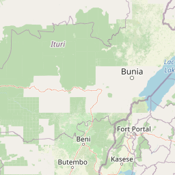
Why Rwenzori Mountains National Park stands out

Rwenzori Mountains National Park is best known for its dramatic glacial landscapes and unique Afro-alpine ecosystem. The park contains the only glaciers in Uganda and East Africa, making it one of the few places on the continent where visitors can experience alpine environments. Margherita Peak, Africa's third-highest summit, attracts mountaineers from around the world. The park's distinctive vegetation features giant lobelia and groundsels that grow to extraordinary heights in the Afro-alpine zone, creating an otherworldly landscape unlike any other in tropical Africa.

Rwenzori Mountains National Park history and protected-area timeline

The Rwenzori Mountains have held fascination for European explorers since the late 19th century. The mountains were first documented by Henry Morton Stanley in 1889, who recognized the snow-capped peaks visible from the African savanna. The Mountains of the Moon name dates to antiquity, with early geographers including Ptolemy noting the existence of snow-covered mountains in central Africa. The area was designated as a forest reserve in 1932 and later upgraded to a national park in 1991. Uganda's President Yoweri Museveni officially opened the park that same year. The park received UNESCO World Heritage designation in 1994, recognizing both its outstanding natural value and the cultural significance of the mountains to local communities. Mountaineering and trekking activities have developed as major attractions, with the Central Circuit Trail offering access to the high peaks.

Rwenzori Mountains National Park landscape and geographic character

The Rwenzori landscape is defined by massive glaciated mountains rising abruptly from the surrounding savanna. The range consists of six major massifs, with Mount Stanley being the highest and most impressive. The mountain's three peaks, including Margherita at 5,109 meters, are permanently capped with glaciers that have retreated significantly but still cover substantial areas. The terrain features dramatic glacial valleys with steep walls, hanging glaciers, and cirques. Below the glaciers, the landscape descends through distinct vegetation zones: Afro-alpine meadows with giant vegetation, then into bamboo and Hagenia forest, followed by dense tropical montane forest dominated by cedar and podocarpus trees. The lower slopes give way to heath and grassland before meeting the savanna. Glacial lakes, or tarns, are scattered throughout the high altitude zones, their icy waters reflecting the surrounding peaks.

Rwenzori Mountains National Park ecosystems, habitats, and plant life

The Rwenzori Mountains support one of Africa's most distinctive ecological systems. The Afro-alpine zone, occurring above 4,000 meters, contains vegetation found nowhere else in East Africa, with species uniquely adapted to the harsh alpine conditions. Giant lobelia can reach heights of over 5 meters, while groundsels grow into massive tree-like forms. The Hagenia-Hypericum zone between 3,000 and 4,000 meters features dense stands of the endemic Rwenzori rice flower. The bamboo zone contains Arundinaria alpine, the only bamboo species in East Africa above 2,500 meters. Below this, Afro-montane forest covers the slopes with African cedar, podocarpus, and numerous endemic species. The park lies within the Albertine Rift, recognized as a biodiversity hotspot with numerous endemic species found nowhere else on Earth.

Rwenzori Mountains National Park wildlife and species highlights

Despite the extreme altitude, Rwenzori Mountains National Park supports notable wildlife. The park is home to forest elephants, which traverse the mountain slopes in search of mineral-rich soils. African buffaloes graze in the savanna edges, while various antelope species including duikers and bushbucks inhabit the forest zones. The Rwenzori is one of the few places where the endangered Rwenzori Sengi, a type of elephant shrew, has been documented. Over 217 bird species have been recorded, including the Rwenzori turaco, a species endemic to the Albertine Rift. The streams and glacial waters support populations of the endemic Rwenzori clawed frog. Primates including chimpanzees and grey-cheeked mangabeys inhabit the lower forests, while the higher zones support smaller mammals adapted to the harsh conditions.

Rwenzori Mountains National Park conservation status and protection priorities

Rwenzori Mountains National Park represents one of Africa's most significant protected areas for high-altitude and Afro-alpine ecosystems. UNESCO recognized the park as a World Heritage Site based on its outstanding universal value, including exceptional biodiversity and unique geological processes. The glaciers within the park are the subject of intense scientific study as indicators of climate change, with significant retreat documented over recent decades. The park protects critical watersheds that feed rivers serving both Uganda and DRC populations. Conservation challenges include managing the impact of climate change on the glaciers, addressing human-wildlife conflict at park boundaries, and sustainable management of visitor activities in this sensitive environment. Ongoing research programs monitor the health of the unique ecosystems and the status of endemic species.

Rwenzori Mountains National Park cultural meaning and human context

The Rwenzori Mountains hold profound cultural significance for the peoples of western Uganda. The Bakonjo people have lived in the shadow of the mountains for generations, with their traditional territory encompassing much of the park's current boundaries. The Bamba people also inhabit lower elevations to the south. These communities have developed deep knowledge of the mountain's ecology, using traditional routes to access high-altitude grazing areas and mineral springs. The mountains are woven into local spiritual beliefs and traditional practices. The Bakonjo traditionally conduct ceremonies at sacred sites on the mountain, and certain peaks hold particular spiritual importance. The relationship between these communities and the mountain landscape represents centuries of adaptation to one of Africa's most challenging environments.

Top sights and standout views in Rwenzori Mountains National Park

The Rwenzori Mountains offer trekking experiences found nowhere else in Africa. The Central Circuit Trail provides access to the high glacial valleys and the base of the major peaks, with the trek to the Floyds Gap and then to the summit of Margherita Peak representing a challenging mountaineering objective. The dramatic scenery of the Stanley Valley, with its glacial lake and towering peaks, is a highlight for visitors. The unique giant vegetation of the Afro-alpine zone, with lobelia and groundsels reaching monumental proportions, creates photographic opportunities found only in the Rwenzori. Birdwatchers seek out the Rwenzori turaco and other Albertine Rift endemics, while the chance to see forest elephants and primates in the lower forest zones adds wildlife interest to any visit.

Best time to visit Rwenzori Mountains National Park

The best time to visit Rwenzori Mountains National Park is during the dry seasons, typically from December to February and from June to August. These periods offer the most stable weather conditions for trekking, with clearer skies providing better views of the peaks. The Rwenzori receives heavy rainfall throughout the year, with the wettest periods from March to May and September to November. During the wet seasons, trails become extremely slippery and dangerous, and many routes become impassable. Even during dry seasons, visitors should be prepared for variable conditions, as the high-altitude environment can produce sudden weather changes. The Afro-alpine zone can experience temperatures well below freezing, while the lower elevations remain warm and humid.

Park location guide

Geography guide, regional context, and park location map for Rwenzori Mountains National Park

Rwenzori Mountains National Park park geography, regions, and map view in Uganda
Understand where Rwenzori Mountains National Park sits in Uganda through a broader geographic reading of the surrounding landscape, nearby location context, and its mapped position within the national park landscape.

How Rwenzori Mountains National Park fits into Uganda

Uganda is a landlocked East African nation spanning approximately 241,000 km². It borders five countries and contains part of Lake Victoria, the world's second-largest freshwater lake. The country operates as a presidential republic with Kampala as its capital and largest city.

Wider geography shaping Rwenzori Mountains National Park in Uganda

Uganda is situated in East Africa, bordered by Kenya to the east, South Sudan to the north, the Democratic Republic of the Congo to the west, Rwanda to the southwest, and Tanzania to the south. The southern portion includes a substantial part of Lake Victoria. The terrain features volcanic hills, mountains, and lakes.

Map view of Rwenzori Mountains National Park

Use this park location map to pinpoint Rwenzori Mountains National Park in Uganda, understand its exact geographic position, and read its mapped placement within the surrounding landscape more clearly.

Pigeon | © OpenStreetMap contributors

Location context for Rwenzori Mountains National Park

Western Region
Park atlas

Trace the regional spread of protected areas, comparing mountain, forest, and savanna landscapes across East Africa.

Browse More National Parks and Protected Areas Near Rwenzori Mountains National Park
Explore additional national parks and protected areas situated near Rwenzori Mountains National Park, tracing a regional spread of neighboring mountain ranges, distinct montane forests, and expansive savanna landscapes. This comparison offers valuable insights into regional biodiversity, revealing how diverse ecosystems are preserved and connected within the broader East African protected area atlas.
National parkDemocratic Republic of the Congo

Virunga National Park: Democratic Republic of the Congo's Premier Protected Landscape

Mapped boundaries and diverse Albertine Rift endemic geography.

Virunga National Park represents a pivotal protected area within the Democratic Republic of the Congo, characterized by an exceptional range of geographic features and vital ecosystems. Its protected landscape includes active volcanoes like Nyiragongo with its lava lake, the towering Rwenzori Mountains, and diverse lowland savannas. This atlas-focused entry highlights the park's unique position in the Albertine Rift, crucial for numerous endemic species and offering significant insight into regional geography and protected land context.

Area
7,800 km²
Established
1925
IUCN
II
National parkKagera Region

Ibanda-Kyerwa National Park: Tanzania's Tri-Border Protected Landscape and Geographic Atlas

Savanna, riparian habitats, and vital regional geography exploration.

Delve into Ibanda-Kyerwa National Park, a recently established national park in Tanzania's Kagera Region. This protected area is distinguished by its critical location at the tri-border with Uganda and Rwanda, with the Kagera River system defining its unique savanna and riparian landscapes. Understanding its mapped boundaries and ecological context provides essential insight into protected land discovery in northwestern Tanzania and its role within the wider regional atlas.

Area
200 km²
Established
2019
IUCN
II
National parkDemocratic Republic of the Congo

Maiko National Park National Park: Map and Protected Landscape Exploration

Discover primary forest terrain and endemic species sanctuary.

Maiko National Park, situated in the Democratic Republic of the Congo, is a cornerstone of central African conservation, protecting over 10,000 square kilometers of pristine tropical rainforest. This national park is recognized globally for its critical role in harboring endemic species such as Grauer's gorilla and the okapi, alongside significant populations of forest elephants and chimpanzees. Its extensive river systems and varied terrain within the Ituri Rainforest ecosystem provide essential habitat, establishing Maiko as a key area for understanding and preserving central African biodiversity and landscape context.

Area
10,885 km²
Established
1970
IUCN
II
National parkUganda

Murchison Falls National Park: Uganda's Largest Protected Landscape with Dramatic Nile Gorge

Explore mapped boundaries and diverse savanna terrain.

Murchison Falls National Park represents a significant protected landscape in Uganda, renowned for the powerful cascade of the Victoria Nile through a narrow gorge. This expansive national park encompasses varied terrain, from savanna woodlands to riparian forests, offering a rich geographic context. Understanding its mapped distribution within the region is key to appreciating its conservation importance and unique natural features, providing a compelling atlas-style entry point for exploration.

Area
3,893 km²
Established
1952
IUCN
II
National parkSouth Kivu Province

Kahuzi-Biéga National Park: A Protected Landscape in South Kivu Province's Albertine Rift

Explore its mapped boundaries and diverse terrain.

Kahuzi-Biéga National Park, a significant national park in South Kivu Province, is defined by its dramatic geographic diversity. Spanning approximately 6,000 square kilometers, it features a unique ecological gradient from dense lowland equatorial rainforest in the west to the subalpine zones of the Mitumba Mountains in the east, dominated by the dormant volcanoes Mount Kahuzi and Mount Biéga. This protected landscape offers a rich atlas context for understanding the biodiversity and regional geography of the Albertine Rift, showcasing a vital transition in terrain and habitat.

Area
6,000 km²
Established
1970
IUCN
II
National parkDemocratic Republic of the Congo

Garamba National Park: Protected Landscape Atlas and Geographic Context in DRC

Explore Mapped Boundaries of Africa's Historic Savanna Sanctuary

Garamba National Park is a foundational protected area within the Democratic Republic of the Congo, spanning nearly 5,200 square kilometers of distinctive tropical savanna. Established in 1938, this national park is recognized globally as a UNESCO World Heritage Site due to its exceptional biodiversity and role as a critical habitat. The park's landscape is characterized by rolling grasslands, scattered woodlands, and a unique ecological position that supports a rich variety of wildlife, including significant populations of elephants and the DRC's last giraffes. Exploring Garamba National Park through MoriAtlas provides insight into its mapped boundaries, regional geography, and its status as a vital sanctuary for endangered species.

Area
5,200 km²
Established
1938
IUCN
II
National parkUganda

Mount Elgon National Park: Uganda's Transboundary Volcano and Mapped Protected Area

Explore volcanic terrain, unique cave systems, and diverse montane landscapes.

Mount Elgon National Park offers a rich tapestry of protected landscapes, centered on a dormant shield volcano straddling the Uganda-Kenya border. This park is recognized for its extraordinary botanical diversity and spectacular cave systems, such as Kitum Cave, where wildlife congregates to lick salt. The elevation gradient supports distinct vegetation zones, from dense montane forests to high-altitude heath and moorland, providing crucial habitat and watershed protection. Understanding Mount Elgon National Park through its mapped boundaries and geographic context reveals a unique protected area in East Africa.

Area
1,279 km²
Established
1968
IUCN
II
National parkMara Region

Serengeti National Park: National Park Atlas and Protected Landscape Discovery

Explore savanna grasslands, regional geography, and mapped park boundaries.

Serengeti National Park, a significant national park within Tanzania's Mara Region, offers an unparalleled view into a vast protected landscape. This page provides access to the park's geographic identity, its defining savanna ecosystem, and its role as a critical component of the regional atlas. Understand the mapped extent of its protected boundaries and the unique natural context that supports its renowned wildlife.

Area
14,763 km²
Established
1940
IUCN
II

Common questions about visiting, size, designation, and location context for Rwenzori Mountains National Park

Rwenzori Mountains National Park FAQs for park facts, access, geography, and protected area context
Find quick answers about Rwenzori Mountains National Park, including protected-area facts, park geography, trail and visitor context, and how the park fits into its surrounding country and regional landscape.
MoriAtlas Explorer

Continue Your Protected Areas Search Across the Global Atlas

Deepen your exploration by continuing the structured search for national parks and protected areas worldwide. Utilize the comprehensive filtering capabilities to compare different conservation landscapes and refine your understanding of global park geography. Discover more about the distribution and characteristics of protected natural areas.

Global natural geography