Mori Atlas logo
National parkSouthern National Park

Discover its expansive floodplains, savanna woodlands, and critical wildlife conservation within the Nile basin.

Southern National Park National Park: South Sudan's Premier Protected Landscape and Wildlife Atlas

Southern National Park, a cornerstone of protected land in South Sudan, offers an unparalleled atlas-scale view of equatorial savanna woodlands and seasonal floodplains. Covering approximately 23,000 square kilometers, this vast national park situated in the southwestern region provides critical habitat, particularly for large mammal populations, and serves as a significant wilderness area within the Nile basin's unique geography.

National ParkSavannaWetlandsLarge MammalsFloodplainsRiver Ecosystems

Southern National Park

National park

Park overview

Structured park overview, official facts, and landscape profile for Southern National Park

Southern National Park park facts, protected area profile, and essential visitor context
Review the core facts for Southern National Park, including designation, size, terrain, visitor scale, habitats, and operating context in one park-focused overview.

About Southern National Park

Southern National Park occupies a significant position in South Sudan's protected area network as one of the oldest and largest national parks in the country. Established in 1939 during British colonial administration, the park was created to protect the extraordinary wildlife populations that inhabited this equatorial region of the upper Nile basin. The park's vast extent of 23,000 square kilometers encompasses a remarkable diversity of landscapes, from riverine forests along the major watercourses to extensive seasonally flooded grasslands that transform the character of the landscape between wet and dry seasons. The three rivers that traverse the park, the Sue, Gel, and Ibba, create a complex hydrological system that defines much of the park's ecological character. The Gel and Ibba rivers particularly contribute to extensive floodplain development in the central regions, creating swampy habitats that support distinctive wildlife communities adapted to periodically inundated terrain. The park sits at a biogeographic crossroads, receiving influences from both Sudanian savanna ecosystems to the north and the Guinea-Congolian forest zone to the south, resulting in a unique mixing of species from different regional faunas.

Quick facts and research context for Southern National Park

Southern National Park covers 23,000 square kilometers in southwestern South Sudan, making it one of the largest national parks in East Africa. Established in 1939, it lies at approximately 6.55°N latitude and 28.28°E longitude. The park is drained by three major river systems: the Sue River to the west, the Gel River to the east, and the Ibba River through the center. These rivers create extensive floodplains and swampy habitats during seasonal flooding. The park features a transition zone between Sudanian savanna to the north and Guinea-Congolian forest ecosystems to the south, supporting remarkable biodiversity.

Park context

Deeper park guide and search-rich context for Southern National Park

Southern National Park history, landscape, wildlife, and travel context
Explore Southern National Park through its history, landscape character, ecosystems, wildlife, conservation priorities, cultural context, and seasonal travel timing in a structured park guide built for atlas discovery and search intent.

Why Southern National Park stands out

Southern National Park is best known for its exceptional large mammal populations, particularly the significant herds of giant eland that historically populated the region. The park's extensive floodplains created by the Gel and Ibba rivers support important populations of waterbuck, kob, and African buffalo. The presence of northern white rhinoceros historically gave this park particular conservation significance, though their current status in the area is uncertain. The combination of gallery forests lining the river corridors, vast seasonal grasslands, and the transition between Sudanian and Congolian ecological zones creates a distinctive protected landscape within the Nile basin.

Southern National Park history and protected-area timeline

Southern National Park was established in 1939 through colonial administrative action, making it one of the earliest protected areas designated in what was then the Anglo-Egyptian Sudan. The park's establishment reflected the colonial administration's interest in preserving the significant wildlife populations that existed in this remote equatorial region. Early documentation from the mid-twentieth century, particularly from A.B. Anderson who served as Assistant Game Warden, provides valuable historical context about the park's original extent and character. Anderson reported in 1950 that the park covered approximately 7,800 square miles and was traversed by three major river systems that fundamentally shaped its ecological character. The colonial era saw limited development of infrastructure or visitor facilities, and the park remained a largely wild and inaccessible wilderness throughout this period. Following South Sudan's independence in 2011, the park remained under national administration but has faced significant challenges related to political instability and limited resources for protected area management.

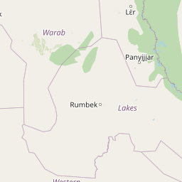
Southern National Park landscape and geographic character

The physical landscape of Southern National Park is dominated by a combination of river valleys, seasonal floodplains, and gently undulating savanna terrain. The park lies within the White Nile basin, with the Sue River forming a well-defined channel that joins the Nile system to the west of the protected area. The Gel River enters from the east and, together with the Ibba River flowing through the central portion of the park, creates extensive floodplains that become seasonally inundated during monsoon periods. The floodplain areas support tall grasslands that can reach heights of approximately 15 feet during the wet season, dramatically transforming the visual character of the landscape. The underlying soils vary across the park, with whitish clay predominating in many areas and sandy valleys interspersed throughout. Gallery forests follow the major river corridors, creating distinctive linear strips of denser woodland that contrast with the surrounding savanna landscapes. The overall terrain is relatively flat with only modest elevation changes, typical of the South Sudanese plateau region.

Southern National Park ecosystems, habitats, and plant life

The ecological character of Southern National Park reflects its position at the intersection of major biogeographic zones. The park contains a mosaic of habitat types including bushveld savanna, true rainforest vegetation in the wettest areas, forests developing on laterite soils, and the distinctive gallery forests that follow river courses. During the monsoon season, the park's grasslands expand dramatically as seasonal rains transform the landscape and create extensive wetland habitats. The combination of permanent water in the major rivers and the seasonal floodplains supports productive aquatic ecosystems and provides critical resources for wildlife during the dry season. The diverse habitats support a rich array of plant and animal species, with the park's size and relative remoteness allowing for the maintenance of ecological processes that have been disrupted in many other protected areas in the region. The thin human population and limited historical development have allowed the park's natural systems to persist with relatively less modification than in many other parts of South Sudan.

Southern National Park wildlife and species highlights

Southern National Park supports significant populations of large mammals representative of East African savanna ecosystems. The park historically contained notable populations of giant eland, Africa's largest antelope species, which remain one of the most distinctive large mammal species in the protected area. Other prominent ungulates include waterbuck, kob, hartebeest, and the endangered Kordofan giraffe, a subspecies of giraffe with limited distribution. The floodplain environments support substantial populations of African buffalo, while the grasslands and woodlands provide habitat for oribi, reedbuck, and korrigum. Predators present in the park include lion populations that are part of the Central African lion ecotype. The park's forest areas support primate species including various galagos and colobus monkeys, while the giant forest hog represents one of the more distinctive smaller mammals found in the denser woodland habitats. River systems support crocodiles and diverse fish communities including tilapia, Nile bichir, and other species. The bird fauna includes large waterbirds such as marabou storks and pelicans that concentrate in wetland areas.

Southern National Park conservation status and protection priorities

Southern National Park represents a critical conservation resource within South Sudan, protecting one of the largest remaining tracts of relatively intact savanna ecosystem in the Nile basin region. The park's IUCN designation as a Category II protected area reflects its primary function of preserving natural biodiversity and ecological processes. The presence of species such as the northern white rhinoceros gives the park particular international conservation significance, though the status of this critically endangered population within the park requires verification. The vast size of the protected area allows for the maintenance of viable populations of wide-ranging species that require large tracts of contiguous habitat. The seasonal floodplains and river systems provide important ecosystem services including water regulation and nutrient cycling while supporting the wildlife communities that define the park's conservation value. Management challenges include addressing threats from poaching, habitat degradation, and the broader political instability that has affected much of South Sudan.

Southern National Park cultural meaning and human context

Southern National Park exists within a region that has been historically sparsely populated, with local communities traditionally practicing hunting, fishing, and honey collection as part of their livelihoods. The park's limited population density has contributed to the preservation of its natural character, as human-wildlife conflict and land conversion pressures have remained relatively low compared to many other protected areas in eastern Africa. The traditional land use patterns of local communities have been largely compatible with wildlife conservation, though the specifics of indigenous relationships with the park's landscapes would benefit from additional documentation. The broader region has experienced significant political and social upheaval during the late twentieth and early twenty-first centuries, which has affected both human communities and wildlife populations throughout South Sudan.

Top sights and standout views in Southern National Park

Southern National Park's defining qualities include its exceptional size, making it one of the largest protected areas in East Africa, and its location at a biogeographic crossroads that creates remarkable habitat diversity within a single park. The extensive floodplain systems created by the Gel and Ibba rivers support productive wetland ecosystems that attract diverse wildlife concentrations, particularly during the dry season when water becomes limited in surrounding landscapes. The gallery forests lining the river corridors provide striking contrast to the surrounding savanna and offer habitat for forest-dependent species. The presence of giant eland populations gives the park particular significance for large mammal conservation, while the historical presence of northern white rhino adds to its conservation importance. The park represents one of the few remaining wilderness areas where ecological processes continue to function at landscape scales.

Best time to visit Southern National Park

The optimal period to visit Southern National Park falls during the dry season months from November through April, when wildlife concentrations increase around the remaining water sources and access is generally more feasible. The landscape transforms dramatically during the wet season from May through October, when extensive flooding makes many areas inaccessible but creates spectacular wetland environments. The monsoon season brings dramatic changes to the vegetation, with grasslands reaching their full height and the park's character shifting from the more open savanna of the dry season to a largely impassable wetland. Wildlife viewing is generally most productive during the dry season when animals concentrate along rivers and permanent waterholes, though the wet season offers excellent birdwatching opportunities and the chance to see the park's landscapes at their most lush and verdant.

Park location guide

Geography guide, regional context, and park location map for Southern National Park

Southern National Park park geography, regions, and map view in South Sudan
Understand where Southern National Park sits in South Sudan through a broader geographic reading of the surrounding landscape, nearby location context, and its mapped position within the national park landscape.

How Southern National Park fits into South Sudan

South Sudan is a landlocked sovereign state in East Africa, the most recent country to achieve independence (2011). It occupies an area of 644,329 km² and shares borders with six countries. The Nile River flows through the country, feeding the extensive Sudd wetland. With a population of approximately 12.7 million, South Sudan is linguistically diverse with English as its official language and numerous recognized national languages including Dinka, Nuer, and Bari.

Wider geography shaping Southern National Park in South Sudan

South Sudan is located in East Africa, landlocked between six countries: Sudan to the north, Ethiopia to the east, Uganda to the south, Kenya to the southeast, the Democratic Republic of the Congo to the southwest, and the Central African Republic to the west. The terrain consists primarily of vast plains and plateaus, with diverse environments ranging from dry savannah to tropical savannah and inland floodplains. The Nile River system runs south to north through the country's center.

Map view of Southern National Park

Use this park location map to pinpoint Southern National Park in South Sudan, understand its exact geographic position, and read its mapped placement within the surrounding landscape more clearly.

Pigeon | © OpenStreetMap contributors
Park atlas

Compare Southern National Park with other protected areas, exploring shared savanna, wetland, and river ecosystems in the surrounding region.

Discover Nearby National Parks and Protected Areas Surrounding Southern National Park
Explore additional national parks and protected areas adjacent to Southern National Park, comparing diverse savanna, wetland, and river ecosystems across the regional geography. This allows you to gain valuable atlas context, tracing connected ecological zones and understanding the broader conservation landscape of East Africa's Nile basin.
National parkDemocratic Republic of the Congo

Garamba National Park: Protected Landscape Atlas and Geographic Context in DRC

Explore Mapped Boundaries of Africa's Historic Savanna Sanctuary

Garamba National Park is a foundational protected area within the Democratic Republic of the Congo, spanning nearly 5,200 square kilometers of distinctive tropical savanna. Established in 1938, this national park is recognized globally as a UNESCO World Heritage Site due to its exceptional biodiversity and role as a critical habitat. The park's landscape is characterized by rolling grasslands, scattered woodlands, and a unique ecological position that supports a rich variety of wildlife, including significant populations of elephants and the DRC's last giraffes. Exploring Garamba National Park through MoriAtlas provides insight into its mapped boundaries, regional geography, and its status as a vital sanctuary for endangered species.

Area
5,200 km²
Established
1938
IUCN
II
National parkUganda

Murchison Falls National Park: Uganda's Largest Protected Landscape with Dramatic Nile Gorge

Explore mapped boundaries and diverse savanna terrain.

Murchison Falls National Park represents a significant protected landscape in Uganda, renowned for the powerful cascade of the Victoria Nile through a narrow gorge. This expansive national park encompasses varied terrain, from savanna woodlands to riparian forests, offering a rich geographic context. Understanding its mapped distribution within the region is key to appreciating its conservation importance and unique natural features, providing a compelling atlas-style entry point for exploration.

Area
3,893 km²
Established
1952
IUCN
II
National parkUganda

Rwenzori Mountains National Park: Uganda's Distinctive Glacial National Park Landscape

Mapped terrain and Afro-alpine ecosystems of this East African protected area.

Rwenzori Mountains National Park represents a unique protected landscape in Uganda, known for its iconic glacial peaks and endemic Afro-alpine vegetation. As a UNESCO World Heritage Site, it showcases dramatic terrain ranging from montane forests to permanent glaciers, with Margherita Peak standing as the crown jewel. This park offers a rich geographic context for understanding East African mountain ecosystems and the mapped boundaries of significant conservation areas, providing valuable data for atlas-style exploration.

Area
996 km²
Established
1991
IUCN
VI
National parkDemocratic Republic of the Congo

Maiko National Park National Park: Map and Protected Landscape Exploration

Discover primary forest terrain and endemic species sanctuary.

Maiko National Park, situated in the Democratic Republic of the Congo, is a cornerstone of central African conservation, protecting over 10,000 square kilometers of pristine tropical rainforest. This national park is recognized globally for its critical role in harboring endemic species such as Grauer's gorilla and the okapi, alongside significant populations of forest elephants and chimpanzees. Its extensive river systems and varied terrain within the Ituri Rainforest ecosystem provide essential habitat, establishing Maiko as a key area for understanding and preserving central African biodiversity and landscape context.

Area
10,885 km²
Established
1970
IUCN
II
National parkDemocratic Republic of the Congo

Virunga National Park: Democratic Republic of the Congo's Premier Protected Landscape

Mapped boundaries and diverse Albertine Rift endemic geography.

Virunga National Park represents a pivotal protected area within the Democratic Republic of the Congo, characterized by an exceptional range of geographic features and vital ecosystems. Its protected landscape includes active volcanoes like Nyiragongo with its lava lake, the towering Rwenzori Mountains, and diverse lowland savannas. This atlas-focused entry highlights the park's unique position in the Albertine Rift, crucial for numerous endemic species and offering significant insight into regional geography and protected land context.

Area
7,800 km²
Established
1925
IUCN
II
National parkEthiopia

Omo National Park: Ethiopia's Remote Protected Landscape with Rich Wildlife Spectacles

Mapped boundaries, savannah plains, and Maji Mountains terrain.

Omo National Park is a remote protected area in Ethiopia renowned for its expansive savannah, riverine woodlands, and remarkable wildlife concentrations. Covering over 4,000 square kilometers, this national park presents a landscape of sweeping plains, the vital Omo River corridor, and the dramatic Maji Mountains. The park's protected status safeguards exceptional populations of large mammals, offering a glimpse into an untamed African wilderness. Explore the mapped geography and the unique ecological zones that contribute to its significant conservation value.

Area
4,068 km²
Established
1980
IUCN
II
National parkSouth Ethiopia Regional State

Mago National Park: Protected Savanna and Riverine Ecosystems in South Ethiopia

Discover the unique landscapes and wildlife habitats mapped within this national park.

Mago National Park stands as a critical protected landscape within the South Ethiopia Regional State, characterized by its significant riverine forests, acacia savanna, and wetland environments along the Mago and Omo rivers. This national park is integral for understanding the distribution of wildlife and the geographic context of Ethiopia's natural heritage. Its mapped terrain offers insights into a landscape that supports both diverse ecosystems and unique cultural traditions, making it a vital component of the country's conservation network.

Area
2,220 km²
Established
1979
IUCN
II
National parkKagera Region

Ibanda-Kyerwa National Park: Tanzania's Tri-Border Protected Landscape and Geographic Atlas

Savanna, riparian habitats, and vital regional geography exploration.

Delve into Ibanda-Kyerwa National Park, a recently established national park in Tanzania's Kagera Region. This protected area is distinguished by its critical location at the tri-border with Uganda and Rwanda, with the Kagera River system defining its unique savanna and riparian landscapes. Understanding its mapped boundaries and ecological context provides essential insight into protected land discovery in northwestern Tanzania and its role within the wider regional atlas.

Area
200 km²
Established
2019
IUCN
II

Common questions about visiting, size, designation, and location context for Southern National Park

Southern National Park FAQs for park facts, access, geography, and protected area context
Find quick answers about Southern National Park, including protected-area facts, park geography, trail and visitor context, and how the park fits into its surrounding country and regional landscape.
MoriAtlas Explorer

Continue Your Protected Areas Search Across the Global Atlas

Deepen your exploration by continuing the structured search for national parks and protected areas worldwide. Utilize the comprehensive filtering capabilities to compare different conservation landscapes and refine your understanding of global park geography. Discover more about the distribution and characteristics of protected natural areas.

Global natural geography