Mori Atlas logo
Protected areaGibi National Forest

Explore the mapped boundaries and geographic context of this key West African protected area.

Gibi National Forest: Liberia's Protected Tropical Landscape in Nimba County

Gibi National Forest, a protected area established in 1960, safeguards 607 square kilometers of tropical forest in Liberia's Nimba County. Situated near the prominent Nimba Range, this forest is a vital component of the Upper Guinea region's ecological landscape, an area recognized for its significant biodiversity. As part of Liberia's national forest system, Gibi contributes to critical conservation efforts aimed at preserving its unique forest ecosystem and the surrounding terrain.

LiberiaNimba Countynational forestprotected areaUpper Guineatropical forest

Gibi National Forest

Protected area

Park overview

Structured park overview, official facts, and landscape profile for Gibi National Forest

Gibi National Forest park facts, protected area profile, and essential visitor context
Review the core facts for Gibi National Forest, including designation, size, terrain, visitor scale, habitats, and operating context in one park-focused overview.

About Gibi National Forest

Gibi National Forest is a protected area in northeastern Liberia, established in 1960 to preserve the forest resources of the Upper Guinea region. The forest is located in Nimba County, an area characterized by mountainous terrain associated with the Nimba Range, which extends across the borders into Guinea and Ivory Coast. At 607 square kilometres, the protected area represents a substantial tract of tropical forest within Liberia's protected area network. The forest exists within a broader landscape that includes both protected and disturbed areas, as Nimba County has experienced pressures from logging, mining, and agricultural expansion. Liberia, once known as the "Green Heart of Africa," has lost significant forest cover over recent decades, making the role of protected areas like Gibi increasingly important for maintaining biodiversity and ecosystem services.

Quick facts and research context for Gibi National Forest

Gibi National Forest is situated in Nimba County, northeastern Liberia, near the borders with Guinea and Ivory Coast. The forest covers 607 square kilometres and was established in 1960, making it one of Liberia's older protected areas. The area falls within the Upper Guinea forest ecosystem, a biodiversity hotspot that extends across parts of West Africa. Nimba County is characterized by mountainous terrain associated with the Nimba Range, and the forest contributes to the regional network of protected areas that help preserve West Africa's diminishing forest cover.

Park context

Deeper park guide and search-rich context for Gibi National Forest

Gibi National Forest history, landscape, wildlife, and travel context
Explore Gibi National Forest through its history, landscape character, ecosystems, wildlife, conservation priorities, cultural context, and seasonal travel timing in a structured park guide built for atlas discovery and search intent.

Why Gibi National Forest stands out

Gibi National Forest is known as a protected tropical forest area within Liberia's network of national parks and reserves. The forest represents the country's efforts to conserve its Upper Guinea forest ecosystem, which is recognized as one of Africa's biodiversity hotspots. While the park does not have the international prominence of some other Liberian protected areas, it serves as an important component of regional conservation efforts in the Upper Guinea region, an area that has experienced significant deforestation pressure in recent decades.

Gibi National Forest history and protected-area timeline

Gibi National Forest was established in 1960 as part of Liberia's early efforts to formally protect its forest resources. During the mid-twentieth century, Liberia was one of the few West African countries with extensive remaining forest cover, and the government recognized the need to designate certain areas for conservation. The creation of national forests during this period reflected both ecological priorities and emerging awareness of sustainable resource management. Nimba County has since experienced various development pressures, including mining activities associated with iron ore deposits and agricultural expansion, making the continued protection of areas like Gibi increasingly important for maintaining the region's ecological integrity.

Gibi National Forest landscape and geographic character

The landscape of Gibi National Forest is characterized by tropical forest terrain within the broader Nimba County region. The area lies near the Nimba Range, a mountainous formation that extends across the borders of Liberia, Guinea, and Ivory Coast. The terrain in this part of northeastern Liberia features rolling hills and elevated areas that form part of the Upper Guinea highlands. The forest area sits within a landscape that transitions between different elevation zones, with the mountainous regions supporting distinct ecological communities. The regional landscape has experienced varying degrees of human modification, with areas of intact forest existing alongside zones of agricultural land and settlements.

Gibi National Forest ecosystems, habitats, and plant life

Gibi National Forest exists within the Upper Guinea forest ecosystem, a biodiversity-rich region that extends across parts of West Africa. This ecosystem type is characterized by tropical moist forest with high species diversity, though the extent of intact forest has diminished significantly across the Upper Guinea region in recent decades. The forest provides habitat for various species adapted to tropical forest environments, though detailed species inventories specific to Gibi are not readily available in current source materials. The protected area contributes to the broader conservation network in the Upper Guinea region, which includes several other protected areas across Liberia, Guinea, and Ivory Coast. The forest's role in maintaining ecological connectivity and supporting biodiversity makes it a valuable component of regional conservation efforts.

Gibi National Forest wildlife and species highlights

The Upper Guinea forest ecosystem that includes Gibi National Forest is home to diverse wildlife, though specific information about species present within Gibi is limited in available sources. The broader Nimba region is known for its biodiversity significance, with several species of conservation concern found in the area. Forest ecosystems in this part of West Africa typically support populations of primates, including various monkey species, as well as small mammals, reptiles, and diverse invertebrate groups. The region is also significant for birdlife, with numerous species associated with forest habitats. While detailed wildlife surveys specific to Gibi National Forest are not readily available in current sources, the forest's protected status provides important habitat for wildlife in an area that has experienced significant habitat loss and fragmentation.

Gibi National Forest conservation status and protection priorities

Gibi National Forest represents an important element of Liberia's protected area network and contributes to regional conservation efforts in the Upper Guinea region. The forest's designation as a national park reflects Liberia's commitment to preserving its forest heritage and the ecological services these areas provide. Conservation in this region faces significant challenges, including pressures from agricultural expansion, logging, mining, and population growth. The Upper Guinea forest ecosystem has experienced substantial deforestation and degradation, making the role of protected areas increasingly critical for maintaining biodiversity. The forest contributes to regional efforts to preserve the Upper Guinea biodiversity hotspot, which is recognized as a priority area for conservation due to its high species endemism and the threats it faces.

Gibi National Forest cultural meaning and human context

Nimba County has a rich cultural heritage, with communities whose livelihoods are closely tied to the surrounding landscape. The region's population includes various ethnic groups with traditional connections to the land and its resources. The area near the Guinean and Ivorian borders has historical connections to broader regional trade and movement patterns. While specific cultural information related directly to the Gibi National Forest area is limited in available sources, the forest exists within a region where local communities have historically depended on forest resources for various needs. The relationship between protected areas and local communities in Liberia involves ongoing considerations around land use, resource access, and sustainable development.

Top sights and standout views in Gibi National Forest

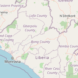
Gibi National Forest covers 607 square kilometres of protected tropical forest in northeastern Liberia, established in 1960. The forest lies within Nimba County near the Nimba Range, a mountainous area shared with Guinea and Ivory Coast. As part of Liberia's national forest system, Gibi contributes to the country's conservation efforts in the Upper Guinea region, an area of significant biodiversity importance. The protected area provides habitat within a forest ecosystem that has faced substantial pressure from development activities across West Africa.

Best time to visit Gibi National Forest

Specific visitor guidance for Gibi National Forest is not readily available in current source materials. Liberia's tropical climate features distinct wet and dry seasons, with the wet season typically running from May to October and the dry season from November to April. The forest's mountainous setting in Nimba County can create distinct microclimatic conditions. Visitors to Liberia's protected areas generally should consider health and safety precautions, including vaccination requirements and awareness of regional security conditions. Detailed planning for visits to national forests in Liberia would require current local information beyond what is available in this source material.

Park location guide

Geography guide, regional context, and park location map for Gibi National Forest

Gibi National Forest park geography, regions, and map view in Liberia
Understand where Gibi National Forest sits in Liberia through a broader geographic reading of the surrounding landscape, nearby location context, and its mapped position within the national park landscape.

How Gibi National Forest fits into Liberia

Liberia is a West African country on the Atlantic coast, bordered by Sierra Leone, Guinea, and Ivory Coast. Founded as an American Colonization Society settlement in 1822, it became Africa's first independent republic in 1847. The country has a population of approximately 5.4 million and uses both the US dollar and Liberian dollar as currency.

Wider geography shaping Gibi National Forest in Liberia

Liberia occupies the West African Atlantic coast, stretching from Sierra Leone in the northwest to Ivory Coast in the east. The country features a coastal plain that rises to a rolling plateau and mountainous regions in the northeast. Several rivers, including the Mano and St. John rivers, flow across the territory. The climate is tropical with distinct wet and dry seasons.

Map view of Gibi National Forest

Use this park location map to pinpoint Gibi National Forest in Liberia, understand its exact geographic position, and read its mapped placement within the surrounding landscape more clearly.

Pigeon | © OpenStreetMap contributors

Location context for Gibi National Forest

Nimba County
Park atlas

Map the regional park context and surrounding protected landscapes across Liberia's Upper Guinea forest.

Discover Other National Forests and Protected Areas Near Gibi National Forest in Liberia, West Africa
After exploring Gibi National Forest, browse other nearby national forests and protected areas across Nimba County and the broader Upper Guinea region of West Africa. Compare the varied protected landscapes and regional conservation efforts to understand the broader ecological significance of Liberia's forest heritage.
Protected areaNimba County

Nimba National Forest: Protected Mountain Landscape & Bird Area in Nimba County

Explore mapped boundaries and regional geographic context.

Nimba National Forest, a protected area of approximately 187 square kilometers, is defined by its mountainous terrain in Nimba County, Liberia. Situated at the tri-border region with Guinea and Ivory Coast, this forest is recognized for its importance as a habitat for diverse bird species and its role in regional conservation efforts. Discover its mapped landscape, its position within the Nimba Range, and its ecological significance within West Africa's protected natural areas.

Area
187 km²
IUCN
VI
National parkIvory Coast

Taï National Park: A Primary Rainforest Protected Area in Ivory Coast

Explore mapped boundaries and critical primate habitats in West Africa.

Taï National Park in Ivory Coast stands as a monumental protected landscape, comprising the largest contiguous area of primary rainforest remaining in West Africa. Its designation as a national park highlights its critical role in preserving biodiversity and unique geographic features. Users exploring this destination can delve into its mapped terrain, understand its regional landscape context within Ivory Coast, and appreciate its significance as a vital habitat for endangered species and an integral part of the Upper Guinean forest ecosystem.

Area
3,300 km²
Established
1972
IUCN
II
National parkEastern Province

Gola Rainforest National Park: Sierra Leone's Premier Rainforest Protected Area

Explore mapped boundaries and biodiversity in Eastern Province's vast tropical rainforest.

Gola Rainforest National Park is Sierra Leone's second national park and the largest intact rainforest landscape in the country, located in the Eastern Province. As part of the Upper Guinea Forest biodiversity hotspot, it is renowned for its exceptional wildlife, including western chimpanzees and pygmy hippopotamuses. This protected area's mapped extent covers over 71,000 hectares, contributing significantly to regional conservation and providing a vital natural resource for both wildlife and local communities.

Area
710.7 km²
Established
2010
IUCN
II
Relief
Lowland
National parkFaranah Region

National Park of Upper Niger: Protected Landscape and Geographic Context in Faranah Region

Explore mapped boundaries and regional natural terrain.

National Park of Upper Niger is a key protected area within the Faranah Region of Guinea, providing a focal point for understanding regional geography and conservation landscapes. Its designation as a national park highlights its importance in the mapped atlas of protected territories. This page offers detailed insights into the park's geographic setting and its specific natural terrain, aiding exploration of Guinea's protected lands.

Area
6,000 km²
Established
1997
IUCN
II
Relief
Mixed relief
National parkAbidjan

Banco National Park National Park: Primary Forest Landscape and Abidjan Geography

Explore mapped boundaries and urban conservation.

Banco National Park is a globally significant protected area, uniquely preserving dense primary tropical forest within the urban sprawl of Abidjan, Ivory Coast. This national park offers critical insights into urban conservation, featuring rare tree species and providing essential ecosystem services like water supply and carbon sequestration for the surrounding region. Its landscape, characterized by the Gbangbo River and rare mahogany and avodire trees, forms a vital geographic element within the metropolitan atlas.

Area
30 km²
Established
1953
IUCN
II
National parkWestern North Region

Bia National Park: Ghana's Vital Protected Forest Landscape with West Africa's Tallest Trees

Explore the unique mapped geography and biodiversity of this key conservation area.

Bia National Park serves as a crucial protected landscape in Ghana's Western North Region, celebrated for harboring some of West Africa's tallest trees and a rich diversity of wildlife. This detailed entry provides context on its mapped boundaries and ecological significance as one of the last relatively untouched forest remnants in the region. Understand the park's place within Ghana's geography and its value for conservation research, showcasing its unique transitional forest ecosystem and the documented species it protects.

Area
563 km²
Established
1974
IUCN
II
Climate
Tropical
National parkIvory Coast

Comoé National Park: A UNESCO World Heritage Site and Ivory Coast's Largest National Park

Explore its diverse savanna ecosystems and gallery forest geography.

Comoé National Park is a landmark protected area in West Africa, celebrated as the most biodiverse savanna on Earth. Situated across northeastern Ivory Coast, it encompasses a unique geographic gradient from Guinea savanna to Sudanian zones, supporting varied habitats from expansive savannas to dense gallery forests along the Comoé River. Its status as a national park highlights its critical role in wildlife conservation and its significant contribution to the understanding of transitional ecological landscapes.

Area
11,500 km²
Established
1983
IUCN
II
Relief
Lowland
National parkGhana

Nini-Suhien National Park: Ghana's Coastal Forest Protected Landscape and Avian Sanctuary

Explore mapped boundaries of vital tropical forest habitat.

Nini-Suhien National Park in Ghana is recognized for its protected coastal forest, a habitat type critically endangered across West Africa. Established in 1976, this national park spans 160 square kilometers, serving as a key component of the Ankasa Conservation Area and a vital corridor for wildlife. Its designation as an Important Bird Area highlights its global importance for birdlife, offering a unique geographic and ecological study within the nation's atlas of protected lands.

Area
160 km²
Established
1976
IUCN
II
Relief
Lowland

Common questions about visiting, size, designation, and location context for Gibi National Forest

Gibi National Forest FAQs for park facts, access, geography, and protected area context
Find quick answers about Gibi National Forest, including protected-area facts, park geography, trail and visitor context, and how the park fits into its surrounding country and regional landscape.
MoriAtlas Explorer

Continue Your Protected Areas Search Across the Global Atlas

Deepen your exploration by continuing the structured search for national parks and protected areas worldwide. Utilize the comprehensive filtering capabilities to compare different conservation landscapes and refine your understanding of global park geography. Discover more about the distribution and characteristics of protected natural areas.

Global natural geography